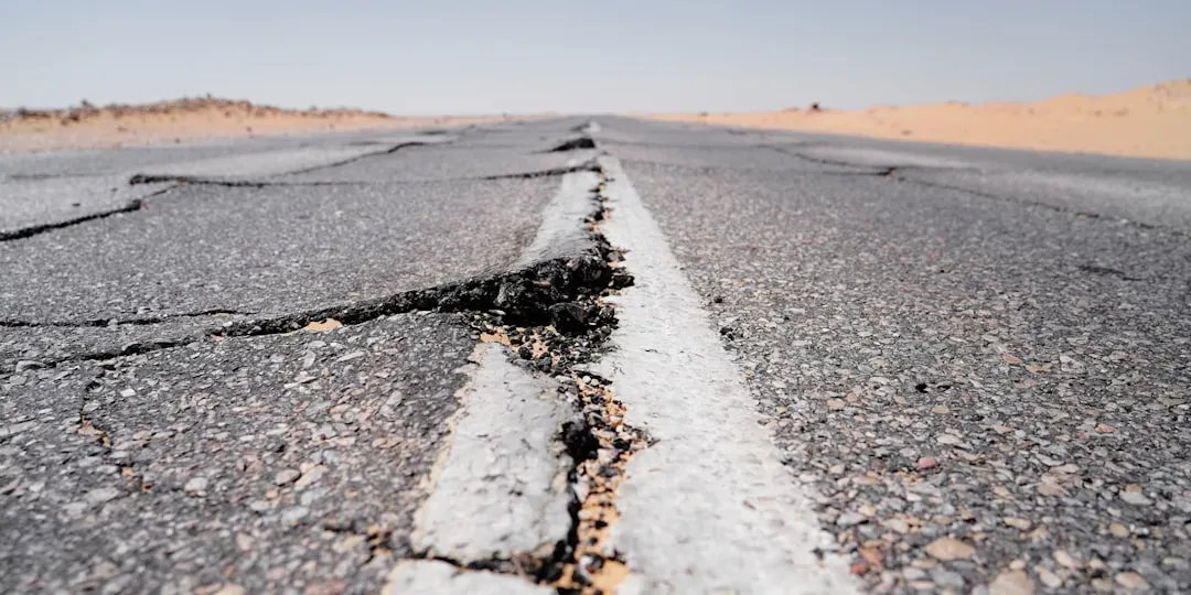
When you picture a major earthquake, you probably imagine the moment the ground rips and buildings sway, not the quiet, hidden drama unfolding in the days just before it. Yet behind the scenes, the crust around a future rupture is changing stress, shifting by tiny amounts, and occasionally whispering warning signs that sensitive instruments can pick up long before you feel anything. You will not see all of these signals with your own eyes, and many big quakes still strike with no clear, reliable precursor, but scientists are getting better at spotting subtle patterns that hint the system is getting restless.
In the United States, agencies like the U.S. Geological Survey (USGS) focus less on predicting the exact time of a single quake and more on understanding how the Earth behaves as stress builds and releases. That means tracking how faults move, how the ground deforms, how tiny earthquakes cluster, and how fluids and gases behave below your feet. If you have ever wondered what might be happening under the surface in the last seventy‑two hours before a major event, you are really asking about these small but telling changes. Let’s walk through the main warning signs scientists actually monitor, what they might mean, and just as importantly, what they do not guarantee.
1. Microearthquake Swarms: The Fault’s Low-Volume Rehearsal
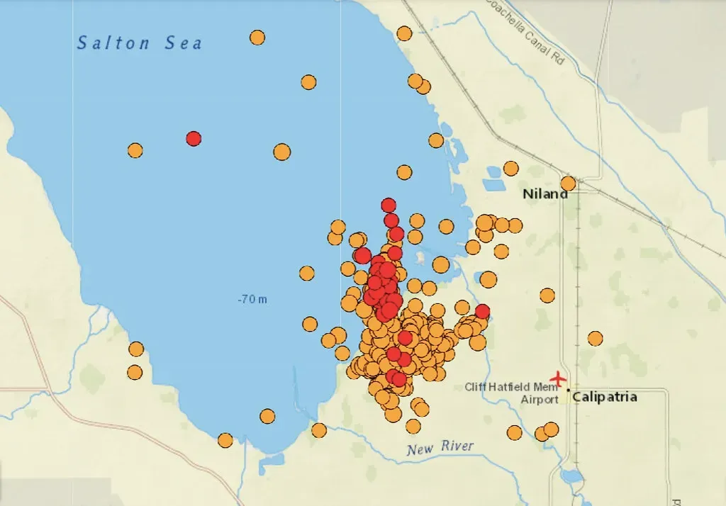
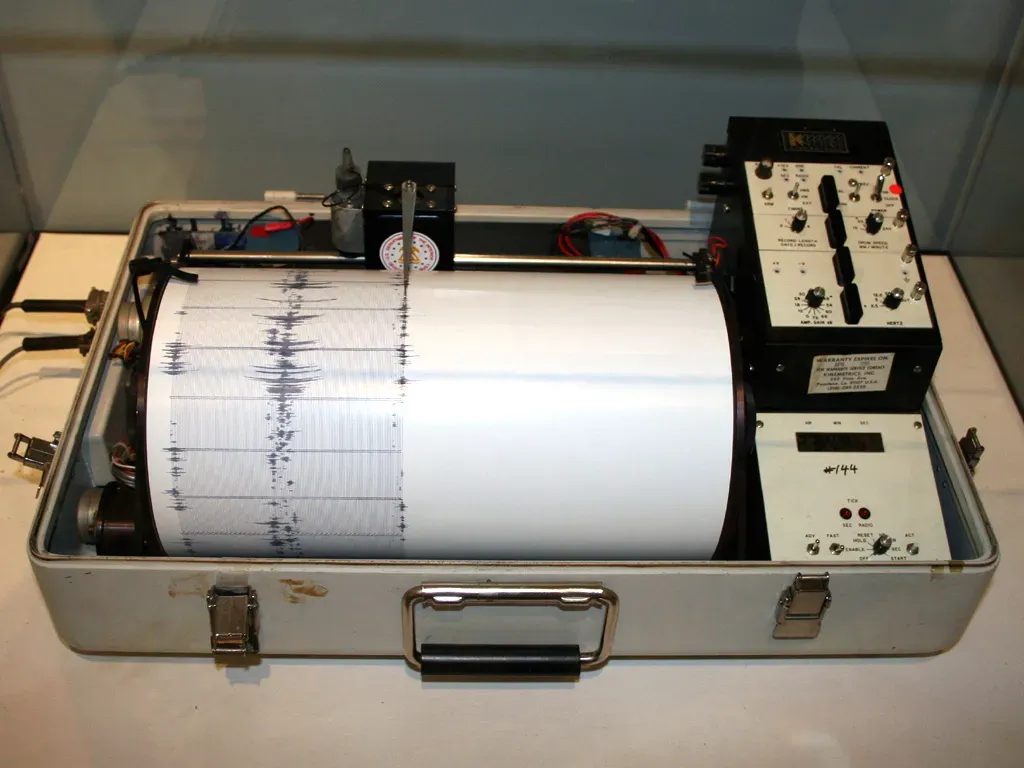
One of the first things you would see on a seismologist’s screen in a restless region is a burst of tiny quakes, too small for you to feel but very obvious to sensitive instruments. These “microearthquakes” can pop off by the dozens or even hundreds over a day or two, forming what is called a swarm. Instead of one clear mainshock and a tidy string of aftershocks, you get a messy cluster of little pops, each one releasing a nibble of stress along a fault zone.
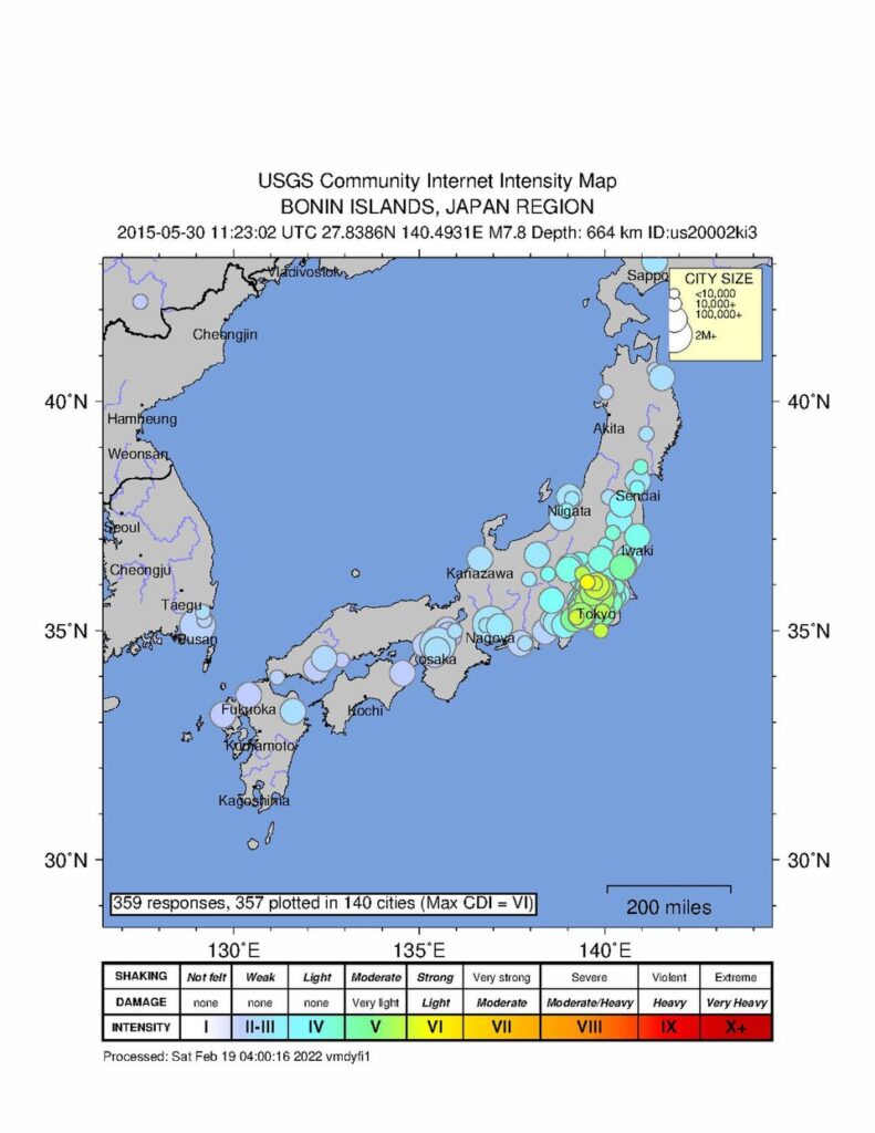
USGS networks constantly record these small events, because their pattern can tell you about how a fault is behaving. When you see a swarm migrating along a known fault, it may signal that a patch of rock is slowly failing, or that fluids are moving through fractures at depth. Sometimes swarms precede a larger earthquake, other times they just fizzle out. That uncertainty is why, if you live in quake‑prone areas like California or Alaska, you will often hear scientists say a swarm “raises interest” but does not prove a big one is coming.
2. Foreshocks: Not Every Small Quake Is a Teaser
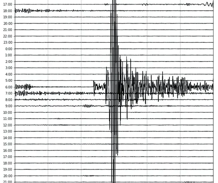
Just before some big earthquakes, you can get what later turns out to be a foreshock: a smaller quake that happens on or near the same fault patch that will soon rupture more violently. In real time, though, you cannot label it that way with confidence, because every earthquake looks like a standalone event until a larger one follows. You only recognize a foreshock in hindsight, which makes them incredibly tricky to use for prediction, even though they are one of the most dramatic patterns you see on seismic records.
USGS catalogs let you look back and see cases where a noticeable quake hit, then hours or days later, the true mainshock arrived on the same structure. What you can do in the moment is watch for that sudden jump in activity in a tight area and check how it lines up with known faults. If you see a moderate event, followed by more shaking nearby, scientists may raise short‑term hazard assessments, especially if large faults are involved. As a resident, you should treat any felt quake in a high‑hazard area as a reminder to be ready, even though the vast majority of small shocks will never grow into something huge.
3. Subtle Ground Deformation: The Crust Quietly Breathing
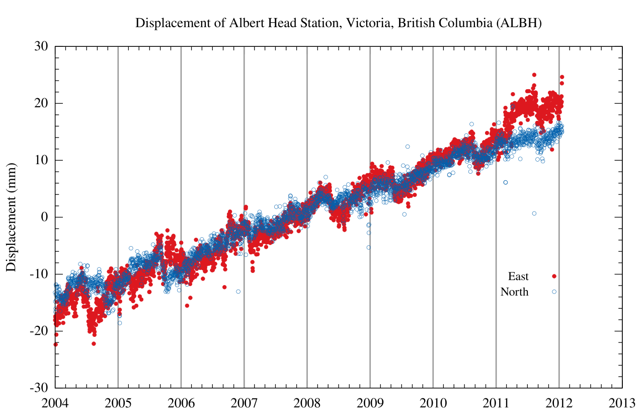
Long before you sense anything under your feet, the ground can be stretching, compressing, or sliding sideways by millimeters. With dense networks of GPS stations, tiltmeters, and radar from satellites, USGS and partner agencies can track this deformation with surprising precision. Over months and years, these measurements show you how tectonic plates drag faults toward their breaking point, but every so often, you see more abrupt shifts that stand out over hours to days.
In the seventy‑two hours before some earthquakes, instruments have picked up localized uplift or tilt changes near the eventual rupture, as if the crust briefly “breathes in” and “exhales” under changing stress. You would never notice this with the naked eye, yet the data can reveal a patch of rock slipping slowly before it finally breaks in a seismic jolt. The challenge is that not every big earthquake leaves a clear, short‑term deformation signature, and some deformation episodes end without a major event. For you, that means ground motion data is powerful for understanding risk trends, but still not a crystal ball for specific days.
4. Episodic Creep and Slow Slip: Faults That Move Without a Bang
Not every fault locks tight and then snaps; some creep, sliding so slowly that they barely shake at all. Along certain segments in California and the Pacific Northwest, instruments capture episodes of slow slip that can last hours to days. In that seventy‑two‑hour window, a portion of a fault might quietly move by a few millimeters, redistributing stress along neighboring locked sections that are capable of producing strong quakes.
You would not feel this kind of motion, but a cluster of GPS stations and seismic sensors would record it as a gentle, drawn‑out shift rather than a sharp shock. Sometimes these slow‑slip events correlate with small earthquake swarms or tremor, suggesting that stress is migrating along the fault zone. In some regions, such patterns have lined up with later larger quakes, while in others they simply come and go as part of the background behavior of the system. From your perspective, this is a reminder that a fault can be active even when your day on the surface seems completely calm.
5. Changes in Seismic Noise and Tremor: The Constant Murmur Gets Weird
If you could listen to the Earth through a seismometer all day, you would hear a constant hum of tiny vibrations from oceans, weather, and distant quakes. This background “seismic noise” usually behaves in predictable ways, but sometimes, in the run‑up to a major event, its character can change. Researchers have detected episodes where low‑frequency tremor or subtle noise patterns increase, especially in deep, subduction‑zone settings where one plate dives beneath another.
USGS and academic teams analyze this murmur with advanced signal processing, watching for shifts that might hint at changing friction conditions on a fault. To you, it is like noticing that a normally steady engine starts to sound rough, even though it has not yet broken down. Still, the Earth’s interior is noisy for many reasons, and most odd patterns in the seismic background never lead to a destructive quake. That is why these signals are treated as clues to fault behavior rather than direct, reliable alarms.
6. Shifts in Groundwater Levels and Well Pressures
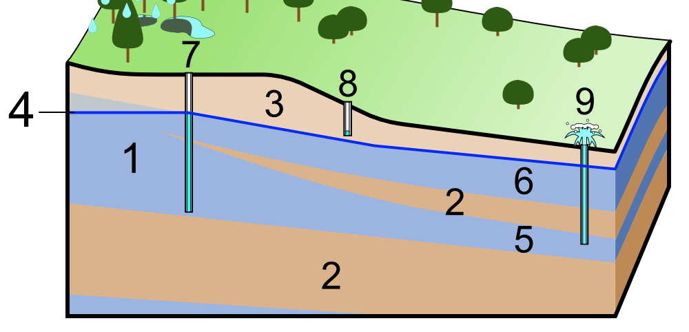
Another subtle sign scientists keep an eye on is the way groundwater levels and pressures in wells change as the crust deforms. When rock around a fault is squeezed or stretched, pores and fractures that hold water can be compressed or opened, causing water levels to rise or fall, sometimes quite abruptly. In the days or hours before certain historical earthquakes, monitoring wells have recorded sudden jumps or drops that coincided with nearby stress changes.
If you rely on a well, you might one day notice an unusual level change and wonder if it is linked to seismic activity. The honest answer is: possibly, but not conclusively. Weather, pumping, seasonal cycles, and human activity can all move groundwater around, and these influences usually dominate what you see. For USGS scientists, that means they look for coordinated, unexplained changes across multiple wells, especially near active faults, before they even consider a possible connection to an impending quake.
7. Gas Emissions and Temperature Anomalies: The Hottest Myths and the Hard Data
You may have heard stories about strange smells, steaming ground, or odd temperature changes before earthquakes, and there is a kernel of real science inside those tales. In some tectonically active areas, gases like radon or carbon dioxide can move more freely through fractured rock as stress builds or microcracks open. A few studies have reported short‑term changes in gas concentrations in soil or groundwater ahead of certain events, raising interest in these signals as possible precursors.
However, when you look across many earthquakes and many regions, the picture becomes far less clear. Gas emissions and shallow temperature variations are influenced by countless factors: rainfall, barometric pressure, biological activity, and even human infrastructure. USGS researchers generally treat gas and temperature anomalies as experimental clues, not operational early‑warning tools. If you ever see unusual steam or smell something odd near volcanic or geothermal zones, it is still worth reporting to local authorities, but you should not assume it means a large tectonic quake is locked in for the next three days.
8. Statistical Changes in Regional Seismicity: The Bigger Picture Behind the Blips
Beyond individual swarms or foreshocks, USGS scientists also look at the broader pattern of seismicity in a region over time. Sometimes, the run‑up to a major event includes a period where the rate of small and moderate quakes ticks up or their locations subtly shift toward the fault segment that will eventually rupture. In other cases, you get what seems like an eerie quiet just before the storm, with activity dipping in some areas as stress concentrates elsewhere.
You, as a resident, will not be running those complex statistical models, but you benefit from them indirectly through updated hazard assessments and public information. When patterns change in meaningful ways, agencies may adjust probabilities for aftershocks, related events on nearby faults, or short‑term shaking risk. Still, those probabilities are expressed over days to months and stay grounded in uncertainty. The reality is that even the best statistical tools do not let anyone truthfully say, “a major quake will hit this exact spot in seventy‑two hours,” and any claim like that deserves serious skepticism.
Conclusion: What You Can Do When the Earth Refuses to Give Exact Appointments

When you pull all of this together, the story of the seventy‑two hours before a major earthquake is not a neat countdown with clear, universal warning bells. Instead, you get a patchwork of possible signals: microquake swarms lighting up a fault, subtle ground tilt, slow slip, odd groundwater shifts, and statistical quirks in the regional seismic rhythm. USGS tracks these patterns because they help reveal how the Earth fails, even when they do not give a precise time and place for the next disaster. The more scientists learn, the better they can refine hazard maps, building codes, and early‑warning systems that shave precious seconds off your response time once shaking actually begins.
For you, the practical takeaway is simple but powerful: rely on preparedness, not prediction. Keep emergency supplies ready, secure heavy furniture, know how to drop, cover, and hold on, and stay tuned to official alerts in quake‑prone areas. You cannot control what happens deep in the crust in those final seventy‑two hours, but you can control how ready you are when the ground finally lets go. If you had to bet on something today, would you rather gamble on a perfect warning sign, or on your own readiness to handle the unexpected?