
Thursday’s Turbulence Leaves Lasting Marks (Image Credits: Upload.wikimedia.org)
Midwest and Plains regions – Residents across a vast swath of the central United States prepared for back-to-back severe weather episodes as powerful thunderstorms loomed for Friday afternoon. The storms threatened large hail, damaging wind gusts and possible tornadoes from Iowa to Texas, placing more than 65 million people at risk over a 1,500-mile corridor extending to western Pennsylvania.[1] This escalation followed Thursday’s turbulent outbreaks that already delivered tornado touchdowns and flash flooding in key areas.
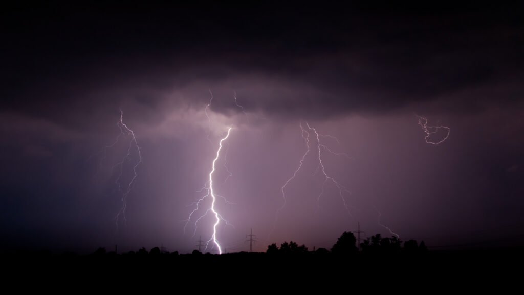
Thursday’s Turbulence Leaves Lasting Marks
A rope tornado touched down near West Liberty, Iowa, on Thursday afternoon, marking one of several confirmed twisters in the state. Farm structures in nearby West Branch sustained significant damage when high winds ripped off roofs. No injuries resulted from these events, but the storms signaled the intensity building across the region.[1]
Egg-sized hail pelted eastern Iowa and western Illinois, while wind gusts reached 65 mph in multiple spots. Flash flooding forced road closures in Johnson County, Missouri, east of Kansas City. Warm air aloft had suppressed some tornado formation earlier in the day, yet the hazards proved substantial.[2]
Friday’s Peak Dangers Center on Iowa and Missouri
Portions of southern Iowa and northern Missouri fell under the highest alert with a Level 3 out of 5 severe thunderstorm risk from NOAA’s Storm Prediction Center. Supercell storms posed the primary concern in this zone, with potential for tornado production just south of Thursday’s hotspots. A narrow window from mid-to-late afternoon offered the best chance for these discrete storms to develop.[1]
Storms expected to ignite ahead of a cold front stretching from the Ohio Valley to Texas. In the evening, they could organize into a robust line from western Iowa to West Texas before surging eastward overnight. The FOX Forecast Center highlighted this setup as ripe for escalation.[1]
All Major Hazards in Play Across Vast Region
Damaging winds emerged as the leading threat, particularly in Kansas and Oklahoma, where gusts could pack destructive force. Large hail remained a widespread danger, building on Thursday’s reports. Tornadoes lurked as a lower-probability but high-impact risk, especially within supercells.[1]
| Risk Level | Areas Affected | Key Threats |
|---|---|---|
| Level 3/5 | Southern Iowa, Northern Missouri | Supercells, tornadoes, large hail |
| Lower Risks | Western Oklahoma to West Texas dryline | Damaging winds, hail |
| Widespread | Texas Big Bend to Western Pennsylvania | All hazards possible |
A separate system pushed out of the Rockies into the Plains, fueling activity along a dryline in western Oklahoma and West Texas. This combination amplified the overall outlook for more than 65 million under some form of severe weather potential.[1]
Flood Risks Complicate the Picture
Heavy rainfall compounded the dangers, with a Level 2 out of 4 flash flood risk through Saturday morning from northern Texas to southwestern Missouri. Forecasts called for 2 to 3 inches of accumulation from Dallas to Kansas City. Repeated storm passages over saturated ground heightened the urgency.[1]
Thursday’s downpours already overwhelmed local infrastructure near Kansas City. Officials urged vigilance as the holiday weekend approached, with moisture-rich air from the Gulf sustaining the pattern. April’s historical surge in severe activity aligned perfectly with this forecast.[1]
- Monitor local alerts from the National Weather Service for real-time updates.
- Secure outdoor items ahead of wind gusts.
- Avoid flooded roads and low-lying areas.
- Have a severe weather plan ready for family or business.
- Stay informed via reliable sources like NOAA’s Storm Prediction Center.
Key Takeaways
- Over 65 million at risk from Texas to Pennsylvania Friday.[1]
- Level 3 severe risk in southern Iowa and northern Missouri for supercells and tornadoes.
- Damaging winds primary threat in Kansas and Oklahoma; flash floods through Saturday.
As spring severe weather season ramps up, communities from the Plains to the Midwest stood ready for impacts that could rival recent outbreaks. The back-to-back nature of these events underscored the need for preparedness amid a volatile pattern. What steps are you taking? Share in the comments below.