Rare Moderate Risk Grips the Nation’s Capital (Image Credits: Flickr)
Washington, D.C. – A powerful storm system barreled across the eastern United States, placing more than 12 million residents under threat of damaging winds and strong tornadoes on Monday.[1] The National Weather Service and Storm Prediction Center elevated risks for the capital region and surrounding areas, marking a rare occurrence for the urban corridor. Forecasters warned of widespread severe thunderstorms that could disrupt afternoon commutes and daily routines.
Rare Moderate Risk Grips the Nation’s Capital
The Storm Prediction Center issued a Moderate Risk for severe thunderstorms across the Southeast and Mid-Atlantic states, a level uncommon for the densely populated Washington area.[2] This outlook highlighted the potential for tornadoes, including some strong ones, alongside particularly damaging straight-line winds from South Carolina to Maryland during the afternoon. Meteorologists noted that computer models consistently predicted this outbreak well in advance.[1]
WTOP meteorologist Mike Stinneford observed, “It basically tells us that the models had a pretty good idea that we were going to see an outbreak of severe weather on Monday afternoon.” The setup involved warm, humid air clashing with a robust cold front, fueling explosive storm development.[1] Schools in the region announced early dismissals to avoid the peak danger window.
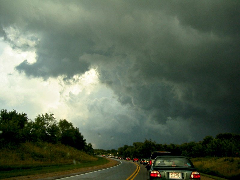
Primary Dangers: Winds, Tornadoes, and More
Damaging wind gusts emerged as the foremost hazard, with speeds possibly exceeding 75 miles per hour in the strongest storms.[3] Isolated tornadoes posed a secondary but serious risk, particularly from discrete supercells ahead of the main squall line. Large hail and heavy rainfall capable of causing flash flooding rounded out the threats.
- Damaging winds: 60-75+ mph gusts, capable of downing trees and power lines.
- Tornadoes: Isolated spin-ups, some potentially strong (EF2+).
- Hail: Up to quarter-size in supercells.
- Flooding: Brief but intense downpours during rush hour.
Storms began forming in western suburbs around noon, with the primary squall line striking the metro area between 2 p.m. and 5 p.m.[1] The severe window extended into early evening, overlapping with peak traffic.
Key Regions in the Crosshairs
The enhanced to moderate risk enveloped the DMV – District of Columbia, Maryland, and Virginia – extending from the Shenandoah Valley to the Eastern Shore.[3] Cities like Baltimore, Richmond, and areas east of the Blue Ridge Mountains faced the highest odds for impactful storms. The threat stretched northward toward Philadelphia and southward to Raleigh.
| Area | Risk Level | Main Threat |
|---|---|---|
| Washington, D.C. Metro | Enhanced/Moderate | Winds, Isolated Tornado |
| Maryland/Virginia East | Moderate | Damaging Winds |
| South Carolina to NC | Moderate/High | Tornadoes, Winds |
This multi-state swath underscored the system’s scale, following earlier impacts in the Midwest and Heartland.
Essential Steps for Safety
Residents prepared by securing outdoor items and reviewing emergency plans as the front approached. Authorities urged avoiding travel during the 2-5 p.m. window when visibility could plummet. Power outages loomed large given the wind potential.
- Stay indoors away from windows during storms.
- Monitor local alerts via NOAA Weather Radio or apps.
- Have a safe room designated for tornado warnings.
- Charge devices and keep flashlights handy.
- Report downed lines to utilities without approaching.
Key Takeaways
As the storms pushed eastward, communities in the Mid-Atlantic reflected on the need for vigilance in an active severe weather pattern. The event served as a stark reminder of spring’s volatile skies. What preparations have you made? Share in the comments below.