Cloud Heights and Forms: The Basics of Prediction (Image Credits: Flickr)
Clouds drift across the sky, constantly reshaping themselves in response to atmospheric forces. These formations provide reliable hints about weather shifts, from sunny spells to sudden storms. Meteorologist Ross Lazear explains that grasping cloud development processes equips anyone to anticipate conditions ahead.[1][2] This timeless method complements digital tools and proves especially useful during outdoor activities.
Cloud Heights and Forms: The Basics of Prediction
Clouds sort into categories based on altitude, which influences their appearance and weather signals. High clouds hover above 20,000 feet (6 kilometers), mid-level ones occupy 6,500 to 20,000 feet, and low clouds stay below 6,500 feet. Shapes range from thin wisps at height to dense puffs near the ground.[3][4]
Wind shears reveal direction changes across layers, offering clues to approaching systems. Observers note movement: faster high clouds signal jet stream influence. This framework sets the stage for specific forecasts.
| Height Level | Typical Clouds | Shape Description | General Weather Clue |
|---|---|---|---|
| High | Cirrus | Wispy, feathery | Fair or change ahead |
| Mid | Altostratus | Layered sheets | Precipitation possible |
| Low | Cumulus, Stratus | Puffy or flat layers | Fair or overcast |
| Vertical Growth | Cumulonimbus | Towering anvils | Storms imminent |
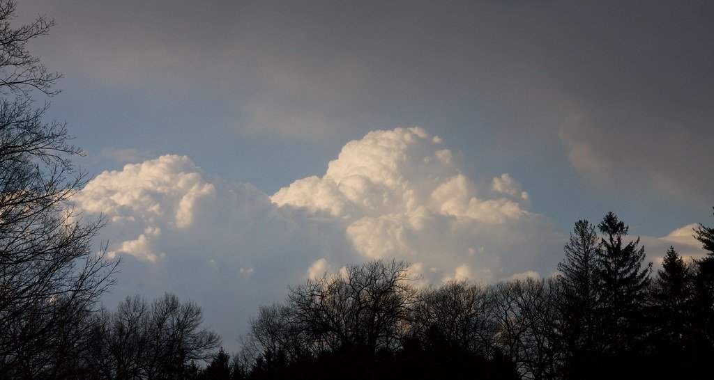
Cotton Ball Cumulus: From Calm Days to Storm Warnings
Picture scattered white puffs resembling cauliflower heads against a clear sky. Cumulus clouds form at low levels from rising warm air on humid days. They signal stable, fair weather under sunny conditions.[1]
However, rapid vertical growth transforms them into cumulonimbus giants. Crisp edges and towering heights predict heavy rain, hail, or thunderstorms within hours. Watch bases flatten as they expand.
- Flat bases with dome tops indicate pleasant afternoons.
- Billowing upward in humid air foreshadows severe outbursts.
- Evening dissipation often means clear nights follow.
- Clusters building midday suggest monitoring closely.
- Smooth outlines versus ragged edges differentiate fair from foul.
Wispy Cirrus and Layered Stratus: Subtle Shifts in the Atmosphere
High-altitude cirrus clouds appear as delicate ice-crystal threads, often translucent enough to reveal the sun or moon. They form in cold upper air, typically bringing tranquil conditions. Yet thickening veils or anvil spreads atop storms hint at moisture advancing.[5]
Stratus clouds blanket the sky in uniform gray layers at low or mid levels. They deliver overcast skies and light drizzle. When moisture lifts them into nimbostratus, steady rain or snow persists for hours.
Lazear notes, “Once you understand how certain clouds develop their shapes, you can learn to forecast the weather.”EarthSky
Mountain Specialties: Lenticular and Banner Clouds
Lens-shaped lenticular clouds hover like UFOs over peaks, created by steady winds rippling over terrain. They persist in stable air, rarely producing precipitation but marking windy conditions aloft. Banner clouds stream like flags from summits in turbulent flow.
These formations highlight topography’s role without broader storm threats. Spot them in regions like the Alps or Sicily for local wind insights. They remind observers that clouds adapt uniquely to landscapes.
Key Takeaways
- Cumulus puffs promise fair skies unless they tower into storms.
- Cirrus wisps often precede fronts; watch for thickening.
- Stratus layers bring prolonged gloom and wet weather.
Cloud observation sharpens intuition for nature’s rhythms, bridging science and instinct. Next clear day, scan the horizon – what story do the clouds tell? Share your sightings in the comments.