Polar Vortex Collapse Sets Stage for Chaos (Image Credits: Pexels)
A formidable lobe of the polar vortex surges southward from Canada into the central and eastern United States, igniting the explosive Winter Storm Iona amid an already turbulent weather pattern.[1]
Polar Vortex Collapse Sets Stage for Chaos
The polar vortex, a massive ring of high-altitude winds encircling the North Pole, has weakened following a major stratospheric warming event. This disruption splits the vortex, allowing a deep lobe to extend far south into the U.S. heartland. Powerful jet stream winds topping 130 knots amplify the trough, creating ideal conditions for rapid storm development.[1]
A classic dipole pattern emerges, with a blocking high pressure over the North Pacific and western U.S. locking in the cold air mass. Abundant moisture from the Gulf of Mexico clashes with this Arctic intrusion, fueling cyclogenesis. Forecasters highlight this setup as textbook for late-season intensity.[1]
Storm Iona Undergoes Bombogenesis
Winter Storm Iona organizes early Sunday across the Midwest, rapidly intensifying into a bomb cyclone as central pressure plummets more than 24 millibars in 24 hours. The system tracks northeast toward the Great Lakes and interior Northeast by Sunday night into Monday. Warm, humid air surges northward ahead of the low, colliding with frigid Arctic air to drive the explosive growth.[1]
This temperature contrast sharpens pressure gradients, spawning severe surface winds. The storm matures Sunday evening, expanding its reach with heavy precipitation bands. Lake-effect snow bands then intensify downwind of the Great Lakes from Monday through Wednesday, prolonging hazards in snowbelt areas.[1]
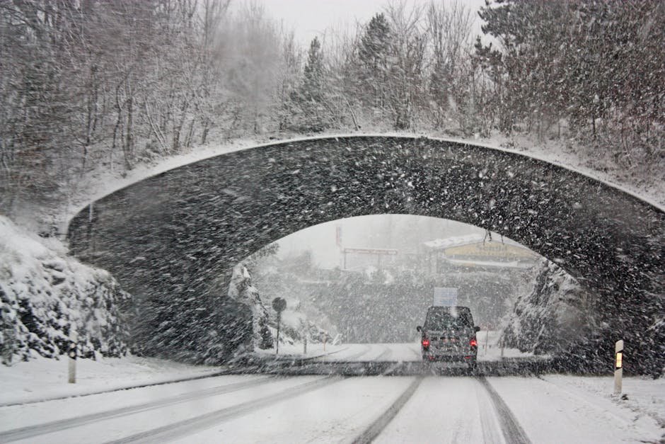
Blizzard Warnings Target Upper Midwest and Great Lakes
Sunday brings widespread blizzard conditions to the Upper Midwest and northern Great Lakes, with snowfall totals potentially exceeding 25-30 inches in Minnesota, Wisconsin, and parts of Michigan. Localized areas could see over 30 inches, including northern Ontario in Canada. Winds gusting 60-70 mph whip snow into whiteouts, creating near-zero visibility and massive drifts.[1]
Impacted regions include:
- Upper Midwest: Minnesota, Wisconsin
- Great Lakes: Northern Illinois, Indiana, Ohio, Michigan
- Interior Northeast: Upstate New York, northern New England
- Canada: Northern Ontario
Roads turn impassable, stranding travelers and prompting power outages. Flight delays and cancellations loom large across the affected zones.[1]
Deep Freeze Grips Eastern U.S. in Storm’s Wake
Behind Iona, a renewed Arctic surge plunges temperatures 30-40°F below normal across the Midwest, Ohio Valley, and East Coast through Tuesday. Monday mornings bring single digits or sub-zero readings from northern Iowa through Minnesota and Wisconsin. Sub-freezing air reaches central Texas, Louisiana, and Georgia.[1]
Flash freezing threatens as pre-storm rain ices over rapidly. Strong west-northwesterly winds sustain lake-effect snow, compounding travel woes. The cold snap abruptly halts recent spring-like warmth, ushering in a prolonged hard freeze.[1]
Key Takeaways:
- 25-30+ inches of snow possible in Upper Midwest and Great Lakes.
- Blizzard conditions with 60-70 mph gusts Sunday through Monday.
- Arctic cold drops temps below zero in northern areas, sub-freezing to the Southeast.
As Storm Iona carves its path, residents from the Midwest to the Northeast prepare for one of the season’s most disruptive events. This polar vortex-driven assault reminds us of winter’s lingering grip. What are your plans to weather the blizzard? Share in the comments.