
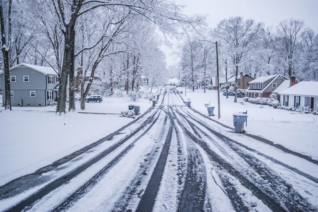
A Winter Event for the Record Books (Image Credits: Unsplash)
North Carolina – Measurable snow blanketed every one of the state’s 100 counties from January 30 to February 1, delivering the most widespread winter precipitation in more than 12 years.[1]
A Winter Event for the Record Books
Residents from the highest peaks to the eastern shores witnessed a sight unseen since January 2014: snow accumulating statewide. The storm produced drifts up to 50 inches deep in isolated spots and lingered in many areas for days. Charlotte endured 23 straight hours of snowfall, while near-blizzard conditions struck parts of the coast with heavy snow, high winds, and low visibility. This event stood out not just for its reach but for shattering long-standing records in multiple regions.[1]
Forecasters had noted potential dry slots in central areas like the Triangle, yet even Raleigh recorded 2.8 inches. The precipitation fell entirely as snow, thanks to deeply entrenched cold air. Surface temperatures dipped into the teens across much of the state on Saturday, locking in ideal conditions.
Snowfall Breakdown by Region
The storm spared no area, with totals varying dramatically from west to east. Mountains saw the heaviest early accumulations, while coastal zones surprised with some of the state’s highest marks. Piedmont cities like Charlotte and Greensboro notched significant falls not seen in years.
| Region | Example Locations | Peak Snowfall |
|---|---|---|
| Mountains | Beech Mountain, Peletier | 13.3 inches, 10.8 inches |
| Piedmont | Charlotte, Kannapolis | 11 inches, 16 inches |
| Coastal Plain | New Bern, Swansboro | 12.5 inches, 17 inches |
- Mountains: 8 inches in Marshall, 10.3 inches in Little Switzerland, up to a foot in Watauga County.
- Piedmont: 10.3 inches at Greensboro airport, lighter 1.5-2.8 inches around Raleigh.
- Coastal Plain: 19.5 inches in Peletier – the state’s highest – plus 15 inches in Kinston and 5.8 inches in Wilmington.
Ideal Setup Fuels the Storm
An Arctic front earlier in the week trapped frigid air across North Carolina. A deepening upper-level low over the west amplified surface development, while a moisture-rich low tracked just offshore. This near-shore path proved perfect for heavy snow in the east. Cold air aloft produced unusually high snow-to-liquid ratios, such as 18-to-1 in Wilmington, where 0.32 inches of liquid yielded nearly 6 inches of flakes.
No sleet or rain mixed in; all precipitation stayed snow. Riverbanks in Haywood County wore up to 8 inches of cover. Boone logged its longest sub-freezing stretch since 2018, with temperatures refusing to climb above freezing for over a week.
Records Shattered and Impacts Felt
Several areas marked their biggest snows in decades. Charlotte’s 11 inches topped February 2004 levels. New Bern and Newport saw their first foot since 1989. Parts of Beaufort County along the Pamlico River received a foot for the first time since 1958. Wilmington’s total ranked as the largest since 1989.[1]
Travel disruptions mounted amid whiteouts on the Crystal Coast, where winds gusted over 35 mph. Snow piled deep, complicating cleanup. Asheville more than doubled its prior winter’s total in one event. The North Carolina State Climate Office highlighted this as a classic setup yielding extraordinary results.
Key Takeaways
- Measurable snow in all 100 counties for the first time since 2014.
- Coastal records broken, including 19.5 inches near the Crystal Coast.
- High snow ratios and persistent cold amplified accumulations statewide.
This extraordinary storm underscored North Carolina’s capacity for wintry extremes despite its mild reputation. Communities now dig out while reflecting on a rare shared experience. How did the snow affect your area? Share your stories in the comments.