A Mild Start Gives Way to Active Skies (Image Credits: Fox2now.com)
St. Louis – Residents in the Gateway City woke to a mild morning on this January Thursday, setting the stage for a day marked by shifting weather patterns across Missouri and Illinois.
A Mild Start Gives Way to Active Skies
The day began with temperatures already climbing into the upper 40s and low 50s, well above typical January norms. Light rain arrived early, spreading northward from southern Missouri into the St. Louis metro area. Forecasters noted a brief lull following the initial showers, allowing for a temporary dry spell before conditions intensified.
By midday, humidity levels rose, fueling the potential for more widespread precipitation. Winds picked up from the south, pushing highs toward 67 degrees – a figure that neared the daily record set back in 2006. Such warmth in winter remains unusual, drawing attention from local meteorologists who linked it to broader patterns of mild air dominating the Midwest.
Thunderstorms Pose Risks in the Afternoon
As the afternoon progressed, scattered thunderstorms developed, particularly along the Mississippi River corridor. The National Weather Service highlighted the possibility of gusty winds exceeding 50 mph in stronger cells, alongside brief heavy downpours that could lead to localized flooding. While most storms stayed garden-variety, a marginal risk for severe weather covered parts of eastern Missouri and southwestern Illinois.
Hail and damaging winds emerged as primary concerns, though tornado chances remained low. Storms moved quickly due to the brisk southerly flow, limiting prolonged impacts in any one spot. Drivers and outdoor enthusiasts faced the biggest challenges, with slick roads reported in low-lying areas. Emergency officials urged caution, emphasizing the need to monitor updates from reliable sources like the Storm Prediction Center.
Transition to Cooler Weather Ahead
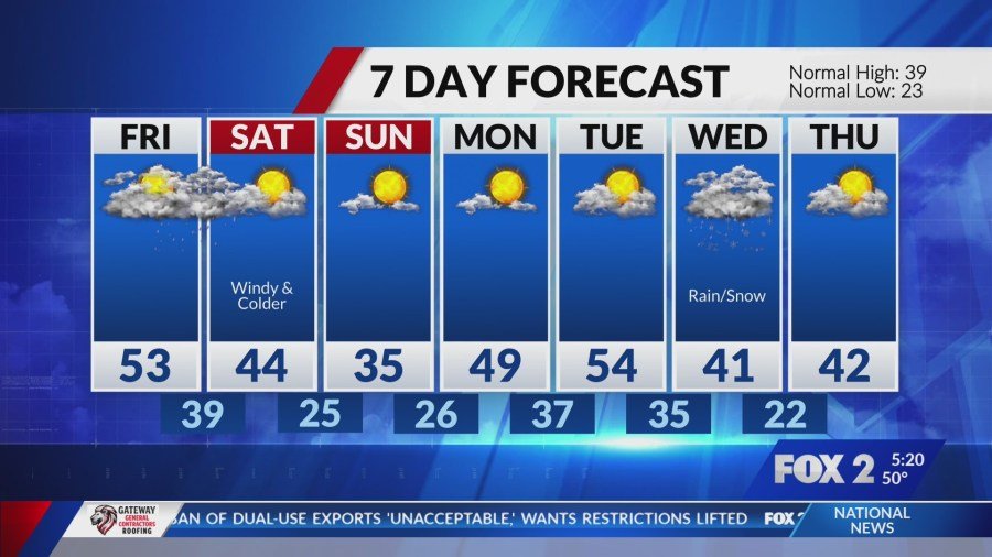
Friday brought a noticeable drop, with clouds lingering and highs dipping to around 55 degrees. The warm front responsible for Thursday’s balmy conditions retreated, allowing cooler air to filter in from the north. Scattered showers persisted into the evening, but overall activity tapered off compared to the previous day.
Over the weekend, temperatures settled into more seasonal territory, with lows in the 30s and highs reaching the upper 40s. Dry conditions prevailed by Saturday, offering a respite for those planning outdoor activities. This shift marked the end of an extended warm spell that had persisted through much of the week, reminding locals of winter’s lingering presence.
Weekly Forecast Highlights
To help residents plan, here’s a snapshot of the coming days based on current models:
- Thursday: Cloudy with rain and thunderstorms; high near 67, low 48. Breezy conditions throughout.
- Friday: Mostly cloudy with possible lingering showers; high 55, low 35.
- Saturday: Partly sunny and cooler; high 48, low 30.
- Sunday: Increasing clouds; high 52, low 32.
- Monday: Chance of light rain; high 50.
This outlook reflects the rapid changes typical of Midwestern winters, where systems move swiftly across the plains.
Key Takeaways
- Thursday’s warmth nears records, but thunderstorms bring hazards like wind and flooding.
- A cool down starts Friday, with seasonal temperatures returning by the weekend.
- Stay alert for severe weather alerts, especially during afternoon hours.
As St. Louis navigates this blend of unseasonal warmth and stormy interludes, the weather serves as a reminder of the region’s unpredictable climate. With cooler air on the horizon, the focus shifts to preparing for a more typical January feel. What are your plans if rain cuts them short? Share in the comments below.


