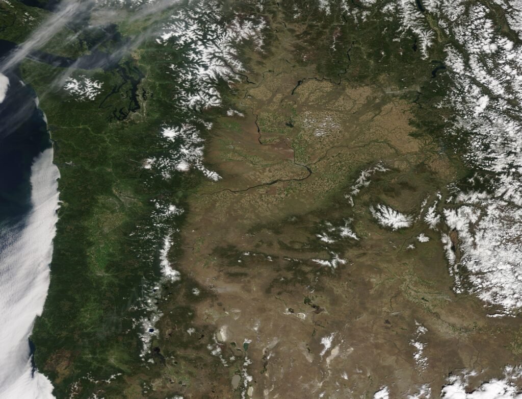

Temperatures: A Gentle Warm-Up Across the Region (Image Credits: Upload.wikimedia.org)
Pacific Northwest – As the first days of 2026 unfold, meteorologists and residents alike reflect on the previous year’s climate patterns, which offered a blend of familiar rhythms and subtle changes across Washington, Oregon, and surrounding areas.
Temperatures: A Gentle Warm-Up Across the Region
The standout feature of 2025’s weather emerged in the temperatures, which trended warmer than historical averages without reaching record-breaking levels. Data from weather stations revealed that the majority of the Pacific Northwest experienced deviations of just 1 to 2 degrees Fahrenheit above normal, painting a picture of consistency rather than extremes. This warmth manifested most noticeably in the coastal and inland valleys, where yellow and orange hues on anomaly maps indicated a region basking in slightly elevated heat.
About 30 percent of the area saw increases of 2 to 4 degrees, particularly in eastern Washington and parts of Oregon, contributing to a sense of a warmer but not alarming year. Stations like Olympic Airport recorded annual averages that ranked among the higher ones over the past 75 years, yet fell short of all-time highs. Ephrata in eastern Washington echoed this pattern, with a gradual upward trend in temperatures over decades but nothing that shattered expectations for 2025. Such shifts align with broader long-term warming influences, though the year avoided the dramatic spikes seen in previous hot summers.
Precipitation Patterns: Mixed Signals and Regional Variations
Rainfall in 2025 presented a more varied story, with roughly 30 percent of the Pacific Northwest receiving above-normal amounts, while 40 percent endured drier conditions at 40 to 90 percent of average. Dark green zones on precipitation maps highlighted pockets of surplus, especially in northern areas, where atmospheric rivers delivered timely downpours. However, vast swaths from the Cascades eastward reported deficits, underscoring the year’s overall lean toward aridity.
At Olympia, cumulative precipitation ended slightly below normal, hampered by minor data gaps but still reflecting steady, unremarkable totals with no pronounced long-term trend. Ephrata mirrored this stability, hovering near average in recent years despite occasional dry spells. Northern stations like Bellingham bucked the trend, logging surpluses that boosted local water reserves. These inconsistencies highlight how 2025’s precipitation avoided extremes, settling into a pattern of modest shortfalls punctuated by wetter interludes.
Seasonal Highlights and Broader Implications
Winter brought warmer-than-average conditions with reduced snowfall, aligning with forecasts from sources like the Old Farmer’s Almanac, which predicted below-normal precipitation through early 2026. Spring and summer followed suit in many areas, with cooler, wetter spells in the north contrasting drier heat in the south, though no season veered into the unprecedented. The absence of severe droughts or floods marked 2025 as a year of equilibrium, even as climate models continue to signal evolving baselines.
Residents noted the lack of blockbuster events – no mega-storms or prolonged heat waves dominated headlines – allowing for a quieter year compared to the volatility of prior decades. This balance extended to air quality and agriculture, where mild warmth supported growth without the strains of excess or scarcity. Yet, the subtle warming trend at key stations serves as a reminder of ongoing climate dynamics at play.
| Station | 2025 Temperature Anomaly | 2025 Precipitation (% of Normal) |
|---|---|---|
| Olympic Airport | +1.5°F | 95% |
| Ephrata | +2.2°F | 92% |
| Olympia | +1.8°F | 98% |
| Bellingham | +1.0°F | 105% |
Looking Back: Why 2025 Felt Unremarkable Yet Telling
In retrospect, 2025 stands out for its restraint – a year that sidestepped the headlines of climatic drama while quietly advancing a narrative of incremental change. The modest warmth and patchy dryness, captured in station records and regional maps, suggest resilience in the face of shifting norms, but also vigilance for future years. As the Pacific Northwest navigates these patterns, the data from 2025 reinforces that even “ordinary” weather carries lessons for adaptation.
Key Takeaways:
- Temperatures rose modestly, with most areas 1-2°F above normal and no records broken.
- Precipitation varied widely, leaning drier overall but with northern surpluses.
- Long-term station trends show gradual warming, underscoring climate continuity.
Ultimately, 2025’s weather in the Pacific Northwest proved a steady chapter, reminding us that stability amid change is worth appreciating. What aspects of last year’s climate surprised you most? Share your thoughts in the comments.