Stand on any beach, mountain ridge, or city street, and you’re standing on the aftermath of ancient chaos. Continents weren’t gently arranged like puzzle pieces; they were smashed together, ripped apart, swallowed, and reborn over billions of years. The wild part? We still don’t fully understand some of the most important events that built the land beneath our feet.
Geologists have pieced together a story from shattered rocks, magnetic whispers frozen in minerals, and hints buried deep in the mantle. But there are still gaps big enough to drive a tectonic plate through. The following ten events are not just “old history” – they’re ongoing mysteries that still shape earthquakes, mountain ranges, oceans, and even climate today.
The Birth of Continents in the Hidden Hadean World
Imagine Earth as a hellish ocean of lava, constantly bombarded by asteroids, its surface too unstable to hold a single continent. That was the Hadean Eon, more than four billion years ago, and yet tiny survivors from this time suggest something astonishing: early fragments of continental crust may already have existed. Ancient zircon crystals from places like Western Australia and Canada hint that small, buoyant patches of proto-continent formed far earlier than many models once allowed.
What’s mysterious is how these first continents actually appeared. Did they rise from partial melting of a wet, subducting crust, or from giant impacts that stirred and differentiated the surface like hot soup? We only have grains of evidence, literally, scattered in much younger rocks. These first continental seeds, whatever their origin, became the scaffolding on which larger continents later assembled, setting the stage for everything from plate tectonics to the possibility of stable oceans and early life.
The Great Tectonic Switch: When Plate Tectonics Truly Began
Today, drifting continents and grinding plates feel like the normal state of Earth, but it wasn’t always this way. For perhaps the first billion years or more, the planet may have been ruled by a “stagnant lid” – a solid outer shell with little large-scale motion. At some point, that lid broke, and the modern style of plate tectonics began: subduction zones formed, plates started diving into the mantle, and continents began traveling long distances like slow-motion ships on a convecting sea.
Pinpointing when this tectonic switch flipped is one of geology’s biggest puzzles. Some evidence suggests subduction was happening over three billion years ago, while other data points to a later global transition. It might not have been a single moment at all, but a patchwork evolution, with some regions subducting while others stayed rigid. Regardless of the exact timing, the onset of true plate tectonics turned continents into restless wanderers, driving collisions, rifts, and mountain building that still define the map of Earth.
Kenorland: The Shadowy Supercontinent Few Have Heard Of
Most people have heard of Pangaea, but long before it, there may have been a much older supercontinent called Kenorland. Formed roughly two and a half billion years ago, Kenorland is like a half-erased drawing: we see hints of it in matching rock belts, ancient cratons, and shared mineral ages scattered across today’s continents. Places now separated by vast oceans – such as parts of North America, Scandinavia, and Africa – might once have sat side by side on this primeval landmass.
What makes Kenorland so mysterious is how incomplete the evidence is. Rocks that old have been baked, buried, and recycled, wiping out many of the original patterns that would prove its shape beyond doubt. Yet the breakup of Kenorland may have triggered huge changes in Earth’s atmosphere and climate, possibly helping oxygen levels rise as new shallow seas formed and weathering intensified. It’s a ghost continent, but its assembly and breakup may have quietly rewired the planet’s surface systems.
Snowball Earth and the Rifting of Rodinia
Roughly between one billion and six hundred million years ago, a massive supercontinent known as Rodinia sprawled across the globe. Then it began to tear apart, and something dramatic seems to have followed: some of the most extreme ice ages in Earth’s history, the so-called “Snowball Earth” episodes. During these times, glaciers may have crept close to the equator, and the oceans could have been sealed under vast sheets of ice. The timing between Rodinia’s breakup and these global freezes is suspiciously close.
Scientists still debate the exact chain of events, but the link between rifting continents and deep-freeze climates is compelling. As Rodinia split, new ocean basins opened, volcanic gases shifted, and weathering patterns changed, possibly pulling carbon dioxide out of the atmosphere and cooling the planet. The continents themselves were rearranged into new positions that altered ocean currents and heat distribution. When the ice finally retreated, the world emerged transformed – and not long afterward, complex multicellular life began to flourish in the newly reshaped continental margins.
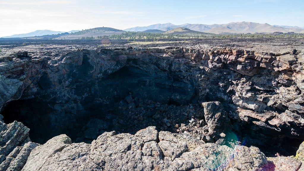
The Great Unconformity: A Giant Missing Chapter in the Rock Record
In places like the Grand Canyon, you can walk up to a contact where young, relatively flat rocks sit directly on top of much older, tilted, and eroded layers. Between them, millions – sometimes over a billion – years of history are simply gone. This gap is known as the Great Unconformity, and it appears on multiple continents, hinting at a global-scale event or sequence of events that stripped away enormous volumes of rock before younger sediments were laid down.
Why so much crust was removed, and how exactly it happened, remains hotly debated. Some scientists suspect massive glaciations associated with Snowball Earth carved into the continents like gigantic sandpaper. Others point to tectonic uplift and erosion during supercontinent assembly or breakup as the main culprit. Whatever the mechanism, the Great Unconformity marks a moment when continents were dramatically reshaped, and the missing record makes it harder to reconstruct exactly how Earth transitioned into a world teeming with complex life.
Gondwana’s Secret Role in Building Today’s Continents
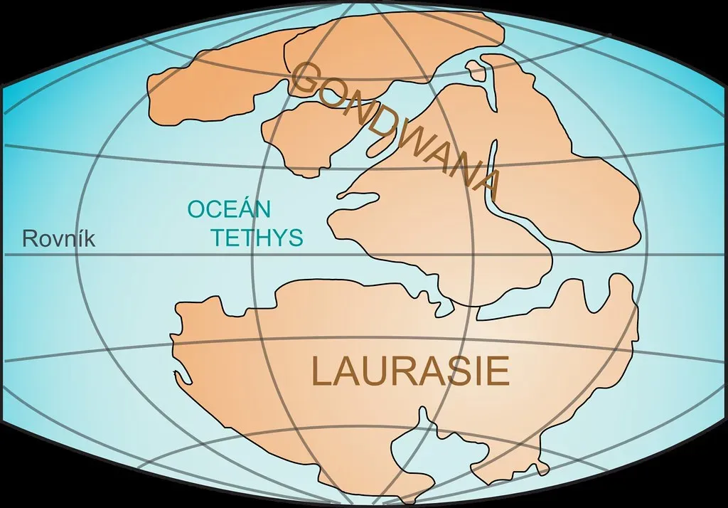
Gondwana was a southern supercontinent that included what is now South America, Africa, Antarctica, Australia, the Indian subcontinent, and parts of the Middle East. For hundreds of millions of years, it sat astride the Southern Hemisphere, influencing ocean currents, climate belts, and the evolution of life on land. We can still trace its outline today in matching mountain belts and fossil patterns across these scattered continents, like a torn photograph that still lines up at the edges.
The mystery lies in the details of how Gondwana came together and broke apart. Its assembly involved a series of colliding crustal blocks and older cratons, creating huge mountain ranges that have since been deeply eroded. Its breakup sent landmasses drifting northward into new climates, changing rainfall patterns and reshaping ecosystems. The paths that India and Australia took, in particular, still raise questions about the forces beneath them, including deep mantle plumes that may have helped pry Gondwana apart from below.
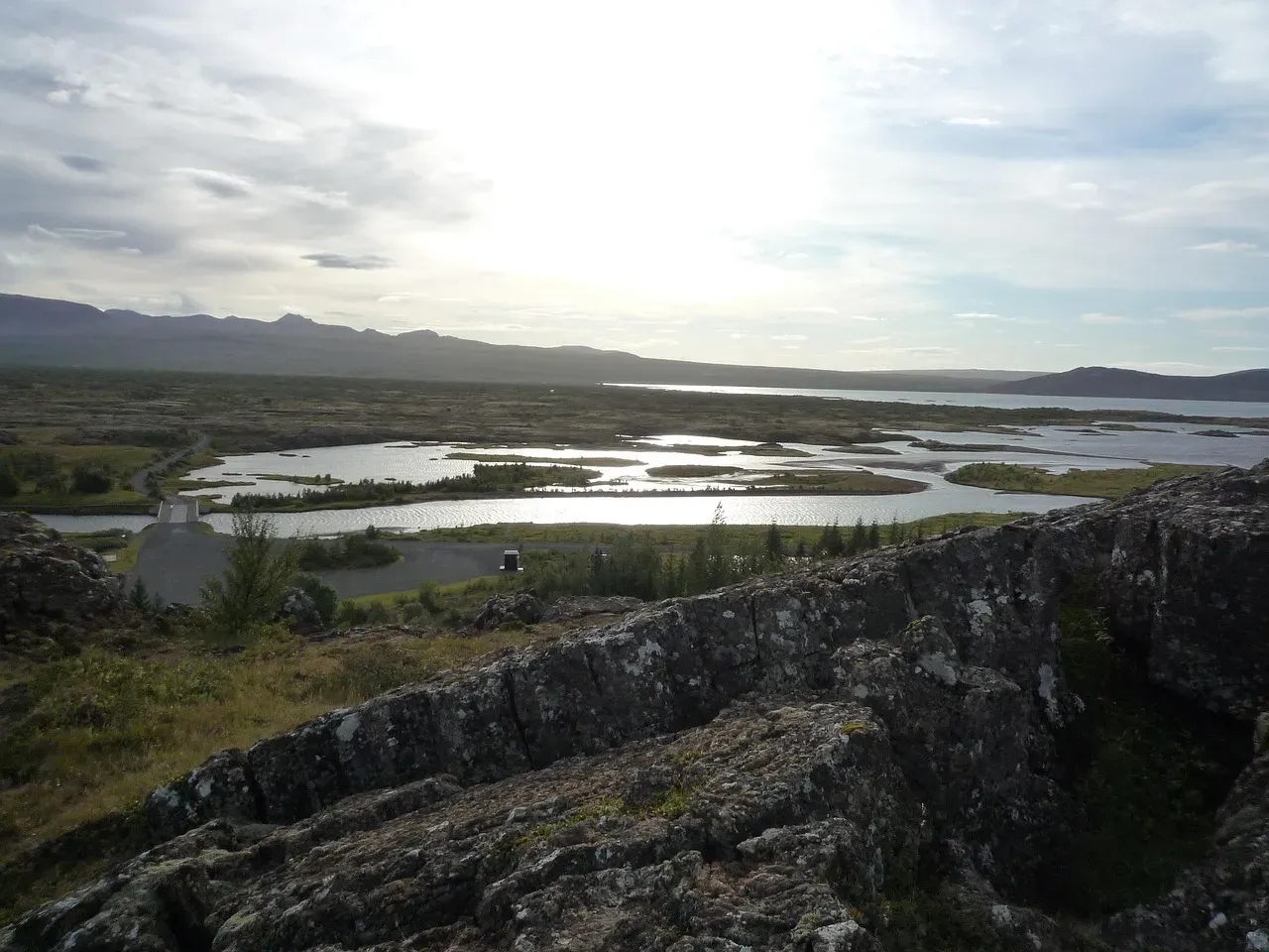
The Pangaea Puzzle and the Opening of the Atlantic
Pangaea, the most famous supercontinent, gathered nearly all of Earth’s land into one vast cluster around three hundred million years ago. It stretched from pole to pole, with deserts in its arid interior and long coastlines facing a single global ocean. The collision that formed Pangaea built titanic mountain ranges, including the ancestors of the Appalachians and parts of the Atlas and Scandinavian ranges. Then, in a reversal of fortune, Pangaea began to split, eventually giving birth to the Atlantic Ocean.
The odd thing is that the Atlantic did not open along the exact same lines where Pangaea first welded together. Instead, older sutures and weaknesses sometimes remained locked, while new rifts exploited different zones of stress and mantle dynamics. This raises a deeper question: why does a future ocean open in one place and not another? The breakup of Pangaea shows how mantle convection, hotspot activity, and stress fields can combine in surprising ways to tear continents along fresh scars instead of old ones, leaving geologists with a continent-scale jigsaw puzzle that doesn’t always behave as expected.
The Afar Triple Junction and the Birth of New Oceans
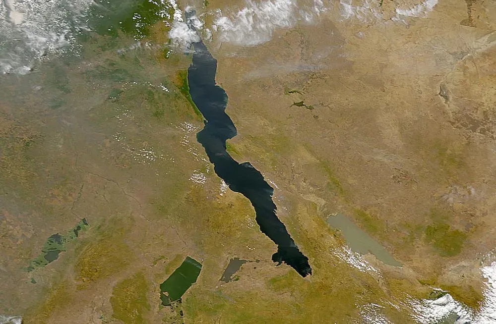
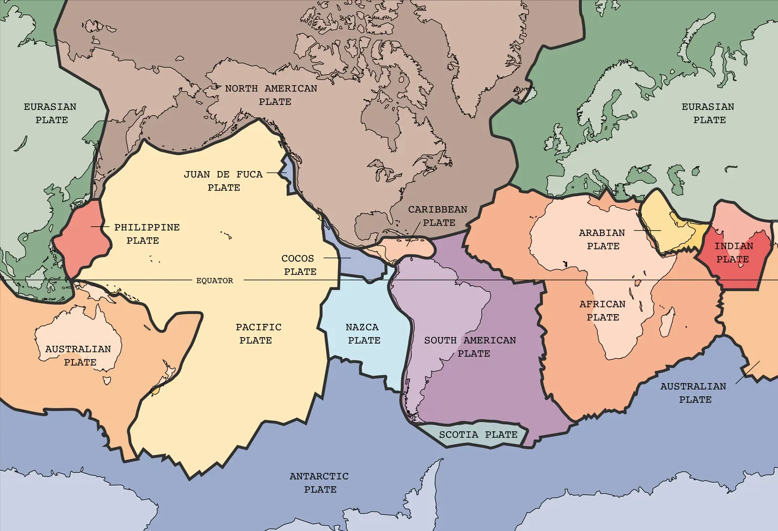
In northeastern Africa, in the Afar region, you can literally walk across the place where a continent is being ripped into pieces. There, three great rift arms meet: one heading north along the Red Sea, one following the Gulf of Aden, and one slicing into East Africa. It’s called a triple junction, and it marks the early stages of ocean birth. Some arms are already flooded by seawater, while others host deep valleys, active volcanoes, and thinned crust on the brink of rupture.
What makes Afar so fascinating is that it offers a real-time glimpse into processes that shaped ancient supercontinents. Yet the driving forces are still debated: how much is due to a hot mantle plume pushing up from below, and how much is due to regional plate stresses pulling apart the crust? Not every rift succeeds in becoming an ocean; some die as failed scars within continents. Whether all three arms at Afar will fully evolve or one will fade remains uncertain, but the outcome will redraw the map of Africa and the surrounding seas over the next tens of millions of years.
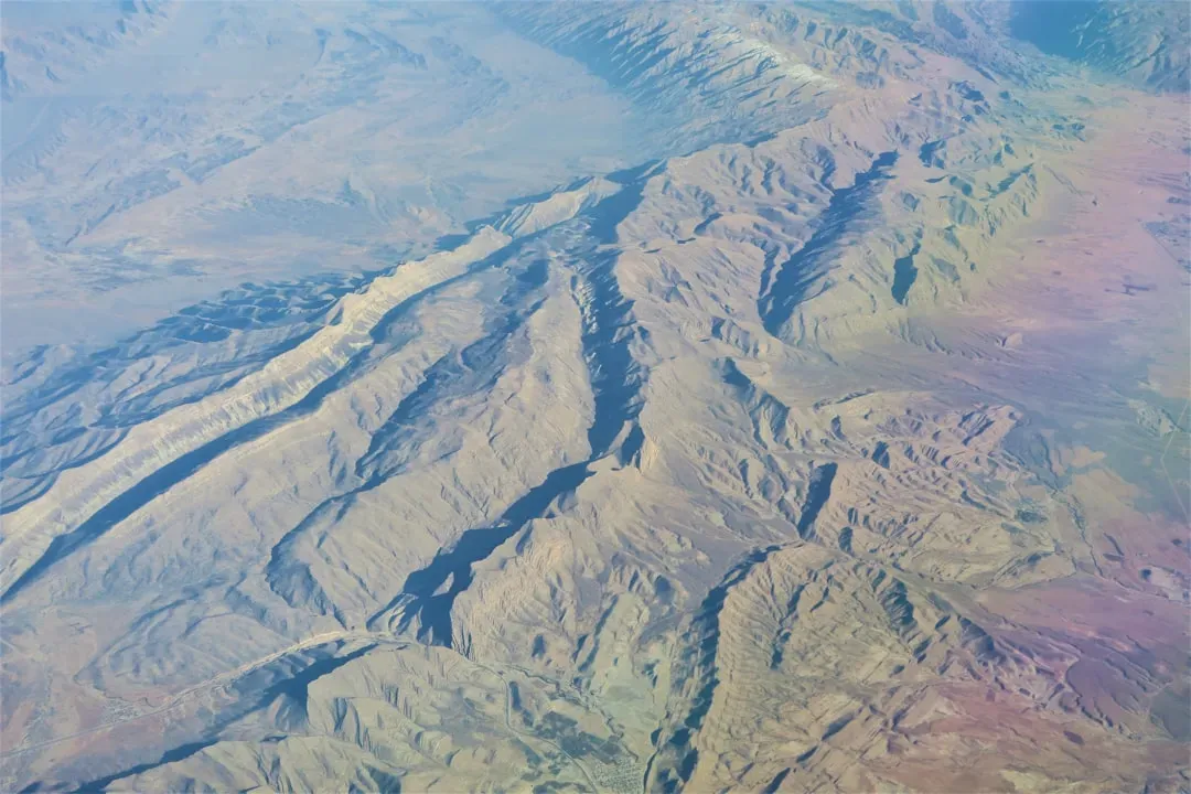
The India–Asia Collision and the Rise of the Himalaya
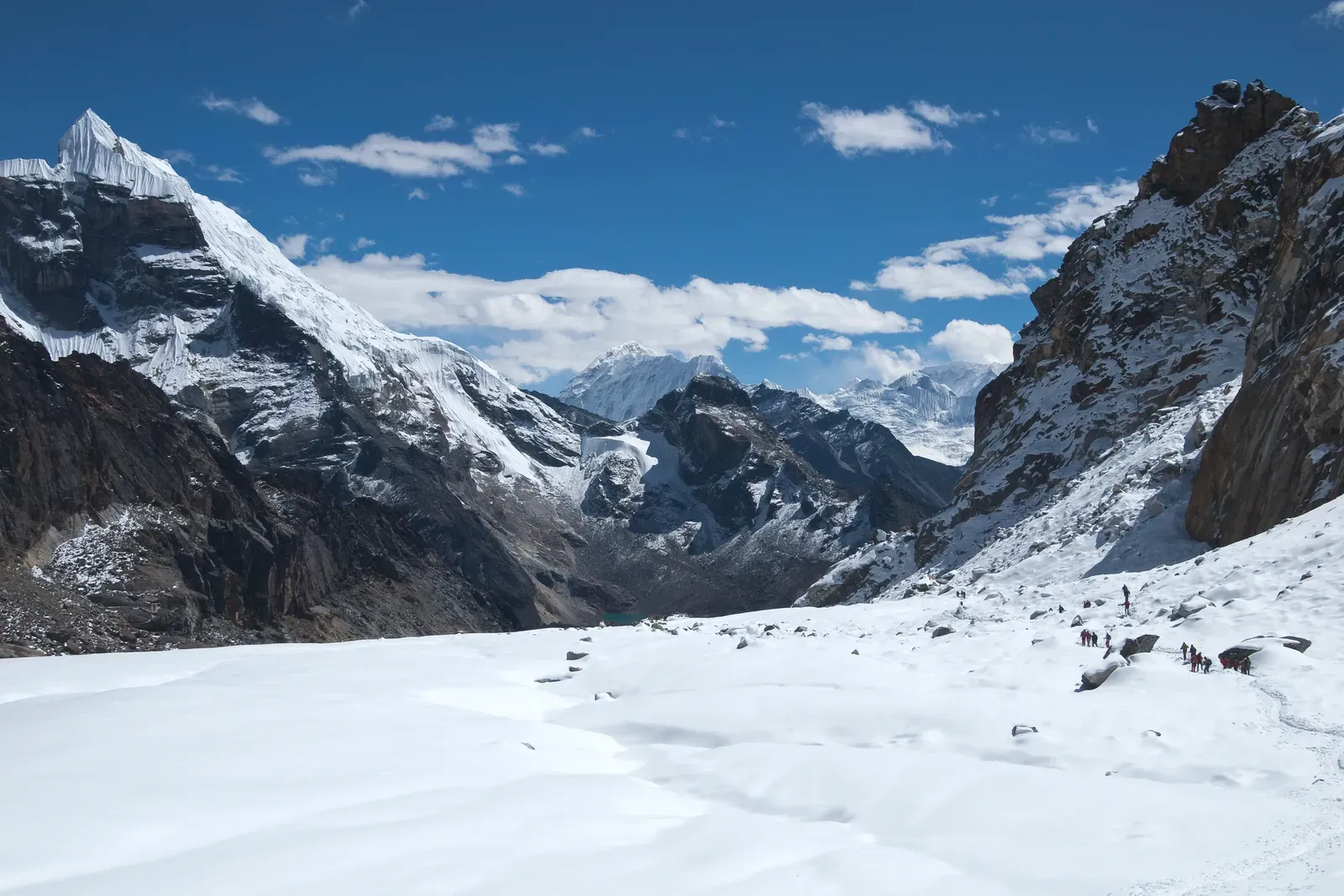
About fifty to sixty million years ago, the Indian plate raced northward across the Tethys Ocean and slammed into Eurasia. The speed was remarkable on geological timescales, like a car careening into a slow-moving truck. The result was the uplift of the Himalaya and the Tibetan Plateau, one of the most dramatic mountain-building events on the planet. These ranges are still rising and eroding today, feeding immense rivers and influencing monsoon systems that support billions of people.
The deep mechanics of this collision remain surprisingly murky. India’s crust seems to have jammed far beneath Asia, but exactly how it deforms and how far it underthrusts is still being unraveled with seismic imaging and GPS measurements. The collision did more than build mountains: it altered atmospheric circulation, increased rock weathering, and may have contributed to long-term cooling by drawing carbon dioxide out of the air. The shape of modern Asia and the climate felt worldwide are, to a large extent, consequences of this one massive continental crash.
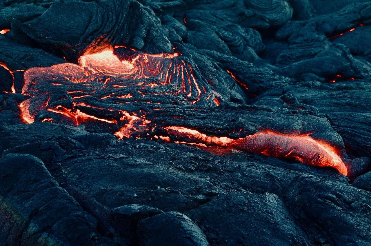
Superplumes, Large Igneous Provinces, and Continental Breakup
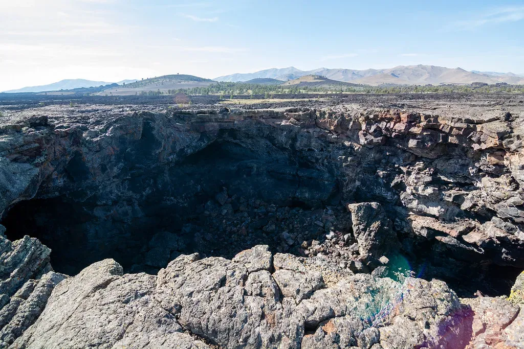
Sometimes the mantle seems to belch. Huge upwellings of hot rock, known as superplumes or large mantle plumes, can flood continents with enormous volumes of lava over relatively short timescales. These outpourings form large igneous provinces, like the Deccan Traps in India or the Central Atlantic Magmatic Province that erupted during the breakup of Pangaea. Their footprint can stretch across entire regions, burying landscapes under layers of basalt and pumping gases into the atmosphere.
The connection between these deep plumes and continental breakup is a topic of intense study. Do plumes rise first, weakening the lithosphere from below and triggering rifting, or does stretching crust create space that allows plume material to surge upward more easily? The answer may differ from case to case, and that uncertainty is part of the mystery. But the impact is clear: these events can help tear continents apart, open new oceans, and even coincide with mass extinctions, tying the hidden rhythms of Earth’s interior to the fate of life on the surface.
Continents as Ghost Stories Written in Stone
Look at a world map and it’s tempting to see stability, as if the continents have always looked more or less this way. In reality, they are the survivors of countless hidden battles between plates, plumes, ice sheets, and time itself. Each of the mysterious events above – from half-imagined supercontinents to missing rock records and unfinished ocean basins – leaves us with questions as important as the answers we already have.
I’ve always loved the idea that every rock outcrop is a sentence in a language we’re still learning to read. We may never fully reconstruct every twist of Earth’s story, but with each new drill core, satellite image, and seismic survey, the continents become a little less silent. The real thrill is that this is not a closed book: the next supercontinent, the next great rift, the next mountain range is already in motion beneath our feet, whether we notice or not. When you stand on the ground tomorrow, will you feel it as something solid – or as a momentary pause in a very long, very restless journey?