
Storm’s Rapid Approach Signals Travel Disruptions (Image Credits: Unsplash)
New York City – Residents and officials alike are on high alert as a potent winter storm barrels toward the region, promising the most substantial snowfall in years.
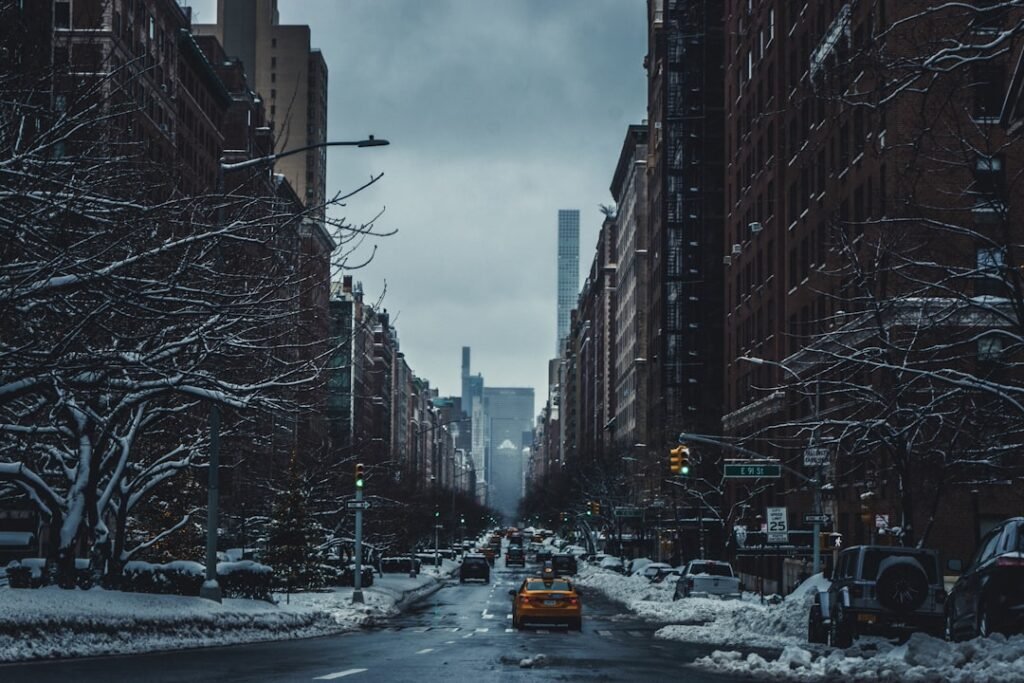
Storm’s Rapid Approach Signals Travel Disruptions
The National Weather Service issued a winter storm warning for the New York City area and surrounding regions, effective from late Friday afternoon through early Saturday. This system marks a departure from recent mild winters, with forecasters predicting a swift intensification that could catch some off guard. Snowfall rates may reach one to two inches per hour during peak conditions, leading to rapid accumulation on roads and sidewalks.
City officials, including Mayor Eric Adams, have urged caution for anyone planning to travel during the evening commute. The storm’s timing aligns with post-holiday activities, potentially complicating returns from family gatherings or shopping trips. Governor Kathy Hochul echoed these concerns, emphasizing the need for preparedness in the broader Tri-State area. While the event promises a picturesque winter scene, the underlying hazards demand immediate attention from commuters and pedestrians alike.
Forecast Details Reveal Varied Snow Accumulations
Across New York City, accumulations of four to eight inches appear likely, with some models suggesting up to seven inches in central areas by Saturday midday. The heaviest bands are expected to target the metro region starting around 8 p.m. Friday, transitioning to lighter flurries by morning. To the north and west, totals could climb higher, while southern zones might see a mix of snow and sleet that tempers buildup.
AccuWeather and other services align on this outlook, highlighting a fast-moving front that limits prolonged effects but maximizes intensity in a short window. Visibility could drop below a quarter mile during the storm’s core, posing risks for drivers on major arteries like the FDR Drive or Brooklyn-Queens Expressway. Historical comparisons place this event among the more notable snowfalls since 2021, though far from record-breaking depths. Forecasters continue to refine predictions as the system evolves offshore.
Impacts Extend Beyond the Immediate Snowfall
Beyond accumulation, the storm threatens icy conditions on untreated surfaces, particularly bridges and overpasses that freeze quickly. Public transit operators, including the MTA, anticipate delays on subways and buses, with possible suspensions on elevated lines if winds pick up. Airports like JFK and LaGuardia have not yet announced widespread cancellations, but travelers should monitor updates closely.
Emergency services prepare for potential pileups and medical calls related to slips and falls. The city’s emergency management department has activated protocols to salt major roads preemptively. In a region still recovering from holiday bustle, this weather shift underscores the unpredictable nature of East Coast winters. While not catastrophic, the combination of snow and timing amplifies everyday vulnerabilities.
Essential Preparation Steps for Residents
To navigate the storm safely, New Yorkers should stock essentials like non-perishable food, water, and medications for at least 72 hours. Clear vehicles of snow before driving, and keep an emergency kit with blankets, flashlights, and a charged phone in the car. Authorities recommend avoiding unnecessary travel from 6 p.m. Friday onward, opting instead for remote work if possible.
Here are key actions to take:
- Charge all devices and ensure backup power sources for outages.
- Insulate pipes to prevent freezing in colder apartments.
- Secure outdoor items like patio furniture against gusts.
- Check on elderly neighbors or those with mobility issues.
- Layer clothing and wear appropriate footwear for outdoor errands.
Regional Outlook and Long-Term Implications
The Tri-State area faces similar threats, with northern New Jersey and southern Connecticut under warnings for up to eight inches. Pennsylvania’s interior may encounter freezing rain, adding a layer of ice to the mix. As the storm exits, milder air returns Sunday, melting much of the snow but leaving slushy streets.
This event serves as an early reminder of winter’s grip, potentially setting the tone for a snowier season influenced by La Niña patterns. For more details, consult forecasts from The New York Times.
Key Takeaways
- Expect 4-8 inches of snow in NYC, with peak rates Friday evening.
- Travel advisories are in place; plan to stay indoors if feasible.
- Prepare kits and monitor local alerts for real-time updates.
As the flakes begin to fall, this storm offers a chance to embrace winter’s beauty while respecting its power – perhaps dusting off sleds for neighborhood hills once safer. What are your plans to weather this wintry blast? Share in the comments below.