There is something deeply unsettling about a civilization that seems to be doing everything right – building vast cities, mastering the local environment, trading over continents – only to vanish just as it hits its stride. Archaeologists today are piecing together these disappearances with tools that would have sounded like science fiction a generation ago: ancient DNA sequencing, high‑resolution climate models, satellite‑based mapping. Yet, even with all that tech, some of the most advanced ancient cultures still slip through our fingers at the moment of their greatest success. What, exactly, pushes a thriving society over the edge – and what does that say about our own? Those questions haunt every excavation pit and climate graph tied to these lost worlds.
The Indus Valley Civilization: When Climate Quietly Undermined a Super-City Network
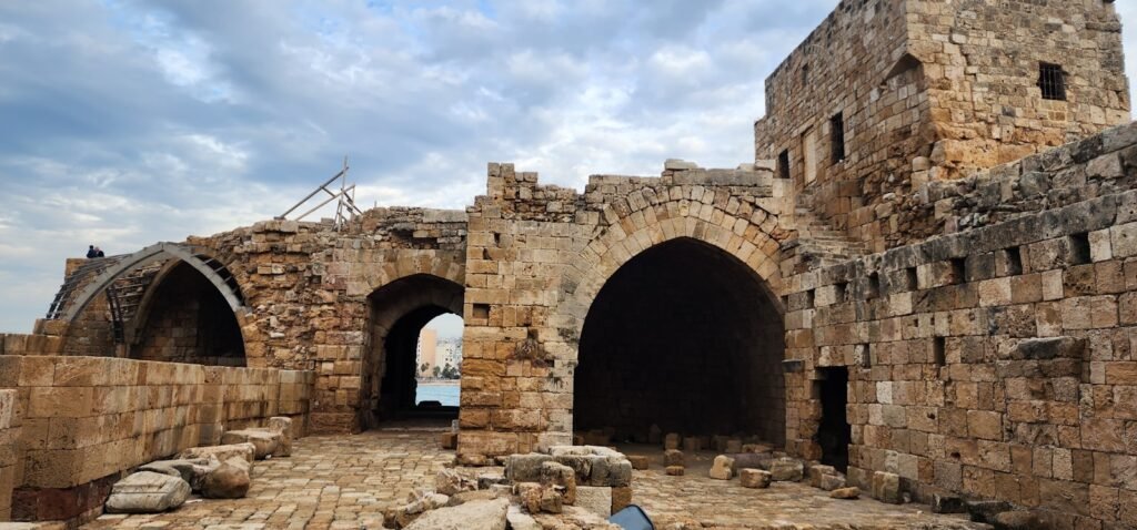
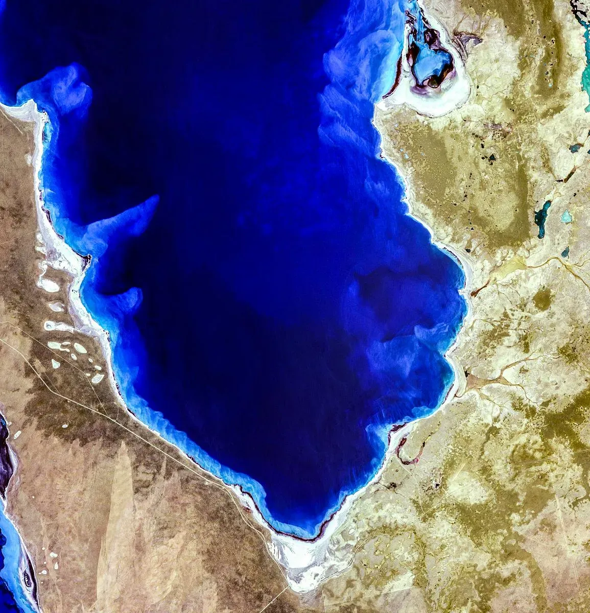
Imagine a Bronze Age world of straight, gridded streets, multi-story brick houses with private bathrooms, and drainage systems that would embarrass some modern towns. That was the Indus Valley Civilization at its height, stretching across what is now Pakistan and northwest India, with great cities like Mohenjo‑daro and Harappa anchoring a web of trade to Mesopotamia and beyond. For centuries, this network thrived on precise water management, harnessing monsoon-fed rivers and seasonal floods to support dense urban populations. Then, right around its zenith, the system began to quietly unravel – not with a single invading army or volcanic blast, but with something far more patient: long, grinding drought. Recent climate reconstructions show repeated century‑scale dry periods that chipped away at the very foundation of Indus urban life.
New studies published in late 2025 combine paleoclimate records, river modeling, and archaeological data to paint a picture of relentless environmental pressure rather than spectacular catastrophe. Multi-decade and even century-long droughts weakened monsoon rains, shrank rivers, and turned once-reliable floodplains into patchy, risky farmland. Rather than a Hollywood‑style collapse, people seem to have gradually abandoned the big cities, shifting toward smaller, rural settlements closer to whatever water remained. Archaeologists see this in the shrinking size of urban sites, changes in crop choices, and the fading of standardized weights and writing that once tied the civilization together. In a sense, the Indus people adapted impressively to climate stress – just not enough to sustain their urban peak, leaving behind a sprawling network of ruins that mark where a hydrological gamble finally stopped paying off.
The Maya Classic Cities: Great Pyramids, Fractured Politics, and a Sky That Stopped Delivering Rain
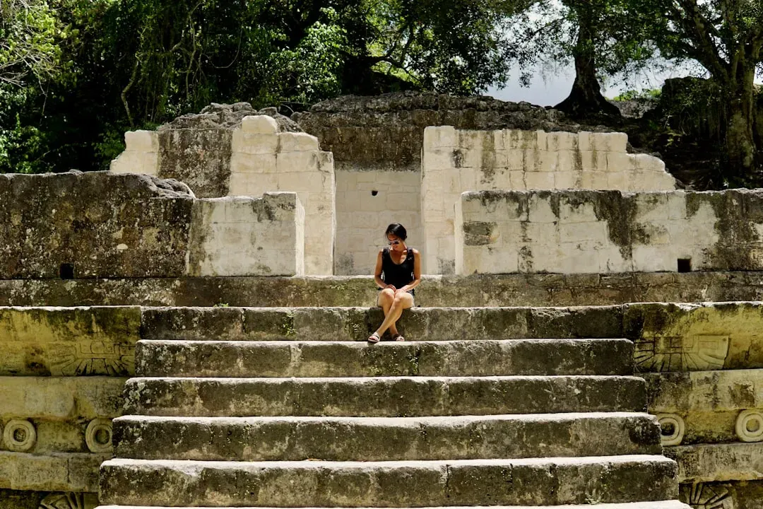
By the eighth century of the Common Era, the great Maya cities of the southern lowlands were staging something like an arms race in stone. Kings commissioned taller pyramids, more elaborate palaces, and intricately carved monuments proclaiming their victories. Places like Tikal, Copán, and Palenque were not just ceremonial centers; they were political and economic engines pulling in tribute, goods, and labor from far beyond their walls. From a distance, it looked like an unstoppable ascent. Then, within a few generations, many of these cities were largely deserted, plazas choking with vegetation, their final monuments hinting at turmoil and desperation.
For years, people blamed some single cause – war, a mysterious plague, or cultural “decadence.” The modern picture is harsher and more complex. Cave formations, lake sediments, and mud cores now show that the Maya lowlands were hit by a series of severe, prolonged droughts during the so‑called Classic Maya collapse. These dry spells struck just as populations peaked and deforested landscapes amplified water stress, undermining the intensive agriculture that had been feeding swollen city populations. At the same time, inscriptions speak of intensifying warfare and political fragmentation, as rulers fought for dwindling resources and status. It was the worst possible combination: fragile food systems, a changing climate, and rival elites locked in escalating competition, pushing the civilization off balance right at the top of its pyramid-building arc.
Tiwanaku in the Andes: High-Altitude Mastery That Failed on a Knife-Edge
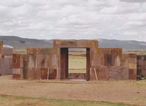
High on the Bolivian Altiplano near Lake Titicaca, the Tiwanaku civilization pulled off one of the most audacious feats of ancient engineering: turning cold, frost-prone highlands into reliable farmland. At its peak around the first millennium of the Common Era, Tiwanaku’s capital sprawled over several square kilometers, with monumental stone platforms, sunken plazas, and carefully carved monoliths aligned with solar events. Archaeologists estimate that tens of thousands of people lived in and around the city, supported by a sophisticated system of raised fields and canals that buffered crops against temperature extremes. It was an unlikely place for a power center, and that was exactly its strength – until it became a weakness.
For a long time, scholars pointed to a single drought as the smoking gun that killed Tiwanaku, arguing that reduced rainfall made raised-field agriculture impossible. Recent work has complicated that story, suggesting that aridity probably intensified after the civilization was already weakening, and that internal social and political shifts played a major role. Excavations reveal evidence of deliberate destruction – monolithic gates toppled, elite compounds burned, storage jars smashed – as if the very symbols of Tiwanaku power had become targets. At the same time, new discoveries like the Palaspata temple complex in 2025, aligned with the solar equinox and perched on ancient trade routes, show just how integrated Tiwanaku’s religious and economic systems were at their peak. When that nexus of ritual, trade, and high‑altitude farming faltered, the collapse was steep: an imperial highland hub reduced to scattered communities and enduring myths in less than two centuries.
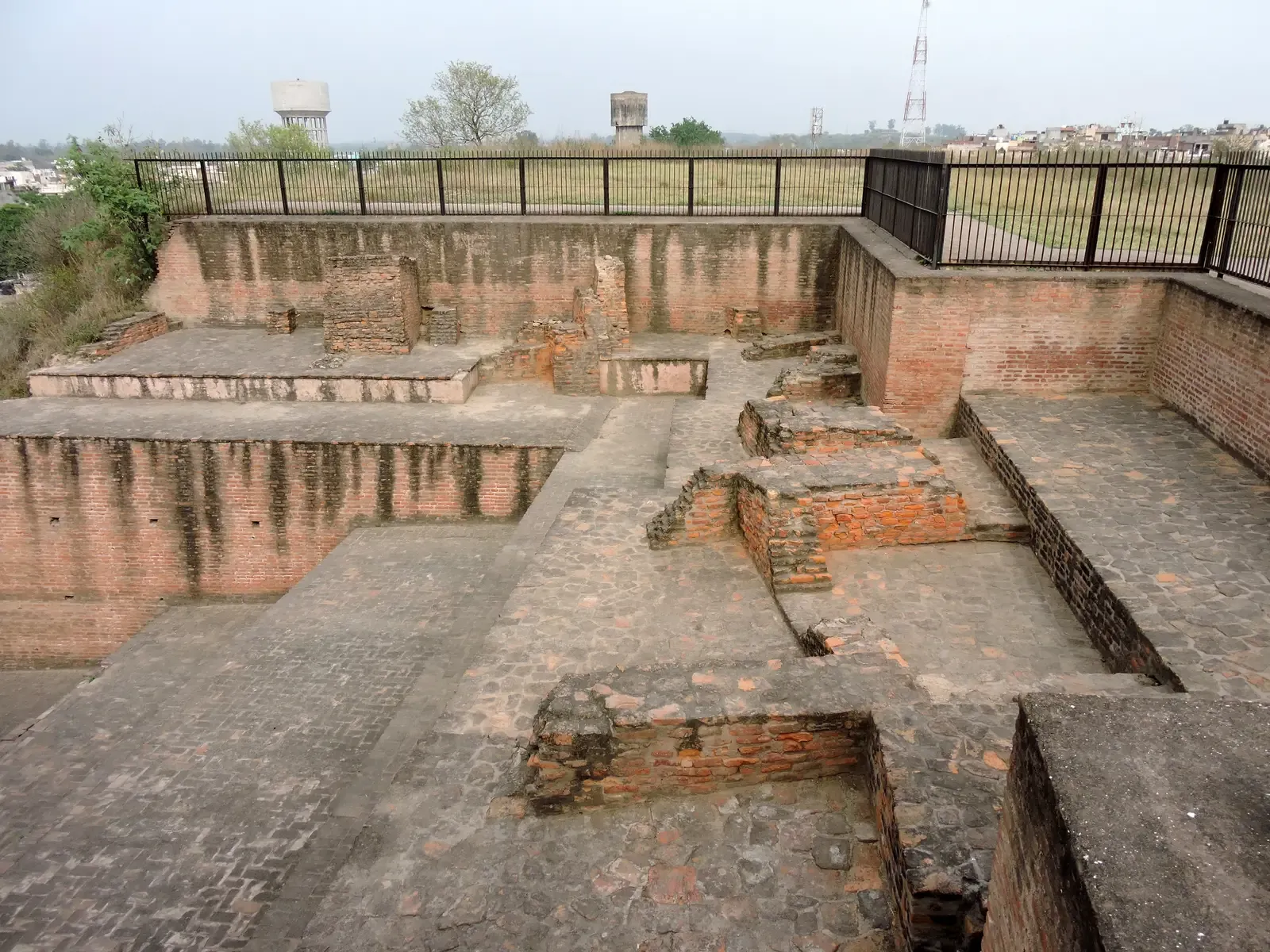
Ancestral Puebloans of Chaco Canyon: Megastructures in the Desert That Emptied Overnight
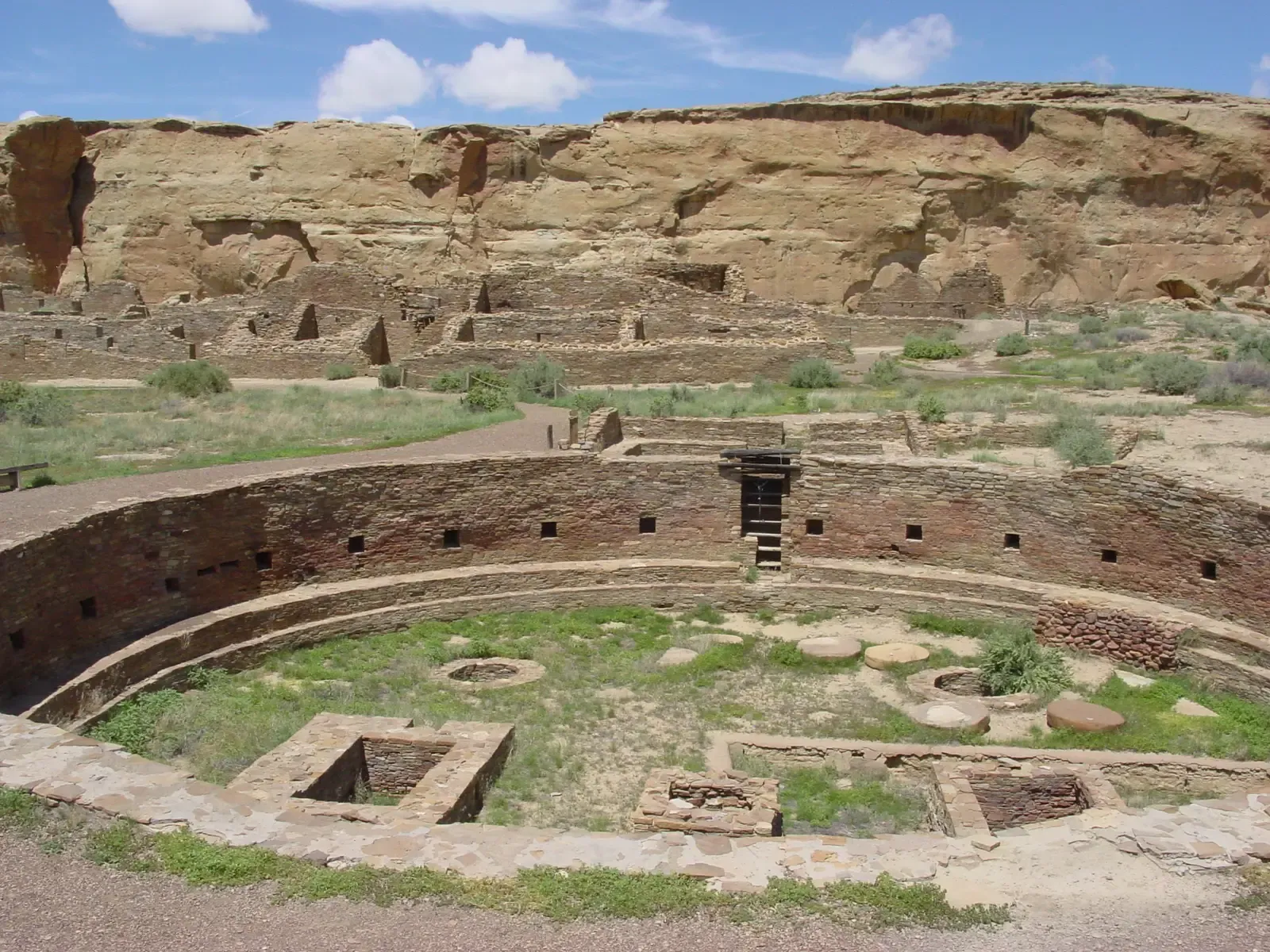
Walk into Chaco Canyon in New Mexico today and the great houses feel almost out of place, like multi-story apartment blocks mysteriously dropped into a harsh desert. Between about 900 and 1150 of the Common Era, the Ancestral Puebloans turned this landscape into one of North America’s most complex cultural centers. They quarried vast quantities of sandstone, hauled timber from mountain ranges dozens of miles away, and assembled buildings such as Pueblo Bonito that held hundreds of rooms around open plazas. These structures were laced together by straight, engineered roads radiating across the San Juan Basin, suggesting a level of planning and coordination that would not be matched on the continent for centuries.
Then, almost as suddenly as Chaco rose, people stopped living there in large numbers. Excavations show a decline in construction, a shift in room use, and eventually large-scale abandonment by the late twelfth century. Climate records point to a prolonged drought beginning in the 1130s, which would have strained local agriculture and food storage just as Chaco’s population and ceremonial demands peaked. Yet climate alone is not the whole story. Political power may have been highly centralized, with elites controlling ritual gatherings, food distribution, and long-distance trade in items like turquoise. Once that system became too brittle – too dependent on increasingly scarce resources and precarious harvests – the logic of gathering in Chaco faltered, and people moved to other regions. Recent genetic work linking present‑day Pueblo communities to Chaco’s residents underscores a crucial point: this was not a disappearance of a people, but the collapse of a specific, high‑risk way of organizing their world.
The Moche of Peru: Master Metalworkers Ambushed by El Niño and Rival Powers

On the arid north coast of Peru, the Moche built something remarkable out of sand and river mud: a culture of towering adobe pyramids, intricate irrigation systems, and some of the finest metalwork and ceramics in the ancient Americas. By around 600 of the Common Era, Moche elites presided over large urban centers, directed massive labor projects, and staged elaborate rituals that are still visible in wall paintings and buried offerings. Their economy depended on carefully managed irrigation canals that coaxed crops from bone-dry valleys, turning narrow river oases into densely farmed strips of green. It looked like total mastery of a marginal environment – until the Pacific Ocean changed its mood.
Geological and archaeological evidence indicates that the Moche heartland was hammered by extreme climate swings tied to El Niño patterns: years of catastrophic flooding followed by grinding drought. Flood deposits buried fields and settlements; later droughts turned canals into empty scars in the landscape. These environmental shocks arrived just as the Moche political system seemed to be centralizing power and concentrating wealth, creating vulnerabilities when agriculture failed. In the aftermath, their once-unified sphere appears to fragment into regional polities and, eventually, new cultural configurations. Their sudden loss of dominance right at their technological and artistic peak is a reminder that sophisticated metal tools and awe‑inspiring monuments do not automatically translate into long‑term resilience when the climate plays rough.
The Hittite Empire: A Superpower That Vanished from Diplomatic Tables
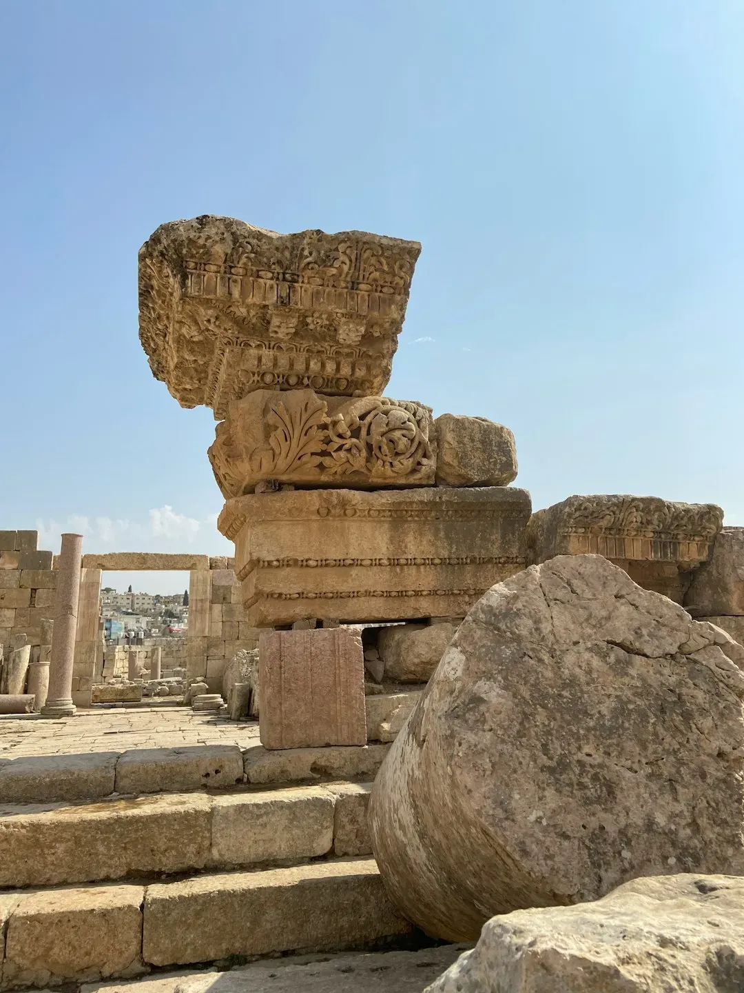
In the Late Bronze Age Near East, the Hittites were one of the big players – the sort of empire that shows up in other people’s archives. From their capital at Hattusa in central Anatolia, they negotiated treaties with Egypt, fought over Syrian cities, and integrated a patchwork of vassal states into a formidable military machine. Clay tablets from their palaces describe a bureaucracy capable of tracking grain deliveries, diplomatic marriages, and religious festivals across a wide territory. Around the thirteenth century before the Common Era, the Hittites were at or near their political zenith, a superpower embedded in a complex international system. Then, shockingly, they disappeared from that system almost entirely.
By the early twelfth century, Hattusa was abandoned, its archives buried and its temples silent. Scholars have tied this collapse to the wider crisis that hit much of the eastern Mediterranean at the end of the Bronze Age, when several major states faltered or fell. Possible culprits include extended droughts that undermined agriculture, invasions or migrations sometimes labeled as “Sea Peoples,” internal rebellions, and disruptions to long‑distance trade in vital materials like tin. Rather than a single cause, the Hittites may have been hit by a perfect storm at the height of their complexity and interconnectedness. Their rapid erasure from written records – followed by centuries of obscurity until modern excavations – has turned them into a textbook warning about how quickly even seemingly stable great powers can vanish from the diplomatic stage.
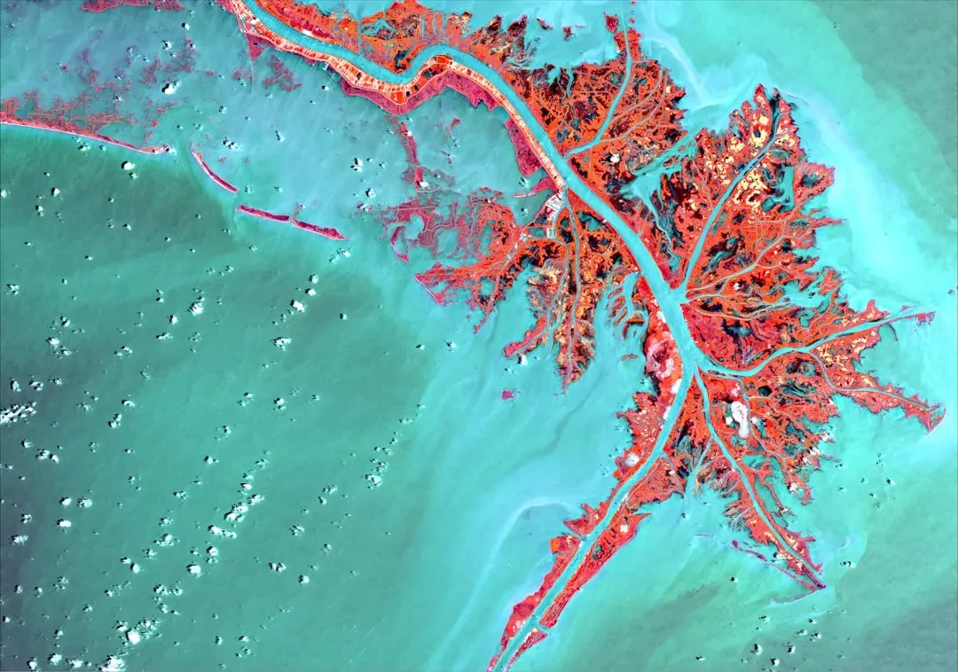
The Khmer Empire at Angkor: A Water Empire That Outgrew Its Own Infrastructure

If any ancient city looks immortal, it is Angkor. At its peak between the twelfth and early thirteenth centuries, the Khmer Empire’s capital in present‑day Cambodia was one of the largest urban complexes on Earth, with vast temple-mountains like Angkor Wat rising above a checkerboard of rice fields and reservoirs. Archaeologists using lidar (laser scanning from aircraft) over the last decade have revealed an astonishing, low‑density urban sprawl of roads, canals, ponds, and neighborhoods hidden beneath the forest canopy. The entire system was essentially a giant machine for capturing, storing, and distributing water in a monsoon climate – an engineering achievement on a continental scale. Yet this very success may have set the city up for a dramatic fall.
Evidence from tree rings, lake sediments, and the archaeological record suggests that Angkor was battered by a series of unusually severe droughts punctuated by intense monsoon floods in the fourteenth and fifteenth centuries. The water-management system, finely tuned for more typical conditions, began to fail: canals silted up, embankments broke, and emergency modifications seem to have made things worse in some areas. At the same time, the political focus of the Khmer rulers shifted, and trade routes increasingly favored emerging coastal centers. Angkor did not vanish overnight – people lived among the temples for centuries – but its role as a vibrant imperial capital collapsed just as its hydraulic and architectural achievements reached their peak. Today, tourists see serene stone faces in the jungle; scientists see the scars of an overextended infrastructure pushed beyond its design limits.
Why These Lost Peaks Matter Now
It is tempting to treat these civilizations as distant curiosities, safely sealed off in the past, but the pattern that emerges from their stories lands uncomfortably close to home. Time and again, societies hit their greatest heights of complexity and ambition just as their ability to absorb shocks quietly erodes. Dense populations, elaborate political hierarchies, and intricate infrastructure tie everything together – but also ensure that when one part fails, the damage can cascade. The Indus cities could not simply move their rivers; Chaco’s great houses could not conjure rain; Angkor’s reservoirs could not be rebuilt overnight. In that sense, the “mystery” is not that they disappeared, but that they sustained such fragile equilibria for as long as they did.
Modern climate models, satellite data, and high‑precision dating have let researchers test ideas that used to be pure speculation, shifting the narrative away from simplistic tales of vanished peoples and toward nuanced stories of adaptation, resilience, and eventual limits. These studies challenge the comforting idea that technological prowess or monumental architecture automatically buys long-term security. Instead, they show how societies at their zenith can be nudged past tipping points by the slow grind of environmental change, political overreach, or the accumulated weight of earlier decisions. For a world now building its own planetary‑scale infrastructure and nudging its own climate, these ancient case studies feel less like ghost stories and more like early chapters of a book we are still writing.
The Future Lens: New Tools, New Warnings
What makes this field so exciting in 2025 is how rapidly the toolkit for studying these vanished peaks is expanding. High‑resolution climate reconstructions now use everything from cave stalagmites to coral skeletons to simulate rainfall centuries or millennia ago, letting researchers overlay environmental data directly onto archaeological timelines. Ancient DNA, when handled with community partnership and ethical safeguards, can trace real lineages from past populations into the present, as seen with the connections between Chaco Canyon and modern Pueblo communities. Meanwhile, lidar and other remote‑sensing technologies are exposing hidden neighborhoods, roads, and field systems that were literally invisible beneath forests or modern development. Each new dataset nibbles away at the “mystery,” but also reveals how much more complex these societies really were.
Looking ahead, one of the biggest challenges will be integrating all these lines of evidence into models that can genuinely test “what‑if” scenarios. How close was Angkor to surviving its worst droughts if certain canals had been built differently? How much more could the Indus cities have endured if their water systems had been less centralized, or their crops more diversified? These are not just academic questions. Similar models are now being used to assess the vulnerability of modern megacities and food systems to prolonged droughts, sea‑level rise, or heat waves. The unsettling possibility is that many of today’s global networks may be just as finely tuned – and therefore as fragile – as the ancient systems we admire in museum exhibits and coffee‑table books.
What You Can Do With This Knowledge
It is easy to finish a story about lost civilizations and think, “That was then, this is now,” but the whole point of this research is to shrink that distance. As a reader, you can turn curiosity about mysterious ruins into support for the science and stewardship that keep those sites, and their lessons, alive. That can mean something as simple as following and sharing work by archaeologists, Indigenous scholars, and climate scientists who study these past worlds, or as concrete as visiting heritage sites responsibly – staying on marked paths, respecting local rules, and recognizing that these are not just ruins, but living cultural landscapes. Paying attention to how modern communities connect themselves to these ancient places also pushes back against the outdated notion that these civilizations “disappeared” rather than changed.
On a broader level, you can treat these stories as a lens on present-day choices. When you hear debates about water management, land use, or the risks of building critical infrastructure on increasingly unstable climate assumptions, remember the Indus rivers drying or Chaco’s drought-stricken fields. Support policies and initiatives – local, national, or global – that prioritize resilience over short‑term gain, especially in climate‑sensitive regions. And maybe the next time you see an image of an overgrown pyramid or a sunbaked great house, ask yourself a simple, unsettling question: how will future archaeologists read the ruins we are in the middle of building today?

Suhail Ahmed is a passionate digital professional and nature enthusiast with over 8 years of experience in content strategy, SEO, web development, and digital operations. Alongside his freelance journey, Suhail actively contributes to nature and wildlife platforms like Discover Wildlife, where he channels his curiosity for the planet into engaging, educational storytelling.
With a strong background in managing digital ecosystems — from ecommerce stores and WordPress websites to social media and automation — Suhail merges technical precision with creative insight. His content reflects a rare balance: SEO-friendly yet deeply human, data-informed yet emotionally resonant.
Driven by a love for discovery and storytelling, Suhail believes in using digital platforms to amplify causes that matter — especially those protecting Earth’s biodiversity and inspiring sustainable living. Whether he’s managing online projects or crafting wildlife content, his goal remains the same: to inform, inspire, and leave a positive digital footprint.