The most astonishing thing about Earth’s greatest landscapes is not that they exist, but that they are still changing beneath our feet right now. Mountains are rising, volcanoes are building new land, rivers are carving deeper scars, and even seemingly “frozen” deserts are quietly on the move. For scientists, these places are like open laboratories where the planet’s inner machinery is laid bare, if only for a moment. For the rest of us, they are a reminder that solid ground is anything but static. Once you start to see these living landscapes as works in progress rather than finished masterpieces, the whole planet feels less like a backdrop and more like a story still being written.
The Fiery Edge: Kīlauea Volcano and the Birth of New Land
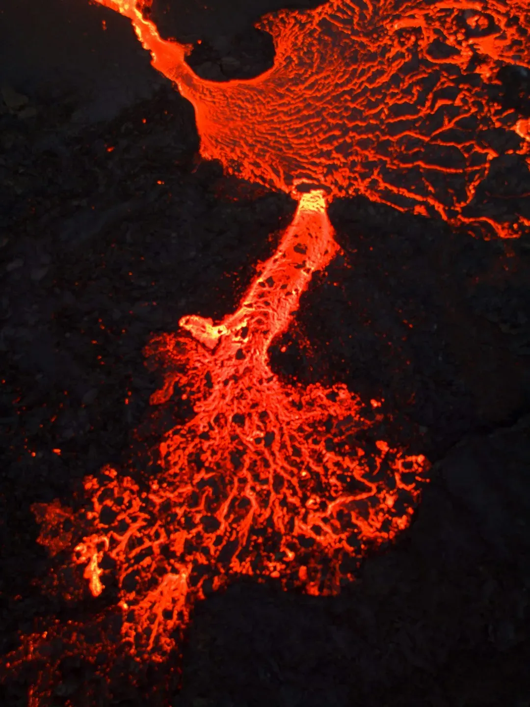
Stand on the flanks of Kīlauea in Hawaiʻi, and you’re watching Earth write new coastline in slow, glowing handwriting. This shield volcano, one of the most active on the planet, has been erupting on and off for centuries, but recent decades have seen especially dramatic outpourings of lava that extend the island into the Pacific Ocean. Instead of a single explosive peak, Kīlauea is more like a leaking cauldron, with lava vents, fissure eruptions, and lava lakes that rise and fall like a feverish pulse. Every flow that cools and hardens becomes fresh rock, a new chapter in the island’s growth. To walk on lava less than a human lifetime old is to feel time compressed under your boots.
Scientists track Kīlauea with a swarm of instruments: seismometers listening for deep rumbles, GPS stations measuring the slightest bulge or sag, and gas sensors sniffing sulfur and carbon dioxide from hidden magma. These real-time measurements help volcanologists understand how magma moves through the volcano’s plumbing system and where it might erupt next. They’ve learned that Kīlauea’s eruptions can switch styles abruptly – from steady “curtains of fire” to lava fountains or long-lived shield eruptions that feed rivers of molten rock. For local communities, this is not abstract science but crucial early warning, determining who may need to evacuate and when. The volcano may be a hazard, but it’s also a lifeline for Hawaiʻi’s origin story, continuously proving that this land is literally born of fire.
The River That Carves a Planet-Sized Scar: The Grand Canyon in Motion

People usually talk about the Grand Canyon as if it were a finished monument, but the Colorado River is still chiseling away at this mile-deep masterpiece. Over millions of years, water, rock, and time teamed up to slice through layer after layer of ancient sediments, exposing a cross-section of Earth’s history that spans nearly two billion years. What feels shocking is that this erosion has not stopped; the river is still grinding its load of sand and gravel against the bedrock like a planetary sandpaper. Flash floods surge through side canyons, undercutting cliffs and triggering rockfalls that reshape walls overnight. The canyon we photograph today is already slightly different from the one early explorers saw more than a century ago.
Geologists monitor erosion rates, landslides, and seasonal changes in river flow to understand how this iconic landscape keeps evolving. Modern dams have changed the river’s natural pulse, but carefully planned “controlled floods” from upstream reservoirs are sometimes released to mimic historic high flows, rebuilding sandbars and reshaping habitats for fish and riparian plants. Hikers occasionally witness fresh rockfalls or new debris fans poured out by thunderstorms, small but real reminders that gravity never sleeps. In a way, visiting the Grand Canyon is like walking into a construction site where the workers never clock out; you’re just arriving during a particularly quiet shift.
Under-Ice Volcanoes: Iceland’s Glaciers Hiding Fire Below
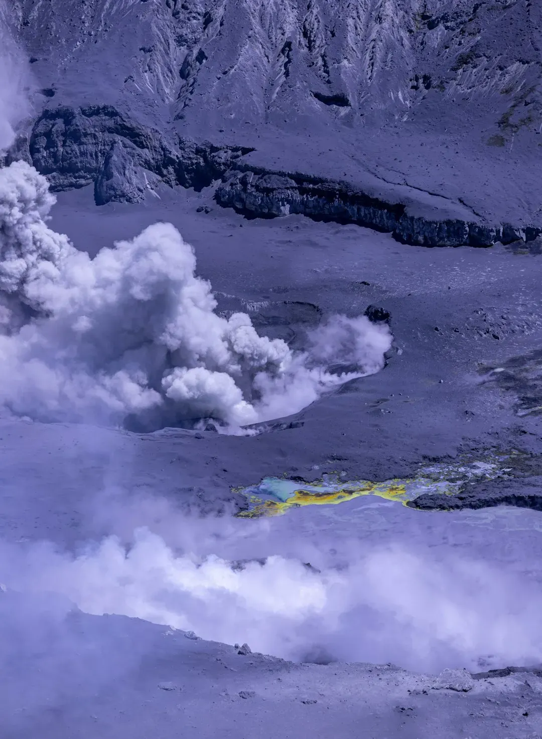
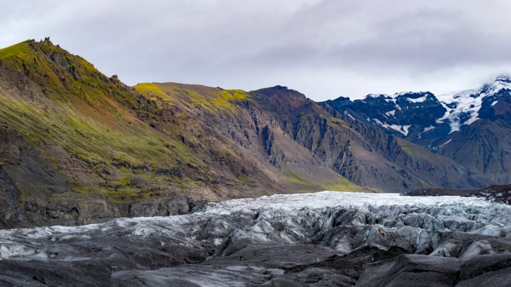
Nowhere does Earth feel more like a science fiction set than in Iceland, where glaciers and volcanoes literally share the same address. Beneath thick ice caps like Vatnajökull lie active volcanoes that erupt under the ice, melting it from below and triggering sudden glacial floods called jökulhlaups. The idea that a lava eruption you cannot see can still unleash walls of roiling, muddy water downstream is almost surreal. These floods can rip up roads, bridges, and power lines, rearranging valleys in a single chaotic day. Yet they are also part of a natural cycle that has shaped Iceland’s landscapes for thousands of years.
Researchers keep close watch on these hidden systems using GPS, satellite imagery, and radar that can see through ice to track swelling ice caps and subglacial lakes. When magma intrudes under the ice, it can lift the glacier subtly, like a bedsheet over a rising balloon, and that deformation is detectable from space. Recent decades have shown that Iceland’s ice-covered volcanoes are among the most dynamic on Earth, with episodes of unrest that challenge scientists to interpret incomplete clues. For Icelanders, the combination of glaciers and fire is a way of life: roads have detour plans, hazard maps are constantly updated, and communities practice how to live on a crust that is literally baking beneath a frozen crust.
Moving Mountains: The Himalaya Still Rising Toward the Sky
The Himalaya feel timeless, but geologically they are newborn giants still stretching upward. These mountains exist because the Indian Plate is colliding with Eurasia, ramming into it at the speed your fingernails grow and crumpling the crust into towering ridges. GPS measurements show that many parts of the range are still inching northward and upward every year, converting slow motion into colossal topographic drama. Earthquakes along the plate boundary occasionally release pent-up strain, abruptly shifting the landscape and reminding millions of people that they live on the front line of a planetary collision. Every valley, fold, and cliff in this region is essentially a freeze-frame from a slow-motion crash that is still far from over.
Geologists read the Himalaya like detectives, tracing thrust faults, folded strata, and metamorphic rocks that were once buried deep and are now exposed near the surface. River systems like the Ganges and Brahmaputra are busy trying to erode the mountains as fast as tectonics can build them, carrying vast loads of Himalayan sediment toward the ocean. In a rough sense, tectonics pushes up and erosion grinds down, and the visible mountains are the uneasy compromise between those two opposing forces. For communities across Nepal, India, Bhutan, and Tibet, this means living with landslides, glacial lake outburst floods, and earthquake risks that come directly from active mountain building. The Himalaya may be a spiritual refuge and a mountaineer’s challenge, but at their core they are a living, shifting experiment in plate tectonics.
Deserts in Motion: The Shifting Dunes of the Sahara and Beyond

When you look at satellite images of the Sahara or the Arabian Peninsula over time, one thing becomes instantly clear: dunes are not fixed. Sand seas made of crescent-shaped barchan dunes and towering star dunes are continuously on the move, driven by prevailing winds that push grains one tiny hop at a time. Individual dunes can migrate several meters a year, swallowing roads, fields, or even abandoned villages in their path. To people living nearby, sand encroachment is not a poetic idea but a daily challenge that reshapes where they can build homes or grow crops. It is strange to think of a landscape that feels so barren acting more like a slow, shallow river of sand.
Scientists study these dune systems with time-lapse satellite data, drone surveys, and on-the-ground measurements of wind speed and grain movement. They have learned that dunes can interact, merging like waves or splitting apart, creating complex patterns that echo across hundreds of kilometers. Climate shifts that alter wind strength or direction can gradually re-route entire dune fields, changing where sand accumulates and where it thins. Some governments track advancing dunes that threaten infrastructure, using windbreaks, vegetation barriers, or even dune stabilization projects to slow the sand’s march. The world’s great deserts might look timeless in photos, but on a geologic and even human timescale, they are restless giants drifting across continents.
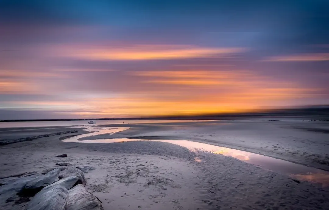
Coasts on the Edge: Delta Lands That Are Sinking and Growing
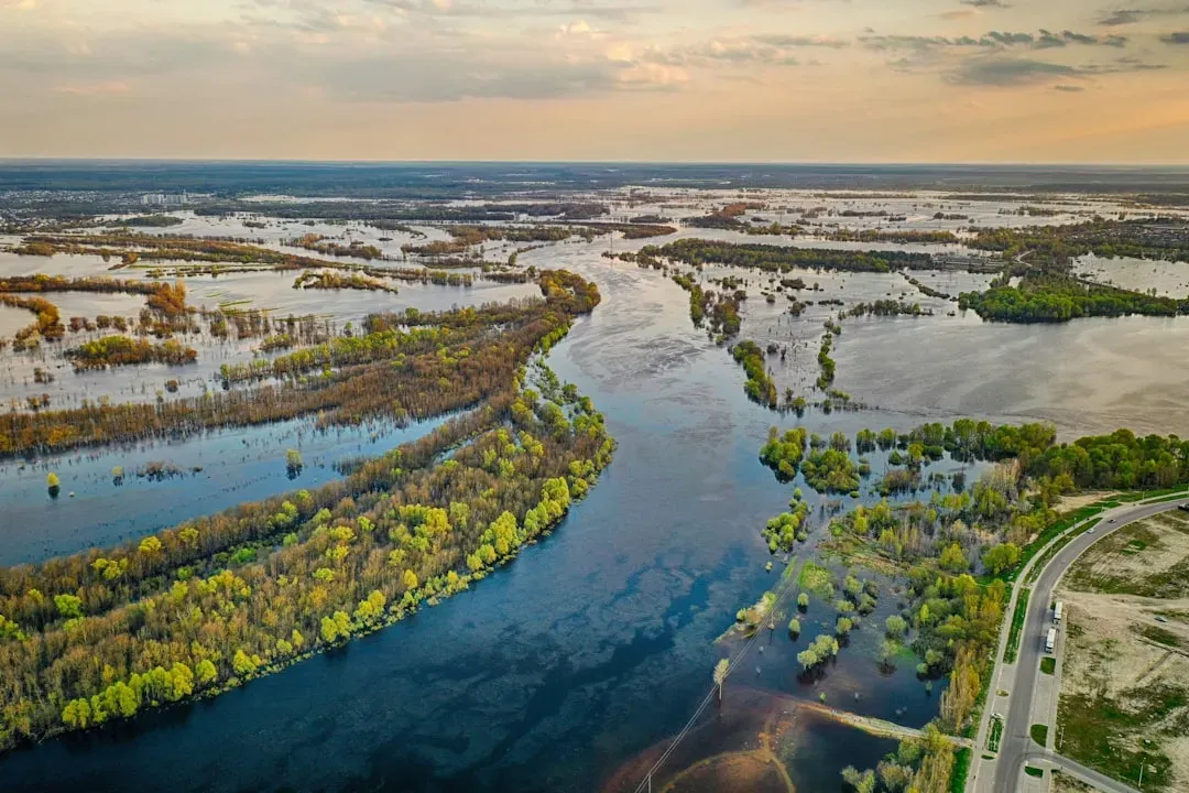
River deltas like those of the Mississippi, Nile, and Mekong are some of the most dynamic and vulnerable landscapes on Earth. These flat, marshy regions exist because rivers drop their sediment load as they slow down near the sea, building layer upon layer of mud and sand into low-lying land. At the same time, that soft sediment compacts and sinks, and rising seas push back, so deltas are engaged in a constant tug-of-war between growth and drowning. In many places, human activity has tipped the balance: levees and dams trap sediment upstream, starving the delta of the material it needs to keep up. As a result, large portions of some deltas are now subsiding and disappearing under the waves.
Scientists track these changes using satellite altimetry, tide gauges, and long-term field surveys of sediment thickness and land elevation. In rough terms, many deltas must grow vertically by several millimeters a year just to match modern sea-level rise, and some are falling behind. Coastal communities are on the front lines, facing land loss, saltwater intrusion into freshwater supplies, and more severe storm impacts. Restoration projects, like engineered sediment diversions on the Mississippi, attempt to reintroduce river mud into sinking wetlands and barrier islands. Standing on a delta today, you’re standing in a landscape that may be newly born, already sinking, or both at once.
Why These Living Landscapes Matter
It might be tempting to treat geology as a story about the distant past, but these twelve kinds of active landscapes prove that Earth’s engine is still humming loudly. Watching a volcano add new land or a river carve deeper into rock turns abstract concepts like plate tectonics and erosion into something visceral and real. Compared with older views that imagined continents as mostly fixed and unchanging, modern Earth science shows a planet in constant negotiation with itself. This shift in understanding is not just academic; it transforms how we plan cities, build infrastructure, and prepare for natural hazards. You cannot design wisely for the next century if you pretend the ground you build on is frozen in time.
These wonders also matter because they are natural climate archives and climate actors at the same time. Glaciers and ice-covered volcanoes store records of past atmospheres while responding dramatically to present warming. Deltas reveal how sea levels and sediment flows have changed over centuries, and deserts testify to shifts in wind and rainfall patterns. By reading these landscapes carefully, scientists can test climate models, refine hazard forecasts, and push beyond rough guesses toward evidence-based predictions. In a world wrestling with rapid environmental change, places that are visibly, measurably evolving become some of our most important teachers.
The Future Landscape: Technology, Risks, and the Next Century of Change
Peering forward, it is clear that the tools we use to study Earth’s active landscapes are becoming as transformative as the forces we’re trying to measure. High-resolution satellites, ground-based radar, drone fleets, and dense GPS networks now allow scientists to track tiny motions of ground and ice almost in real time. Machine learning tools sift through enormous datasets to spot subtle signals that humans might overlook, like precursory ground deformation before eruptions or patterns in dune migration linked to seasonal winds. These technologies promise earlier warnings for volcanic eruptions, landslides, and floods, potentially saving countless lives. Yet they also raise thorny questions about who has access to this information and how quickly it reaches at-risk communities.
Climate change adds another layer of urgency and complexity to this picture. As temperatures rise, glaciers retreat, permafrost thaws, and sea levels climb, reshaping the rules for mountains, coasts, and polar regions. Some landscapes are likely to cross tipping points, where small additional changes produce outsized responses – like sudden drainage of glacial lakes or rapid collapse of thawing cliffs. Governments and local communities will be forced to decide which places to defend, which to retreat from, and which to let transform. The next century of geology will be written not only by tectonic forces but also by human choices layered directly on top of them.
How You Can Engage With Earth’s Changing Wonders
You do not need to be a geologist to take part in the story of these living landscapes. Simple choices – like supporting protected areas around volcanoes, glaciers, and fragile coasts – help ensure that scientists can keep studying them and that ecosystems have room to adapt. Citizen science projects invite hikers, travelers, and local residents to log landslides, track shoreline changes, photograph glaciers, or monitor water levels in rivers and deltas. Those crowdsourced observations often fill gaps between official instruments, providing early hints that something unusual is happening. Even sharing that knowledge with friends and family shifts the conversation from seeing Earth as static scenery to seeing it as a responsive, changing system.
If you do get the chance to visit one of these places, go as both a witness and a caretaker. Choose local guides who respect safety rules around volcanoes, unstable cliffs, and deserts, and follow their lead rather than chasing the most dramatic photo. Support science centers, natural history museums, and field stations that translate cutting-edge research into accessible stories. And when you stand at the rim of a canyon, on a black lava field, or beside a restless glacier, take a moment to remember that you’re not looking at a finished picture but a single frame in a very long film. The next frame is already forming – are you ready to notice it?

Suhail Ahmed is a passionate digital professional and nature enthusiast with over 8 years of experience in content strategy, SEO, web development, and digital operations. Alongside his freelance journey, Suhail actively contributes to nature and wildlife platforms like Discover Wildlife, where he channels his curiosity for the planet into engaging, educational storytelling.
With a strong background in managing digital ecosystems — from ecommerce stores and WordPress websites to social media and automation — Suhail merges technical precision with creative insight. His content reflects a rare balance: SEO-friendly yet deeply human, data-informed yet emotionally resonant.
Driven by a love for discovery and storytelling, Suhail believes in using digital platforms to amplify causes that matter — especially those protecting Earth’s biodiversity and inspiring sustainable living. Whether he’s managing online projects or crafting wildlife content, his goal remains the same: to inform, inspire, and leave a positive digital footprint.