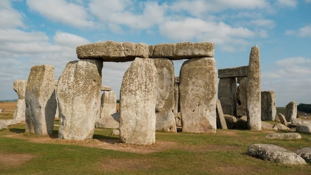
Scattered across the United States are stone circles, earthen mounds, and astronomy-ready alignments that look like they belong in a university textbook on Old World archaeology – except they sit above American strip malls and cornfields. Archaeologists have mapped thousands of these sites, yet for many of them, the basic questions of who built what, when, and why are still being argued in field camps and conference halls. In some cases, Native oral histories and cutting-edge science line up beautifully; in others, radiocarbon dates and local legends point in very different directions. What we do know is that ancient American builders were far more sophisticated than popular history once allowed. What we do not know is still reshaping how we think about the deep past of this continent.
The Serpent in the Hills: Ohio’s Enigmatic Effigy
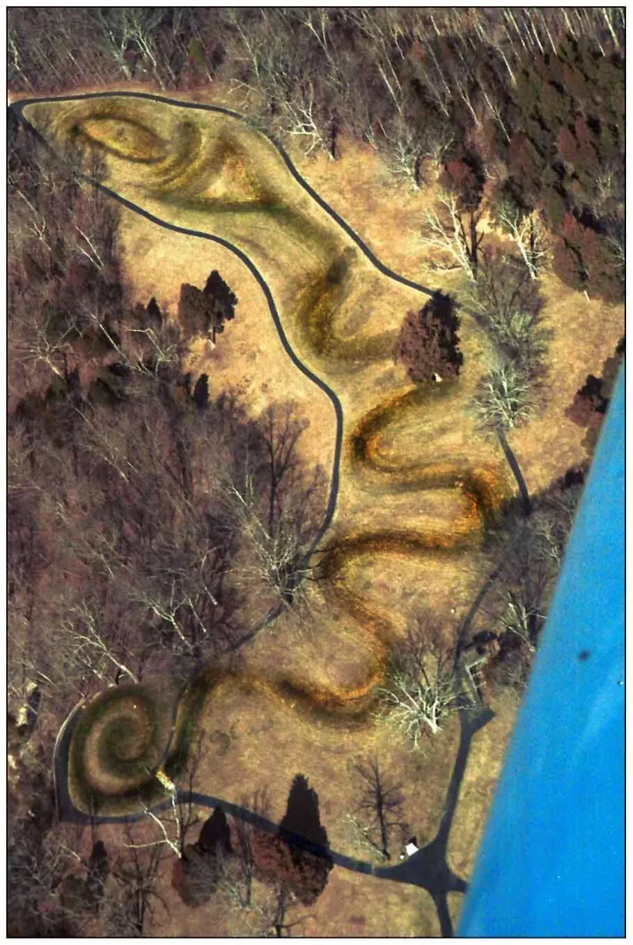
On a ridge in southern Ohio, a snake longer than four football fields uncoils in packed earth, jaws open toward a mysterious oval shape. Serpent Mound has inspired every kind of theory, from a cosmic calendar to a record of a catastrophic comet impact, and even now scholars disagree on which culture actually built it. Early researchers linked it to the Adena people around two thousand years ago, but more recent radiocarbon dates from charcoal in the embankment point toward the later Fort Ancient culture, active roughly about a thousand years ago. That chronological whiplash matters, because it changes who we credit with one of North America’s most iconic earthworks.
Archaeologists have used lidar scanning, soil analysis, and careful excavation to trace subtle construction stages in the mound, suggesting rebuilding or ritual renewal over generations. The site’s alignment with solstice sunsets hints at a complex knowledge of the sky, even if it is not the perfect “Stonehenge in dirt” some early writers imagined. Local Shawnee and other Native communities see Serpent Mound as a living sacred landscape rather than a puzzle to be solved, and that perspective increasingly shapes how research is conducted. Standing there at dusk, with the sky bleeding orange over the coiled ridge, it is hard not to feel that the mound was meant to be experienced as much as decoded.
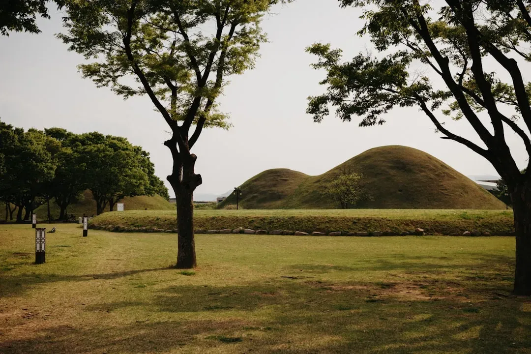
Cahokia’s Missing Builders: The City Without a Name
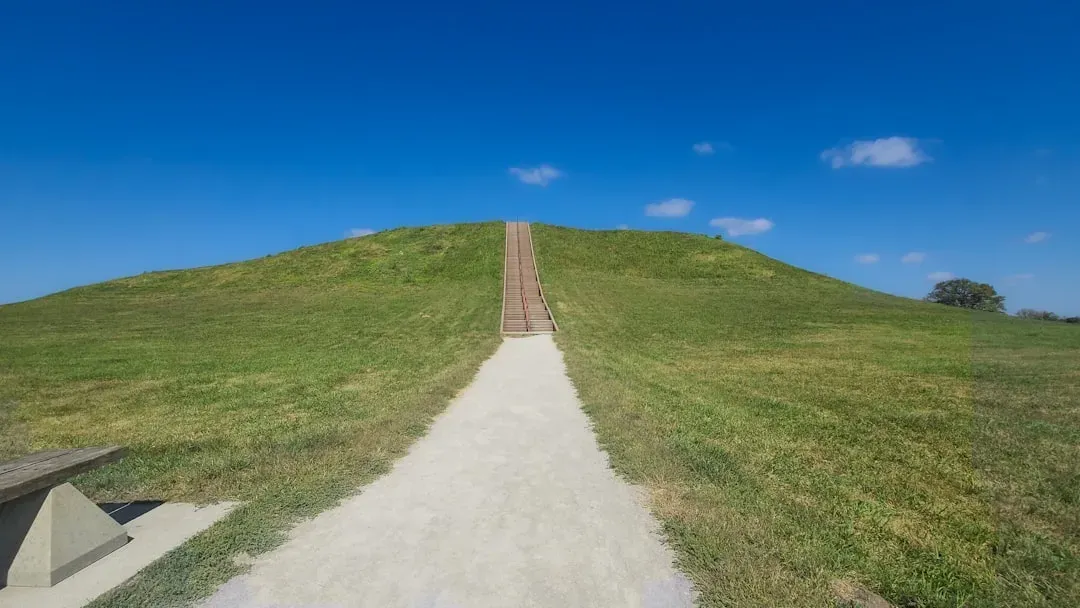
Just outside modern St. Louis, traffic whips past one of the largest pre-Columbian cities north of Mexico, and most drivers barely realize it. Cahokia once held a population comparable to a medieval European town, with a central plaza, a wooden “woodhenge” circle aligned to the solstices, and more than a hundred earthen mounds. Yet the people who built it left no known writing system, no convenient stone temples, and no clear descendants claiming its name. The city peaked around nine hundred to twelve hundred years ago, then declined and was largely abandoned long before Europeans arrived.
Archaeologists scrape at trash pits and burial mounds to reconstruct how Cahokia worked: a powerful central elite, long-distance trade in exotic materials like Gulf Coast shells and Great Lakes copper, and a social order that could mobilize thousands of laborers. Climate records suggest a mix of drought and flooding may have stressed the city’s food supply at the same time as political tensions grew. What makes Cahokia such a gripping mystery is the silence that followed its collapse; neighboring Indigenous traditions remember complex societies along the Mississippi, but rarely point clearly back to this specific city. For many of us who have walked the slopes of Monk’s Mound, the biggest question is simple and haunting: how do you misplace a civilization this big?
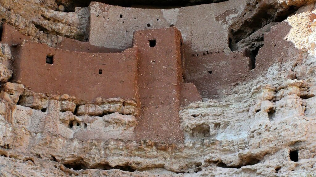
The Ancestral Puebloan Cliff Dwellings: Why Walk Away?
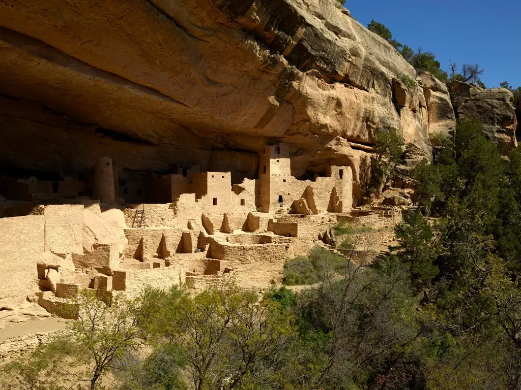
In the American Southwest, whole villages cling to cliff faces like architectural barnacles, tucked beneath sandstone overhangs with views that would make a luxury developer jealous. Places such as Mesa Verde and Bandelier were home to Ancestral Puebloan communities that engineered multi-story dwellings, kivas, and sophisticated water management in a demanding high desert environment. Tree-ring dating and excavations show that many of these dramatic cliff sites were built relatively late in the region’s sequence, often in the twelfth and thirteenth centuries. Then, within a few generations, many were abandoned as people moved south and east into areas that later became home to modern Pueblo communities.
The big question is not who built these structures; descendant communities such as the Hopi and various Pueblo nations see them as part of their own history. The unresolved puzzle is why so many cliff dwellings were constructed in these precarious locations and then vacated so quickly. Climate reconstructions point to repeated droughts that would have stressed crops and strained social ties, while some archaeologists see signs of conflict and the need for defensible positions. Walking through a cliff village, you notice details – stone steps carved into rock, plastered walls, smoke-blackened ceilings – that suggest deep investment in place, not a temporary hideout. That tension between attachment and departure is exactly what keeps researchers and visitors coming back with new questions.
Poverty Point and the Earthwork Engineers of Louisiana

Long before Cahokia rose, builders on the lower Mississippi created a landscape of ridges and mounds at a place now called Poverty Point in Louisiana. From above, the site resembles a giant fan or nested C-shapes opening toward a bayou, with a central plaza and large platform mounds beyond. For decades it baffled archaeologists because of its sheer scale and the apparent lack of intensive agriculture to support such concentrated labor. Radiocarbon dates place most construction around three thousand years ago, at a time when conventional wisdom said people in this region were still mostly mobile hunter-gatherers.
Excavations and geophysical surveys suggest an organized community able to move millions of baskets of earth with remarkable precision, coordinating projects over decades. Artifacts – such as finely made stone tools, clay objects often interpreted as cooking balls, and non-local lithic materials – hint at long-distance exchange networks down the Mississippi and beyond. What makes Poverty Point such a mystery is not just who organized this work, but how they did it without the classic markers of hierarchical states seen elsewhere. Some archaeologists now argue that we should abandon the idea that only farming kingdoms build big things, and see Poverty Point as proof that complex engineering can emerge from very different social models. For anyone used to textbook timelines, it feels like a quiet revolution in earth and clay.
The Great Stone Circles and Medicine Wheels of the Northern Plains
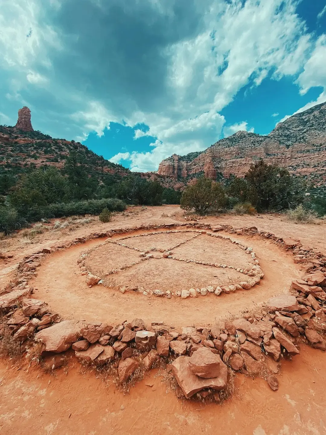
High on windswept ridges in Wyoming, Montana, and the Dakotas, rings of stones and radiating spokes stretch toward horizons that seem endless. The Bighorn Medicine Wheel in Wyoming, with its central cairn and stone spokes, has become the poster child of these features, drawing hikers, tribal elders, and astronomers alike. Measurements suggest correlations with the rising and setting points of certain bright stars and the summer solstice sunrise, but the level of intentionality is still actively debated. Oral histories from several Plains tribes connect medicine wheels to ceremonial journeys, healing, and cosmological teachings, but not always in ways that match archaeologists’ neat diagrams.
Unlike massive earthworks, many stone circles are subtle and fragile, easily disturbed by grazing animals or off-road vehicles, which makes their study challenging. Some archaeologists now lean on drone mapping and 3D modeling to capture these layouts with millimeter precision before they erode away. The mystery extends beyond a single wheel: there are hundreds of circles and alignments across the Plains, built over many centuries, likely by different groups with different intentions. Seeing them only as observatories risks flattening a much richer story about movement, vision quests, and relational landscapes. The more carefully researchers listen to tribal partners and revisit assumptions, the more these “simple” circles turn into multi-layered archives of Indigenous science.
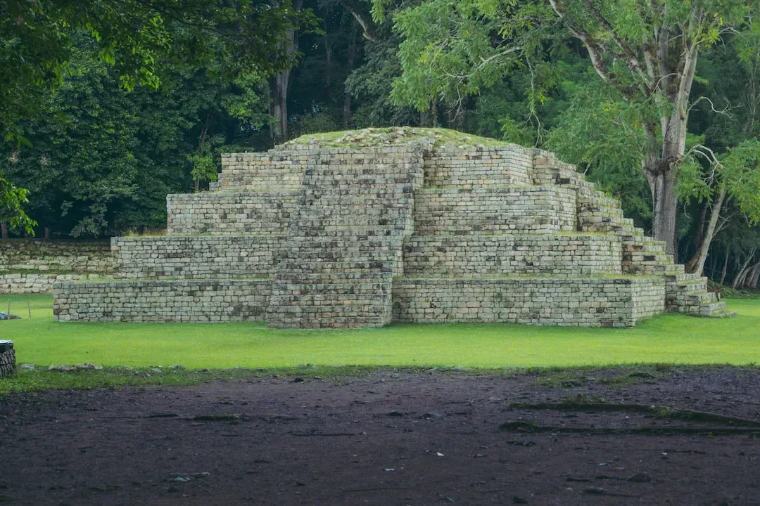
Moundville, Etowah, and the Puzzle of Mississippian Iconography
In Alabama and Georgia, the mound centers of Moundville and Etowah rise from river valleys as flat-topped pyramids of packed earth, once capped with wooden structures and ceremonial buildings. They are visually impressive, but the real mystery lies in the artwork carved into shell, stone, and copper – raptor figures, warrior beings, swirling motifs, and what looks very much like a shared mythological toolkit. Archaeologists group this style under the label “Southeastern Ceremonial Complex,” an imperfect name for an iconographic language that spread across much of the Southeast about seven hundred to eight hundred years ago. No one can fully agree whether this art represents a unified religion, a loose network of shared stories, or political propaganda dressed up as cosmology.
Excavations at Moundville reveal a carefully ordered social space, with elite burials near the largest mounds and everyday houses on the outskirts, mirroring a cosmos of upper, middle, and lower worlds seen in some Indigenous traditions. Yet the specific meanings of many symbols remain under active debate, in part because living Native nations hold related stories but also value cultural privacy. Scientific analysis of pigments, shell sourcing, and copper-working methods adds technical detail – who traded with whom, who controlled exotic resources – but does not fully crack the code. For me, visiting these sites feels like walking through a graphic novel with most of the dialogue removed; the panels are powerful, but the storyline is just out of reach. That partial understanding is exactly why these centers continue to draw both researchers and descendant communities into sometimes difficult, and often necessary, conversations.
The Rock Art Labyrinth: Petroglyphs and Pictographs Across the West
From the basalt cliffs of New Mexico’s Petroglyph National Monument to the red-rock canyons of Utah and Nevada, the American West is covered in carvings and paintings that defy simple explanation. Spirals, bighorn sheep, anthropomorphic figures with radiating heads, abstract grids – each panel looks like part of a message written in a script we half recognize. Archaeologists usually avoid single, sweeping interpretations, because these images span thousands of years and multiple cultures, including ancestors of today’s Pueblo, Ute, Navajo, and other nations. Some motifs do line up with recurring themes: hunting scenes near game trails, water symbols near springs, or celestial imagery tied to solstice sun daggers and lunar standstills.
Scientific approaches have grown more delicate, combining pigment chemistry, micro-erosion studies, and careful recording to build relative chronologies without damaging fragile surfaces. Yet the most honest researchers will tell you that, beyond broad patterns, much of the specific meaning is likely lost or held deliberately within descendant communities. The real danger is in forcing tidy stories onto panels because they look familiar to modern eyes or match popular myths. When I first hiked into a canyon and saw a rock wall layered with centuries of imagery, it felt less like a single painting and more like a crowded social media feed from the deep past. That sense of many voices layered together is a useful antidote to the urge to assign a single, simple explanation.
Why These Ancient Mysteries Matter Today
It can be tempting to treat these ancient American structures as quirky roadside attractions or blank canvases for wild theories, but they sit at the core of how we tell the story of this continent. For a long time, mainstream narratives downplayed the scale and sophistication of Indigenous engineering, suggesting that “real” civilization arrived with European stone and steel. Sites like Cahokia, Poverty Point, and the great mound centers thoroughly dismantle that myth, showing complex urban planning, long-distance trade, and precise astronomical awareness well before colonization. Recognizing the true builders – Ancestral Puebloans, Mississippian societies, hunter-gatherer engineers along the Mississippi, and many others – forces a rebalancing of historical credit.
There is also a deeper scientific payoff. Each site is a natural experiment in how communities respond to climate stress, resource limits, and social conflict – challenges we recognize all too well in the twenty-first century. By pairing archaeology with climate science, soil chemistry, and even ancient DNA in ethically guided projects, researchers can piece together how past societies adapted or failed. That does not turn mounds into simple moral lessons, but it does offer case studies in resilience, cooperation, and collapse. In a way, these earthworks and stone circles are not just about the mystery of who built them; they are about whether we are willing to learn from people whose names we may never know.
From Ancient Tools to Cutting-Edge Science: How We Study the Builders
Archaeologists working at these sites still use trowels, brushes, and notebooks, but the toolkit now includes instruments that would have looked like science fiction even a generation ago. Lidar surveys fired from planes or drones strip away vegetation to reveal hidden earthworks under forests and farmland, mapping ditches, mounds, and roads without turning a single shovel of soil. Ground-penetrating radar and magnetometry let researchers see buried structures, post holes, and even house patterns, guiding smaller, more targeted excavations. This combination of non-invasive mapping and surgical digging is transforming how we understand the layouts of places like Cahokia and Moundville.
At the microscopic level, residue analysis on pottery can identify traces of ancient foods, while isotopic studies of human teeth and bones reveal where people grew up and what they ate. Radiocarbon dating has become more precise, sometimes narrowing construction phases to within the span of a few decades, which lets archaeologists connect building booms with climate swings or political shifts. Collaborative projects increasingly include tribal historians, language experts, and traditional knowledge holders as equal partners, challenging older, top-down research models. As someone who has sat in on these joint meetings, I have seen the atmosphere shift from archaeologists presenting “findings” to a room of observers, to actual shared problem-solving about which questions matter. That change might be one of the most important tools we have for unlocking the human stories behind the dirt and stone.
The Future Landscape: Preserving and Rethinking Ancient American Destinations
Looking ahead, the greatest threats to these mysterious structures are often depressingly mundane: suburban sprawl, looting, erosion, and the slow grind of climate change. Rising groundwater and heavier rains can weaken mounds; hotter, drier conditions accelerate the weathering of cliff dwellings and rock art. Archaeologists and land managers are turning to predictive modeling – using past climate data, erosion rates, and land-use patterns – to prioritize which areas need protection first. In some places, that means rerouting roads or trails; in others, it means moving visitor centers and parking lots away from fragile features.
New technologies also raise ethical questions. High-resolution 3D models of sacred spaces can be invaluable for research and virtual tourism, but they also risk turning living ceremonial landscapes into downloadable curiosities. Many Indigenous nations are now negotiating data sovereignty agreements, insisting on control over how digital records of their ancestral sites are stored and shared. On the hopeful side, citizen science apps and community archaeology programs are inviting more people into the work of monitoring and documenting sites, turning casual hikers into the first line of defense. If we can balance curiosity, respect, and smart technology, the next few decades could see these ancient American destinations better understood and better protected than ever before.
How You Can Engage With America’s Ancient Builders
For most of us, the first step into this world is simple: visit these places with your eyes open to who built them and who still claims them. When you walk up Monk’s Mound at Cahokia, stand at Serpent Mound’s overlook, or tour a cliff dwelling in the Southwest, take a moment to read interpretive signs closely and look for the voices of descendant communities. Choose guided tours and audio programs that highlight Indigenous perspectives rather than leaning on generic mystery narratives. What seems like a small choice in the gift shop or at the visitor center can either reinforce old myths or support updated, more accurate stories.
You can also help protect these sites in very practical ways. Stick to marked trails, avoid touching rock art, and report vandalism if you see it – simple actions that matter more than most people realize. Consider supporting tribal museums, local historical societies, or nonprofit groups working on site preservation and community-based archaeology projects. If you are a parent or educator, introduce kids to these places as examples of scientific ingenuity, engineering, and art, not just as spooky ruins. The more we treat ancient American structures as living classrooms and shared responsibilities, the more likely they are to survive for the next generation of curious visitors.

Suhail Ahmed is a passionate digital professional and nature enthusiast with over 8 years of experience in content strategy, SEO, web development, and digital operations. Alongside his freelance journey, Suhail actively contributes to nature and wildlife platforms like Discover Wildlife, where he channels his curiosity for the planet into engaging, educational storytelling.
With a strong background in managing digital ecosystems — from ecommerce stores and WordPress websites to social media and automation — Suhail merges technical precision with creative insight. His content reflects a rare balance: SEO-friendly yet deeply human, data-informed yet emotionally resonant.
Driven by a love for discovery and storytelling, Suhail believes in using digital platforms to amplify causes that matter — especially those protecting Earth’s biodiversity and inspiring sustainable living. Whether he’s managing online projects or crafting wildlife content, his goal remains the same: to inform, inspire, and leave a positive digital footprint.