The story of the early American South is often told as a clash between European empires and the young United States, but that version leaves out a crucial player: the Muscogee, often called Creek. Long before state borders and cotton kingdoms, Muscogee towns knit together a vast, river-laced world of trade, diplomacy, and adaptation. Archaeologists, historians, and tribal scholars are now piecing together how deeply this Indigenous nation engineered the landscapes, politics, and even economies of the Southeast. When you follow the rivers instead of the textbooks, a different map appears – one in which Muscogee decisions shaped everything from where cities rose to how wars were fought. And once you see that hidden architecture, it becomes hard to imagine the region without it.
The River Roads: How Muscogee Water Highways Structured the South
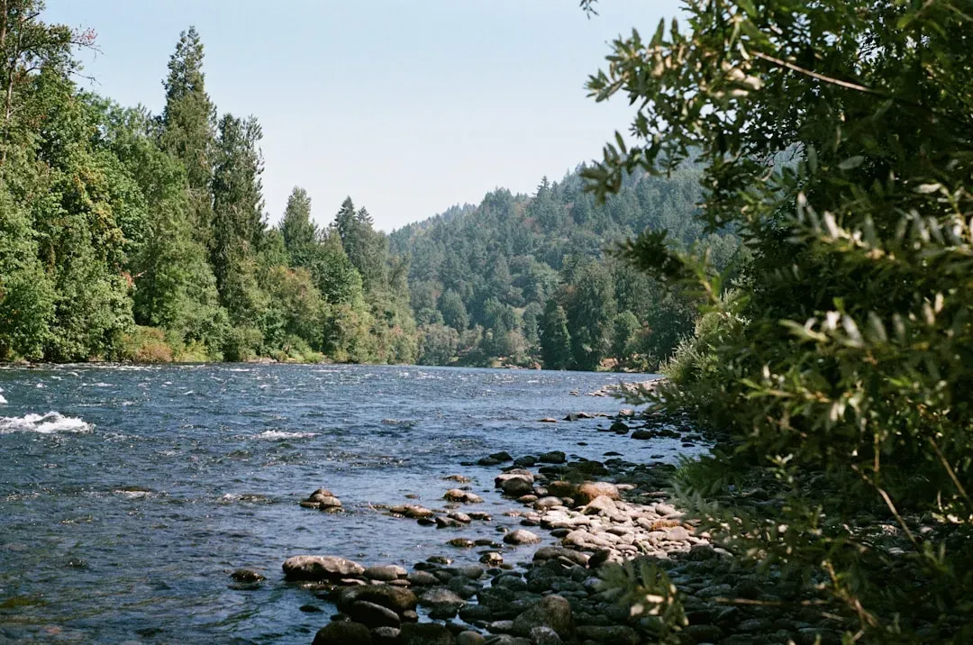
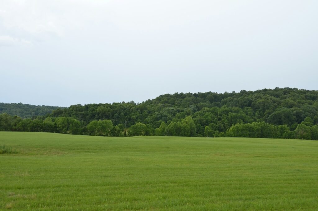
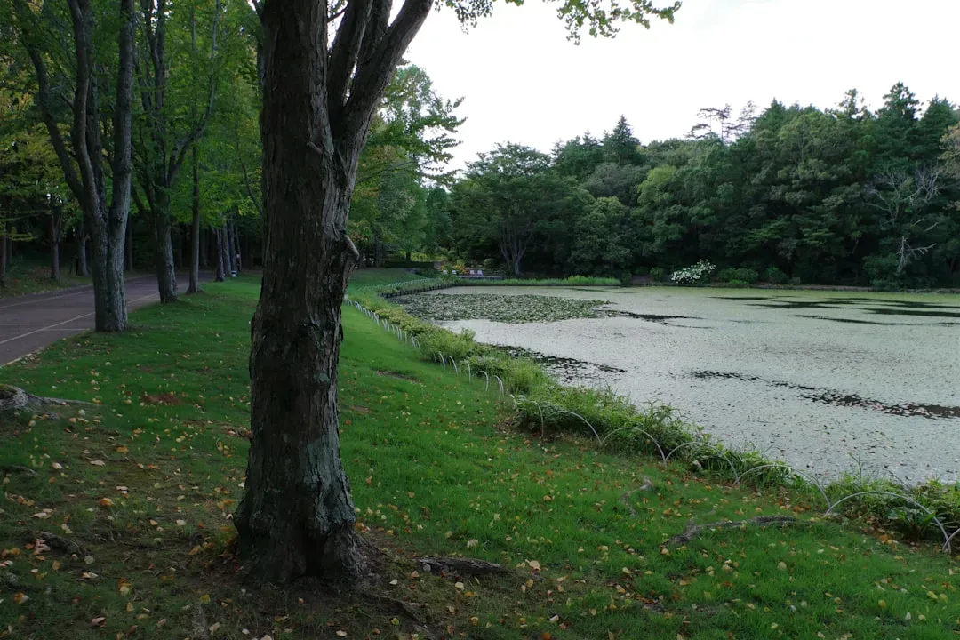
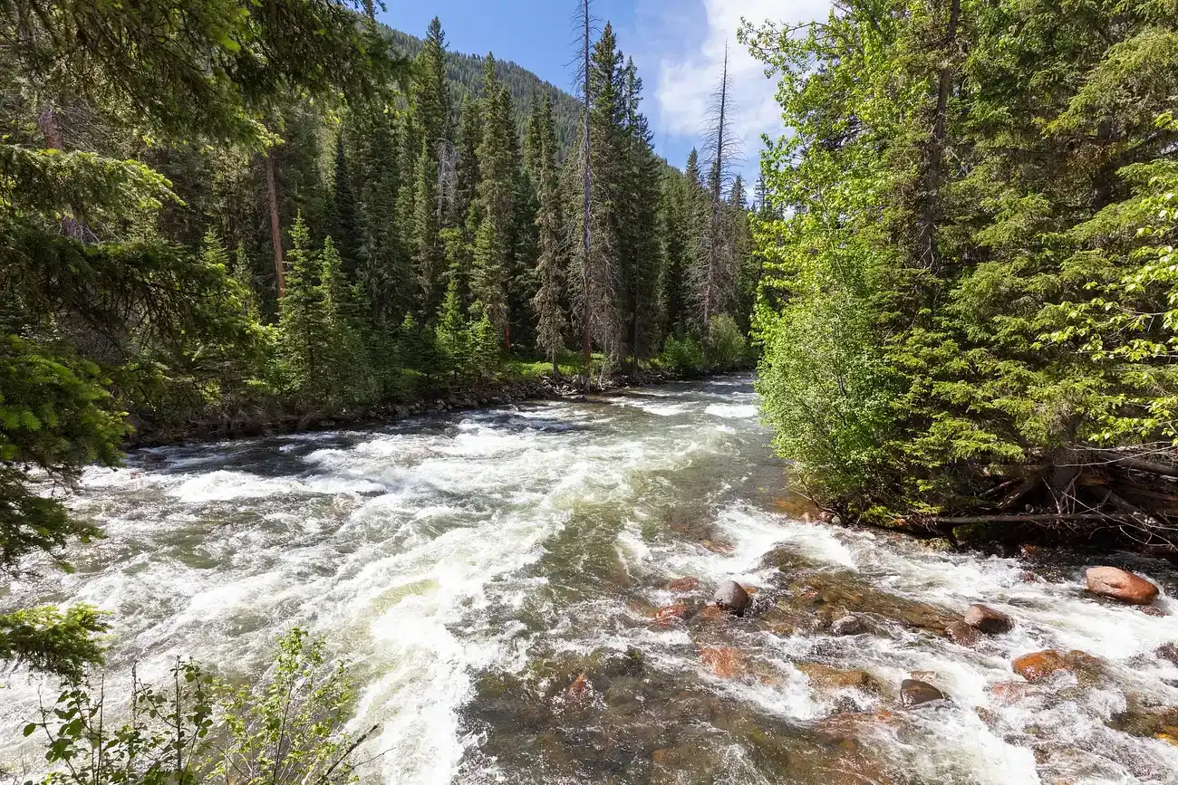
The Muscogee world was built around rivers that today carry barges, fishing boats, and hydroelectric dams – but once carried canoes full of goods, news, and diplomacy. The Alabama, Chattahoochee, Tallapoosa, and Flint were not barriers; they were the bloodstream of a political network stretching from what is now Georgia and Alabama into Florida. Muscogee towns positioned themselves along these waterways with strategic precision, turning confluences into hubs and river bends into checkpoints. Early European traders quickly learned that if they wanted to move inland, they had to plug into this preexisting Muscogee river system rather than attempt to replace it. In effect, the first colonial trade routes in the Southeast were layered directly onto Muscogee-designed river corridors.
This river logic still echoes in modern infrastructure. Several major Southern cities and transportation routes sit where Muscogee towns once managed crossings and exchanges. Colonial forts, then later American garrisons, tended to rise right beside old Muscogee settlements along the same bends and shoals. What looks today like a rational highway network is, in many places, a ghost trace of Indigenous logistics – optimized for paddle and portage long before pavement. Seeing rivers as ancient roads, not just scenic backdrops, flips the usual narrative: it was newcomers adapting to Muscogee geography, not the other way around.
Town Squares and Cosmic Order: Muscogee Civic Science Beneath Southern Cities
At the heart of many historic Muscogee towns was a central square ground, a carefully arranged open space used for councils, ceremonies, and ball games. These were not accidental clearings; archaeologists and Muscogee cultural experts describe them as deeply encoded with social and spiritual meaning. The square often reflected the four directions, seasonal cycles, and relationships among different clans or political factions. In a sense, Muscogee urban design fused astronomy, social structure, and law into a single spatial blueprint. When Europeans arrived, they often built their own forts or villages beside, and sometimes directly atop, these existing layouts.
Over time, pieces of that logic seeped into colonial and later American town planning in the region. You can see distant cousins of the Muscogee square in courthouse squares, central greens, and shared public spaces of many Southern towns, even if their original meanings were drastically altered. While it would be simplistic to say one directly caused the other, the physical co-location meant that European officials watched how Indigenous civic spaces worked in real time. The idea that power should gather in a central, visible place – in a square where the community could speak, watch, and remember – was already being practiced in Muscogee towns before it appeared in territorial capitals. That older Indigenous civic science helped shape what public space looks like in the Southeast today.
The Hidden Trade Empire: Muscogee Markets that Fed Two Worlds
Long before American banks and cotton brokers took over the Southern economy, Muscogee people were running a sophisticated trade network that linked the Gulf Coast to the Appalachian foothills. Deerskins, river cane baskets, agricultural surplus, shell beads, and later European manufactured goods all moved through Muscogee-controlled routes and markets. This was not a loose, improvised system; it was governed by protocols, kinship obligations, and diplomatic agreements that allowed goods and information to move efficiently. When British, Spanish, and French traders entered the region, they had to negotiate access to this Indigenous marketplace. Many historians now argue that Muscogee decisions about who could trade, where, and under what conditions significantly influenced which colonial powers thrived in the Southeast.
That influence was not abstract. Muscogee communities learned to leverage access to trade as a political tool, rewarding allies and pressuring rivals. By directing where and when deerskins or food supplies could be sold, they could tilt the balance between competing forts or colonial governors. In some periods, their decisions buffered devastating shortages or amplified them, not unlike how modern nations use control over oil or rare earth minerals. Early Southern capitalism did not emerge in a vacuum; it grew out of negotiations at Muscogee trading houses and river landings. In that sense, the Creek were not just participants in the colonial economy – they were key architects of its terms in the region.
Fields of Three Sisters: Muscogee Agriculture Behind the “Fertile South” Myth
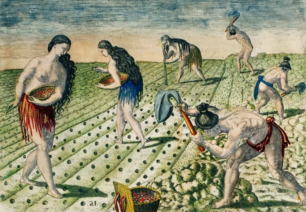
The Southeast is often portrayed as naturally rich farmland, but that erases centuries of Indigenous land management. Muscogee farmers grew corn, beans, squash, and other crops in interdependent combinations that nurtured soil health and buffered against climate variability. Instead of exhausting fields and moving on, they used techniques like intercropping, crop rotation, and controlled fire in nearby woodlands to maintain productivity. When European settlers later marveled at the “fertility” of the land, they were often looking at landscapes already shaped by generations of Indigenous care. The seemingly spontaneous abundance was, in reality, the long-term result of very specific human choices.
Some ecologists and historians now compare these Muscogee practices to sustainable agriculture and regenerative farming movements today. The idea that you can design fields to be cooperative communities, rather than battlefields where one crop dominates, was already being lived out in Muscogee towns. That knowledge influenced early colonial survival, as settlers leaned heavily on Indigenous-grown crops and farming advice, especially in their first decades. The tragedy is that while the crops were adopted, the underlying ethics of reciprocity with the land were largely ignored. The plantation model that followed extracted the productivity without honoring the relationships that kept those systems resilient.
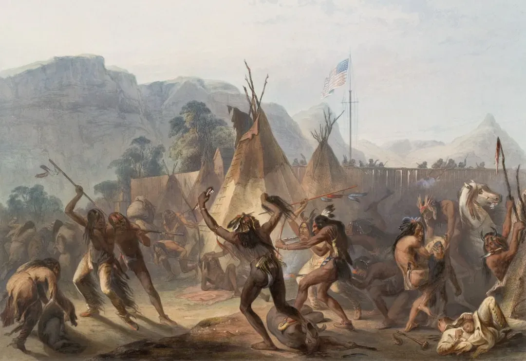
Diplomats of a Contested Continent: Muscogee Strategy in an Age of Empires
In the eighteenth century, the Southeast was one of the most geopolitically complicated regions on the continent. Spain, Britain, France, and later the United States all vied for influence, and the Muscogee were right in the middle of this storm. Far from being passive obstacles, Muscogee leaders became highly skilled diplomats, reading shifting alliances and using treaties as tools rather than final sentences. They engaged in what some scholars call balance-of-power politics, deliberately preventing any one foreign power from gaining overwhelming control. This was a calibrated strategy, not chaos: a way to preserve autonomy by keeping rivals busy negotiating with each other.
Many key treaties and border decisions in the Southeast only make sense when you see them through this Muscogee lens. When they granted limited land or trade concessions, they were often trading space for time, hoping to adapt or regroup. At certain moments, Muscogee decisions tipped the scales in wars between colonizing powers, influencing which flag flew over forts along the Gulf and inland rivers. This diplomatic agility delayed, but could not ultimately stop, the relentless pressure of land-hungry U.S. expansion. Still, their strategic choices shaped the map of the early American Southeast in ways that standard state-focused histories routinely miss.
War Science and Resistance: Red Sticks, Tactics, and the Remaking of Power
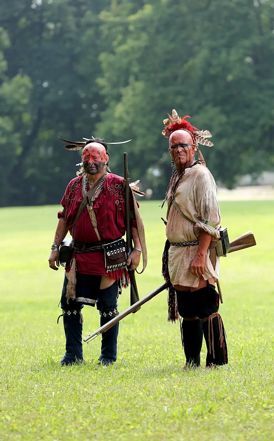
The Creek War of the early nineteenth century is usually remembered as a stepping-stone in the rise of Andrew Jackson, but from a Muscogee perspective it was a struggle over how to respond to an accelerating invasion. Factions known as Red Sticks drew on older ceremonial and spiritual traditions to rally resistance, while others pushed for accommodation or selective alliance. This created a civil war within the nation, but it also produced striking tactical innovations. Muscogee fighters used intimate knowledge of swamps, rivers, and forests to stage ambushes and control movement in ways that baffled U.S. forces at first. Their war science was built on generations of living with the land, rather than treating it as an obstacle.
The eventual defeat of the Red Sticks led to massive land cessions that opened much of Alabama and Georgia to U.S. settlement, but the cost for the United States was higher than many schoolbook summaries admit. The conflict forced American military leaders to rethink logistics, supply chains, and fort placement in the Southeast. Future Indian removal campaigns, including the one that targeted Muscogee people themselves, drew on lessons learned in this deadly laboratory of resistance. In a grim way, Muscogee tactics reshaped U.S. military doctrine in the region even as they were being pushed off their homelands. That paradox – losing ground while still shaping the rules – runs through much of Creek history.
Why It Matters: Rethinking Southern History Through a Muscogee Lens
So why should anyone beyond historians and tribal citizens care about how the Muscogee shaped the early Southeast? Because once you center their role, familiar stories about the region start to look incomplete, if not misleading. The emergence of cotton states, the route of major highways, even where Civil War battles later unfolded are all tied to choices made much earlier by Indigenous nations. Ignoring that is like trying to explain the behavior of a river without mentioning its source. You can describe what you see on the surface, but you miss the deeper forces driving it.
There is also a broader scientific issue at stake: how we understand human-environment systems over long time scales. Muscogee land management shows that the “natural” Southeast was already a co-created landscape, with fire regimes, crop systems, and settlement patterns tuned over centuries. This challenges old assumptions that Indigenous peoples were simply living lightly and passively on untouched wilderness. Instead, they were active experimenters in ecology, politics, and engineering. Recognizing that pushes modern science to take Indigenous knowledge seriously, not as an optional cultural footnote, but as rigorous, tested insight into how societies can adapt – or fail – in changing worlds.
The Future Landscape: Muscogee Knowledge and Science Moving Forward
Today, Muscogee (Creek) Nation citizens and researchers are collaborating across disciplines to recover, protect, and apply traditional knowledge in new contexts. Projects focused on river restoration, controlled burning, and native foodways are not about nostalgia; they are about designing resilient futures in a warming, flood-prone South. Hydrologists, ecologists, and climate scientists are increasingly interested in how past Indigenous land management shaped flood patterns, soil health, and biodiversity. That matters when cities along those same rivers now face stronger storms and higher stakes. The old Muscogee insight that rivers are living roads, not just drainage channels, takes on a fresh urgency in this context.
At the same time, there is a political future at play. As tribes press for greater consultation rights on development and conservation decisions, Muscogee perspectives on land, water, and community could alter how the Southeast responds to climate and infrastructure challenges. There is potential for tension, especially when short-term economic plans clash with long-term Indigenous stewardship goals. But there is also an opportunity: to build policies that do not repeat the extractive logic that once tore the region apart. In that unfolding story, Muscogee science and history are not relics – they are active tools for navigating what comes next.
How You Can Engage: Listening, Learning, and Supporting Muscogee Futures
Engaging with this history starts with something deceptively simple: paying attention to whose stories you hear when you look at a map of the South. If you live in or visit Alabama, Georgia, Florida, or Oklahoma, learn the Muscogee place names that lie beneath modern labels and ask how rivers, towns, and roads came to be. Museums, tribal cultural centers, and Indigenous-led tours offer ways to listen without demanding emotional labor from strangers. Supporting Native-authored books, podcasts, and research helps shift resources toward those closest to the story. Even small choices in what you read, watch, and share can change which versions of history gain momentum.
There are also tangible steps beyond learning. You can support organizations and initiatives that back tribal sovereignty, environmental justice, and the protection of sacred and historic sites. When local debates arise over river management, land use, or heritage preservation, look for Muscogee and other Indigenous perspectives and amplify them. Teachers and parents can push for curricula that show Indigenous nations as central actors, not side notes in colonial dramas. In doing so, you help ensure that the deep imprint of Muscogee people on the Southeast is recognized not as a vanished past, but as a living influence that still shapes the region’s choices today.

Suhail Ahmed is a passionate digital professional and nature enthusiast with over 8 years of experience in content strategy, SEO, web development, and digital operations. Alongside his freelance journey, Suhail actively contributes to nature and wildlife platforms like Discover Wildlife, where he channels his curiosity for the planet into engaging, educational storytelling.
With a strong background in managing digital ecosystems — from ecommerce stores and WordPress websites to social media and automation — Suhail merges technical precision with creative insight. His content reflects a rare balance: SEO-friendly yet deeply human, data-informed yet emotionally resonant.
Driven by a love for discovery and storytelling, Suhail believes in using digital platforms to amplify causes that matter — especially those protecting Earth’s biodiversity and inspiring sustainable living. Whether he’s managing online projects or crafting wildlife content, his goal remains the same: to inform, inspire, and leave a positive digital footprint.