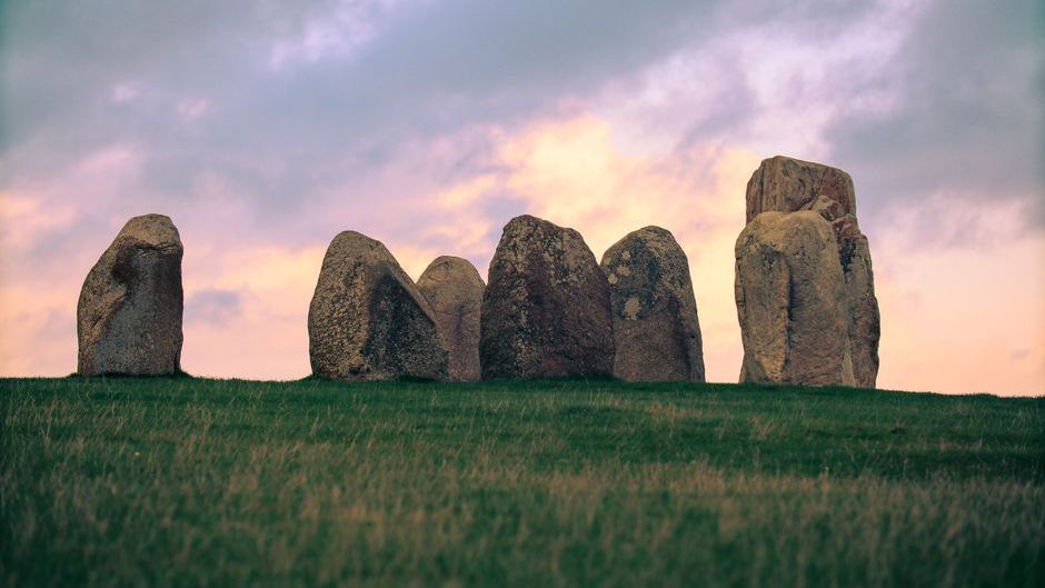
You’ve probably heard of Stonehenge, that iconic circle of standing stones in England that draws millions of curious visitors each year. It’s the go-to reference when people talk about ancient mysteries. Here’s the thing though: across North America, there exist earthworks and structures so elaborate, so astronomically precise, and so utterly baffling that they rival or even surpass the mysteries of Stonehenge.
Yet many people don’t know they’re there. These sites were built by Indigenous cultures who left behind no written records, just their monumental works etched into the landscape. Some of these places align with celestial events in ways that seem almost impossible without modern instruments. Others required moving millions of cubic feet of earth without wheels, horses, or metal tools. Let’s be real, the sheer scale and sophistication of what you’re about to discover might just change how you think about ancient America.
Cahokia Mounds: The Forgotten Metropolis
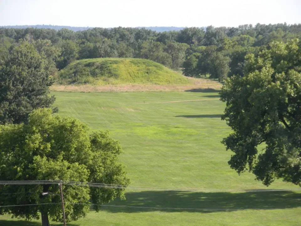
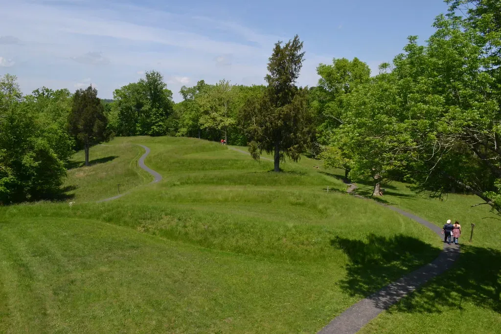
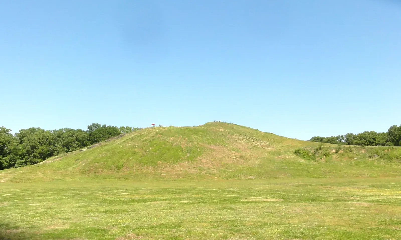
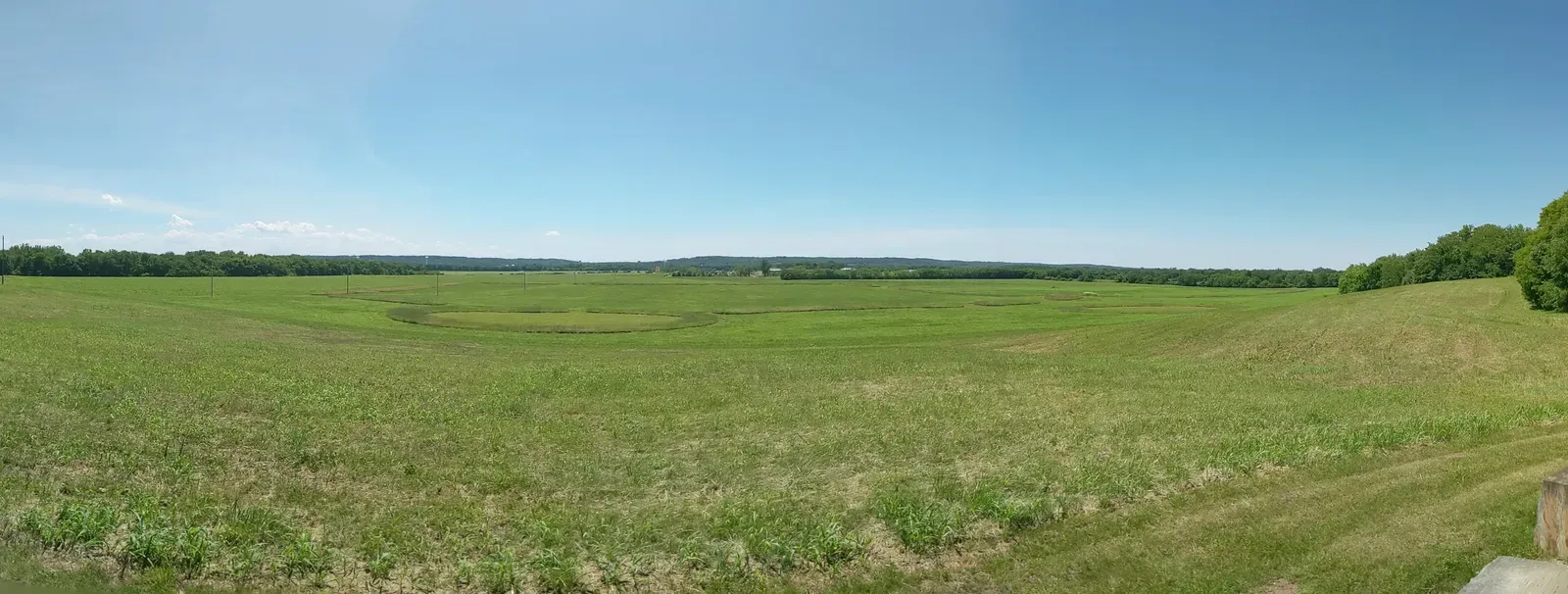
Cahokia Mounds near present-day St. Louis was once a Native American city that flourished between roughly 1050 and 1350 CE, and at its peak around 1100 CE, it covered about 6 square miles and included about 120 earthworks with a population between 15,000 and 20,000 people. This made it the most extensive urban center in prehistoric America north of Mexico, larger than London at that same time. What makes this place genuinely mysterious is not just its size though.
The site featured a series of large timber circles called “Woodhenges,” thought to have been constructed between 900 and 1100 CE, and researchers began referring to the circles as “woodhenges,” comparing the structures to England’s well-known circles at Woodhenge and Stonehenge. A reconstructed circle with 48 posts and a central post has been used to investigate archaeoastronomy at Cahokia, with observations held at the vernal and autumnal equinoxes and the winter and summer solstices. Monks Mound, the largest prehistoric earthen structure in the Western Hemisphere, rises to 100 feet, covers more than 14 acres, and contains more than 25 million cubic feet of earth. How did they organize thousands of workers to accomplish this? In Mound 72, archaeologists found remains of about 270 individuals, including one burial on a bed of 10,000 marine-shell disc beads arranged in the shape of a falcon. The mysteries of who wielded such power, and why the city was abandoned, remain unsolved.
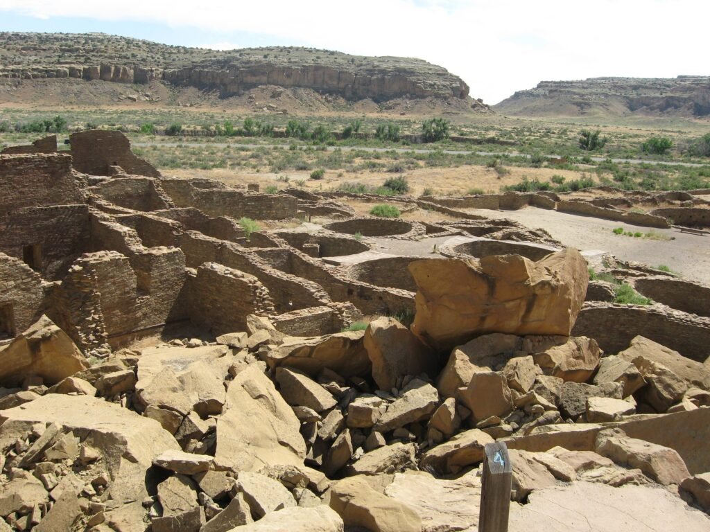
Chaco Canyon: An Astronomical Clock in Stone
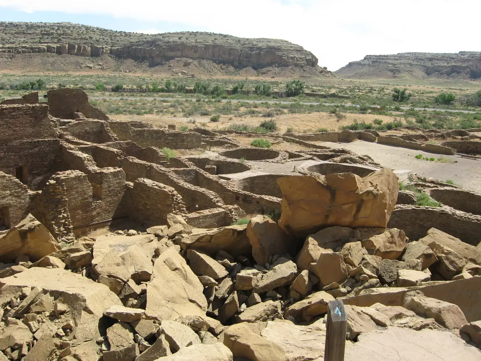
Research by the Solstice Project has shown that twelve of the Chacoans’ major buildings, eight in Chaco Canyon and the four largest outlying buildings, are oriented to the solar and lunar cycles. Chaco Canyon was a complex ceremonial center with extraordinary astronomical alignments of buildings and roads, where landscape, directions, sun and moon, and movement of shadow and light were used by the Chacoan builders to unite with a cosmic order. Pueblo Bonito, the largest ruin, has one straight exterior wall that runs perfectly East and West, and only on the Spring and Autumn Equinoxes does the sun rise and set at each end of this wall.
Think about the level of observation required to design this. This complex, likely the largest and most sophisticated astronomical clock in the world, reveals an intricate understanding of solar and lunar cycles embedded in stone structures and rock art with breathtaking accuracy. Most chambers lack entrances, exits, or hearths, showing no evidence of habitation, suggesting these weren’t homes at all. The northern wall of Chetro Ketl aligns with the maximum moon of the 18.6-year lunar cycle, with the next maximum occurring on March 7th, 2025. No other culture in the world is known to build structures in alignment with this long cycle. What drove them to track the heavens with such obsessive precision?
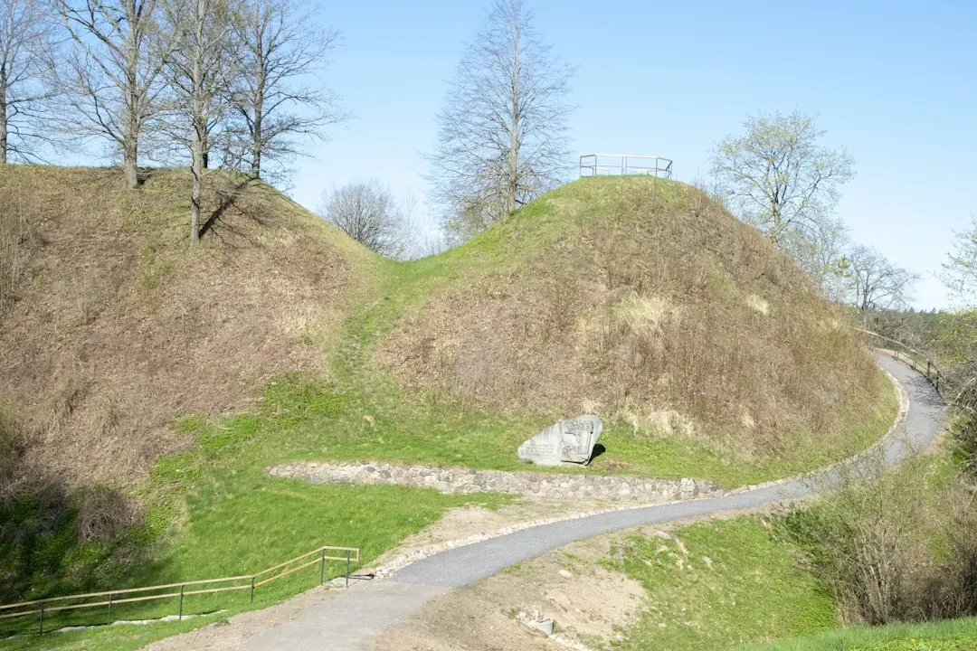
Serpent Mound: The Great Earthen Snake
The Great Serpent Mound is a 1,348-feet-long, three-feet-high prehistoric effigy mound located in Peebles, Ohio, built on the Serpent Mound crater plateau, running along the Ohio Brush Creek in Adams County, and is the largest serpent effigy known in the world. The fact that it was constructed on an ancient meteor crater adds another layer of intrigue. Was this placement intentional? Did ancient peoples recognize the geological uniqueness of this spot?
Dating the mound has been a nightmare for archaeologists. A 1991 site excavation used radiocarbon dating to determine that the mound was approximately 900 years old, suggesting builders belonged to the Fort Ancient culture (A.D. 1000–1500), though in 2014, another team presented new radiocarbon dates suggesting it was built by the Adena culture at around 300 B.C. Harvard University archaeologist Frederic Ward Putnam excavated Serpent Mound but found no artifacts in the Serpent that might allow archaeologists to assign it to a particular culture. The head and oval are aligned to the setting sun on the Summer Solstice, and researchers have proposed various astronomical alignments throughout its curves. The Adena culture is not known to have built effigy mounds or to have used serpent symbolism in their art, whereas the Fort Ancient culture built the Ohio Alligator Mound and frequently depicted serpents in their art. So who actually built it remains hotly debated.
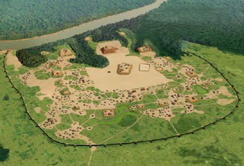
Poverty Point: The Pre-Agricultural Enigma
Poverty Point is a prehistoric earthwork constructed by the Poverty Point culture in present-day northeastern Louisiana, with earthen ridges and mounds built by indigenous people between 1700 and 1100 BCE during the Late Archaic period in North America. Here’s what makes it utterly perplexing: those who moved the earth, basket by basket, were hunter-gatherers, and it is unusual that such a society could build the complex system of mounds at Poverty Point. Settled agricultural societies typically build monumental architecture, not nomadic groups.
Mound A, one of the largest constructed earthen mounds in North America, dominates the site. Mound A is the largest Poverty Point mound at 72 feet tall, 710 feet long and 660 feet wide, while Mound B is a small, conical mound 21 feet tall and 180 feet in diameter built around 1700 B.C. The earthworks include six concentric, C-shaped ridges that extend to the edge of the Macon Ridge and several mounds outside and inside of the earthen ridges, with these concentric ridges being unique to Poverty Point. A transportation system was created that imported several tons of rocks and minerals into the area from as far as 1,000 miles away. Hunter-gatherers at Poverty Point may have built its massive earthworks not under the command of chiefs, but as part of a vast, temporary gathering of egalitarian communities seeking spiritual harmony in a volatile world, with new radiocarbon data suggesting far-flung travelers met to trade, worship, and participate in rituals designed to appease the forces of nature. The complexity challenges everything we thought we knew about prehistoric social organization.
Casa Grande: The Desert Mystery House
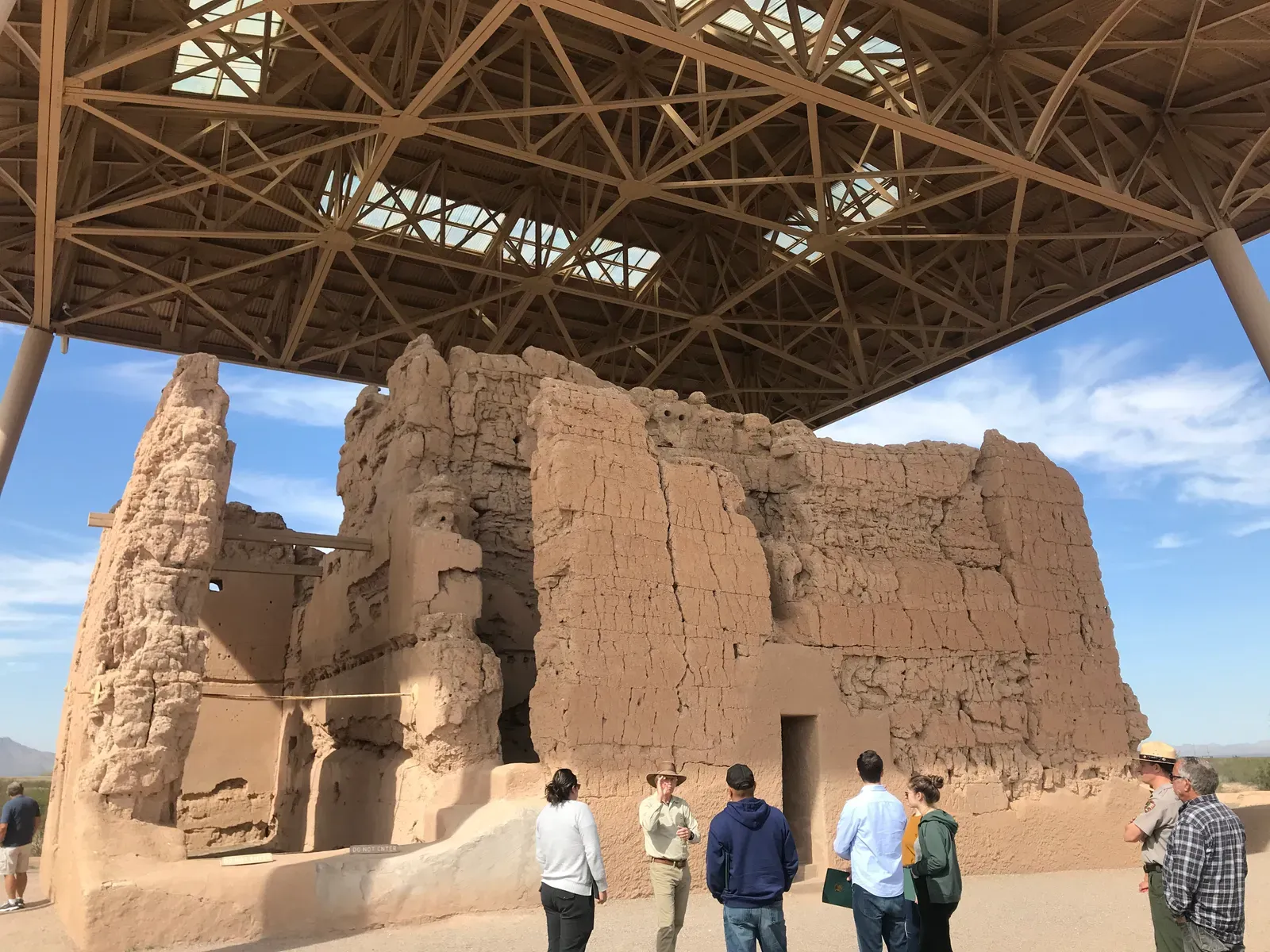
Casa Grande Ruins, located in Arizona, is one of the oldest and most mysterious prehistoric structures in North America, built by the Hohokam people around 1350 CE, featuring a massive four-story earthen building thought to have served as a ceremonial or astronomical center. The structure stands in the middle of the Sonoran Desert, and nobody quite understands how or why it was built. Made from caliche (a type of natural concrete), the “Great House” demonstrates advanced engineering skills in a desert environment.
The Hohokam also created extensive irrigation canals to support agriculture, showing they were master engineers in multiple domains. The exact purpose of Casa Grande remains uncertain, adding to its intrigue. Some researchers suggest astronomical alignments in the structure’s windows might have tracked solstices or other celestial events. Others propose it served as an administrative center or religious temple. The Hohokam civilization thrived for centuries before mysteriously abandoning the site, leaving us with more questions than answers about this enigmatic desert tower.
Hopewell Earthworks: Geometry in the Wilderness
This collection of six major mound complexes outside modern-day Chillicothe, Ohio, illustrates the engineering prowess of the Hopewell Culture, which lived in the region as early as 100 BCE. The mounds, built around 2,000 years ago and containing structures up to 1,000 feet wide, are preserved across six separate locations in the park. What’s stunning about these earthworks is their precise geometric design. We’re talking about circles, squares, and octagons constructed with accuracy that seems impossible without surveying equipment.
Hopewell Culture National Historical Park protects the remarkable ceremonial earthworks of the ancient Hopewell culture, constructed between 200 BCE and 500 CE, with impressive geometric mounds and embankments reflecting the spiritual beliefs and sophisticated artistry of their builders. The Newark Earthworks in Ohio, part of this culture, include an octagon connected to a circle that aligns with the 18.6-year lunar cycle. Honestly, the mathematical and astronomical knowledge required to design these structures is staggering. These weren’t random piles of dirt. They were carefully planned monuments that served purposes we’re only beginning to understand.
Bighorn Medicine Wheel: Stone Circle in the Clouds
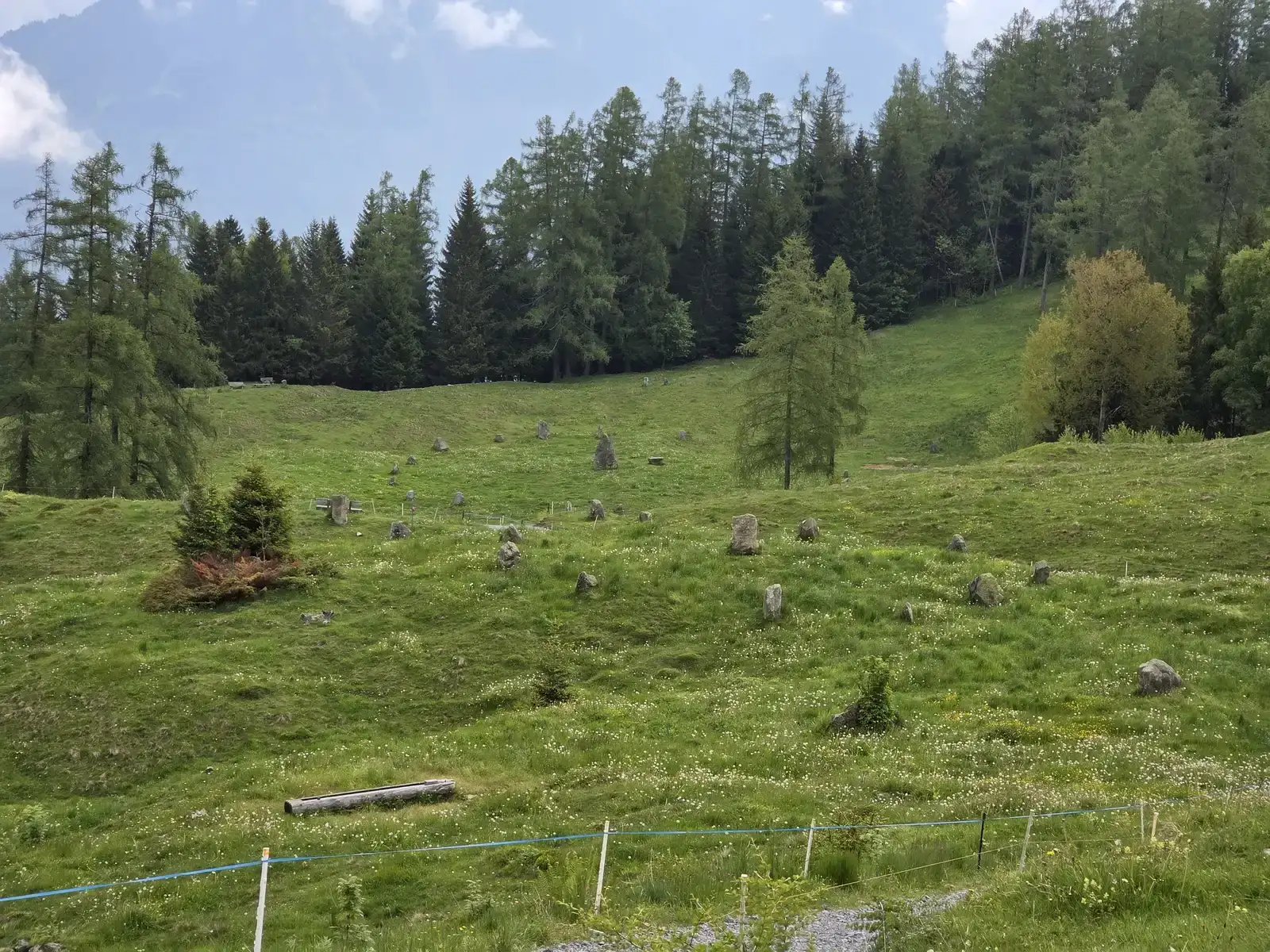
The mountaintop site is dated to at least as far back as AD 1300 and forms part of a chain of Native American archaeological sites up to 7,000 years old, and it’s thought that the pattern was used to predict astronomical events such as the summer solstice, though the truth remains something of an enigma. Located at nearly 10,000 feet elevation in Wyoming’s Bighorn Mountains, this stone wheel features a central cairn with 28 radiating spokes extending to an outer rim roughly 80 feet in diameter.
The harsh alpine environment makes the site even more remarkable. Why build something so elaborate in a location that’s only accessible a few months each year due to snow? The wheel’s design incorporates alignments to the summer solstice sunrise and the rising points of certain bright stars. The wheel is protected by a fence, onto which dreamcatchers and prayer cloths have been tied, showing it remains sacred to modern Indigenous peoples. Various tribes including the Crow, Shoshone, and Cheyenne consider this a holy place. The effort required to haul stones up the mountain and arrange them in this precise pattern suggests profound spiritual importance, yet the original builders left no explanation of their intentions.
Moundville: The Second City
The Moundville site, a large settlement of Mississippian Culture located on the Black Warrior River in central Alabama, is believed to be second only to Cahokia Mounds in terms of complexity, was once a busy town as well as a political and religious center, with 26 earthen mounds alternating with smaller ones throughout the area surrounding a central plaza. Occupied from around AD 1000 to 1450, the site was once home to a 300-acre village, and from 1933 to 1941, 2,000 burials, 75 house remains, and thousands of artifacts were discovered.
The development, sociopolitical organization, and reasons for the eventual abandonment of the site remain a mystery. Two impressive flat-topped mounds may have been the sites of the chiefs’ houses and temples. The scale suggests a highly stratified society with powerful leadership, yet we don’t know what happened. Did disease wipe them out? Environmental collapse? Warfare? To date, only 14% of the site has been excavated, meaning vast secrets still lie buried beneath the Alabama soil.
Etowah Mounds: The Southeastern Puzzle
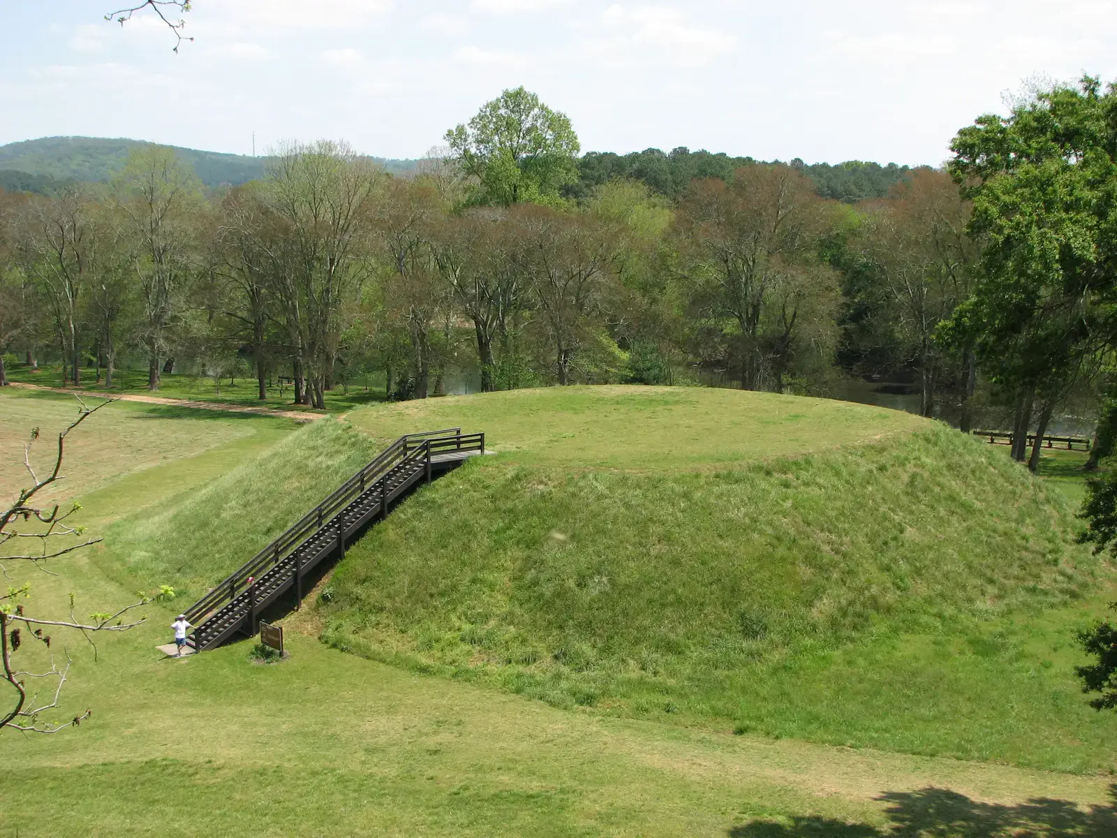
Etowah Mounds, also known as Etowah Indian Mounds, is a National Historic Landmark enclosing the ruins of a prehistoric Native American city whose original name is unknown, located on Muscogee-Creek Native American land, with three large mounds including the chief’s residence (Mound A), the ceremonial site for religious rituals (Mound B), and the burial site for the nobility (Mound C) and three smaller mounds. The most intact Mississippian Culture site in the Southeast, Etowah Mounds State Historic Site comprises six mounds, a village site, a central plaza, and other structures that demonstrate the complex society that lived there between 1000 and 1500 CE.
An excavated and reconstructed burial mound yielded remains of 350 people and archaeological clues about the culture’s customs and social hierarchy, with an onsite museum displaying many of the grave goods, including two large marble effigies of a man and a woman that were likely used in ceremonies. These marble statues are extraordinary works of art. The level of craftsmanship suggests a society with specialized artisans and leisure time for cultural pursuits. What rituals took place here? What beliefs drove them to bury their elite with such elaborate grave goods? The site whispers of a sophisticated civilization that thrived for centuries before vanishing.
Conclusion
So there you have it. Nine ancient Native American sites that rival the mystery and sophistication of Stonehenge, yet remain relatively unknown to most Americans. These aren’t just piles of dirt or random rock formations. They’re precisely engineered monuments that required massive labor coordination, advanced astronomical knowledge, and purposes we’re still struggling to understand.
What’s particularly fascinating is that many of these sites were built by cultures we once dismissed as simple hunter-gatherers or primitive farmers. That narrative has crumbled. The evidence shows us complex societies capable of multi-generational construction projects, continent-spanning trade networks, and mathematical precision that wouldn’t be matched for centuries.
These monuments deserve the same recognition and wonder we give to ancient wonders elsewhere in the world. They’re proof that North America hosted sophisticated civilizations long before European contact. What do you think drove these ancient peoples to build such elaborate structures? Were they purely ceremonial, astronomical observatories, or something we haven’t even considered yet?