On a quiet night in Guatemala or Costa Rica, the ground can go from stillness to a violent roar in a matter of seconds, turning streets into chaos and mountainsides into rivers of rock. Central America may look like a narrow tropical bridge between continents, but deep below the rainforests and volcanoes, the region is being slowly torn, crushed, and reshaped by forces that never sleep. For geologists, it is a natural laboratory; for millions of people living there, it is a constant, often terrifying gamble. Why does this relatively small strip of land host so many earthquakes and eruptions, and what does that mean for its future? The answer lies in a tangle of tectonic plates, hidden faults, and a growing race to understand the next big shake before it happens.
The Hidden Clues Beneath a Narrow Land Bridge
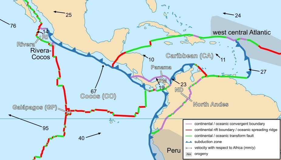
At first glance, Central America looks fragile, like a slim green thread connecting North and South America, but beneath that thread lies a brutal tectonic collision zone. The region sits at the meeting point of several major and minor tectonic plates: the Cocos Plate pushing from the Pacific, the Caribbean Plate sliding eastward, and the North American and South American plates crowding from the sides. This creates a dense web of subduction zones and strike-slip faults that constantly store and release energy. Every time the Cocos Plate dives beneath the Caribbean Plate off the Pacific coast, it drags water and sediments into the mantle, feeding both earthquakes and volcanism.
Scientists map these hidden structures using seismic waves that travel through the Earth, like medical scans for the planet’s crust. By analyzing how these waves bend, slow, or speed up, researchers can spot subducting slabs, magma reservoirs, and locked sections of faults that might be primed to rupture. What appears on the surface as a random pattern of quakes is, at depth, a structured, if ruthless, machine. Living in Central America means living directly above this machine, often with only a few kilometers of brittle rock between your home and the grinding of plates. That proximity explains why so many disasters here feel sudden, even though they have been building for centuries.
How Tectonic Plates Turn Daily Life Into a High-Stakes Gamble

For people in places like El Salvador, Honduras, Nicaragua, and Guatemala, earthquakes are not rare, cinematic events; they are part of the background rhythm of life. Small tremors rattle dishes and swing light fixtures several times a month in some areas, a constant reminder that something large may one day follow. The Pacific coast, especially along the so-called Pacific Ring of Fire, is lined with subduction-related faults that can generate powerful megathrust earthquakes. In inland regions, secondary faults linked to plate interactions can unleash shallow, destructive shaking right beneath cities and villages. The result is a patchwork of risk where even a modest quake, if shallow and close, can be devastating.
Daily life adapts, but never fully adjusts. People trade stories of the biggest quake they remember, the way others might talk about a blizzard or hurricane. Parents teach children where to duck, how to cover their heads, and why it matters to move away from crumbling walls in seconds. Yet in many neighborhoods, especially poorer or informal settlements, buildings are still made of unreinforced masonry that performs terribly in strong shaking. That disconnect – between knowing the danger and lacking the resources to fully prepare – is one of the most painful realities of living in this earthquake alley.
Disaster Flashpoints: From Managua to San Salvador
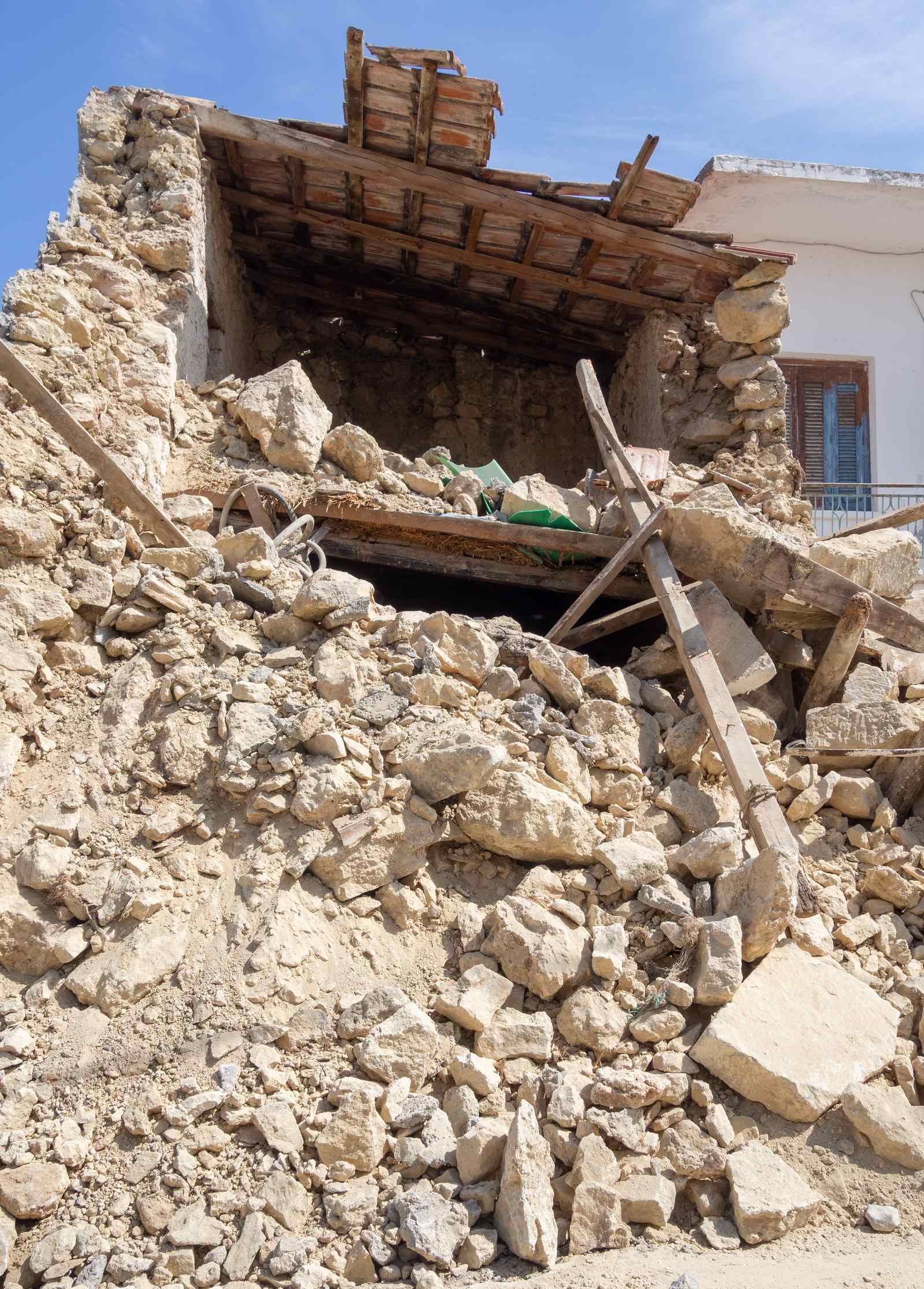
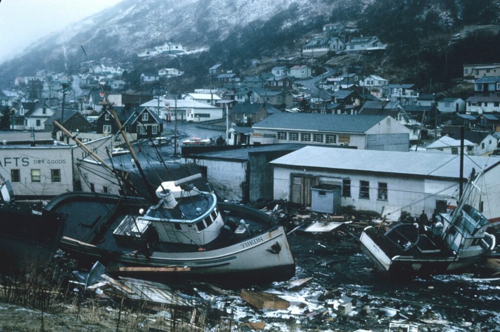
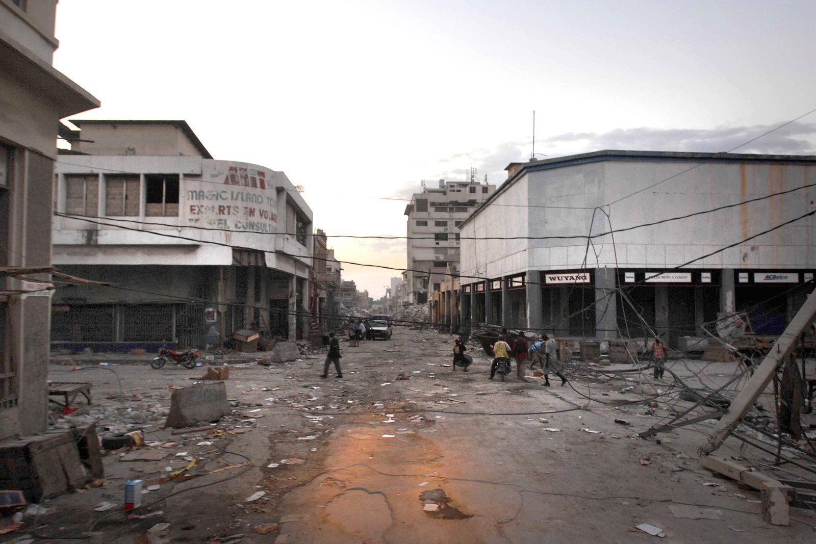
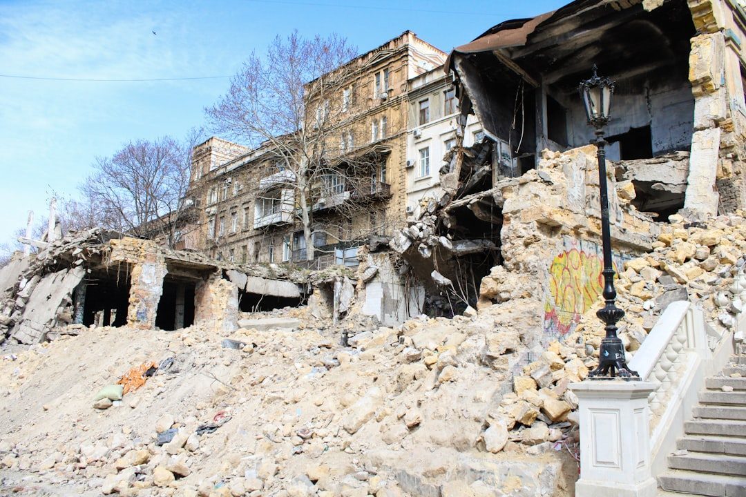
History in Central America is punctuated by earthquakes that forever changed its cities. In 1972, a powerful quake struck Managua, Nicaragua, collapsing much of the downtown and killing tens of thousands, leaving deep physical and political scars that shaped the country for decades. San Salvador has been hit repeatedly, with quakes in the 1960s, 1980s, and early 2000s triggering landslides that buried entire neighborhoods on the steep volcanic slopes. In Guatemala, the 1976 earthquake ripped open the ground for hundreds of kilometers along the Motagua Fault, destroying villages and revealing just how long and dangerous that fault system truly is. Each of these catastrophes exposed weaknesses in building design, emergency response, and governance.
What makes these disaster flashpoints especially tragic is how often the damage clusters in predictable places: soft soils that amplify shaking, hillside communities perched above unstable slopes, dense urban cores built without modern seismic codes. In many cases, post-quake investigations find that the geology did what geologists predicted, but the human systems failed to adapt in time. Still, each disaster has driven some progress. After major events, countries have updated building standards, mapped landslide-prone zones, and installed new monitoring networks. The challenge is that the earthquakes do not pause while these improvements catch up, so every new event tests both old vulnerabilities and the strength of recent reforms.
Volcanoes, Tsunamis, and the Chain-Reaction Nature of Risk
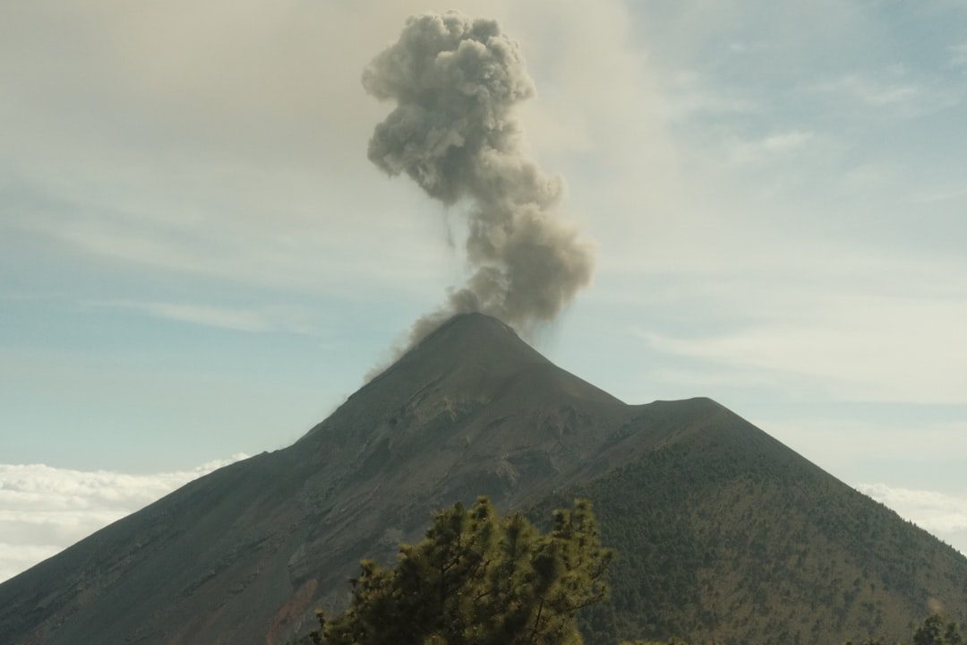
Central America’s seismic story is not just about shaking ground; it is also about the fiery and watery domino effects that earthquakes can trigger. The same subduction processes that generate large quakes also fuel an almost continuous line of volcanoes stretching from Guatemala through Costa Rica. Many of these volcanoes are active, periodically releasing ash, lava, and toxic gases that can blanket farmlands, close airports, and displace communities. Earthquakes can destabilize volcanic slopes, triggering landslides or lahars – fast-moving mud and debris flows that race down river channels with almost no warning. In some eruptions, people have been killed not by lava, but by the sudden collapse of slopes shaken loose by seismic swarms.
Offshore, major earthquakes along the subduction interface can displace large volumes of water, generating tsunamis that race toward the coast at jet-like speeds. Fishing villages and tourist communities along the Pacific shore of countries like El Salvador and Nicaragua live with this dual threat of shaking followed by flooding. Because some quakes are too close and fast for distant warning systems to respond in time, education about natural warning signs – such as sudden strong shaking near the coast or a rapid retreat of the sea – can be lifesaving. In this way, Central America’s risk is chained: one hazard can trigger another, and resilience depends on how well people and systems can handle both the first blow and the waves that follow.
From Ancient Tools to Modern Science in Earthquake Alley
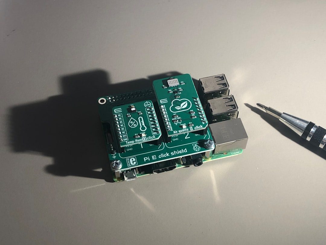
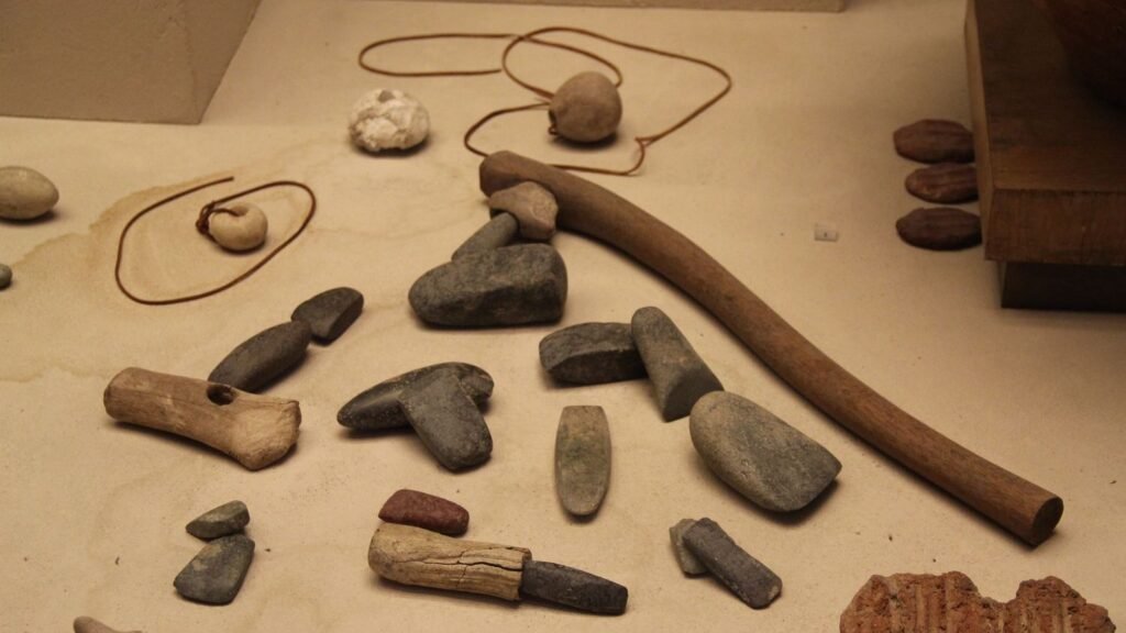
Long before seismometers and satellites, Indigenous communities in Central America paid close attention to the land’s subtle signals. They noticed changes in springs, animal behavior, and unusual ground noises, and wove these into stories and practices that helped them remember which areas were dangerous. While these traditional observations were not formal science in the modern sense, they were grounded in careful, generational watching. Today, seismologists and geologists combine that local knowledge with cutting-edge tools like GPS networks, ocean-bottom sensors, and radar satellites that can detect ground motion down to millimeters. Together, these methods create a multilayered picture of how stress is building and where faults might be close to failure.
In recent decades, Central American countries have installed denser seismic networks capable of detecting small earthquakes and swarms that might indicate changes in stress along faults or beneath volcanoes. Satellite-based systems track how the Earth’s crust is slowly deforming over time, showing where it is stretching, compressing, or twisting. This is crucial in a region where not every dangerous fault leaves a clear scar at the surface. Still, even with advanced sensors, scientists cannot yet predict the exact time and size of a future quake, only the probability and likely impacts. That limitation can be frustrating for communities that want precise answers, but it also makes clear why preparedness and strong infrastructure remain the most reliable tools for survival.
Why This Seismic Cauldron Matters Far Beyond Central America
It might be tempting for someone living far from these fault zones to see Central America’s seismic chaos as a local problem, but in a connected world, that is an illusion. Critical trade routes pass through this region, including ports, highways, and pipelines that link North and South America and serve global supply chains. When a major earthquake or volcanic eruption shuts down a port, damages a canal, or cuts roads, the ripple effects can hit prices and availability of goods thousands of miles away. In addition, millions of people from Central America live abroad, sending money home, and disasters can suddenly strain these communities and social systems in other countries.
There is also a moral and scientific dimension to why it matters. Central America is on the front line of multiple overlapping risks: earthquakes, volcanoes, hurricanes, and climate-related hazards, often affecting the same vulnerable populations. Studying how this region adapts – through building codes, early warning systems, and community organizing – offers lessons for other seismic hot spots, from the Mediterranean to parts of Asia and the Pacific. When scientists refine hazard models here or test new monitoring equipment on its restless faults, the resulting insights can improve safety in cities worldwide. In a real sense, paying attention to Central America’s earthquakes is not just empathy; it is self-interest.
The Future Landscape: Technology, Tough Choices, and a Moving Earth
Looking ahead, Central America’s seismic reality is not going to soften; the plates will keep grinding for millions of years. What can change is how societies respond. New technologies are already reshaping the odds: early warning systems that can send alerts seconds before the strongest shaking arrives, smartphone apps that crowdsource felt reports, and AI tools that rapidly estimate damage from incoming seismic data. These systems can give hospitals, firefighters, and utility operators a brief but precious window to brace for impact or automatically shut down critical infrastructure. In some cities, that might mean trains slowing, gas valves closing, and surgeries paused before the worst shaking hits.
However, technology alone will not solve the underlying vulnerability. Many buildings across Central America remain old, under-reinforced, or informally constructed, and retrofitting them is expensive and politically complicated. Governments face hard choices about where to invest limited resources: in dense urban centers, in rural villages near active volcanoes, or in critical pipelines and ports. Climate change adds another layer of strain, as heavy rains and storms destabilize slopes that can later fail during earthquakes. The future landscape of risk will depend not just on engineering breakthroughs, but on political will, fair policies, and the ability of communities to demand and sustain safer environments.
How You Can Pay Attention, Support Science, and Reduce Risk
Even if you live far from Central America, there are real ways to engage with what happens in this seismic corridor. Following reputable scientific institutions and regional observatories helps keep attention on both the science and the human stories behind the numbers. Supporting disaster relief and preparedness organizations that work before and after earthquakes can strengthen communities long after headlines fade. Educators can use Central America’s experiences to teach students about plate tectonics, risk, and resilience, making a distant hazard feel concrete and understandable. Travelers can choose operators and lodgings that respect local safety standards and support communities rather than exploiting them.
On a broader level, advocating for science-based policies in your own region – strong building codes, hazard mapping, and early warning systems – creates a global climate where investing in resilience is normal, not optional. The same mindset that pushes one city to retrofit bridges may eventually help a town in Guatemala strengthen its schools. In a world stitched together by trade, migration, and shared technology, ignoring Central America’s earthquakes is like ignoring a crack in the foundation of the house next door. The shake may start there, but the lessons, and sometimes the consequences, do not stop at the border.

Suhail Ahmed is a passionate digital professional and nature enthusiast with over 8 years of experience in content strategy, SEO, web development, and digital operations. Alongside his freelance journey, Suhail actively contributes to nature and wildlife platforms like Discover Wildlife, where he channels his curiosity for the planet into engaging, educational storytelling.
With a strong background in managing digital ecosystems — from ecommerce stores and WordPress websites to social media and automation — Suhail merges technical precision with creative insight. His content reflects a rare balance: SEO-friendly yet deeply human, data-informed yet emotionally resonant.
Driven by a love for discovery and storytelling, Suhail believes in using digital platforms to amplify causes that matter — especially those protecting Earth’s biodiversity and inspiring sustainable living. Whether he’s managing online projects or crafting wildlife content, his goal remains the same: to inform, inspire, and leave a positive digital footprint.