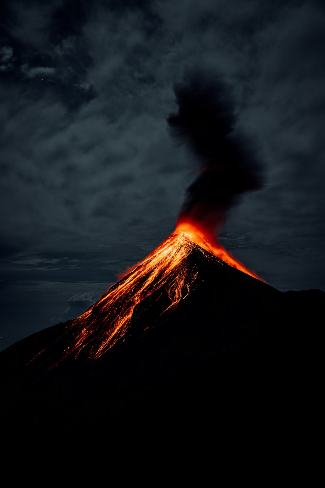
They arrive like a switch flipped by the planet: a thunderclap, a cloud racing upward, ash and rock flung without a drop of fresh lava in sight. Scientists call them phreatic eruptions, steam-blast events that can tear open craters and transform sunny tourist spots into disaster zones in minutes. The mystery is that they often hide in plain view, simmering beneath calm crater lakes and quiet geothermal fields. As researchers refine new tools – from satellite radar to fiber-optic listening lines – the goal is to spot the subtle clues that precede these sudden blasts. What we’re learning, and what remains painfully uncertain, is reshaping how we think about volcanic risk in the twenty-first century.
The Hidden Clues
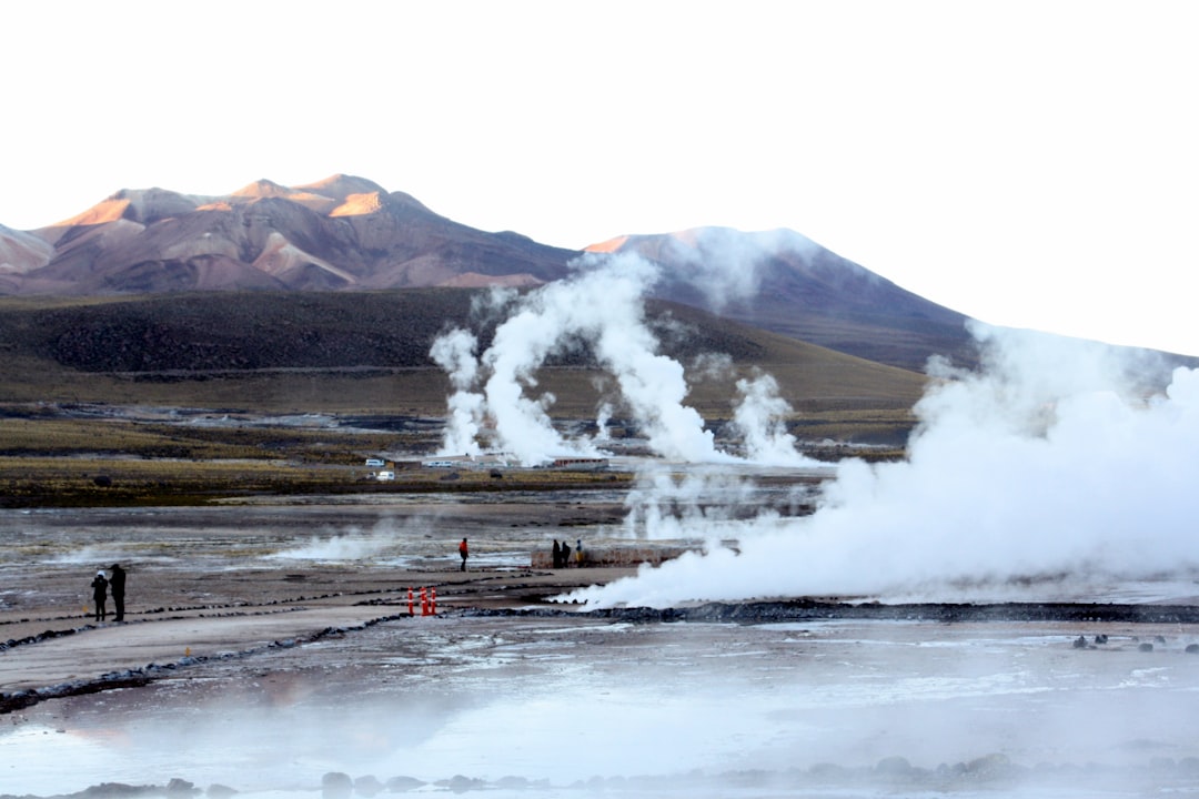
Here’s the shocker: a volcano can explode violently even when the magma stays put. Steam, trapped in cracks and pores, flashes to gas and expands hundreds of times in volume, fracturing rock like a pressure cooker gone rogue. The earliest hints are frustratingly small – tiny earthquakes, faint ground swelling, or a whiff of warmer gas that gets lost in the daily noise. Many eruptions arrive after weather shifts, heavy rain, or subtle barometric changes that tip a fragile system into runaway pressure.
The trick is separating signal from the chorus of a living volcano. A spur of seismic chatter might be a harmless bubble collapsing deep underground – or the first domino in a chain that culminates at the surface. Field teams track temperature in fumaroles, acidity in crater lakes, and the chemistry of gases that seep through soil, piecing together a patchwork forecast. When a cap of altered, clay-rich rock seals in steam, it can turn a mountain into a loaded spring. The uncomfortable truth is that the last quiet moment and the first blast can be separated by just minutes.
Steam, Pressure, and Sudden Violence
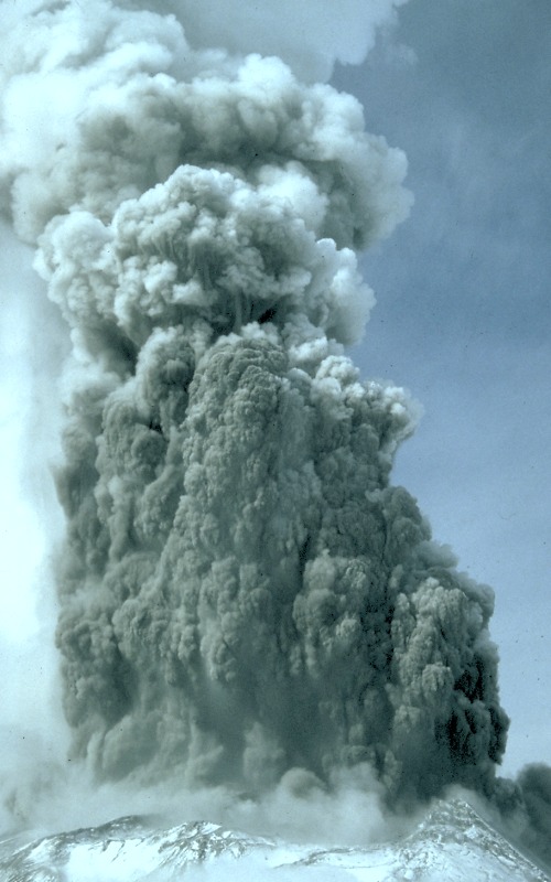
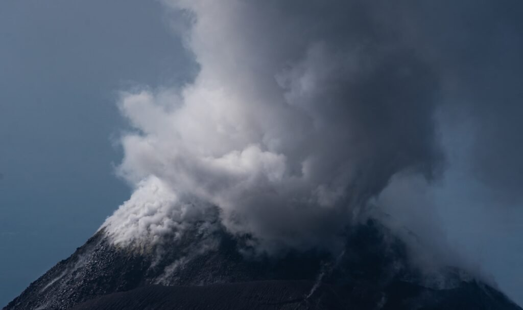
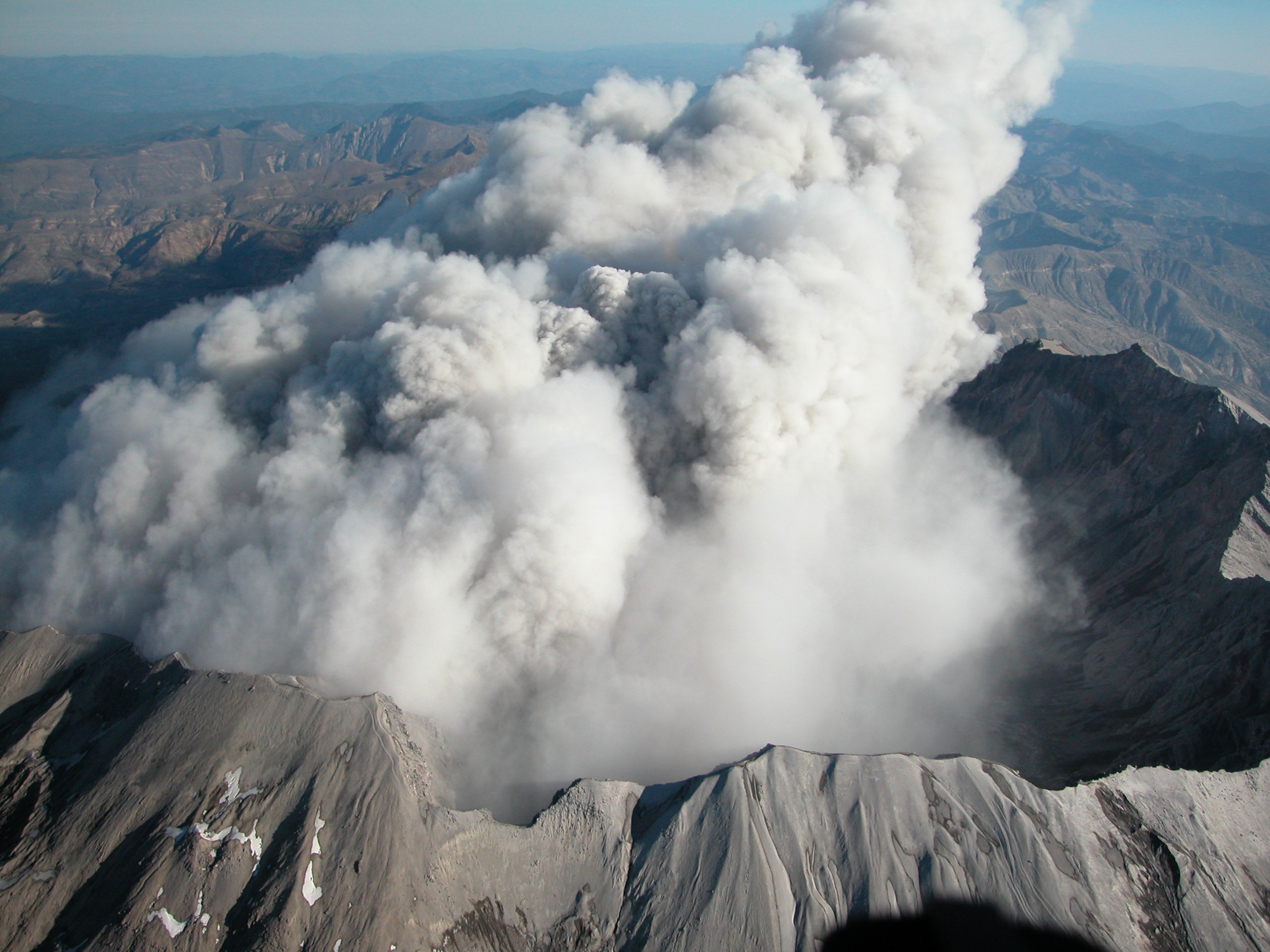
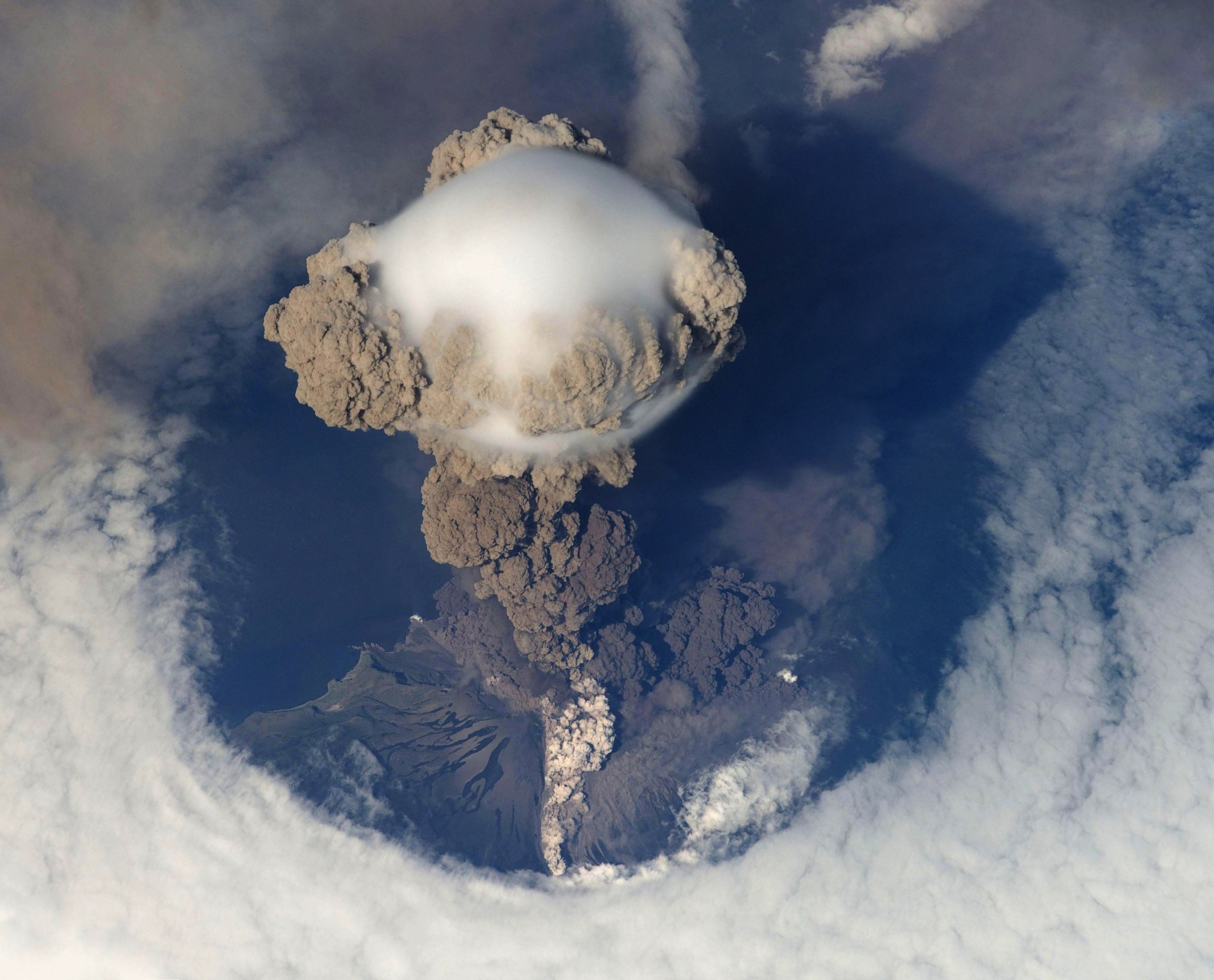
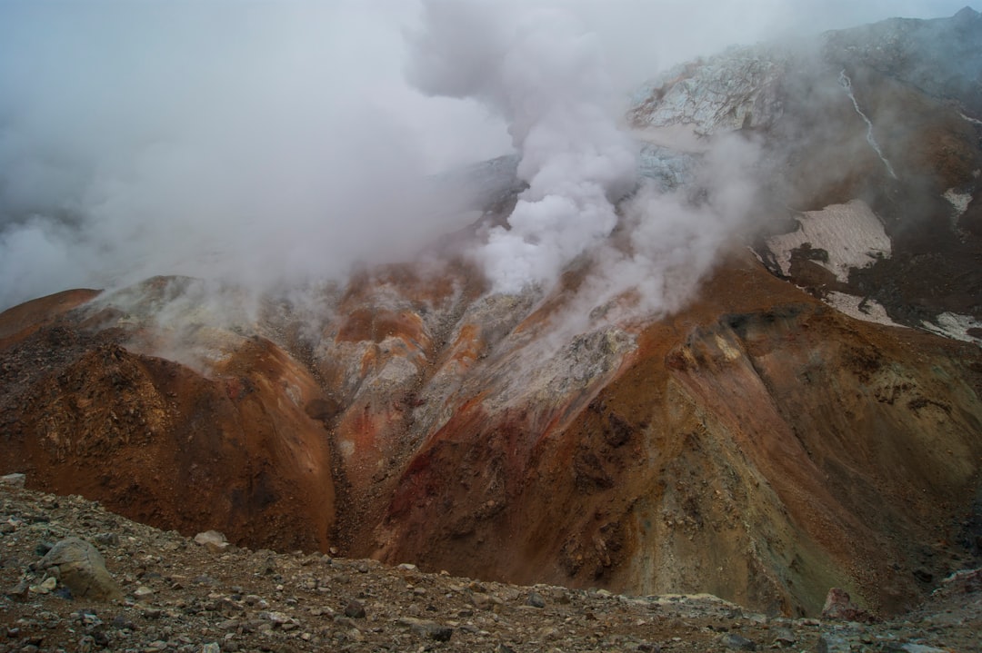
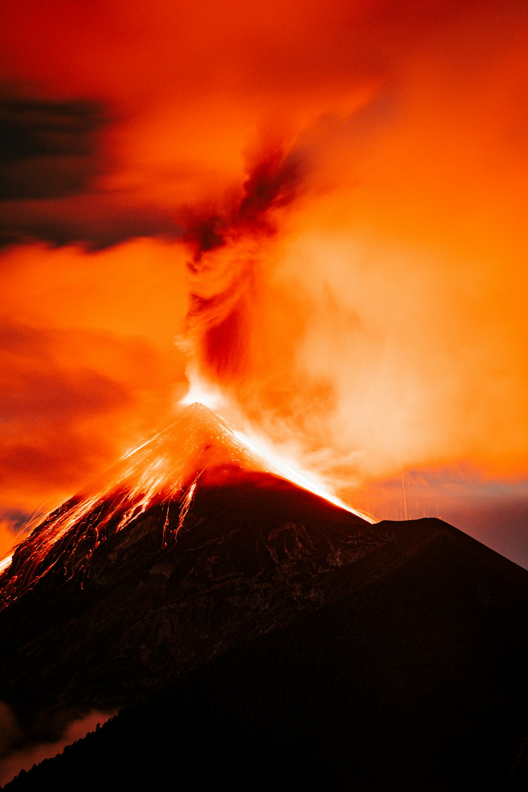
Phreatic eruptions are powered by physics more than fresh magma. Water percolates into hot rock, flashes to steam, and the pressure spike shatters the brittle crust above it. The eruption ejects old rock and clay rather than new lava, which is why the ash looks recycled and the fragments are often hydrothermally altered. Think of it as a shaken soda can whose tab was welded shut until the metal suddenly tears.
Because no new magma must reach the surface, classic warning signs – like sulfur-rich gas spikes or glowing lava – may never appear. Instead, scientists look for rapid heating of groundwater, a change in thermal patterns near vents, or sudden shifts in shallow seismicity. Even a small landslide can uncap a fissure and trigger a blast. The absence of lava doesn’t mean the absence of danger; it means the hazard is dressed in a subtler costume.
From Ancient Tools to Modern Science
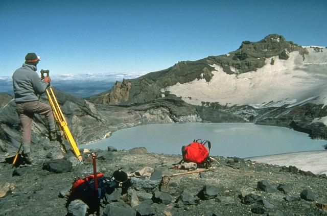
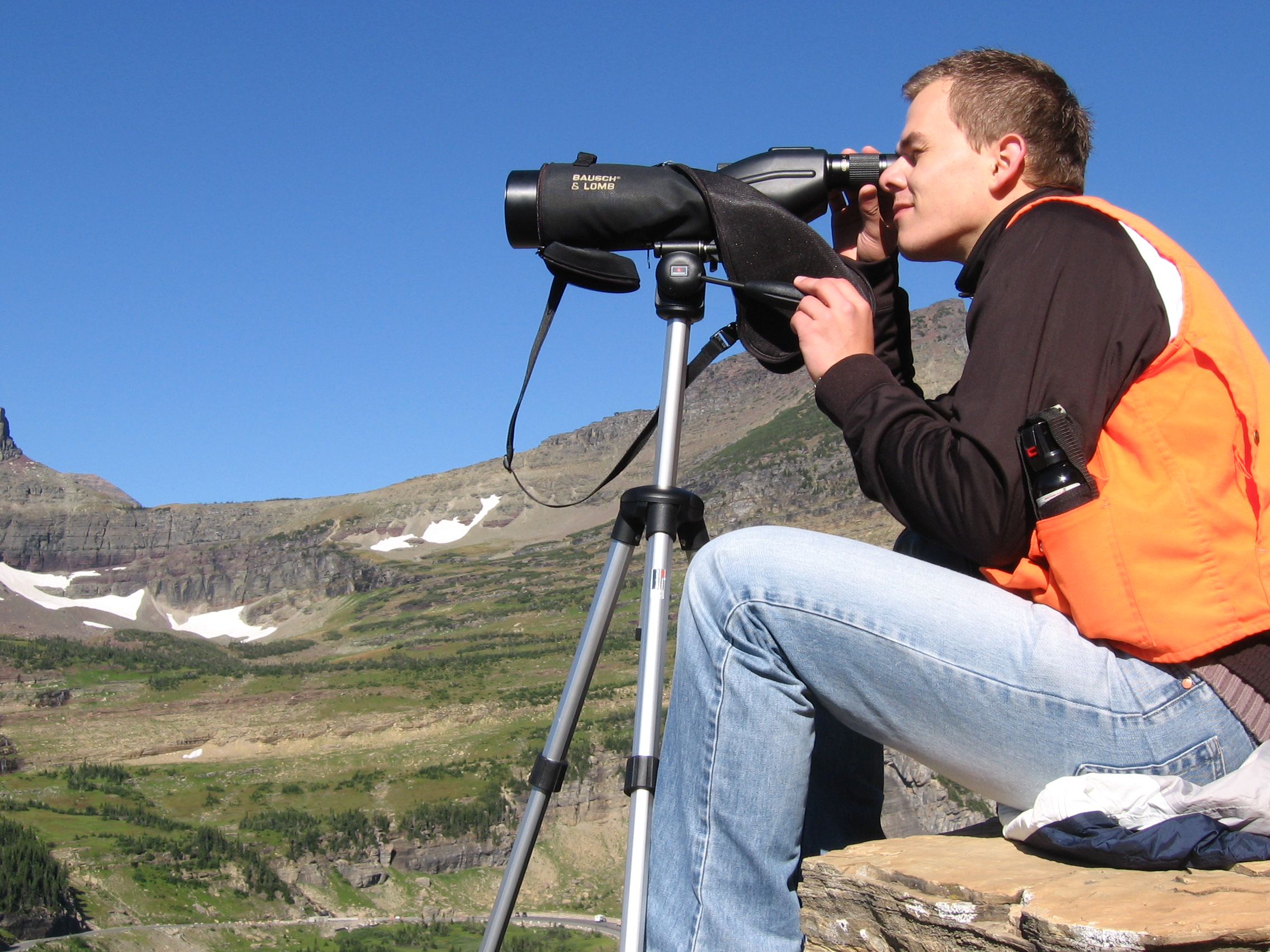
For centuries, people read volcanoes the way sailors read the sea: by eye, ear, and gut. Today, the tool kit looks more like a space mission. Satellites track millimeter-scale swelling with radar interferometry, while drones sniff crater gases and map heat from safe distances. Infrasound microphones hear low rumbles that ears miss, and tiltmeters capture the tiniest nods of a restless cone.
Newer methods are changing the game. Fiber-optic cables laid on the ground act like thousands of motion sensors, listening for micro-tremors that hint at boiling fluids. Thermal cameras map heat fingerprints in real time, showing where steam is growing bold. Even muon imaging – a technique that uses cosmic particles – can peer through a volcano to reveal hidden voids or dense plugs. The aim is a coherent picture of pressure building, before the rock snaps.
Case Files: When Steam Turns Deadly
In September 27, 2014, Japan’s Mount Ontake erupted during peak hiking season, sending a surge of ash and rock that outran any warning hikers might have had. Investigations later found patterns consistent with a steam-blast event, with little clear magmatic involvement at the surface. In December 2019, New Zealand’s Whakaari/White Island exploded while visitors were on the crater floor, a devastating reminder that tourist-friendly does not mean risk-free. Both events echoed a hard lesson: hydrothermal systems can fail catastrophically without flaunting the obvious signals that precede lava eruptions.
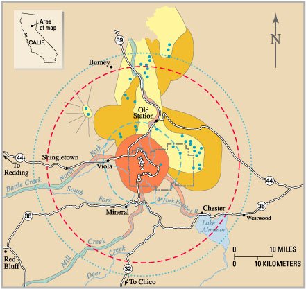
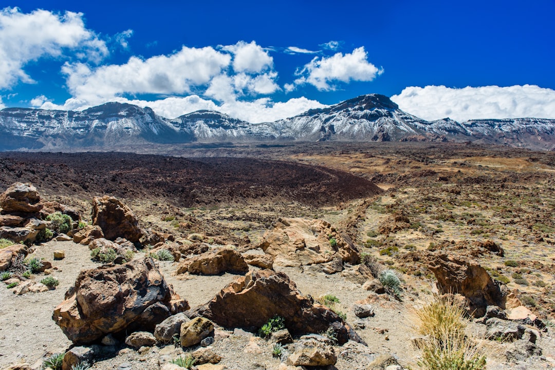
Elsewhere, the scars tell older stories. In Yellowstone, broad craters and rubble fields mark prehistoric hydrothermal explosions that moved more earth than many lava flows, sculpting shorelines and throwing boulders like dice across a table. Smaller blasts strike geothermal fields in Italy, Iceland, and Latin America, often as sudden crater-lake bursts or vent ruptures. The common thread is the same: a sealed, heated, water-rich system reaching a tipping point, then failing fast.
Why It Matters
This isn’t just a geologic curiosity; it’s a public-safety puzzle. Popular trails, spas, and crater rims often sit directly above the plumbing that fuels steam blasts. Traditional hazard thinking tends to prioritize lava and ash columns, but the deadliest window for hydrothermal sites can be the ten seconds after a cap rocks pops. Emergency plans built around slowly rising magma need a complementary playbook for quick-trigger steam events.
Phreatic hazards also challenge how we communicate uncertainty. Forecasts may be honest yet unsatisfying: elevated risk without a clear timeline. That ambiguity complicates closures, tourism, and livelihoods tethered to the volcano’s reputation. The scientific imperative is to turn vague alarms into actionable guidance – probabilities tied to zones, time frames, and specific activities – so decisions don’t hinge on guesswork. In short, we need a language for danger that fits the speed of steam.
Global Perspectives
The hottest lessons are arriving from places where people and volcanoes share backyards. Japan’s dense hiking culture meets steep, hydrothermally active peaks; New Zealand pairs bold tourism with island-scale risk; Italy’s Campi Flegrei and Solfatara sit beside bustling communities. Each landscape demands its own balance of access and caution, and each has adopted tiered alert systems to guide closures and warnings. What works on a lonely cone won’t translate to a caldera ringed by neighborhoods.
International collaborations are stitching these experiences together. Shared data sets let scientists compare the fingerprints of unrest across very different systems, refining how we interpret gas ratios, lake chemistry, or sudden temperature jumps. Training exchanges move know-how where it’s needed most, equipping local teams to maintain sensors and parse messy signals. The endgame is a global toolbox that respects local realities while leveraging collective insight.
Reading the Volcano’s Breath
I once stood on a boardwalk above a hissy fumarole, lulled by the rhythm of steam exhaling and inhaling like a sleeping animal. It felt safe – almost domestic – until a guide explained how a thin mineral crust can behave like a trapdoor. That image stuck, and it maps neatly onto what field data show: a cap that seals, heat that accumulates, and pressure that hunts for a weakness. Often the breaking point arrives where clay-rich alteration has quietly weakened rock to the texture of a stale cookie.
Scientists are getting better at reading that breath. A sudden spike in chloride in a crater lake may indicate deeper water flushing upward. Slight warming at a single vent, coupled with a change in seismic wave speeds, can mark migrating fluids. None of these indicators guarantee an imminent blast, but together they sketch a risk picture with sharper edges. The art is in the ensemble, not the solo.
The Future Landscape
Expect volcano monitoring to look more distributed and more automated in the next decade. Low-cost sensors that talk to one another can blanket hazard zones, flagging changes in seconds rather than days. Machine-learning models trained on past unrest are starting to rank which combinations of signals matter most for steam-trigger scenarios, providing a rolling, probabilistic forecast. Drones and small satellites will fill blind spots, especially over crater lakes and unstable rims too dangerous for human crews.
Challenges remain stubborn. Steam environments are harsh on instruments, and false alarms erode public trust. Data sharing across agencies can lag the speed of a crisis, and liability worries complicate swift closures. Still, the momentum is real: more open data, better community drills, and faster translation from raw seismic squiggles to clear advice. The forecast won’t be perfect, but it can be timely enough to matter.
From Ancient Tools to Modern Science, Revisited
It’s striking how the oldest instincts – listening, watching, smelling – are returning alongside advanced hardware. Rangers who notice a vent sounding throatier or a lake turning a deeper turquoise provide context that sensors alone can miss. Paired with satellite maps and subsurface imaging, those human observations help resolve contradictions, like rising heat without increased gas or earthquakes without deformation. The future isn’t about replacing eyes with algorithms; it’s about letting each sharpen the other.
There’s also a cultural shift underway. Communities want to participate, not just receive alerts. Citizen networks that log odors, steam intensity, or water discoloration can feed real-time dashboards, particularly where budgets are thin. When locals become observers, risk awareness becomes routine rather than reactive. That change can save precious minutes when they count most.
Call to Action
If you live near or visit a volcanic or geothermal area, treat steam as seriously as lava. Learn the local alert levels before you go, and respect closures even when the weather looks perfect. Stay on marked paths, avoid vent and crater-lake edges, and leave immediately if you see rapid water discoloration, new mud geysers, or hear stronger vent roaring. Support monitoring programs and park science funds, which keep sensors running and data available to the teams who must act fast.
You can also become part of the listening network. Report unusual changes to park rangers or local observatories, and follow official channels for updates rather than rumors. Encourage schools and community groups to host preparedness drills focused on hydrothermal hazards, not just lava. Small habits – checking conditions, carrying a mask and eye protection, giving vents a wide berth – stack up to a safer culture around Earth’s hot breath.
Conclusion
Steam-blast eruptions are the quiet cliff edge in our understanding of volcanoes, astonishing not because they are rare, but because they are intimate and fast. They trade the spectacle of lava for the physics of pressure, turning groundwater into a force capable of rewriting a landscape before a message can load on your phone. The science is catching up, with sharper ears, keener eyes, and a growing humility about what we still don’t know. If we listen closely and plan boldly, we can move risk from the trailhead to the blueprint, from the rumor mill to the checklist. Did you expect steam to be this loud?

Suhail Ahmed is a passionate digital professional and nature enthusiast with over 8 years of experience in content strategy, SEO, web development, and digital operations. Alongside his freelance journey, Suhail actively contributes to nature and wildlife platforms like Discover Wildlife, where he channels his curiosity for the planet into engaging, educational storytelling.
With a strong background in managing digital ecosystems — from ecommerce stores and WordPress websites to social media and automation — Suhail merges technical precision with creative insight. His content reflects a rare balance: SEO-friendly yet deeply human, data-informed yet emotionally resonant.
Driven by a love for discovery and storytelling, Suhail believes in using digital platforms to amplify causes that matter — especially those protecting Earth’s biodiversity and inspiring sustainable living. Whether he’s managing online projects or crafting wildlife content, his goal remains the same: to inform, inspire, and leave a positive digital footprint.