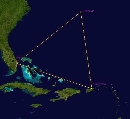
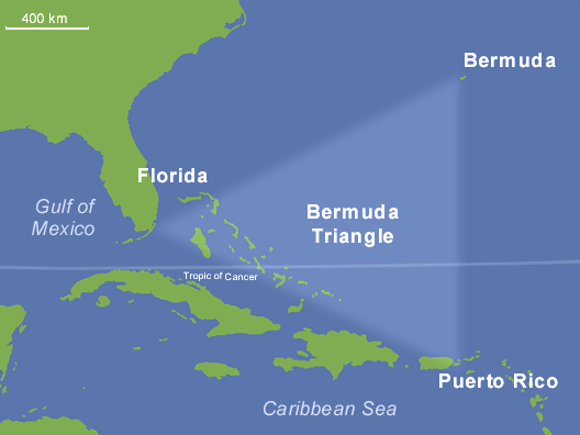
Stormy headlines love a mystery, and few places swallow more speculation than the stretch of Atlantic between Miami, Bermuda, and Puerto Rico. has long been painted as a zone where ships vanish and compasses spin, but fresh data tells a far steadier story. Scientists, mariners, and aviation investigators have mapped its waters, tracked its storms, and decoded its mishaps with tools that would’ve stunned earlier generations. The tension now is less haunted ocean versus rational science and more storytelling versus statistics, with human error and fast-changing weather sitting at the center. The real plot twist is that understanding the Triangle can make all of us better at reading risk, not just here, but across an ocean planet under rapid change.
The Hidden Clues
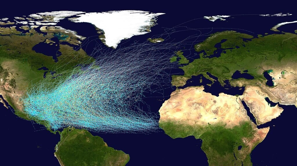
What if ’s greatest secret is that it isn’t a secret at all? Look at a shipping density map and the area lights up like a city at night; look at flight corridors and you see the same pattern. More traffic naturally means more incidents recorded, especially across a century of evolving technology and record-keeping. Add the Gulf Stream, a narrow, swift current that can carry debris hundreds of miles in days, and disappearances feel stranger simply because wreckage is whisked away.
Then there’s geography: shallow banks, deep trenches, and sharp gradients that amplify waves when strong winds oppose the current. Thunderstorms brew fast over warm water, and squalls can go from bruised horizon to deck-slamming in minutes. Compasses do behave differently where magnetic variation changes quickly, but that happens in many parts of the world and is charted on modern maps. The clues aren’t supernatural – they’re the messy, powerful physics of a busy ocean corridor.
From Ancient Tools to Modern Science
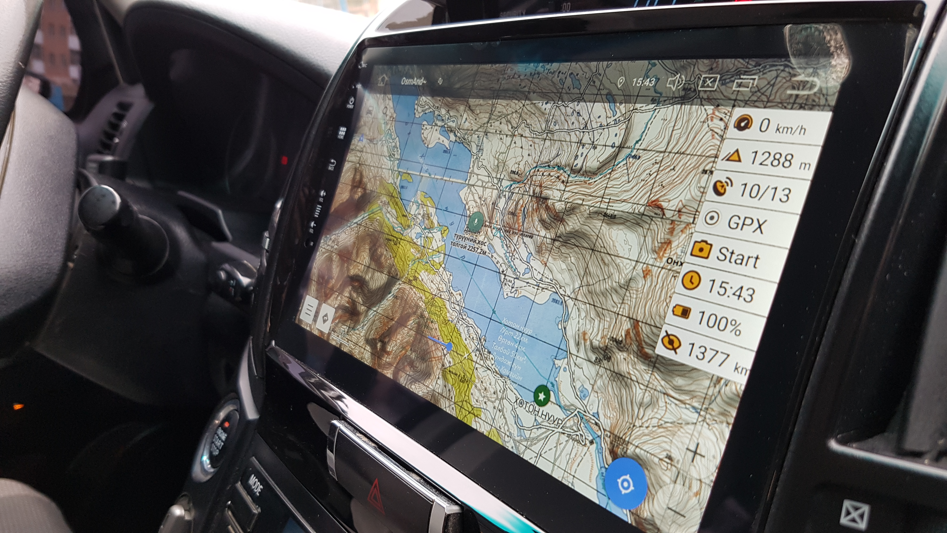
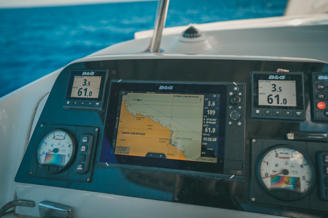
Navigators once relied on dead reckoning and celestial fixes, vulnerable to cloud cover and fatigue; today, GPS and inertial systems cross-check each other every second. Ships broadcast their position via AIS, aircraft via ADS-B, and that telemetry is archived, letting investigators reconstruct routes with clockwork precision. Synthetic aperture radar satellites can spot vessels through clouds and at night, while high-resolution altimeters map the heartbeat of currents and eddies. When storms threaten, hurricane models ingest data from ocean buoys, dropsondes, and aircraft, translating turbulence into forecasts measured in nautical miles and hours.
The result is a region that’s arguably watched more closely than ever. Search-and-rescue teams fuse beacons, drift models, and wind fields to shrink the haystack before time and hypothermia close in. Digital logs replace rumor, and maintenance records tell stories that once would have been guesswork. Technology doesn’t erase risk, but it makes the risk legible – and that changes everything.
Winds, Waves, and Rogue Phenomena
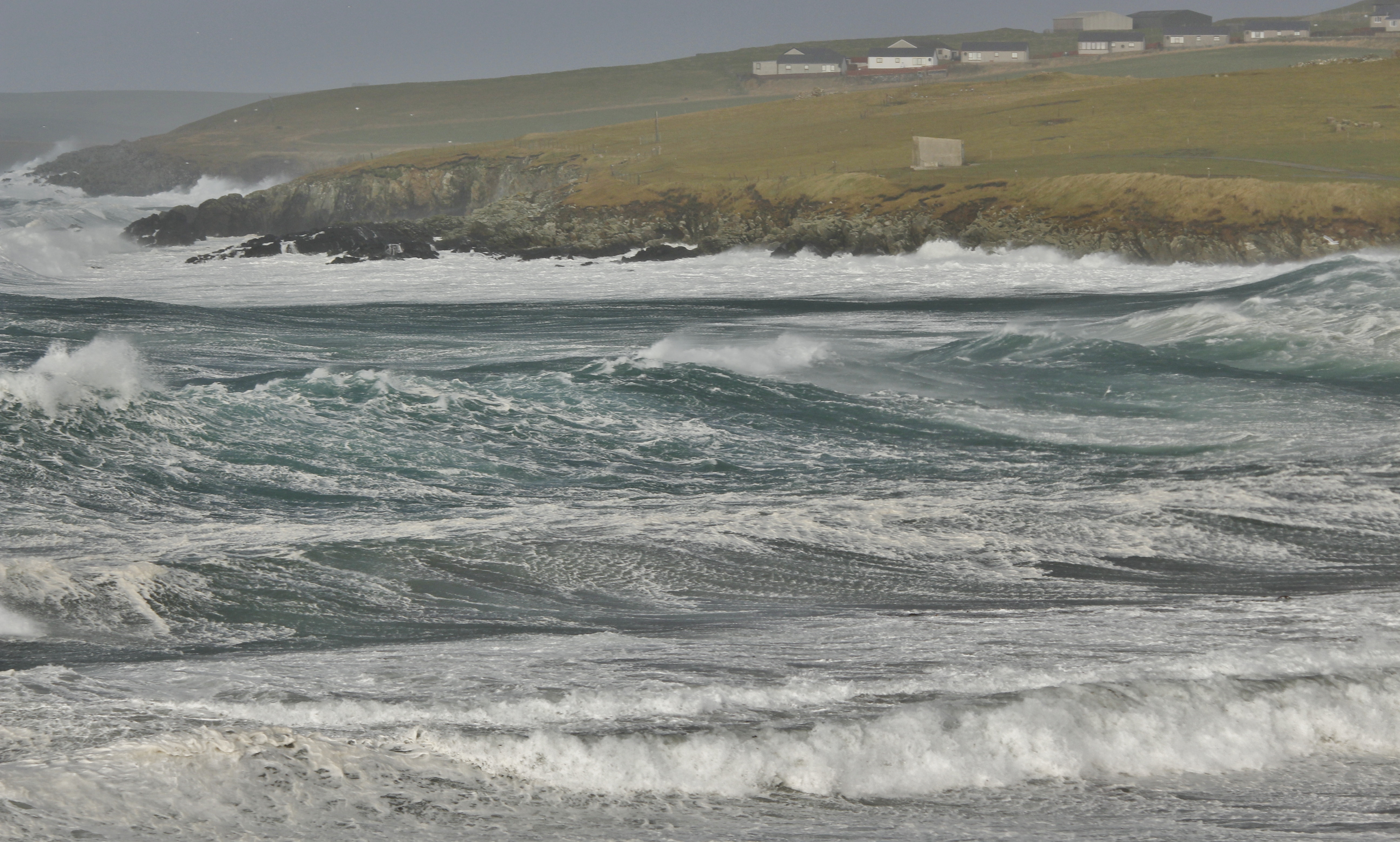
The Triangle’s weather isn’t uniquely cursed; it’s uniquely energetic. Warm seas feed thunderstorms that can collapse into microbursts, slamming the surface with downdrafts that shove small aircraft and boats off balance. When strong winds run against the Gulf Stream, short, steep waves pile up like a broken staircase; add a squall line and that staircase turns into a moving wall. Waterspouts spiral through summer squalls, and rapid pressure jumps can scramble altimeters and pilot judgment.
Rogue waves – rare but real – are most likely where currents, winds, and swells cross at sharp angles, the very geometry common here. These giants don’t need to be skyscraper-high to be deadly; a steep breaker a few times taller than its neighbors can snap masts and stove in pilothouses. None of this requires exotic explanations, only the right ingredients in a turbulent kitchen. The physics is dramatic enough without embellishment.
The Human Factor at Sea and in the Air
In investigations, patterns often point to decisions taken under stress. Fuel calculations trimmed too close, pushback against a forecast, a maintenance snag deferred until the next port – each small gamble multiplies in fast-changing conditions. Spatial disorientation at night or in rain can mislead even experienced pilots if instruments aren’t flown by the book. On the water, a course line that ignores set and drift can quietly slide a vessel off track, turning a routine leg into a frantic radio call.
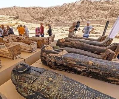
Famous cases amplify the allure, but they also underline ordinary vulnerabilities: incomplete logs, weather underestimated, training gaps exposed. Historical losses sometimes lacked recoverable wreckage, not because the sea played tricks, but because currents scattered clues beyond the reach of mid-century searches. My own view is straightforward: the Triangle magnifies the cost of small errors, the way a mountain magnifies a slipped crampon. That isn’t magic – it’s risk layered on risk.
Global Perspectives
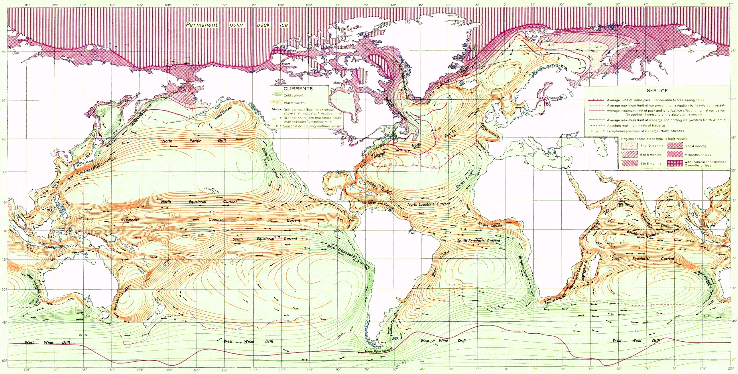
If the Triangle were truly unique, we’d expect outlier statistics after adjusting for traffic and weather. Instead, other corridors show similar risk profiles when those factors match: the Agulhas Current off South Africa, the western North Pacific’s typhoon lanes, and the frigid, storm-lashed North Atlantic routes. In each, fast currents and hostile weather turn routine into peril, and in each, the narrative varies with culture and media attention. Where one region gains a folkloric label, another is treated as hard-nosed seamanship.
The comparison makes a sober point: myths cluster where stories do, while patterns emerge where data are dense. Insurers, coast guards, and safety boards focus on exposure, maintenance, and training rather than latitude and legend. That lens doesn’t kill curiosity; it channels it. The Triangle becomes a case study in how we tell stories about uncertainty, and how those stories can help – or hinder – safer choices.
Why It Matters
is a public-science teachable moment, and it arrives every hurricane season. It shows how confirmation bias can turn coincidence into pattern, and how memories of spectacular tragedies overshadow thousands of uneventful passages. It challenges us to value boring, cumulative evidence over the irresistible pull of a single dramatic tale. And it highlights the real stakes: lives at sea and in the air, responders who launch when beacons light up, and families who need answers rooted in physics rather than folklore.
Compared with traditional lore, modern investigation tools widen the circle of accountability. Instead of shrugging at mystery, we can track maintenance histories, quantify forecast errors, and refine training based on human-factors research. The payoff isn’t just regional; it improves safety protocols from the Caribbean to the South China Sea. Put simply, demystifying the Triangle strengthens the whole global safety net.
The Future Landscape
Tomorrow’s ocean will be mapped and modeled in near real time. Constellations of satellites will watch wave fields evolve hour by hour, while swarms of uncrewed drones taste the boundary between air and sea that births sudden storms. Machine-learning systems will blend radar, lightning, and surface currents into nowcasts tuned for small craft and general aviation, the communities most vulnerable to pop-up squalls. Underwater, autonomous vehicles will trace wreck sites and hazards with centimeter-scale sonar, turning rumor into charted reality.
Challenges loom: data gaps between satellite passes, communications dead zones during severe weather, and the need to translate probabilistic forecasts into decisions on tight margins. Climate change adds another layer, raising sea temperatures that can turbocharge rainfall rates and push more storms toward the high end of intensity. Equity matters too, because the best tools don’t help if only a few can access them. The direction is clear, though – the more we see, the less we need a legend to explain the ocean’s moods.
Conclusion
Curiosity is powerful; pair it with preparation. Before a flight or a run offshore, check updated marine and aviation forecasts, file a plan, and brief your crew on what-ifs. Carry redundant navigation, keep an emergency beacon registered and tested, and practice instrument and night skills when conditions are calm so they’re automatic when the horizon vanishes. Support the agencies and volunteer groups that maintain buoys, analyze storms, and launch searches when seconds count.
Most of all, resist the false comfort of mystery and choose the harder, more helpful habit of evidence. The Triangle isn’t a riddle to fear but a lesson to learn, again and again, wherever weather, current, and human judgment meet. If we treat it that way, stories become safety – and that’s a plot twist worth repeating. Ready to retire the myth and keep the wonder?

Suhail Ahmed is a passionate digital professional and nature enthusiast with over 8 years of experience in content strategy, SEO, web development, and digital operations. Alongside his freelance journey, Suhail actively contributes to nature and wildlife platforms like Discover Wildlife, where he channels his curiosity for the planet into engaging, educational storytelling.
With a strong background in managing digital ecosystems — from ecommerce stores and WordPress websites to social media and automation — Suhail merges technical precision with creative insight. His content reflects a rare balance: SEO-friendly yet deeply human, data-informed yet emotionally resonant.
Driven by a love for discovery and storytelling, Suhail believes in using digital platforms to amplify causes that matter — especially those protecting Earth’s biodiversity and inspiring sustainable living. Whether he’s managing online projects or crafting wildlife content, his goal remains the same: to inform, inspire, and leave a positive digital footprint.