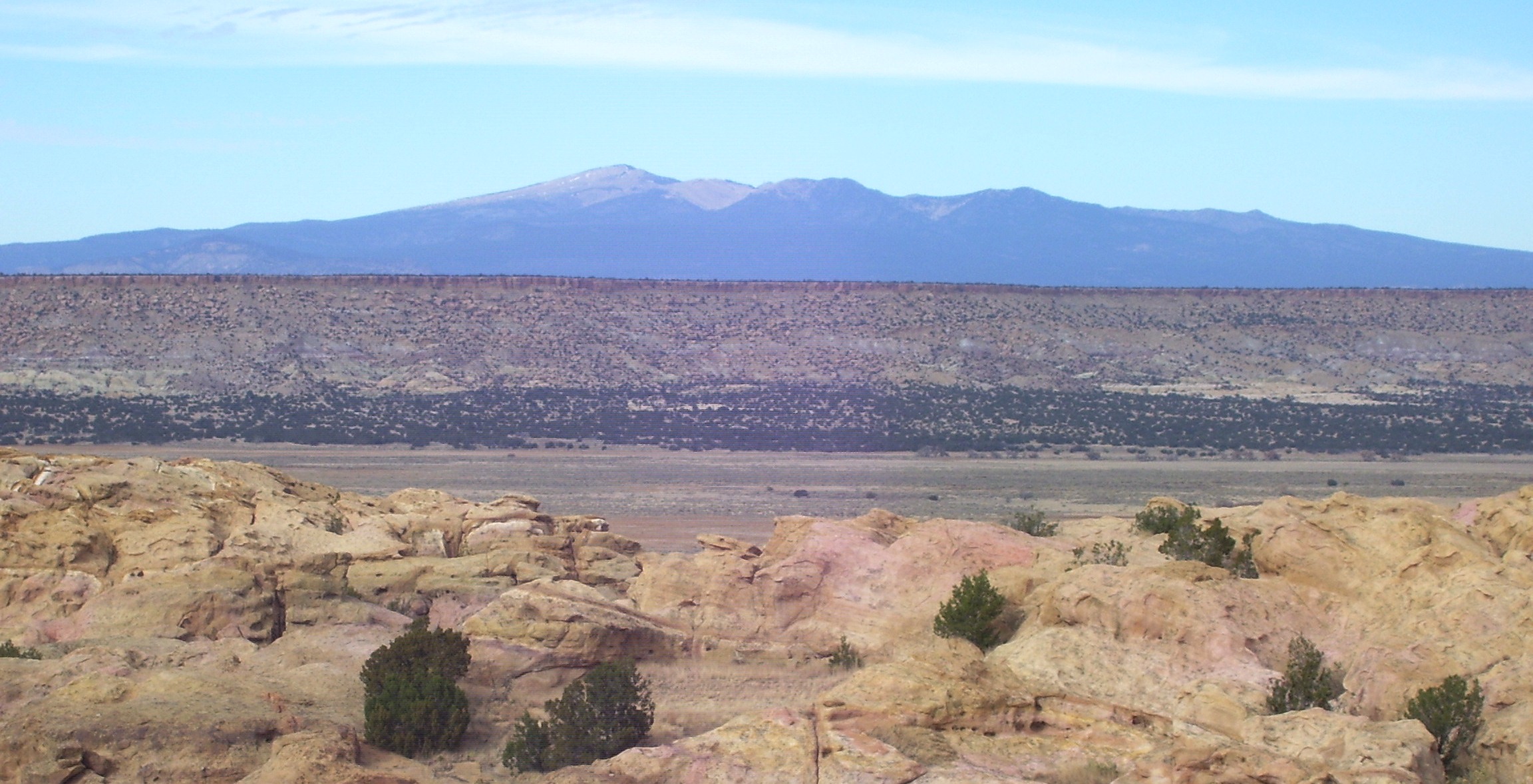
Beneath the seemingly barren landscape of New Mexico’s high desert lies one of North America’s most intriguing geological secrets. You might drive across this terrain and see nothing but rolling hills, ancient mesas, and scattered scrub vegetation. Yet below your feet stretches an extensive network of volcanic features that tells a remarkable story spanning millions of years.
This hidden volcanic realm isn’t just a collection of old lava flows and craters. It represents an active geological frontier where scientists are continuously uncovering new insights about our planet’s fiery interior. Recent research has mapped an astonishing discovery that challenges everything we thought we knew about volcanic activity in the American Southwest.
The Dormant Giants Hiding in Plain Sight
What makes New Mexico’s volcanic landscape so fascinating isn’t what you can see, but what remains concealed beneath the surface. Scientists have identified numerous monogenetic volcanoes that erupted in the region during the past 2.58 million years, covering Nevada, Utah, Arizona, Colorado, New Mexico and parts of California’s eastern edge.
These aren’t the towering peaks you might imagine when thinking about volcanoes. Most of these volcanoes are monogenetic, meaning that they only produced one eruptive episode that may have lasted for days to years. Think of them as geological one-hit wonders that erupted once and then went dormant forever.
The sheer scale of this volcanic field system is staggering. The volcanic fields of the Jemez Lineament cover an extensive area, with a total erupted volume of about 3,300 cubic kilometers. That’s enough volcanic material to bury entire states under layers of lava and ash.
Mapping the Underground Network
Volcano Observatory staff monitor, research, and issue formal notices of activity for volcanoes in assigned geographic areas, while scientists also assess volcano hazards and work with communities to prepare for volcanic eruptions. The challenge in New Mexico is that most of these volcanic features remain hidden or appear as seemingly innocuous hills and mesas.
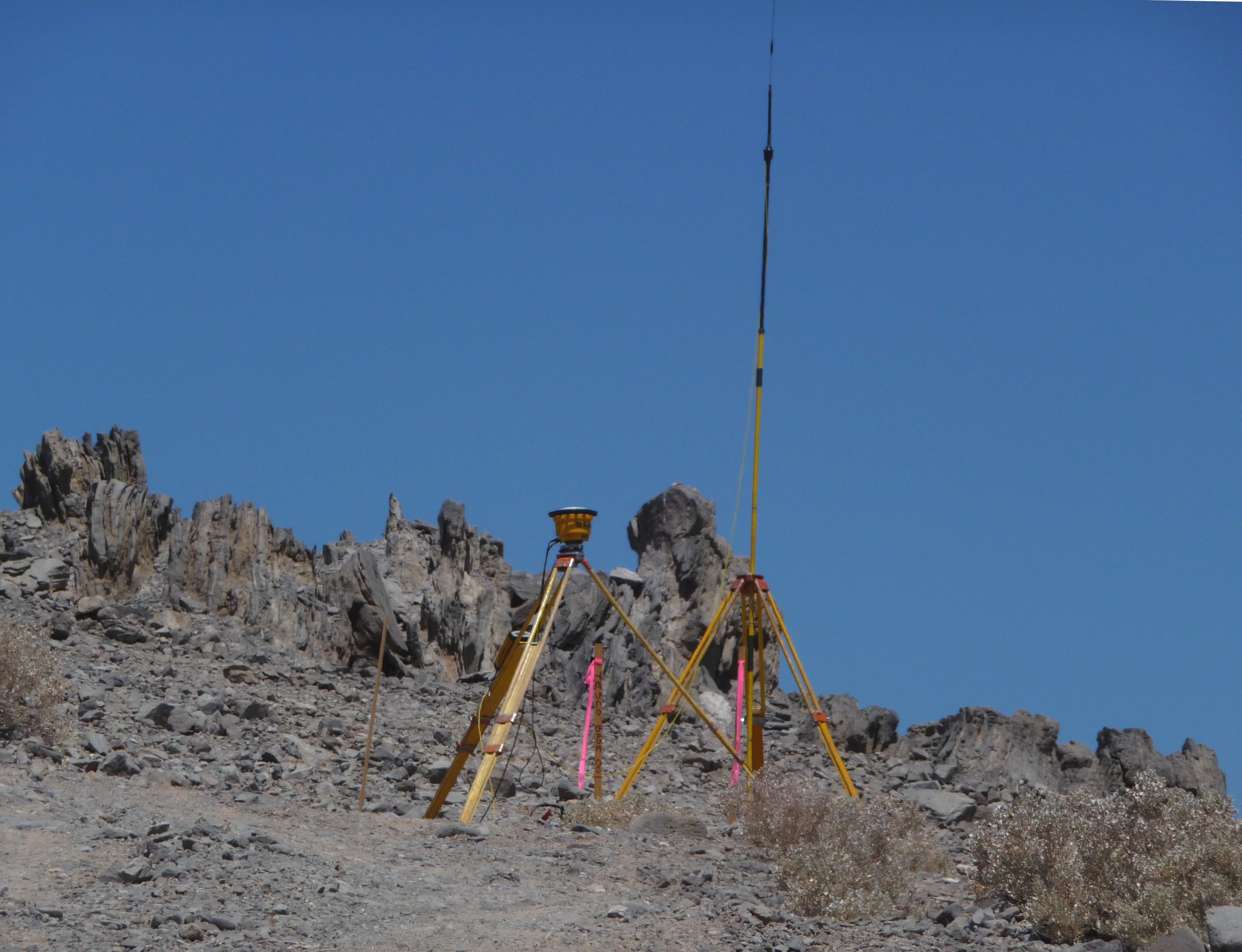
Modern mapping techniques have revolutionized how scientists study these dormant volcanic systems. Researchers now utilize very small networks of seismometers around each volcano and leverage recent enhancements to seismic broadband stations, applying techniques that use scattered wavefields from distant earthquakes to create detailed subsurface images.
Previously, imaging methods required deploying tens to hundreds of seismometers around a volcano, making for a challenging undertaking. This technological breakthrough has opened up entirely new possibilities for mapping volcanic fields that were previously too remote or extensive to study comprehensively.
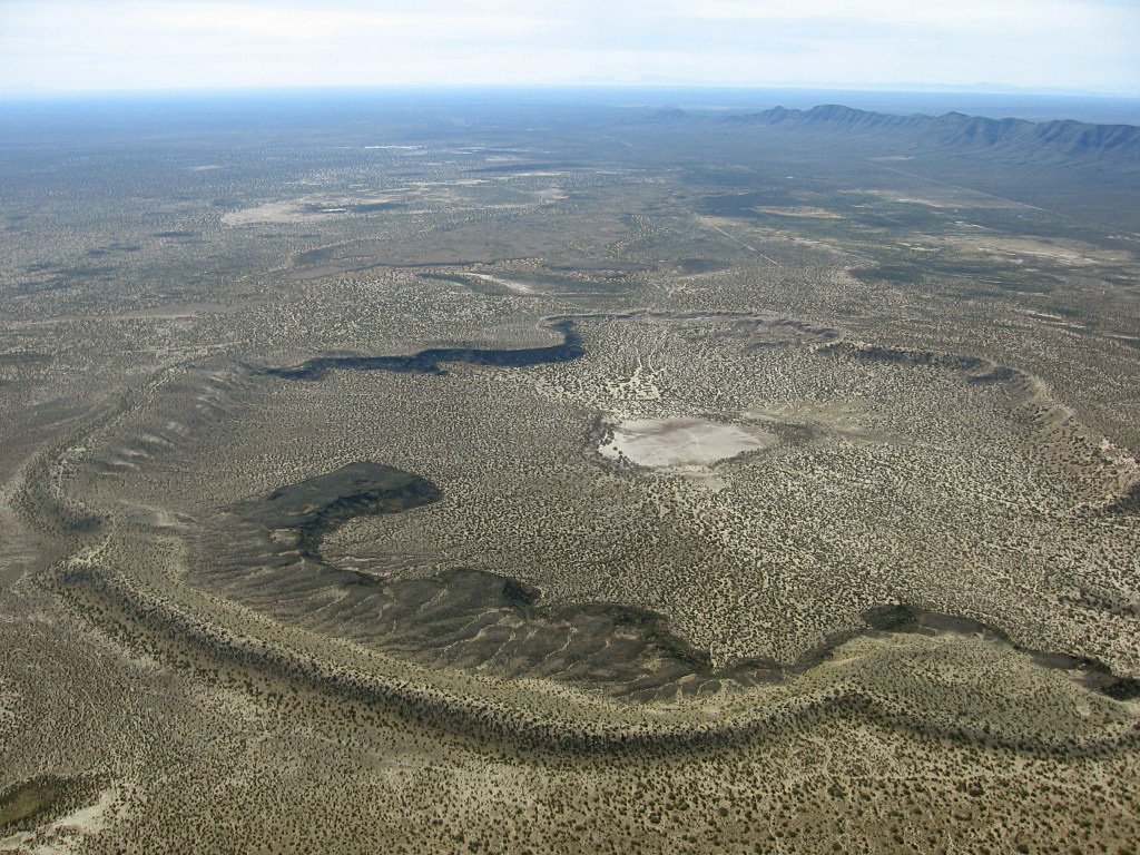
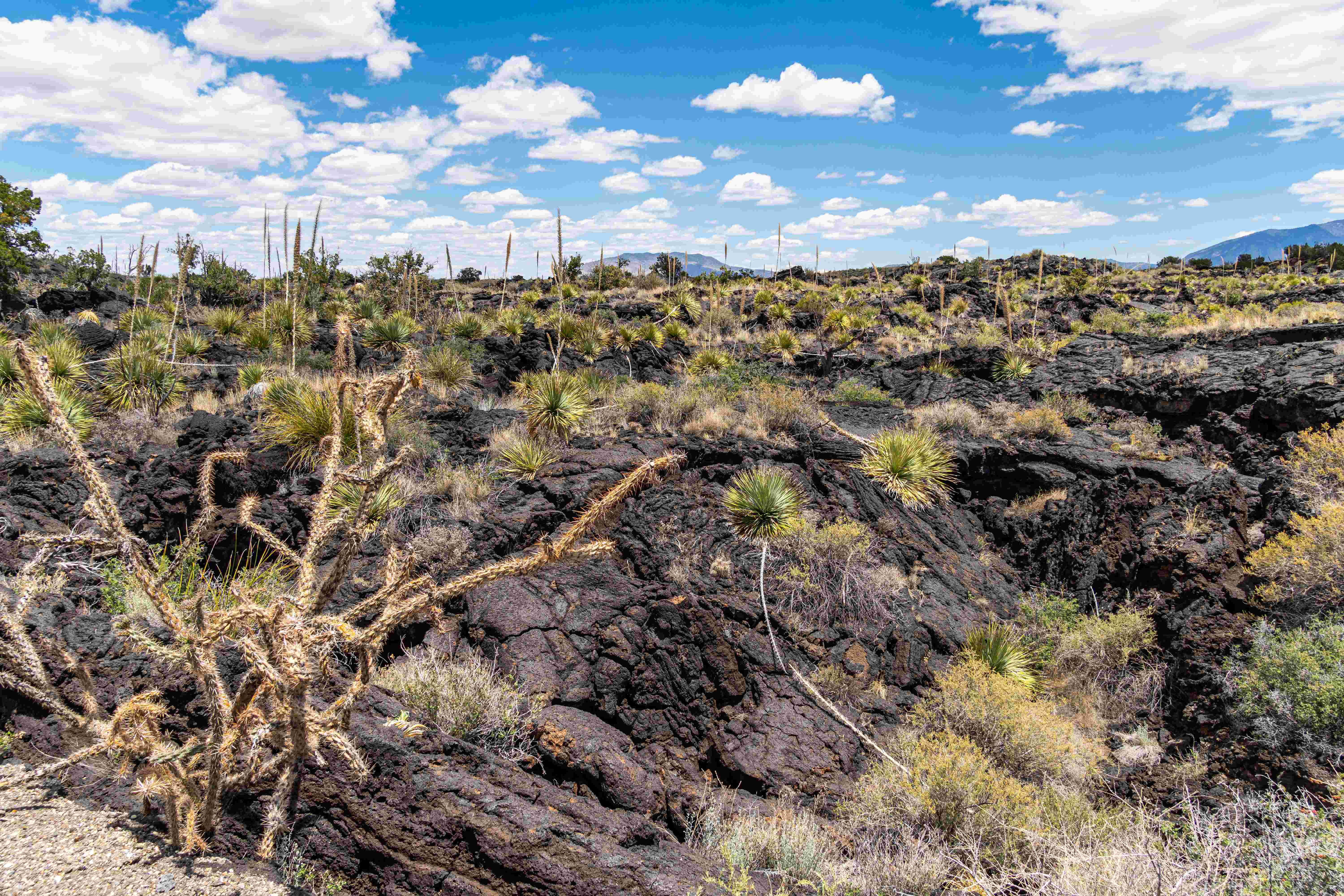
The Potrillo Volcanic Field Mystery
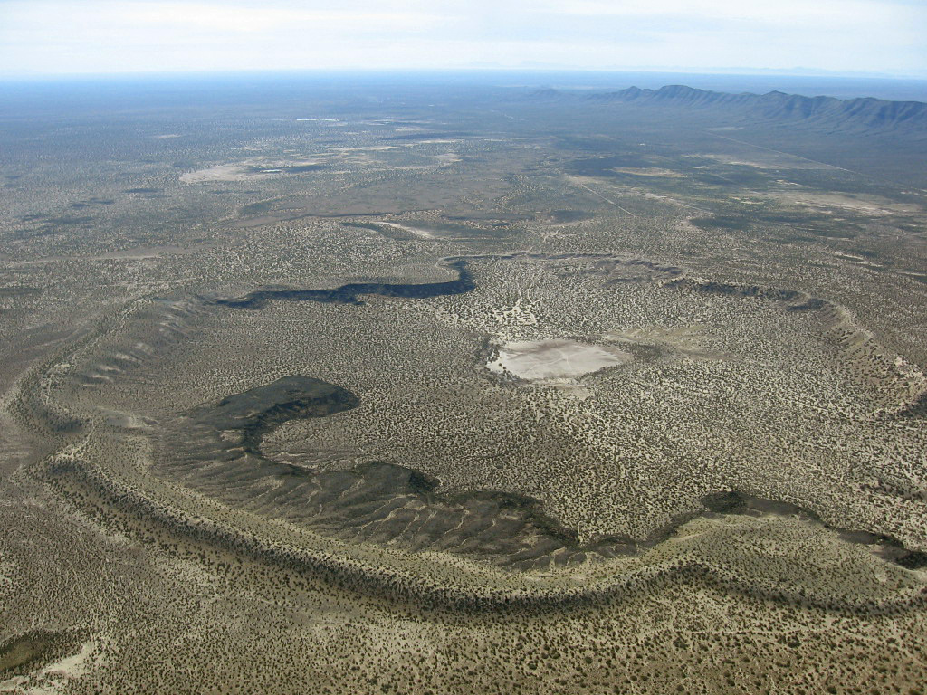
The Potrillo volcanic field is a now-dormant region in the New Mexico portion of the Chihuahuan Desert. This particular field captures the imagination because it combines multiple types of volcanic activity in one relatively compact area, making it a natural laboratory for understanding volcanic processes.
The eastern side has a small shield volcano with many tube-fed lava flows and two large maar craters, formed by the explosive interaction of magma with ground water, with the age of the field ranging between 1 million to 20,000 years old.
What makes Potrillo particularly intriguing is its diversity of volcanic features. The current morphology of the Potrillo volcanic field consists of over 100 cinder cones, ranging in age from 1 million to 20,000 years old. Each of these represents a separate volcanic event that shaped the landscape in its own unique way.
Ancient Explosions and Modern Discoveries
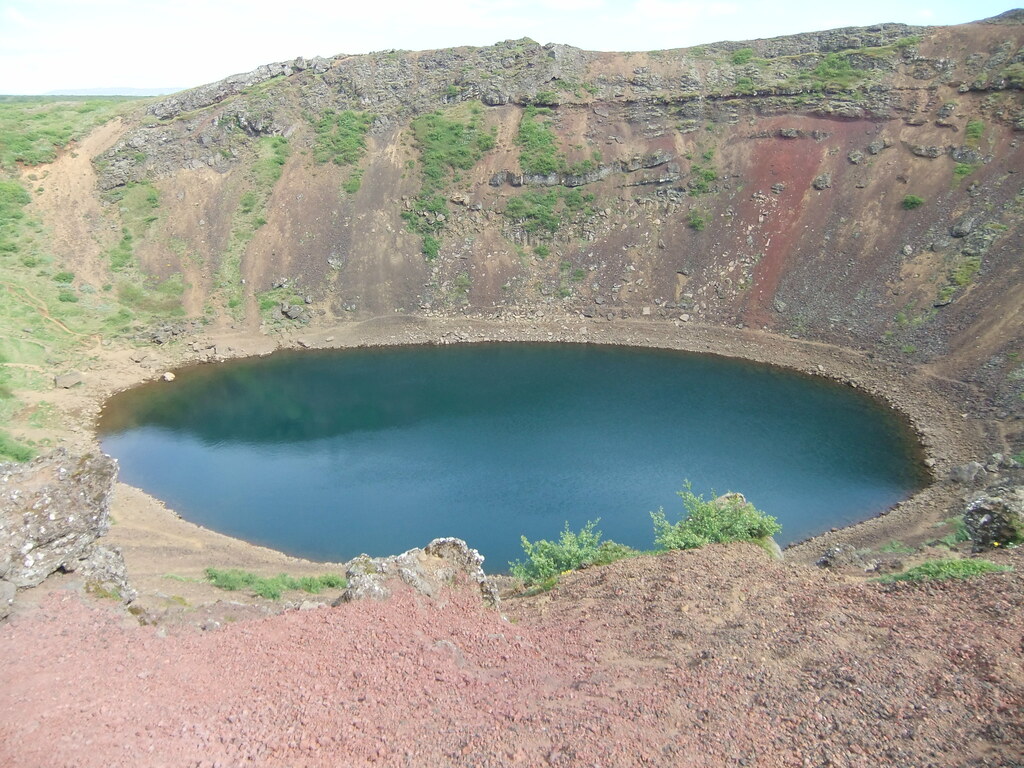
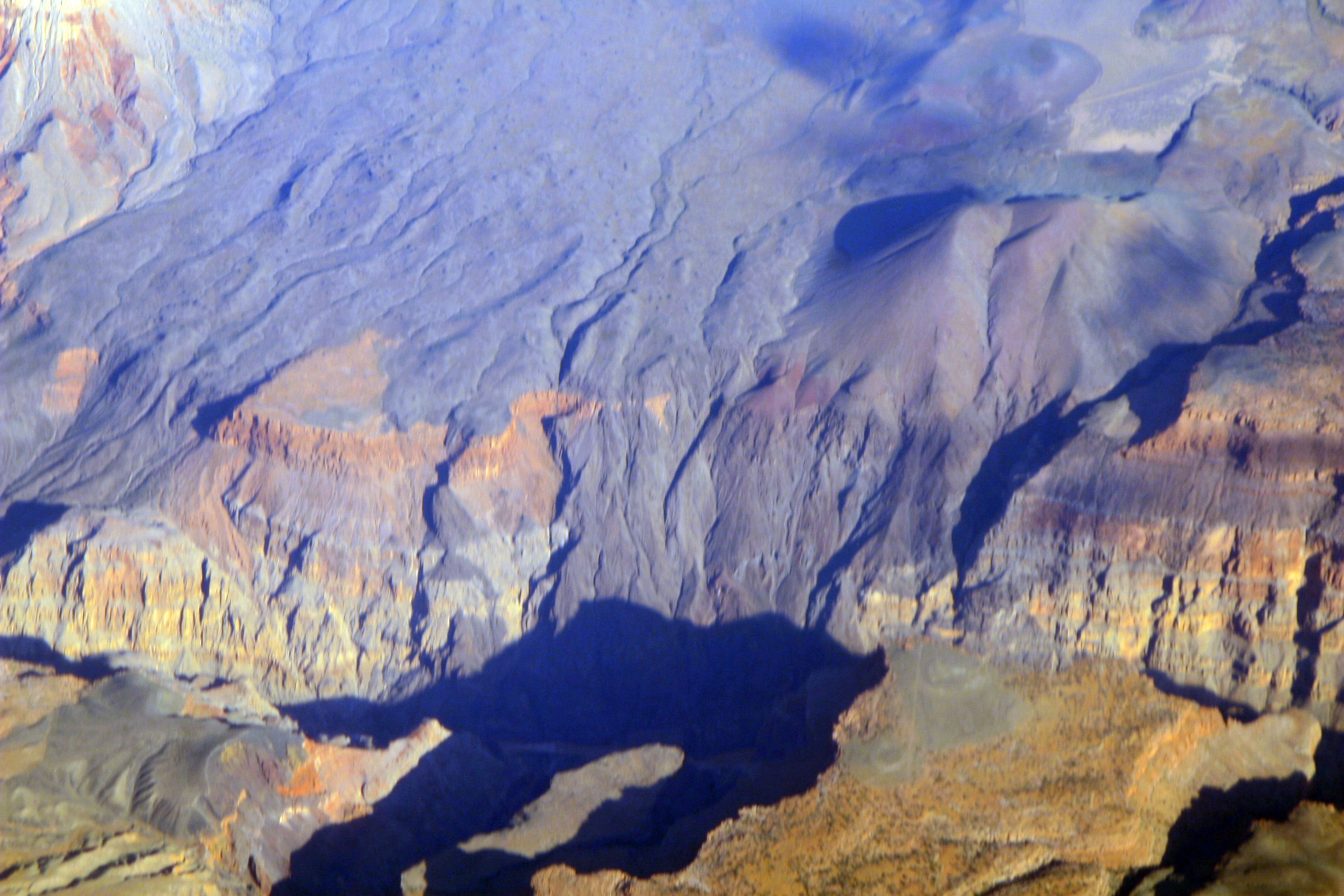
The most famous feature within the Potrillo field tells a story of explosive violence. Kilbourne Hole, which formed between 24,000 and 100,000 years ago, extends for about two miles in length and about a mile in width, with its bottom lying several hundred feet below the surrounding desert floor.
Kilbourne Hole has long attracted scientists who want to compare the maar with similar features on other bodies in the solar system, with lunar scientists and Apollo astronauts studying it back in the 1960’s during manned flights to the moon, and more recently, scientists comparing it with what may be maar-type volcanoes they have seen on Mars.
This connection between terrestrial and planetary geology highlights how New Mexico’s volcanic fields serve as analogs for understanding volcanic processes throughout the solar system. The preserved features here offer insights into how similar processes might work on other planets.
The Zuni-Bandera Surprise
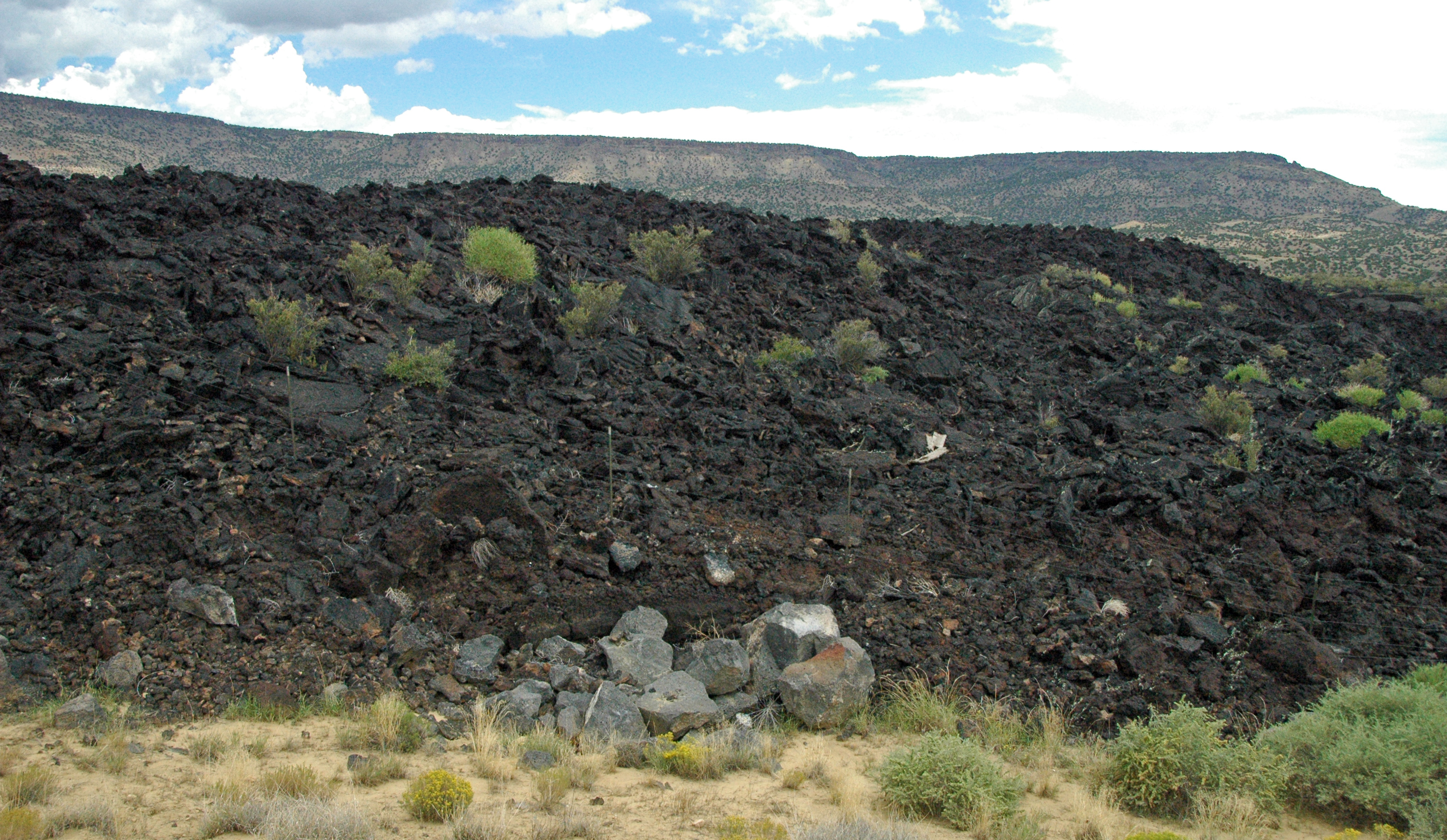
The Zuni-Bandera volcanic field, in northwest New Mexico, has had many episodes of basaltic eruptions over the last million years, with the youngest lava flow in the field being the McCartys flow, which is approximately 3000-5000 years old, one of the youngest volcanic features in the 48 contiguous United States.
This recent volcanic activity surprises many people who think of New Mexico as geologically quiet. The massive lava flow, which was dated at about 5200 years Before Present, traveled 75 km down the Tularosa Basin in south-central New Mexico, with the extremely lengthy travel distance facilitated by movement within lava tubes, which thermally insulated the flow.
The youth of these lava flows means they retain remarkable detail about volcanic processes. An inflated pahoehoe type lava flow, it is 40 km long and retains characteristic surface glass and other millimeter-scale features typical of fresh lava flows.
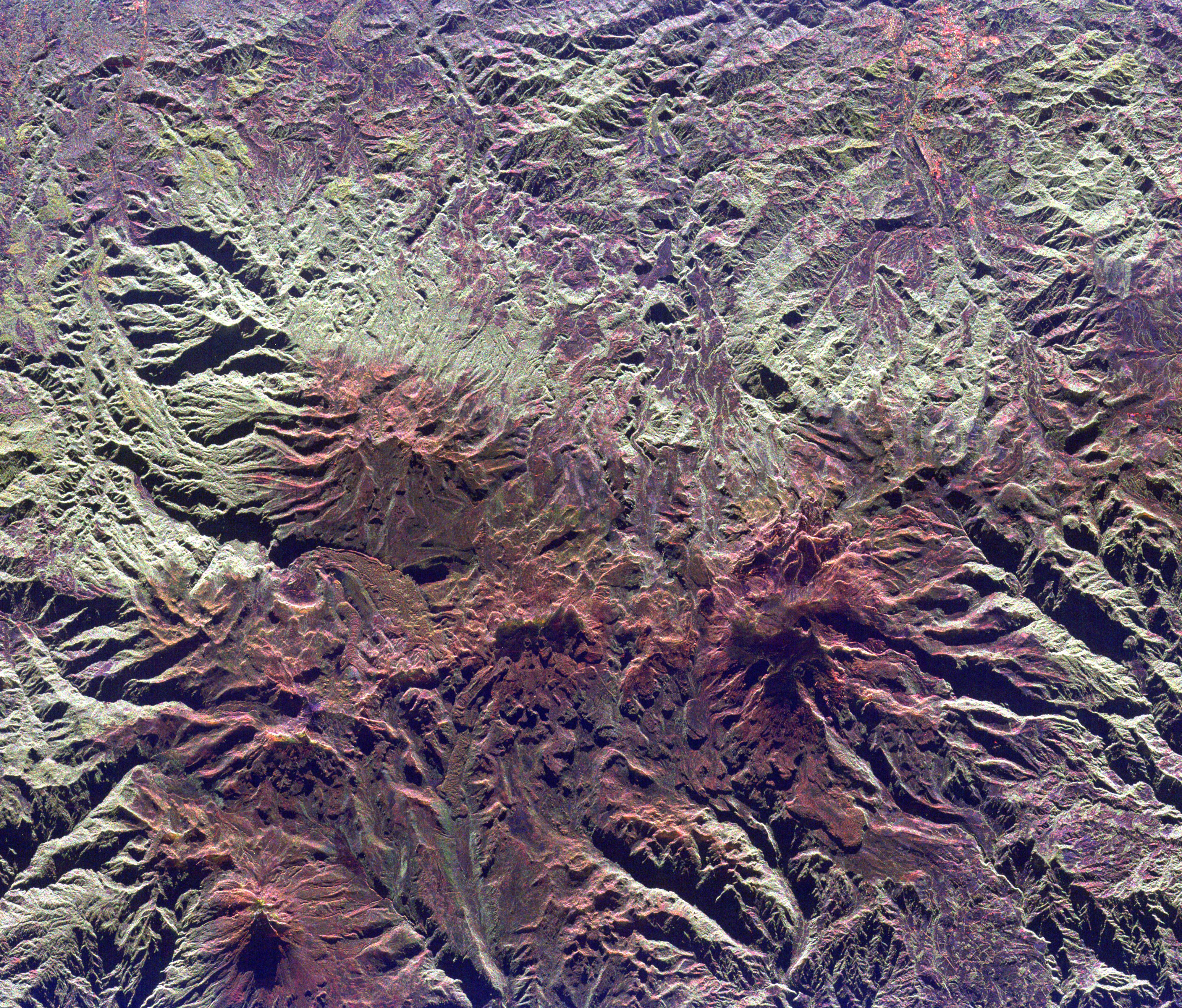
The Navajo Volcanic Field’s Ancient Secrets
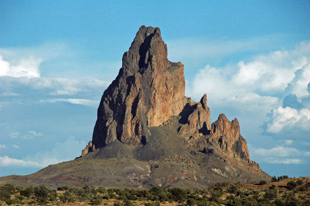
The Navajo volcanic field extends from Gallup and Farmington, New Mexico to Window Rock, Arizona, consisting of the eroded remains of very old volcanoes that erupted around 30 million years ago, with the best-known landform being the volcanic neck, Ship Rock, the eroded roots of a very large volcano.
Ship Rock represents a different type of volcanic mystery entirely. Shiprock formed about 27 million years ago when molten rock pushed up under what’s now northwestern New Mexico, with experts calling it a volcanic neck – the solid core left after a volcano’s softer parts wore away.
Wind and water did the work over millions of years, uncovering a structure of broken rock and dark minette, a kind of lava stone, with thin walls of hardened lava, called dikes, spreading out from it like rays. These radiating dikes are visible for miles across the desert landscape, creating one of the Southwest’s most distinctive geological signatures.
Mount Taylor’s Complex Volcanic History
Mount Taylor volcano, a prominent landmark that can be seen on the skyline west of Albuquerque, is located about 15 miles northwest of the town of Grants, New Mexico, with Mount Taylor Peak, at an elevation of 11,249 feet, standing approximately one mile above the Rio San Jose 12 miles to the south.
Potassium-argon dating showed that a large majority of the volcanic activity from Mount Taylor occurred between 4.3 and 1.5 million years ago, with the peak of the volcanism occurring between 3.0 mya and 2.5 mya, when Mount Taylor volcano was the leading source of volcanism in this area.
What makes Mount Taylor particularly significant is its complex eruptive history. The trend of Mount Taylor eruptions can be divided into four sequences or phases, with the first phase, from 3.74 to 2.93 million years ago, being mostly basanite with some alkali basalt which formed mesa caps, accompanied by small volumes of more silicic volcanism, producing trachyte, trachydacite, and rhyolite tuffs, domes, and plugs.
The Jemez Lineament Connection
The Jemez Lineament is a chain of late Cenozoic volcanic fields, approximately 700 kilometers long, reaching from the Springerville and White Mountains volcanic fields in East-Central Arizona to the Raton-Clayton volcanic field in Northeastern New Mexico, which was long interpreted as a hotspot trace but is now interpreted as a hydrous subduction zone scar.
This lineament represents something far more profound than a simple chain of volcanoes. This formed about 1.7 billion years ago, when oceanic crust was subducting under what was then the southern edge of North America, with the arrival of a large island arc in the subduction zone shifting subduction further south, leaving remnants of oceanic crust at the top of the Earth’s mantle along the former subduction zone that are rich in hydrous minerals that lower the melting temperature of the rock containing them.
This ancient geological scar continues to influence volcanic activity today, providing a weakness in the Earth’s crust that allows magma to reach the surface more easily than in surrounding areas.
Recent Scientific Breakthroughs
Scientists acknowledge there’s significant uncertainty in understanding these volcanic systems, describing it as “kind of a wide-open research field” where “when you look at the region from the perspective of volcanic hazards, we really have very little information,” with most of the volcanoes not having been dated, so “we don’t know how old they are, except that they likely formed sometime within the Quaternary Period,” and “very few have been studied in detail”.
Recent technological advances are changing this situation rapidly. Plans are already in the works to expand the magma monitoring system and see if the Cascade discovery translates to other locations, including Alaska, with the method being “very portable and can be used at many if not most other volcanoes around the world, with just a small number of modern seismographic stations”.
This portability means that remote volcanic fields in New Mexico that were previously impossible to study comprehensively can now be mapped and monitored using relatively simple equipment deployments.
The Future Volcanic Threat
Even though volcanic eruptions are comparatively rare in the American Southwest, the States of Arizona, Colorado, New Mexico, and Utah were host to numerous volcanic eruptions in the past 10,000 years and will experience volcanic activity in the future, which is why YVO is investing in monitoring for potential signs of volcanic unrest in these states.
The probability of future eruptions might be higher than many realize. Looking throughout the Southwest, researchers estimated the chances of a new volcano emerging in the area within 100 years at about 8 percent, based on the total count of volcanoes that have erupted in the study region.
This is the nature of monogenetic volcanic fields – eruption sites open for a single episode of activity, and subsequent eruptions can occur anywhere within the field, creating the inherent volcanic hazard in the southwestern U.S. – new eruptions can originate at unknown locations within broad areas of widely varying land use patterns.
Conclusion: A Landscape of Hidden Fire
New Mexico’s hidden volcano field represents one of the most extensive and least understood volcanic systems in North America. From the ancient volcanic necks of the Navajo field to the surprisingly young lava flows of Zuni-Bandera, this underground network tells a story of geological processes that continue to shape the landscape today.
The ongoing research using advanced seismic imaging techniques promises to reveal even more secrets about this vast volcanic realm. As scientists continue mapping these dormant systems, we’re beginning to understand that the quiet desert landscape above conceals a complex and potentially active geological frontier that could surprise us in ways we’re only beginning to imagine.
What amazes you more about this hidden volcanic world – the vast scale of the underground network or the fact that future eruptions remain entirely possible? Share your thoughts about these geological mysteries lurking beneath the Southwest’s peaceful desert surface.