Ocean currents are nature’s massive conveyor belt, silently carrying heat, nutrients, and energy across our planet’s waters. Think of them as the arteries of Earth’s climate system, pumping warmth from tropical regions to cooler areas thousands of miles away. Yet these vital lifelines are beginning to falter under the weight of climate change, with some regions of the United States bearing the brunt of these dramatic shifts.
You might be surprised to learn that changes happening in the deep ocean thousands of miles away can dramatically alter weather patterns, sea levels, and marine ecosystems right off your local coast. As these massive oceanic systems weaken or shift course, certain states find themselves on the front lines of unprecedented environmental changes. Let’s explore which American regions are facing the most dramatic consequences from these oceanic transformations.
Florida and the Gulf Stream’s Weakening Grip
Florida sits at the epicenter of one of the most concerning oceanic changes unfolding today. The Gulf Stream, which has historically swept warm water away from Florida’s east coast, is experiencing a notable weakening that directly translates to higher sea levels for the state. Sea levels around Florida have already risen up to 8 inches since 1950, with current rates reaching as much as 1 inch every 3 years, primarily due to this slowing Gulf Stream.
The consequences for Florida residents are becoming increasingly tangible. Tidal flooding across the state has increased by an staggering 352% since 2000, with communities now spending over $4 billion on solutions. Current data suggests that as many as 3.5 million people in Florida are at risk of coastal flooding, with an additional 1.1 million people expected to face threats by 2050, while areas like Virginia Key could see flooding jump from an annual average of 10 days to as many as 55 days by 2050.
The consequences to Florida of a weaker Gulf Stream will be hotter summers and cooler winters, along with additional sea level rise along the Atlantic coast. If the Gulf Stream continues to slow, much of the heat that would have traveled to Europe will instead remain along the U.S. east coast and in Florida, creating a “pileup of waters” along the eastern seaboard and Gulf of Mexico.
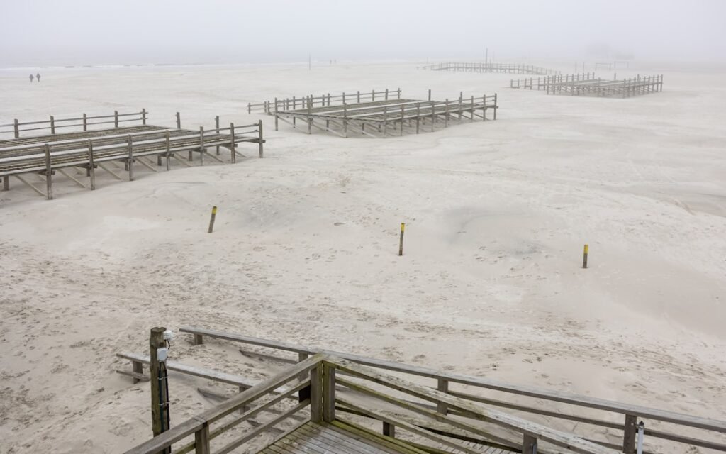
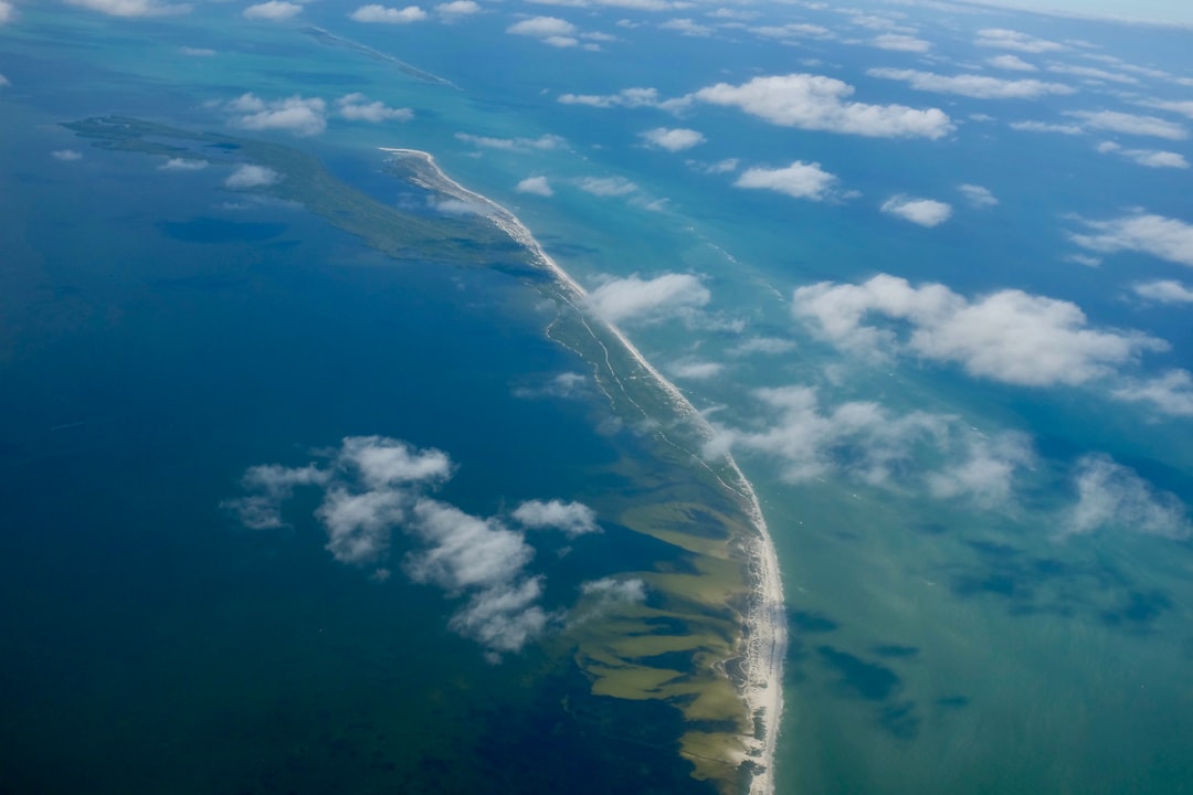
North Carolina’s Cape Hatteras: Where Ocean Patterns Converge
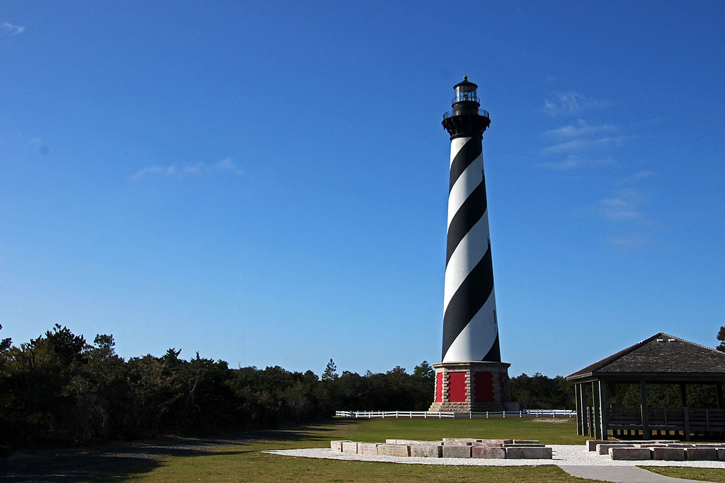
Scientists have discovered rapidly rising sea levels from 2011 to 2015 along the coast from Cape Hatteras, North Carolina south to Miami, with some areas seeing sea levels rise nearly 5 inches in just five years. This region serves as a critical transition zone where multiple oceanic forces intersect, making it particularly vulnerable to current shifts.
The North Atlantic Oscillation acts as a seesaw mechanism that focuses increased sea level rise either north or south of Cape Hatteras, with researchers identifying three primary factors making the southeastern U.S. coast a regional hot spot: a slowing Gulf Stream, shifts in major North Atlantic weather patterns, and the effects of El Niño climate cycles. Coastal areas in this region are more vulnerable than they realize to short-term rapid acceleration of sea level rise, as recent years have revealed a clear correlation between Gulf Stream measurements offshore and coastal sea level changes.
The Mid-Atlantic’s Multiple Vulnerabilities
For U.S. regions, the Mid-Atlantic has, by far, the most local influences on sea levels, with local rates of sea level rise across the region consistently well above the global trend. States like Virginia, Maryland, and Delaware face a perfect storm of oceanic changes that compound their coastal challenges.
This part of the U.S. coast is affected by groundwater withdrawal, ocean variability related to the Gulf Stream and El Niño and La Niña patterns, plus ongoing impacts from the last ice age. The coastal land in the Southeast, including the Carolinas, Georgia and eastern Florida, is very low in elevation, putting the region at high risk of permanent submersion as sea level rises, with some communities already experiencing flooding of storm drains and infrastructure during high tides even without storms.
Sea level is rising off the northeastern and mid-Atlantic states, with part of this increase driven directly by the weakening of the Gulf Stream. Even a relatively modest increase of 10 centimeters can significantly worsen coastal flood impacts during hurricanes, while climate change is simultaneously making hurricanes more intense with stronger winds that push seawater against the coast.
California’s Marine Heatwave Rollercoaster
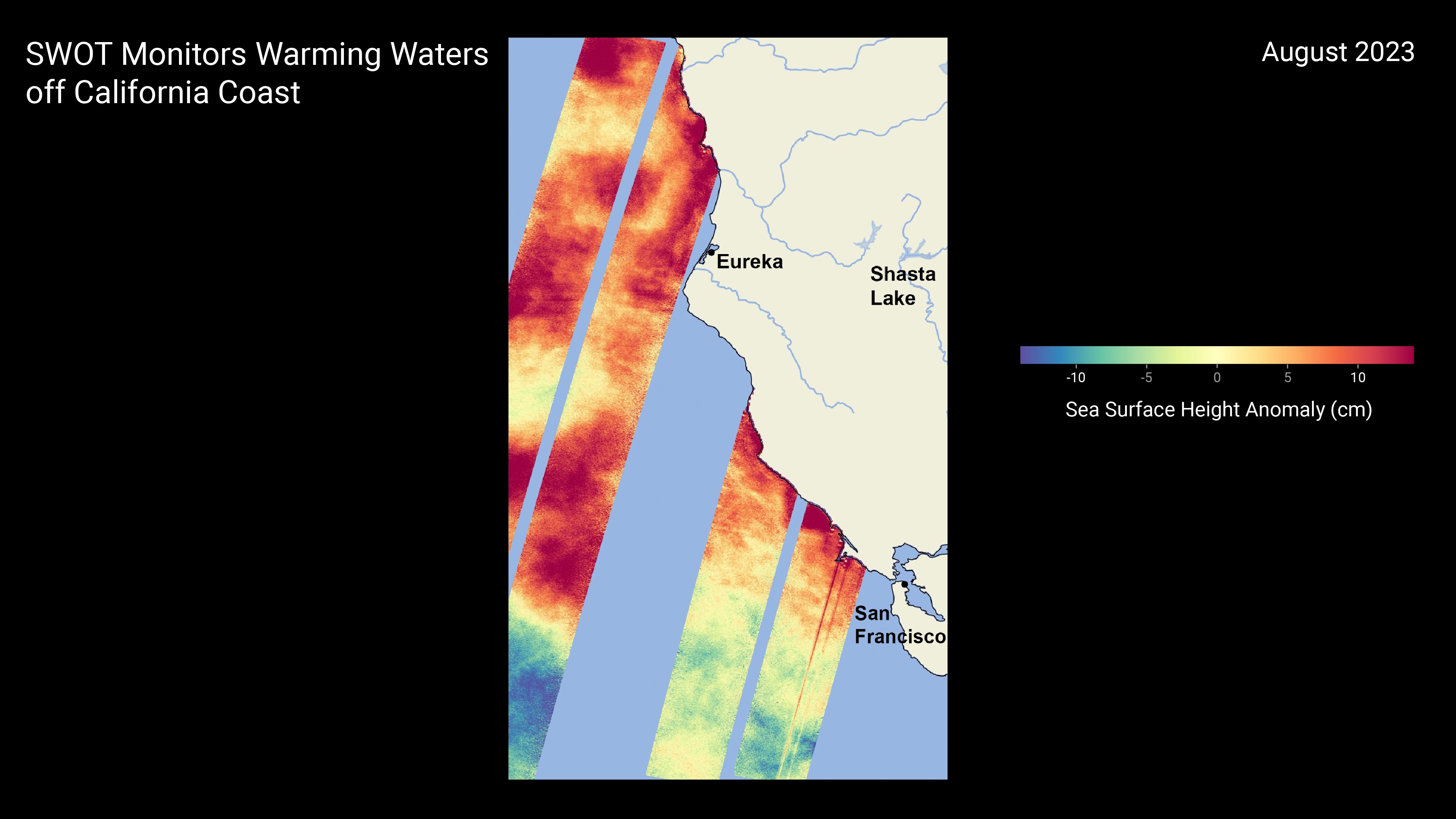
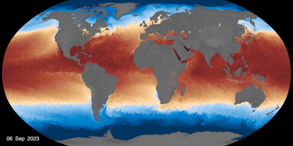
While the East Coast grapples with Gulf Stream changes, California faces its own oceanic upheaval through recurring marine heatwaves. Large marine heatwaves have occurred in each of the last six years from 2019 to 2024, typically beginning during spring in the far offshore region and impacting the U.S. west coast during fall, with five of these ranking as the largest heatwaves on record for the eastern North Pacific since monitoring began in 1982.
The warm water expanse building off the West Coast stretches roughly from Alaska south to California, ranking as the second largest marine heatwave by area in the northern Pacific Ocean in the last 40 years, after “the Blob”. Similar marine heatwaves have repeatedly formed in the Pacific over the last decade, shifting species and reducing productivity, with salmon suffering from the warmer waters that reduce survival rates in the ocean and forcing closures of salmon fishing in California over the last 2 years.
The blob of 2014–2016 had significant impacts on the ocean ecosystem up and down the West Coast, prompting toxic algal blooms and massive die-offs of marine life, with researchers observing a significant decline in phytoplankton that serves as the base of the food web, replaced by smaller, less-nutritious warm-water species.
Oregon and Washington: Pacific Northwest Under Pressure
Long-term NOAA marine heatwave forecasts have predicted movement of offshore marine heatwaves toward the Pacific Northwest coast, with large marine heatwaves occupying the eastern north Pacific Ocean for much of 2023 before moving closer to shore. During the week of May 10, 2025, the current marine heatwave briefly reached within approximately 50-75 kilometers of the Oregon and Washington coasts, which is atypical for that time of year, with this pattern already appearing to have affected the Washington coast.
Researchers are using ecosystem models to examine the consequences of these heatwaves on the Northern California Current food web, a highly productive ecosystem that supports important fisheries and endangered salmon, with the region experiencing anomalous warm water periods since 2013. These heatwaves are periods of prolonged, abnormally warm ocean temperatures that significantly alter marine ecosystems, with some gelatinous species like pyrosomes increasing dramatically while others, including some jellies and fish, have decreased.
The Gulf Coast’s Rising Waters and Sinking Land
In many parts of the Gulf of Mexico, local sea level is rising faster than the global average, with coastal land around the Western Gulf sinking because people are pumping groundwater out of aquifers faster than natural processes can replace it, causing soil to compact and ground to settle. States like Louisiana and Texas face this double threat of rising seas and sinking land.
Another influence in this area involves variations in the strength and location of the Loop Current, which carries warm water from the Caribbean Sea northward in a clockwise pattern around the Gulf of Mexico, with the current’s “loop” sometimes breaking off from the main current, creating eddies of warm water that drift near the Gulf Coast and raise local sea levels.
Alaska’s Arctic Ocean Transformations
A band of high pressure stretching north to the Bering Sea and Alaska has contributed to unusually warm conditions in recent years, fundamentally altering the state’s marine environment. During La Niña events, coastal sea levels are often lower than normal along the U.S. West Coast all the way to Alaska, but during decades with more El Niños than La Niñas, sea level around the Gulf of Alaska might be higher than average.
Alaska represents a unique case where both Pacific and Arctic Ocean changes converge to create complex environmental pressures on coastal communities and marine ecosystems. The state’s position at the intersection of major oceanic systems makes it particularly sensitive to shifts in global circulation patterns.
The Atlantic Meridional Overturning Circulation Crisis
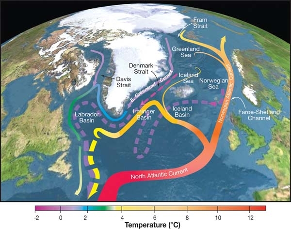
Scientists have identified an exceptionally warm area along the northeast coast of the U.S., caused by the Gulf Stream shifting closer to the coast as the Atlantic Meridional Overturning Circulation (AMOC) weakens. The AMOC has been weakening, with some controversial predictions suggesting it could switch off between 2025 and 2095, though most scientists consider complete collapse before 2100 as unlikely according to IPCC assessments.
Multiple studies suggest the AMOC is weakening with some projecting it could even collapse this century as global warming disrupts the balance of heat and salinity that keeps it moving, which would usher in huge global weather and climate shifts, including plunging temperatures in Europe. Both systems are at risk of passing a tipping point, with collapse weakening the northward transport of ocean heat, regional cooling in the north Atlantic, more frequent weather extremes in Europe and shifts in global precipitation patterns.
New England’s Changing Waters
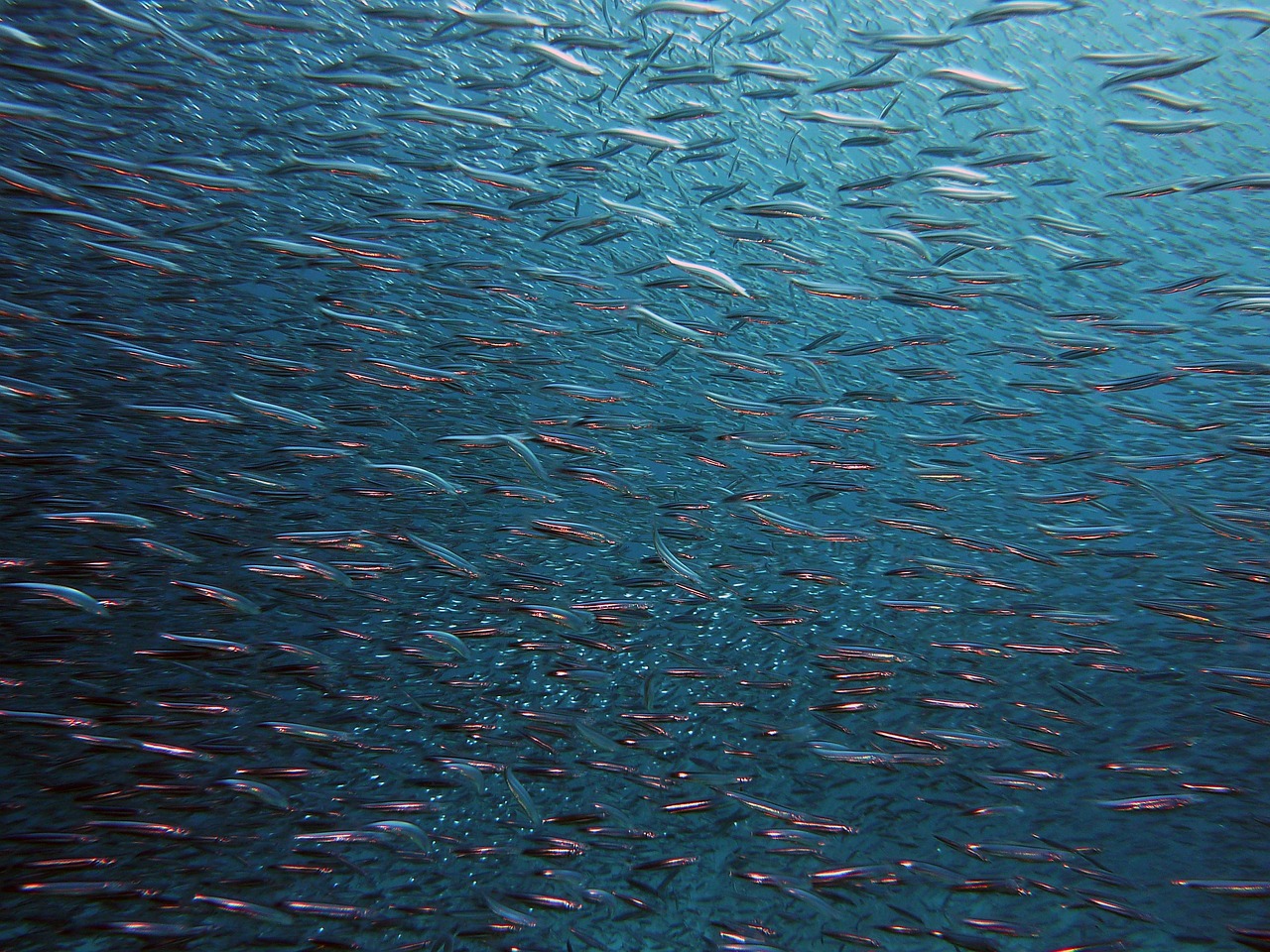
East coast fisheries are already showing the effects of changing ocean currents, with rapidly warming waters in the Gulf of Maine contributing to the near-collapse of the Cod fishery. New England states find themselves caught between the weakening Gulf Stream system and warming waters that fundamentally alter their marine ecosystems.
The region’s fishing communities, which have depended on cold-water species for generations, now face unprecedented challenges as traditional fish populations migrate northward or decline entirely. Changes to ocean density and circulation patterns can alter regional weather patterns such as rainfall and affect where and how well crops can grow, with scientists predicting the AMOC is “very likely to weaken over the 21st century” due to climate change.
The Cascading Effects on Marine Ecosystems
A disruption in the thermohaline circulation system could lead to more extreme weather patterns, including droughts, heatwaves, and stronger storms, while changes in currents could impact the distribution of marine species as warmer waters shift northward and colder regions become more inhospitable. Marine heatwaves have complex and cascading effects on marine ecosystems, with some species benefiting from these changes while others struggle, making understanding these dynamics essential for adapting fisheries management practices and protecting marine biodiversity.
Oceanographers have discovered that upper ocean currents are accelerating, with this acceleration having potential for huge knock-on effects, including sea level rise, changing fish migration cycles, and shifting storm patterns. These changes ripple through entire food webs, affecting everything from microscopic plankton to massive marine mammals.
Future Projections and Adaptation Challenges
Global warming has already doubled or tripled the odds of extreme high water events over widespread areas of the U.S. coast, with widespread areas likely to see storm surges on top of sea level rise reaching at least 4 feet above high tide by 2030 and 5 feet by 2050, affecting nearly 5 million U.S. residents currently living on land less than 4 feet above high tide.
Current projections from the IPCC show that the AMOC is unlikely to stop or collapse before the year 2100, but if such a collapse were to occur, it would very likely cause abrupt shifts in regional weather patterns and the water cycle, including southward shifts in tropical rain belts, weakening of African and Asian monsoons, strengthening of Southern Hemisphere monsoons, and drying in Europe. Society in many parts of the Northern Hemisphere is not built for extreme cold conditions that could result, with crops dying and infrastructure buckling, while Europe would still endure increasingly deadly heat waves in summer as the climate crisis intensifies.
Conclusion
The United States faces a complex web of oceanic changes that affect different regions in dramatically different ways. From Florida’s accelerating sea level rise to California’s recurring marine heatwaves, from the Gulf Coast’s sinking lands to Alaska’s warming Arctic waters, no coastal state remains untouched by these massive shifts in ocean circulation.
Swift cuts in greenhouse gas pollution can significantly reduce sea level increases, but past and present pollution already commit us to a good deal more rise, making it essential that we start preparing for higher seas and storms to avoid their worst effects. Understanding these regional impacts isn’t just academic curiosity, it’s essential for communities, businesses, and governments to prepare for a future where the ocean’s ancient patterns are fundamentally altered. What aspects of these oceanic changes concern you most? Tell us in the comments.

Hi, I’m Andrew, and I come from India. Experienced content specialist with a passion for writing. My forte includes health and wellness, Travel, Animals, and Nature. A nature nomad, I am obsessed with mountains and love high-altitude trekking. I have been on several Himalayan treks in India including the Everest Base Camp in Nepal, a profound experience.