Across a landscape famous for emptiness, scientists keep finding the shape of water. Radar images and gravity maps now show a web of buried valleys snaking under dunes from the Atlantic coast to the Nile, reminding us that the Sahara was once a green engine for life. The mystery is simple and gripping: how did people, elephants, hippos, and grasses flourish here for thousands of years, and where did all that water go? The answer is arriving in careful layers, like a palimpsest being read with new light, revealing subsurface rivers and aquifers that still move – slowly, silently – through sand and stone. It’s a discovery that changes how we see the desert, not as a dead zone, but as a living archive.
The Hidden Clues
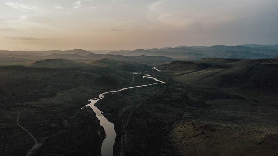
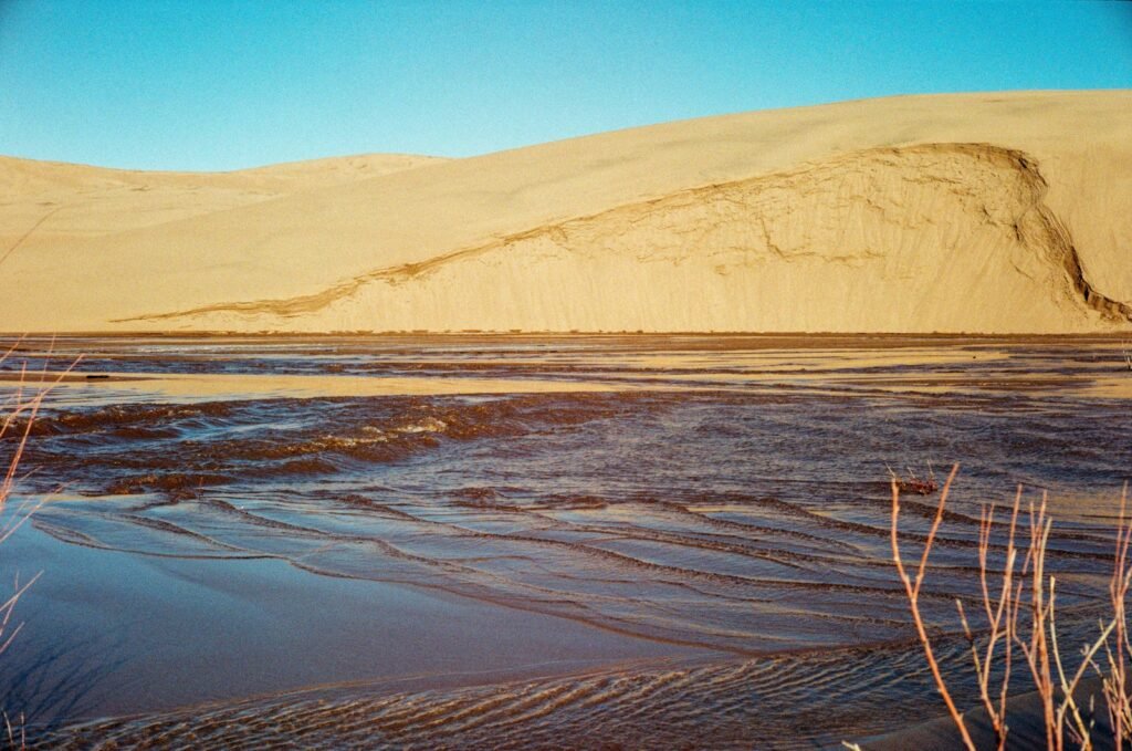
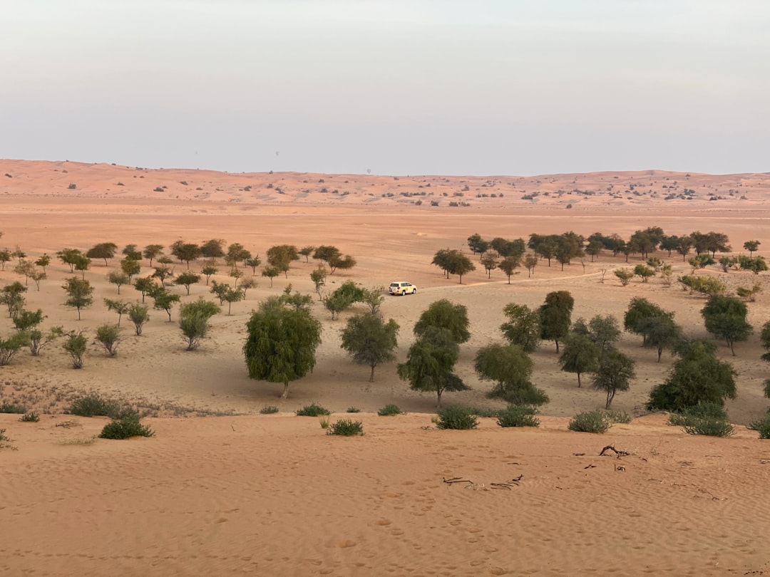
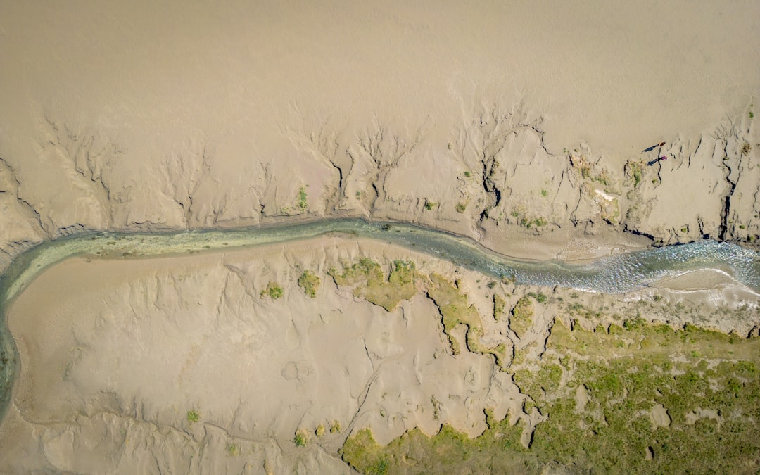
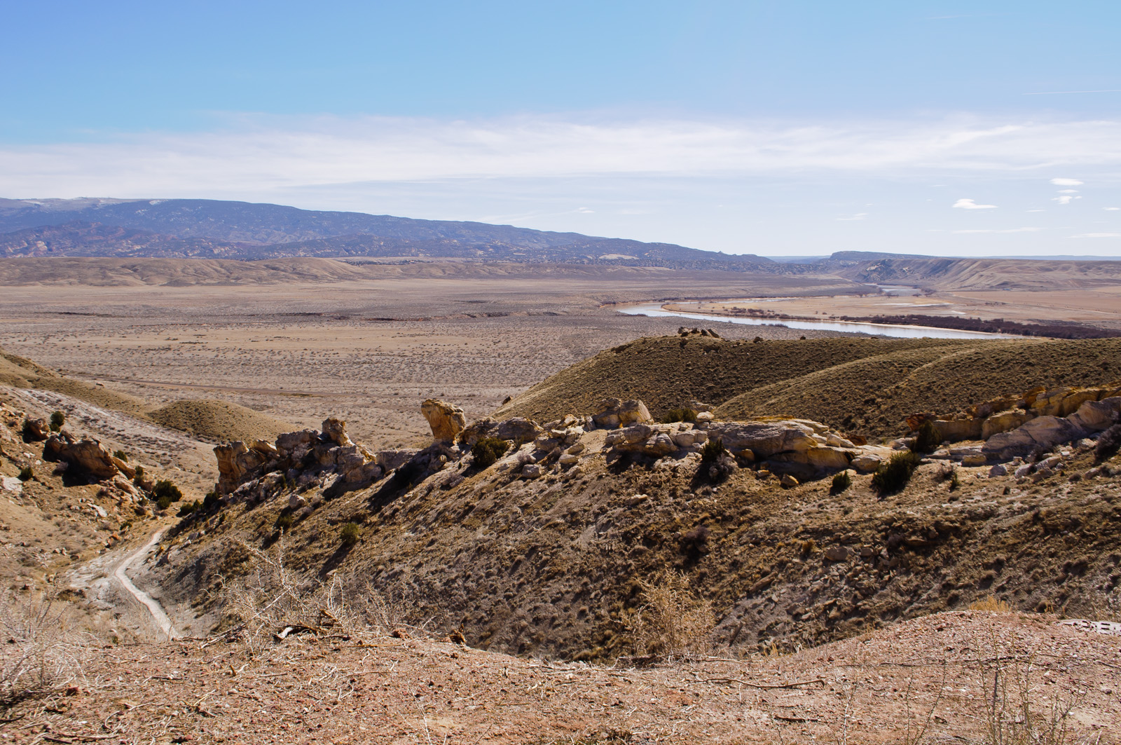
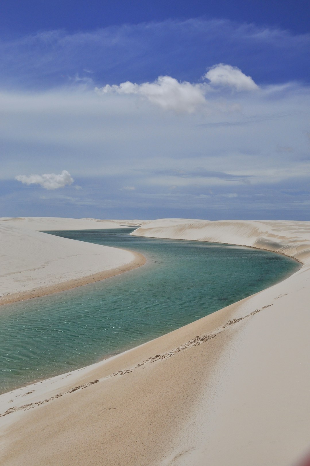
What if the world’s largest desert is still crossed by rivers – only now they run in the dark? That’s the startling picture emerging from satellites that pierce sand with radar and sense tiny shifts in Earth’s gravity. Beneath the rippling dunes, scientists trace long, sinuous ridges of buried channels, some wide enough to rival major rivers today. The surface offers hints too: oases lining up like beads on a thread, wind-scoured trenches that echo the curves of a floodplain, and seafloor canyons offshore that align with ghostly valleys on land.
I remember standing in a dry wadi in southern Morocco, the sand underfoot crunching like old snow, and feeling the ground give slightly where fine sediments had settled. It felt less like a desert and more like the roof of a cathedral – beautiful, hollow, and hiding something vast.
From Ancient Tools to Modern Science
Archaeologists first mapped the human story: stone tools scattered along old shorelines, rock art showing swimmers and fish, and campsites perched above extinct lakes. These clues hinted at rivers, but couldn’t sketch the channels themselves. Enter modern geophysics and remote sensing, which swap trowels for wavelengths and altitude.
Spaceborne radar reveals lineaments – subtle stripes – that mark buried riverbeds; gravimetry detects density contrasts where sediments fill ancient valleys; and thermal infrared highlights moisture pockets that linger after rare rains. Airborne electromagnetic surveys then refine the picture, tracing fresh and saline groundwater along those paleochannels. Piece by piece, a continent-scale puzzle starts to snap into place.
The Green Sahara Clock
The Sahara hasn’t always been a furnace. During cycles driven by Earth’s wobble, monsoons pushed north and the desert transformed into grasslands, wetlands, and sprawling river systems. These humid pulses, including the most recent one ending roughly 4,000 to 5,500 years ago, carved channels and fed mega-lakes that stretched for hundreds of miles. As rains retreated, dunes marched back and sealed the rivers beneath sand like a pressed flower in a book.
Crucially, the water didn’t vanish; much of it sank. In porous layers – the kind geologists call aquifers – groundwater now creeps along ancient paths, seeping toward low spots and feeding oases and salt lakes that look impossible on a map.
Life Along a Buried River
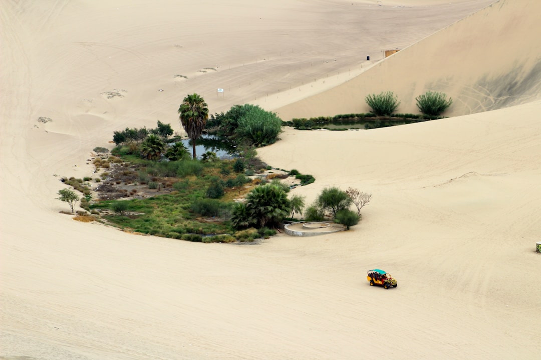
Follow the oases and you trace the arteries of the old Sahara. Chains of palm groves and wells across Libya, Algeria, and Egypt sit where subsurface flow is nudged to the surface by geology, faults, or a pinch in the sediment layers. In northeastern Chad, lakes persist in searing heat because they tap fossil water stored since wetter times. Even today, irrigation tunnels and ancient water-sharing systems grew up precisely where these hidden gradients deliver just enough pressure to lift water toward daylight.
That wadi in Morocco taught me a simple lesson: deserts are honest about scarcity, but they’re also full of memory. The green fringe you see around a town is less a miracle than a map – a living footnote pointing straight down to the buried river that sustains it.
Global Perspectives
The Sahara’s ghost rivers are part of a larger story about drylands on every continent. The Empty Quarter in Arabia hides similar paleochannels that feed coastal aquifers, while parts of Australia’s interior carry networks that only flow during rare, continent-spanning rains. In Chile’s Atacama, ancient drainage carved bedrock long before today’s extreme aridity, leaving conduits for groundwater that still moves very slowly through the subsurface. Scientists even borrow this playbook for Mars, comparing radar-bright layers and sinuous ridges to fossilized streambeds on the Red Planet.
Seen together, these places argue for a new mental map of deserts – not blank spaces, but complex plumbing systems set by climate cycles and locked in by time. The Sahara is the flagship example because of its scale and the human history tied to it.
Why It Matters
This isn’t just a cartographic curiosity; it’s a survival issue in a warming world. Locating buried channels helps countries drill smarter, minimize dry wells, and avoid overpumping that collapses the very sediments storing the water. It’s also a cultural lifeline, protecting oases that anchor trade, language, and food traditions across North Africa. And it’s a climate archive: sediments in those paleorivers record past monsoons, dust storms, and ecosystems with a resolution you can’t get from a single dune core.
There’s a hard truth here: calling this water “renewable” can be misleading. In many places, recharge today is slow to negligible, so extraction is more like spending a trust fund than cash flow. Planning with that in mind is the difference between a century of water and a generation. The science buys time; policy decides how it’s used.
The Future Landscape
New tools are about to sharpen the map. Next-generation radar satellites will image through sand with finer detail, while constellations flying in tandem can detect millimeter-scale ground subsidence that betrays hidden pumping. Airborne electromagnetic arrays and passive seismic surveys can stitch three-dimensional aquifer models across borders, giving planners a shared, open dataset. Machine learning is already flagging channel patterns across petabytes of imagery that a single team could never scan by eye.
The challenge is less tech than governance. Transparent water budgets, community monitoring, and cross-border agreements can turn discovery into stewardship instead of a short-lived drilling rush. If we treat the subsurface rivers as infrastructure we inherited – not resources we own – the desert’s future looks steadier.
Conclusion
Start local: support organizations that maintain wells and protect oases, because small repairs keep entire communities supplied. Follow and share open desert research so good data travels as fast as speculation, and push for public release of groundwater maps funded by taxpayers. If you work in tech or mapping, volunteer skills to classify radar images or digitize old hydrology records; if you teach, bring these maps into classrooms so students see deserts as systems, not blanks.
Most of all, ask your leaders for water plans that account for the age and limits of these aquifers, and for investment in efficiency where every drop counts. The rivers are still there, whispering under sand; whether they endure for our grandchildren depends on what we do next – will we listen?

Suhail Ahmed is a passionate digital professional and nature enthusiast with over 8 years of experience in content strategy, SEO, web development, and digital operations. Alongside his freelance journey, Suhail actively contributes to nature and wildlife platforms like Discover Wildlife, where he channels his curiosity for the planet into engaging, educational storytelling.
With a strong background in managing digital ecosystems — from ecommerce stores and WordPress websites to social media and automation — Suhail merges technical precision with creative insight. His content reflects a rare balance: SEO-friendly yet deeply human, data-informed yet emotionally resonant.
Driven by a love for discovery and storytelling, Suhail believes in using digital platforms to amplify causes that matter — especially those protecting Earth’s biodiversity and inspiring sustainable living. Whether he’s managing online projects or crafting wildlife content, his goal remains the same: to inform, inspire, and leave a positive digital footprint.