In the hush of predawn, a survey boat traced a slow grid across steel-blue water, firing sound into darkness and listening for echoes older than cities. What came back was a sudden cliff on the lake floor – a drowned canyon cut by ice-age floods, hidden in plain sight beneath a shipping lane. The discovery didn’t happen in a blaze of publicity; it arrived as a pixelated slope on a sonar screen and a collective gasp in a dim cabin. have always promised vastness, but this is different: a new piece of the continent’s skeleton revealed. It challenges what we thought we knew about how these inland seas formed and how they still change under our feet.
The Hidden Clues
Long before the canyon took shape on a high-resolution map, clues whispered at the surface. Slightly cooler upwellings curled along an otherwise uniform temperature field, and currents bent where they should have flowed straight. Anglers swapped stories about odd, abrupt depth drops that snagged gear, mysterious features that never quite showed up on old charts.
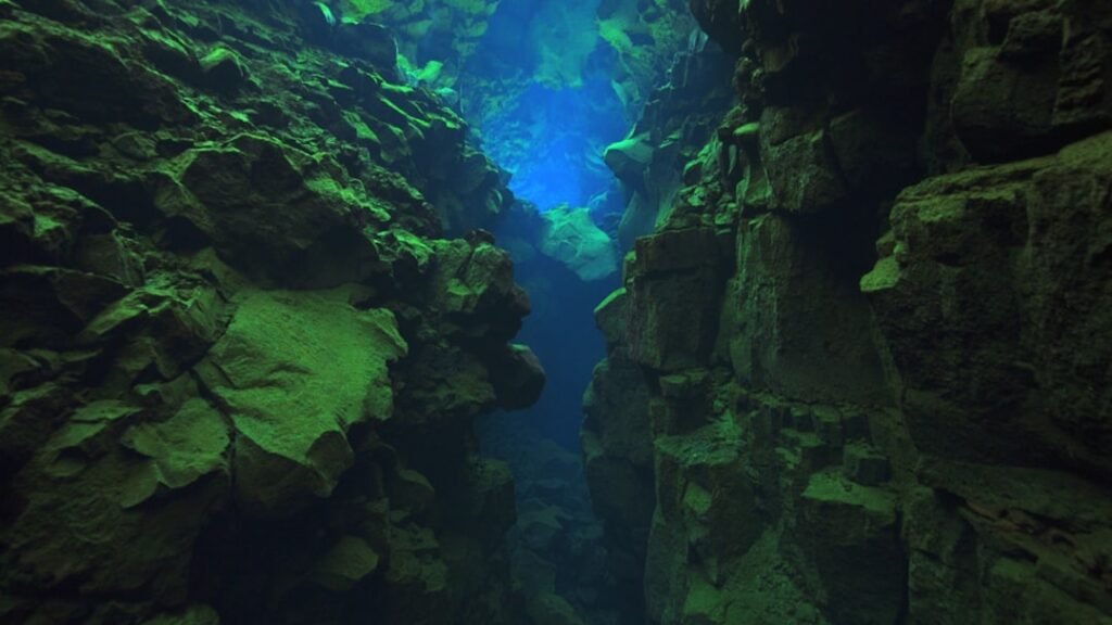
Those anecdotes nudged scientists toward a focused survey and a tighter grid of soundings. When the multibeam swaths overlapped, the lake floor snapped into relief – a steep-walled trench with terraces and a sinuous floor. In a region often portrayed as flat and muddy, it felt like the curtains had finally parted on a stone amphitheater.
From Ancient Tools to Modern Science
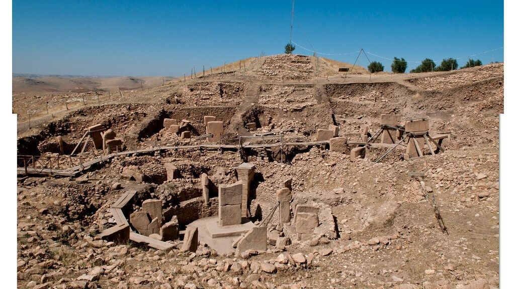
The canyon’s story begins with ice and stone, but it also threads through human ingenuity. Archaeological features on now-drowned ridges across remind us that shorelines marched in and out as the last ice retreated, and people followed. Those shifting edges left markers – subtle steps, beach gravels, and channels – that modern instruments can now trace under water.
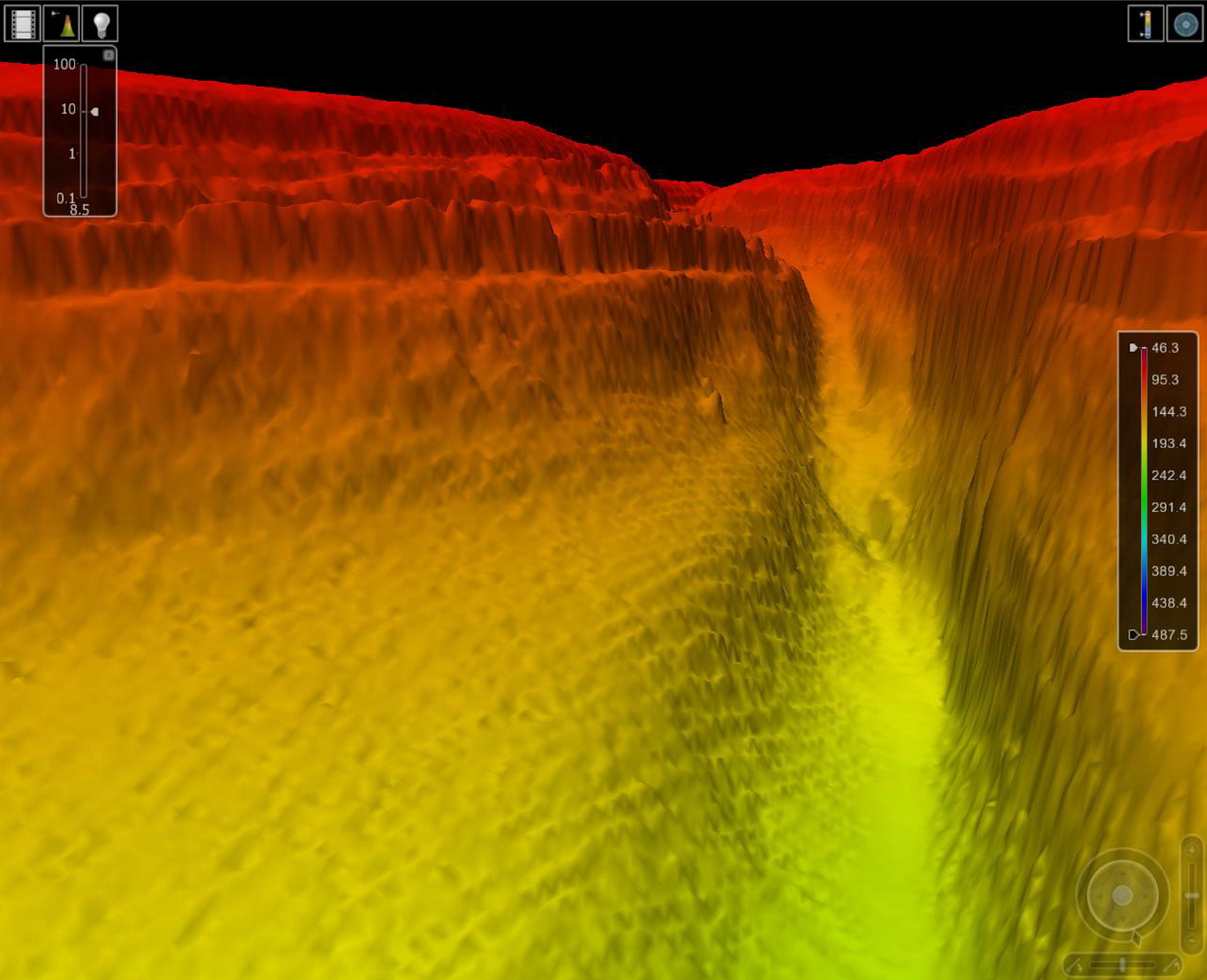
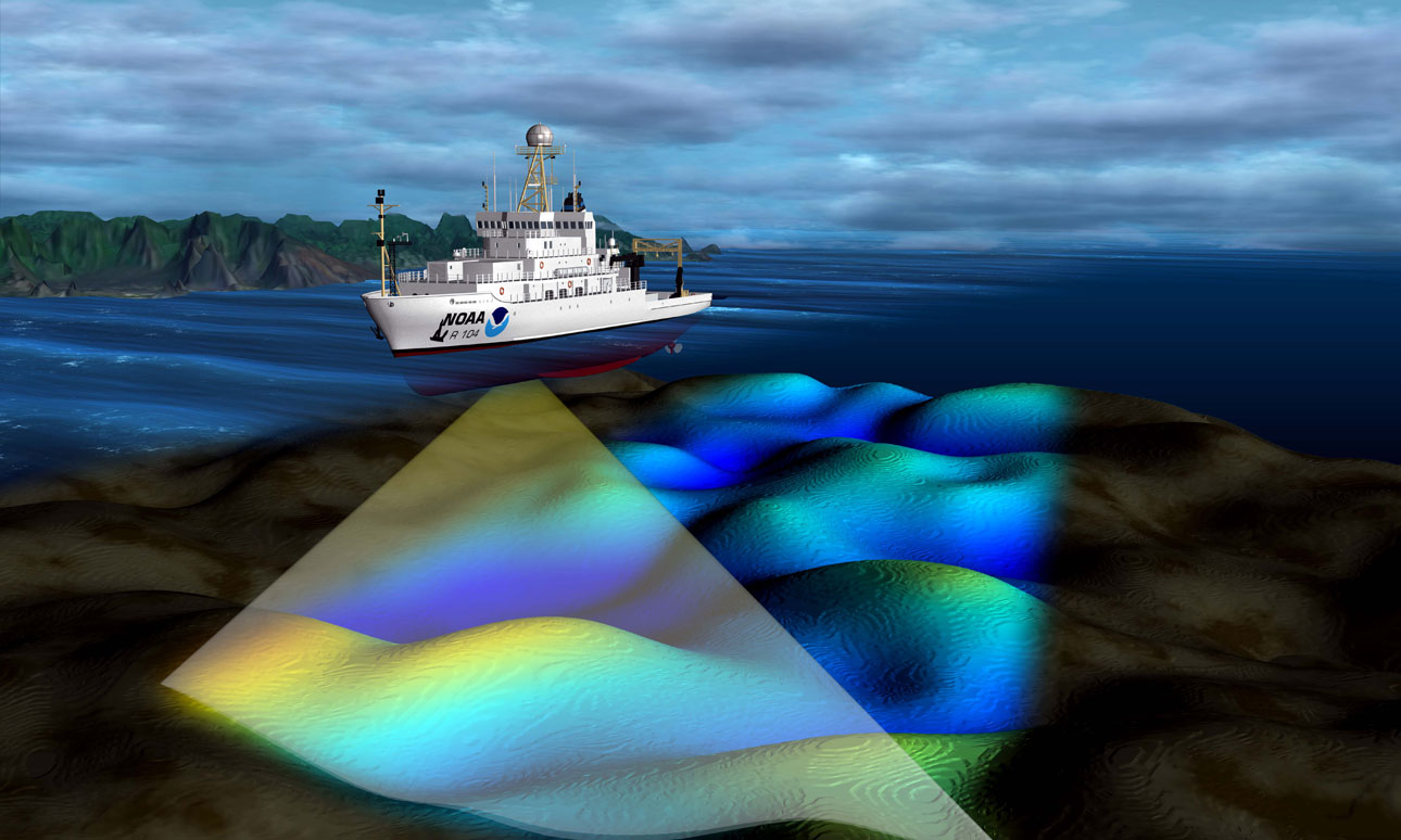
Today’s teams bring a kit that would make any field geologist grin: multibeam sonars to sculpt the lake floor in 3D, sub-bottom profilers to probe the shallow subsurface, and magnetometers to sniff out buried rock and debris. Engineers stitch millions of echoes into a single, seamless terrain model with centimeter-scale vertical precision in places. It’s the kind of leap that turns scattered hints into a coherent landscape.
How Sonar Sees Through Darkness
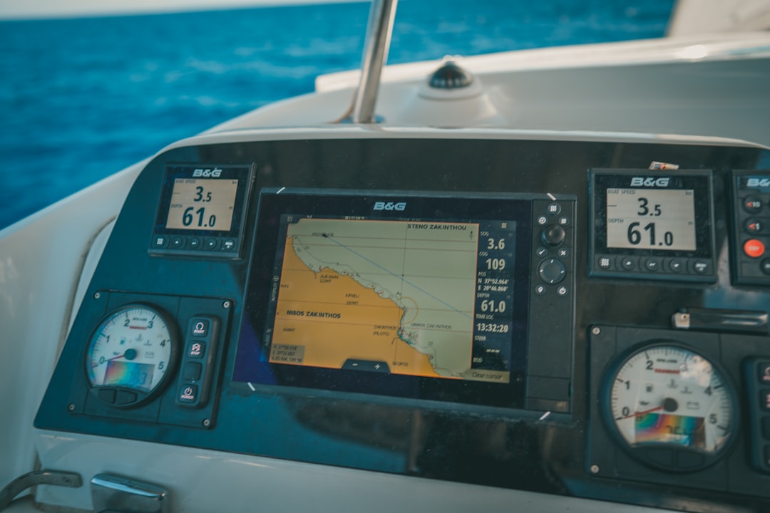
Multibeam echosounders sweep the bottom with hundreds of narrow acoustic beams, measuring the return time and intensity of each ping to map depth and texture. Hard rock cliff? Bright return. Soft sediment drape? Muted, grainy echo. By running tightly spaced lines, vessels build a quilt of swaths that overlap enough to correct errors and capture small ledges.
Sub-bottom profilers add the time dimension by revealing buried layers, like an ultrasound for sediment. Engineers tune frequency to trade depth of penetration for detail, then cross-compare with sediment cores to ground the picture in physical samples. When the pieces align, you don’t just see a canyon – you see when its flanks collapsed, when floods scoured its floor, and when quiet waters slowly filled its pockets with silt.
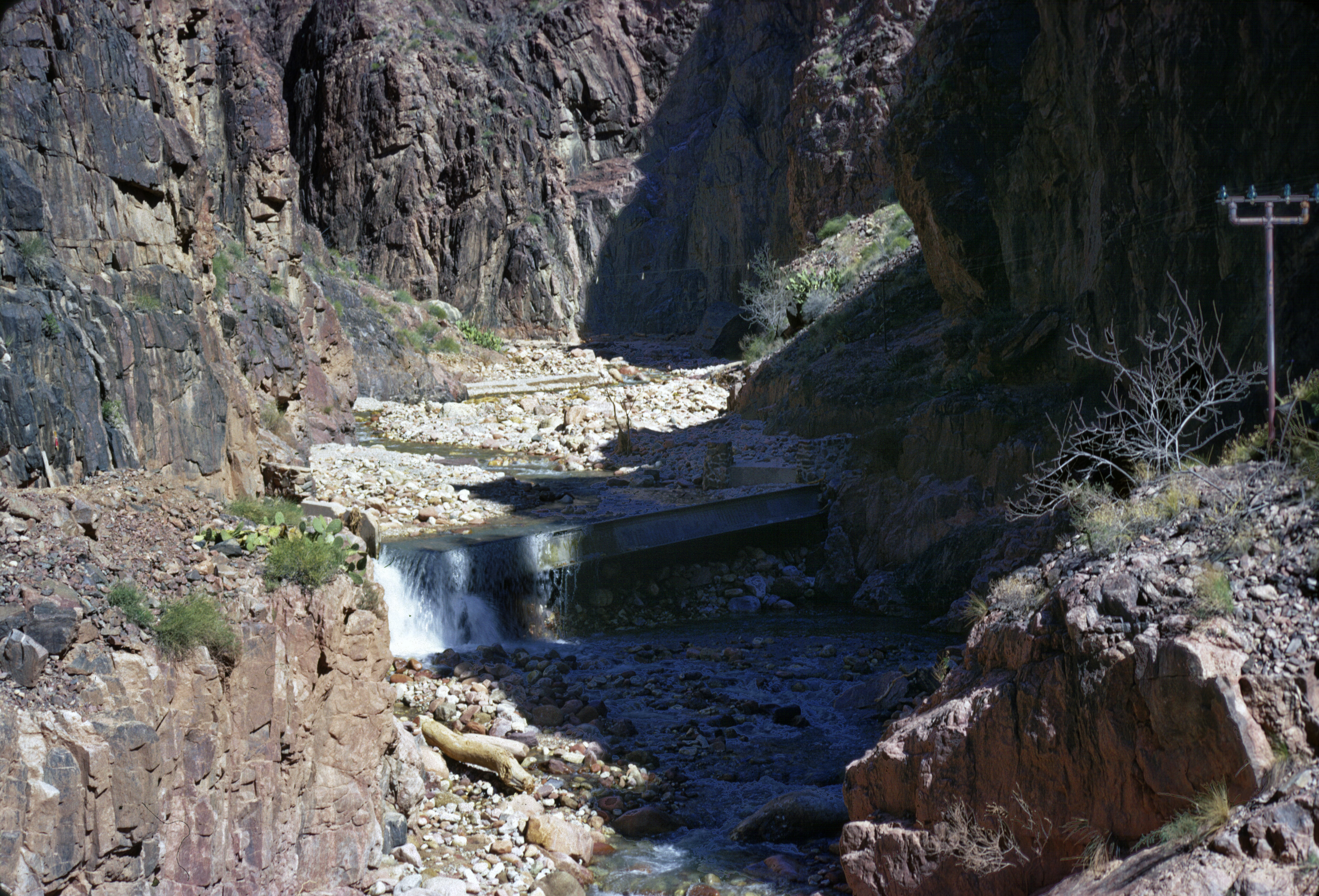
The Canyon’s Geological Story
Picture meltwater pouring off the waning ice sheet roughly ten to twelve thousand years ago, funneled through bedrock weaknesses and pre-glacial valleys. Turbid torrents plunged down steep gradients, carving notches into ledges and plucking blocks from fractured walls. As water levels rose and fell with shifting outlets, the canyon alternated between frenzy and hush, its terraces marking pauses like rings in a tree.
Later, calmer currents draped fine sediment along the floor, while occasional slope failures tumbled material downslope, leaving aprons of debris. Dropstones – lonely boulders once locked in ice – punctuated the soft layers like punctuation marks in an otherwise quiet sentence. The result is a classic sequence: incision, stabilization, infill, and reactivation, written in rock and mud beneath an unassuming horizon.
Why It Matters
This isn’t just cartographic bragging rights; it reshapes hazards, habitats, and history. Submerged canyons can focus bottom currents, which in turn influence where sediment piles up or vanishes – critical for navigation channels, intake structures, and fiber lines. Knowing those patterns helps planners decide where not to lay new infrastructure and where to expect nature to tug hardest.
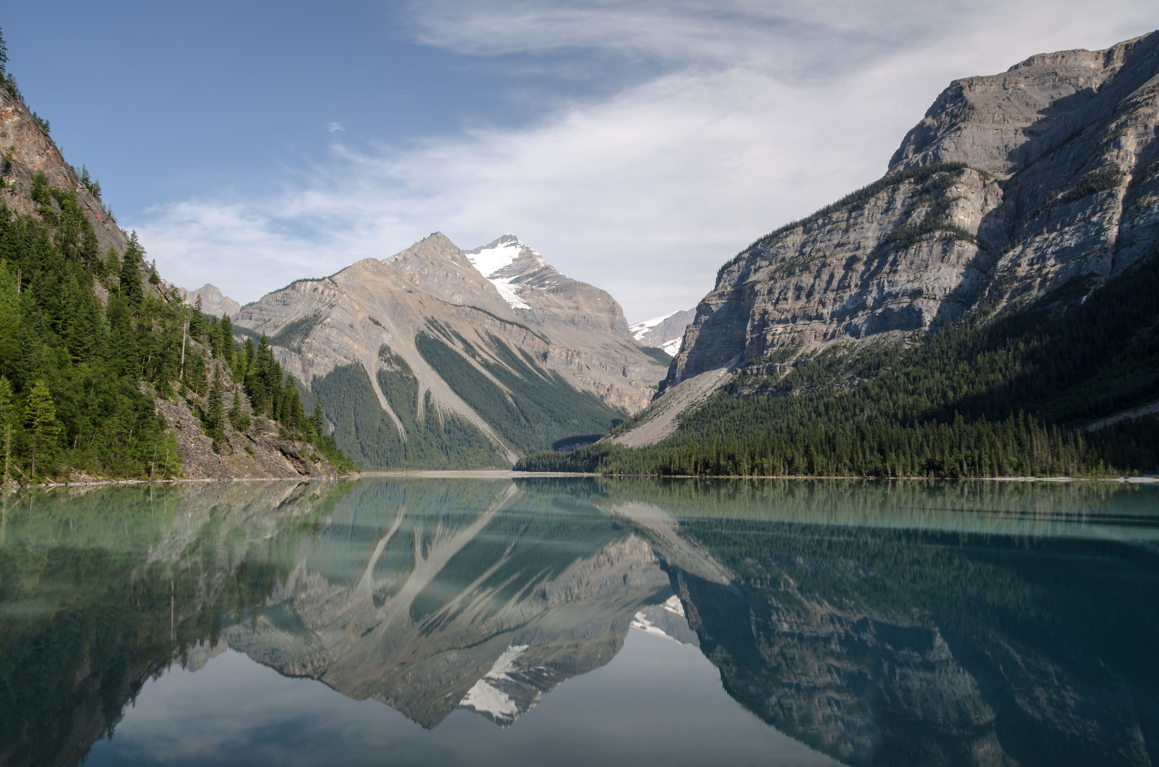
Ecologically, steep walls and variable substrates create microhabitats that act like apartment towers for bottom-dwelling life. Cold, oxygen-rich flows can provide seasonal refuges for fish, while ledges host invertebrates that anchor local food webs. Culturally, submerged landscapes connect to ancestral shorelines, shaping where people traveled, fished, and settled when the lakes breathed at different levels.
Global Perspectives
Underwater canyons are not only ocean stories; many great lakes on Earth hide them, and they behave like arteries for sediment and energy. In Alpine lakes, for instance, sudden inflows can trigger dense underflows that dash along canyon floors, redistributing silt in a single night. The physics scales from mountain tarns to inland seas: gravity, density contrasts, and channel geometry do the heavy lifting.
By mapping a Great Lakes canyon with the same rigor used on continental margins, researchers fold this region into a global conversation about how basins age. It also invites comparison across climates, linking ice-fed systems to monsoon-fed reservoirs. The payoff is predictive power: the more we recognize shared patterns, the better we can forecast the next slump, surge, or bloom.
Human Footprints on a Drowned Landscape
Most people think of in terms of shipping lanes and beaches, not cliffs and chasms, yet our choices ripple into these hidden spaces. Dredging, shoreline hardening, and altered river inflows can tweak the sediment budget that feeds or starves a canyon. Even a distant storm, intensified by a warming climate, can send a plume racing along the bottom like a freight train.
I’ve watched a sonar screen flicker with suspended layers after a gale, a ghostly curtain that wasn’t there the day before. Multiply that by a basin the size of a small sea, and the choreography gets complicated fast. A mapped canyon turns that complexity from rumor into a plan, giving managers a chart where guesswork used to be.
The Future Landscape
The next leap won’t just be sharper maps – it’ll be living maps. Uncrewed surface vessels can quietly resurvey after storms, while machine-learning models flag changes in slope angles and textures that hint at fresh instability. Distributed acoustic sensing along existing cables can eavesdrop on distant vibrations, catching turbidity flows in the act.
Pair those streams with environmental DNA sampling, and geology meets biology in near-real time. We’ll see when a ledge slumps and when a cold pulse brings a burst of life, stitched into a single timeline. In that world, the canyon stops being a static picture and becomes a pulse we can monitor and, perhaps, anticipate.
Challenges and Ethical Questions
Great maps create great temptations: to excavate, to exploit, or to publicize sensitive sites without context. Some canyon-ledges may shelter cultural heritage or fragile biota that don’t need sudden attention. Scientists and communities have to decide what gets shared broadly and what stays generalized on public charts.
There’s also the practical matter of funding and coordination across jurisdictions that split a single lake by invisible lines. Data standards, open access, and long-term stewardship matter as much as the shiniest sensor. A canyon can be mapped in a season, but safeguarding it takes decades and trust.
Conclusion
Start local: if you live near the lakes, support community science days, museum programs, and habitat projects that translate maps into action. Encourage agencies to invest in continuous lake-floor monitoring, not just one-off surveys, and to integrate Indigenous knowledge alongside instrument data. Ask your representatives to back open-data policies so schools, boaters, and researchers can read the same living charts.
For those far from these shores, remember that hidden canyons lace through reservoirs, fjords, and big lakes worldwide – advocating for careful mapping and smart management pays off at home too. canyon reminds us that the most dramatic landscapes are sometimes the ones we never see, shaping water quality, biodiversity, and safety in quiet ways. What other marvels are waiting just beneath the wake?

Suhail Ahmed is a passionate digital professional and nature enthusiast with over 8 years of experience in content strategy, SEO, web development, and digital operations. Alongside his freelance journey, Suhail actively contributes to nature and wildlife platforms like Discover Wildlife, where he channels his curiosity for the planet into engaging, educational storytelling.
With a strong background in managing digital ecosystems — from ecommerce stores and WordPress websites to social media and automation — Suhail merges technical precision with creative insight. His content reflects a rare balance: SEO-friendly yet deeply human, data-informed yet emotionally resonant.
Driven by a love for discovery and storytelling, Suhail believes in using digital platforms to amplify causes that matter — especially those protecting Earth’s biodiversity and inspiring sustainable living. Whether he’s managing online projects or crafting wildlife content, his goal remains the same: to inform, inspire, and leave a positive digital footprint.