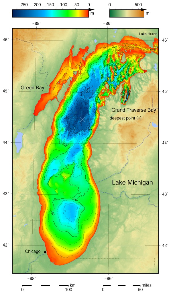
A cold, blue emptiness stretches across , but beneath those waves a different world has been hiding – a landscape of cliffs, riverbeds, and ridgelines that once felt the sun. New high-resolution sonar surveys are pulling back the water’s curtain, revealing a canyon-like system carved by ice and ancient floods. The discovery doesn’t just redraw maps; it rewrites chapters of North American history. What was once a blank blue patch on charts now shows evidence of a connected land where people and animals moved, hunted, and adapted as ice receded. Scientists continue to study these underwater landscapes, and it feels like stepping into a room we thought was locked forever.
The Hidden Clues
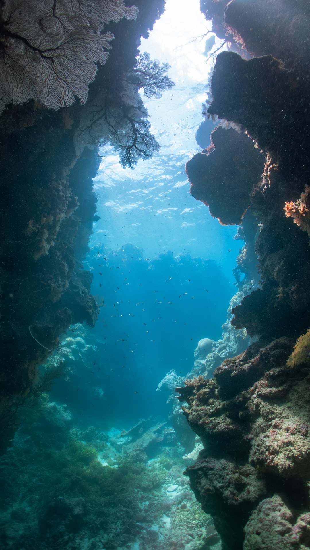
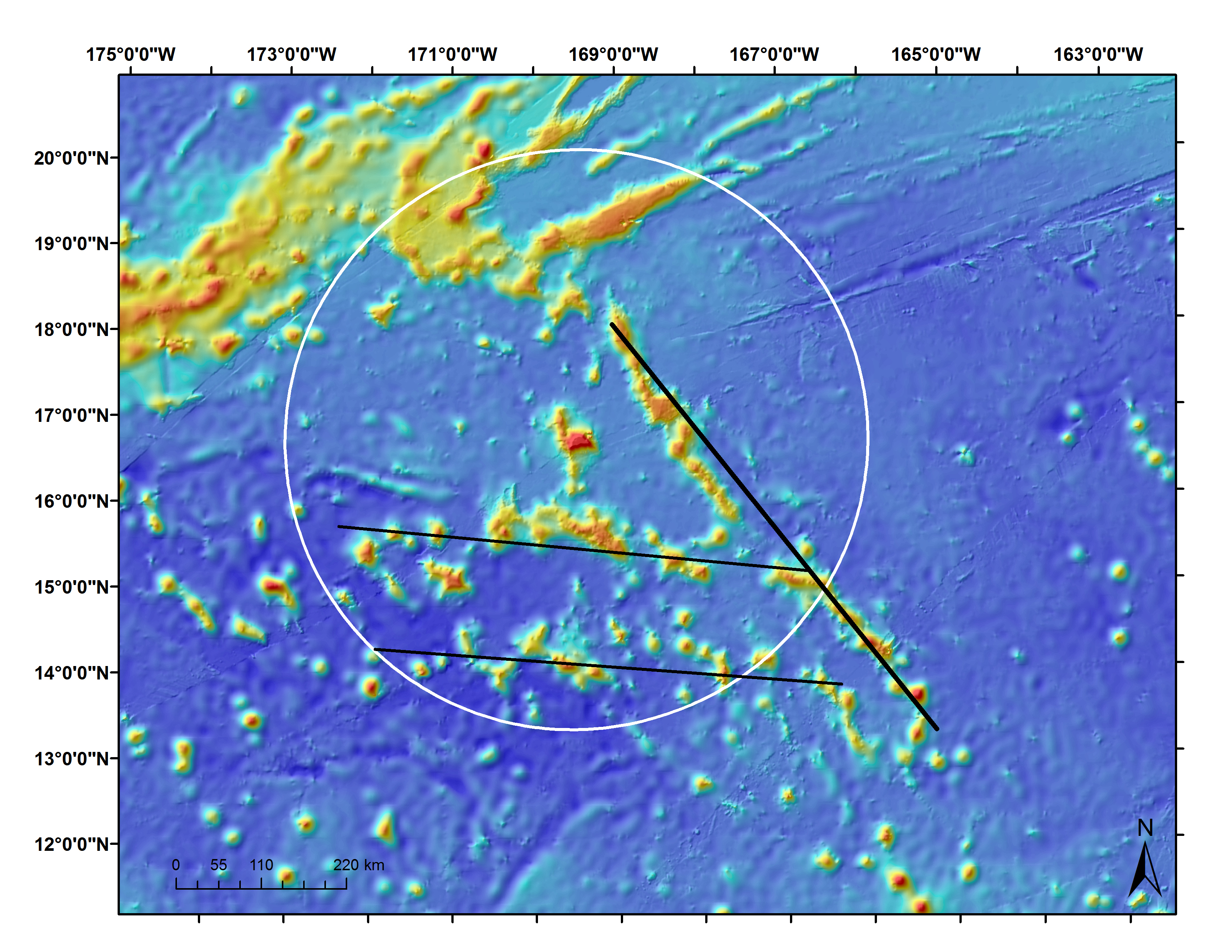
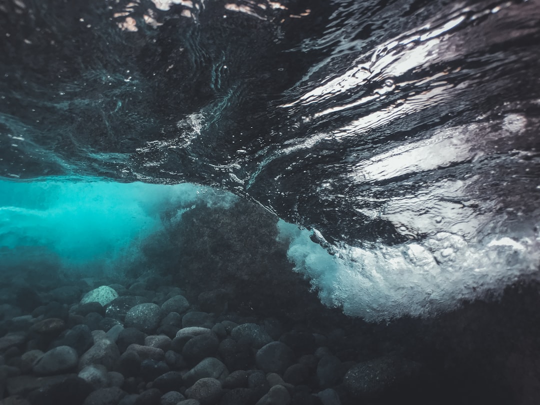
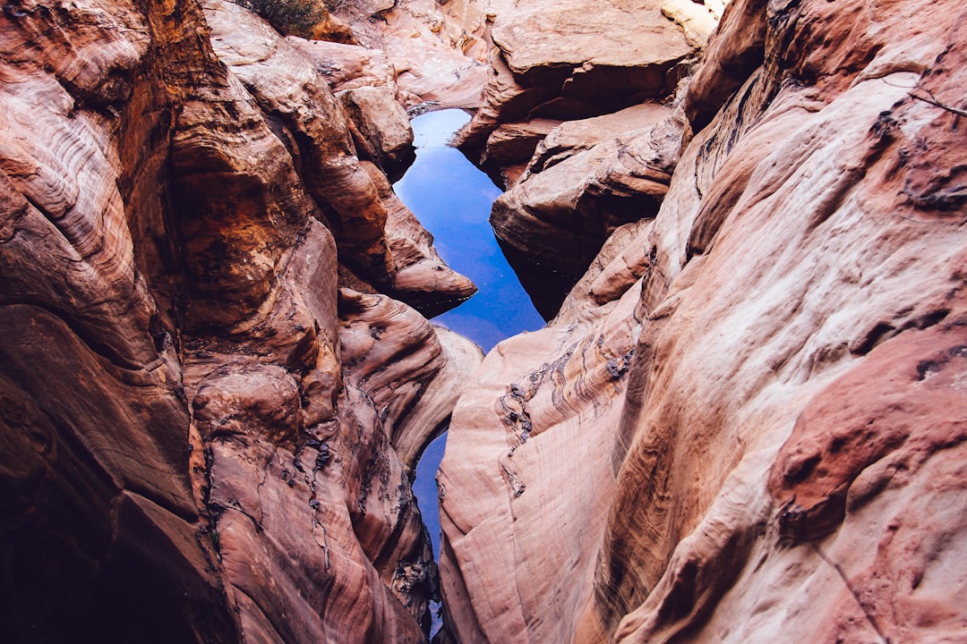
What first looks like a smooth, featureless lake floor turns out to be a maze of terraces, ledges, and steep-sided gullies. Multibeam bathymetry – think of it as a painter’s brush made of sound – returned images with startling relief, the kind that makes a geologist instinctively zoom in. One channel snakes for miles, its walls rising like bookends, hinting at torrents that once chiseled the bedrock. A ridge nearby interrupts the flow, not random at all, but placed by ice like a speed bump on a highway. Even the sediment, in thin acoustic layers, tells a story of quiescent years interrupted by surging pulses of meltwater.
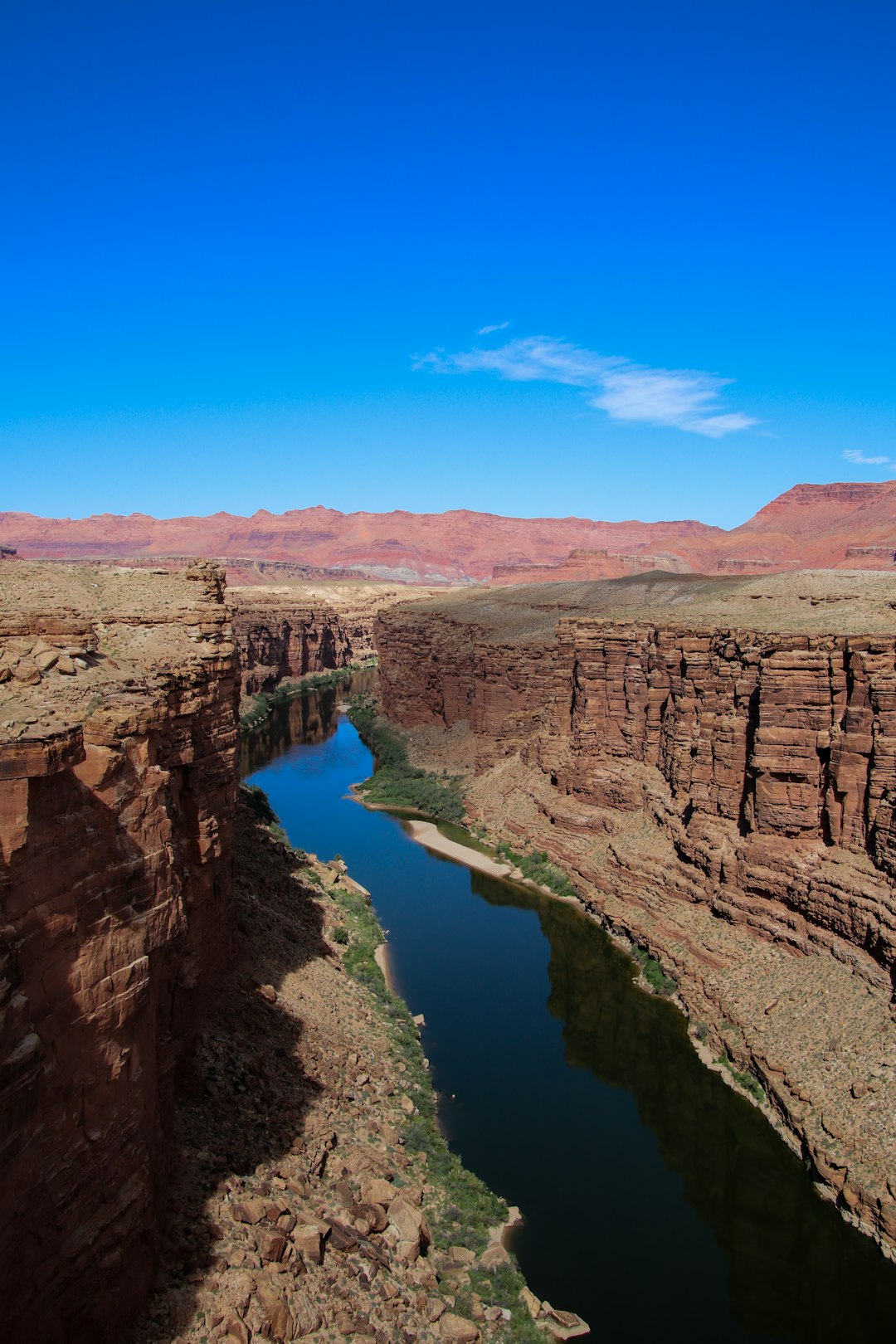
There are places where the canyon pinches, narrowing into a throat that must have thundered with ice-marginal floods. Elsewhere, it opens into fan-like deltas now buried beneath silt, ghostly fingerprints of calmer periods. The result is a composite portrait that feels both wild and precise – like seeing a heartbeat on an ultrasound for the first time. These are not doodles of chance, but the engravings of climate, water, and time. The canyon was never lost; we had simply been looking with duller eyes.
From Ancient Tools to Modern Science
Before sonar traced the canyon’s walls, divers and underwater archaeologists had already found hints of a vanished world across . On a limestone ridge drowned by rising waters, they documented stone alignments and hunting features that point to caribou crossings during colder, drier times. Those discoveries sketched the outlines of a terrestrial corridor, suggesting people moved across ground that is now hundreds of feet under. The new acoustic maps stitch that human story to a geologic backbone, filling in the valleys and passes those travelers likely used. Suddenly, archaeological waypoints connect to drainage paths, and the landscape becomes a working theory, not just a coincidence of artifacts.
What changes the game is the alignment of disciplines: geology, archaeology, climatology, and imaging science in the same boat, literally. Side-scan mosaics reveal textures; sub-bottom profiles show buried channels; and multibeam delivers the bas-relief. It’s the difference between following footprints in the snow and seeing the entire path overhead from a helicopter. I still think the most astonishing detail is how coherent it all looks when layered – human patterns resting on glacial geometry. The canyon is the spine, and the cultural finds are the nerves that bring it to life.
Mapping the Invisible: How Sonar Sees Through Water
Sonar works by sending pulses of sound that bounce off the lakebed and return to the receiver, with travel time converted into distance. Multibeam systems sweep wide swaths in a fan pattern, building a dense 3D mesh of depth measurements point by point. Side-scan adds a photographic feel, capturing tonal contrasts – rough rock, smooth mud, jagged talus – that hint at processes and age. Sub-bottom profilers push deeper, penetrating sediment to reveal buried channels, ancient shorelines, and the faint seams where one flood ended and another began. All of this gets gridded, cleaned, and colorized, turning raw echoes into a landscape you can navigate with your eyes.
It’s meticulous work: calibrating for water temperature, salinity, boat motion, and even the angle of the lake’s internal layers. The payoff is resolution down to a scale where boulders resemble punctuation marks in a long geologic sentence. Once integrated with GPS and inertial navigation, the maps lock into place like tiles in a mosaic. The result is a corridor you can trace from ridge to basin with confidence, not just hope. The invisible turns visible, and the data earns the right to be believed.
A Timeline Carved in Ice and Floods
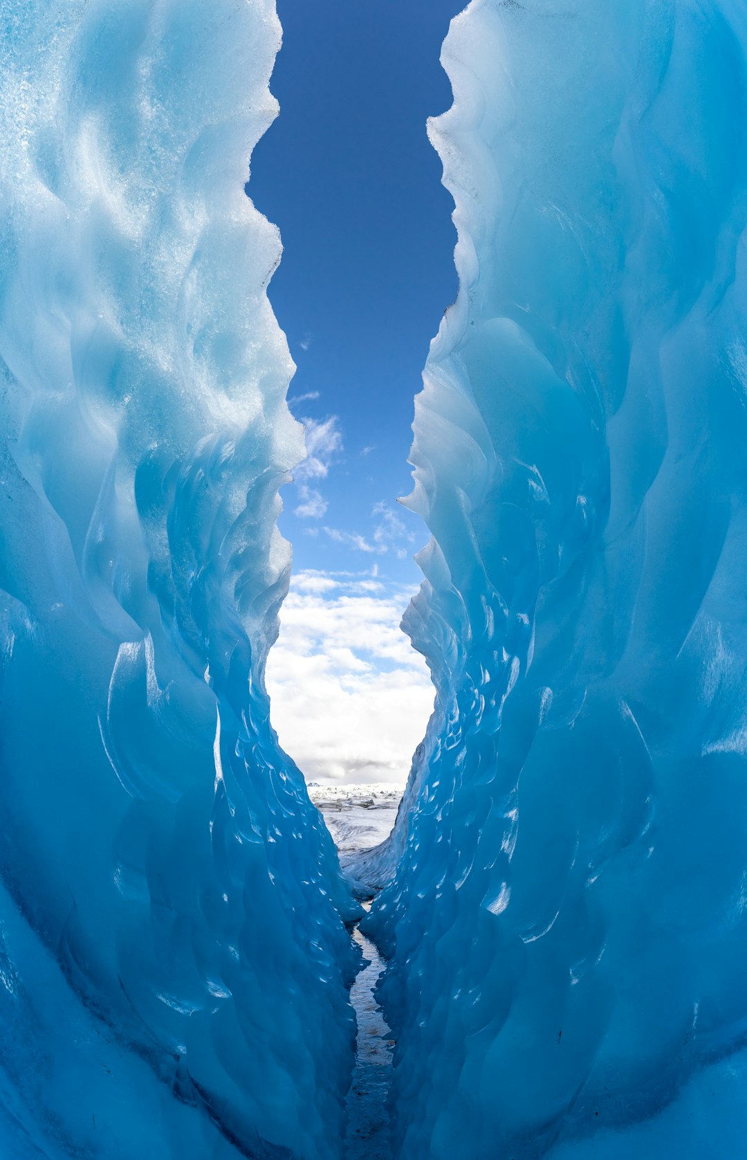
The canyon’s first sculptors were the margins of the Laurentide Ice Sheet, an ice mass that once smothered the region and pressed the crust like a heavy hand on a table. As the ice retreated roughly ten to twelve thousand years ago, meltwater flushed through soft sediments and around bedrock highs, carving fast and deep. Proglacial lakes rose and fell in pulses, their shorelines stepping down like a staircase as outlets shifted. In some phases, water roared through narrow gates, behaving less like a river and more like a release valve. In others, quiet basins accumulated fine silts, laying down annual layers that still record seasonal rhythms.
This alternating tempo – catastrophic scouring followed by calm deposition – shaped the canyon’s asymmetry and its abrupt turns. When you overlay this with the region’s fracture patterns and ancient faults, the channels make structural sense. The story blends physics and place: ice pressure, hydrostatic gradients, and the stubborn geometry of old rock. The lake levels we see today are just the latest page, not the whole book. And that book is still being edited by waves, currents, and the slow creep of sediment.
Why It Matters
The canyon is more than a pretty picture; it’s a master key for understanding climate, water, and people in a region that holds nearly one fifth of Earth’s surface fresh water. Knowing where meltwater once rushed can refine models of past lake levels, which improves forecasts for future extremes. Buried shorelines and organic pockets become natural archives, preserving pollen, wood, and microfossils that pin dates and climate swings to specific events. For cultural historians, the mapped corridors suggest where to search next for submerged sites that could broaden the record of early inhabitants. In short, the canyon organizes questions and makes them testable.
There’s also a practical edge: shipping lanes, cable routes, and habitat restoration plans benefit from knowing which slopes are stable and which are ready to slump. The steep walls and loose fans behave differently under storm stress and ice shove, and that matters for risk. A canyon concentrates energy, just like wind in a mountain pass, with currents that can surprise even seasoned crews. Treating it as a coherent system keeps management from being a patchwork of guesses. Better maps mean fewer blind spots, and fewer blind spots mean better decisions.
Global Perspectives
Submerged landscapes are not unique to ; they’re part of a global story as coastlines rose after the last ice age. Across the North Sea, researchers have mapped drowned river plains where people once hunted, lived, and watched the tides creep higher, a distant cousin to the ridge-and-channel world under our lakes. On the Black Sea shelf, paleo-shorelines tell of abrupt changes that reorganized ecosystems and trade routes. Even in massive rift lakes and polar fjords, the same sonar toolkit is revealing patterns of ice retreat and meltwater architecture. The echoes rhyme across continents, each basin a verse in a longer poem about climate and resilience.
What sets apart is the sheer volume of fresh water and the binational stewardship it demands. The canyon intensifies that conversation by putting a bold underline beneath shared history and shared risk. When maps improve, agreements can too, because the physical facts become harder to ignore. Science turns into policy more smoothly when the landmarks are indisputable. And a canyon is very hard to argue with.
The Future Landscape
The next leap will come from fleets of autonomous surface and underwater vehicles pairing multibeam swaths with machine learning that flags features in near real time. Cloud platforms already stitch terabytes of soundings into seamless atlases, and soon updates could flow like weather forecasts for the lakebed. Add water chemistry sensors and DNA sampling, and the canyon becomes a living observatory, not just a static map. Low-frequency imaging will likely reach deeper, tracing older channels hidden beneath thick drapes of sediment. That could push the timeline further back and reveal the earliest pulses that set the stage for everything we see now.
Challenges remain: zebra and quagga mussels alter visibility and substrates; storms chew at slopes; and funding rarely keeps pace with ambition. Data standards need to align so agencies and universities can fuse results without heroic effort. There’s also a storytelling gap – turning dense bathymetry into something communities can use and care about. That gap is as important to close as any survey line. Maps change minds only when people can read them.
On the Water: A Personal View
I keep coming back to the first time I studied a Great Lakes bathymetric chart and felt the ground drop away under my mind’s feet. It’s like realizing your hometown sits above a cathedral you never knew existed. The canyon feels improbable at first, then inevitable, and finally intimate – once you see it, you can’t unsee it. I find that mix of shock and recognition addictive, the way a plot twist suddenly clarifies earlier scenes. It makes the lakes feel more alive, and more ancient, at the same time.
That tension is the heart of good science: wonder sharpened by measurement. We don’t have to choose between poetry and precision when the data themselves are beautiful. The canyon doesn’t need myth to be mesmerizing; it only needs good field days and patient processing. Every cleaned line of soundings is a brushstroke in a portrait of change. And the face emerging belongs to all of us.
What You Can Do Now
Start local: visit a maritime museum or coastal center and ask about new lakebed maps and how they guide restoration and safety. Support research vessels and student programs that put more eyes – and ears – on the water, because surveys don’t happen without fuel, time, and training. If you fish, paddle, or sail, treat the lakebed like a park you can’t see; report unusual finds and avoid anchoring on sensitive habitats. Encourage your community to include underwater terrain in shoreline planning, because hazards don’t stop at the waterline. Small nudges add up when the goal is clarity rather than spectacle.
At home, explore publicly available bathymetry and see the canyon for yourself; curiosity is contagious when shared. Ask policymakers for open data and cross-border projects that reduce duplication and increase coverage. Consider volunteering with beach cleanups and tributary monitoring that feed data upstream to lakewide models. The more we participate, the better the maps and the stories we build on them. Stewardship starts with paying attention.
Conclusion
have always held secrets, but the canyon changes the scale of the secret and the urgency of the questions. Sonar didn’t just find a dramatic landform; it found a framework for linking ice, water, ecosystems, and people into one readable narrative. That narrative can guide better science and better choices, if we let it. We’re finally seeing the ground that shaped the waters that shape us. What else has been hiding in plain sight, waiting for us to look harder?

Suhail Ahmed is a passionate digital professional and nature enthusiast with over 8 years of experience in content strategy, SEO, web development, and digital operations. Alongside his freelance journey, Suhail actively contributes to nature and wildlife platforms like Discover Wildlife, where he channels his curiosity for the planet into engaging, educational storytelling.
With a strong background in managing digital ecosystems — from ecommerce stores and WordPress websites to social media and automation — Suhail merges technical precision with creative insight. His content reflects a rare balance: SEO-friendly yet deeply human, data-informed yet emotionally resonant.
Driven by a love for discovery and storytelling, Suhail believes in using digital platforms to amplify causes that matter — especially those protecting Earth’s biodiversity and inspiring sustainable living. Whether he’s managing online projects or crafting wildlife content, his goal remains the same: to inform, inspire, and leave a positive digital footprint.