Stand beneath a smoke-darkened sky during a major fire and you can feel the atmosphere turn restless, almost electric, as if the blaze is rewriting the rules above your head. Across the world’s fire-prone regions, scientists are documenting a remarkable phenomenon: intense wildfires that grow tall enough and hot enough to spawn clouds, winds, and lightning that feed the flames. The mystery is both scary and fascinating – how can a fire on the ground build a storm in the sky, and why does it sometimes explode into something far more dangerous than a typical blaze? The answer blends fluid dynamics, cloud physics, and a hint of chaos, and it’s reshaping how firefighters, meteorologists, and communities prepare for extreme fire weather.
Understanding this hidden engine is not just academic; it’s a matter of forecasting what tomorrow’s fire seasons will look like and how we can live with them.
The Hidden Clues
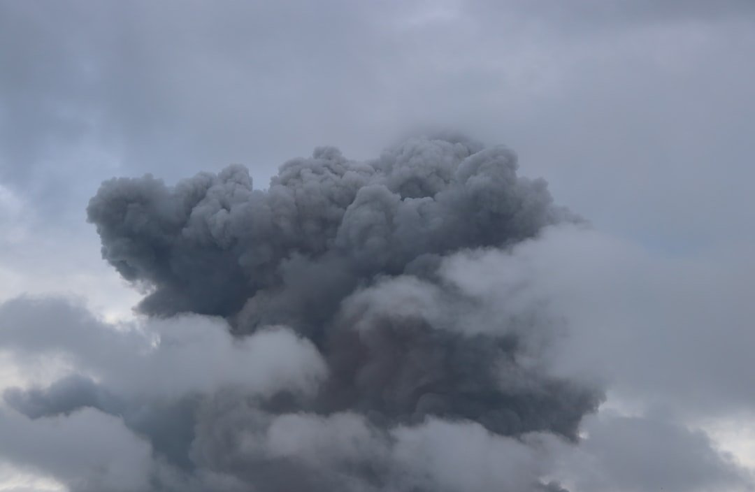
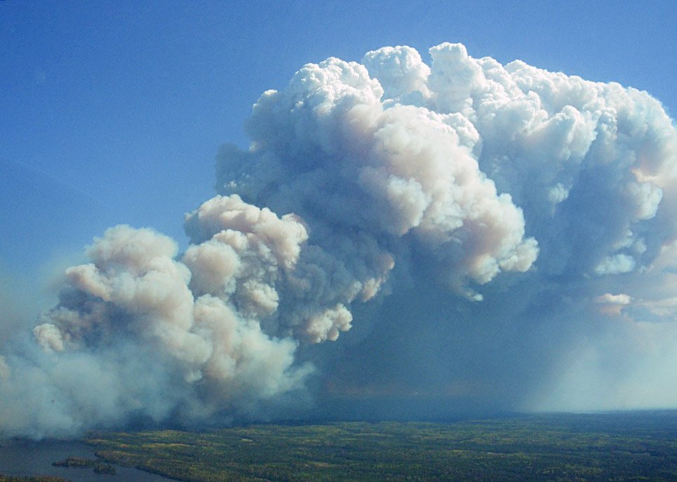
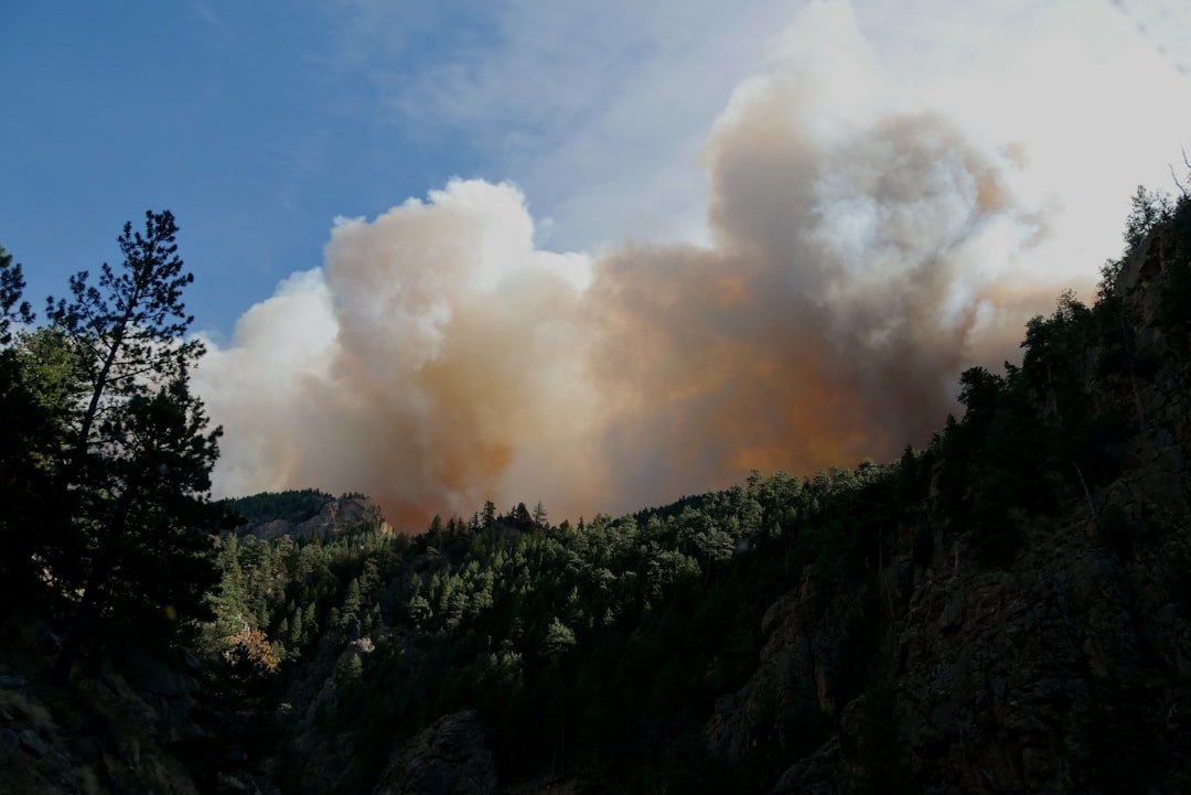
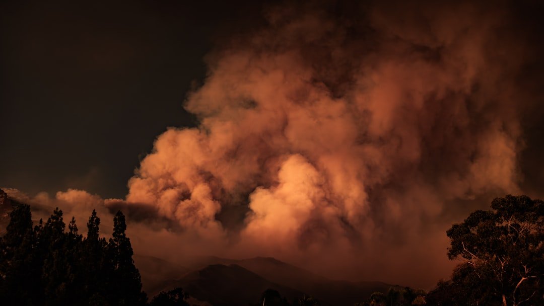
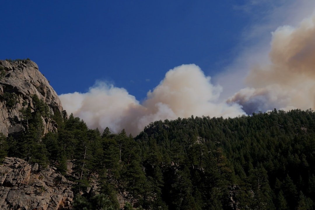
Look closely at a towering column of smoke and you’ll see the first clues that a fire is punching into the weather itself: a roiling, cauliflower-like dome that looks suspiciously like a storm cloud. That shape signals a deep updraft, the rising motion powered by superheated air near the flames that is strong enough to haul ash, vapor, and tiny particles kilometers into the sky. As that plume ascends and cools, moisture condenses on smoke particles, forming a pyrocumulus cloud – the fire’s own lightweight canopy. If the updraft keeps intensifying, that cloud can grow into pyrocumulonimbus, a thunderstorm-like system that can generate lightning and violent downdrafts.
From the ground, the shift is subtle at first – slightly darker skies, a chill wind rushing toward the fire – before the atmosphere flips into a turbulent feedback loop. Each of these clues is a telltale warning that the fire has found a new gear.
Heat That Lifts the Sky
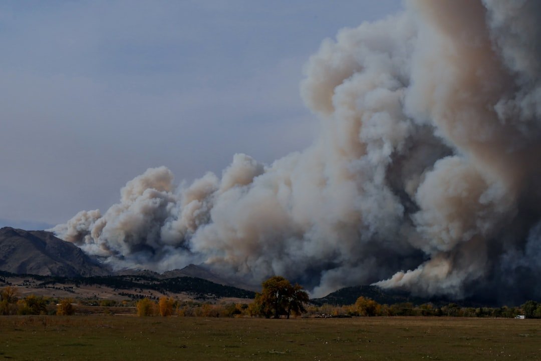
Every wildfire pumps out heat, but extreme fires concentrate it into narrow plumes where air accelerates upward like water through a nozzle. That rising air lowers surface pressure locally, drawing in winds from all directions and ventilating the flames with fresh oxygen, which can make the fire’s edge race and pivot unpredictably. Inside the plume, temperatures can climb enough to reduce air density dramatically, turbocharging the ascent and carrying embers far beyond containment lines.
The physics mirrors a thunderstorm’s updraft, but the energy source is combustion rather than warm ocean water or sun-heated fields. Because the plume is loaded with aerosols – microscopic particles that act as cloud seeds – droplets form quickly once the rising air cools, and that early cloud deck can shade the ground and change local winds. The whole structure becomes a living column, tightening and stretching as terrain, fuel, and wind shear sculpt its motion.
When Smoke Seeds Storms
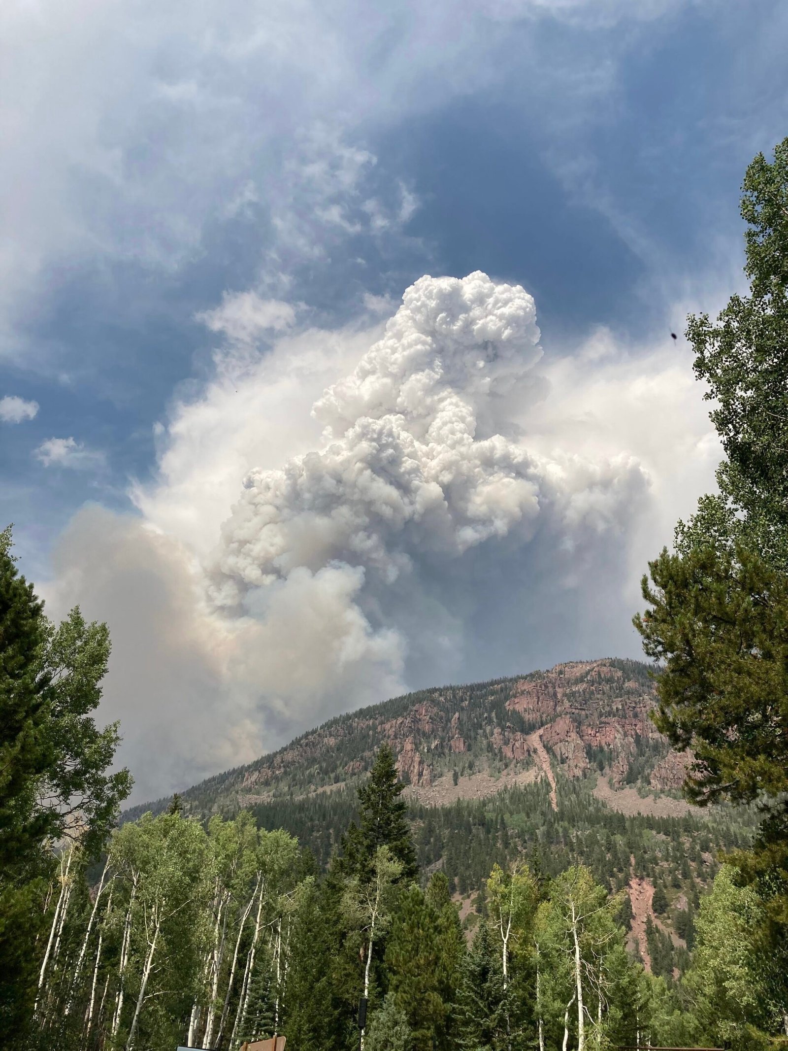
Cloud microphysics is the quiet engine of fire weather, and smoke particles are its spark plugs. These particles provide abundant surfaces for water vapor to condense on, accelerating the birth of cloud droplets and ice crystals that define pyrocumulus and, when electrification ramps up, pyrocumulonimbus. As the cloud grows, the release of latent heat – the energy freed as vapor turns to liquid or ice – adds buoyancy, reinforcing the updraft in a self-sustaining loop. In some extreme events, this loop lofts smoke into the lower stratosphere, where it can linger for weeks and drift across continents, subtly cooling or warming layers of the atmosphere as it absorbs and scatters sunlight.
Meanwhile, on the ground, shaded areas can briefly calm fire behavior while sunlit flanks flare, creating a patchwork of microclimates around the perimeter. What looks like a simple smoke cap is actually a churning weather factory built from tiny particles and phase changes.
Lightning From the Flames
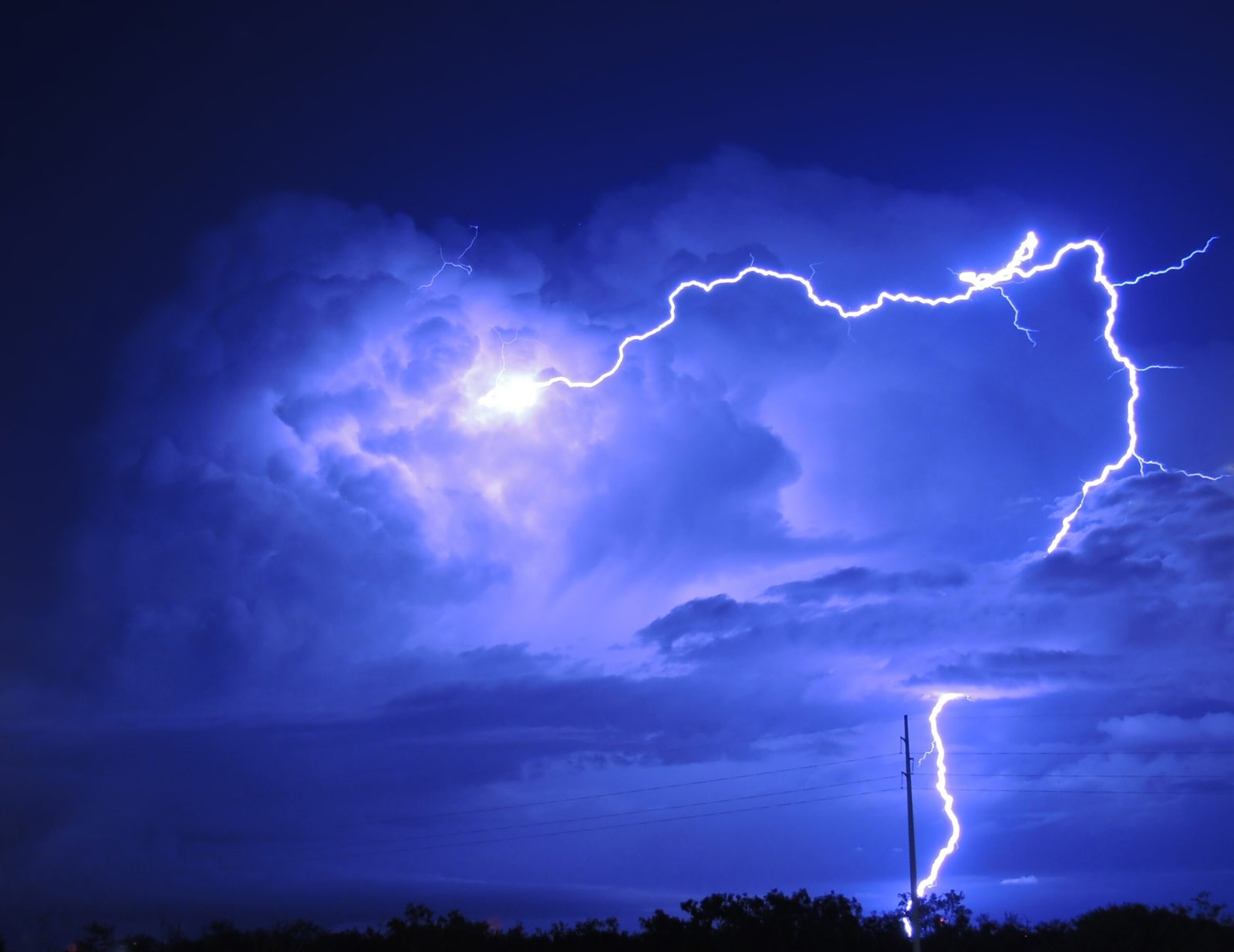
Once a fire-driven cloud grows deep enough, collisions between ice particles and graupel charge the cloud, and lightning becomes possible – sometimes striking miles downwind of the fire’s core. Those bolts can ignite new spot fires in receptive fuels, setting off a daisy chain of flare-ups that stretches the firefight across valleys and ridges. The storm’s downdrafts complicate things further by hammering the surface with cool, dense air that splays outward as gust fronts, flipping flame angles and showering embers into unburned areas. Fire crews talk about the surreal moment when the wind suddenly changes direction, a signature of a downburst that arrived not from a passing front but from the fire’s own sky.
Unlike typical summer thunderstorms, these pyro-storms carry more ash and less rain, so lightning often arrives without the soaking relief that would tame the line. It’s a paradoxical storm, both born of fire and geared to keep it alive.
Fire Tornadoes and Vortices
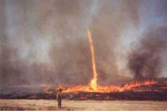
Under the right shear and heat conditions, rotating columns can spin up along the plume’s edge, ranging from brief fire whirls to rare, violent fire tornadoes. These vortices form when intense updrafts stretch a pocket of ambient rotation – think of a figure skater pulling in their arms – and that spin focuses into a narrow, flaming column. Even modest whirls can loft burning debris over firelines; the stronger ones can scour trees and power poles, carving damage paths that resemble those left by severe storms. The danger is not just the wind speed but the chaos they inject, as winds wrap back on themselves and oxygen is funneled to the flame front.
Terrain funnels, canyon mouths, and sharp fuel transitions act like valves and nozzles, strengthening vortices in sudden bursts that catch crews off guard. In a fire that’s making its own weather, spin is the flashy but treacherous flourish.
From Ancient Tools to Modern Science
Human beings have watched smoke columns for clues since controlled burning began, reading color, height, and drift to predict shifts on the ground. Today, satellites track thermal hotspots and plume heights in near real time, while Doppler radar occasionally captures the internal circulation of pyrocumulonimbus much like it does a summer thunderstorm. Portable weather stations, drone-based temperature and humidity profiles, and high-resolution numerical models let scientists dissect how a plume evolves minute by minute. Machine learning aids forecasters by flagging combinations of fuels, humidity, wind shear, and terrain that make plume-driven storms more likely.
I once stood on a ridge during a prescribed burn where a small, tidy column suddenly bulged and darkened; the crew lead pointed at the sky and called a pause, reading those ancient signs long before the instruments chimed. The blend of intuition and instrumentation is becoming a cornerstone of modern fire-weather operations.
Why It Matters
Fires that generate their own weather can outrun traditional playbooks that assume wind and humidity are set by the broader forecast. In a typical wildfire, crews plan around regional wind fields and daily temperature swings; in a plume-dominated fire, those fields can be rewritten locally within minutes. That difference complicates evacuations, air support, and safety zones, because gust fronts and lightning can emerge where no ordinary storm is expected. It also expands the risk footprint, as lightning-sparked spot fires leapfrog containment lines and smoke reduces visibility on highways far from the flame.
For communities, the stakes are practical and immediate: understanding fire-driven weather shapes building codes, evacuation routes, and how utilities manage power shutoffs during red flag days. This is not an edge case – it increasingly defines the most destructive days of fire season.
Global Perspectives
From the Mediterranean to Siberia, Australia to the American West, the signature of fire-made weather shows up wherever heat, fuel, and unstable air align. Vast forest tracts feed taller plumes, while drought-stressed shrublands prime the ground for fast-moving gust fronts that shatter containment strategies. Some of the world’s most notorious fire seasons have featured pyrocumulonimbus events that lofted smoke across oceans and deposited soot on distant ice. In regions with rugged topography, canyons and slopes act like giant wind instruments, tuning and amplifying the plume’s airflow.
Urban-wildland interfaces complicate this picture further by adding heat-absorbing surfaces and intricate wind eddies around buildings. As more landscapes experience longer, hotter dry seasons, the geography of fire weather is expanding, and so is the list of places where a fire can become a storm.
The Future Landscape
Forecasters are racing to build tools that can predict when a fire is poised to flip into storm mode, using satellite plume-height algorithms, lightning nowcasting, and ensemble models that ingest real-time fuel data. Emerging research couples wildfire spread models with cloud-resolving meteorology, allowing simulations to capture feedbacks between combustion and convection that older systems missed. New sensors mounted on crew vehicles and small aircraft provide rapid profiles of temperature, moisture, and aerosol load, improving the odds of catching a plume before it deepens.
There’s also a push to integrate health impacts into forecasts, so communities receive combined alerts for smoke exposure, downburst risk, and lightning potential. Challenges remain – especially computing power, data latency, and the inherently chaotic nature of turbulent plumes – but the trajectory is clear. The better we can anticipate the switch from fire to fire-storm, the smarter and safer our response can be.
Conclusion
If you live in fire country, learn to read the sky: a suddenly billowing column, anvil-shaped tops, or odd gust fronts can be practical cues to move, mask up, or check alerts. Support prescribed fire and fuels treatments led by local agencies and tribes, which lower the chances that future blazes will reach plume-dominated intensity. Advocate for community-scale sensors and clean-air shelters, and sign up for regional warning systems that combine fire behavior with weather updates. Keep vehicles fueled, go-bags ready, and routes planned that avoid canyons and ridge saddles where downbursts can complicate evacuations.
And if you’re a weather or science enthusiast, consider volunteering with citizen networks that report smoke, visibility, and lightning – small observations that help researchers validate the models.

Suhail Ahmed is a passionate digital professional and nature enthusiast with over 8 years of experience in content strategy, SEO, web development, and digital operations. Alongside his freelance journey, Suhail actively contributes to nature and wildlife platforms like Discover Wildlife, where he channels his curiosity for the planet into engaging, educational storytelling.
With a strong background in managing digital ecosystems — from ecommerce stores and WordPress websites to social media and automation — Suhail merges technical precision with creative insight. His content reflects a rare balance: SEO-friendly yet deeply human, data-informed yet emotionally resonant.
Driven by a love for discovery and storytelling, Suhail believes in using digital platforms to amplify causes that matter — especially those protecting Earth’s biodiversity and inspiring sustainable living. Whether he’s managing online projects or crafting wildlife content, his goal remains the same: to inform, inspire, and leave a positive digital footprint.