Picture this: you’re sipping your morning coffee in Sacramento when suddenly the news alerts start pinging on your phone. Another atmospheric river is barreling toward California. Roads are closing, evacuation warnings are issued, and you can’t help but wonder – didn’t this just happen a few months ago?
You’re not imagining it. These so-called “rivers in the sky” have been pummeling the Golden State with increasing fury, turning neighborhoods into swimming pools and making headlines worldwide. From the catastrophic Oroville Dam crisis to billion-dollar damages across Los Angeles, atmospheric rivers are rewriting California’s flood story in ways that would make even seasoned meteorologists nervous.
The Invisible Giants Above Our Heads
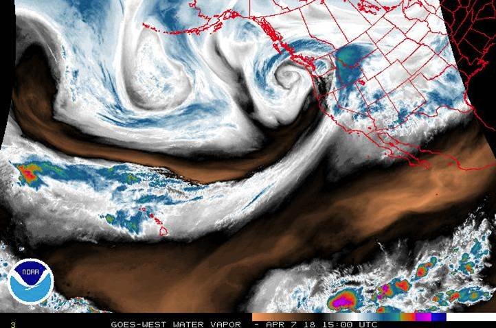
Think of atmospheric rivers as invisible highways of water vapor stretching thousands of miles across the Pacific Ocean. They are narrow bands of water vapor that wind sinuously through the atmosphere, like a river; they can transport vast quantities of water across the ocean, generally from the warm tropics toward the cooler midlatitudes, like California. At their strongest, these systems can carry up to 15 times the amount of water flowing out of the Mississippi River.
The most famous type is the “Pineapple Express,” which sounds like something you’d order at a tropical smoothie bar. One common flavor of AR, explains Christine Shields, an atmospheric scientist at the National Center for Atmospheric Research, is the colloquially termed “Pineapple Express.” Those ARs originate in the tropics near Hawaii and “essentially just move water from lower latitude to a higher latitude, like a river on Earth,” she says. These atmospheric conveyor belts can stretch up to 1,000 miles long and 300 miles wide, carrying enough moisture to rival the Amazon River itself.
Nature’s Double-Edged Sword

Here’s where things get tricky – atmospheric rivers aren’t inherently villains. Atmospheric rivers provide roughly half of California’s annual precipitation, restoring the state’s snowpack and filling reservoirs, but the storms can also cause significant damage, especially when they arrive in groups. Without them, California would be a desert, and your avocados would cost even more than they already do.
USGS research has found that 33%–74% of droughts on the West Coast between 1950 and 2010 were broken by the arrival atmospheric river storms, making them nature’s drought-busters. But when these systems go into overdrive, they transform from savior to destroyer faster than you can say “flash flood warning.” It’s like having a friend who brings amazing gifts but occasionally floods your house in the process.
When Rain Becomes a Weapon of Mass Destruction

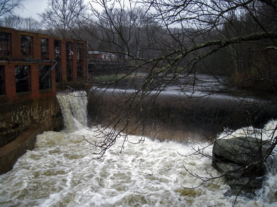
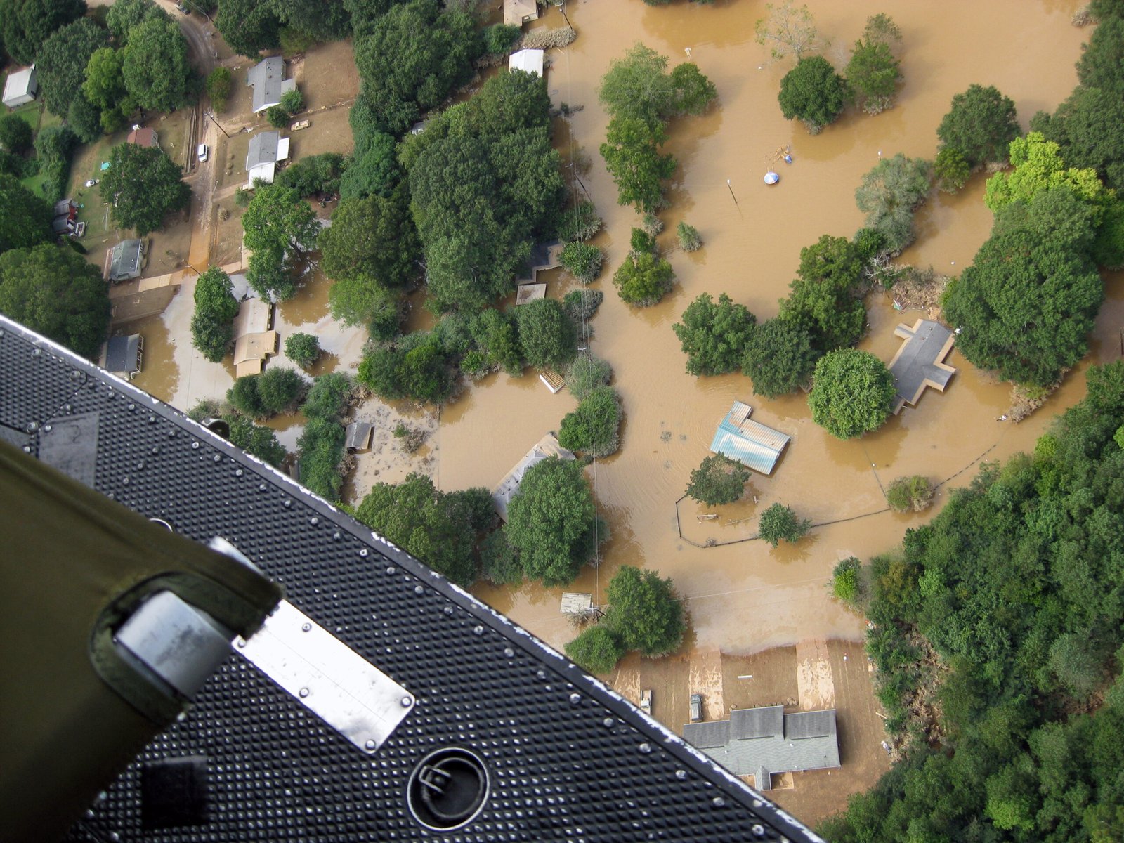
The sheer volume of water these storms can unleash is genuinely terrifying. Downtown Los Angeles received 4.1 inches (100 mm) of rain on February 4, 2024, marking it the wettest day since March 15, 2003. Downtown Los Angeles had received 7.03 inches (179 mm) of rain in two days from February 4–5 making it the third wettest two-day span in the city’s history. To put that in perspective, Downtown Los Angeles only averages 14.25 inches (362 mm) of rain in a normal rain year.
The February 2024 atmospheric river didn’t just break records – it shattered them like a sledgehammer through glass. Heavy rainfall caused more than 300 landslides and severe flash flooding throughout the state. Streets turned into rivers, hillsides gave way, and power outages caused by the storms left approximately 850,000 people without power. It’s no wonder meteorologists started using terms like “biblical flooding” to describe what was happening.
Climate Change: The Unwelcome Party Crasher

If you think atmospheric rivers are intense now, buckle up – they’re about to get a serious upgrade courtesy of climate change. There’s very strong evidence that climate change will increase the intensity of atmospheric rivers and the rain and therefore flood risk that they produce. Human-driven climate change has primed the atmosphere to hold more of that water. Atmospheric temperatures have risen about 2 degrees Fahrenheit (just over 1 degree Celsius) since the late 1800s, when people started burning massive volumes of fossil fuels. The atmosphere can hold about 4% more water for every degree Fahrenheit warmer it gets.
This isn’t theoretical anymore – it’s happening right now. Swain estimates those sky-rivers can carry and deliver about 5 to 15% more precipitation now than they would have in a world untouched by climate change. That might sound modest, but when you’re already dealing with storms that can dump months of rain in days, even a small percentage increase can trigger catastrophic flooding.
The Terrifying Power of Sequential Strikes

Bad news: atmospheric rivers are apparently learning teamwork. When I started this work, I was expecting the losses to be 10 or 20% higher for atmospheric rivers occurring in a sequence, but the losses are tripled or quadrupled, according to Stanford researcher Corinne Bowers. In all, nine atmospheric rivers hit California between Dec. 26, 2022, and Jan. 17, 2023.
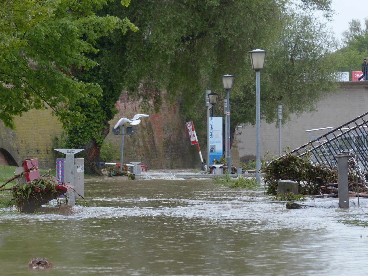
Think of it like being punched repeatedly in the same spot – each hit hurts more than it should because you never had time to recover from the previous one. Flooding, power outages, and mudslides from the deluge resulted in 21 deaths and over $3 billion in losses. When atmospheric rivers arrive in rapid succession, they create a perfect storm of destruction that makes individual events look like gentle spring showers.
California’s Aging Infrastructure Meets Modern Storms
Here’s a sobering reality: California’s flood protection system was built for yesterday’s weather, not tomorrow’s climate chaos. Those damages are so severe in part because flood protections, including dams, levees, and spillways, were built for the climatic conditions of the past. As human emissions drive worsening storms, outdated infrastructure fails under the new precipitation extremes.
The Oroville Dam crisis of 2017 serves as a chilling example of what happens when 50-year-old infrastructure meets modern atmospheric rivers. The fifty-year-old dam was no match for two atmospheric rivers that hit in 2017. Its emergency spillway struggled to control the deluge of water. With the dam threatening to overflow, 180,000 people evacuated their homes. It’s like trying to handle a fire hose with a garden sprinkler system.
The Economic Tsunami Behind the Water
The dollar signs attached to atmospheric river damage are staggering enough to make your head spin. The economic cost from the destruction is now estimated to reach $11 billion in damages, as droves of homes, roadways, and other infrastructure were destroyed. Meanwhile, atmospheric rivers in late 2022 and early 2023 caused between $5 and $7 billion in losses, Moody’s RMS estimated.
A 2019 study by researchers at the University of California, San Diego, found that atmospheric rivers pose a $1-billion-a-year flood risk to the western United States. These aren’t just numbers on a spreadsheet – they represent shattered communities, destroyed businesses, and lives turned upside down. When nature decides to flex its muscles, the economic aftershocks can be felt for years.
The Flood Map Deception
If you’re relying on FEMA flood maps to assess your risk, you might want to sit down for this one. Today, much of the state relies on Federal Emergency Management Agency (FEMA) flood maps to guide land-use planning and the siting of flood infrastructure. But these maps are principally based on historical conditions rather than current, rapidly changing conditions. In addition, many of these maps are incomplete, and don’t take into account all sources of flood risk.
The reality is far worse than the maps suggest. FEMA maps show that roughly 500,000 California properties are at substantial likelihood of flooding, with a 1% chance of being flooded in any given year. The study found that more than twice that amount – 1.1 million properties – are already at this level of risk, and that an additional 150,000 properties will join them in the next 30 years, mainly because of rising seas. It’s like finding out your home security system has been displaying a screensaver while burglars ransacked your house.
The Geography of Destruction

Not all parts of California face the same atmospheric river fury, but the differences might surprise you. Forecasters note that Northern California typically experiences about six strong atmospheric rivers every year, but by April 1, that number had already reached nine. This increase in storm system intensity and frequency led to above-normal precipitation levels, particularly in critical watershed zones, but, in contrast, Southern California saw very few significant storms, receiving only a handful of weak systems.
This creates a bizarre tale of two Californias – while Northern California gets pummeled by biblical floods, Southern California often remains bone dry, creating perfect conditions for devastating wildfires. As a result, precipitation totals in Southern California dropped to 70% or less of average levels through early March, setting the stage for an increasingly dangerous fire season. It’s nature’s cruel irony: too much water in one place, not enough in another.
When Fire Meets Flood: The Perfect Storm of Destruction
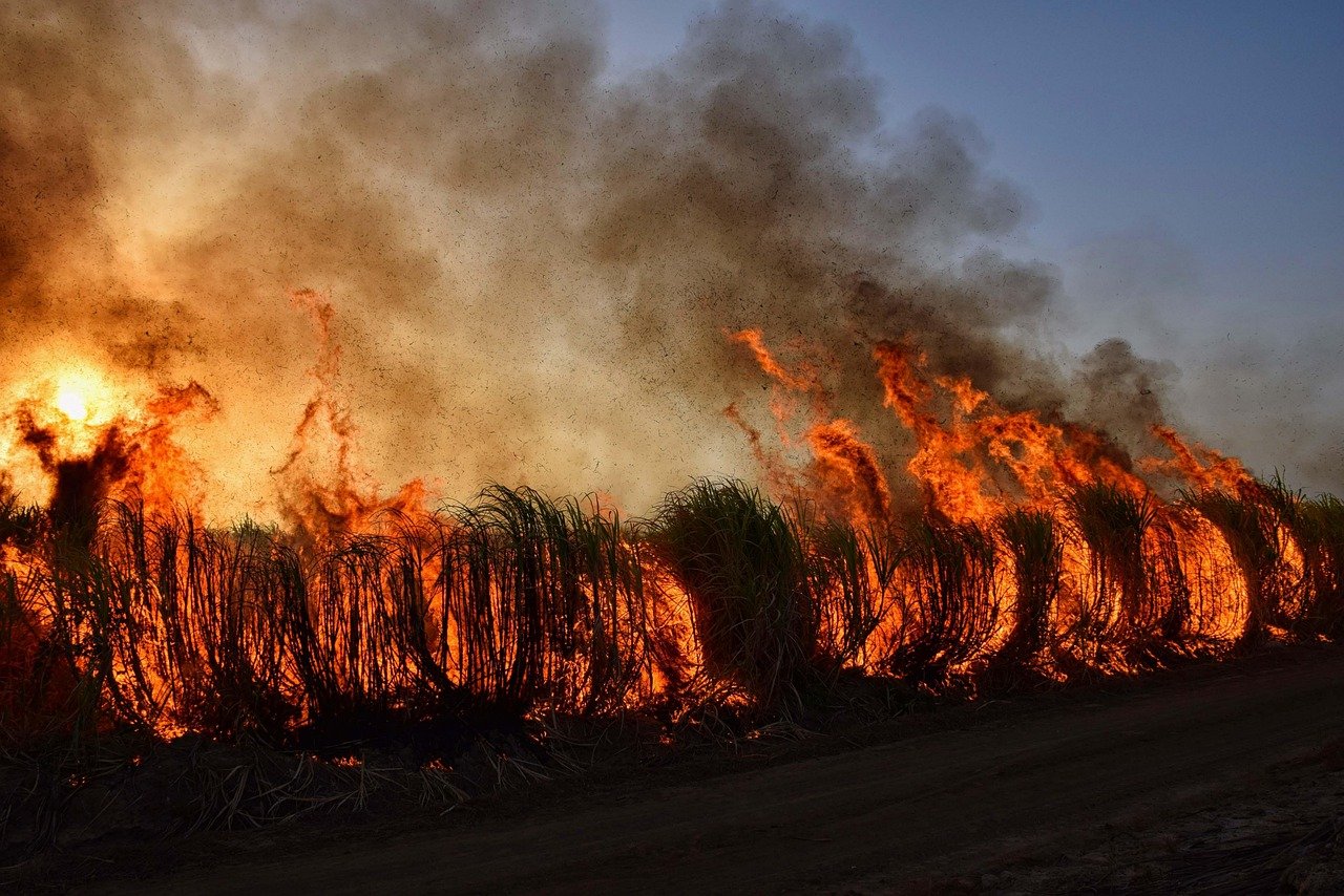
California’s atmospheric river problem gets exponentially worse when you throw wildfires into the mix. Researchers and emergency managers are also particularly worried about severe rain falling on areas that recently burned, like in parts of Los Angeles. High-intensity fire can make soils less able to absorb water, and many of the places that burned in Southern California’s January fires have been denuded of vegetation and structures that help hold steep hills in place.
When atmospheric rivers hit burn scars, the results are catastrophic. When a severe wildfire burns on a hillside, little vegetation remains, and the slope is vulnerable to flash floods and debris flows. It’s like removing nature’s sponge and replacing it with a waterslide. The 2018 Montecito debris flows that killed 23 people serve as a grim reminder of what happens when these forces collide.
The Future Forecast: More Chaos Ahead
The crystal ball for California’s atmospheric river future isn’t pleasant reading. However, it’s unlikely the biggest change will be in overall amount of precipitation the state gets. Instead, it’s currently thought the character of precipitation will probably change, with more intense atmospheric rivers and longer dry spells between them. In other words, California’s already variable climate may become even more extreme.
Scientists are predicting atmospheric rivers will become not just stronger, but longer-lasting and more destructive. The rivers could become 25 percent wider and longer as well as last longer, according to a NASA study. Atmospheric rivers could also come more quickly one after another, compounding their effects. Imagine today’s worst atmospheric river, then make it bigger, stronger, and give it siblings that arrive back-to-back. That’s California’s future.
California’s atmospheric river problem isn’t going away – it’s evolving into something more powerful and unpredictable than ever before. As climate change continues to supercharge these storms, the Golden State faces a future where biblical floods alternate with devastating droughts, testing every aspect of its infrastructure, economy, and resilience. The question isn’t whether the next big atmospheric river will come – it’s whether California will be ready when it does. Will we finally build flood defenses for tomorrow’s storms instead of yesterday’s weather, or will we keep getting caught off guard by nature’s increasingly violent moods?