Across Oklahoma, tornadoes aren’t just weather – they’re a force that redraws maps and memories. Scientists chase their clues with radars and models, while families measure them by the scars on homes and school calendars. The state’s most notorious twisters – spanning from the late 1990s to the 2010s and beyond – did more than snap power poles; they accelerated research, sharpened warnings, and reshaped building practices. This is a story of violent wind married to rapid science, of losses that pushed breakthroughs, and of a future that could turn those hard-won lessons into life-saving minutes.
The Hidden Clues
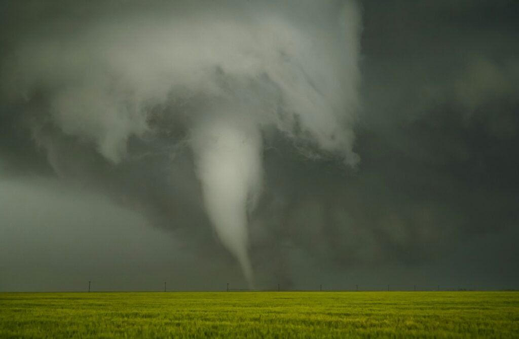
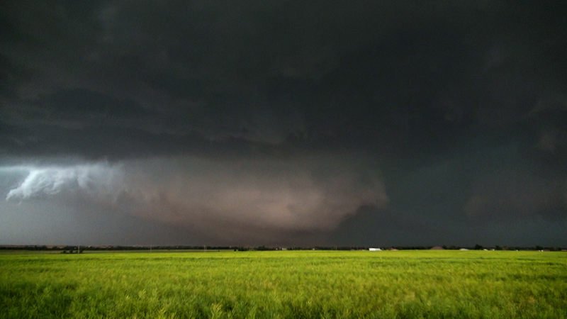
Here’s the gut-punch truth: on the most ominous days, the air over Oklahoma can feel heavy and electric, like the atmosphere is leaning in to whisper what happens next. Meteorologists translate that mood into physics – juicy dew points, explosive instability, and wind shear that twists storms into rotating supercells. A dryline can set the stage in the west, while a low-level jet roars by evening, feeding storms that spin like skaters pulling in their arms.
Those clues show up on instruments long before the first siren. The Oklahoma Mesonet, a dense, state-spanning network of weather stations, tracks conditions every few minutes across prairies and towns. Dual-polarization radar hints at debris lofted thousands of feet high, confirming a tornado in progress when seconds matter most. Even the hum of distant thunder becomes part of a bigger, data-rich conversation between sky and science.
The Day the Sky Roared: May 3, 1999
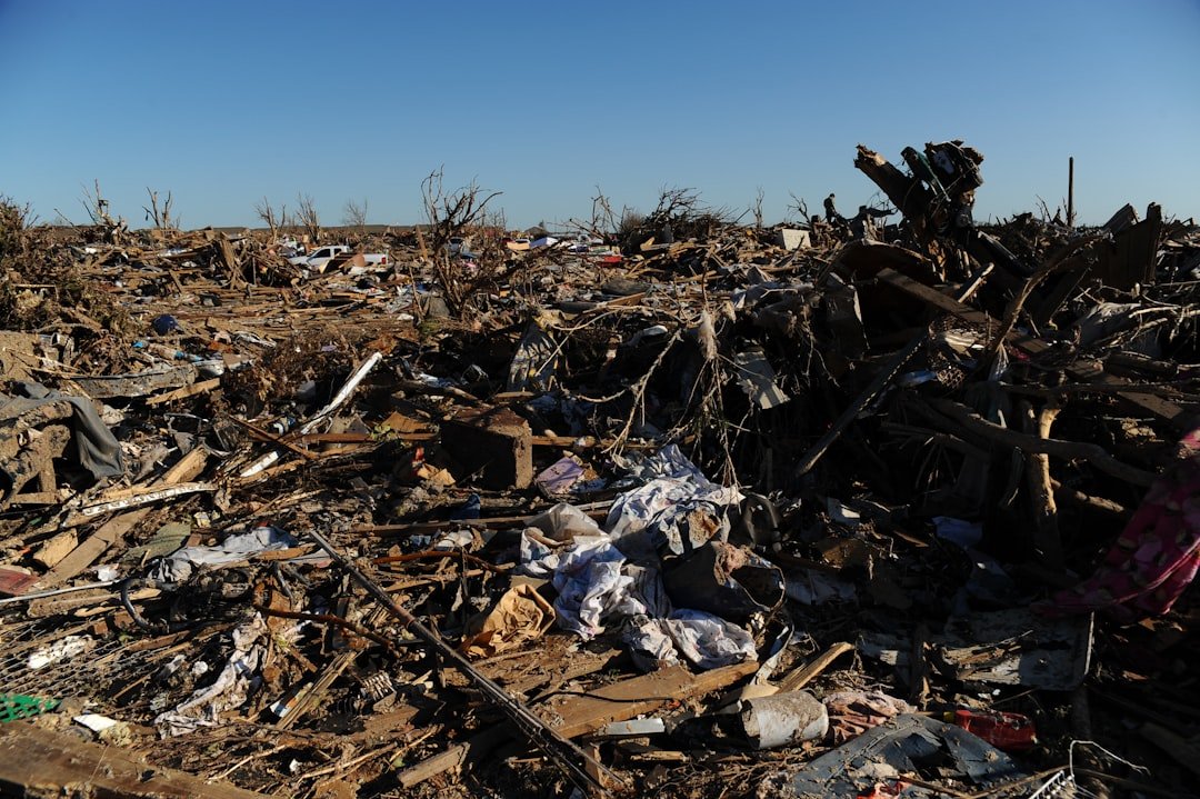
When the Bridge Creek–Moore tornado carved across central Oklahoma, it became a defining page in the state’s weather ledger. Rated at the top of the original Fujita scale, its violence was quantified by mobile Doppler measurements that stunned even seasoned researchers. Neighborhoods that had existed for decades were peeled open in minutes, and emergency managers found themselves grappling with damage that looked like the aftermath of a detonation.
That disaster didn’t just shatter homes; it changed habits and priorities. It pushed researchers to refine field campaigns and validated the value of mobile radars that could sample the lowest, nastiest parts of the storm. Communities began rethinking sheltering, safe rooms, and how to communicate urgency without panic. In many ways, the era of modern tornado research in Oklahoma was tempered in that storm’s heat.
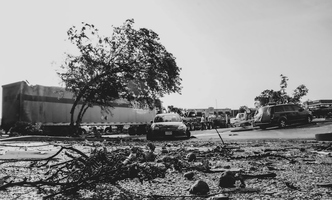
A City Tested Again: Moore, May 20, 2013
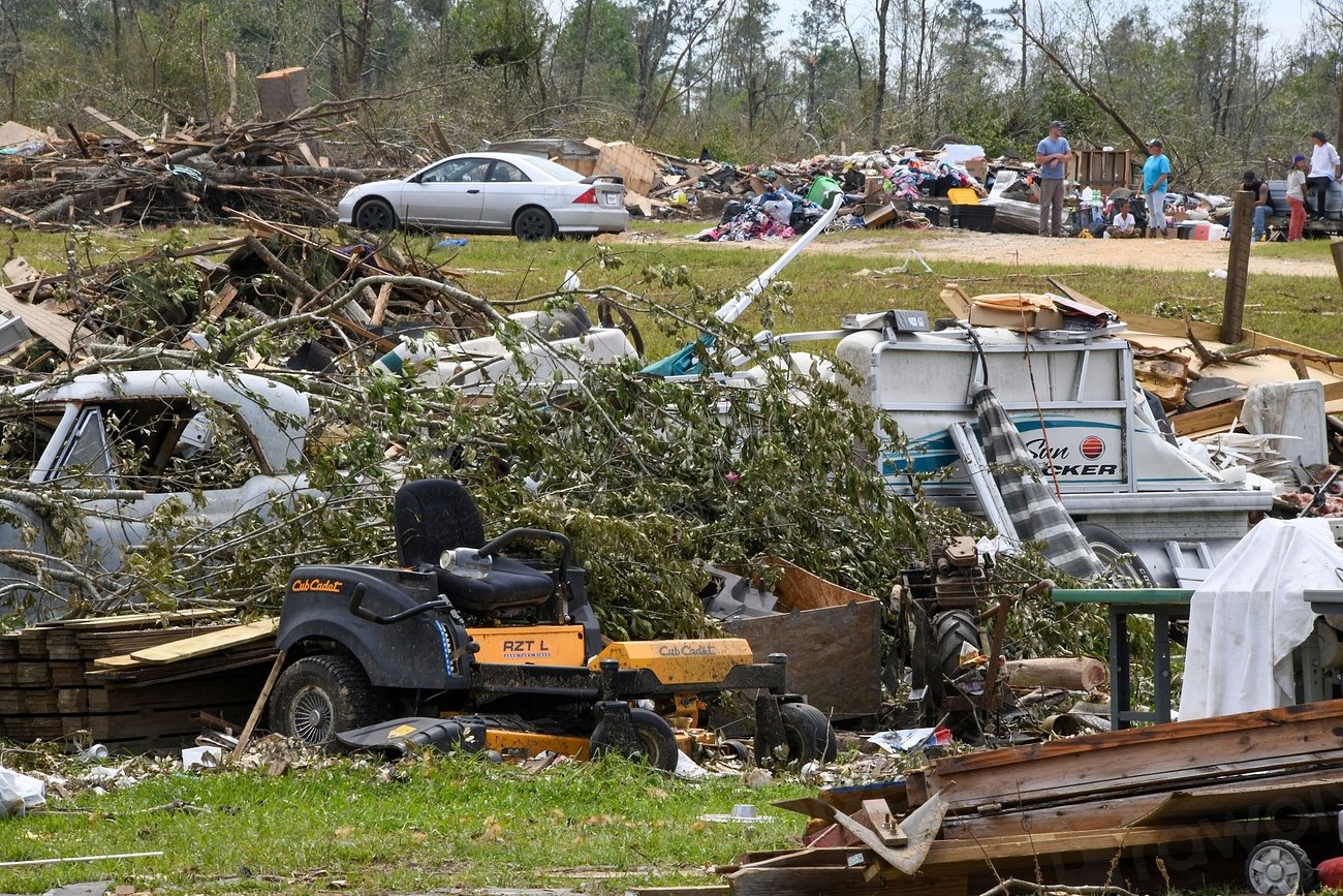
Fourteen years later, Moore faced the unthinkable again as another violent tornado tore a path through schools and neighborhoods. The Enhanced Fujita scale, updated to better match engineering realities, captured the ferocity in both wind and failure of structures. The city became a case study in how a community grieves, rebuilds, and demands better protection the second time around.
Policy followed pain. Stronger local building requirements and a surge of interest in residential safe rooms reflected a hard-earned consensus: construction details – from roof-to-wall connections to garage doors – matter when wind tests every nail. For many families, the new normal included helmets by the hallway, pet carriers near the closet, and a practiced plan that didn’t exist before. Moore’s resolve became part of Oklahoma’s scientific and civic DNA.
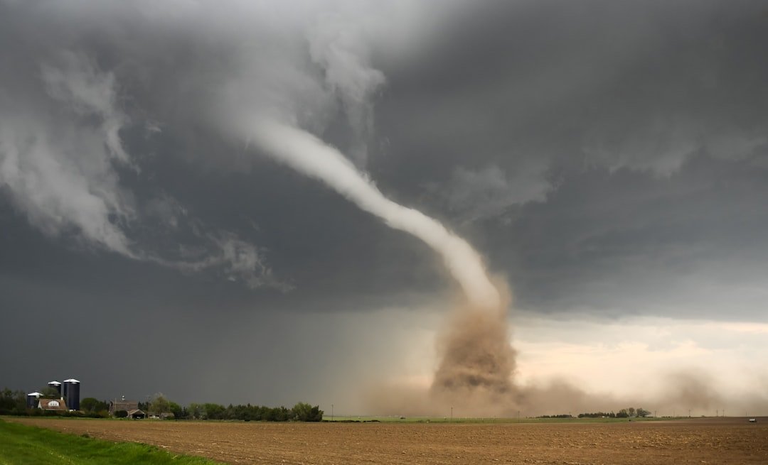
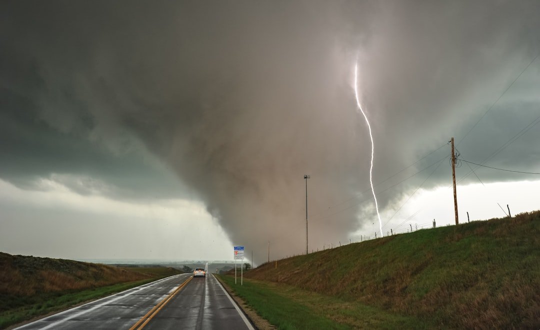
The Monster with a Twisting Heart: El Reno, May 31, 2013
The El Reno tornado earned an infamous distinction: the widest observed tornado on record, a sprawling, multi-vortex labyrinth hidden at times in rain. Its path and sudden changes in motion confounded even experienced storm chasers, underscoring that proximity can flip from thrilling to deadly in a heartbeat. Radar slices revealed a storm that didn’t behave like a neat textbook diagram but a living, evolving machine.
El Reno recalibrated risk for the research and chaser community. It spurred new approaches to mapping circulation, analyzing satellite vortices, and communicating hazards when visibility collapses. Training shifted from “where is the tornado” to “how fast can everything change,” with stronger respect for road networks, escape routes, and rainfall-wrapped danger. The event stands as a scientific milestone and a sober warning about uncertainty.
From Ancient Tools to Modern Science
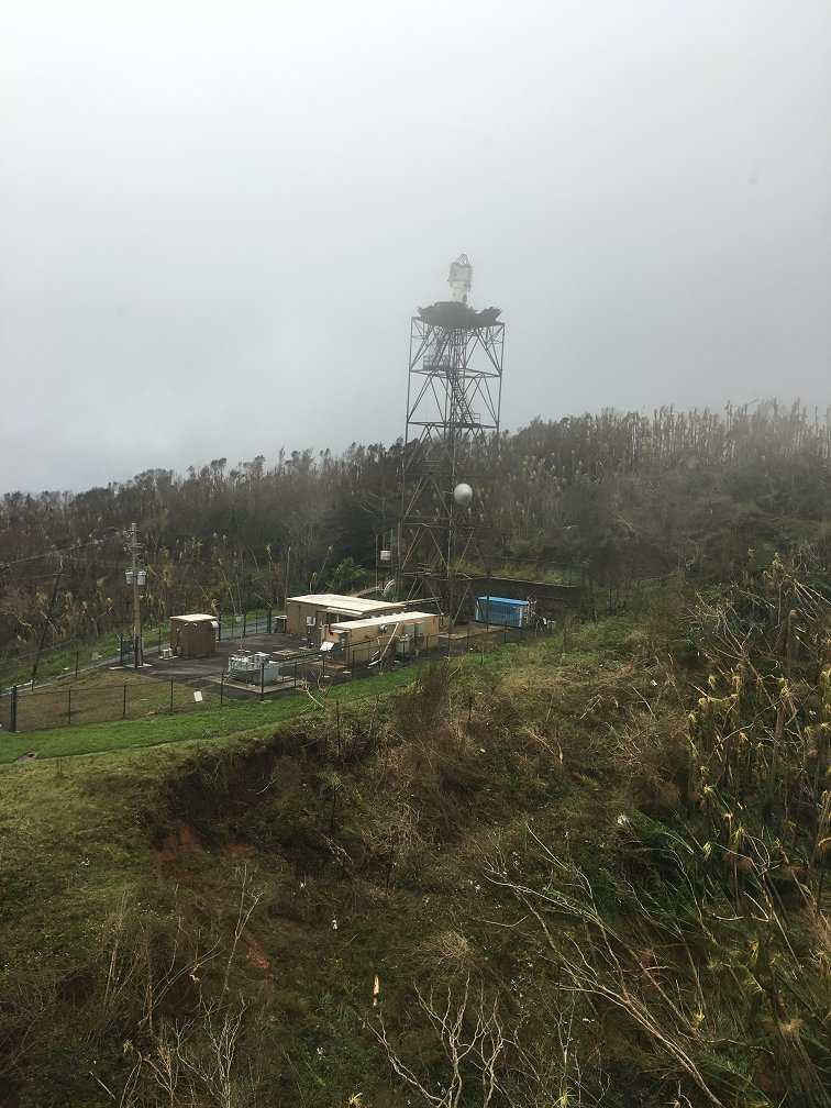
Long before radar, people read the sky like a ledger – cloud bases, wind shifts, the uneasy calm before a storm. Today, Norman’s research corridor pairs that folk awareness with cutting-edge tools: dual-pol radars that can spot debris, phased-array antennas that scan the atmosphere in seconds, and lightning mappers that flag intensifying updrafts. Mobile Doppler trucks nose close to the action, while drones and high-resolution models stitch together what’s happening at the surface and aloft.
The result is a faster, sharper warning ecosystem. Average lead times have improved over the decades, and impact-based warnings now emphasize specific threats like large, destructive tornadoes. Probabilistic guidance helps forecasters weigh evolving risk, while social scientists study how people interpret and act on alerts. In my first spring living in Norman, I learned that technology helps – but a practiced plan still carries the day.
Why It Matters
Tornadoes are low-probability at any one address but high-consequence for entire communities, and Oklahoma sits near the crossroads of prime storm ingredients. The state’s experience shows that the costliest failures often occur at familiar weak points: unanchored roofs, garage doors that blow inward, windows that become pressure valves. Scientists and engineers translate those patterns into practical fixes that are neither exotic nor expensive compared with the losses they prevent.
There’s also the bigger scientific picture. Researchers have documented more days featuring clustered, high-count outbreaks, even as year-to-year totals wobble and shift across regions. Some evidence points to subtle seasonal and geographic changes that challenge long-held assumptions about when and where risk peaks. For public safety, that means keeping complacency on a short leash and pushing risk communication that is plain, local, and relentlessly actionable.
The Future Landscape
Oklahoma is becoming the proving ground for Warn-on-Forecast, a vision in which high-resolution models and rapid-refresh radar feed minute-by-minute guidance on where rotation may tighten. Phased-array radar prototypes promise faster volume scans, reducing blind spots in the crucial lowest slices. Artificial intelligence is moving from buzzword to tool, flagging subtle patterns in radar and environmental data that human eyes might miss in a fast-breaking event.
On the ground, resilience will hinge on stubborn details. Wider adoption of wind-rated garage doors, hurricane clips, and continuous load paths could turn near-misses into survivable strikes. Equity matters too, because manufactured housing and under-resourced neighborhoods bear a disproportionate share of losses. The yardstick of success won’t be perfect forecasts; it will be ordinary families walking out of safe rooms to tell the story.
Conclusion

The next decision you make on a blue-sky day matters more than the one you make under a siren. Build a simple plan: know your safest interior room, stash helmets and sturdy shoes, and keep a charged flashlight and a whistle within reach. Install a weather app with wireless emergency alerts and, if you can, a NOAA Weather Radio that wakes you when storms turn serious.
If you’re rebuilding or renovating, ask about wind-rated doors, roof-to-wall connections, and anchoring; small upgrades add up when winds test every shortcut. Support your local forecast office, volunteer groups, and community shelters, and consider storm-spotter training to become part of the safety chain. Oklahoma’s hardest storms rewrote the playbook – now it’s on all of us to use it well. Ready to make your plan today?

Suhail Ahmed is a passionate digital professional and nature enthusiast with over 8 years of experience in content strategy, SEO, web development, and digital operations. Alongside his freelance journey, Suhail actively contributes to nature and wildlife platforms like Discover Wildlife, where he channels his curiosity for the planet into engaging, educational storytelling.
With a strong background in managing digital ecosystems — from ecommerce stores and WordPress websites to social media and automation — Suhail merges technical precision with creative insight. His content reflects a rare balance: SEO-friendly yet deeply human, data-informed yet emotionally resonant.
Driven by a love for discovery and storytelling, Suhail believes in using digital platforms to amplify causes that matter — especially those protecting Earth’s biodiversity and inspiring sustainable living. Whether he’s managing online projects or crafting wildlife content, his goal remains the same: to inform, inspire, and leave a positive digital footprint.