Texas doesn’t just experience weather – it collides with it. From a phantom wall of water in 1900 to a rainstorm that parked over Houston for days, a handful of events have rewritten the rules for how we forecast, build, and prepare. These storms are more than headlines; they’re pivot points that forced new science out of hard lessons. Today, as the Gulf warms and cities expand, the old playbook isn’t enough, and Texas knows it better than most. Here’s how a series of brutal encounters with wind, water, and ice reshaped the way we understand extreme weather – and what comes next.
The Hidden Clues
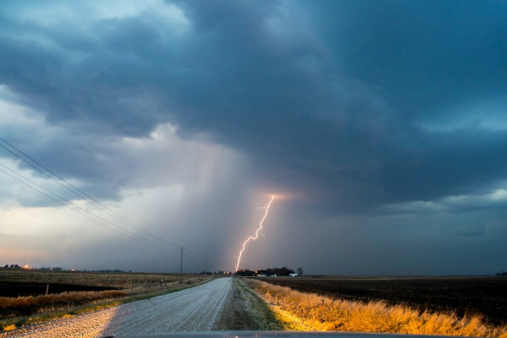
What if the sky tries to warn us and we just don’t recognize its language yet? Before every famous Texas storm, scattered signals appeared – air pressure slipping, sea surface temperatures creeping up, radar echoes sharpening into menace. The state’s history reads like a codebook of these hints, and each disaster helped scientists decipher more of it.
I grew up watching squall lines roll in over the Gulf, and the eerie hush before the first gust never felt like silence; it felt like a held breath. Texas taught forecasters to listen differently, to weigh slow-building patterns along with last-minute bursts. That shift – from snapshots to stories – has saved lives, changed infrastructure, and transformed emergency planning.
Galveston’s Reckoning: The 1900 Hurricane
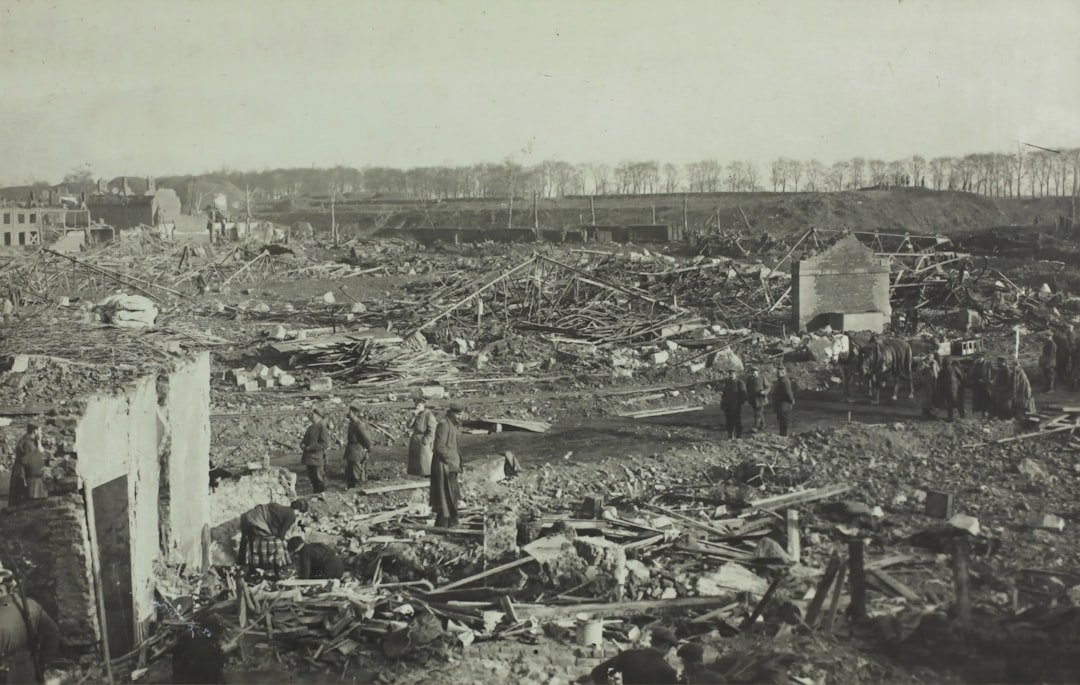
The 1900 Galveston hurricane arrived without modern satellites or radar, and the island paid the worst possible price. A massive storm surge overran the city, making it one of the deadliest natural disasters in U.S. history and a defining moment in coastal risk awareness. In the aftermath, Galveston built a seawall and elevated entire neighborhoods, literally jacking up houses and filling beneath them.
That bold engineering wasn’t cosmetic; it reframed the battle against surge as a design problem, not a fate. The catastrophe also spurred changes in forecasting and communication, laying groundwork for a more centralized, coordinated warning system. It’s no exaggeration to say that modern preparedness culture along the Gulf Coast grew from those flooded streets.
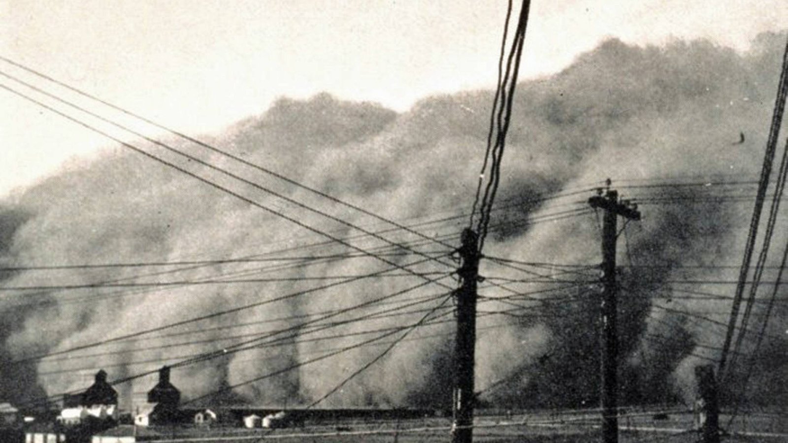
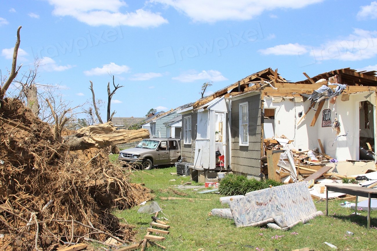
Waco’s Dark Funnel: The 1953 Tornado
On a spring afternoon in 1953, a violent tornado ripped into Waco and exposed deadly gaps in warning and sheltering. Downtown buildings crumpled, and the event became a nationwide wake-up call about urban tornado vulnerability. It pushed radar research and public education forward, accelerating efforts to detect rotation and to communicate urgency in ways that people would act on.
Texas learned that wind isn’t just a number on a scale; it’s a behavior to be tracked minute by minute. The legacy of Waco helped expand siren systems, improve building practices, and seed the culture of drills and alerts many of us take for granted. Every smartphone warning and Doppler scan owes something to that grim afternoon.
Carla’s Lesson: Mass Evacuation and Forecast Breakthroughs
Hurricane Carla in 1961 was huge – so sprawling that the wind field read like a continent on radar. Its approach triggered one of the largest coastal evacuations of its era, a logistical test Texas had to pass in real time. The storm pressed forecasters to translate probability into plain guidance, bridging the gap between scientific confidence and public action.
Carla’s high-impact, high-uncertainty setup drove the evolution of hurricane messaging: cones, surge maps, watch-to-warning transitions with clear timing. Evacuation planning matured, with officials refining staggered routes and contraflow concepts to move people faster. The storm set a template for how to manage risk at the scale of a coastline, not just a city.
Allison Rewrites the Flood Map
Tropical Storm Allison wasn’t a hurricane, and that’s precisely why it changed the conversation. It stalled over Houston in 2001, unleashing days of rain and historic flash flooding that swamped streets, hospitals, and research centers. The event proved that rainfall alone – without extreme winds – could be catastrophic in a dense, paved metropolis.
Allison helped reset the math: floodplain maps were reevaluated, design standards revisited, and the notion of “rare” rainfall reclassified in light of real-world totals. Hydrologists doubled down on modeling how water moves through urban bayous, culverts, and underpasses, treating the city like a living watershed instead of a static map. It was the moment when urban flood risk stopped being hypothetical and became a planning baseline.
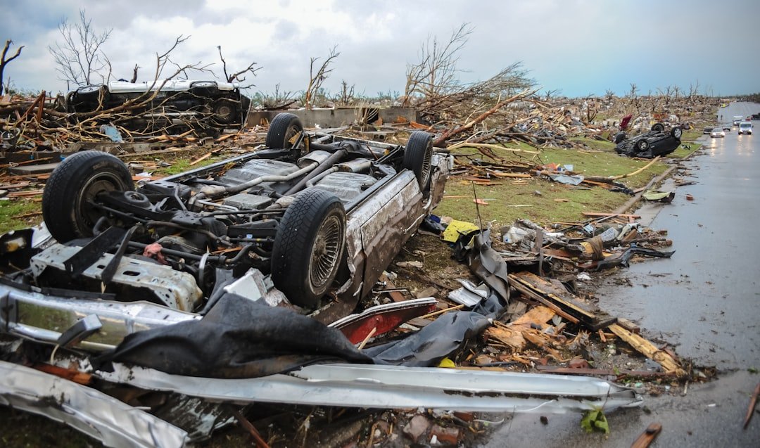
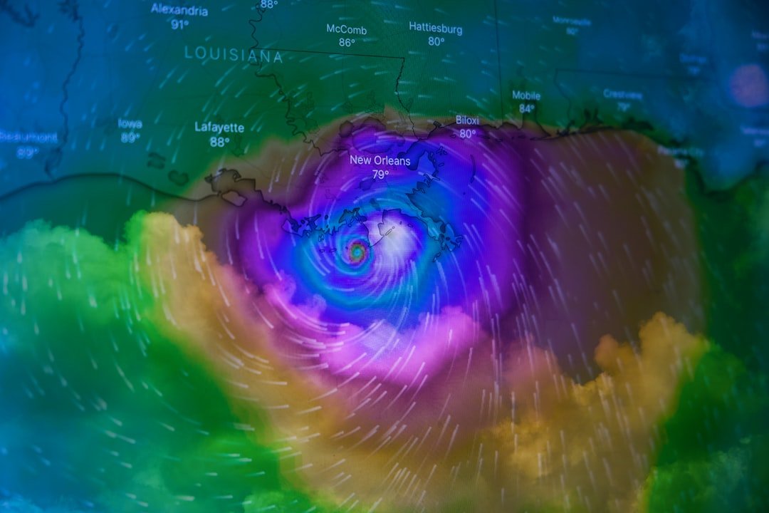
Harvey’s Standstill: When the Sky Wouldn’t Move
Hurricane Harvey in 2017 broke records not just with wind or surge, but with the sheer persistence of rain over the same region. The storm stalled near the coast and wrung moisture from a warm Gulf, delivering multiple feet of rainfall across greater Houston. It forced engineers and policymakers to confront compound risk – rainfall, runoff, and releases – happening all at once.
After Harvey, agencies updated rainfall frequency estimates and pushed tougher standards for detention, elevation, and critical facilities. The storm also reframed the limits of traditional categories: a Category number says wind, not water, and water is often what kills. Harvey’s legacy is a blueprint for designing cities around inevitable deluges rather than improbable ones.
Why It Matters
Texas storms pull the curtain on the most important truth in modern meteorology: hazard is a moving target. The historical baseline that planners relied on for decades has shifted, and the consequences are written across neighborhoods, supply chains, and power lines. When risk is dynamic, the old habit of planning to the average becomes a liability, not a comfort.
These events also reveal the power of timely, trusted information, from dual‑pol radar to street‑level flood guidance. They show how layered defenses – smarter codes, greener floodways, portable power, and clear alerts – work together better than any single fix. Most of all, they remind us that preparation is not panic; it’s the quiet work that makes tomorrow normal instead of historic.
From Ancient Tools to Modern Science
A century ago, Texans watched the horizon and read barometers; today, satellites, aircraft, and high‑resolution models map storms from ocean core to rooftop. Dual‑polarization radar discerns raindrop shapes and debris, improving tornado and flash‑flood warnings. Ensemble forecasts no longer deliver a single answer; they outline a field of possibilities and the odds behind each one.
That probabilistic approach – born from hard lessons in storms like Carla, Allison, and Harvey – helps emergency managers stage assets before the first drop falls. It also empowers the public to make tiered decisions: cancel the game, pack the car, or leave tonight. Science hasn’t removed uncertainty, but it has turned uncertainty into something you can plan around.
The Future Landscape
Looking ahead, Texas will lean on faster data and finer detail: next‑gen geostationary satellites, street‑scale flood models, and surge forecasts that factor in tides, river flows, and urban shape. Grid‑aware weather intelligence will help utilities pre‑position crews and balance loads as storms approach, reducing the human cost of outages. Coastal projects – from natural dunes to engineered barriers – will work in tandem rather than in competition.
At the same time, warmer Gulf waters and expanding pavement can amplify extremes, loading storms with more moisture and speeding runoff. The future is about coupling forecasts with design: permeable streets, higher thresholds for critical infrastructure, and shelters that assume multi‑day stress. If the past was about learning to see the hazard, the future is about building so it has nowhere to win.
Conclusion
Start small but start now: know your flood and surge zones, and keep a go‑bag that you actually update. Back up power needs with simple options – battery banks for devices, ice chests, and a plan for medicines that require cooling. If you live in a flood‑prone area, elevate valuables, scan documents, and walk your evacuation route before the season starts.
Support the invisible infrastructure by showing up: vote for drainage and resiliency projects, volunteer with community response groups, and participate in local flood‑alert pilots. Encourage schools and workplaces to run realistic drills and to integrate weather literacy into curricula. Texas storms will keep writing chapters; our job is to make sure the next ones are stories of near‑misses instead of milestones.

Suhail Ahmed is a passionate digital professional and nature enthusiast with over 8 years of experience in content strategy, SEO, web development, and digital operations. Alongside his freelance journey, Suhail actively contributes to nature and wildlife platforms like Discover Wildlife, where he channels his curiosity for the planet into engaging, educational storytelling.
With a strong background in managing digital ecosystems — from ecommerce stores and WordPress websites to social media and automation — Suhail merges technical precision with creative insight. His content reflects a rare balance: SEO-friendly yet deeply human, data-informed yet emotionally resonant.
Driven by a love for discovery and storytelling, Suhail believes in using digital platforms to amplify causes that matter — especially those protecting Earth’s biodiversity and inspiring sustainable living. Whether he’s managing online projects or crafting wildlife content, his goal remains the same: to inform, inspire, and leave a positive digital footprint.