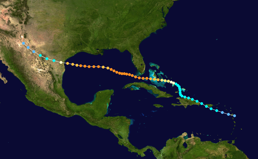
Some coastlines seem unlucky; the Gulf Coast feels targeted. Every few years, familiar names circle back like unwelcome callers, and the map fills with the same arcs toward Texas, Louisiana, Mississippi, Alabama, and Florida. The pattern looks personal, but there’s a cool, scientific logic beneath the heartbreak. Warm water, tricky winds, and a coastline shaped like a catcher’s mitt all conspire to guide storms into narrow, heavily populated corridors. Understanding those mechanics is more than curiosity – it’s a roadmap for survival in a warming world.
The Hidden Clues
Why do so many storms bend toward the same stretch of shoreline? The Gulf of Mexico is a semi-enclosed basin with water that warms early, stays hot late, and offers hurricanes a fast meal of energy on their final approach. Add the subtropical high – an atmospheric steering wheel that often sits to the east – and storms naturally arc around its western flank like marbles rolling along a bowl’s rim. The result is a gentle nudge that becomes a firm push toward the central and western Gulf.
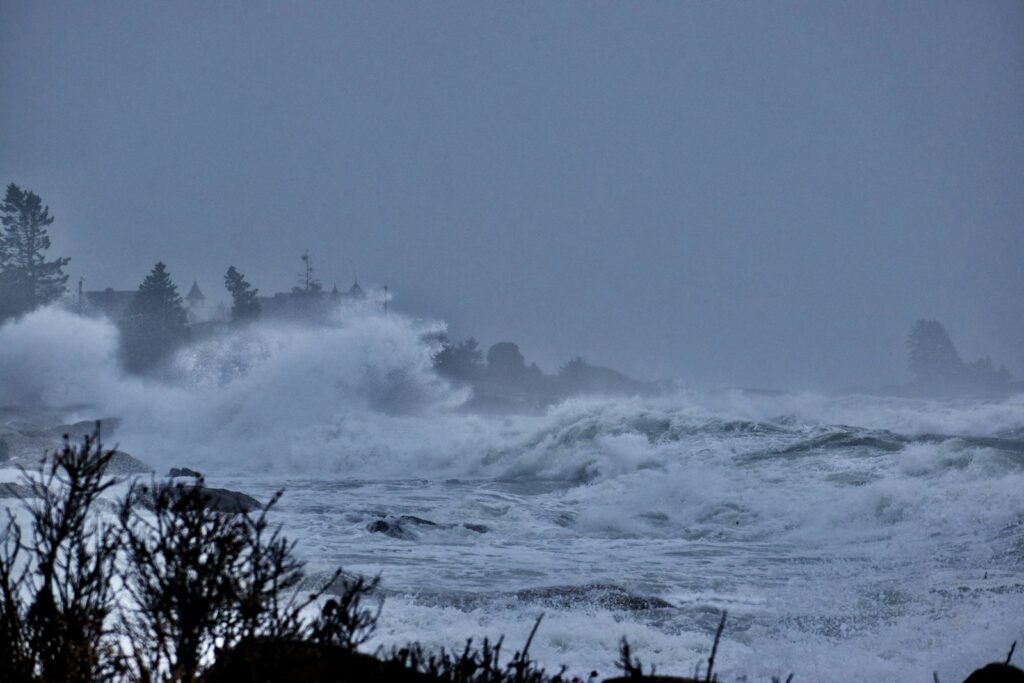
Geography adds one more shove at the finish line. Barrier islands, broad bays, and low-lying marshes create long, shallow shelves that amplify surge and slow storms down just enough to keep the damage close to shore. Once inland, flat terrain and saturated soils can help a storm linger, squeezing out more torrential rain. To residents, it feels like fate; to forecasters, it’s physics playing out in plain sight.
Heat Engines in a Hotter Gulf
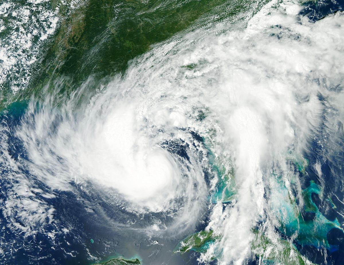
Hurricanes are heat engines, and the Gulf keeps raising the thermostat. It isn’t just the surface temperature that matters, but the ocean heat content – the deep reservoir of warm water that prevents storms from cooling their own fuel. The Loop Current and its warm eddies act like underwater batteries, storing energy that can power rapid bursts of intensification. When a storm crosses one of these eddies, it’s like finding an express lane on a crowded freeway.
In a warming climate, the atmosphere can also hold more water vapor, and that loads the dice for heavier rain. Warmer nights in late summer limit the natural cooling that sometimes tamps storms down before landfall. Even modest shear can be overcome when the oceanic fuel is this rich, especially close to the coast. Put simply, when the Gulf runs hot at depth, hurricanes run hot too.
Steering Winds and the Unforgiving Coastline
Steering currents – those broad, invisible rivers of air – decide where a storm goes, and the Gulf’s summer pattern often funnels systems toward the same gateways. The subtropical ridge can act like a guardrail, preventing a storm from curving out to sea and guiding it along the periphery toward Texas or Louisiana. Early-season systems sometimes sneak in from the Bay of Campeche, while late-season storms can hook toward the Florida Panhandle as fronts begin to sag south.
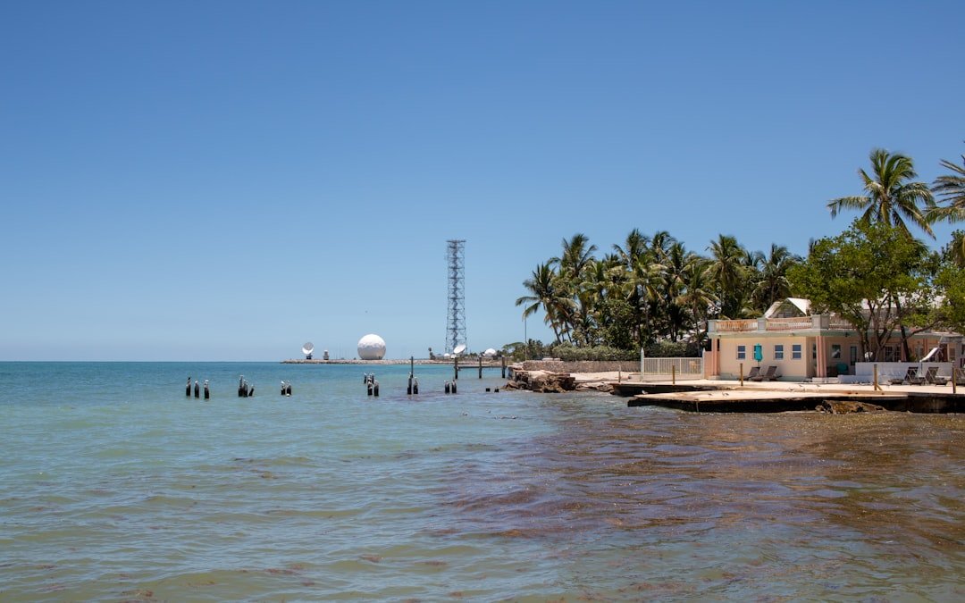
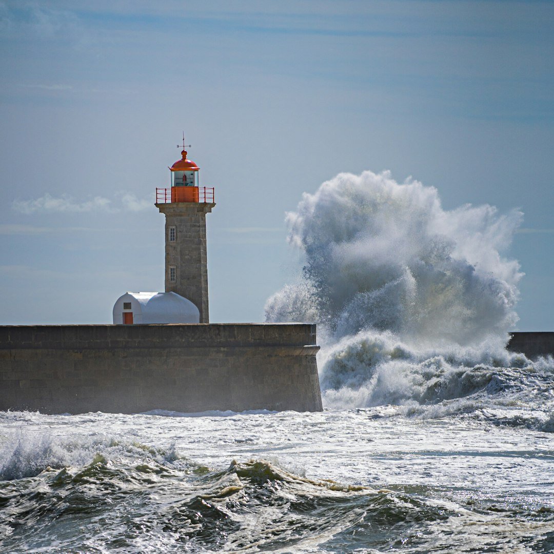
Then comes the coastline itself, which can squeeze and magnify the impacts. Concave shorelines concentrate surge, while bays and estuaries focus water like a lens. Low elevation and subsiding ground increase the reach of inundation, turning what would be a bad flood into a catastrophic one. When that water piles up against roads, refineries, neighborhoods, and ports, the Gulf’s strategic assets become its vulnerabilities.
Rapid Intensification: The New Red Alert

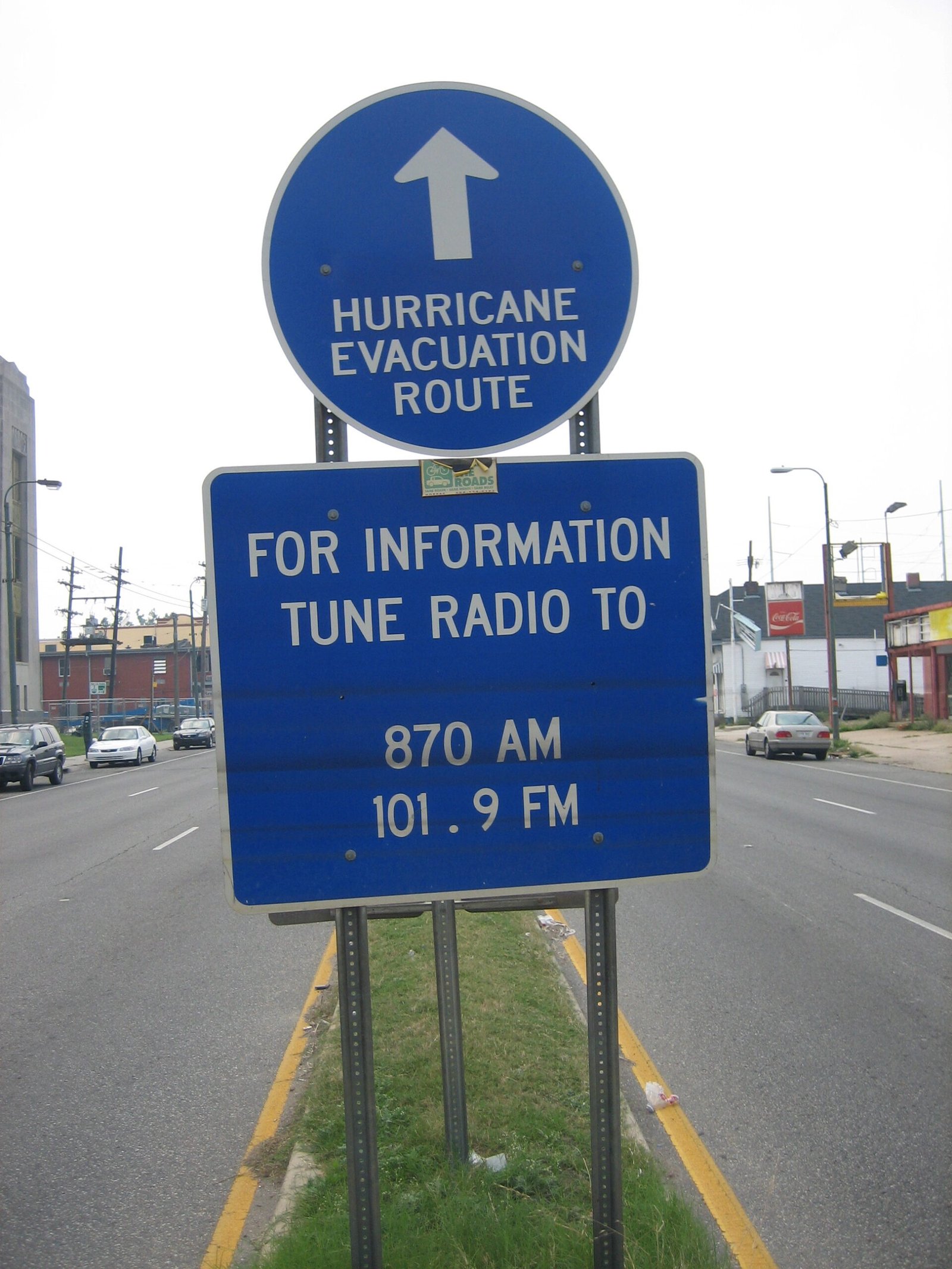
Rapid intensification – an increase in maximum sustained winds of at least 35 mph within 24 hours (about one hurricane category) – has shifted from outlier to recurring headline. In the Gulf, the combination of deep warm water, moist inflow, and relatively low shear can “flip the switch” just hours before landfall. That’s a forecasting nightmare for emergency managers who need time to move people, protect hospitals, and close industrial facilities safely. It can also change the risk picture overnight, turning a planned shelter-in-place into a last-minute evacuation decision.
Scientists have improved alerts for these leaps, but uncertainty still looms at short lead times. Internal storm dynamics, like eyewall replacement cycles, can stall or accelerate the process in ways that models struggle to nail down precisely. When intensification happens close to the coast, even a well-communicated risk can outrun the clock. It’s the meteorological equivalent of a curveball that breaks late and hard.
From Ancient Tools to Modern Science
Long before satellites, Gulf mariners read the sky, the swell, and the barometer’s slow collapse for clues. Today’s arsenal looks almost futuristic: polar-orbiting and geostationary satellites, hurricane-hunter aircraft slicing through the eyewall, and dropsondes parachuting down to sample pressure, wind, and moisture. Underwater gliders now patrol the Loop Current, measuring the heat content that fuels intensification. That ocean intelligence feeds directly into forecast models.
On the modeling front, high-resolution systems such as NOAA’s newer hurricane analysis and forecast frameworks simulate storm structure, surge, and rainfall with growing skill. Data assimilation improved the starting portrait of each storm, which is critical for track and intensity guidance. Probabilistic surge tools help communities understand not just what could happen, but how likely different outcomes are. The gap between what we wish we knew and what we actually know is narrowing, even if it isn’t closed.
Why It Matters
The Gulf Coast isn’t just a line on a map; it’s a dense weave of lives, cultures, and critical infrastructure. Energy corridors, shipping hubs, fisheries, and tourism all share the same vulnerable waterfront with schools, neighborhoods, and historic districts. When a storm hits the same places again and again, recovery stacks on top of recovery, and the margin for error shrinks. Even when forecasts improve, exposure multiplies the bill.
There’s also a public-health and equity dimension that can’t be ignored. Heat and humidity after a landfalling storm strain the body, especially for elders and outdoor workers, while outages complicate medical care. Flooded homes can mean mold, displacement, and months of bureaucratic limbo. Lower-income communities often sit in the most flood-prone footprints and have the fewest resources to bounce back, turning a natural hazard into a social crisis.
The Future Landscape
Looking ahead, the signals are sobering but not paralyzing. Continued ocean warming and rising seas make heavier rainfall and larger storm surges more likely, even if long-term hurricane counts wobble from year to year. Near-coast rapid intensification may remain the hazard that keeps emergency planners up at night, because hours matter when bridges, petrochemical plants, and hospitals must be secured. At the same time, smarter building codes and elevated structures can dramatically cut losses, as newer construction has shown in more recent storms.
Nature-based solutions – like restoring wetlands, oyster reefs, and barrier islands – can shave precious inches off surge and waves. Microgrids and distributed energy can shorten outages, keeping cooling centers and clinics running in the hottest weeks. Better risk communication, especially about probabilities and uncertainty, can help families make decisions without waiting for perfect clarity. None of this stops hurricanes, but it can blunt the worst blows.
The Hidden Human Story
I still remember waiting on a sticky dock in Galveston as the sky lost its color, the air suddenly smelling like hot pennies and rain. Everyone spoke in short sentences, half watching the water, half checking their phones, because we all knew that turn to the north could come at any hour. That uneasy vigil is common all along the Gulf, where storms arrive as both weather and event. In kitchens and break rooms, people swap evacuation routes like recipes.
That lived memory is its own form of data, and it should sit beside the spreadsheets. When communities share high-water marks, power-restoration timelines, and which intersections flood first, they create hyperlocal knowledge that models can’t easily see. Pair that with the best science, and decisions get sharper, faster, and fairer. The story of the Gulf’s hurricanes is not just atmospheric – it’s deeply human.
How You Can Help
Start with your own risk picture: learn your evacuation zone, elevation, and likely flood pathways, then build a plan that accounts for pets, medications, and power outages. Harden what you can – roof tie-downs, cleared gutters, trimmed trees, and documented insurance are unglamorous steps that pay off. If you live inland, remember that rainfall and river flooding can rival coastal surge, and prepare accordingly with safe routes and backup charging.
Support the bigger fixes that reduce repeat pain. Vote for resilient infrastructure, from raised roads and stronger grids to wetland restoration that defends multiple towns at once. Back local science efforts that monitor sea level, rainfall, and water quality, and share trustworthy forecast updates in your circles when storms threaten. Small actions scale when a whole coast moves together.

Suhail Ahmed is a passionate digital professional and nature enthusiast with over 8 years of experience in content strategy, SEO, web development, and digital operations. Alongside his freelance journey, Suhail actively contributes to nature and wildlife platforms like Discover Wildlife, where he channels his curiosity for the planet into engaging, educational storytelling.
With a strong background in managing digital ecosystems — from ecommerce stores and WordPress websites to social media and automation — Suhail merges technical precision with creative insight. His content reflects a rare balance: SEO-friendly yet deeply human, data-informed yet emotionally resonant.
Driven by a love for discovery and storytelling, Suhail believes in using digital platforms to amplify causes that matter — especially those protecting Earth’s biodiversity and inspiring sustainable living. Whether he’s managing online projects or crafting wildlife content, his goal remains the same: to inform, inspire, and leave a positive digital footprint.