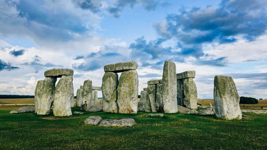
Each hurricane season sweeps in with the same uneasy question: what will still be there when the skies clear? Along the Atlantic and Gulf coasts, storms do more than scatter debris and flood streets; they redraw the edges of the continent, sometimes in ways that last far beyond a news cycle. Scientists now treat hurricanes not only as weather events but as geomorphic engines, moving sand, carving channels, and tipping delicate balances already strained by rising seas. The mystery isn’t whether change happens – it’s how much, how fast, and where communities can still keep pace. The emerging story blends long-term forces with punctuating shocks, revealing a shoreline that’s never truly fixed.
The Hidden Clues
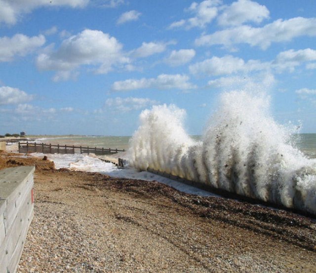
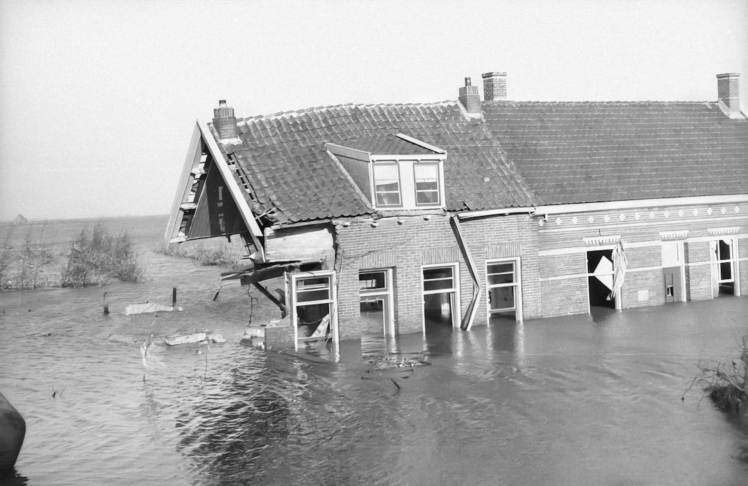
What if the beach you visit this summer isn’t the same beach by winter, not just in mood but in map lines? Storm surge lifts whole dunes and pushes them inward, the ocean’s brute force acting like a conveyor belt that runs only during the worst hours of a hurricane. In the aftermath, geologists search for clues: fresh overwash fans spread like pale tongues across barrier islands, new inlets quietly capture tidal flows, and buried soil layers appear in steep scarps where waves bit into the shore.
These features are not random scars – they are signatures of a system doing what it has always done, only faster. I remember walking a post-storm beach and realizing the “cliff” I stood on had been a gentle berm days earlier; the land had shifted beneath familiar footsteps.
From Ancient Tools to Modern Science
Long before satellites, coastal change was tracked by hand-drawn charts and lighthouse keepers’ notes, meticulous but thin slices of time. Today, scientists pair high-resolution lidar, drone surveys, and on-the-fly satellite imagery to watch shorelines migrate in near real time. Instruments anchored offshore capture wave energy and surge heights, while beach profiles are resurveyed after every major storm to measure what moved and where it went.
Core samples pulled from island interiors reveal older storm layers – coarse sands tucked into quiet marsh mud – proof that big hurricanes have been reworking coasts for centuries. By blending modern sensors with these buried archives, researchers can separate routine seasonal shuffles from step changes that mark a new normal.
Barrier Islands on the Move
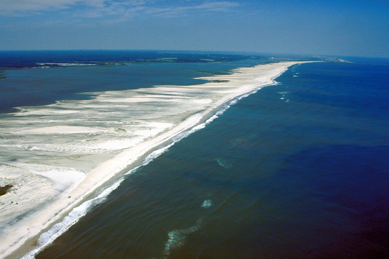
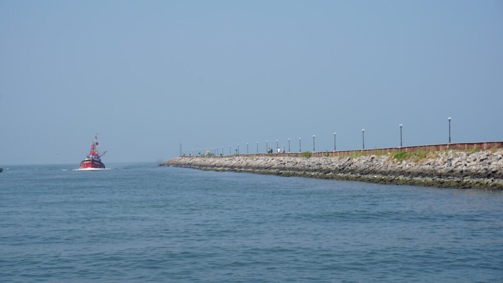
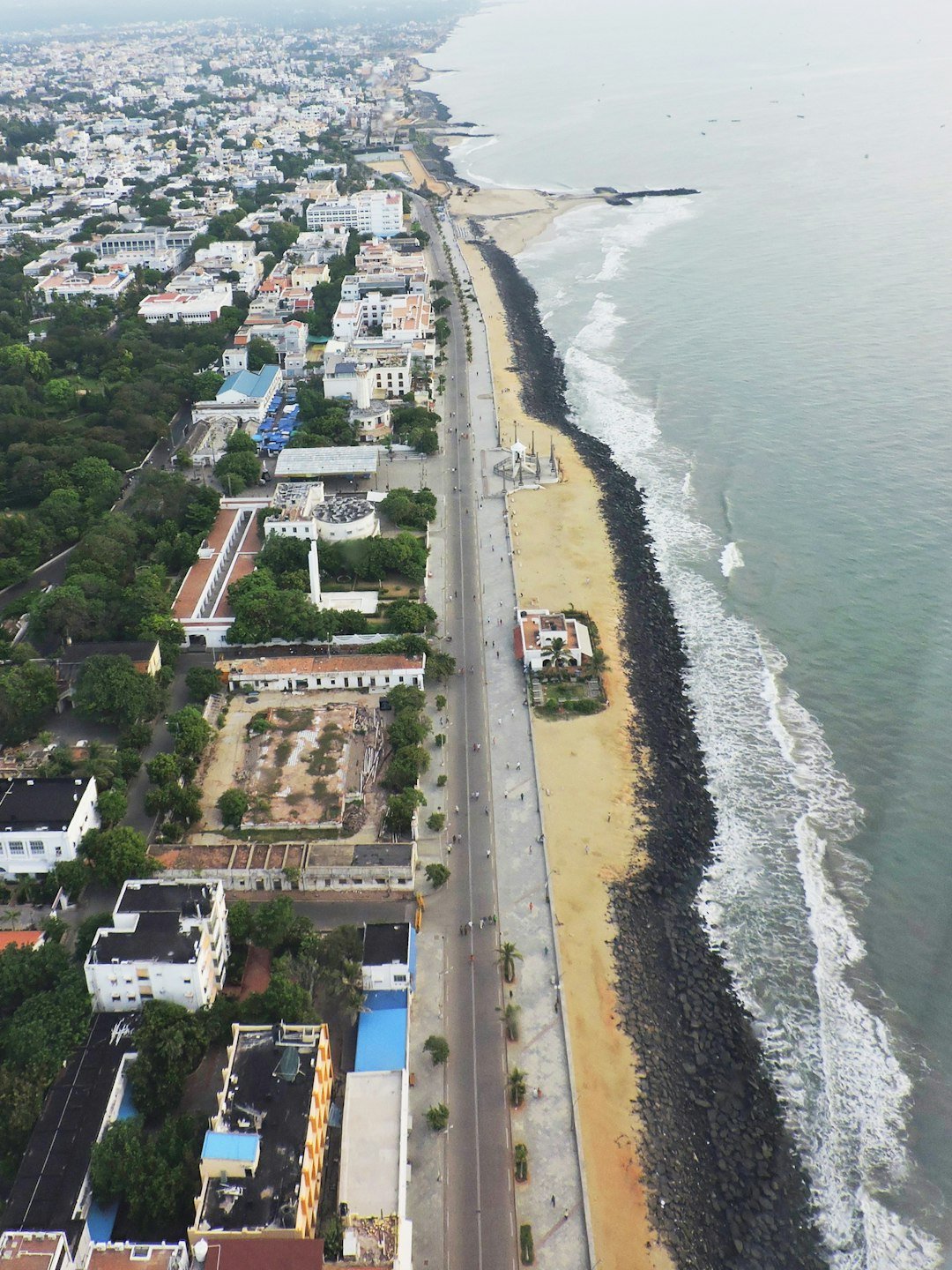
America’s Atlantic and Gulf barriers – think of the Outer Banks, Fire Island, and Padre Island – act like storm buffers and shape-shifters at once. During intense hurricanes, waves tear gaps through narrow spots, forming inlets that rewire currents and sediment pathways, sometimes for years. Overwash carries sand from the beach crest into back-barrier marshes, a natural “rollover” that helps islands migrate landward as seas rise.
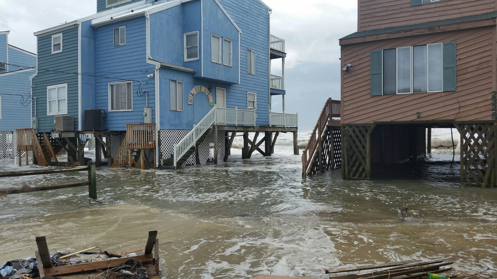
When we block that motion with roads and seawalls, islands often thin and lower instead, leaving towns more exposed despite the hard defenses. The paradox is stark: the very movement that protects communities long term is the movement we most try to stop.
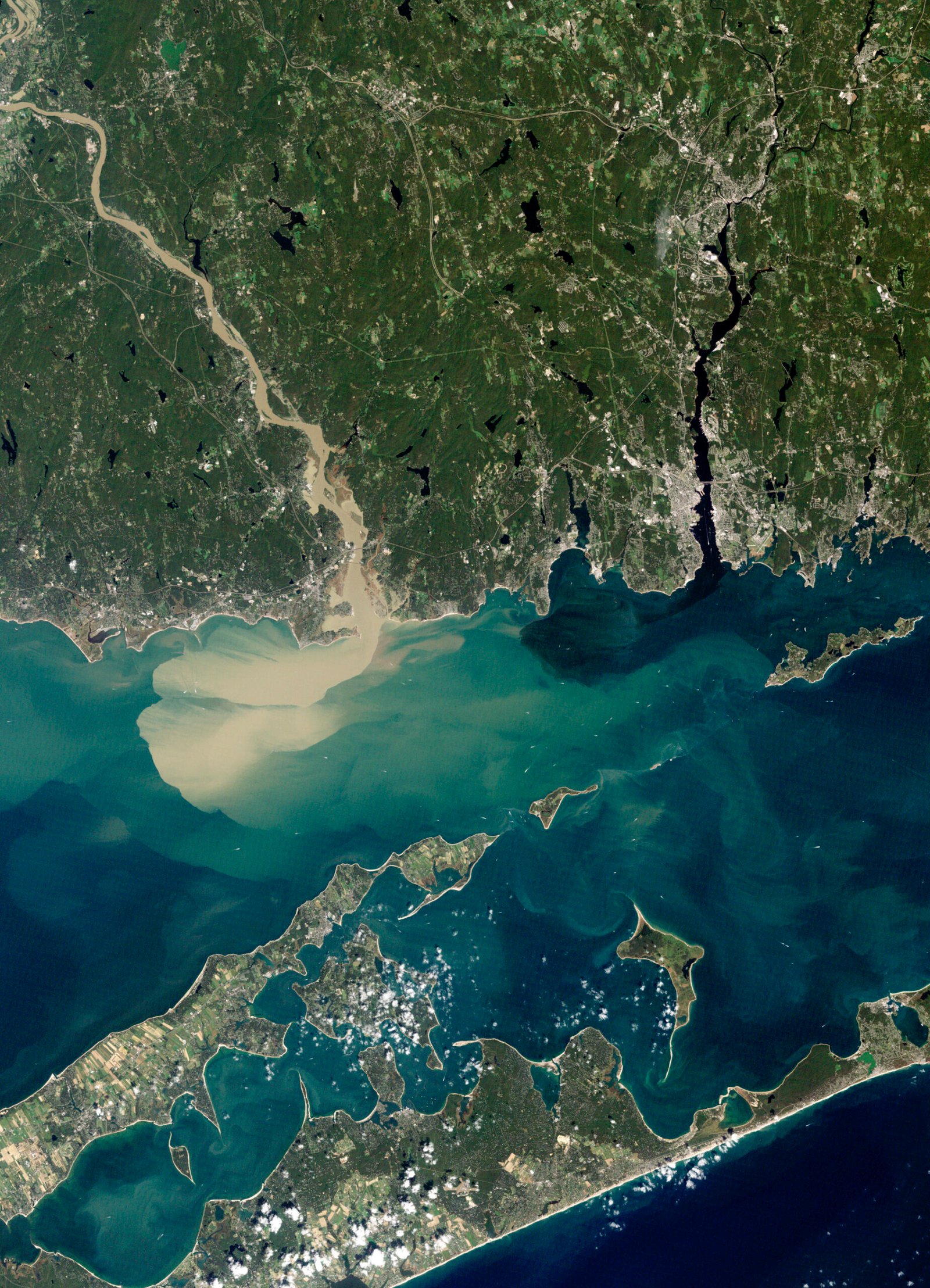
Deltas, Subsidence, and the Long Memory of Storms
Nowhere is the question of permanence more loaded than in river deltas like coastal Louisiana, where land is already sinking and starved of new sediment. Hurricanes can rip open marshes, topple vegetation that holds soil in place, and push salty water deep into freshwater wetlands, turning them into open water that may not rebound. In some cases, storms also deliver sediment pulses that rebuild shoals and barrier fragments, but whether that gift sticks depends on post-storm currents and human alterations upstream.
When levees trap river mud from spreading, storms act mostly as erasers rather than editors, subtracting land faster than nature can print it back. The coastline’s “memory” here is long and painful, a record of many small losses punctuated by abrupt, map-changing blows.
Why It Matters
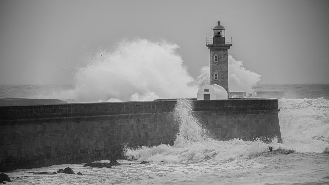
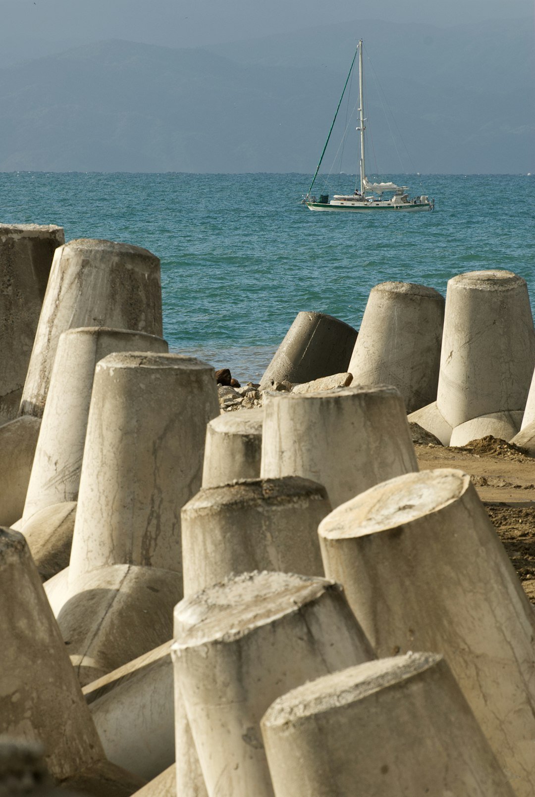
This is more than beachfront aesthetics; it’s a ledger of risk, equity, and national infrastructure. Roughly about two in five Americans live in coastal counties, and many critical assets – ports, refineries, military bases, highways, evacuation routes – sit within storm surge zones that are growing wider as the baseline sea level creeps up. Insurance markets feel the tremors first, with premiums climbing and coverage shrinking where maps show compound flooding from surge and rain. Traditional fixes like beach nourishment can buy time but often wash away in the next big blow, turning multi-million-dollar projects into short-lived sand sculptures.
The science says the durable investments are the ones that work with sediment movement – restoring dunes and wetlands, elevating or relocating structures, and opening space for barrier islands to roll landward rather than pinning them in place.
Global Perspectives
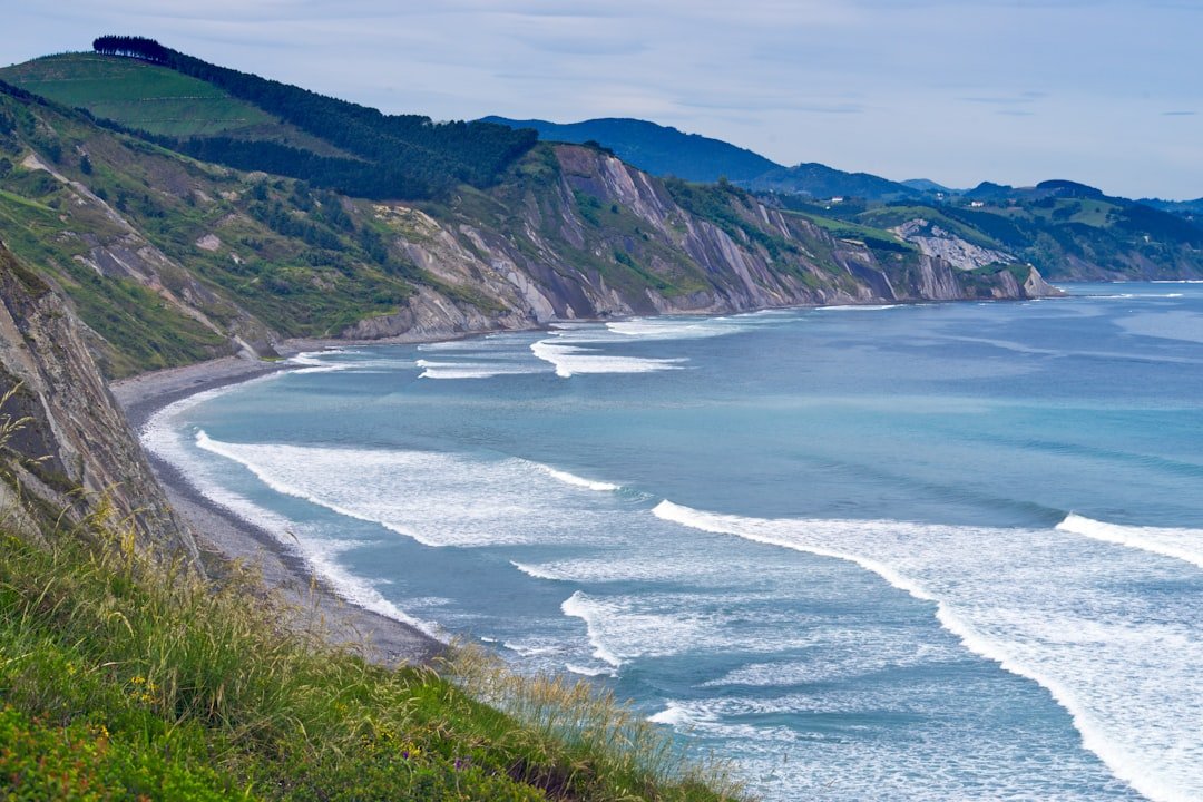
Other coastlines face similar tests and offer telling lessons. In parts of the Caribbean and the western Pacific, storms routinely rearrange coral sands, yet reefs and mangroves blunt some of the most destructive waves when they are healthy. Countries along the Bay of Bengal have pioneered early-warning systems and cyclone shelters that slash death tolls, reminding us that social infrastructure can be as protective as concrete.
Northern Europe’s embrace of nature-based defenses – oyster reefs, managed realignment, floodable parks – shows how coastlines can absorb energy without losing character. The common thread is humility: acknowledging that shorelines move and then designing with that motion, not pretending to freeze the tide.
The Future Landscape
Looking ahead, models suggest hurricanes will draw more energy from warmer waters, raising the odds of rapid intensification close to shore and pushing higher storm surges onto already elevated seas. That doesn’t guarantee more landfalls every year, but it stacks the deck toward bigger coastal reworkings when landfalls happen. Emerging tools – AI-assisted surge forecasting, real-time morphodynamic models, and community-scale digital twins – will help planners test where sand, water, and people move under different storm tracks.
New materials and designs aim to break the old binary of “hard wall” or “do nothing,” with living shorelines, hybrid reefs, and dunes engineered to self-heal after storms. The defining challenge is governance: aligning local zoning, federal funding, and community goals fast enough to keep up with a coast that’s already on the move.
Engineering with the Grain of Nature
Engineers and ecologists increasingly speak the same language: build for change, not against it. Restored dunes backed by native vegetation can capture windblown sand between storms, quietly raising and widening the buffer that surge must cross. Oyster and coral projects roughen nearshore waters so waves break sooner, sparing the beach the worst of their punch while creating habitat.
Elevated roads and utilities acknowledge periodic flooding rather than trying to banish it, cutting recovery times when water inevitably returns. The goal isn’t to defeat hurricanes; it’s to reduce the damage they do while letting the landscape perform its age-old dance.
Living With Uncertainty
Coastal residents don’t need a lecture on uncertainty – they live it, season after season. What science can offer is clearer framing: not “if” the shoreline will change, but how to plan for the range of changes most likely under different storm and sea-level scenarios. That means updating flood maps with the latest surge and rainfall data, stress-testing evacuation routes, and widening setbacks where island rollover is inevitable.
It also means recognizing the limits of memory; a quiet decade invites complacency, but sediment budgets and sea-level trends keep ticking in the background. The more we normalize flexible plans and honest timelines, the less shocking the next re-drawn shoreline will feel.
What You Can Do
Individual actions won’t stop a hurricane, but they can tilt the odds toward smarter, safer coasts. Support local dune and wetland restoration efforts, which amplify natural buffers and give storm-pushed sand places to land. Ask officials to adopt building elevations, open-space setbacks, and buyout programs that steer the most at-risk structures out of harm’s way before the next emergency. Pay attention to flood disclosures, stormwater upgrades, and evacuation plans in your community, and treat them as essential civic infrastructure. Most of all, keep the conversation grounded in science and neighbors’ lived experience – both are needed to choose a coastline we can live with.

Suhail Ahmed is a passionate digital professional and nature enthusiast with over 8 years of experience in content strategy, SEO, web development, and digital operations. Alongside his freelance journey, Suhail actively contributes to nature and wildlife platforms like Discover Wildlife, where he channels his curiosity for the planet into engaging, educational storytelling.
With a strong background in managing digital ecosystems — from ecommerce stores and WordPress websites to social media and automation — Suhail merges technical precision with creative insight. His content reflects a rare balance: SEO-friendly yet deeply human, data-informed yet emotionally resonant.
Driven by a love for discovery and storytelling, Suhail believes in using digital platforms to amplify causes that matter — especially those protecting Earth’s biodiversity and inspiring sustainable living. Whether he’s managing online projects or crafting wildlife content, his goal remains the same: to inform, inspire, and leave a positive digital footprint.