Florida’s coastline looks permanent on postcards, but hurricanes keep carving, flooding, and rewriting the state’s story in fast, unforgettable strokes. From the 1928 Okeechobee catastrophe to Andrew, Michael, Ian, and Idalia, each landmark storm forced scientists, builders, and communities to rethink what safety really means. The mystery isn’t whether the next storm will come; it’s how the land and people will adapt when it does. Researchers are piecing together hidden evidence in mud cores, satellite data, and insurance ledgers to show how storms alter ecosystems, economies, and even migration patterns. The path forward blends new science with old wisdom, and it starts with recognizing the clues already under our feet.
The Hidden Clues
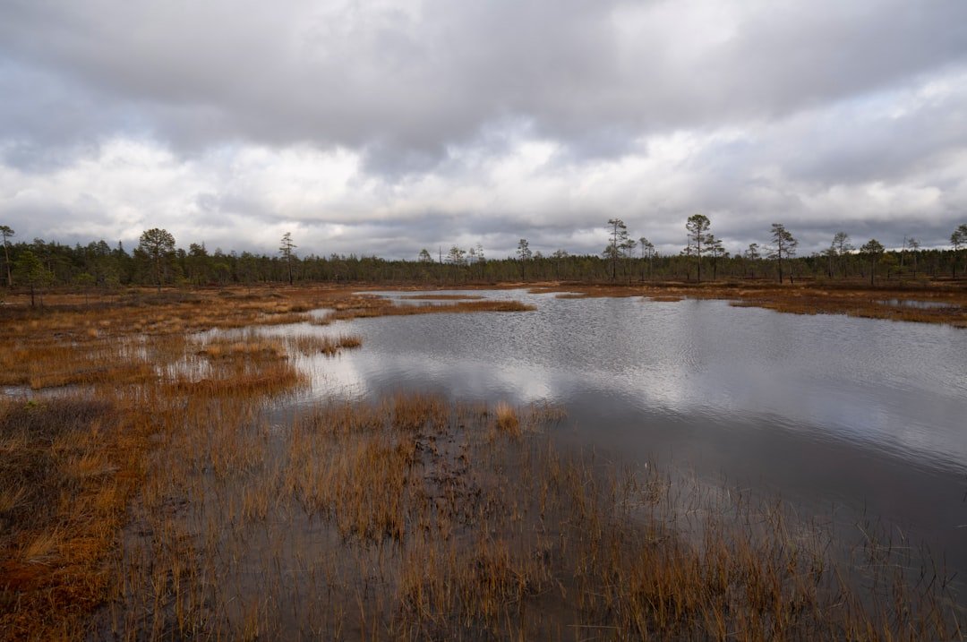
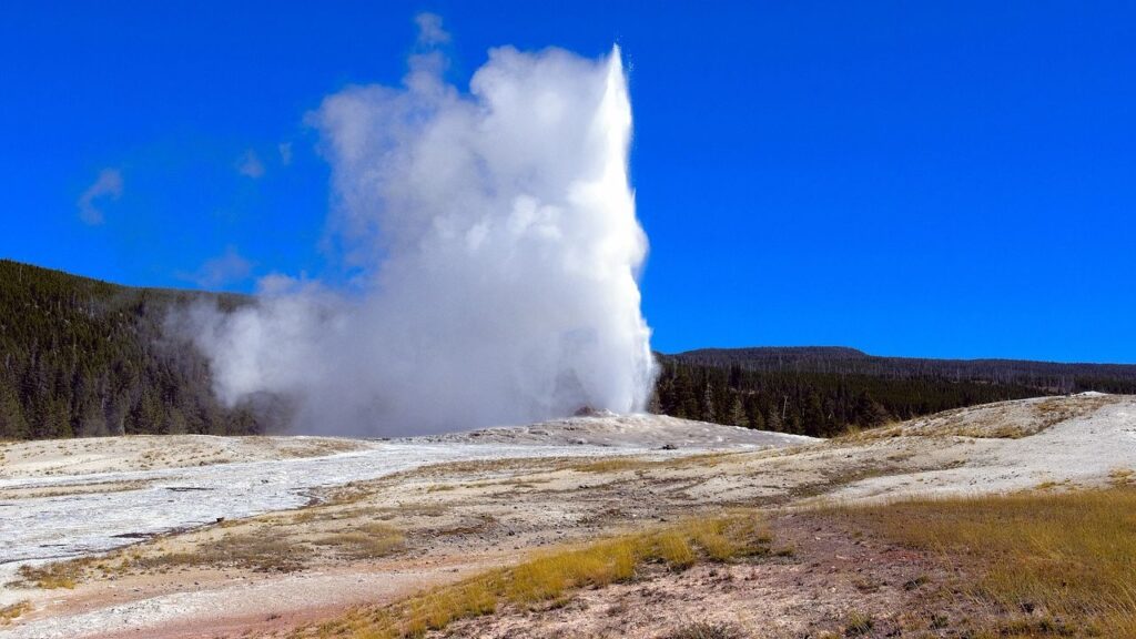
Look closely at Florida’s wetlands and you’ll find quiet archives of past fury: layers of shell, sand, and peat laid down by storm surge like pages in a long, restless book. In the Everglades, thin bands of marine sand in freshwater marsh cores reveal moments when saltwater barreled far inland, giving scientists a timeline of ancient landfalls. Tree rings along the Big Bend carry subtle signatures of stress from salt and wind, hinting at seasons when rivers reversed and forests gasped. I still remember walking a mangrove shoreline near Everglades City and seeing storm-torn roots cradling bright, newborn sediment – a messy, beautiful record in real time. Those clues help confirm that certain coasts are regularly reset, not rarely tested.
Paired with tide-gauge records and high-water marks, these natural files show how each era’s biggest storms reworked the map. They help explain why some barrier islands leap landward during extreme surges, leaving behind buried beach ridges like footprints. They show that overwash fans – those fan-shaped mounds of sand thrown inland – are not accidents but part of how islands survive. And they reveal that what looks like destruction to us can be renewal for mangroves and salt marshes that thrive on sediment deliveries. The science is unromantic and powerful: storms are architects as much as they are wrecking balls.
Storms That Rewrote the Map
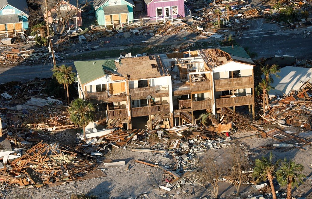
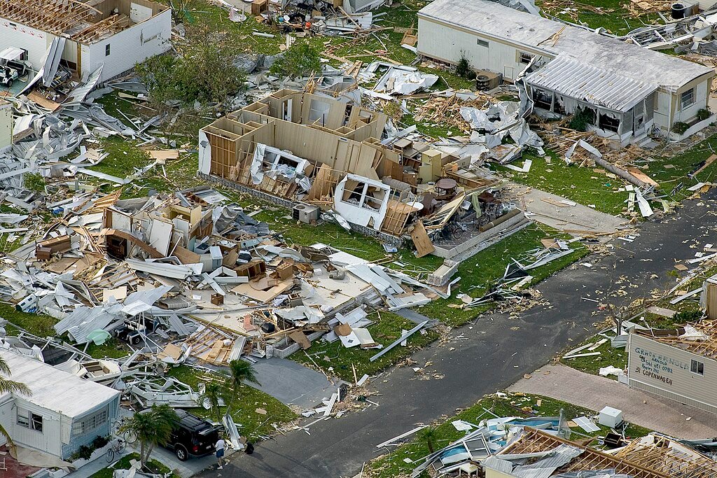
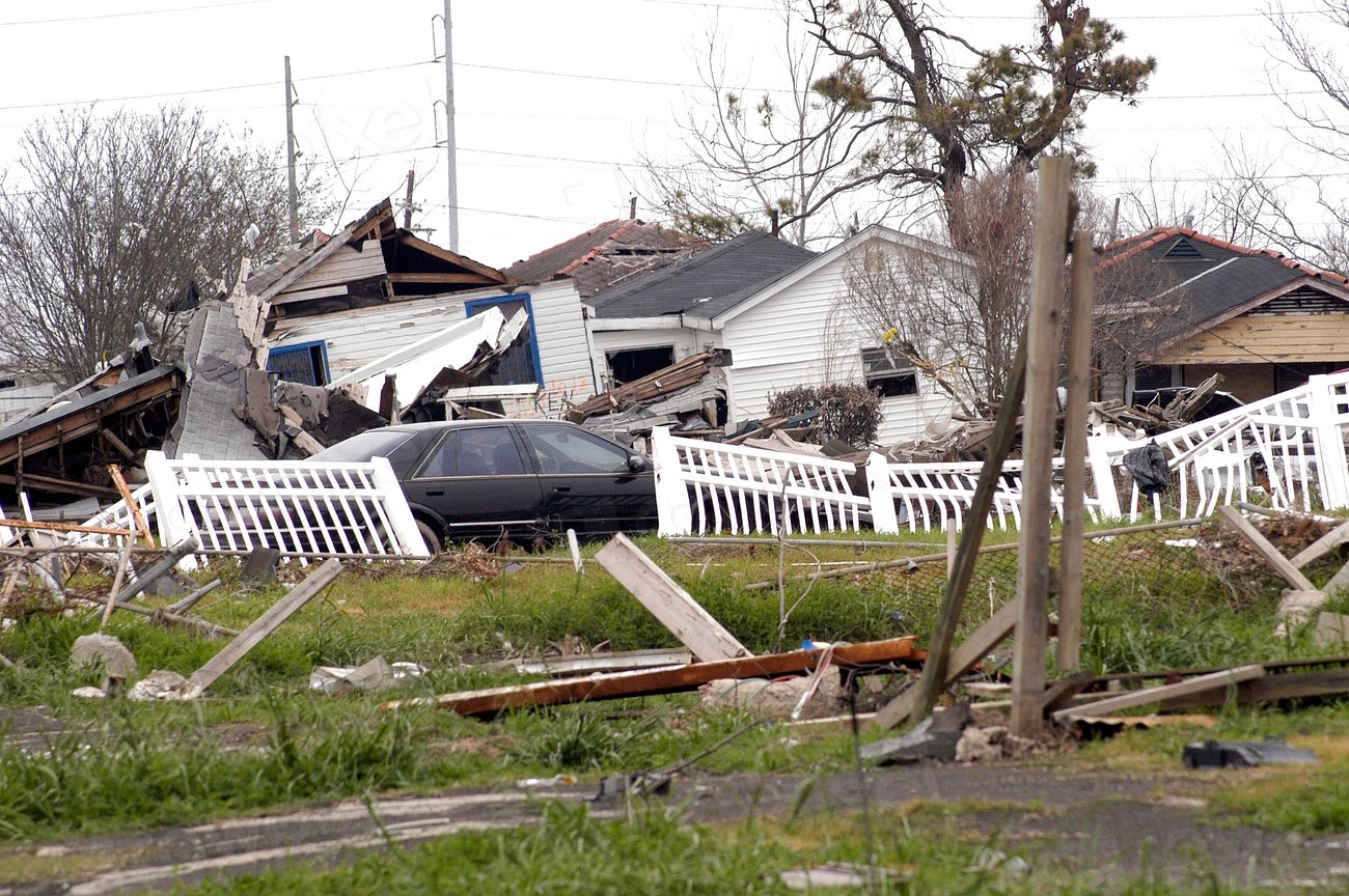
Florida’s history is punctuated by storms that changed everything, sometimes overnight. The 1935 Labor Day hurricane in the Keys, one of the most intense to hit the United States, reshaped channels and moral resolve about warning systems. Hurricane Andrew in 1992 shattered south Miami-Dade and, in response, triggered the strongest building-code overhaul in state history. Hurricane Michael in 2018 peeled back the Panhandle’s veneer, blasting Mexico Beach and exposing how wind and surge team up to punish weak connections. Hurricane Ian in 2022 tore through barrier islands near Fort Myers, carving breaches and redrawing shorelines that had looked stable for a generation.
Even when winds weaken before landfall, the storm’s footprint can expand in other ways. Idalia in 2023 piled record water into parts of the Big Bend, reminding everyone that a wide, shallow continental shelf is a storm surge amplifier. Those water heights weren’t just numbers; they were the difference between ground floors survivable and ground floors lost. After each event, new inlets appear, beach profiles lower, and navigation channels demand emergency dredging. Maps are updated, evacuation zones are reconsidered, and some communities learn the hard lesson that high ground is priceless. In Florida, the coastline is less a line and more a set of moving parts.
From Ancient Tools to Modern Science

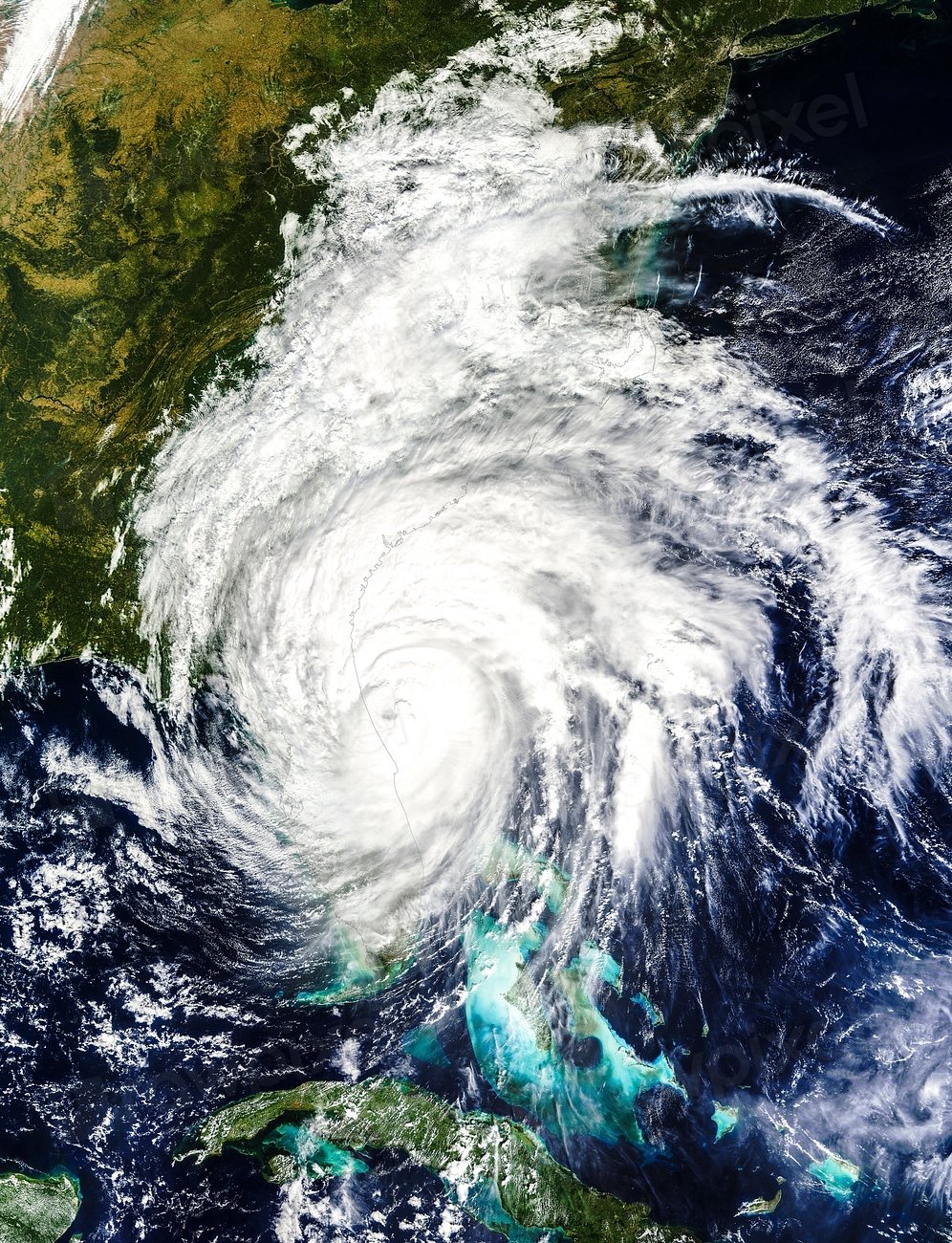
Our toolkit for reading hurricanes has evolved from barometers and broken anemometers to a sprawling suite of sensors in sea, air, and space. Aircraft drop instruments into the eyewall to taste pressure, humidity, and wind, feeding models that now simulate the storm’s entire inner life. Doppler and dual-polarization radar peer into rainbands to find tornado signatures and rainfall rates with fine-grained precision. Satellites capture sea-surface temperature patches as small as neighborhoods, revealing streaks of warm water that can turbocharge intensity. And along the coast, pressure loggers and wave buoys map surge and wave timing so engineers can test how seawalls and dunes actually fail.
On the modeling side, next-generation hurricane systems integrate ocean heat content, coastal bathymetry, and land-surface feedbacks to sharpen track and surge forecasts. Storm surge warnings now stand alongside wind alerts, making it clearer that water is often the main threat. Local flood models stitch together building elevations, drainage, and soil saturation to show where the water will sit, not just where it will pass. Even insurance models borrow from meteorology, translating wind fields and flood depths into expected losses street by street. It’s a new kind of weather literacy, and it turns raw fear into actionable hours.
The Human Aftershock
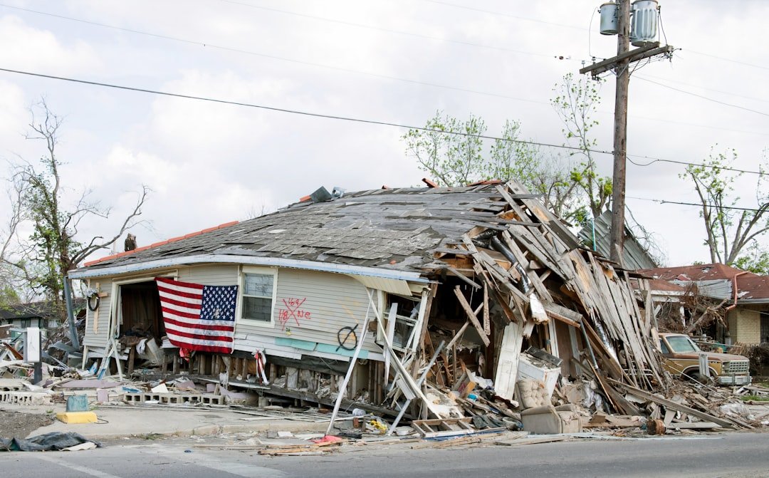
Hurricanes leave psychological pressure ridges long after the winds die down. Families decide whether to rebuild, relocate, or elevate, and that choice ripples through schools, hospitals, and tax rolls. After Andrew, entire neighborhoods in Homestead were rebuilt with clips, straps, and impact windows – a transformation you can literally see in rooflines and fasteners. After Ian, some homeowners discovered that flood risk isn’t only about living near the beach; rivers, bays, and canals turned into surging alleys. Meanwhile, landlords and small businesses weigh rising premiums against staying put, shifting where jobs cluster along the coast.
There’s a quiet demographic reshuffling that follows the debris trucks. Some residents move inland to slightly higher ground, while others choose new coastal towns with stronger codes and quicker utility restoration. Hospitals analyze generator performance and water supply under duress, revising playbooks for the next evacuation. Utilities bury lines where feasible and harden substations against both wind and brackish floodwater. With each storm, the social geography redraws as surely as the shoreline does, and the human map of Florida tilts toward resilience or retreat.
Why It Matters
This isn’t only a coastal story; it’s a statewide ledger of risk, cost, and adaptation. Traditional approaches treated wind as the headline and water as the subtext, but recent events flipped that script in many communities. Historic thinking assumed rare, spaced-out catastrophes; modern data show clusters and compound hazards, like surge arriving after days of saturating rain. The difference is more than academic – it determines where you build schools, how you route evacuation buses, and whether bridges can take both scouring currents and hurricane winds. Ignoring the new evidence is like navigating with last year’s reef chart; you’ll run aground where the sandbar moved.
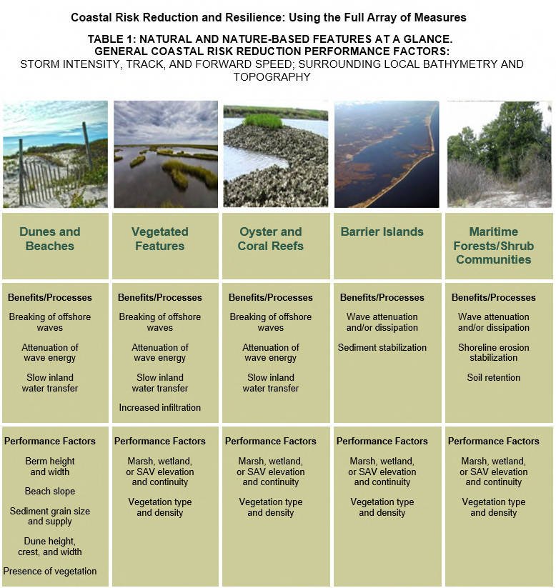
Understanding the full picture ties science to everyday choices. Home elevation, roof retrofits, and mangrove buffers aren’t abstract ideas; they’re practical levers that cut losses and save lives. Sound building codes undercut the most damaging winds, while living shorelines reduce the bite of waves without starving beaches of natural sand. Modern surge maps show block-by-block differences that can change a family’s evacuation plan by miles. When we grasp how storms truly transform Florida, we stop chasing the last disaster and start preparing for the next one.
Global Perspectives
Florida isn’t alone; it’s a front-row seat in a Gulf and Caribbean theater where heat-rich waters fuel rapid intensification. Lessons from Cuba’s civil-defense drill culture, Mexico’s coastal setbacks, and the Bahamas’ elevation challenges echo across Florida’s choices. In each place, the interplay of poverty, topography, and governance determines who absorbs the worst impacts. When a major storm slices across shared waters, the sediment, fish larvae, and even disease vectors don’t stop at borders. The ecological aftermath – from seagrass die-offs to mangrove recovery – is a regional experiment running in plain sight.
That broader view is practical, not poetic. Forecasting centers share data streams, and regional surge models improve when neighboring bathymetry is mapped well. Port closures ripple through supply chains from Tampa to Veracruz, sending price signals far from landfall. Migratory species rebound or falter depending on whether storm-damaged habitats are restored quickly. By reading Florida’s storms as part of a larger system, we trade isolation for insight and speed up solutions that scale.
The Future Landscape
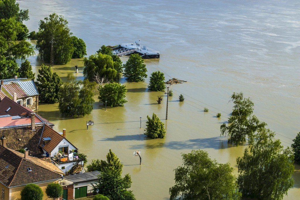
Warmer seas and higher baseline water levels tilt the playing field toward bigger surges and wetter storms, even when winds aren’t record-breaking. Rapid intensification near shore shortens the window between watch and worst-case, stressing evacuation timelines. Meanwhile, barrier islands are on the move, and inlets will keep opening and closing like gills as storms push and pull sediment. Expect more “compound” events, where coastal surge meets flooded rivers, turning familiar streets into braided channels. Inland towns that never felt coastal are learning that water finds a way, especially when creeks are straightened and wetlands are paved.
Technology will help, but it won’t rescue bad decisions. Better models will flag hot spots for surge and rainfall earlier, and smarter grids will isolate failures before they cascade. Elevated critical facilities, from fire stations to telecom hubs, will keep communities stitched together under stress. Living shorelines and marsh migration corridors will act like shock absorbers, if we give them room. The harsh truth is simple: adaptation is not optional; the only choice is how intentional and equitable we make it.
From Ancient Tools to Modern Science
Florida’s resilience revolution started with nails and straps, but it’s accelerating with sensors and feedback loops. Post-storm building assessments feed into code updates, and insurers now track how specific retrofits change claims outcomes. Municipalities deploy temporary gauges in creeks and bays to capture flood peaks, then redesign culverts and pump stations based on real-world performance. University labs test roof systems and garage doors in wind tunnels, translating research into checklists homeowners can actually use. Utilities measure saltwater intrusion impacts on transformers and rethink where to place critical gear.
What’s new is how quickly the loop closes. A hurricane hits, the data pour in, and design tweaks show up in the next permitting cycle. Emergency managers revise clearance times, re-route fuel deliveries, and pre-stage high-water vehicles where models say they’ll be needed most. Coastal managers adjust dune templates and plantings after seeing which cross-sections stood up best to waves. And neighborhoods share what worked, from window protections to neighbor-to-neighbor phone trees, giving resilience a human network to match the technical one.
What You Can Do Right Now

Start with your exact risk, not your zip code’s reputation. Know your evacuation zone, ask your insurer about wind and flood deductibles, and get an elevation certificate if you’re anywhere near surge or river flood maps. Walk your property and look up – roof edges, soffits, and garage doors are weak points that can be strengthened without a full renovation. If you rent, ask about window protection and where the nearest hardened shelter is located, then keep copies of documents on a small flash drive. Think of a hurricane kit as a weekend-camping setup with a battery bank and medications, not a bunker.
Then widen the circle. Support mangrove and dune restoration days, because every planted seedling is a tiny seawall that grows. Encourage local officials to adopt and enforce strong building codes, and back infrastructure projects that elevate roads and protect water systems. Sign up for community science after storms – high-water photos with GPS tags help improve the next forecast for your block. Finally, check on neighbors who might need help carrying shutters or finding a safe ride, because resilience spreads person to person faster than any warning can. Ready to be the reason your street bounces back faster next time?

Suhail Ahmed is a passionate digital professional and nature enthusiast with over 8 years of experience in content strategy, SEO, web development, and digital operations. Alongside his freelance journey, Suhail actively contributes to nature and wildlife platforms like Discover Wildlife, where he channels his curiosity for the planet into engaging, educational storytelling.
With a strong background in managing digital ecosystems — from ecommerce stores and WordPress websites to social media and automation — Suhail merges technical precision with creative insight. His content reflects a rare balance: SEO-friendly yet deeply human, data-informed yet emotionally resonant.
Driven by a love for discovery and storytelling, Suhail believes in using digital platforms to amplify causes that matter — especially those protecting Earth’s biodiversity and inspiring sustainable living. Whether he’s managing online projects or crafting wildlife content, his goal remains the same: to inform, inspire, and leave a positive digital footprint.