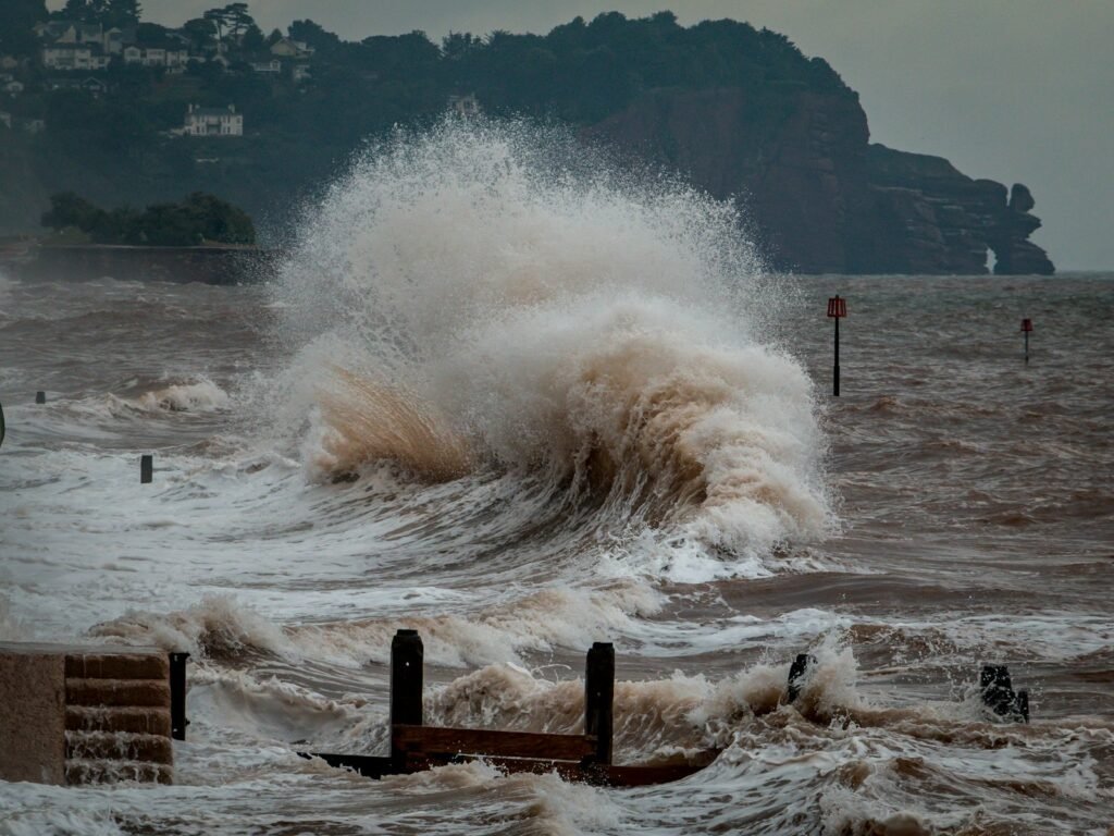
A great wall of water seems the opposite of permanence, yet long after the roar fades, a tsunami can leave a signature that hardens into history. For decades, geologists have been reading those signatures in buried sand sheets, uprooted forests, and marine microfossils stranded far inland. The mystery was simple but profound: how do you prove that one violent day is locked inside quiet layers of mud and sand? The answer, it turns out, lives in patterns, particles, and timekeepers. And once you see how the story is written, the idea of a “fossilized” tsunami stops sounding strange and starts feeling inevitable.
The Hidden Clues
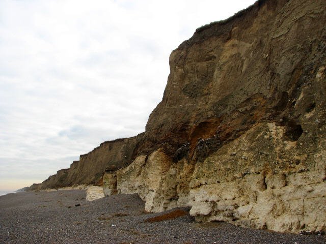
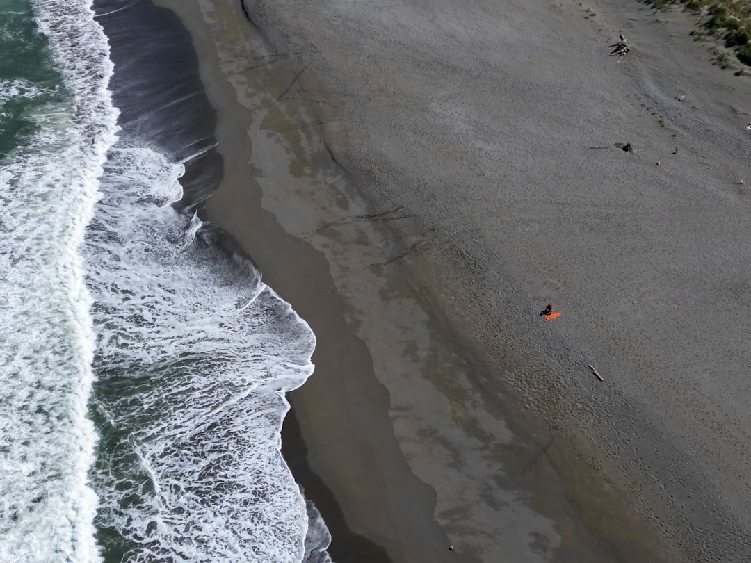
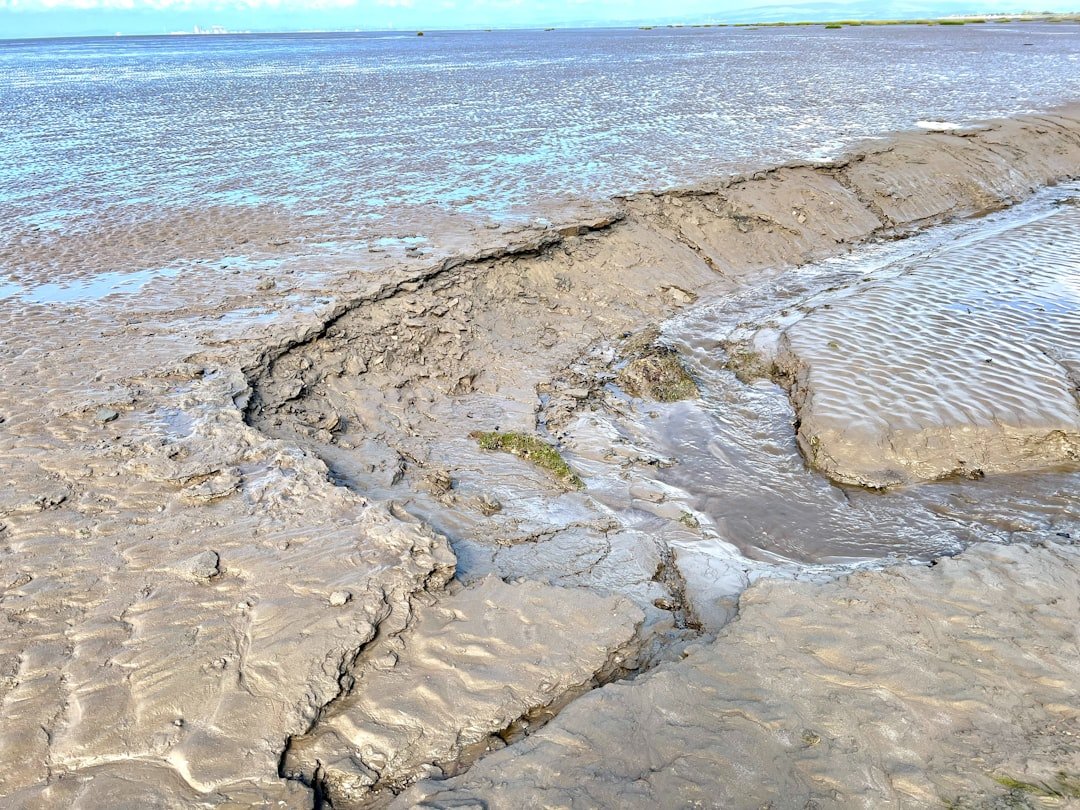
Imagine peeling back the ground like a layered cake and spotting a bright, clean slice of beach sand where it doesn’t belong – under a marsh, inside a peat bed, or well beyond the reach of ordinary storms. That misplaced layer often begins with coarse grains and shells, then fines upward into silt and clay, a natural settling sequence after fast, turbulent flow rushes inland and then retreats. Mixed into the sand are tiny marine messengers: diatoms and foraminifera that usually live offshore, suddenly marooned miles inland. You might also find ripped bits of soil and vegetation, torn up and folded into the deposit like confetti after a parade. Above it all sits a thin “mud cap,” a quiet-water blanket that settles out when the sea calms – nature’s punctuation mark at the end of the surge.
Reading the Sand Sheet
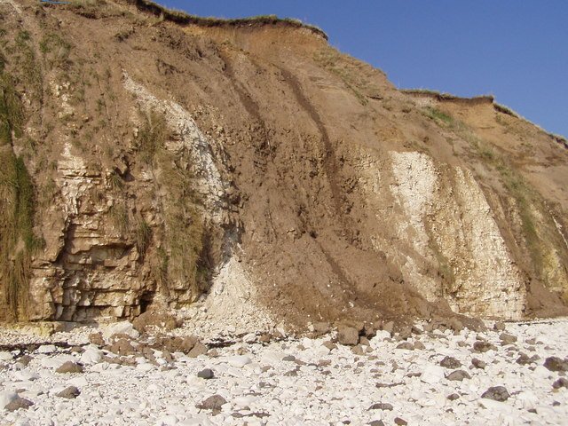
Field teams don’t just admire a layer; they measure it like detectives at a scene. They trace how the sand thins landward, map its edges, and log its subtle textures from basal gravels to fine drapes. Grain-size analyses reveal the energy of the flow, while geochemical fingerprints – like elevated salts, sulfur, or marine strontium – betray a seawater source. Microfossils narrow it further: offshore species mixed with land plants is the kind of odd couple only a tsunami can arrange. Crucially, the deposit often cuts across prior soils or peat in a single abrupt jump, rather than the stepped, seasonal rhythm left by tides or storms.
- Landward-thinning sheets with upward-fining grains point to rapid inundation and settling.
- Marine microfossils inland strengthen the case for seawater transport.
- A sharp base and a mud cap suggest a single, high-energy event with a calm-water finish.
Timekeepers in Mud and Trees
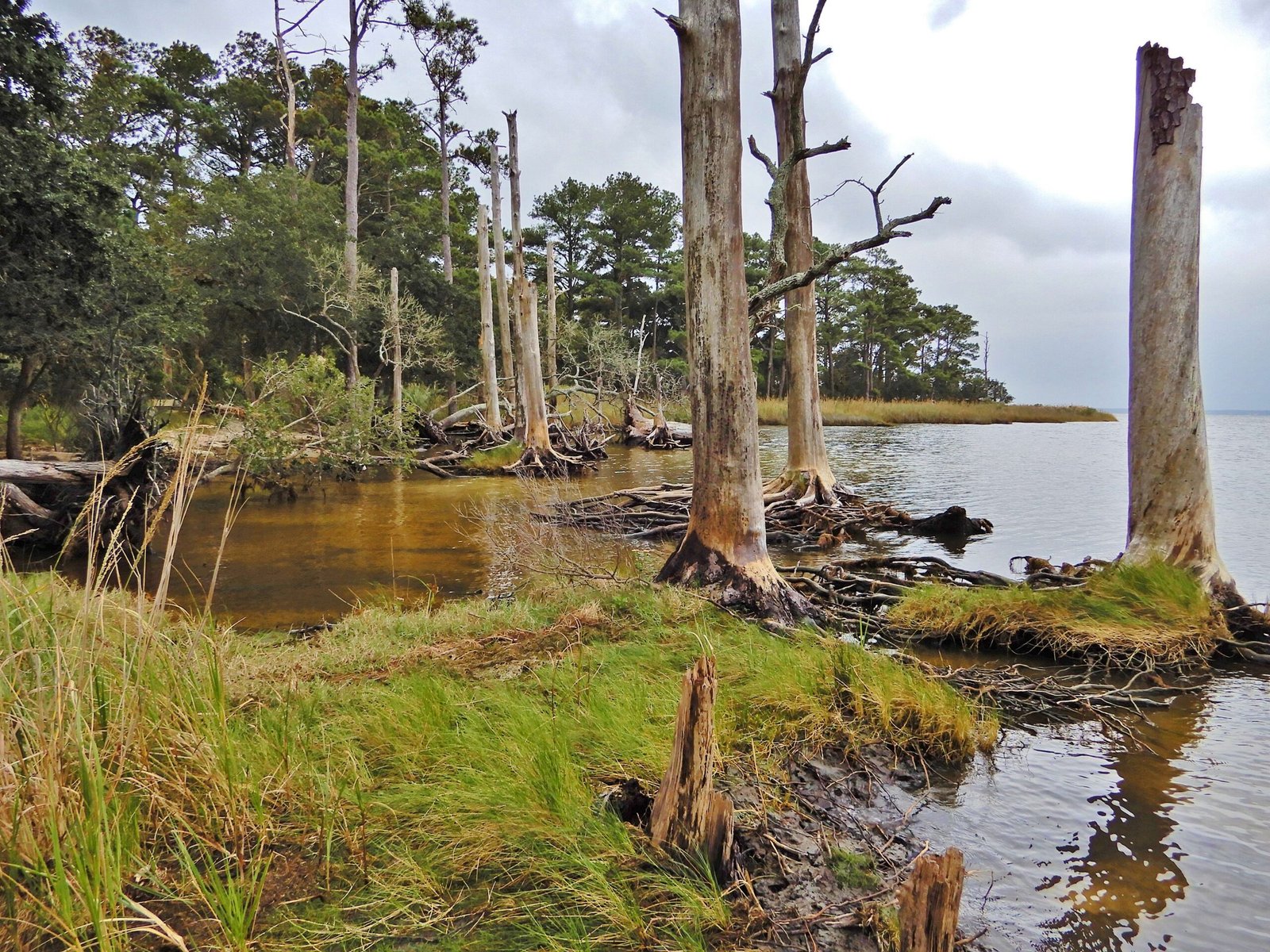
To turn sand into a date, scientists lean on clocks that nature sets for us. Radiocarbon dating of buried leaves or peat just below the tsunami layer frames a “no earlier than” time, while charcoal or plant bits inside the sand refine that window. Optically stimulated luminescence, which measures when quartz grains last saw sunlight, can timestamp the sand itself – especially useful when organic material is scarce. On forested coasts, tree rings and “ghost forests” add drama and precision: stands of trees abruptly killed by saltwater dieback can be cross-dated down to a specific winter. When those independent clocks align, a vague story becomes a timeline you can trust.
From Ancient Tools to Modern Science
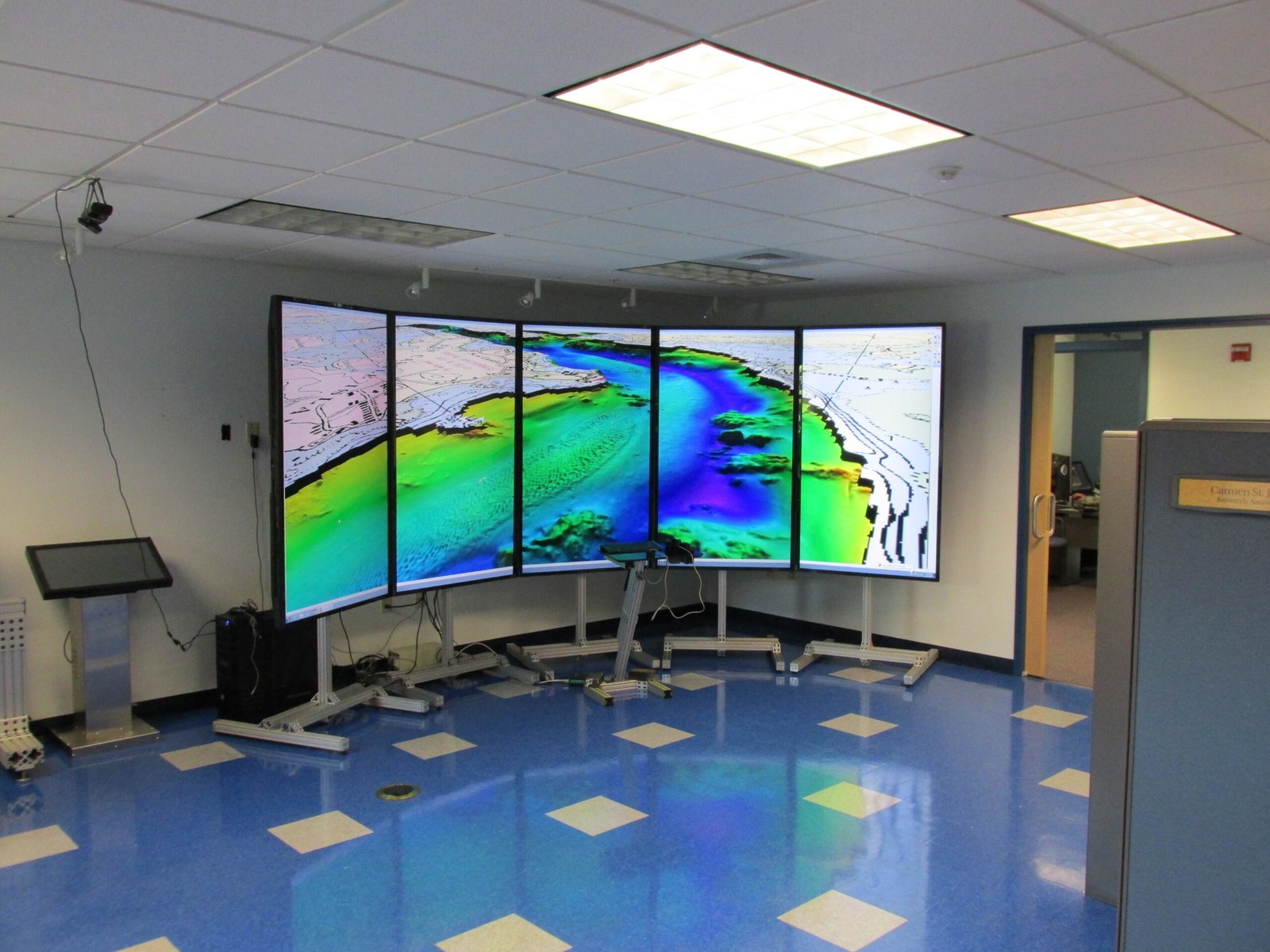
The toolkit has grown from simple shovels and notebooks to instruments that read sediments like medical scanners read bones. Ground-penetrating radar detects buried layers without digging, while micro–CT scans reveal grain fabrics, tiny rip-up clasts, and internal laminations in exquisite detail. Portable X-ray fluorescence guns map chemical shifts that track the arrival and fade of seawater across a site. Machine learning now helps classify core photos and grain-size data, flagging tsunami-like patterns that busy humans might miss. The result isn’t just more data; it’s a tighter chain of evidence that separates a true tsunami layer from a flashy but ordinary storm deposit.
Global Perspectives
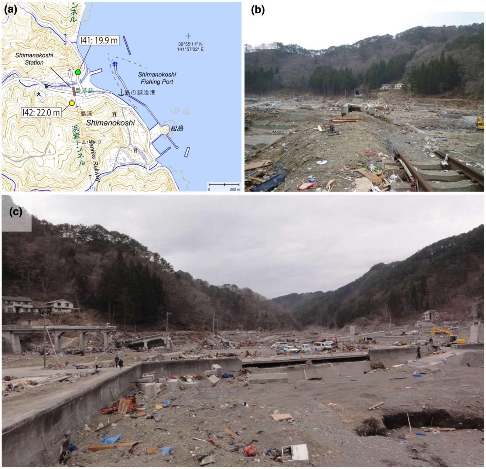
From Japan to the Pacific Northwest, the geological record holds a chorus of tsunami stories. Along the Sendai Plain, modern deposits from the 2011 event sit atop older sand sheets tied to ancient earthquakes, allowing researchers to calibrate what a large tsunami leaves behind. On North America’s west coast, a ring of dead coastal trees and sand sheets in bays and marshes points to a massive Cascadia earthquake in the year 1700, a tale echoed by an “orphan” tsunami that struck across the Pacific. Farther back in time, the Storegga Slide in the North Atlantic sent waves into Scotland and the Shetlands, its inland sands still traceable in quiet estuaries. The Indian Ocean coasts also archive the 2004 disaster, providing modern analogs that help interpret layers centuries or millennia old.
Why It Matters
Tsunami deposits are not just curiosities; they are the long memory our coastal infrastructure lacks. Historical records rarely reach beyond a few centuries, and written accounts can miss events that struck sparsely populated shores. Sediments extend the timeline, revealing intervals between great tsunamis and the true reach of past inundations – information that shapes hazard maps, evacuation zones, and engineering standards. Compared with relying only on seismic records or tide gauges, a multi-proxy sediment approach captures the full picture of water on land, including wave heights and flow directions that instruments didn’t witness. In practical terms, reading an ancient sand sheet can change where a seawall is built, how a hospital is sited, or how much time a community plans for evacuation drills.
The Field Debate
Of course, the earth is messy, and storms can masquerade as tsunamis in the stratigraphic record. Powerful cyclones move sand inland and sometimes loft boulders, creating deposits that can look deceptively similar. That’s why single-proxy identifications are falling out of favor; the standard now is a converging line of evidence from sedimentology, microfossils, geochemistry, and site context. Researchers test alternative explanations, compare with known modern events, and build regional maps so one puzzling core doesn’t carry the entire conclusion. The debate pushes methods forward and keeps hazard assessments honest, which is exactly how science should work.
The Future Landscape
What comes next is a leap in resolution and reach. Single-grain luminescence dating is getting sharper, helping nail down event ages where radiocarbon is fuzzy, and Bayesian age modeling knits multiple clocks into coherent timelines. Drones and coastal lidar are mapping subtle scours, overwash fans, and boulder trails that guide smarter coring campaigns. Environmental DNA preserved in sediments is being explored as a tracer for sudden marine incursions, potentially adding a biological signal to the physical one. Most transformative, open data platforms are stitching together local studies into continental-scale maps, giving planners something more actionable than scattered case studies.
Conclusion
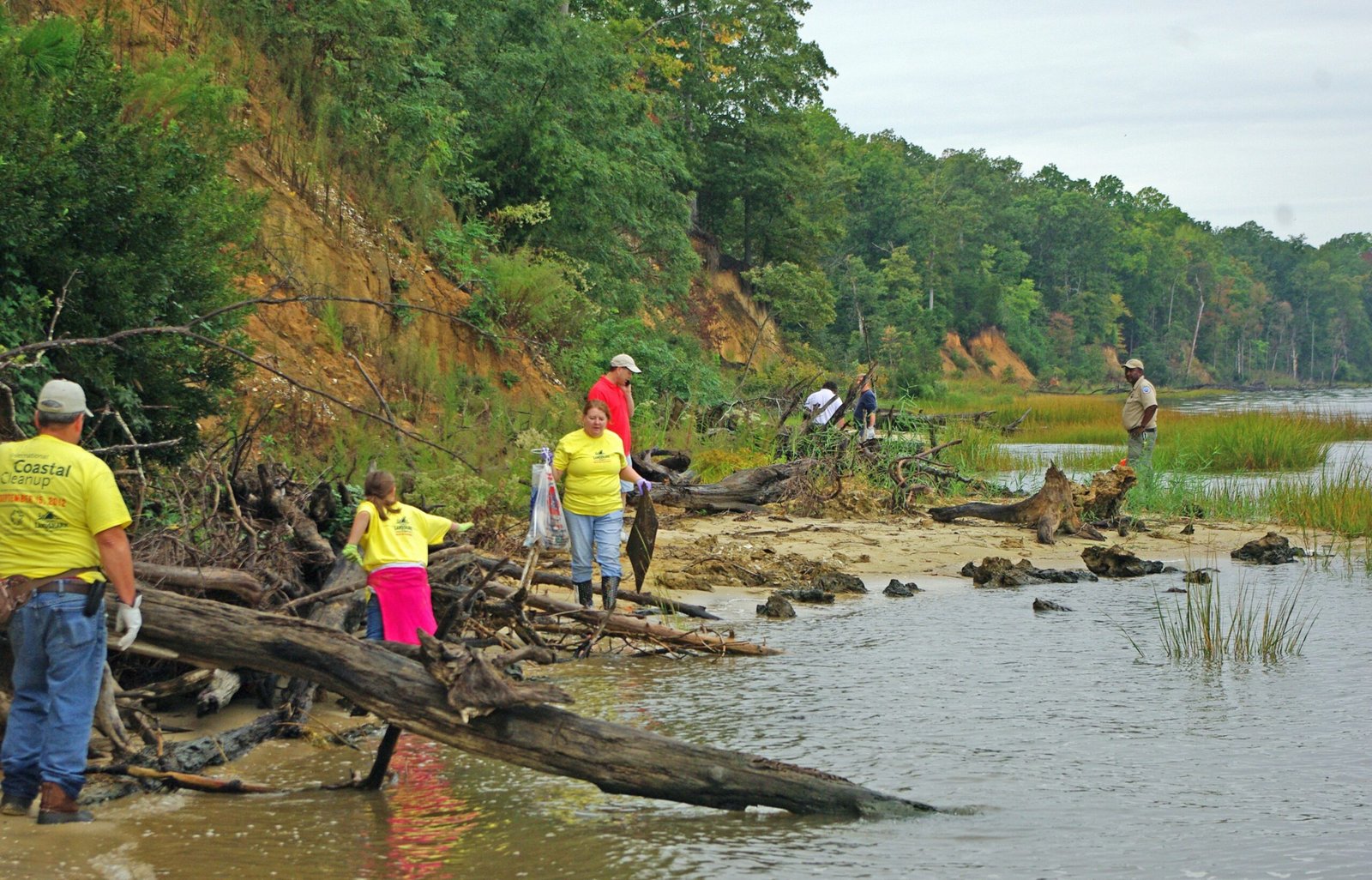
If you live near the coast, you can help turn fragile memories into durable knowledge. Support community coring efforts at local marshes and dunes, which often partner universities with volunteers to sample after storms and earthquakes. Encourage schools and city councils to include paleotsunami maps in evacuation planning, not just recent flood records. Back open-access data repositories so that hard-won cores and dates are shared, not stranded on a single hard drive. And when scientists put out a call for post-event observations, photograph high-water marks, stranded debris lines, and sediment layers – small notes that can anchor big conclusions.

Suhail Ahmed is a passionate digital professional and nature enthusiast with over 8 years of experience in content strategy, SEO, web development, and digital operations. Alongside his freelance journey, Suhail actively contributes to nature and wildlife platforms like Discover Wildlife, where he channels his curiosity for the planet into engaging, educational storytelling.
With a strong background in managing digital ecosystems — from ecommerce stores and WordPress websites to social media and automation — Suhail merges technical precision with creative insight. His content reflects a rare balance: SEO-friendly yet deeply human, data-informed yet emotionally resonant.
Driven by a love for discovery and storytelling, Suhail believes in using digital platforms to amplify causes that matter — especially those protecting Earth’s biodiversity and inspiring sustainable living. Whether he’s managing online projects or crafting wildlife content, his goal remains the same: to inform, inspire, and leave a positive digital footprint.