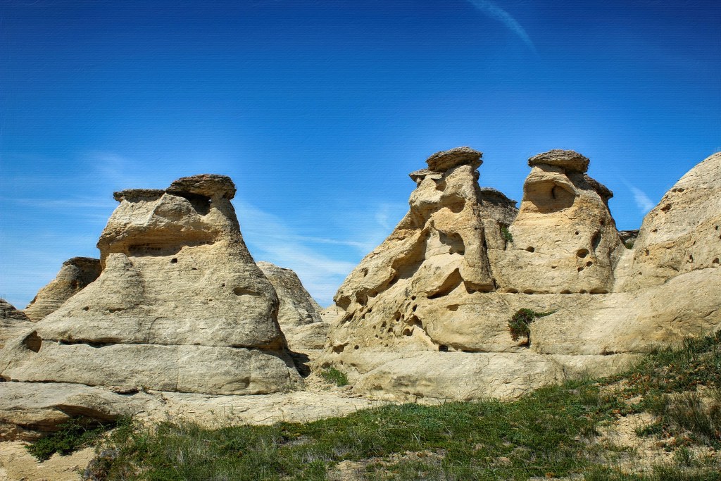
Every now and then, Earth throws us a curveball. Just when geologists think they have the planet more or less figured out, a strange rock structure, a baffling crater, or an impossible-looking landscape shows up and quietly says: not so fast. These are the places that make even experts stare out the helicopter window and mutter that very unscientific phrase: how on Earth?
This article walks through nine of the most argued‑over, awkward‑to‑explain geological formations on the planet. None of them are pure mysteries in the sense of having no ideas at all behind them, but each one resists being fully nailed down by current models. The data are incomplete, the processes are messy, and the debates can get surprisingly emotional. As you read, ask yourself: are we looking at gaps in our models, or just places where Earth is reminding us that our neat theories are always a little too simple?
The Yonaguni “Monument,” Japan’s Underwater Staircase
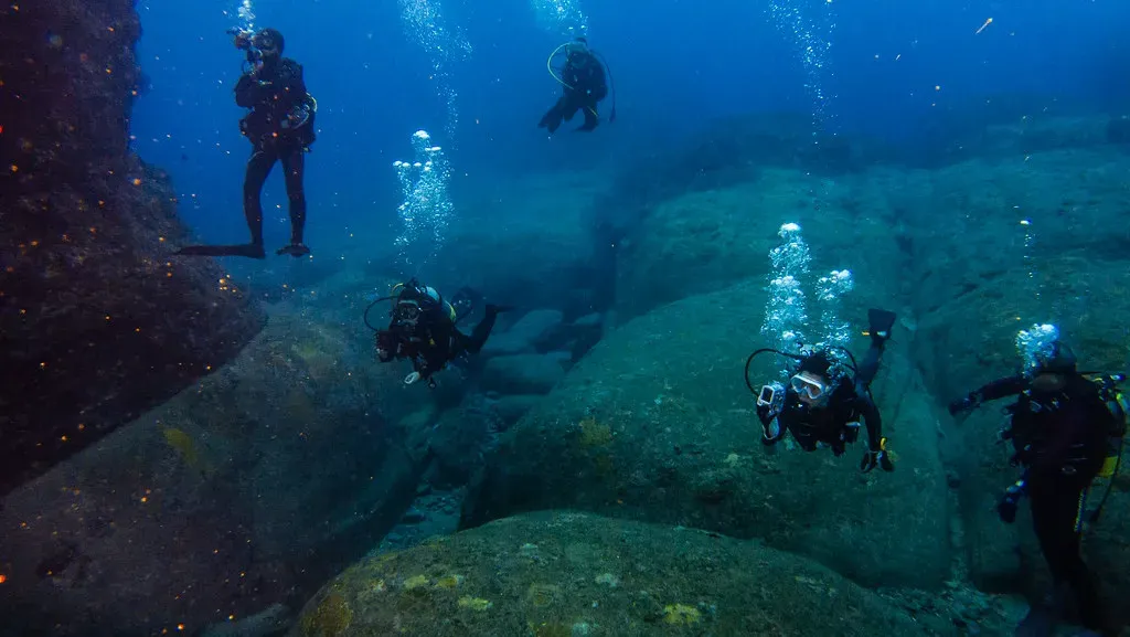
Picture diving off the coast of Japan and suddenly seeing sharp‑edged terraces, right‑angle corners, and what looks like a giant stone staircase dropping into the deep. That is the Yonaguni formation near the Ryukyu Islands, a sandstone and mudstone structure that looks uncannily like a sunken city, complete with apparent platforms and flat walls. The rock itself is not mysterious, but the geometry is: many blocks look chiseled, sliced, or stacked in ways that feel engineered rather than eroded.
Most geologists lean toward a natural explanation, pointing out that layered sedimentary rocks can fracture along joints to make surprising cubes, steps, and slabs, especially where tectonic stresses are intense. The problem is that no single erosion model convincingly reproduces the whole layout: the clean angles, repeated step heights, and odd ledges are a little too tidy in some places and too chaotic in others. So Yonaguni sits in a gray zone where mainstream geology says “most likely natural,” but the details of exactly how waves, currents, and fractures combined to sculpt this huge underwater staircase are still not really locked down.
The Richat Structure, Mauritania’s Eye in the Sahara
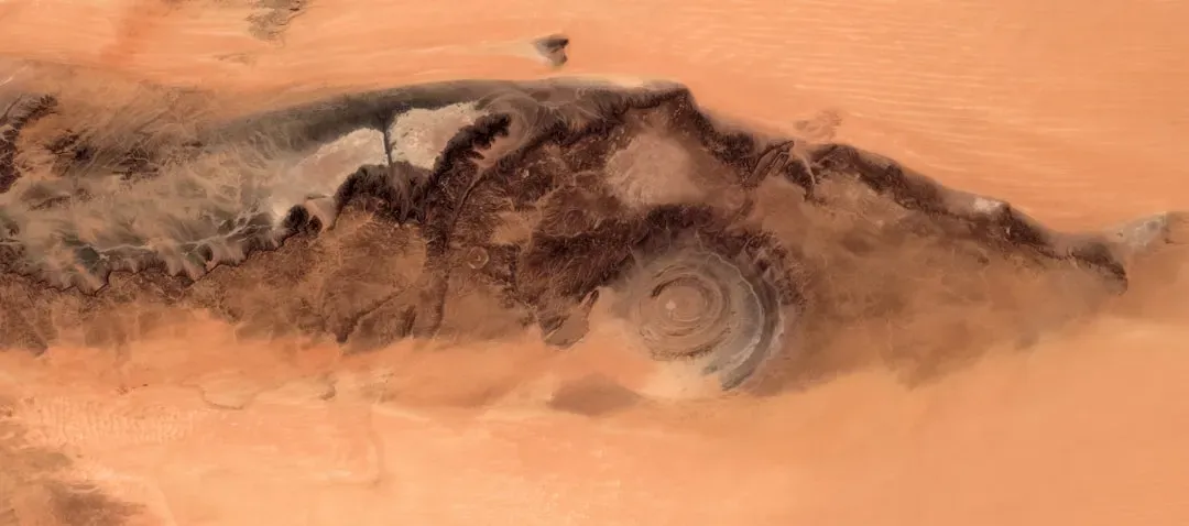
From space, the Richat Structure looks like a giant bull’s‑eye carved into the Sahara Desert: concentric rings of rock roughly forty kilometers across, staring back at orbiting satellites like an enormous fossilized eye. The earliest guess was that it might be an impact crater from a massive asteroid, but the usual smoking guns for such an impact – shocked quartz, high‑pressure minerals, a dense impact melt layer – are missing or weak. That pushed researchers toward a volcanic or tectonic dome origin instead.
The current leading idea is that Richat is a deeply eroded, uplifted dome where different rock layers weather at different rates, giving the bull’s‑eye pattern. Yet even that “standard” explanation has rough edges: the symmetry is unusually clean, the central depression is awkward to fit into classic dome models, and the timing of uplift versus erosion is still debated. In other words, we have a general sketch of how rings could form in principle, but no single, well‑tested model that reproduces the precise geometry and history of this gigantic eye in the desert, leaving plenty of room for argument and speculation.
Giant’s Causeway and Other Polygonal Basalt Fields
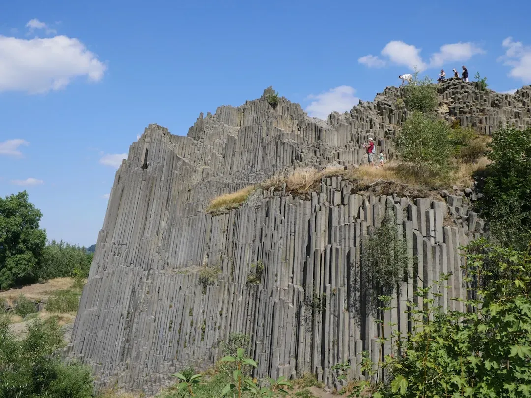
Stand on the edge of the ocean in Northern Ireland and you’ll see it: tens of thousands of interlocking basalt columns, mostly hexagonal, marching into the sea like a frozen army of stone pipes. The textbook explanation is elegant: as thick lava cools and contracts, it cracks, and those cracks propagate downward, forming regular polygonal columns, a bit like drying mud but scaled up. This cooling‑fracture model works beautifully in simplified experiments and computer simulations.
The trouble is that real basalt fields are messier than the neat diagrams. Some columns twist or taper in ways that simple cooling models struggle to predict, and the transition from chaotic jointing to nearly perfect hexagonal tiling is not fully captured by current fracture mechanics. Similar polygonal columns show up in Iceland, the American West, and elsewhere, formed in different volcanic settings but converging on oddly similar geometries. So while the broad strokes are understood, the fine‑scale patterns – the precise spacing, column shapes, and transitions – remain a little ahead of what our current models can reliably reproduce, especially when you try to simulate an entire field instead of a lab‑scale block.
The Carolina Bays, Mysterious Ellipses Along the U.S. East Coast
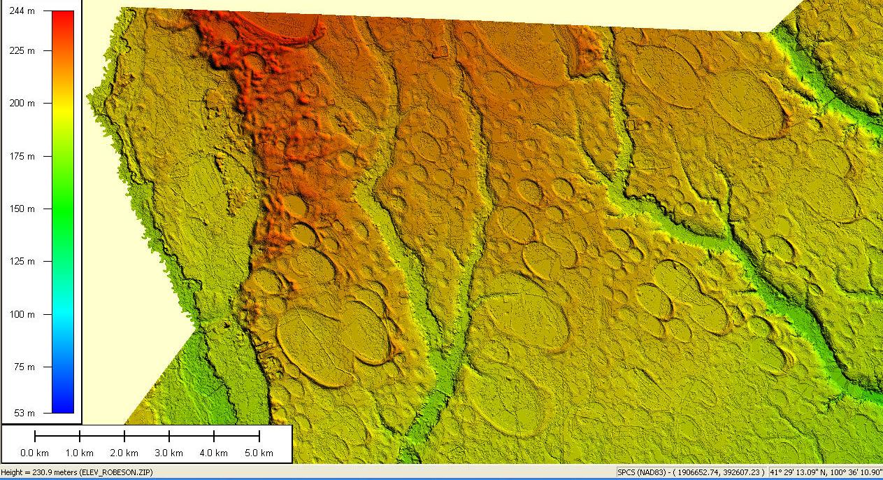
If you fly over parts of the southeastern United States, especially the Carolinas, you’ll notice something strange: thousands of shallow, oval depressions, aligned in similar directions, scattered across the landscape like thumbprints pressed into the Earth. Many are water‑filled and ringed with sand ridges, now known collectively as the Carolina Bays. Their shapes are surprisingly consistent, their orientations are clustered, and yet they appear to cut through different underlying formations and ages of sediments.
Over the past century, people have floated everything from wind‑driven lake erosion to gigantic slush‑covered icebergs sliding across the ground to ancient impact events as explanations. Impact models struggle because there is no clear, cohesive layer of impact debris, and the sheer number and scale of the bays are hard to reconcile with any known shower of objects. Wind and water models can carve elongated basins, but do not fully explain the tight alignment patterns across such huge regions. Modern work leans toward complex, multi‑stage processes combining groundwater, surface flow, and wind, but there still is no single, widely accepted, quantitative model that explains their precise shapes, orientations, and distribution all at once.
Fairy Circles in Namibia and Beyond
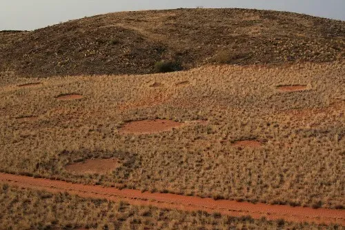
Across parts of the Namib Desert, the ground is dotted with eerie, nearly circular patches of bare earth, surrounded by rings of taller grasses. When you look at aerial photos, these “fairy circles” form patterns that border on hypnotic, with circles spaced at somewhat regular intervals over large areas. Some researchers frame them as an ecological pattern, driven by competition for scarce water between plant root systems. Others have suggested termite activity, underground gas, or combinations of factors.
Here’s the catch: even where one process seems dominant in a specific area, the pattern statistics – circle size distributions, spacing, and longevity – are stubbornly tough to reproduce with a single, simple model. Some patches appear and vanish over decades, others persist, and similar formations have been reported in Australia under different climate and ecological conditions. The current thinking is that fairy circles are a classic example of self‑organized patterning, where many small interactions add up to big, emergent designs. But the exact recipe, and why nearly perfect circles emerge instead of some other shape, is still not explained to everyone’s satisfaction.
Subglacial “Gaia”‑Like Lakes and Landforms in Antarctica
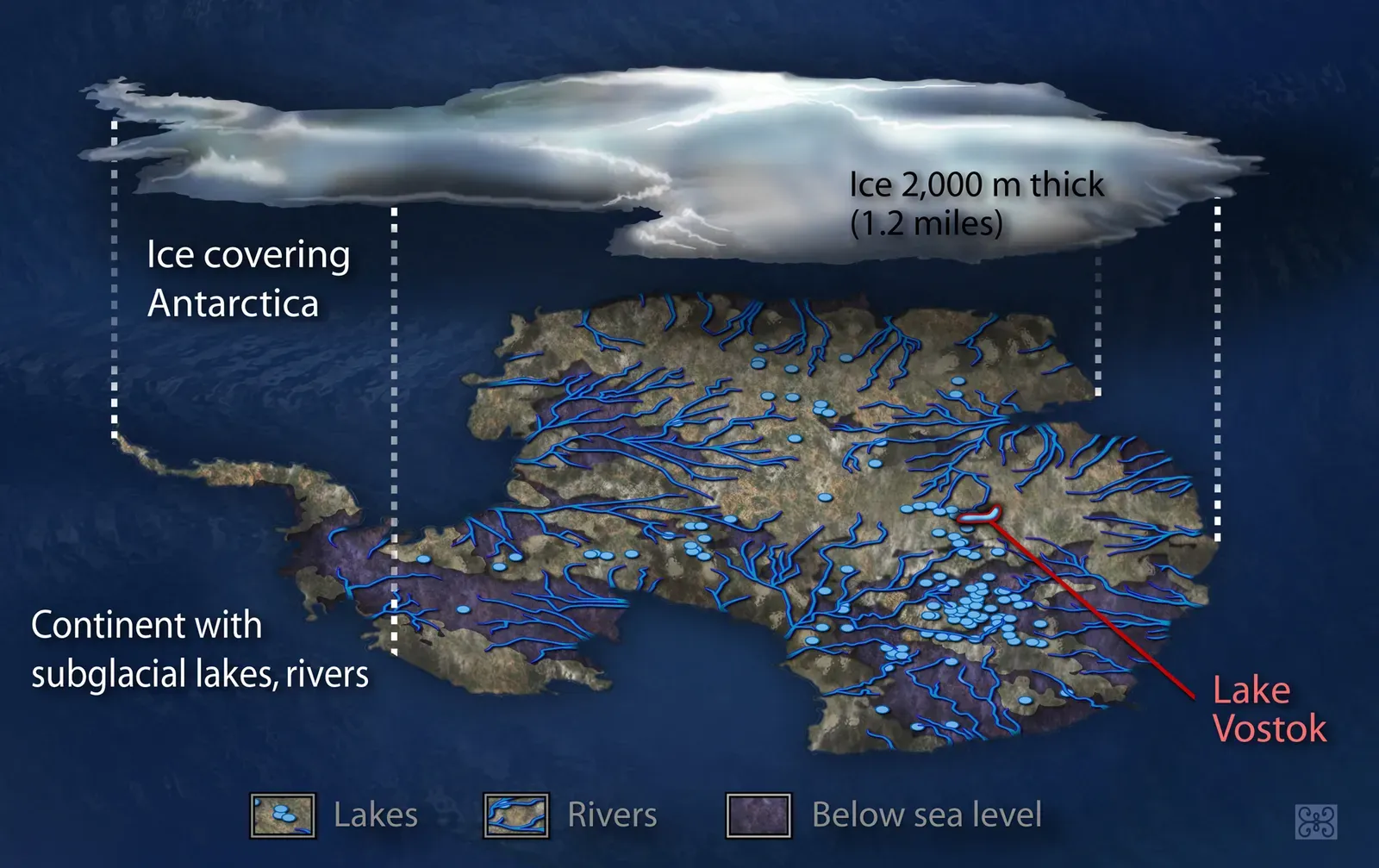
Beneath the vast Antarctic ice sheet lies a hidden world: lakes sealed off from the atmosphere for hundreds of thousands of years, mysterious bumps in the bedrock, and strange, smooth “mega‑scale glacial lineations” that look like someone dragged a colossal rake across the continent. Radar surveys reveal long, streamlined ridges and deep, elongated basins that do not always match expectations from standard models of ice flow over time. Some lakes appear stable, others fill and drain in pulses that affect ice motion far above.
Glaciologists can simulate ice sheets that generally grow, flow, and melt, but they still struggle to explain how some of these subglacial formations achieved their current shapes and configurations, especially at the scales observed. Did ancient, warmer climates carve these landscapes before the ice arrived, or are they mainly the result of the ice sheet sculpting the bedrock over long periods? How exactly do water pressure, geothermal heat, sediment deformation, and ice dynamics interact to organize such striking patterns? Our current models handle pieces of the puzzle, but no one can yet feed in all the parameters and confidently predict the specific labyrinth of lakes and landforms we are now mapping beneath Antarctica.
The Siberian Traps, One of Earth’s Most Extreme Volcanic Provinces
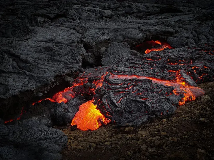
The Siberian Traps are not a single neat structure you can walk around; they are an enormous region of stacked lava flows, intrusions, and volcanic rocks covering an area roughly the size of a continent. They are strongly linked in time to the end‑Permian mass extinction, when life on Earth almost collapsed. The unanswered question is not whether huge eruptions happened – there is abundant evidence for that – but how exactly such a massive, sustained outpouring of magma was triggered and maintained within the framework of current mantle and plate tectonic models.
Popular ideas point to a mantle plume or upwelling, perhaps interacting with pre‑existing weaknesses in the crust, but the volume, rate, and chemical complexity of the Siberian Traps strain simple plume scenarios. Some rocks suggest rapid, pulsed eruptions, others point to longer‑lived magmatic systems that cooked surrounding sediments and released immense amounts of gases. When you try to plug all this into climate and geochemical models, the numbers do not always align neatly with the severity and timing of the extinction event. In that sense, the Siberian Traps are less a tidy geological “thing” and more a glaring reminder that our current models of how the deep Earth can suddenly go into overdrive might be missing key ingredients.
Sinkhole Clusters and “Karst Megastructures” in China and Mexico
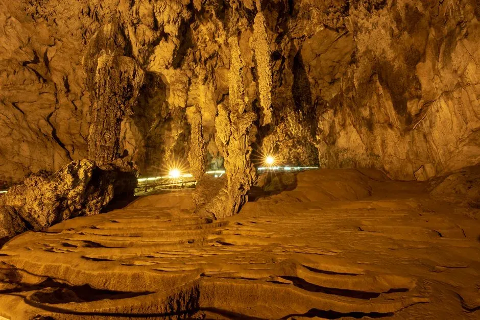
In some regions of southern China and the Yucatán Peninsula in Mexico, sinkholes are not isolated oddities; they form dense clusters, giant pits, and interconnected cave systems that sometimes collapse in dramatic fashion. The broad process – slightly acidic water dissolving limestone, creating voids that eventually fail – is well established. Yet the way multiple sinkholes line up, the sudden appearance of enormous, steep‑walled pits, and the branching of underground rivers often feel more like the architecture of a living system than a simple, uniform corrosion of rock.
Karst researchers build numerical models to explore how dissolution might progress through fractured limestone, but the real‑world complexity of rock layers, fault networks, climate shifts, and groundwater chemistry often drives the system into bizarre configurations those models did not predict. Why do some areas develop towering sinkhole “megapits” while seemingly similar regions remain relatively stable? Why do collapse events sometimes cascade through an area while other voids linger for ages without failing? Current models capture the general concept of karst evolution, but they still fall short of explaining, in a predictive way, the most extreme and spectacular karst megastructures seen on Earth.
The Baltic Anomaly and Odd Seafloor Structures
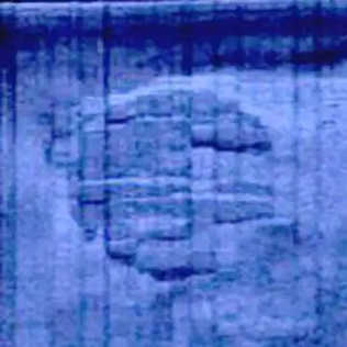
In the Baltic Sea and other shallow shelves around the world, sonar surveys occasionally pick up seafloor shapes that look, frankly, weird: domes, near‑circular mounds, and sharp‑edged ridges that do not fit easily into simple glacial or sedimentary narratives. The most famous is the so‑called Baltic Anomaly, a roughly circular feature that grabbed attention because of its striking sonar outline and unusual texture patterns compared with surrounding sediments. At first glance, it seemed to defy the usual categories of rock outcrop or standard glacial deposit.
Subsequent dives and imaging have suggested it is probably a geological formation, perhaps a mix of rock outcrop, glacially moved material, and sediment draping. But that is where the consensus thins out: exactly what kind of rock, how it ended up in that configuration, and how currents and ice reshaped it remain debated. Similar seafloor anomalies have turned out to be everything from gas‑related mounds to eroded bedrock, and yet a small subset resist any straightforward classification even after sampling. In these cases, current models of glacial transport, sediment dynamics, and gas seepage can offer plausible bits, but no simple, unified story that scientists broadly agree on.
Conclusion: Earth Is Still Better at Surprises Than We Are at Explanations
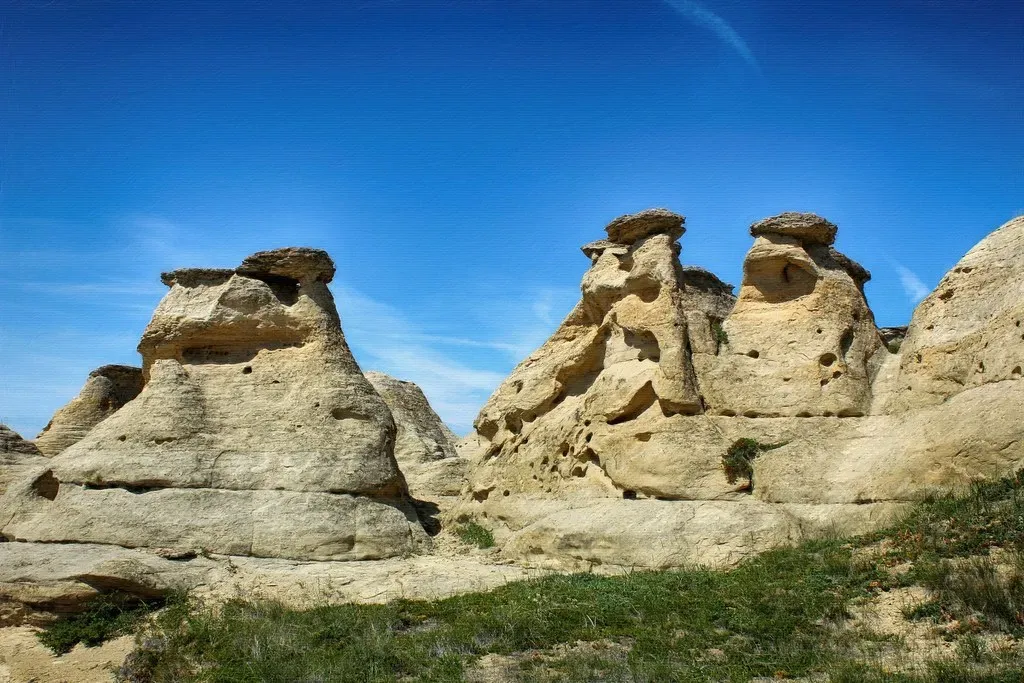
What ties all of these places together is not that they are pure mysteries with no scientific ideas attached, but that they sit right at the edge of what our models can handle cleanly. We have sketches, partial simulations, and leading hypotheses, yet when you zoom in to the awkward details – the exact shapes, alignments, timings, and interactions – the theories fray. I find that oddly comforting: in an age when it feels like every landscape has been mapped, there are still corners of the planet that refuse to be fully reduced to equations and diagrams.
My own bias is that most of these formations will eventually be explained by combinations of familiar processes acting in unfamiliar ways, rather than by any single dramatic new force. But the fact that smart people still argue about Yonaguni’s steps, Carolina Bays, or fairy circles is a healthy sign that geology is not done evolving as a science. Maybe the best takeaway is this: if the ground under our feet can still surprise us this much, what else are we underestimating, both on Earth and beyond? Which of these formations would you have guessed we could already explain perfectly, and which one now bothers you the most?