These most profound waters read like a ledger of ice, fire, and time. Carved by retreating glaciers, birthed by collapsing volcanoes, and scoured by ancient rivers, these lakes hold climate clues and ecological secrets far below the waves. Scientists turn to them not only for staggering depths but for the way they archive storms, wildfires, and the slow creep of warming seasons. Instruments now probe where sunlight never reaches, mapping currents that rise like silent elevators from the abyss. What follows is a journey down the continent’s eight deepest basins – and a look at how these underwater vaults are helping us understand a changing world.
Great Slave Lake, Northwest Territories: The Subarctic Abyss That Outruns Expectation
How deep can a northern lake go before it starts to feel like an ocean trench? Great Slave Lake answers with about 614 meters, making it the deepest on the continent and a cold-water archive for everything from permafrost runoff to wildfire ash. The East Arm, a maze of fjord-like bays, funnels dense, oxygen-rich water into a darkness where pressures climb and temperatures barely budge. Scientists track seasonal layers like pages in a book, teasing out signals of river pulses from the Mackenzie Basin and the timing of ice-off in spring. In winter, a thick lid of ice dampens the wind, and the lake’s interior becomes a whisper of slow-moving water and suspended particles that settle like snow to the bottom.
Those sediments form a ledger of northern change, capturing soot from distant fires and nutrients from thawing soils. For researchers watching rapid Arctic shifts, this basin is less a geographic landmark than a living instrument, tuned to the rhythms of high-latitude climate.
Crater Lake, Oregon: A Volcanic Blue Where Clarity Meets Depth
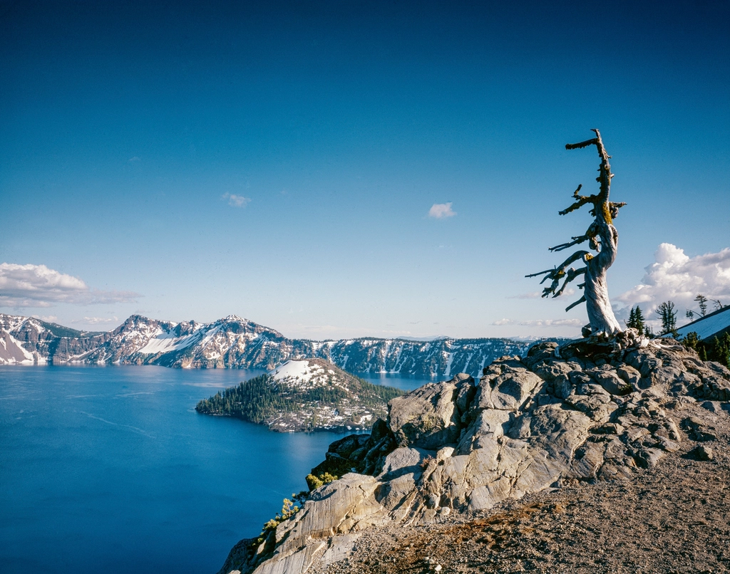
Crater Lake plunges roughly 592 meters inside the caldera of Mount Mazama, a volcano that collapsed thousands of years ago and left behind one of the purest large lakes on Earth. With no major rivers feeding it, the basin is refilled by snow and rain, giving the water its famously intense color and startling transparency. But deep does not mean static: internal waves and rare full-lake mixing events shuffle heat and oxygen, and subaqueous vents hint at the volcano’s lingering heartbeat. Researchers monitor how shrinking snowpack and warmer summers alter stratification, potentially nudging the lake toward longer periods of calm separation between surface and depths. Even tiny changes in clarity can signal shifts in nutrient input or plankton communities.
Crater Lake operates like a natural laboratory where geology, hydrology, and climate intersect. When the snowline creeps upslope, the lake records the change with quiet precision.
Quesnel Lake, British Columbia: A Fjord-Like Giant With a Memory
Quesnel Lake, diving to about 511 meters, stretches long and narrow like an inland fjord, its arms tracing valleys left by relentless ice. The lake drains through the Quesnel River into the Fraser system, making it a crucial hinge between mountain headwaters and salmon-bearing rivers. Deep water here is cold and clear, yet the lake’s sediments tell a busier story – turbidity flows after storms, pulses of organic matter from forests, and the seasonal push and pull of riverine input. The basin’s depth acts like a time capsule, slowing decomposition and preserving layered histories of landscape change. For fisheries scientists, these layers help connect upland events to downstream salmon runs, linking ocean returns with what falls from the surrounding hillsides.
When disturbances occur on land, Quesnel often writes the footnote in fine grain at the bottom. In a warming world, that footnote is becoming essential reading.
Lake Tahoe, California–Nevada: Granite Walls, Sapphire Water, and a Warming Signal
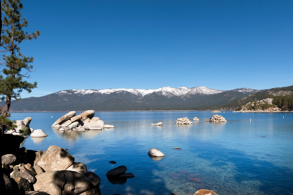
Lake Tahoe drops to around 501 meters, a window of sapphire hemmed by pale granite and ponderosa. The first time I stood on the shore, the water looked like polished glass, but instruments told a stormier story: declining clarity for decades, now stabilizing as restoration takes hold, and subtle changes in deep mixing as winters warm. Wind-driven overturn reaches toward the abyss in some years, recharging oxygen where old waters linger. In lean-snow winters, the surface warms earlier and stratifies longer, keeping deep zones cooler but more isolated. Scientists track these dynamics with moorings, autonomous profilers, and satellite snapshots stitched into a long-term portrait of change.
What happens in Tahoe rarely stays in Tahoe; the methods refined here ripple across lake science, improving forecasts from alpine tarns to inland seas.
Adams Lake, British Columbia: A Quiet Depth Beneath a Salmon Highway
Adams Lake, roughly 457 meters at its deepest, sits off the main tourist map, which is part of its science appeal. Fed and drained by the Adams River, the system is linked to one of the world’s most celebrated sockeye salmon runs, turning nearby channels into liquid arteries every dominant cycle. The lake itself is oligotrophic and cool, ideal for studying how deep basins breathe – slowly – through internal waves and seasonal turnover. Strong winds can set up seiches, gentle sloshes that tilt the thermocline and send internal pulses down the lake’s length. Those movements may be invisible from a campsite but register clearly on pressure sensors anchored far below.
Because the watershed is relatively sparsely populated, Adams offers a cleaner signal of climate-driven trends, making it a benchmark for separating human influence from natural variability.
Lake Chelan, Washington: A Glacial Trough With a Data Backbone
Lake Chelan descends about 453 meters in a narrow trench gouged by ice, a ribbon of blue that begins in steep-walled wilderness and ends at a hydropower dam. Its shape funnels wind along the valley, priming the lake for internal waves that move more like slow tides than surface chop. Down deep, oxygen budgets are tight and sensitive to changes in turnover and food-web dynamics, which researchers watch with arrays of sensors and water-column profiles. The lake is also a wildfire sentinel: ash and nutrients from surrounding slopes can push brief but measurable responses in clarity and plankton. When intense summer heat stacks warm layers near the top, mixing weakens and the deep water waits longer for refresh.
That tight coupling between hillslope events and deepwater chemistry makes Chelan a case study for managing wildfire-era watersheds across the West.
Great Bear Lake, Northwest Territories: Vast, Cold, and Surprisingly Delicate
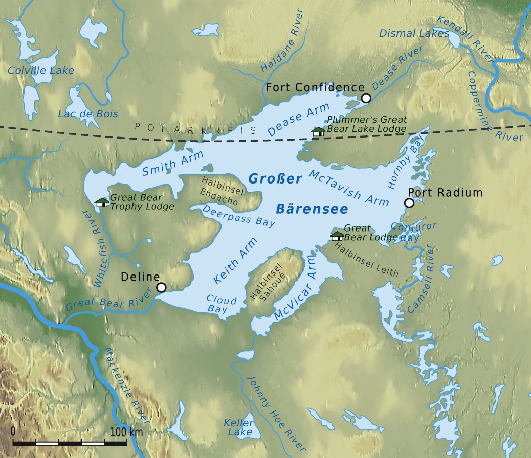
Great Bear Lake reaches roughly 446 meters and sprawls over a huge area, yet it remains strikingly clear and nutrient-poor. Long ice seasons and fierce winds sculpt its mixing regime, while the lake’s sheer size allows weather to paint different stories across its sprawling arms. Deep habitats here support populations adapted to cold, clean conditions, which means small changes in temperature or nutrient loading can echo loudly. Scientists are watching how shorter ice cover and shifting storm tracks alter circulation patterns and oxygen inventories at depth. In such transparent water, even minor increases in particles or plankton can change the way light penetrates, with knock-on effects for the whole food web.
The lesson is counterintuitive: in very large, very clean lakes, resilience can look strong until it isn’t, and then the signals arrive all at once.
Lake Superior, USA–Canada: The Inland Sea With a Long Memory
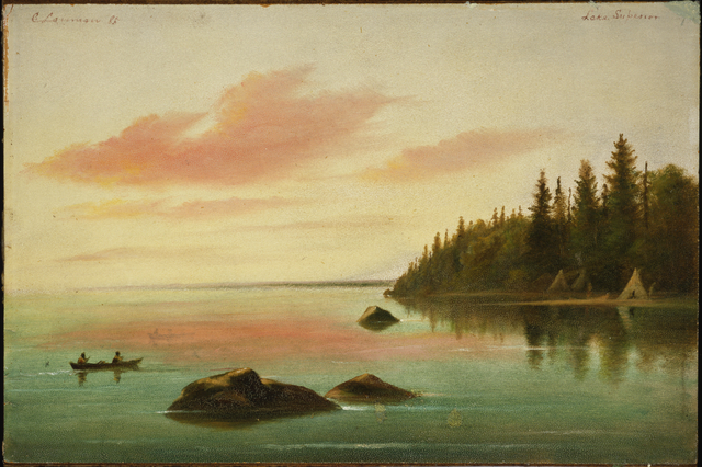
Lake Superior maxes out near 400 meters and carries more water than any other lake on Earth by surface area, a cold inland sea with ocean-like moods. Storms build long-period seiches that rock ports, while internal waves ripple along density layers hundreds of feet below, moving heat and nutrients in slow motion. Decades of buoy and satellite records reveal surface warming, shifting ice seasons, and a trend toward more intense autumn storms that can resuspend sediments and briefly cloud the nearshore. The deep interior, however, changes cautiously, making Superior a powerful baseline for separating short-term weather noise from long-term climate signals. Scientists use this slow-drip record to refine models for everything from harmful algal bloom risk to shipping safety.
For communities around the basin, practical steps matter: support shoreline green infrastructure to reduce runoff, back long-term monitoring programs that keep buoys and sensors in the water, and choose conservation actions – like native plantings and smart stormwater fixes – that keep the lake clearer, colder, and safer for the generations reading this record next.

Suhail Ahmed is a passionate digital professional and nature enthusiast with over 8 years of experience in content strategy, SEO, web development, and digital operations. Alongside his freelance journey, Suhail actively contributes to nature and wildlife platforms like Discover Wildlife, where he channels his curiosity for the planet into engaging, educational storytelling.
With a strong background in managing digital ecosystems — from ecommerce stores and WordPress websites to social media and automation — Suhail merges technical precision with creative insight. His content reflects a rare balance: SEO-friendly yet deeply human, data-informed yet emotionally resonant.
Driven by a love for discovery and storytelling, Suhail believes in using digital platforms to amplify causes that matter — especially those protecting Earth’s biodiversity and inspiring sustainable living. Whether he’s managing online projects or crafting wildlife content, his goal remains the same: to inform, inspire, and leave a positive digital footprint.