
Picture this: your city is slowly roasting from the inside out, turning ordinary streets into blazing infernos that register nearly the same temperature as well-done steak. This isn’t science fiction. It’s the harsh reality of urban heat islands, and American cities are fighting back with a remarkable weapon: thermal imaging drones.
Urban heat islands occur when concrete jungles become dramatically hotter than their surrounding rural areas. These temperature differences can reach upwards of ten degrees or more compared to undeveloped areas. The situation has become so critical that extreme heat is now the number one weather-related cause of death in the U.S. for the last three decades. Yet across America, innovative cities are pioneering revolutionary approaches that combine cutting-edge drone technology with proven mitigation strategies to create cooler, healthier urban environments.
Ann Arbor, Michigan: Pioneering Micro-Scale Heat Analysis

Ann Arbor stands as America’s premier example of comprehensive drone-based heat island mapping. The city developed a novel process using unmanned aerial vehicles that created thermal maps of a public streetscape targeted for revitalization in the greater Detroit metropolitan area, with studies conducted in 2019, 2020, and 2024 to measure the effectiveness of new shade trees, green spaces, and hardscapes.
The project’s precision is remarkable. Drones captured microscale thermal imaging at a resolution of less than 1.5 by 1.5 centimeters per pixel, providing unprecedented detail about how different urban materials absorb and radiate heat. This granular data revealed temperature variations that satellites, with their baseball diamond-sized pixels, simply cannot detect. The research required careful coordination with the FAA, Michigan Department of Transportation, and city officials, using Ann Arbor City Hall’s roof as a staging area for drone operations.
Dallas-Fort Worth, Texas: Comparing Neighborhood Heat Disparities

Dallas-Fort Worth conducted a groundbreaking study measuring land surface temperatures across diverse urban land uses using high-resolution thermal infrared sensors onboard small unmanned aerial vehicles. The research examined industrial areas, residential low-cost neighborhoods, residential high-cost areas, and parks to understand how socioeconomic factors influence heat exposure.
The findings were striking. The study captured micro-urban heat islands varying between 4.83°C and 15.86°C among four urban land uses covering less than a square kilometer, with residential high-cost areas recording the highest heat islands due to reduced ventilation from narrow streets and closely spaced buildings. The research also revealed that dark-colored asphalt shingle roofs in high-cost residential areas reported significantly higher land surface temperatures compared to light-colored roofs in other areas.
Athens, Georgia: Validating Street-Level Thermal Accuracy

Athens, Georgia, launched a pilot project that focused on validating the accuracy of drone thermal imaging for urban heat monitoring. The project utilized a UAV equipped with a FLIR Vue Pro R 640 thermal camera to collect thermal data from two neighborhoods, establishing rigorous standards for urban drone data collection.
The study addressed critical privacy and safety concerns while maintaining scientific rigor. Flight lines were established to respect private neighborhood spaces while avoiding road traffic, following along sidewalks, right-of-way areas, or heavily forested areas where there were no residences. Ground truth data collection involved placing aluminum tiles within view of thermal cameras and taking measurements of different surfaces including concrete, asphalt, grass, and mulch to validate drone readings against handheld infrared cameras.
Roanoke, Virginia: Community-Driven Heat Island Education
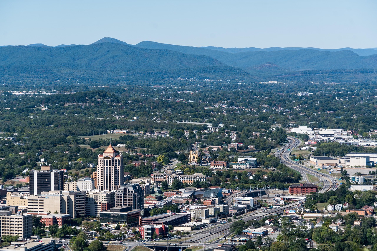
Roanoke implemented an innovative approach combining drone technology with community education and student engagement. In summer 2021, professors from Virginia Tech and UVA partnered with the city’s Sustainability Coordinator and Roanoke City Public Schools to facilitate a 2-week STEM program where students ages 12-14 used urban sensing technologies including handheld weather sensors and drones.
The program revealed disturbing environmental justice connections. The heat island study found that previously redlined communities in Roanoke have air temperatures that are 7-10 degrees Fahrenheit hotter than non-redlined areas in the city. This discovery led to targeted mitigation efforts focusing on the most vulnerable neighborhoods. Students conducted interviews and engaged in planning solutions specific to their own neighborhoods, creating lasting community investment in heat reduction strategies.
New York City: Large-Scale Cool Roof Implementation
New York City launched one of America’s most comprehensive urban heat reduction programs, though not exclusively drone-focused. The Heat Island Reduction Program aimed to reduce urban heat islands through various strategies including cool roofs, green roofs, and tree plantings, successfully demonstrating the effectiveness of these interventions in reducing heat islands and improving the city’s overall sustainability.
The city’s approach emphasized scalable solutions that could be implemented across thousands of buildings. Cool roofs became a cornerstone strategy, using reflective materials to reduce heat absorption. These efforts included cooling centers and cool roofs, with cool roofs being rooftop surfaces painted white or fitted with reflective materials to prevent the absorption of the sun’s rays into structures. The program demonstrated that coordinated municipal action could achieve measurable temperature reductions across entire neighborhoods.
Louisville, Kentucky: Tree Canopy Assessment and Urban Forestry
In 2014, Louisville city officials awarded a $115,700 contract for a tree canopy assessment to help the city use trees to address urban heat, stormwater management, and other concerns, with then-Mayor Greg Fischer noting that knowing where they lack canopy down to the street and address level would help their efforts exponentially.
The economic benefits proved substantial. The study found that Louisville trees provide over $389 million in annual benefits through stormwater interception, temperature moderation, energy savings, increases in property values, air quality improvements, and carbon mitigation. This comprehensive analysis justified expanded urban forestry programs and informed strategic tree planting in the hottest neighborhoods. Louisville’s approach demonstrated how quantifying environmental benefits creates political and economic support for heat mitigation investments.
Charlotte, North Carolina: Federal Partnership for Heat Mapping

Charlotte participated in NOAA’s comprehensive Urban Heat Island mapping campaign, representing one of fourteen U.S. communities selected for the 2024 program. NOAA, partnering with the U.S. Departments of Health and Human Services and Housing and Urban Development, worked with community scientists to map the hottest neighborhoods in fourteen U.S. communities, with Charlotte being among cities like Flint, Michigan, and Santa Fe, New Mexico.
The program utilized community volunteers who drove established routes throughout the city with temperature sensors attached to their vehicles. The campaigns rely on community scientist volunteers to drive around the city using sensors attached to cars to collect data on temperature, humidity, time and GPS location, with this data used to create maps providing detailed analysis of heat distribution in morning, afternoon and evening. This approach created comprehensive thermal maps while building community awareness about heat equity issues.
Phoenix, Arizona: Advanced Material Solutions
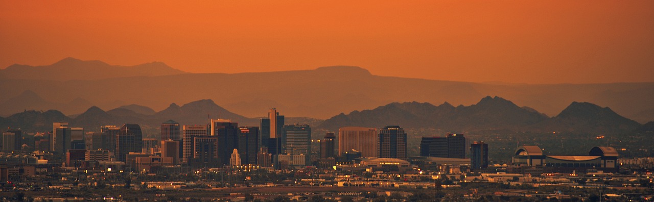
Though specific drone programs weren’t detailed in available research, Phoenix has become a leader in implementing advanced cooling materials and technologies. The city faces extreme urban heat challenges, with drone measurements often clocking temperatures at 160 to 170 degrees Fahrenheit, with researchers comparing these temperatures to meat cooking levels where cities are literally being cooked well-done.
Phoenix’s approach focuses on material innovation and strategic infrastructure modifications. Cool materials such as cool roofs and pavements have gained attention as effective heat island mitigation strategies, with these materials having high solar reflectance that reduces heat absorption and surface temperatures, contributing significantly to reducing urban heat islands and energy consumption in buildings. The city has pioneered cool pavement technologies and reflective building materials that can dramatically reduce surface temperatures in extreme desert conditions.
Conclusion

These eight American cities represent the cutting edge of urban heat island mitigation, proving that the combination of precise drone mapping and targeted cooling solutions can create measurable temperature reductions. From Ann Arbor’s microscale precision to New York’s city-wide programs, these communities demonstrate that technology-driven approaches to urban cooling are not just possible – they’re essential.
The most successful programs share common elements: community engagement, data-driven decision making, and comprehensive implementation strategies that address both immediate cooling needs and long-term urban sustainability. As climate change intensifies urban heat challenges, these pioneering cities offer blueprints for creating cooler, healthier, and more equitable urban environments. What surprises you most about how hot our cities have become, and which solution do you think would work best in your community?