Across highways, cul-de-sacs, and silent mountain passes, America’s last wild cats are still slipping through the margins of our maps. Their survival is a modern paradox: shrinking habitats and busier roads, yet the paw prints keep appearing in fresh mud. Scientists are decoding how these elusive predators persist, and the answers blend hard data with fieldcraft and a little wonder. The mysteries are urgent – where they move, what they hunt, how we can share space – because decisions made this decade will echo for generations. If you think the U.S. lost its big whiskered ghosts, think again; they’re closer than most of us realize.
The Hidden Clues: The Bobcat Next Door
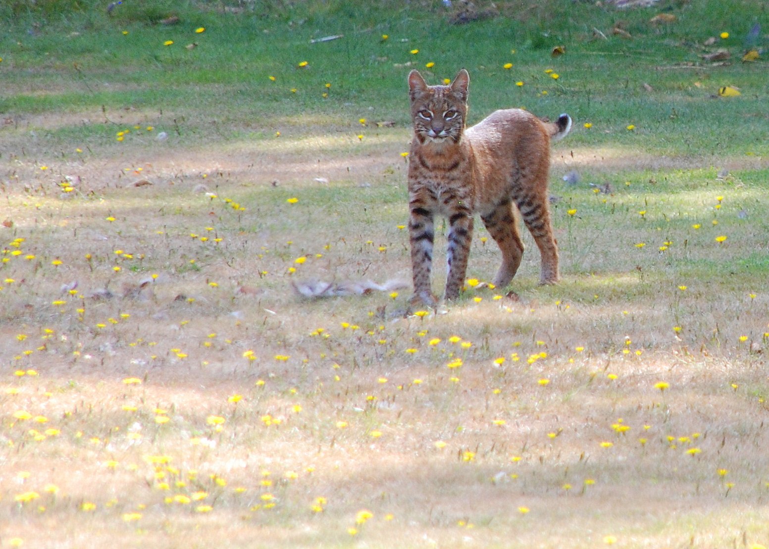
You might have been watched from your own driveway last night, and you’d never know it. Bobcats thread through greenbelts, drainage ditches, and backyard edges like water finding the easiest path downhill. Trail cameras and urban ecology studies keep revealing the same pattern: this medium-sized cat adapts quickly to fragmented suburbs, hunting rabbits, rats, and unwary squirrels. Their tufted ears and short tails are built for ambush, but their true superpower is flexibility – sleep by day, move at dusk, shift routes when a new fence pops up. In ecological terms, they are the janitors and bouncers of the neighborhood food web.
That adaptability hides a tightrope act. Rodent-killing anticoagulant poisons, busy roads, and habitat splintered by development can turn a thriving patch into a trap. Yet bobcats persist, and in many regions they’re rebounding where hunting and trapping are regulated and corridors remain. Think of them as the continent’s quiet constant, the cat most people will never see but often benefit from. When you catch shadows moving at the edge of a park light, don’t be surprised if it’s the local specialist at work.
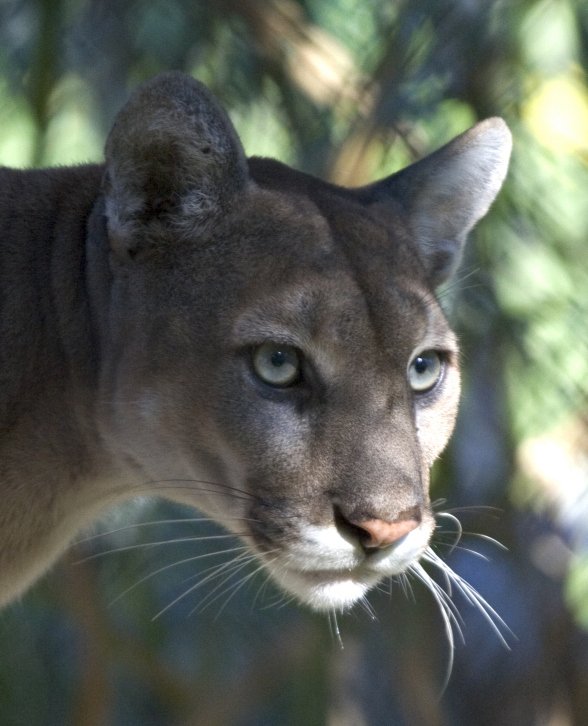
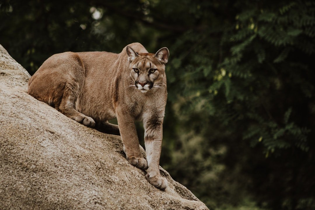
From Ancient Trails to Modern Cities: The Mountain Lion of the West
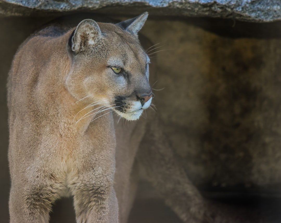
Call it mountain lion, cougar, or puma – this is the continent’s long-distance athlete. Western populations pad between cliffy refuges and river bottoms, keying off deer migrations that still echo down canyons like seasonal drumbeats. GPS collars have mapped their detours around freeways and neighborhoods, showing that most lions would rather ghost past us than tangle with our routines. The science is clear on their role: where they hold ground, deer browse patterns shift and vegetation has a chance to recover. It’s not a fairy tale of balance, but it is a nudge toward healthier landscapes.
Conflicts remain, and they’re real. Livestock losses sting, and rare encounters make headlines that travel farther than the cats themselves. Solutions – from non-lethal deterrents to targeted, evidence-based management – work best when they’re rooted in local data and community buy-in. The lion’s continued presence says something hopeful about the West: wildness can coexist with Wi‑Fi, if we plan for it.
Frost and Silence: The Canada Lynx in Snow Country
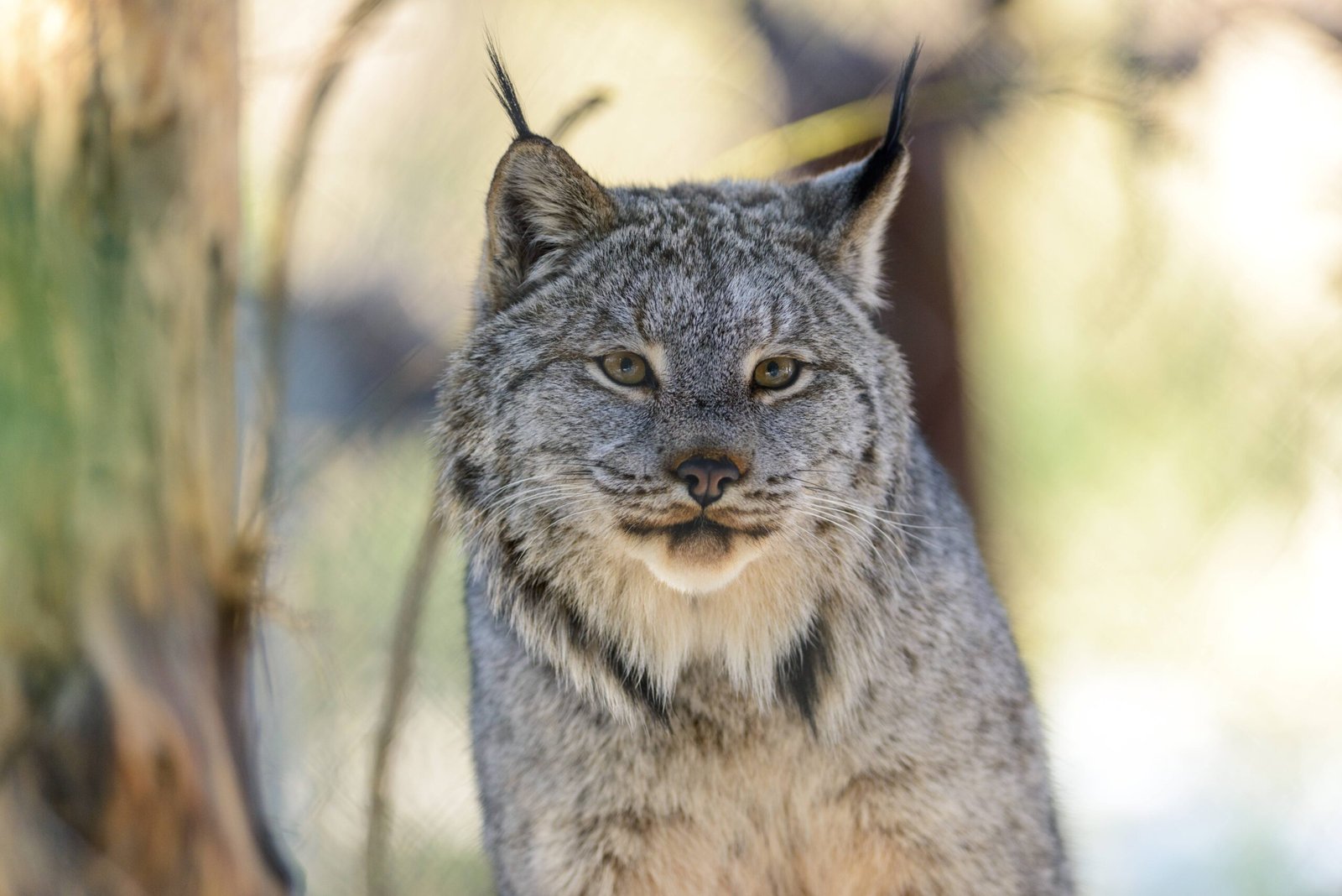
Picture a cat walking on snow like it’s powdered glass and you’ve met the Canada lynx. Oversized paws and long legs spread weight so neatly that lynx float where other predators punch through, a perfect adaptation for chasing snowshoe hares. Their fortunes rise and fall with hare numbers, producing natural booms and lean years that field biologists have been charting for decades. In the Lower 48, clusters persist in the northern Rockies, the North Woods, and high country where winter still holds sway. The lesson is as sharp as an icicle: climate and prey shape everything for this specialist.
Deep, consistent snow is the lynx’s safety net, and warming winters can tangle those threads. Road building, forest management, and recreation all matter at the edges, but nothing matters more than keeping patches of true winter intact. Where habitat is connected and hunting remains primarily hares, lynx can hang on and even expand. When the snow thins and hares drop, the cat behind them flickers too.
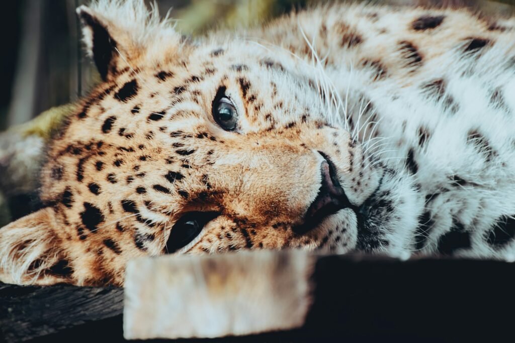
A Peninsula on the Edge: The Florida Panther
On a map, South Florida looks like a green sponge, but on the ground it’s a complicated maze of roads, canals, and neighborhoods. The Florida panther – an endangered puma lineage – navigates that maze with heartbreaking stakes, because vehicle collisions are a leading cause of death. Conservation has made real gains by preserving large tracts and adding wildlife underpasses where roads slice through habitat. Genetic rescue, habitat restoration, and careful monitoring have helped this population step back from the brink. Every kitten born in the swamps is a small miracle of logistics and biology.
Still, pressure ramps up as development pushes inland and sea-level rise squeezes margins from the coasts. The panther’s story is a case study in trade-offs: where a culvert goes, where a fence ends, how a subdivision is shaped. When planners treat panther movement like critical infrastructure, the whole ecosystem benefits – otters, bears, wading birds, and yes, people who prefer safer roads. The stakes are local and national at once, because they test whether a modern, fast-growing state can keep room for its apex cat.
Thornscrub Survivors: Ocelots in South Texas
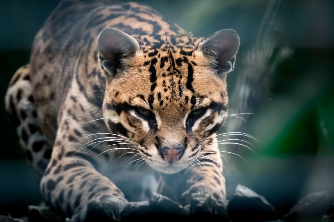
In the thorny tangles of South Texas, the ocelot moves like dappled sunlight – here, then gone. This spotted cat relies on dense brush and quiet corridors, making any open pasture or highway a risky crossing. Biologists working on private ranches and refuges have documented breeding, but numbers remain small and scattered. The solution set is tangible: protect thornscrub, stitch fragments with easements, and build crossings where mortality spikes. Each step turns a fragmented puzzle into a livable landscape.
Ocelots are proof that private land stewardship can be a conservation engine. Where ranchers manage for brush islands and minimize rodenticides, the cats and their prey stabilize. Add strategically placed underpasses, and road deaths can drop by meaningful margins. The future of this U.S. ocelot stronghold may hinge on dozens of small, coordinated choices rather than one grand fix.
Ghosts of the Sky Islands: Jaguars at the Border
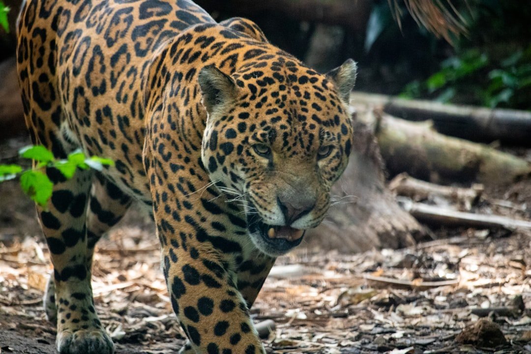
Every few years, a new jaguar photo blooms from a remote camera in Arizona’s Sky Islands – jolting and unmistakable. These are typically wide-ranging males from northern Mexico, felines that treat the border like a contour line instead of a wall. No resident breeding population is confirmed on the U.S. side, but the recurring appearances matter: they show a living, breathing corridor between two countries. The science points to rugged mountains, linked canyons, and quiet river valleys as the arteries of this movement. If those arteries clog, the visits slow; if they flow, a future foothold stays possible.
Debates over reintroduction, grazing, and border infrastructure can spark more heat than light. What’s consistent is the value of connectivity – protecting and restoring pathways that support jaguars and a menagerie of other borderland species. In practice, that means prioritizing open spans in fencing, riparian restoration, and smart siting of development. The jaguar’s shadow keeps attention on those choices like a living exclamation point.
Plains to Parking Lots: The Cougar Comeback East
Don’t let the name “eastern cougar” fool you – the historic subspecies is gone, but the species itself is on the move. Young males from the West ride grassland seams and river corridors hundreds of miles, turning up in places that thought big cats were only in old stories. A few Midwestern states now have small, breeding populations, and scattered confirmations keep popping up farther east. This is recolonization in slow motion, a natural experiment watched by game agencies, landowners, and scientists with a lot to learn. Every documented crossing teaches us which bridges, culverts, and greenways matter most.
With expansion comes responsibility. Rural communities and new exurban edges need practical tools – better livestock protection, carcass removal near roads, calm guidance when sightings occur. The East won’t mirror the West, but it can adapt faster with lessons already banked. Done well, coexistence will feel unremarkable, like a new neighbor who keeps to themselves and makes the block a little safer by being around.
Why It Matters
Wild cats do more than impress us; they reorganize ecosystems in ways that ripple outward to water, vegetation, and even disease. Where big and mid-sized predators persist, deer and small mammal behavior shifts, which can lift pressure off young trees and help streambanks hold. When rodent prey is kept in check, farms at the urban fringe may see fewer crop losses and fewer calls for toxic baits. Keeping cats safely away from traffic is also a public safety win, cutting collisions that injure people and wildlife alike. In short, healthy cat populations are signals of landscapes that still function.
Consider a few grounded points that often guide management and policy discussions:
- Long-distance dispersal by cougars can span hundreds of miles, making connected corridors essential rather than optional.
- Wildlife crossings and fencing, when well placed, can reduce animal-vehicle collisions by large margins, often by well over one half.
- Rodent-control poisons can move up food webs; reducing their use near greenbelts helps bobcats and raptors stay healthy.
- Protecting deep, consistent snow areas supports Canada lynx and snowshoe hares, a cold-weather partnership that defines northern forests.
The Future Landscape
The next chapter will be written by infrastructure as much as wilderness. More crossings on busy corridors, smarter fencing at pinch points, and suburban greenways built with ecology in mind can decide whether cats expand or erode. Satellite mapping, AI-assisted track recognition, and cheaper GPS collars are turning scattered observations into living maps that planners can actually use. Climate projections add urgency, pushing us to safeguard winter refuges for lynx and thornscrub strongholds for ocelots before they shrink further. The technology is here; the question is whether we’ll apply it at the speed growth demands.
Borderland connectivity will remain a defining test. So will coastal resilience in Florida, where sea-level rise and development squeeze the panther’s options. The encouraging sign is that many fixes – crossings, easements, retrofits – pay off across species and even improve human safety. Build for the cat, and you often build for everyone. That’s a future worth designing toward, one culvert and corridor at a time.
What You Can Do Now
Small actions scale when thousands of people take them. If you live near green space, keep pets indoors at night, secure trash, and avoid anticoagulant rodenticides that can poison predators through their prey. Support local land trusts and community plans that prioritize wildlife corridors, and speak up for road projects that include crossings and fencing where animals already move. Hunters and ranchers can be powerful allies by sharing field observations, reporting carcasses near roads, and testing non-lethal deterrents that reduce conflict. Curiosity helps too: a shared trail-camera photo, responsibly geotagged or not at all, can spark support for keeping these routes open.
Schools, libraries, and city councils are listening when neighbors ask for nature-smart design. Start with one ask – a safer crossing at a known hotspot, a preserved hedgerow that connects two parks – and build from there. The cats are doing their part by finding the threads; we can do ours by weaving them together. Ready to keep the wild in our maps just a little longer?

Suhail Ahmed is a passionate digital professional and nature enthusiast with over 8 years of experience in content strategy, SEO, web development, and digital operations. Alongside his freelance journey, Suhail actively contributes to nature and wildlife platforms like Discover Wildlife, where he channels his curiosity for the planet into engaging, educational storytelling.
With a strong background in managing digital ecosystems — from ecommerce stores and WordPress websites to social media and automation — Suhail merges technical precision with creative insight. His content reflects a rare balance: SEO-friendly yet deeply human, data-informed yet emotionally resonant.
Driven by a love for discovery and storytelling, Suhail believes in using digital platforms to amplify causes that matter — especially those protecting Earth’s biodiversity and inspiring sustainable living. Whether he’s managing online projects or crafting wildlife content, his goal remains the same: to inform, inspire, and leave a positive digital footprint.