Every morning, millions of Americans drive past invisible scars that tell Earth’s most dramatic story. You’ve walked over them, built above them, and probably never realized you were standing on ancient fractures that continue shaping the world beneath your feet. These fault lines have quietly sculpted the landscapes we take for granted, creating everything from California’s rolling hills to Utah’s towering mountain walls.
The Santa Monica Fault Beneath Beverly Hills’ Golden Triangle
Drive down Santa Monica Boulevard in West Los Angeles, and you’re literally following one of America’s most visible fault lines. For a mile or so, the fault reveals itself as an obvious south-facing scarp – a sudden 7- to 12-meter rise – along the north side of Santa Monica Boulevard. The fault scarp actually determined the path of the boulevard, which was originally a trolley line, since trolleys avoided steep grades.
Perhaps the best place to see the fault is the sloping lawn in front of the Mormon temple at Santa Monica Boulevard and Overland Avenue: “It’s one of the most beautifully landscaped fault scarps in the world.” The Santa Monica fault runs below Rodeo Drive and the Beverly Hills shopping district, cutting through the so-called Golden Triangle and running between Santa Monica and Wilshire boulevards. The Santa Monica fault cuts through the heart of the Westside, straddling or paralleling Santa Monica Boulevard through Century City and Westwood before veering due west, with segments running into Brentwood, Santa Monica and Pacific Palisades.
What makes this fault remarkable is how early developers instinctively worked with the landscape. “Many parts of the city that these faults traverse were developed quite early in the teens and ’20s before the advent of mechanized grading equipment. So rather than just flattening the landscape to build, we draped the city over the existing landscape.”
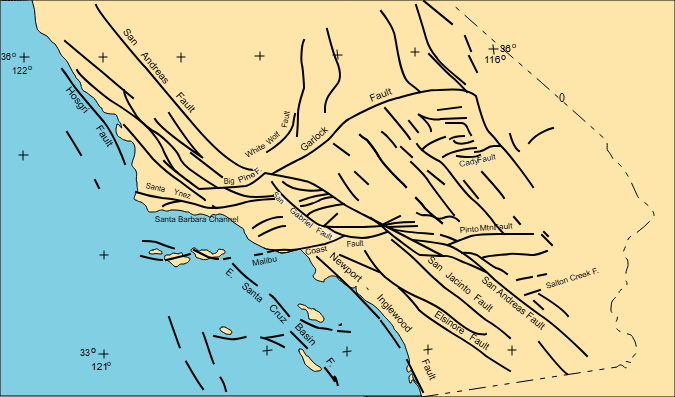
The San Andreas Fault’s Textbook Scar in Carrizo Plain
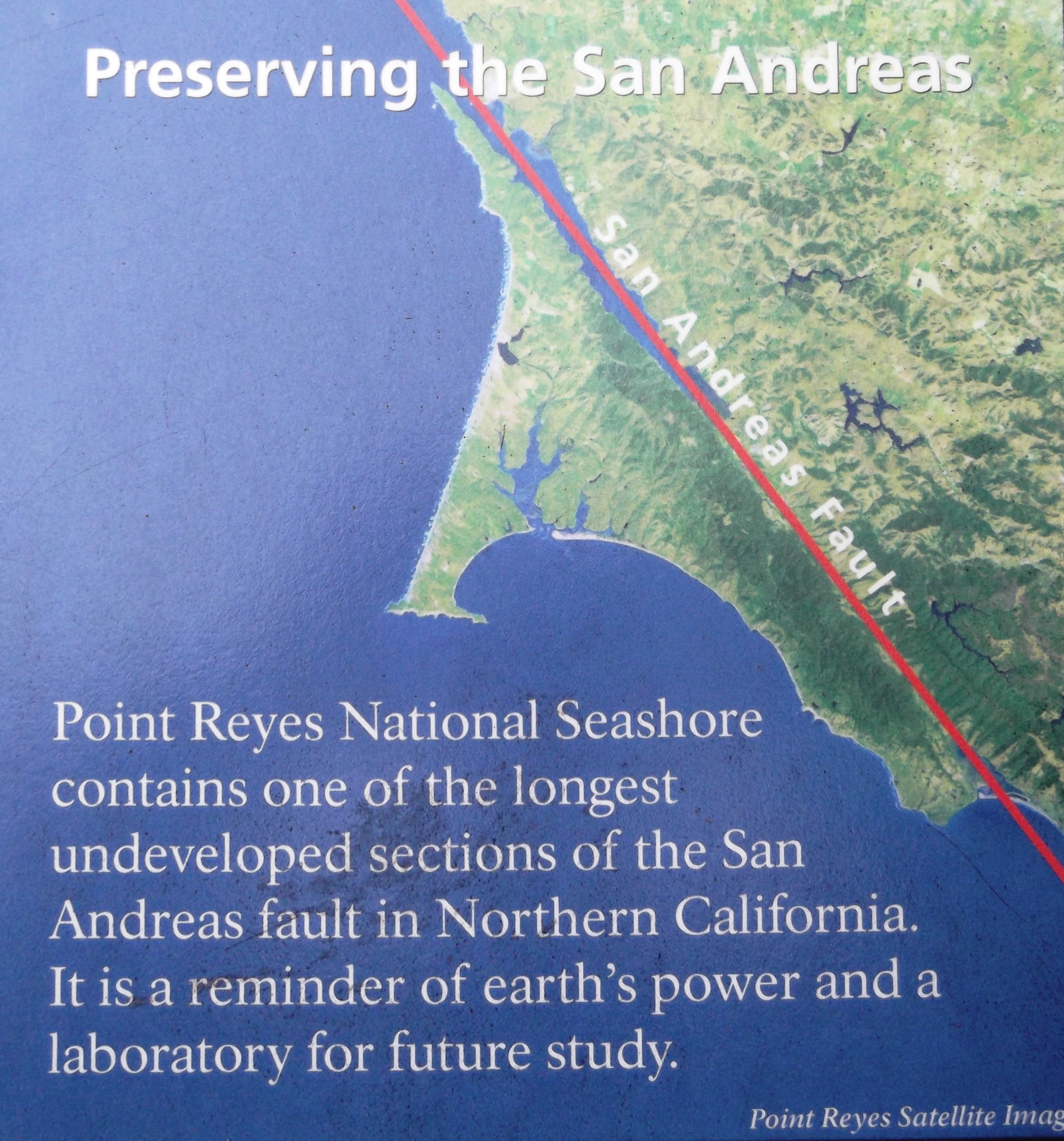
If you want to see a fault line that looks exactly like what you’d draw in a geology textbook, head to Carrizo Plain National Monument northwest of Los Angeles. Check out the Carrizo Plain National Monument in Central California, where you can visibly see the fault scar slicing across the landscape like a giant zipper in the earth.
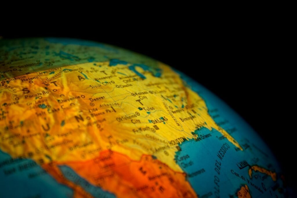
The San Andreas Fault is one of the most famous fault lines in the world and the largest in the United States. Stretching more than 800 miles through California, it forms the boundary between the Pacific and North American tectonic plates. Here, without urban development to mask its presence, the fault creates a linear valley that cuts through ridge after ridge of folded rock.
This dramatic landscape feature has been building for millions of years, as the two plates grind past each other horizontally. The visual impact is so striking that early pioneers used it as a navigation landmark across the remote Central Valley.
The Hayward Fault Tearing Through Bay Area Neighborhoods
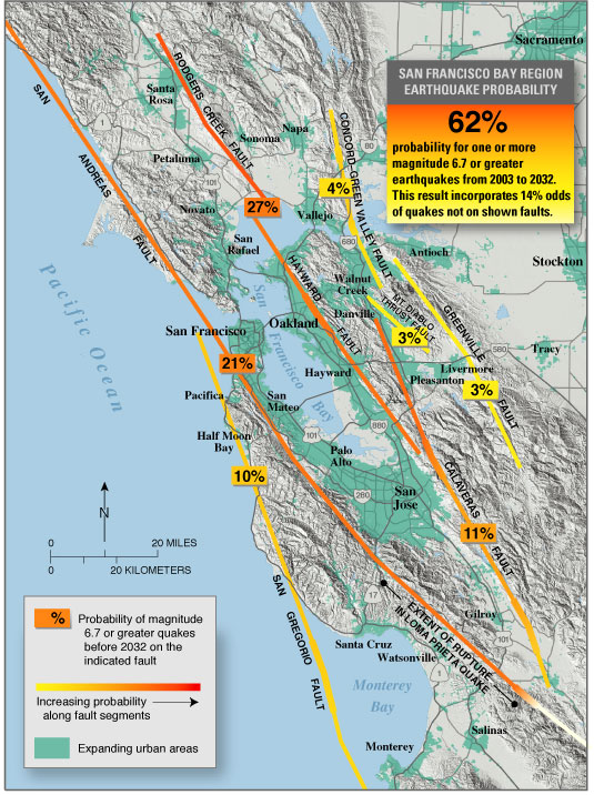
While most of the fault line is covered by urban infrastructure, it also cuts through the Oakland Zoo, where it runs past the otter tank and a bear pen. Berkeley’s university campus straddles the fault as well. The Hayward Fault offers one of the most intimate examples of how geological forces interact with everyday life.
The San Francisco Bay Area is one of the few places in the world where faults “creep,” that is, the fault slip is slow and continuous and does not occur as the result of a large earthquake. This Google Earth file shows locations and photographs of fault creep (such as sidewalk cracks, offset street curbs, and cracked building foundations). Walk through neighborhoods in Fremont or Hayward, and you’ll spot cracked sidewalks, offset curbs, and tilted fences that mark the fault’s gradual movement.
Some of the residence halls near the Greek Theatre and Memorial Stadium at the foot of Strawberry Canyon are built either directly on or just a few yards off the surface trace of the fault. The effects of fault creep in the stadium are clearly visible above section KK in the south curve, where some sections of the wall have separated from each other by at least four inches.
The Wasatch Fault Creating Utah’s Dramatic Mountain Wall
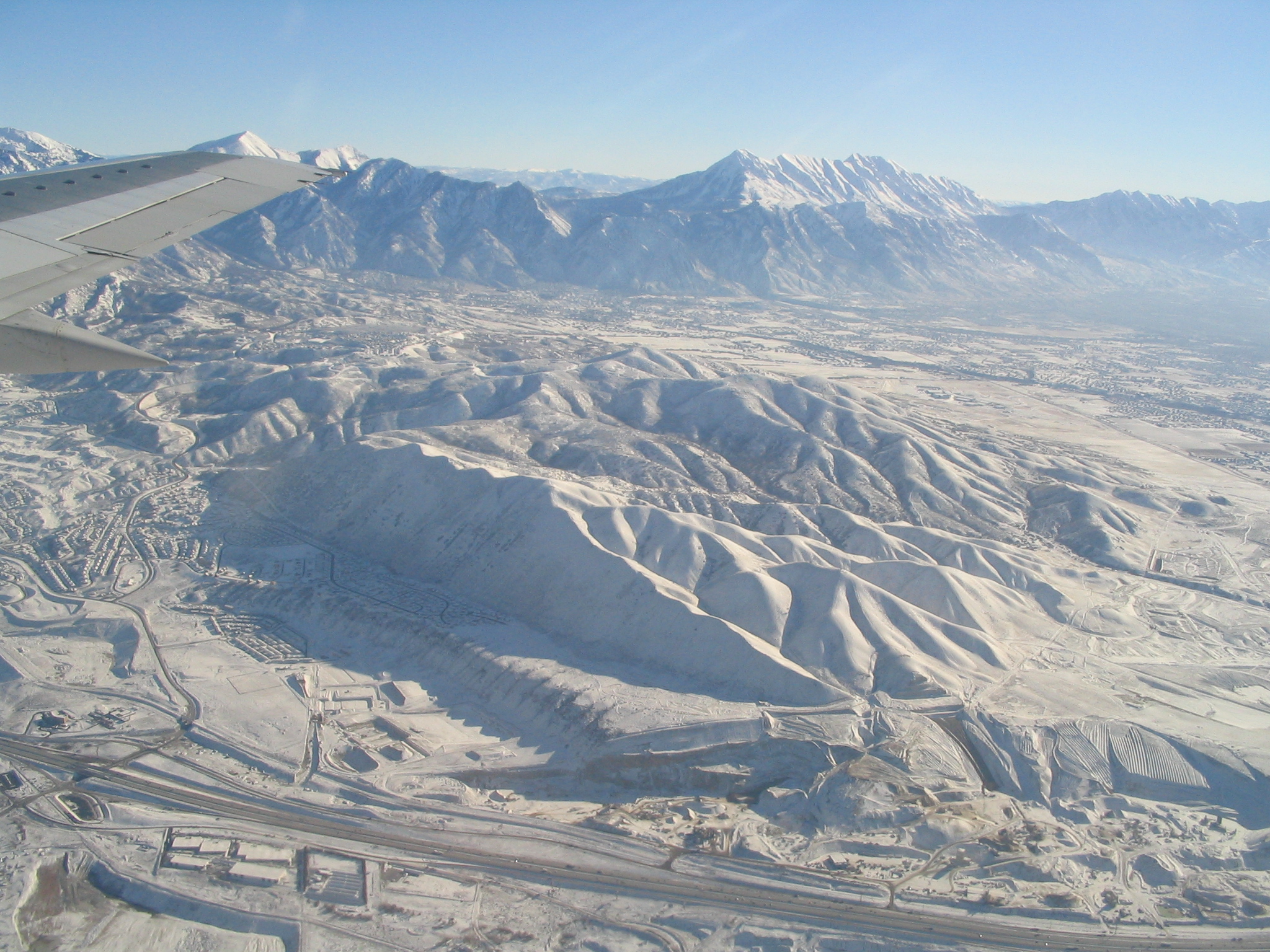
Step outside anywhere along Utah’s Wasatch Front, and you’re looking directly at one of America’s most spectacular fault-created landscapes. The Wasatch Fault runs approximately 230 miles through Utah, forming the Wasatch Front and the backdrop to cities like Salt Lake City. This normal fault is responsible for the uplift of the Wasatch Range and the subsidence of the adjacent valleys.
The fault has created such an abrupt transition that you can literally stand in the desert valley floor and look up at ski slopes thousands of feet above. This isn’t gradual erosion at work – it’s the Earth’s crust dropping on one side and rising on the other along a clean break.
The Wasatch Fault is considered one of the most hazardous faults in the United States due to its proximity to urban areas. Anecdotes from early settlers describe minor tremors, but the fault is overdue for a major earthquake. The dramatic scenery comes with serious risk for the millions who live directly below these towering cliffs.
The New Madrid Seismic Zone’s Hidden Mississippi River Legacy
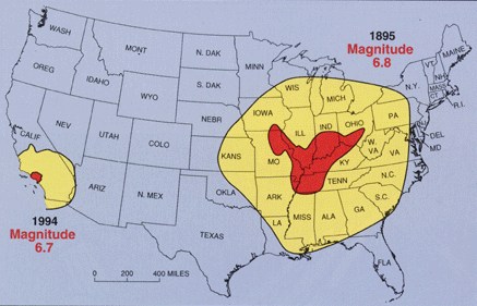
Unlike the obvious scars of western faults, the New Madrid Seismic Zone in the central United States tells its story through subtler landscape clues. The faults that produce earthquakes are not easy to see at the surface in the New Madrid region because they are eroded by river processes and deeply buried by river sediment.
Yet this hidden fault system has dramatically shaped the American Midwest. In the New Madrid region, the earthquakes dramatically affected the landscape during the massive 1811-1812 earthquake sequence. Local uplifts of the ground and the sight of water waves moving upstream gave observers the impression that the Mississippi River was flowing backwards. At New Madrid, trees were knocked down and riverbanks collapsed.
The most obvious effects of the 1811-1812 earthquakes are the large sandy deposits, known as sand blows, resulting from eruption of water and sand to the ground surface. These sandy patches still dot farm fields across Missouri, Arkansas, and Tennessee, marking where underground pressure forced saturated sand to the surface.
The Walker Lane’s Emerging Western Divide
While California’s San Andreas system gets the headlines, scientists are watching a parallel fault system that might eventually split the American West in an entirely different direction. While the San Andreas fault system moves 35 millimeters a year, the southern Walker Lane moves about 10 millimeters a year, and near the latitude of the Reno area the northern Walker Lane moves about 5 to 7 millimeters a year.
The Walker Lane stretches through Nevada and eastern California, creating a complex network of valleys, ridges, and mountain ranges that most travelers see as random desert topography. Just one of the many geologic features found so far in the study includes the discovery of more than two dozen previously unknown faults and a better understanding of many known faults. “These data can help us focus in on where to conduct our geologic work,” Faulds said. This, in turn, will help us put together the puzzle of the Walker Lane and better understand how its evolution is relevant to assessing earthquake hazards in the region.
What appears to casual observers as empty Nevada landscape is actually a zone where the Earth’s crust is actively stretching and breaking, creating the complex basin-and-range topography that defines much of the Great Basin.
The Imperial Fault Shaping Southern California’s Agricultural Heart
In the Salton Sea region of Southern California, another piece of the San Andreas system has created one of America’s most productive agricultural valleys while posing constant seismic threats. The Imperial Fault in Southern California is part of the larger San Andreas Fault system and spans approximately 60 miles. This strike-slip fault has been the source of several significant earthquakes, including the 1979 Imperial Valley earthquake.
Located near agricultural and urban areas, the Imperial Fault is closely monitored for its potential impact on critical infrastructure. The fault’s activity has helped create the below-sea-level Imperial Valley, where the Colorado River’s ancient deposits built some of California’s richest farmland.
Drive through the Imperial Valley today, and you’re seeing a landscape shaped by the ongoing tug-of-war between the Pacific and North American plates. The perfectly straight lines of irrigation canals and farm roads follow the fault’s influence, while the desert mountains rising abruptly on either side mark where the crust has been pushed upward.
Why These Visible Faults Matter for America’s Future
These seven fault systems represent more than geological curiosities – they’re active shapers of American infrastructure, development, and risk management. 60% probability of a major quake in Southern California in the next 30 years means that understanding these visible landscape features becomes crucial for millions of residents.
The visible nature of these faults offers both advantages and challenges for hazard preparation. In California, if property lies within the Alquist-Priolo Earthquake Fault Zones that generally extend 150 meters to each side of a fault, special investigation is required prior to construction. Yet A Los Angeles Times analysis published in 2013 said that the cities of Los Angeles and Santa Monica in the prior decade approved more than a dozen construction projects on or near two well-known faults without requiring seismic studies. Los Angeles building records showed that when officials approved projects, they used outdated information that placed the Santa Monica and Hollywood faults much farther away from the developments.
The most compelling aspect of these fault lines is how they’ve become integral parts of American landscapes and communities, from Santa Monica Boulevard following an ancient scarp to entire metropolitan areas built in fault-created valleys. Understanding their visibility helps us appreciate both the beauty and the ongoing geological processes that continue shaping the continent beneath our feet.
What do you think about it? Tell us in the comments – have you spotted any of these fault features in your own travels across America’s dynamically changing landscape?

Suhail Ahmed is a passionate digital professional and nature enthusiast with over 8 years of experience in content strategy, SEO, web development, and digital operations. Alongside his freelance journey, Suhail actively contributes to nature and wildlife platforms like Discover Wildlife, where he channels his curiosity for the planet into engaging, educational storytelling.
With a strong background in managing digital ecosystems — from ecommerce stores and WordPress websites to social media and automation — Suhail merges technical precision with creative insight. His content reflects a rare balance: SEO-friendly yet deeply human, data-informed yet emotionally resonant.
Driven by a love for discovery and storytelling, Suhail believes in using digital platforms to amplify causes that matter — especially those protecting Earth’s biodiversity and inspiring sustainable living. Whether he’s managing online projects or crafting wildlife content, his goal remains the same: to inform, inspire, and leave a positive digital footprint.