Across the United States, there are places that seem to bend the rules of reality just a little. Compasses spin, lights dance across empty skies, rocks move as if alive, and entire patches of land swallow sound or bend perspective. Scientists have shown up with instruments, measurements, and cautious explanations – yet somehow, nagging questions always remain.
I still remember standing at one of these spots, feeling my sense of balance quietly revolt, like my body knew something my brain refused to accept. That feeling – of being slightly out of sync with the world – is exactly what keeps these locations so haunting. They sit at the blurry border between what we know and what we only think we know, and that’s where things get genuinely interesting.
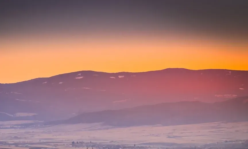
The Oregon Vortex, Oregon
What if the ground beneath your feet was quietly arguing with gravity? At the Oregon Vortex near Gold Hill, visitors report balls rolling uphill, brooms standing on end, and people seeming to change height depending on where they stand. It looks like a cheap trick at first glance, until you realize how many surveyors, physicists, and skeptics have tried to pin it down and still walked away unsatisfied.
The official explanation usually leans toward optical illusions, tilted structures, and the brain’s tendency to misjudge slopes and angles. But the strange thing about the Oregon Vortex is that those explanations never quite feel complete. Compasses behave erratically, and the effect continues even in restored or rebuilt sections. Whether it’s a unique geological anomaly, a magnetic oddity, or just a masterclass in human perception, it still refuses to be fully boxed in by science.
The Brown Mountain Lights, North Carolina
On dark nights near Brown Mountain in western North Carolina, lights appear where no lights should be – hovering, gliding, and sometimes fading in and out like silent signals from another world. People started reporting them more than a century ago, long before cars, drones, or LED flashlights, and those reports keep coming. The lights don’t behave like normal headlights or campfires; they drift above the treeline and appear in areas that are empty wilderness.
Researchers have suggested swamp gas, headlights refracting through layers of air, or even glowing minerals reacting to subtle electrical conditions. Some studies have tied a few sightings to car lights along distant roads, but others occur where no roads or buildings exist. The unsettling thing is the inconsistency: some nights, nothing; other nights, a quiet, eerie show. When you stand there and see faint orbs flicker to life over a ridge, explanations suddenly feel a lot thinner than they do on paper.
Marfa Lights, Texas
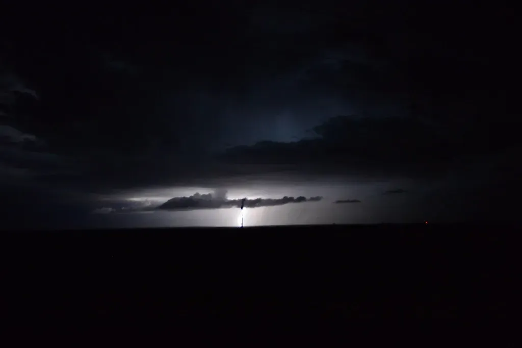
Out in the West Texas desert near the town of Marfa, strange glowing orbs appear on the horizon, often far from any visible source. They split, merge, dart sideways, and vanish without a sound, like someone is playing with invisible lanterns in the distance. Ranchers, travelers, and even military pilots have reported them for generations, and the town has leaned into the mystery with a viewing area and annual festival.
Some researchers argue that many of the sightings come from car headlights distorted by temperature layers in the air, a kind of desert mirage. That might explain a portion of the lights – but not those seen before modern highways, or the ones that behave in ways headlights never do. The Marfa Lights live in this frustrating in‑between zone where science has several maybes but no definitive, consistent answer, and the desert seems perfectly happy to keep its secret.
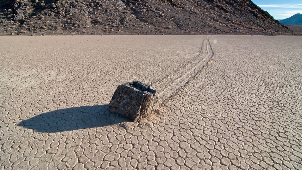
Racetrack Playa’s Sailing Stones, California
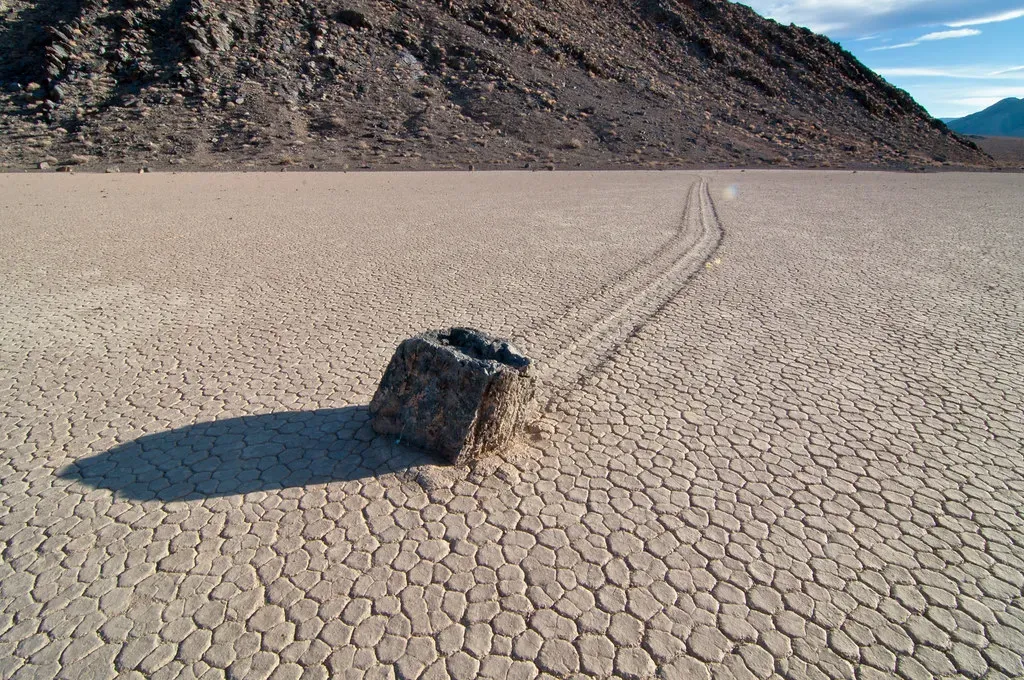
In Death Valley’s Racetrack Playa, heavy rocks appear to move on their own across the dried lakebed, carving long, winding trails in the cracked mud. For decades, no one had actually seen them move. People just found the tracks after the fact – thick, weighty stones that had somehow slid many meters as if pushed by an invisible hand. It felt like the desert was performing a slow-motion magic trick.
In recent years, high‑resolution time-lapse cameras finally caught some movement, and a leading theory emerged: very thin sheets of ice form beneath the rocks after rare rain, then melt and shift under light winds, gently pushing the stones along. That explanation is compelling and supported by some direct observation, but it still doesn’t neatly explain all recorded trails or older patterns formed under different climate conditions. So even here, where science has come closest to solving the puzzle, there’s still a trace of mystery etched into the playa alongside those silent tracks.
Devil’s Kettle Falls, Minnesota
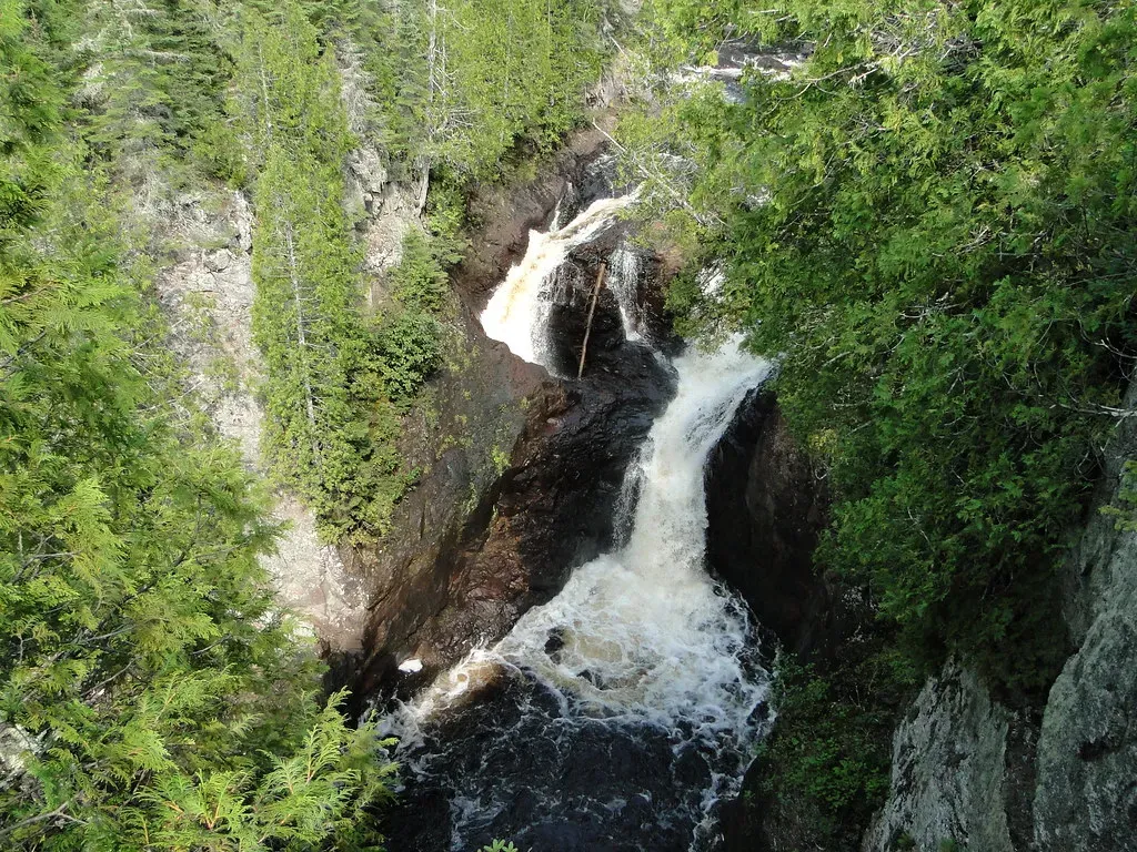
On the Brule River in northern Minnesota, the water reaches a strange split: part of the river flows over a regular waterfall, and the other part plunges into a deep hole in the rock called Devil’s Kettle. For years, no one could say with certainty where that second stream of water ended up. People tossed dye, ping‑pong balls, and other markers into the churning hole, but nothing obvious surfaced downstream, feeding rumors that it vanished into some hidden cavern or underground void.
More recent hydrological studies have suggested that the water does, in fact, rejoin the river below, likely through fractures in the rock, and measurements of flow rates upstream and downstream largely back that up. Still, the exact route and shape of that underground path remain largely unseen and unmeasured, partly because the geology is too dangerous to explore directly. Standing at the overlook, watching half a river simply disappear into the earth, it’s hard not to feel like nature is pulling off a quiet disappearing act right in front of you.
The Bermuda Triangle’s U.S. Corner, Off Florida
The Bermuda Triangle is usually framed in broad strokes – Florida, Bermuda, Puerto Rico – but one of its strangest stretches lies just off the U.S. coast near southern Florida. This slice of ocean has been linked to ship vanishings, bizarre navigation errors, and aircraft incidents, piling up stories that refuse to die. While many of the most dramatic tales have been exaggerated or debunked, there’s still an unusual density of reported anomalies compared with some other heavily traveled waters.
Scientists and maritime experts point to powerful Gulf Stream currents, unpredictable weather, and heavy traffic as major, rational factors. There are also subtle geomagnetic quirks in parts of the region that can nudge compasses slightly off true north, enough to cause trouble if a pilot or captain is already stressed or disoriented. Still, the mythology refuses to fade, and that specific wedge of ocean near the American coastline has become a symbol of how even a well-mapped sea can feel like a blank spot on the mental map.
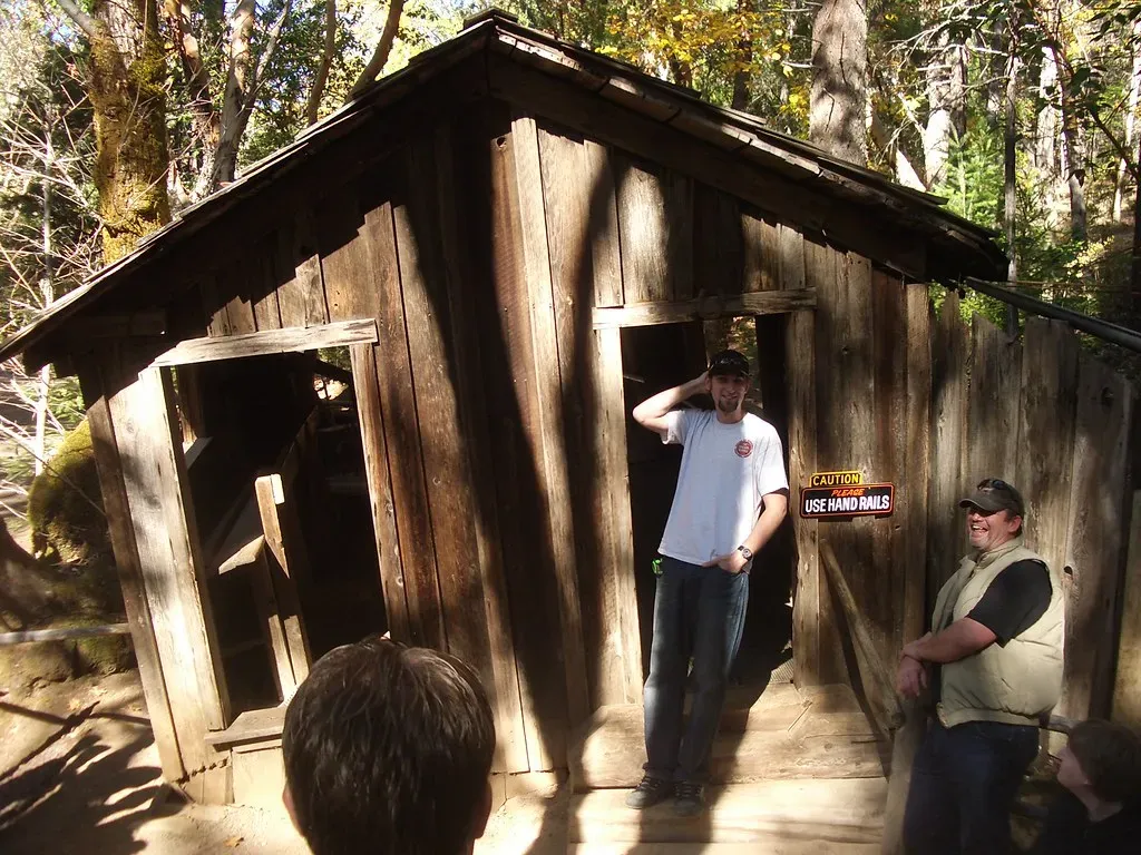
The Mystery Spot, Michigan
Near St. Ignace in Michigan’s Upper Peninsula, the Mystery Spot advertises itself as a place where physics gets a little wobbly – and, uncomfortably, your body agrees. Inside its tilted cabin and on the surrounding grounds, people feel pulled sideways, struggle to stand upright, and watch water appear to flow uphill. It’s part attraction, part lab experiment in how easily the human brain can be fooled by environment and expectation.
The standard explanation is that the structures are cleverly designed to exploit visual confusion: slanted walls, skewed floors, and carefully framed sightlines make level surfaces look crooked and vice versa. That probably accounts for a big chunk of what people feel, especially once you factor in suggestion and group psychology. But compasses and simple leveling tools have sometimes given odd readings here, adding just enough uncertainty to keep the door cracked open for something more. Whether it’s pure illusion or a subtle geophysical anomaly dressed up for tourists, it continues to unsettle anyone who steps inside.
These seven places stretch from cold northern rivers to blistering desert flats, from quiet forested hills to the open Atlantic, yet they share one unsettling trait: they refuse to fit neatly into a single clean explanation. Science has chipped away at the mysteries in some of them, offering solid theories and partial answers, but there’s always a leftover piece that does not quite snap into place. That leftover piece is where imagination, unease, and wonder all rush in together.
Living in a world where satellites map every inch of the planet, it’s tempting to assume that everything important has already been solved. Yet here are patches of American soil, water, and sky that quietly disagree. They remind us that even in a data‑driven age, there are still corners where the numbers don’t fully add up and the story is not finished. Which of these locations would you dare to stand in and trust your own senses over the explanations?