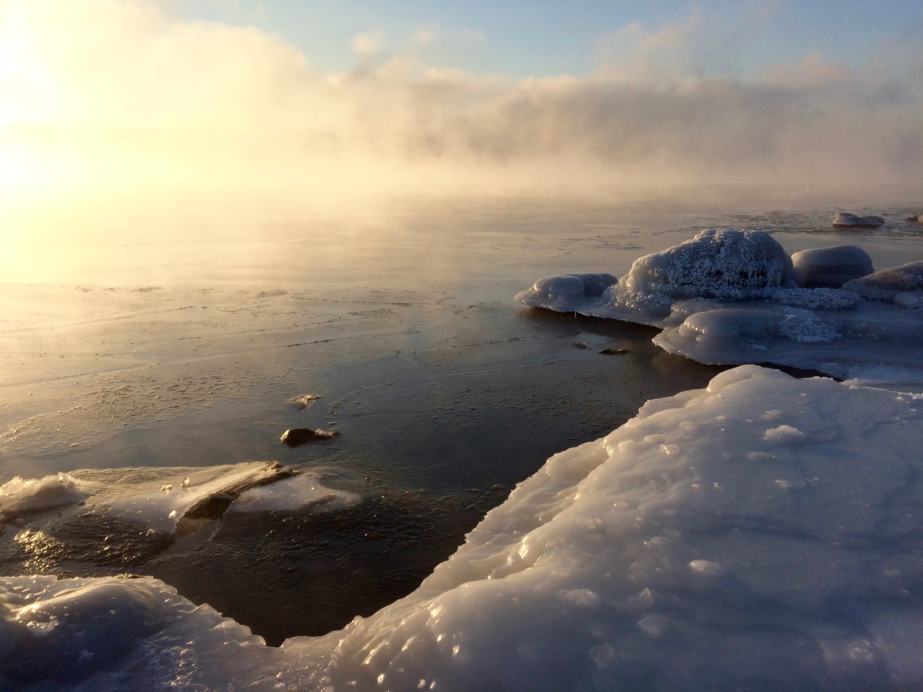
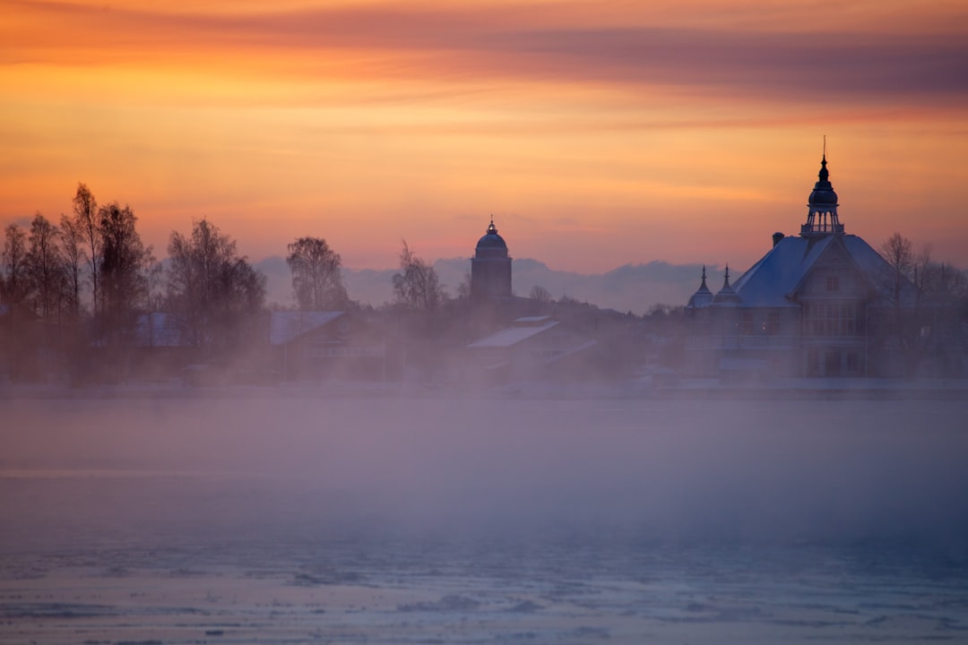
When Arctic air slams into water that’s still holding autumn’s leftover warmth, the surface starts to smoke – except it’s not smoke at all. It’s sea smoke, a fleeting veil of vapor that rises in ragged wisps, then blooms into ghostly plumes. Photographers chase it, mariners respect it, and physicists love it because the recipe lays bare the laws of heat and moisture. The mystery is simple and profound: warm water adds vapor to frigid, dry air until it saturates, condenses, and sometimes freezes in place. In those minutes, you can watch thermodynamics take shape as if sketched on the morning air.
Penobscot Bay, Maine – The Hidden Clues
Here’s the shocker: sea smoke often surges highest when the water hovers just above freezing and the air is punishingly cold. The warm surface evaporates moisture into that dry air, pushing it past saturation in a shallow layer where tiny droplets form almost instantly. The process is turbocharged by contrast – big temperature and humidity gaps make the fog rise in quick, churning streamers.
Look for calm or lightly gusty mornings after a strong cold front, when the sky is clear and the wind hasn’t scoured the vapor. Too much breeze tears the plumes apart; too little limits mixing and keeps the show tame. Along Penobscot’s working docks, you can see narrow columns race like chimney smoke and then knit themselves into a low, silvery mat.
Casco Bay, Maine – From Ancient Tools to Modern Science
Long before modern sensors, navigators read sea smoke as a sign of brutal air temperatures and tricky visibility. Today, weather buoys and satellite skin-temperature maps let forecasters watch the water-air tug-of-war in real time. The physics still tracks the old intuition: evaporation adds invisible vapor, mixing cools it, and the vapor condenses into visible droplets.
On the coldest outbreaks, some droplets supercool and freeze on contact with railings or rigging. That’s why decks glaze and why working boats move slower at sunrise. Casco Bay’s maze of ledges funnels light winds, creating hot spots where sea smoke lights up first.
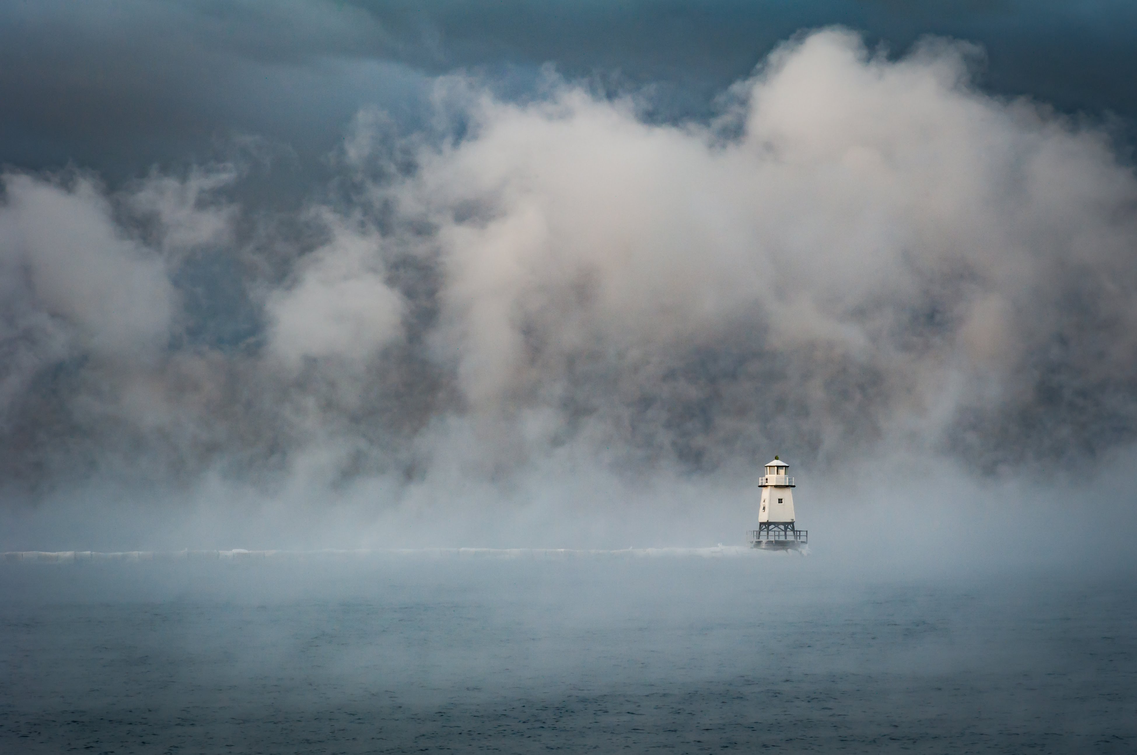
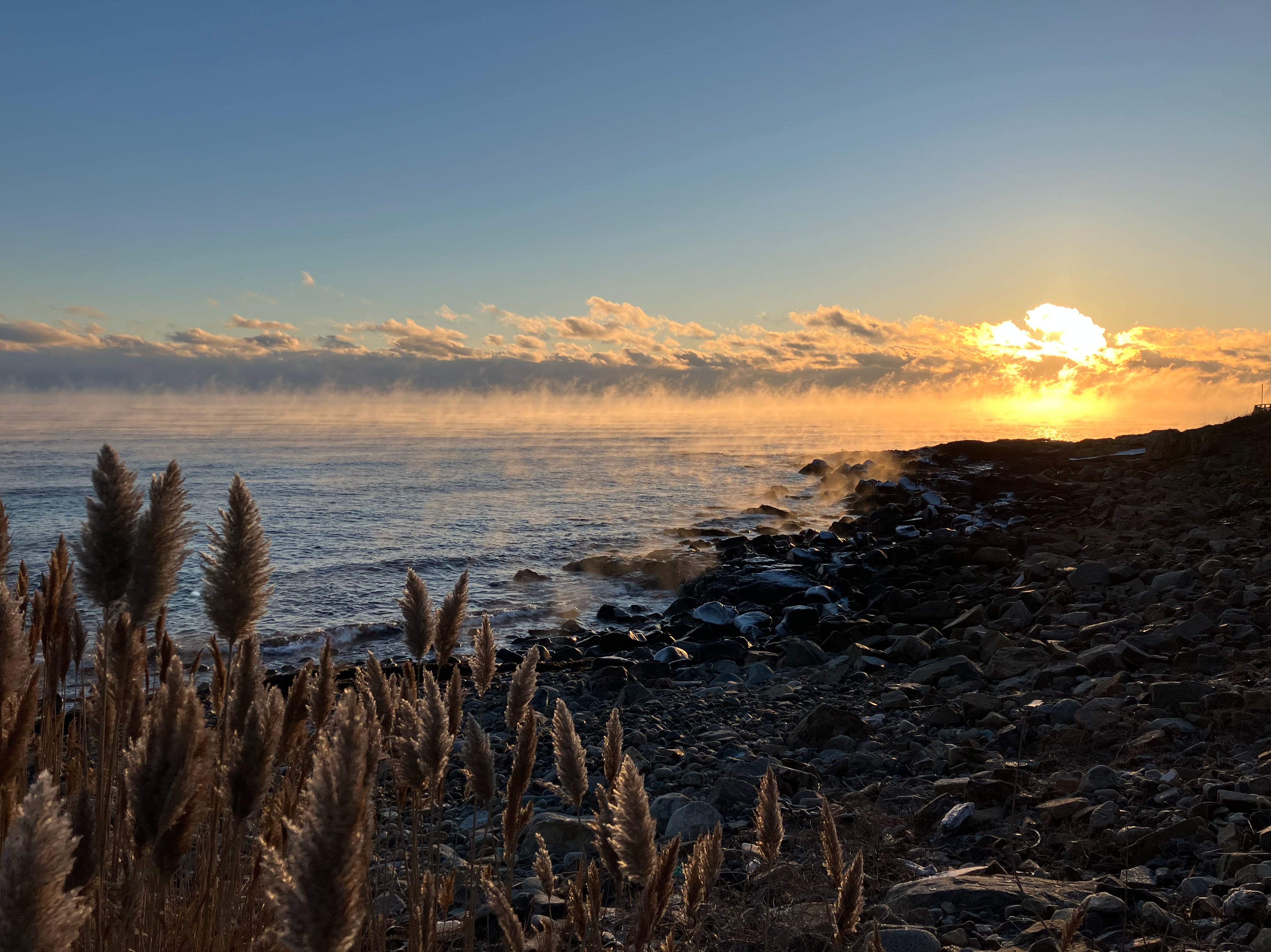
Portsmouth Harbor & Isles of Shoals, New Hampshire – Field Notes on a Frigid Morning
Stand on the tug pier at dawn and you’ll see streamers peel off the tide line, each a living cross-section of heat transfer. Warm eddies lift vapor; frigid air steals energy and cools the mix to its dew point within seconds. The fog thickens near obstacles, where turbulence folds warm and cold layers together.
The best show arrives right after the cold front, when Arctic air is driest and the background sky is crystal blue. Watch the plumes climb a few yards, then collapse as they entrain even colder air aloft. It’s a dance between buoyancy and mixing, written in breath-white strokes.
Boston Harbor, Massachusetts – Urban Thermodynamics
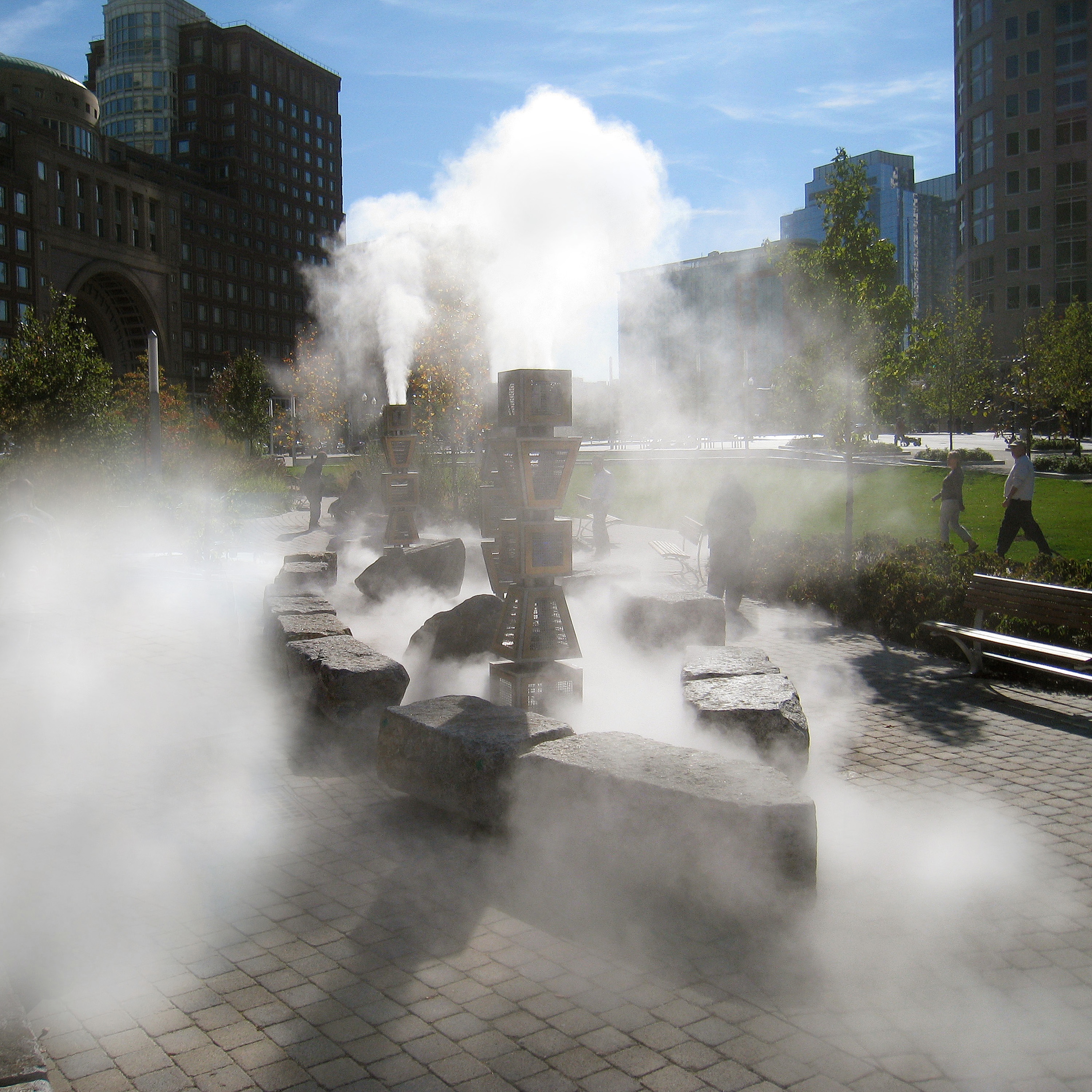
City harbors add a twist: concrete and brick radiate the night’s stored heat while the channel breathes out moisture. That extra nudge can spark early plumes along ferry wake lines, a neat tracer of where mixing is strongest. Warm exhaust from ships also seeds tiny particles that droplets cling to, speeding the fog’s birth.
Yet it only works when the air is truly bitter and the wind behaves. If a northwest gale roars, the plumes shred into tatters; if it’s too still, the vapor pools and the spectacle stays subtle. Boston’s best mornings combine frigid air, water still in the upper 30s, and a gentle harbor breeze.
Cape Cod Canal, Massachusetts – Choke Point for Cold Fronts
The canal is a narrow corridor where tides rip and temperature contrasts stack up. Cold continental air pours through like a funnel, slamming into warmer seawater and wringing out vapor in muscular, fast-moving lanes. Wake turbulence from transiting barges can loft dramatic, curling streamers.
Because the canal connects two water masses, tiny differences in temperature can make one side smoke while the other barely hazes. That side-by-side display reads like a field experiment you can watch from a single bridge. It’s the physics of evaporation-cooling turned into a split screen.
Narragansett Bay, Rhode Island – Offshore Wind’s Subtle Hand
Sea smoke loves a light hand on the fan: just enough wind to mix, not enough to rip. Offshore flow provides that balance, drifting out of the cold land and across water that still remembers October. The bay’s coves are protected labs where vapor can form, thicken, and slide along the surface.
By mid-morning, sunlight warms the lower air and the contrast fades. The plumes slump, visibility rebounds, and the harbor returns to ordinary winter. If you’re scouting, be there at nautical twilight and work your way toward the main channel as the first light reveals the lines.
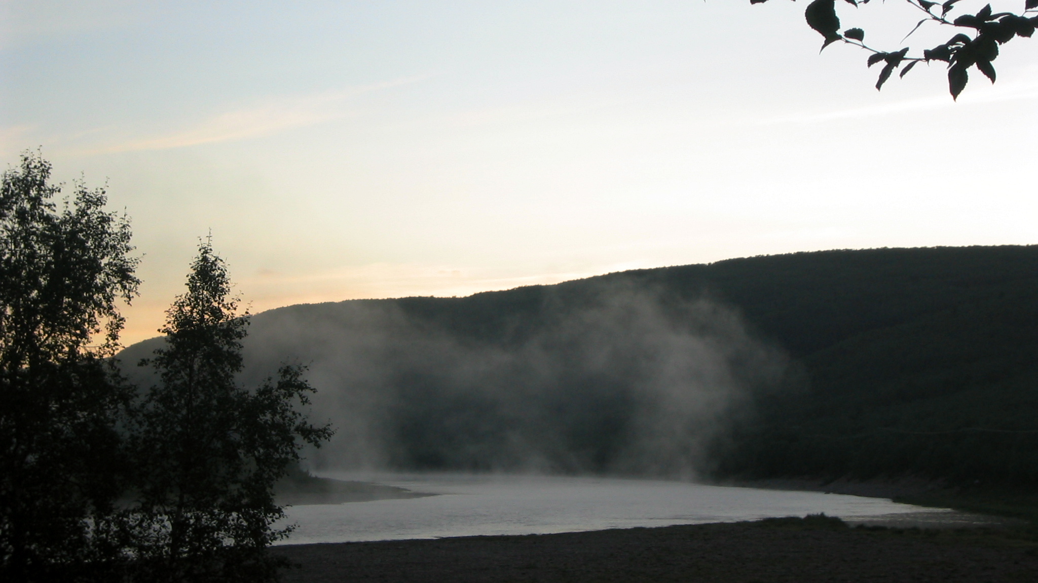
Burlington on Lake Champlain, Vermont – When Valley Air Crashes the Party
Mountain valleys feed bone-dry air toward the lake after a frontal passage. When that air crosses comparatively mild water, the temperature shock is immediate and the fog blooms in ragged sheets. It clings low because the cold cap above traps the steam-like layer near the surface.
Lake bathymetry matters, too: deeper pockets release stored heat longer into winter. A harbor that smoked one day may look quiet the next if wind direction or mixing depth changes. In a place known for ice, this is winter’s last breath of liquid heat meeting Arctic chill.
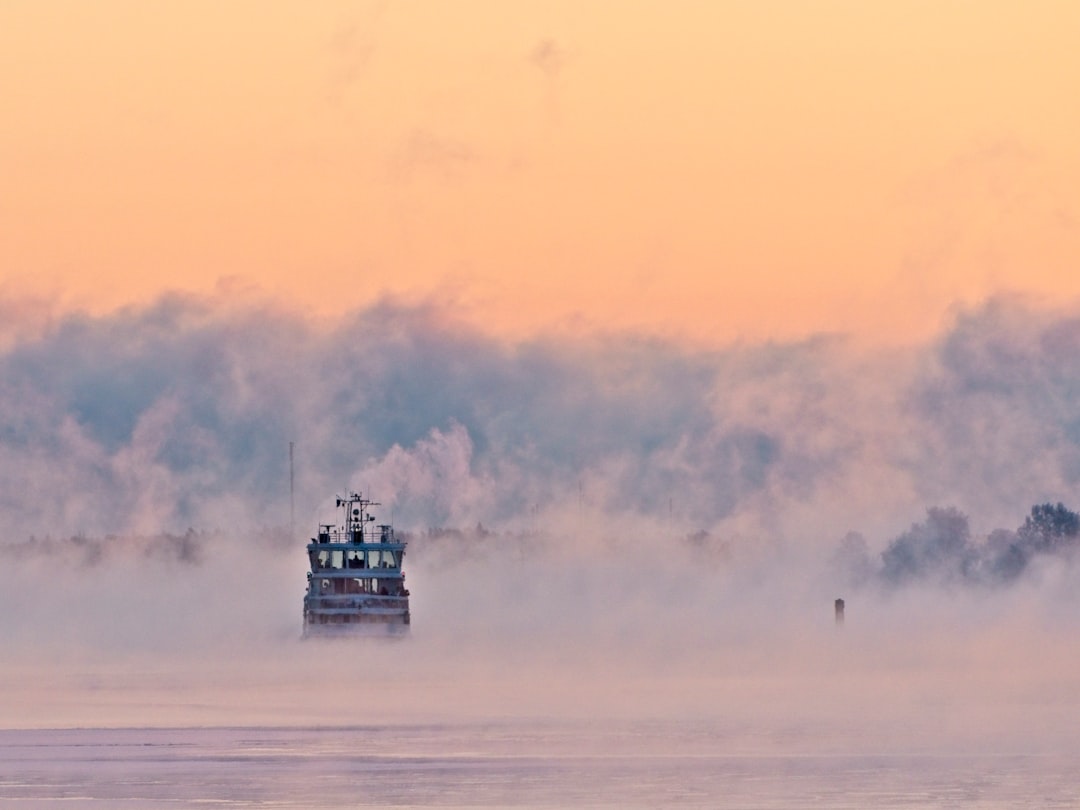
Duluth Harbor, Lake Superior, Minnesota – Why It Matters
Sea smoke is more than a photo op; it’s a real-time indicator of heat exchange between water and atmosphere. Those exchanges influence when ice forms, how fast lakes lose warmth, and even where lake-effect snow bands might sharpen. For mariners, the fog cuts visibility and ices gear, raising risk in an already hostile season.
Compared with fair-weather haze, sea smoke is an energy sprint, not a stroll. It tells us the system is venting heat rapidly, a clue for forecasters and a warning for anyone afloat. Watching it is witnessing the engine of winter spool up.
Apostle Islands, Wisconsin – Microclimates in Motion
Glacial-carved channels create pockets where water warmth lingers and the wind curls in circles. That means sea smoke can erupt in one embayment and vanish around the next headland. Each plume marks where mixing hit the sweet spot of temperature gap, turbulence, and moisture supply.
Kayakers who brave the margins of early winter know to read these cues like road signs. A sudden thickening can hint at a warmer patch or a wind eddy ahead. In the Apostles, microclimate is not an abstract idea – it’s the pattern painted on the water.
Chicago Lakefront, Illinois – The Future Landscape
As winters warm overall, open-water seasons stretch longer on the Great Lakes, yet the coldest outbreaks still punch through. That tug-of-war may concentrate sea smoke into shorter, more intense bursts when conditions align. Less ice cover some years can also leave more surface available to vent heat during Arctic snaps.
Forecasting is catching up, with higher-resolution lake models and better lake-surface temperature mapping. That means tighter nowcasts for visibility and icing risk on harbor operations. The spectacle will endure, but the calendar and character may keep shifting.
Buffalo’s Outer Harbor, New York – Lessons from Lake-Effect Country
Here the story links directly to snow. When Superior and Erie pump heat and vapor into frigid air, the first act is sea smoke; the second can be towering snow bands downwind. The same moisture source feeds both, only the depth of mixing and lift decide the outcome.
On quiet mornings before the bands ignite, the harbor wears a milky shawl. It’s the preview trailer for a day of convective drama. Read the plumes, and you’re reading the next chapter in the lake-effect script.
Door County, Wisconsin – Where Currents Draw the Lines
Between Green Bay and open Lake Michigan, currents lay invisible borders that sea smoke makes visible. Plumes often trace shear zones where water of slightly different temperature meets, like chalk lines sketched by the wind. Photographers find high bluffs to watch the shifting edges form and dissolve.
When the first sun angle hits, those borders move fast. Warmer tongues fade, colder skins spread, and the fog rearranges in minutes. It’s cartography by condensation, an atlas that redraws itself with every gust.
Utqiaġvik (Barrow) Sea Ice, Alaska – How to Watch Responsibly
At the top of the world, leads opening in young sea ice can gush vapor into bitter air, creating brutal, beautiful plumes. The physics is the same – warm water, cold air, rapid saturation – but the stakes are higher in extreme cold. Frostbite is measured in minutes, and icing can be instant on metal or glass.
If you go, respect local guidance, dress for deep cold, and avoid unstable ice or surf zones. Keep distance from wildlife and working crews, and let the scene unfold without chasing it onto hazardous ground. Watch for first light, accept the short window, and leave with all your fingers and a deeper awe for the forces at work.

Suhail Ahmed is a passionate digital professional and nature enthusiast with over 8 years of experience in content strategy, SEO, web development, and digital operations. Alongside his freelance journey, Suhail actively contributes to nature and wildlife platforms like Discover Wildlife, where he channels his curiosity for the planet into engaging, educational storytelling.
With a strong background in managing digital ecosystems — from ecommerce stores and WordPress websites to social media and automation — Suhail merges technical precision with creative insight. His content reflects a rare balance: SEO-friendly yet deeply human, data-informed yet emotionally resonant.
Driven by a love for discovery and storytelling, Suhail believes in using digital platforms to amplify causes that matter — especially those protecting Earth’s biodiversity and inspiring sustainable living. Whether he’s managing online projects or crafting wildlife content, his goal remains the same: to inform, inspire, and leave a positive digital footprint.