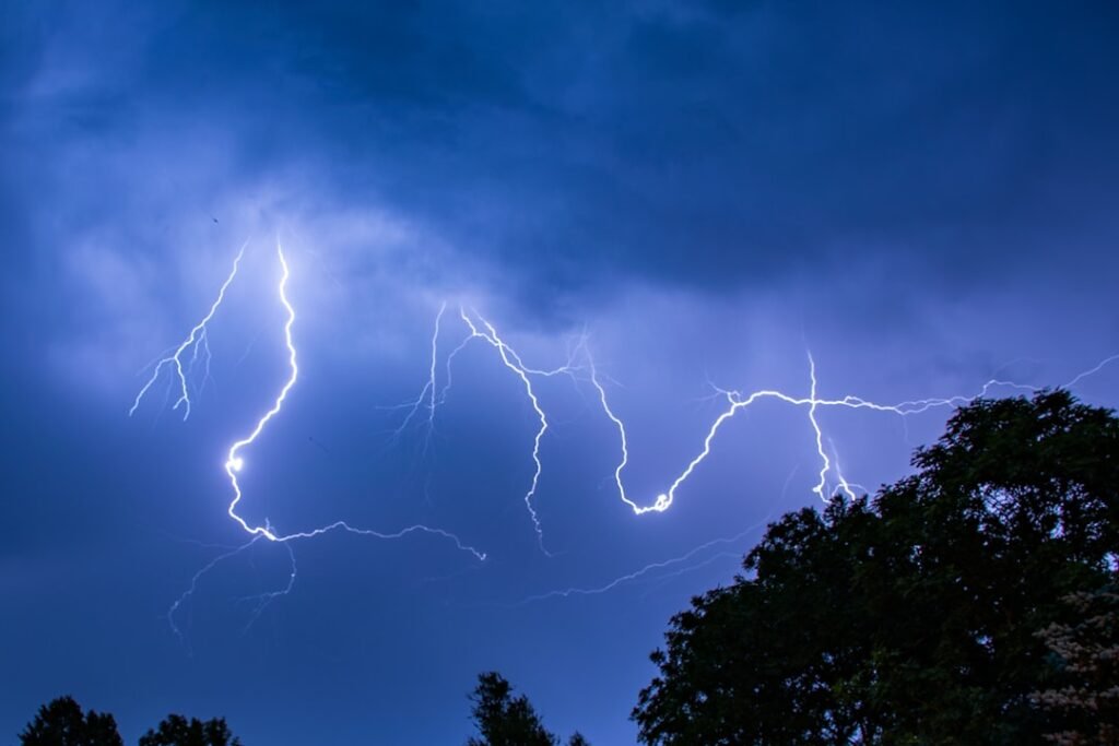
Across the United States, shrinking rivers and receding reservoirs have turned shorelines into surprise archives. Each drop exposes something new: dinosaur tracks stamped into Cretaceous mud, the bones of drowned towns, the hardware of past wars and work. The mystery is stark – what else is hiding beneath the water we thought we knew – and the discoveries feel like messages from deep time and recent history alike. Scientists and historians are racing to document what appears before storms return or silt closes in again. What follows is a tour of a dozen remarkable revelations, and what they mean for research, culture, and the future of drylands.
Texas Tracks Reappear in Stone

When the Paluxy River thins to a chain of pools, slabs of limestone in Dinosaur Valley State Park switch from brown water to living prehistory. Wide three-toed prints stride beside enormous sauropod tracks, the chase scene of apex predators and giants revived by drought. Paleontologists use photogrammetry to capture millimeter-scale details before algae returns, building 3D models that let them test gait, weight, and herd behavior.
Local crews gently broom away silt, then measure pace lengths and deformation halos – the subtle bulges that reveal how a foot pushed into soft mud. The tracks tie Texas to a warmer, coastal world roughly 113 million years ago, when this valley was a tidal flat and not an oak-lined swim hole. Seeing them glowing in sun-baked rock, you feel time collapse like a folded map.
Lake Mead’s Ghosts and a Desert Town
As the nation’s largest reservoir has fallen, the shoreline has coughed up artifacts of boom, bust, and tragedy. Boat ramps now overlook marooned hulls, while sections of old roads and foundations of the drowned Mormon settlement of St. Thomas crack in the heat. Investigators have documented human remains, but archaeologists focus on the more ordinary objects – bottles, anchors, and hardware – that sketch day-to-day life from the last century.
Park staff work with cultural resource teams to tag, photograph, and leave items in place wherever possible, balancing curiosity with respect. The exposed layers are like a filing cabinet of the Southwest’s modern history: dam building, wartime training, Vegas weekends, and hard drought. Every season redraws the map, and with it, the questions.
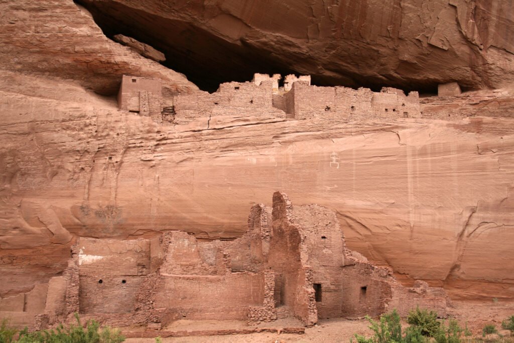
Glen Canyon’s Lost Cathedrals
In the carved heart of the Colorado Plateau, low water has revealed sinuous side canyons untouched for decades. A famous sandstone alcove – nicknamed a cathedral for its acoustics and hanging falls – has re-emerged, a natural amphitheater humming once more with dripping echoes. Elsewhere, ancient granaries tucked on ledges high above the channel have become accessible to the eye, if not the hand.
Archaeologists document these structures from a distance, using drones and long lenses to avoid damage. The focus is on context – how storage, hearths, and trails align with water sources and seasons – and on preserving knowledge without inviting harm. The reappearance is both a scientific windfall and a reminder that what we “lose” to reservoirs can, in rare moments, be seen again.
The Mississippi Uncovers a Wooden Hull
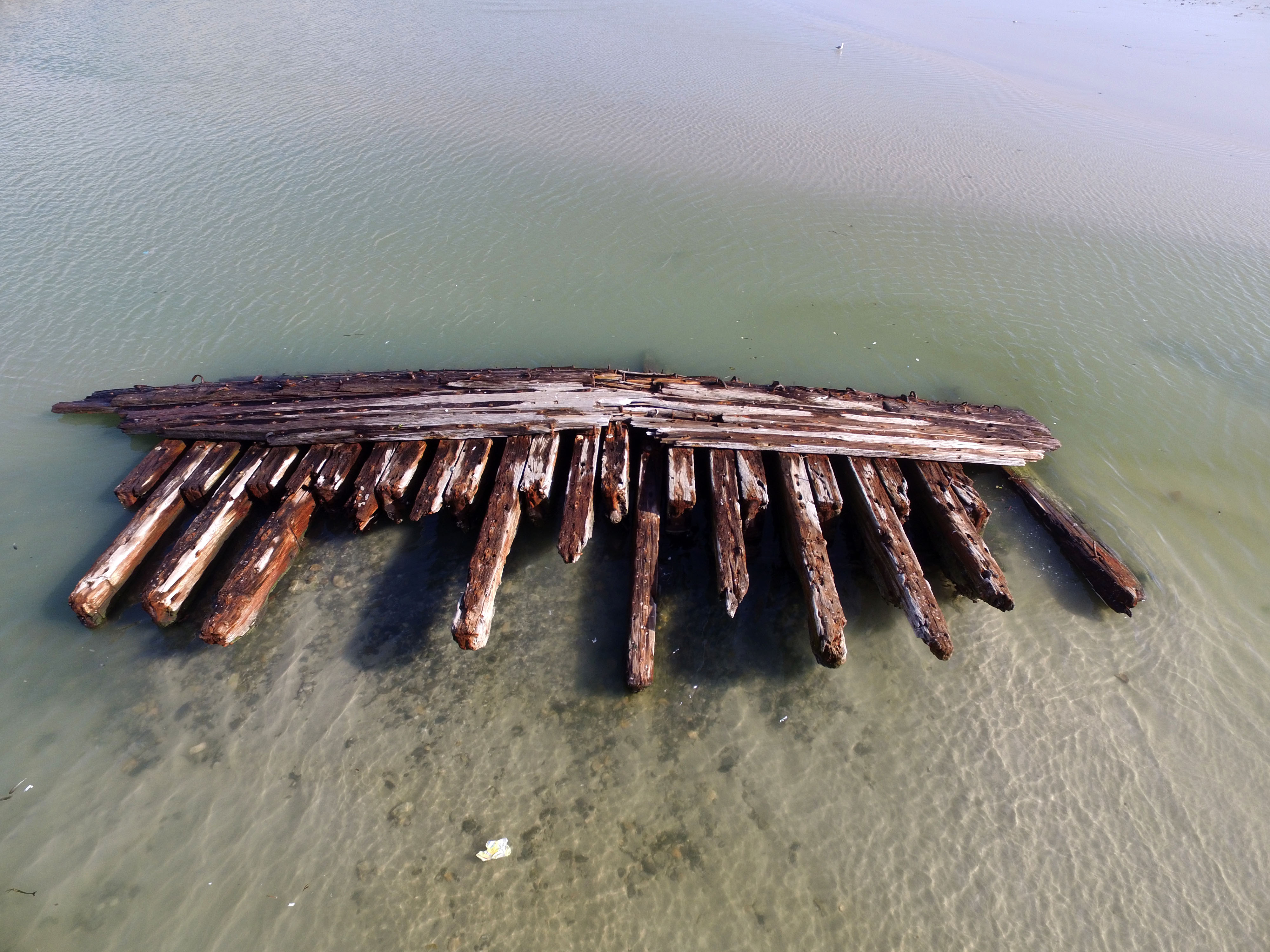
When America’s great river slackens, sandbars grow teeth and strange silhouettes snag the current. Near bends long used for trade, the skeleton of a nineteenth-century vessel surfaced, its ribs and keel pinned under silt like a fossil of industry. Historians compared timbers, fasteners, and construction style to regional ferries and cargo boats to place it on the river’s busy timeline.
Low stages are ideal for such detective work: sonar scans are clearer, and exposed frames allow tree-ring samples that can date the wood to a logging region and era. Barges still pass within sight, a modern echo of the freight that once moved aboard shallow-draft craft built to kiss sand and survive. A drought, briefly, turned the river inside out.
California’s Mormon Island Emerges
In the Sierra foothills, Folsom Lake sometimes gives back the tenacious geometry of a Gold Rush town. Rock walls stitch the shore, the rectangle of a schoolhouse foundation appears, and wagon ruts peek from silty aprons. Families walk the grid with quiet voices, reading a layout that water erased but never destroyed.
Local historians seize the chance to tie artifacts to ledgers and letters, verifying who built, lived, and left as the dam rose. The lake becomes a classroom, with drought as guest lecturer on settlement, extraction, and reinvention. It’s an uncomfortable lesson, but a clear one: abundance and absence are both part of California’s story.
Shasta’s Kennett Rises from the Mud
Farther north, Shasta Lake drops reveal the bones of Kennett, once a busy mining town. Brick, timber, and iron re-align into streets and storefront lines, like a sepia photograph shaking itself into 3D. You can trace the arc from copper smelters to inundation to sudden exposure, each stage written in the stains on rock and the smell of wet clay.
Archaeologists proceed carefully, flagging features for future surveys and reminding visitors to look, not pocket. The site’s value is the whole – where roads meet, where ore moved, how people adapted – not any single bottle or hinge. For a few weeks, a vanished town stands tall enough to be measured again.
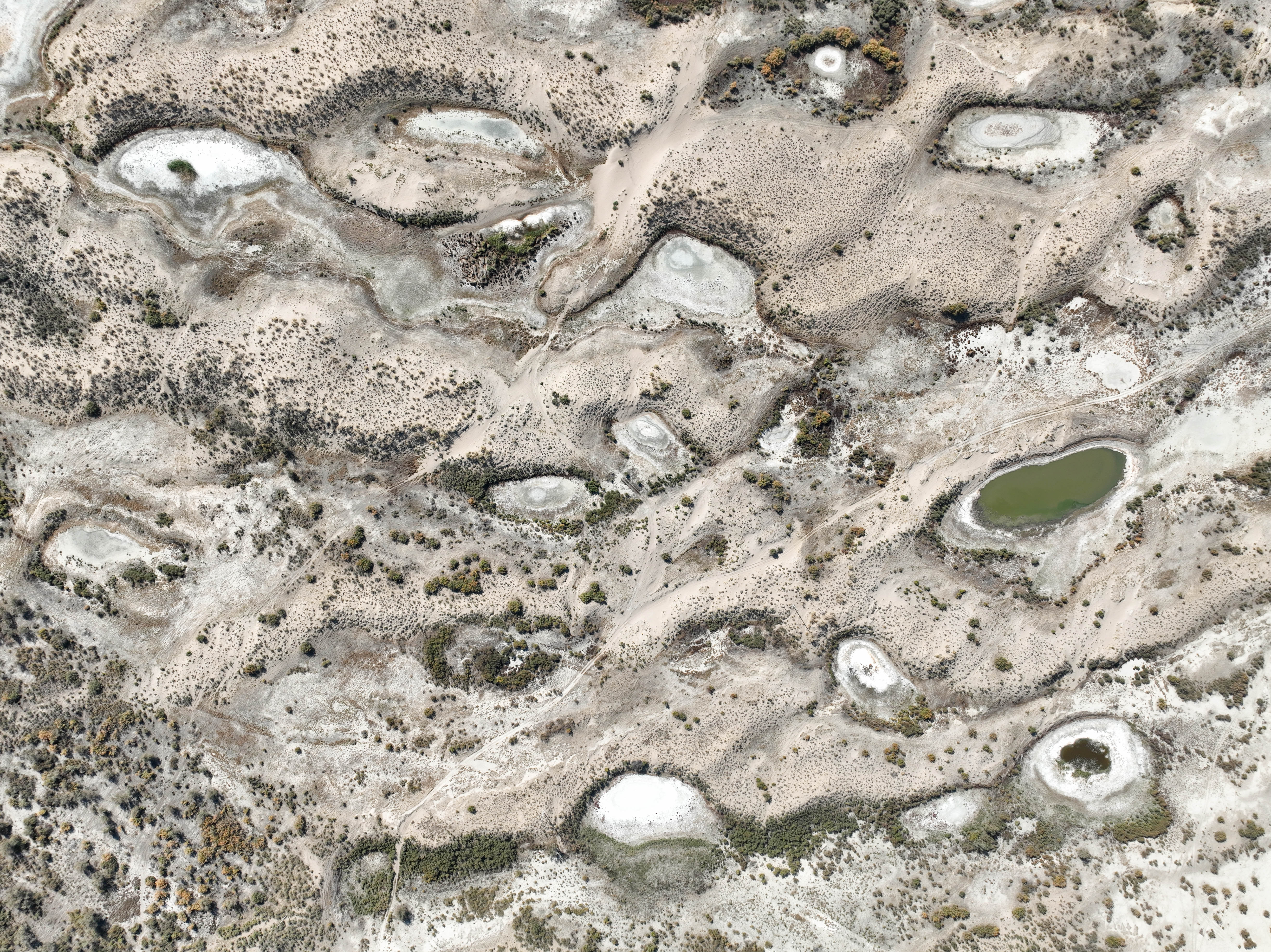
Microbial Reefs at the Great Salt Lake
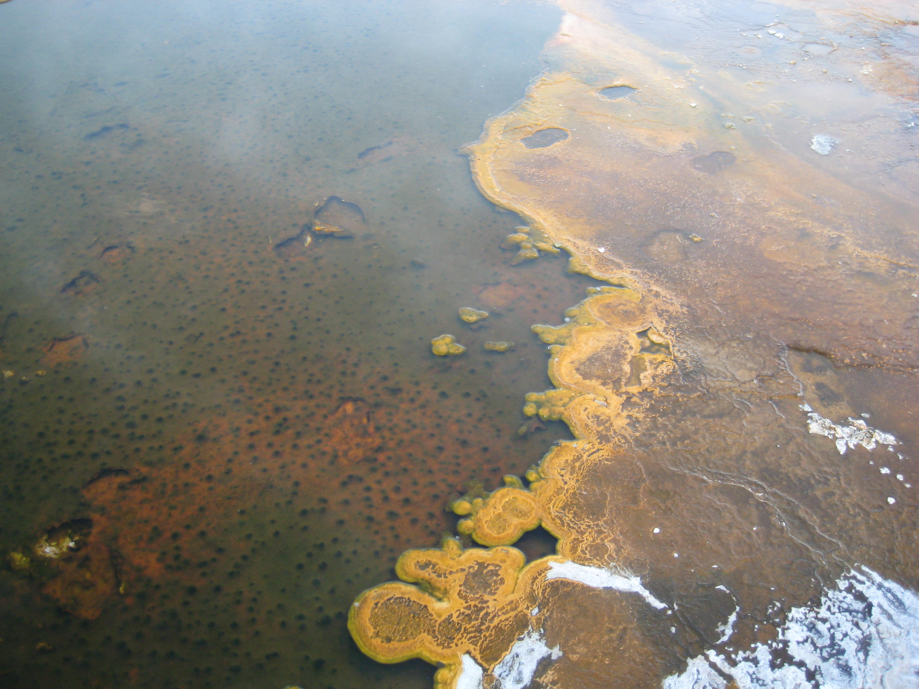
As shorelines retreated, reef-like carbonate domes called microbialites surfaced around the Great Salt Lake, revealing a living architecture built by microbes. Exposed nodules let researchers sample growth layers, DNA, and mineral textures without diving, sharpening models of how such structures form and feed brine flies and shrimp. The findings ripple outward to ancient Earth, where similar mats may have oxygenated seas and stabilized coastlines.
There’s urgency here: prolonged exposure dries and kills the living skin that makes these reefs function. Teams map vulnerable zones, test protective flows, and coordinate with water managers to keep critical shelves wet. Drought delivers access and risk in the same breath.
Blue Mesa’s Drowned Main Street
Colorado’s largest reservoir, Blue Mesa, has periodically pulled back to reveal the outlines of Iola and neighboring communities. Weathered fence posts, cellar holes, and roadbeds draw a ghostly grid across lakebed clay, a rural life paused mid-scene. Former residents and their families sometimes return to walk fence lines they last saw by rowboat.
For historians, the exposure is a ledger check: which buildings were moved, which were razed, which left only nails and stories. The in-place remnants, photographed and mapped, help anchor oral histories that would otherwise drift. Main Street comes up for air, then slips away again with the spring melt.
Pyramid Lake’s Ancient Art

North of Reno, low water exposed boulders bearing deeply carved lines and circles – petroglyphs judged among the oldest in North America by analyzing mineral crusts. The patterns speak a language of place, water, and time that predates modern maps by an order of magnitude. Tribal experts guide how and whether such sites are documented publicly, balancing education with protecting sacred meaning.
Geoarchaeologists use portable instruments to read rock chemistry on site, minimizing contact and preserving context. The lake level becomes a metronome for access, opening a rare window onto early peoples when it is both lowest and safest. Some revelations ask us not to look closer, but to look more carefully.
Why It Matters
These drought-born reveals are more than curiosities; they are data points that sharpen timelines, test hypotheses, and humanize climate impacts. Traditional excavations dig down through layers; this work watches layers come to us, then vanish again. The method forces speed and humility, but it also encourages collaboration between hydrologists, archaeologists, paleontologists, and tribes.
Scientifically, temporary exposure is a powerful natural experiment: changing water levels control oxygen, salts, and microbes in ways no lab can mimic at landscape scale. Socially, the resurfacing of towns and artifacts anchors climate stories in streets, boats, and footprints people can touch with their own shoes. Drought is the alarm; these discoveries are the receipts.
The Future Landscape

Next-generation surveys will lean on lightweight drones, satellite radar that senses ground even through sparse vegetation, and machine learning that flags likely features before they appear. River stage forecasts can be paired with site maps to alert teams where to deploy before wind and waves erase details. Laboratory advances – like non-destructive portable spectrometers and rapid ancient DNA sequencing – will make field days count even more.
The challenges are stark: looting, erosion, and the ethical duty to respect graves and sacred places. Water policy adds another layer, demanding that science move at the pace of law and weather. The likely future is a rhythm – reveal, record, rebury – managed with more precision, more voices, and a sharper sense of care.
How You Can Help
If low water reveals history near you, treat the shoreline like a museum without walls: look, photograph, note the location, and leave objects in place. Report finds to local land managers, state historic preservation offices, or park rangers so experts can evaluate them quickly and respectfully. When visiting lakes and rivers, stay on durable surfaces and avoid walking on fragile trackways, microbialites, or eroding foundations.
Support local museums, tribal cultural programs, and watershed groups that safeguard both knowledge and habitat. Most of all, back the unglamorous work of water conservation – fixing leaks, choosing efficient landscapes, and advocating for policies that keep critical flows alive. The next great discovery might be a mile from your doorstep; will you be ready to protect it when it appears?

Suhail Ahmed is a passionate digital professional and nature enthusiast with over 8 years of experience in content strategy, SEO, web development, and digital operations. Alongside his freelance journey, Suhail actively contributes to nature and wildlife platforms like Discover Wildlife, where he channels his curiosity for the planet into engaging, educational storytelling.
With a strong background in managing digital ecosystems — from ecommerce stores and WordPress websites to social media and automation — Suhail merges technical precision with creative insight. His content reflects a rare balance: SEO-friendly yet deeply human, data-informed yet emotionally resonant.
Driven by a love for discovery and storytelling, Suhail believes in using digital platforms to amplify causes that matter — especially those protecting Earth’s biodiversity and inspiring sustainable living. Whether he’s managing online projects or crafting wildlife content, his goal remains the same: to inform, inspire, and leave a positive digital footprint.