Earth keeps its wildest stories in stone. From oceans frozen solid to continents colliding with unimaginable force, our planet’s past is written in cliffs, craters, reefs, and rifts that quietly remake the world. For decades, many of these places were seen as remote curiosities; today they’re crucial laboratories for understanding climate change, mass extinctions, and even our own origins. As new tools – from satellite imaging to isotope geochemistry – peel back more layers, the landscapes we thought we knew become stranger, older, and more dramatic. These twelve geological wonders do more than inspire awe; they show how Earth became the only known planet where rock, water, air, and life are locked in a restless dance.
The Grand Canyon: A Deep Time Archive Carved by Water
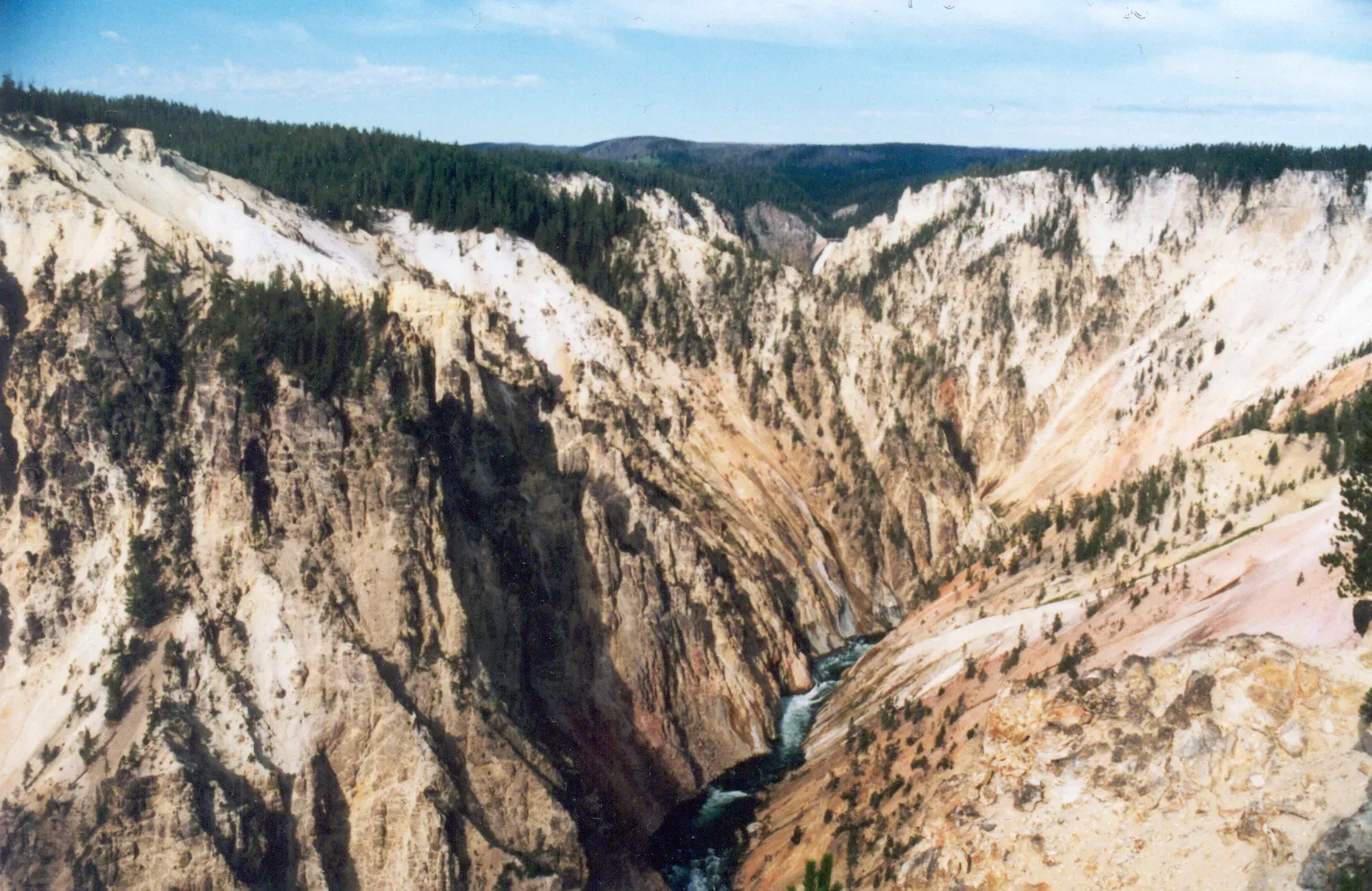
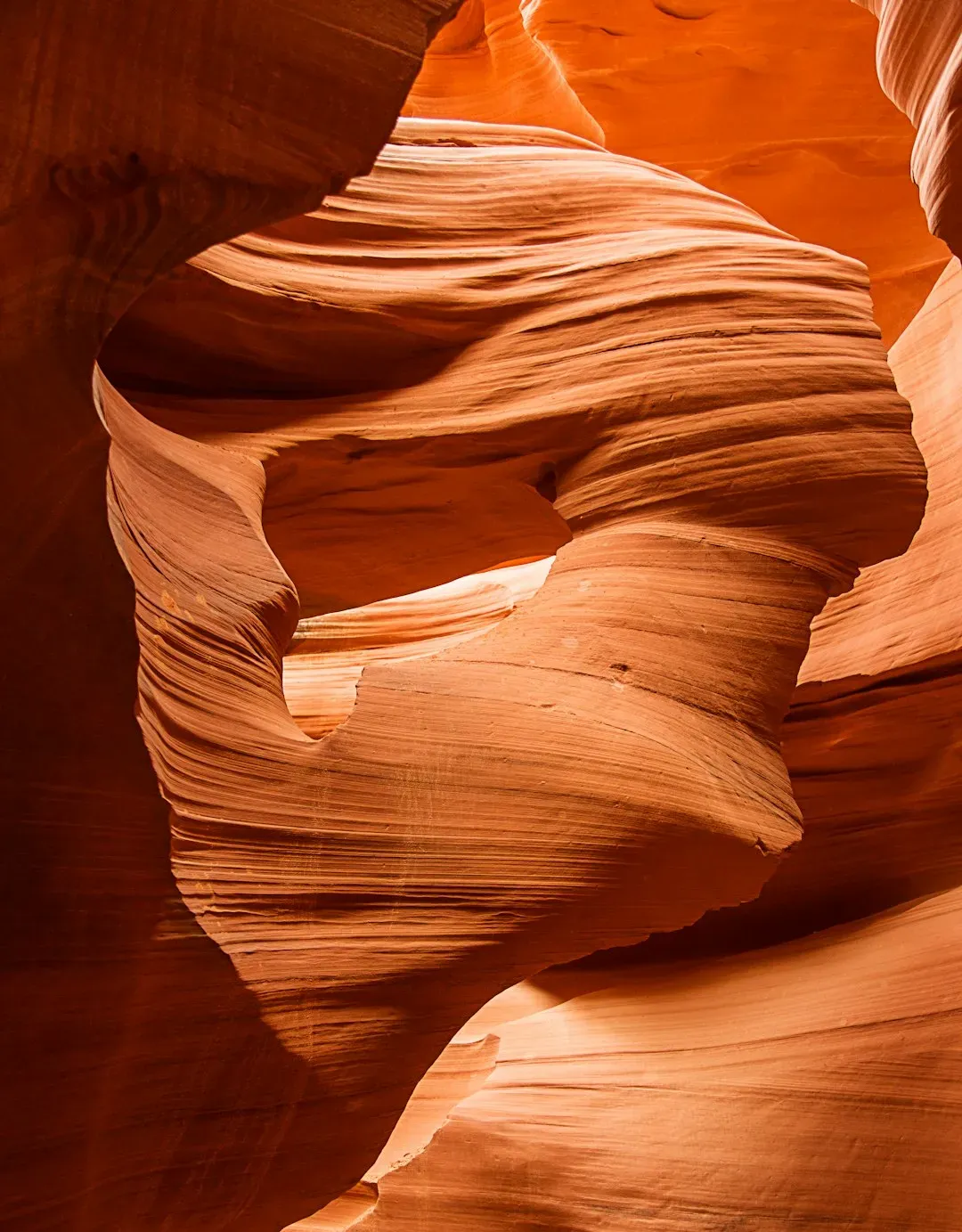
The Grand Canyon is so vast and familiar that it’s easy to forget how unsettling it really is: nearly two billion years of Earth’s history stacked in exposed layers, sliced open by the Colorado River. Stand at the rim and you’re looking not just at a canyon, but at a cross-section of vanished worlds – shallow tropical seas, rising mountains, ancient coastlines, and buried faults. For geologists, it has become a kind of Rosetta Stone, helping them decode the timing of tectonic uplift in the American West and the long, complex story of North America’s interior. Debate still simmers over exactly when the canyon assumed its modern form, but most researchers converge on a story of older gorges reworked and deepened over the last several million years.
What makes the Grand Canyon so scientifically powerful is the way it links processes across space and time. Erosion here tells us how rivers respond to changing climates and mountain building far upstream. Volcanic rocks trapped in side canyons mark dramatic episodes when lava dams briefly blocked the river, only to be ripped apart. The canyon’s rock walls also hold evidence of ancient microbial mats, early animal life, and long-gone ecosystems, connecting geology with paleontology and climate science in one sprawling natural archive.
Iceland’s Rift Zone: Where Continents Split in Real Time
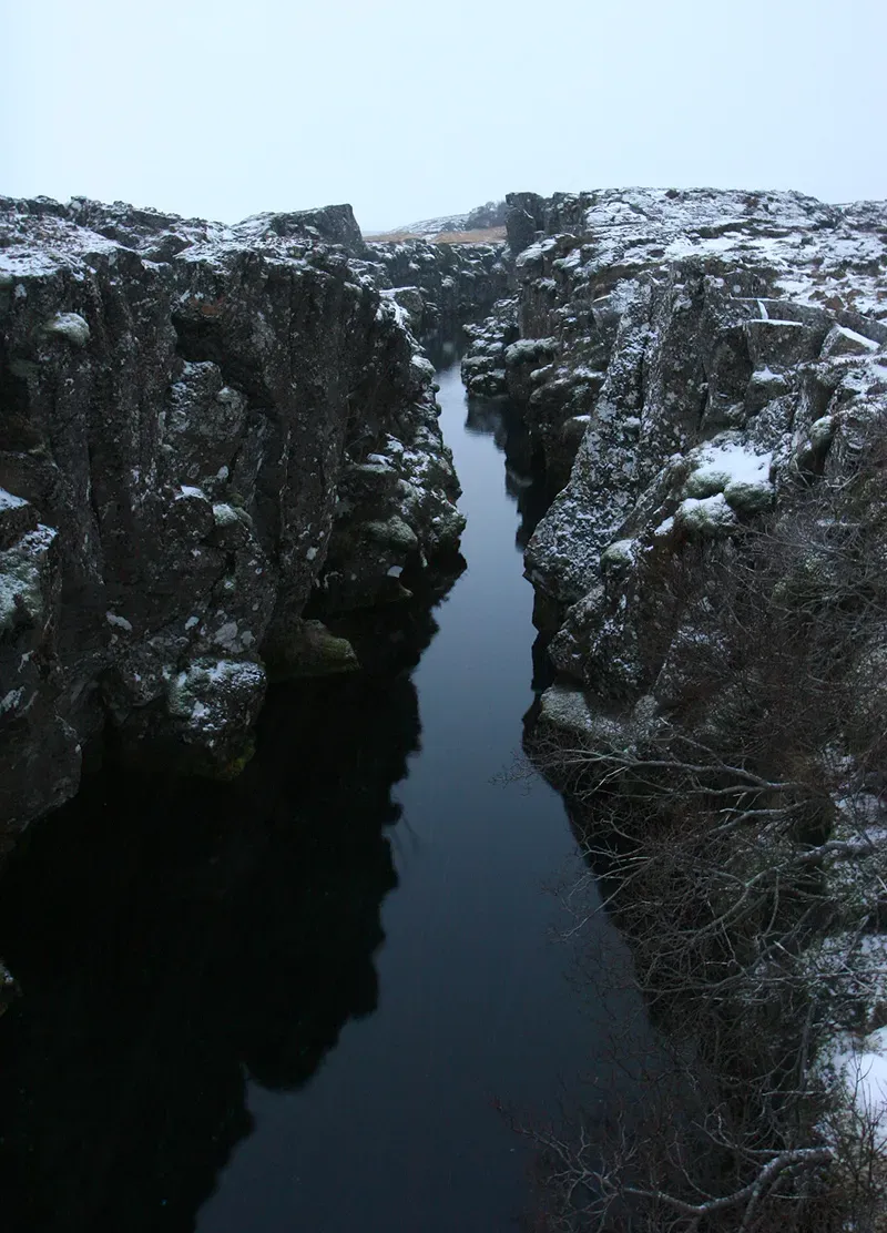
In Iceland, the abstract idea of plate tectonics becomes shockingly concrete: you can literally walk between the diverging North American and Eurasian plates at Þingvellir. This volcanic island sits astride the Mid-Atlantic Ridge, where new oceanic crust is born as magma rises and solidifies, pushing the plates apart. Instead of being hidden beneath deep water, the spreading center is lofted above sea level by a powerful mantle plume, creating a rare above-water window into how oceans grow. Frequent earthquakes and eruptions are not random disasters here; they’re the pulse of a planet that cools and reshapes itself from the inside out.
Modern monitoring networks track the slow unzipping of the crust, measuring ground deformation by the millimeter and mapping magma chambers below. When the 2014–2015 Holuhraun eruption flooded a lava field larger than many cities, satellites recorded not only spewing fire but also immense emissions of sulfur dioxide that affected air quality across northern Europe. Iceland’s rift zone has therefore become a living test site for volcanic hazard forecasting and for understanding how volcanic gases impact atmosphere and climate. In a warming world, the island’s rapidly retreating glaciers are also altering stress on the crust, raising urgent questions about whether melting ice can change patterns of future eruptions.
The Himalaya: A Mountain Range Born from a Lost Ocean
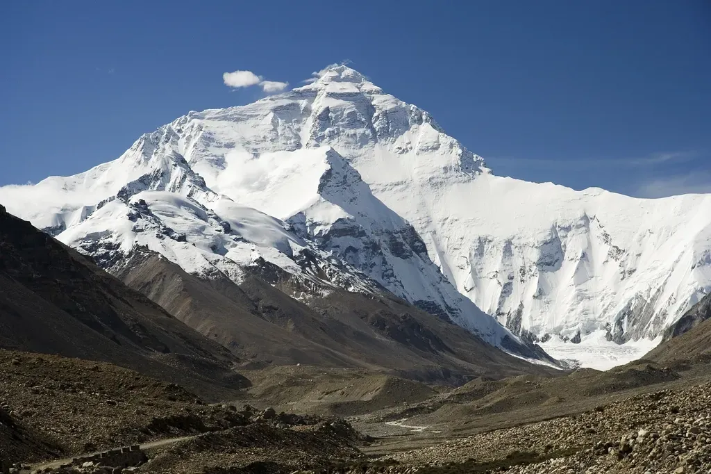
The Himalaya look like the ultimate expression of rock’s brute strength, but they began with something surprisingly fragile: an ocean. Around fifty million years ago, the northward-heading Indian plate slammed into Eurasia, closing the Tethys Ocean and crumpling the intervening sediments into the planet’s tallest mountain chain. Today, you can pick up fossil-rich limestone on Everest that once formed on the floor of that vanished sea, carrying unmistakable proof that the highest peaks on Earth began underwater. That collision is still ongoing, driving devastating earthquakes and slowly raising the range even as erosion wears it down.
For scientists, the Himalaya are a high-altitude laboratory for both tectonics and climate. Weathering of these fresh, uplifted rocks helps draw carbon dioxide out of the atmosphere over millions of years, subtly cooling the planet. At the same time, the range acts like a wall that reshapes atmospheric circulation, helping to set up the Asian monsoon system that billions of people rely on for rainfall. By reading mineral assemblages, fault patterns, and river sediments, researchers are working to piece together how changes in mountain uplift may have nudged global climate over deep time – and how modern human-driven warming will in turn transform Himalayan glaciers and water supplies in the coming century.
The East African Rift: A Continent in the Middle of a Breakup
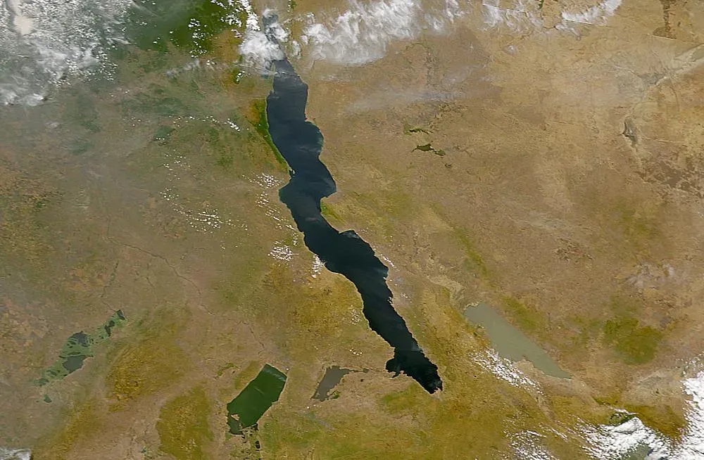
Stretching from the Red Sea down toward Mozambique, the East African Rift is a reminder that continents are not permanent, unbroken rafts of rock. Here, Africa is beginning to tear itself apart along a complex network of fault-bounded valleys, active volcanoes, and long, deep lakes. In 2005, a crack opened in Ethiopia over the course of days, swallowing roads and fields and revealing fresh basalt, a jarring preview of how new ocean basins are born. The region’s volcanoes – like Nyiragongo and Erta Ale – tap magma at relatively shallow depths, giving geophysicists a front-row seat to how continental crust thins before it finally ruptures.
The rift is also inextricably tied to human history. Many of the most famous early hominin fossils, from Australopithecus to Homo erectus, have emerged from rift valley sediments, suggesting that a shifting, broken landscape helped shape our evolutionary path. Long lakes formed in rift basins create unique climate records in their layered muds, revealing how rainfall and vegetation changed during key periods of human evolution and migration. Today, the rift zone’s geothermal potential offers a cleaner energy future for countries like Kenya and Ethiopia, while at the same time, rapid population growth near hazardous volcanoes and fault lines raises urgent questions about risk, resilience, and planning.
The Great Barrier Reef and Ancient Reef Systems: Living and Fossil Time Capsules
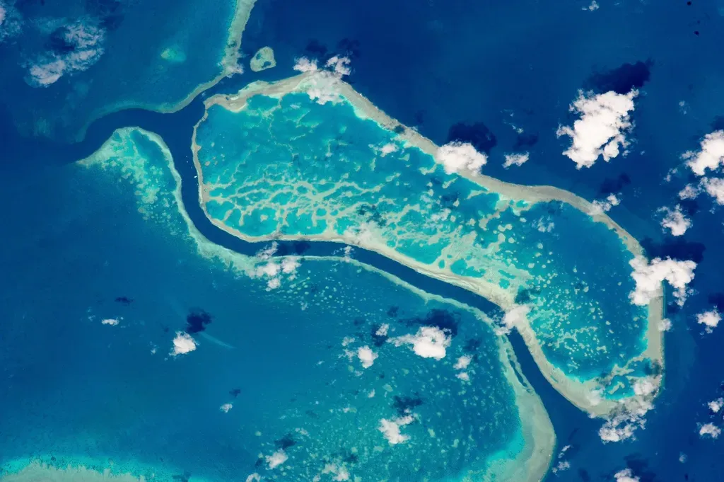
Australia’s Great Barrier Reef is often described as a living wonder, but geologically speaking, it is also a layered structure built atop the ghosts of older reefs drowned by changing sea levels. As ice ages waxed and waned over the last few hundred thousand years, sea level rose and fell by hundreds of feet, periodically exposing and killing vast parts of the reef. New coral growth then colonized the submerged slopes, essentially recording each pulse of melting ice in its skeletons. By drilling into the reef’s foundations, scientists can reconstruct past sea levels and temperatures, creating a finely tuned history of recent climate swings.
Fossil reefs much older than the Great Barrier Reef tell an even grander story. Reef systems from the Devonian or Triassic periods show how marine life rebounded after mass extinctions and how carbonate platforms trapped carbon in rock, modulating long-term climate. Today, the accelerating bleaching and die-off of modern coral reefs is ringing alarm bells, because these structures are not just biodiversity hotspots but also breakwaters that protect coastlines. Looking at ancient reef collapses and recoveries, geologists and ecologists are asking whether current rates of warming and acidification are pushing reefs into uncharted territory – one where past analogues offer limited comfort.
Impact Craters: The Subtle Scars of Catastrophic Collisions
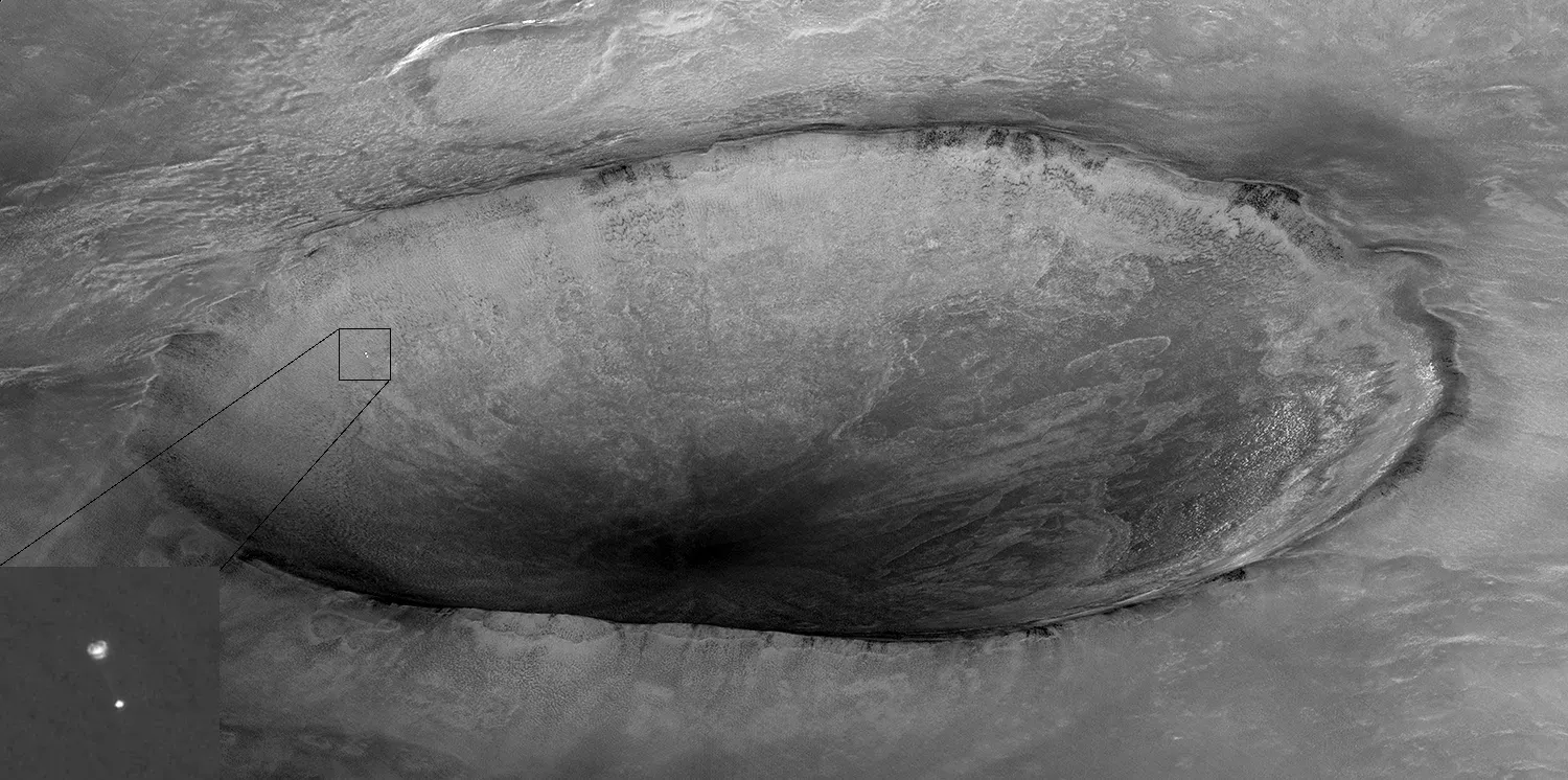
From the surface, many impact craters are easy to miss, softened by erosion, vegetation, or later volcanic activity. Yet they mark some of the most abrupt turning points in Earth’s history, when asteroids or comets slammed into the planet with energies that defy easy visualization. The Chicxulub crater buried beneath Mexico’s Yucatán Peninsula, tied to the end-Cretaceous mass extinction, is the most famous example, associated with the collapse of non-avian dinosaurs and many marine species. Core samples from its peak ring have revealed astonishing details about the first hours and days after impact, including how rock behaved like a fluid under extreme pressures and temperatures.
Smaller craters, from Arizona’s Barringer Crater to structures in Canada, the Sahara, and Siberia, are equally vital for calibrating impact frequencies and energies. By combining crater counts with models of near-Earth objects, researchers estimate how often different-sized impactors strike the planet and what kind of regional or global damage they could inflict. These studies feed directly into modern planetary defense strategies, ranging from sky surveys that catalog hazardous objects to missions that test whether we can nudge an asteroid off course. In this way, ancient scars in Earth’s crust are helping guide decisions that could someday prevent a future cosmic catastrophe.
Flood Basalt Provinces: The Landscapes Built by Planet-Scale Eruptions
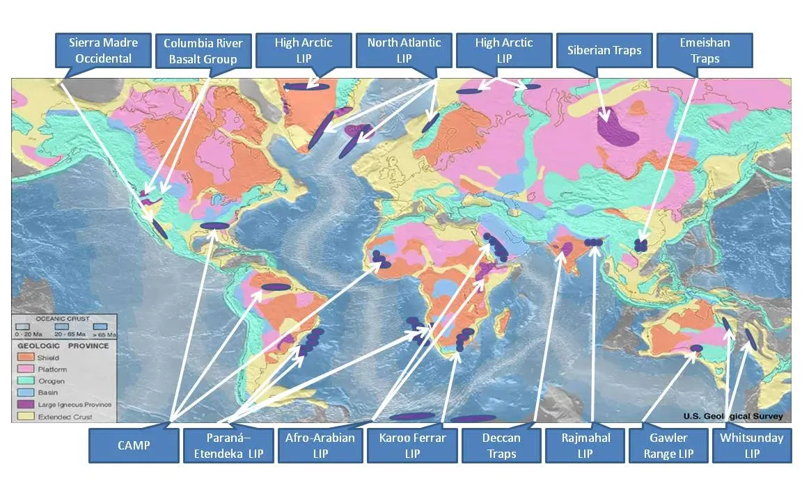
Most people picture volcanoes as steep cones erupting occasionally, but some of Earth’s most transformative eruptions did not look like that at all. Flood basalt provinces – like the Deccan Traps in India or the Siberian Traps in Russia – formed when enormous volumes of lava poured out of fissures over hundreds of thousands of years, burying regions the size of countries under layer upon layer of basalt. These eruptions released not only lava but also staggering amounts of gases, including carbon dioxide and sulfur compounds, that can destabilize climate and ocean chemistry. Several major mass extinctions line up suspiciously well with the timing of such volcanic episodes.
Field studies of these provinces involve tracing ancient lava flows, analyzing their chemistry, and tying them to magnetic reversals that help date the events. At the same time, climate modelers are experimenting with different scenarios for gas release, trying to understand how sustained volcanic outgassing interacts with feedbacks in oceans and biosphere. One emerging picture is that flood basalts can push Earth systems toward tipping points, especially when combined with other stresses such as shifting continents or sea levels. These ancient, stepped landscapes are thus central to debates about how resilient – or fragile – Earth’s climate really is when subjected to slow but relentless forcing.
Why These Geological Wonders Matter for Us Now
It is tempting to treat these places as static tourist destinations, but scientifically they are anything but frozen in time. Each canyon, reef, rift, and crater is a dataset, and together they provide the only long-term record we have of how planet-scale systems behave. Compared to the brief window of satellite measurements or even written history, geological archives stretch across millions of years, capturing events far more extreme than anything humans have directly witnessed. That perspective is crucial when we try to judge how unusual today’s rapid warming is, or how ecosystems respond when pushed to the brink.
By studying mass extinctions in flood basalts, reef collapses during ancient heat waves, or glacial advances recorded in mountain landscapes, scientists can test climate models against real outcomes from the past. This approach is very different from relying solely on short-term observations; it is like checking a weather forecast against an entire library of past storms instead of just last week’s rain. These geological wonders also matter ethically and politically, because they highlight that our actions – burning fossil fuels, reshaping rivers, mining and drilling – are now forces on par with some natural drivers of change. Understanding Earth’s history through these landscapes is not just an academic exercise; it is part of learning how to live on a dynamic planet without repeating the worst endings written in stone.
The Future Landscape: New Tools, Rising Risks, and Global Stakes
Over the last two decades, the way scientists read these geological wonders has been transformed by technology. High-resolution satellite and drone imagery reveal subtle fault movements, hidden impact structures, and deformed rock layers that once required weeks of risky fieldwork to map. Geochemical techniques can now measure isotopic fingerprints in minerals at microscopic scales, teasing out temperature swings, oxygen levels, and even ancient rainfall patterns from a single crystal. At the same time, continuous GPS networks and seismic arrays are turning rift zones, mountain belts, and volcanoes into real-time monitoring systems that record every twitch of the crust.
The stakes of this work keep rising. As populations grow near rift valleys, river deltas, and coastal reefs, the hazards tied to volcanic eruptions, earthquakes, landslides, and sea-level rise are amplified. Decisions about where to build cities, how to manage groundwater, or which energy sources to develop are all entangled with what we learn from these geological archives. Looking ahead, international collaborations will be key: sharing data from deep drilling programs, coordinating planetary defense efforts, and protecting vulnerable sites from both climate impacts and extraction. The future landscape of Earth science will depend not only on better instruments, but also on whether societies treat these wonders as expendable resources or irreplaceable guides.
How Readers Can Engage with Earth’s Geological Story
You do not need a PhD or a research grant to start engaging with the geological wonders that shape Earth’s story. Visiting a nearby canyon, fault scarp, or fossil-rich beach with a field guide or trusted app can turn a casual hike into an investigation of deep time. Many national parks and local reserves now offer geology-focused walks, citizen science programs, and simple tools for recording observations that researchers can actually use. Even small actions, like supporting protected status for key sites or opposing destructive quarrying in sensitive areas, help keep these natural archives intact.
There are also quieter ways to participate. Following reputable geological surveys, university outreach, and observatory accounts can keep you plugged into new findings and alerts, from unusual seismic swarms to reef health reports. Donating to organizations that preserve reefs, fund asteroid-tracking telescopes, or back open-access climate and geology data directly strengthens the science that underpins our understanding of risk. Most importantly, sharing these stories – with kids, neighbors, or friends who have never thought much about rocks – helps build a culture that sees Earth’s dramatic history not as background scenery, but as a living guide. When you next stand on a cliff, a beach, or a city sidewalk, it is worth asking: what buried chapter of Earth’s past is right under your feet?

Suhail Ahmed is a passionate digital professional and nature enthusiast with over 8 years of experience in content strategy, SEO, web development, and digital operations. Alongside his freelance journey, Suhail actively contributes to nature and wildlife platforms like Discover Wildlife, where he channels his curiosity for the planet into engaging, educational storytelling.
With a strong background in managing digital ecosystems — from ecommerce stores and WordPress websites to social media and automation — Suhail merges technical precision with creative insight. His content reflects a rare balance: SEO-friendly yet deeply human, data-informed yet emotionally resonant.
Driven by a love for discovery and storytelling, Suhail believes in using digital platforms to amplify causes that matter — especially those protecting Earth’s biodiversity and inspiring sustainable living. Whether he’s managing online projects or crafting wildlife content, his goal remains the same: to inform, inspire, and leave a positive digital footprint.