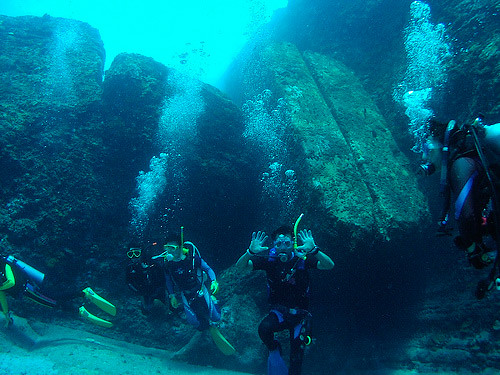

Everyone assumes drowned cities are Hollywood nonsense – Atlantis, El Dorado, campfire stories dressed up as history. Then you look at what marine archaeologists have actually pulled off seabeds, riverbeds, and mountain lakes over the last few decades, and the joke stops landing.
These aren’t special effects. They’re real stone streets, real wells, real temples, sitting in places where the textbooks insist nobody organized enough to build them should have existed yet. Some of these sites will genuinely unsettle you – not because aliens built them, but because ordinary humans did, thousands of years earlier than we gave them credit for. Here’s what’s actually down there.
#11 – Atlit-Yam, Israel: The Neolithic Village That Shouldn’t Exist
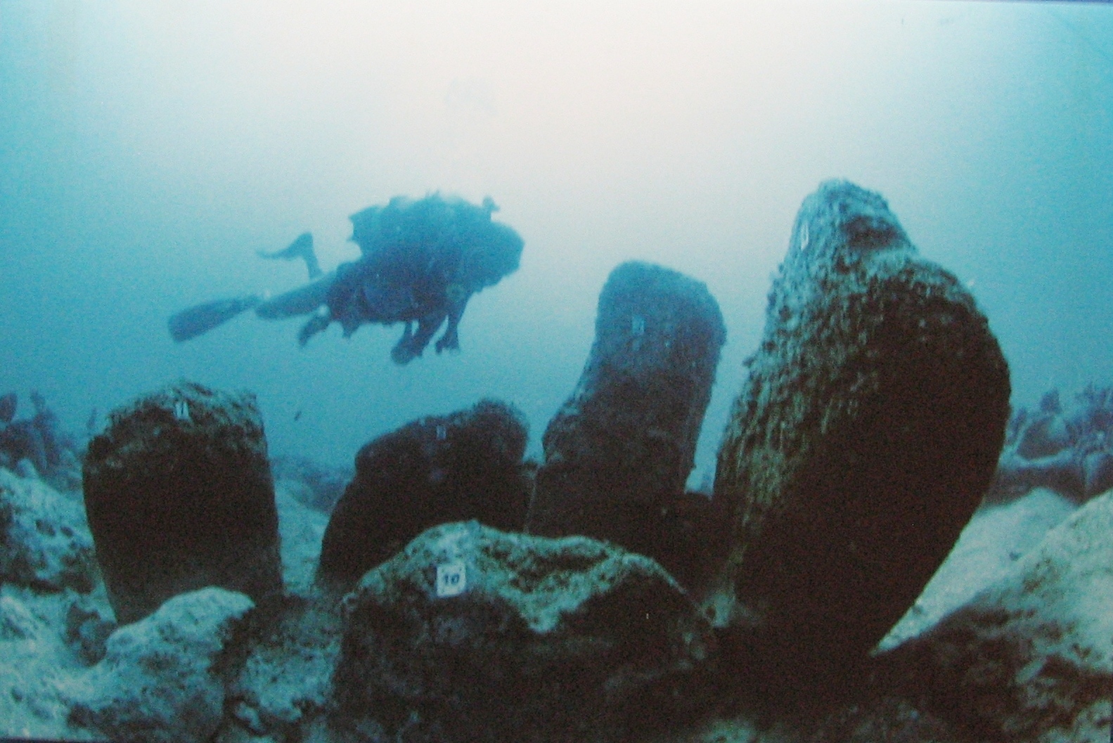
Archaeologists expect early farmers to leave behind scattered bones and maybe a few crude huts. Instead, off the coast of Israel, divers found a 9,000-year-old village now resting 8-12 meters beneath the Mediterranean, complete with stone houses, wells, and a stone circle that looks suspiciously like a ritual space.
For a “simple” Neolithic community, Atlit-Yam is unnervingly organized – rectangular dwellings, paved areas, systematic fishing and herding all packed into a tight, deliberate layout. The real shock is the well that was quietly converted into a rubbish pit once seawater invaded it, which means these people understood groundwater and salinisation well enough to know exactly when to give up on it. That’s not caveman logic. That’s early coastal engineering, thousands of years before anyone assumed such thinking existed.
Fast Facts
- Depth: 8-12 meters below the current Mediterranean seafloor
- Age: roughly 9,000 years old, among the oldest submerged settlements ever found
- Features: stone houses, a freshwater well, and a stone circle likely used for ritual purposes
- Clue to abandonment: the well was repurposed as a rubbish pit once seawater intrusion made it unusable
#10 – Pavlopetri, Greece: A Bronze Age Port Hiding Under Postcard-Clear Water
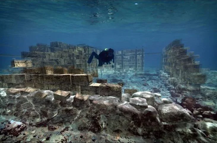
Most people don’t realize that the oldest known submerged town plan in the world sits just off a popular Greek beach, under water so clear you can snorkel straight over its streets. Pavlopetri, dated to at least 3,500 years ago and possibly closer to 5,000, has visible roads, courtyards, multi-room houses, even what looks like a town square.
What actually bothers researchers isn’t that Pavlopetri exists – it’s how mature it looks. You don’t stumble into an organized port town like this on your first attempt at coastal living. It implies a longer, earlier tradition of complex settlements we simply haven’t found yet. While tourists chase myths about Atlantis, this very real city sits in plain sight, quietly rewriting how good ancient Greeks were at maritime trade and urban design.
#9 – Doggerland, North Sea: The Drowned Country Nobody Learned About in School
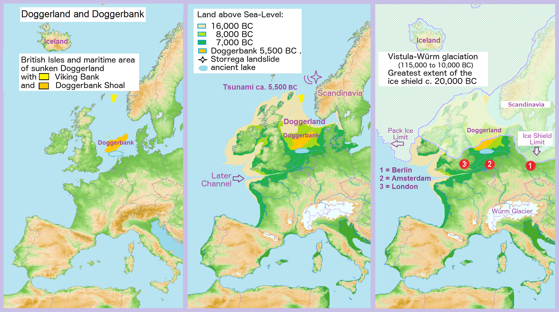
Tell someone there was once a landmass the size of a small country between Britain and mainland Europe, and most people will assume you’re exaggerating. Sonar surveys and dredged artefacts say otherwise – Doggerland was a genuine Mesolithic landscape of rivers, marshes and likely dense human occupation, now sitting silently under the North Sea.
The uncomfortable part is what fishing nets have hauled up: bones, tools, and worked wood suggesting people weren’t just passing through. They were living, hunting, and building seasonal or semi-permanent camps, possibly supporting surprisingly large populations. Then post-Ice Age seas rose, a mega-tsunami called the Storegga slide hit around 8,000 years ago, and an entire human geography vanished almost overnight.
#8 – The Yonaguni Monument, Japan: Ancient Ruins or the Internet’s Favorite Rock?
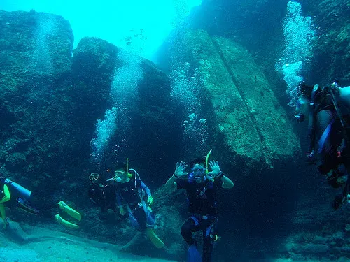
No underwater site starts more arguments than Yonaguni. Off Japan’s Ryukyu Islands, a massive stepped rock formation sits 5-25 meters underwater, looking eerily like a man-made ziggurat or stadium, with broad terraces and near-perfect right angles that have become meme fuel for “lost supercivilisation” theories.
Geologists have a less exciting but more honest answer: Yonaguni’s sandstone naturally fractures into straight lines and stacked steps, and there’s no widely accepted evidence of tool marks or artefacts tying it to human construction. Here’s the twist most people miss, though – even if it’s entirely natural, its location at shallow depth proves the coastline was dry or intertidal when early humans were around. Conspiracy theorists overreach, but the underlying story is still genuinely strange.
#7 – Dwarka, India: A Legend That Refuses to Match the Evidence

Ancient Indian texts describe Dwarka as a glittering city of Krishna, swallowed whole by the sea. For centuries that stayed pure myth. Then sonar surveys near modern Dwarka and Bet Dwarka in the Arabian Sea turned up stone structures, possible walls, and scattered artefacts dating back several thousand years, and headlines instantly declared the legend proven true.
Reality is messier and more interesting. Many archaeologists argue the offshore remains look like a mix of natural rock, eroded formations, and human-built harbors and jetties from different eras – not one perfectly preserved mythical metropolis. There were real, wealthy coastal settlements here, vulnerable to sea-level shifts and erosion, so parts of them genuinely did go under. The sharper lesson is that the ancient Indian coast hosted serious urban life long before we can neatly prove it, and we’ve probably only recovered fragments.
Worth Knowing
- Location: offshore near modern Dwarka and Bet Dwarka, Gulf of Kutch, Arabian Sea
- Findings: stone structures, possible fortification walls, and scattered artefacts spanning several thousand years
- Ongoing debate: researchers are split between natural rock formations and genuine harbor construction
- Cultural weight: tied directly to Hindu scripture as the legendary city of Krishna
#6 – Heracleion and Canopus, Egypt: A Sunken Metropolis Under the Nile Delta
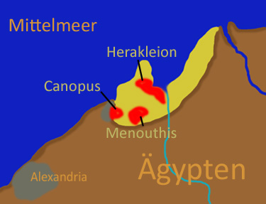
For a long time, Heracleion sounded like classical exaggeration – a bustling Egyptian port where Heracles was honored and pharaohs checked in before entering the country. Then in the early 2000s, survey teams uncovered colossal statues, temple ruins, sphinxes, and shipwrecks buried under silt in Aboukir Bay, right where the Nile meets the Mediterranean, with the nearby city of Canopus turning up submerged remains of its own.
Franck Goddio, who led the excavation, described uncovering Heracleion as finding a city frozen at the exact moment disaster struck it.
Franck Goddio
This wasn’t a crude fishing village. Heracleion had monumental temples, docks, customs facilities, warehouses, and a dense web of canals – essentially a pharaonic-era port metropolis controlling trade and taxation for the whole region. Geologists blame a deadly combination of subsidence, earthquakes, and soil liquefaction, slowly dragging sections of the delta underwater as sea levels crept up. If the Nile could swallow cities built from granite in a couple of millennia, imagine what happened to the flimsier settlements that came before it.
#5 – Shicheng, China: The City That Was Drowned on Purpose
Unlike everything else on this list, Shicheng didn’t sink by accident. When China built the Xin’an River Dam in the 1950s, the valley and the 1,300-year-old city of Shicheng, known as Lion City, were deliberately submerged beneath what’s now Qiandao Lake – and then largely forgotten.
Decades later, divers went down and were stunned. Under 30-40 meters of water, Shicheng’s city gates, decorative arches, and intricate stone carvings remain astonishingly intact, sealed away from air, vandalism, and modern development like a ghost city paused mid-breath. It’s not a case of ” here,” but it proves something more useful – plenty of older drowned sites may be far better preserved than we assume, simply hidden under deeper or murkier water than anyone’s bothered to check.
Quick Compare
- Cause: deliberately flooded for dam construction, unlike the accidental submersions elsewhere on this list
- Depth: 30-40 meters, deeper than most sites here, which helped shield it from erosion
- Age: roughly 1,300 years old, dating back to imperial-era China
- Condition: gates, arches, and carvings remain remarkably intact thanks to minimal oxygen and human disturbance
#4 – Baiae, Italy: The Roman Resort That Partied Its Way Into the Sea
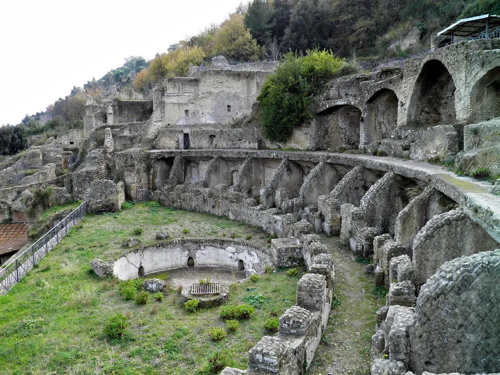
Baiae was where respectable Roman morality went to die. A hedonistic resort for emperors and elites along the Bay of Naples, it was packed with luxury villas, bath complexes, and pleasure palaces. Today, whole chunks of Baiae’s waterfront lie underwater, forming an archaeological park of mosaics, marble columns, and submerged courtyards you can literally snorkel through.
The cause is sober geology, not scandal – the region sits atop a restless volcanic field called the Campi Flegrei, where slow ground subsidence gradually dropped the coastline while sea levels rose to meet it. Here’s the part people gloss over: the Romans knowingly built extravagant properties in an active, unstable caldera because they valued hot springs, prestige, and the view more than long-term safety. Sound familiar? It’s not so different from modern cities built on floodplains and hurricane coasts today.
#3 – Lake Titicaca, Bolivia/Peru: Temples Built Directly Into a Sacred Lake
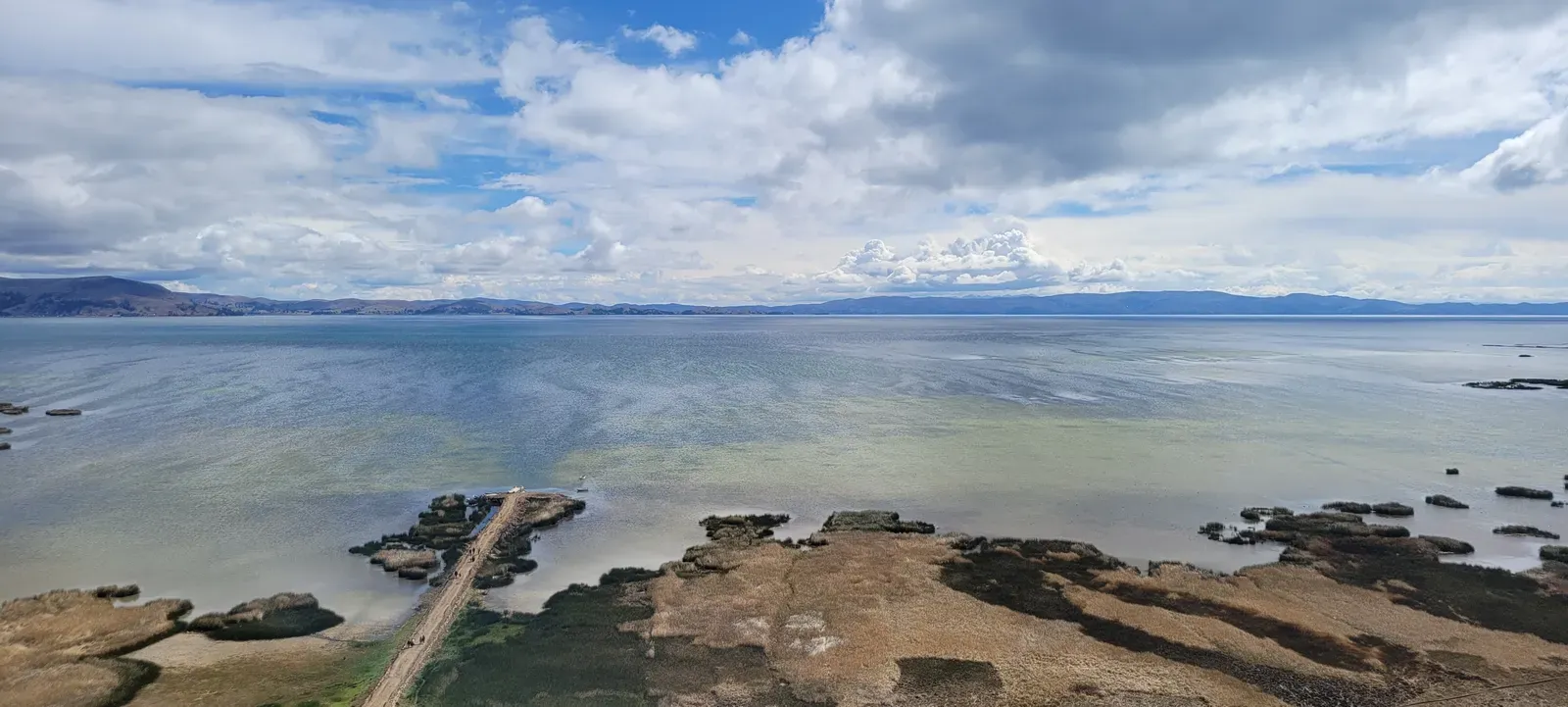
At 3,800 meters above sea level, Lake Titicaca is the last place you’d expect a “sunken city” story. Yet scuba surveys and sonar mapping have identified submerged stone structures, terraces, and what appears to be a temple complex beneath its freezing water, especially near the Island of the Sun – cut stones and alignments that clearly fit into broader Inca and pre-Inca ritual landscapes.
Most researchers now believe many of these structures were deliberately built in and around the water as sacred offerings and ceremonial architecture, not simply an ordinary town swallowed by a flood. That distinction is what makes Titicaca so uncomfortable for lazy narratives – it shows sophisticated Andean societies actively engineering ritual spaces in one of the most punishing environments on Earth, in a place many outsiders still assume people barely survived, let alone thrived.
#2 – The Cuban Deep-Sea “Mega-Structures”: A Mystery With More Hype Than Evidence
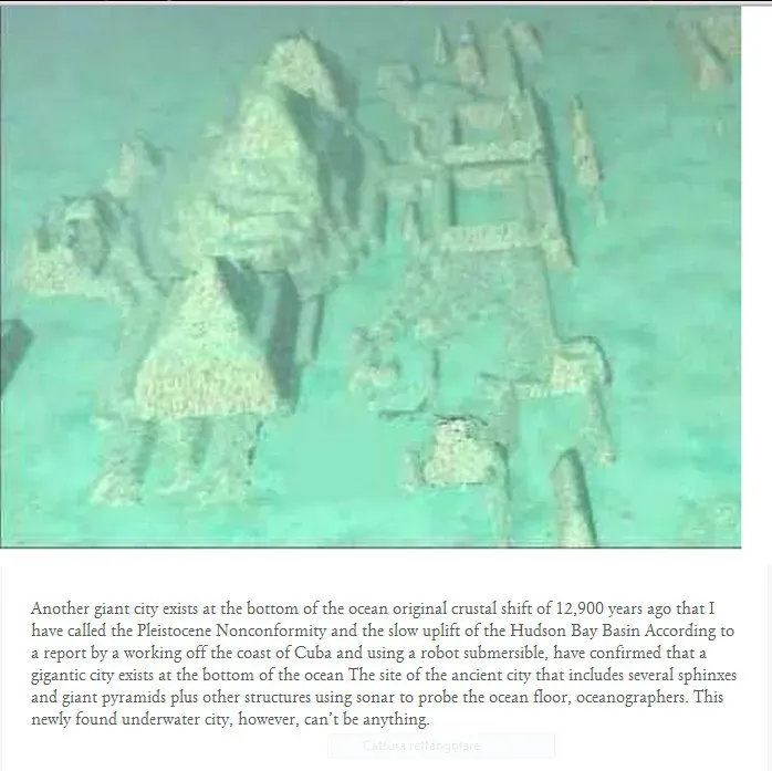
Off Cuba’s western coast, a 2001 sonar survey by a private team reported large geometric shapes and “blocks” sitting at 600-700 meters deep, far beyond where any ordinary coastal settlement could ever have stood, even accounting for Ice Age sea levels. Media coverage immediately ran with “pyramid-like structures” and a lost city older than any known civilisation, despite footage that was blurry at best.
Here’s the blunt, unpopular truth: at those depths, no known sea-level history supports an ordinary ancient city ever being dry land there. Most archaeologists suspect unusual rock formations or sonar misinterpretation, but without transparent follow-up data, the legend refuses to die. This site earns its place on the list not because it proves anything, but because it exposes how quickly we leap from “weird sonar blob” to “ancient supercivilisation.”
At a Glance
- Depth: 600-700 meters, far deeper than any confirmed submerged city on this list
- Discovery: reported by a private survey team in 2001
- Leading theory: unusual natural rock formations rather than deliberate construction
- Status: no peer-reviewed evidence has ever confirmed human origin
#1 – The Black Sea Coastline: An Entire Lost World Behind a Biblical Legend
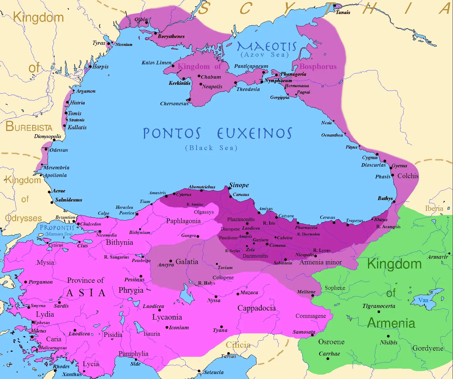
The most disturbing submerged-cities story on this list isn’t a single ruin – it’s an erased coastline. Researchers have proposed that the Black Sea was once a much smaller freshwater lake, catastrophically flooded around 7,500 years ago when Mediterranean waters breached the Bosporus and suddenly raised water levels, drowning vast stretches of shoreline.
The “Noah’s Flood” theory itself is still debated, with some models favoring a gradual rise rather than one dramatic event. But everyone agrees on the bigger picture: post-glacial sea-level rise systematically wiped out low-lying settlements worldwide, especially in semi-enclosed basins like this one. Thousands of early farming and fishing communities – villages, shrines, maybe proto-towns – are simply gone from the map, sitting on continental shelves we barely ever think to search.
The Bottom Line
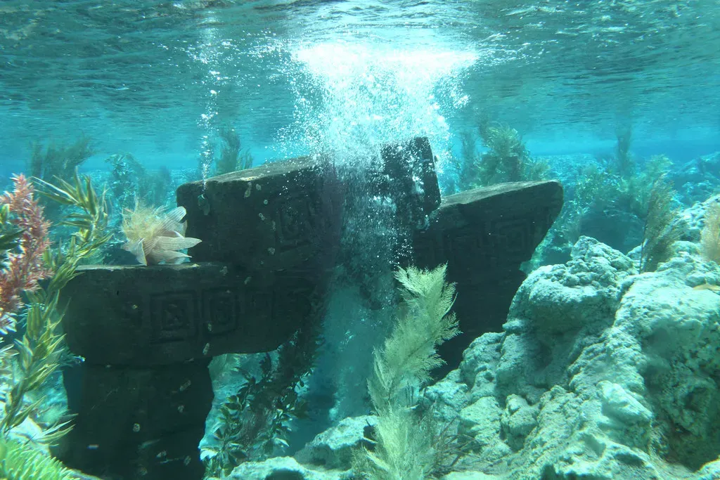
Underwater lost cities aren’t proof of forgotten superhumans. They’re proof of how badly we underestimate ordinary ancient people, and how little respect we’ve historically given the ocean’s patience.
From Atlit-Yam’s Neolithic planners to Heracleion’s drowned port and Baiae’s sunken luxury, these sites all say the same thing: humans have always gambled hard on coastlines, deltas, and fault lines – and the sea almost always collects. Our maps of early civilisation are missing their edges, and those edges are now under tens of meters of water.
Here’s the opinion most people won’t like: the real Atlantis is us. We’re making the same bet the Romans made at Baiae, building dense, fragile cities in places we already know the water wants back. In a thousand years, today’s waterfront skylines may be someone else’s mysterious submerged ruins – and it won’t have taken a flood myth to explain why.