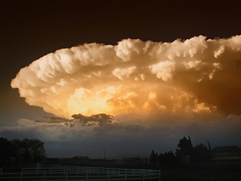
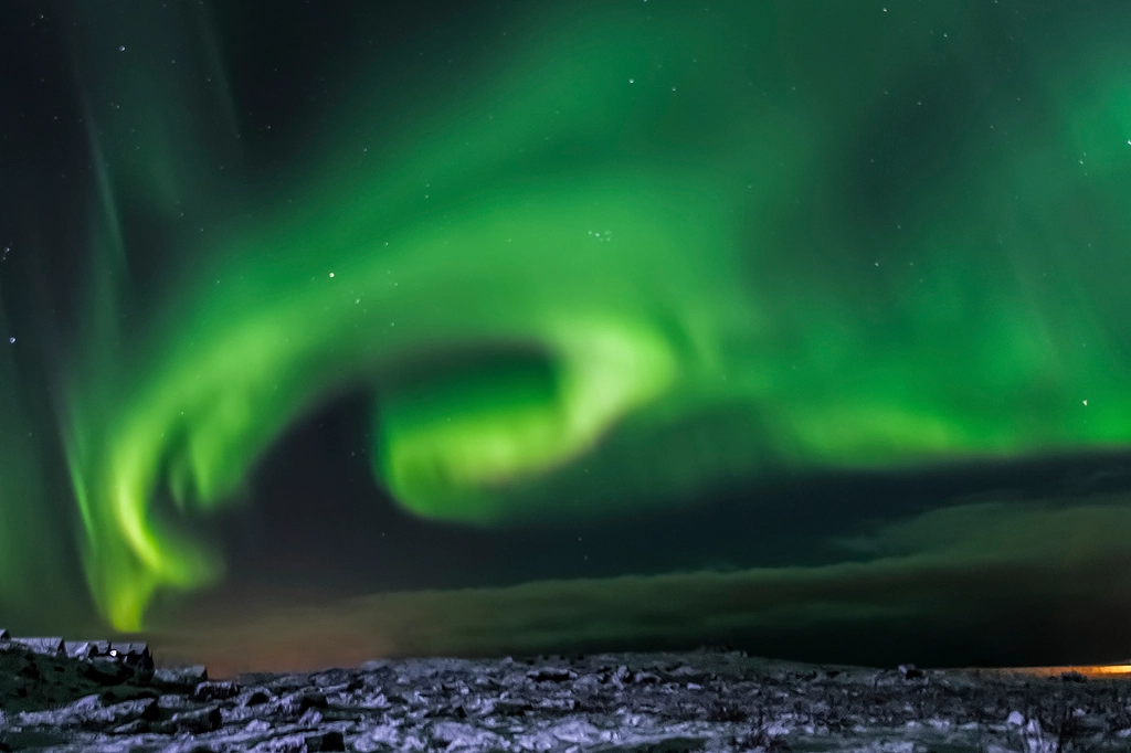
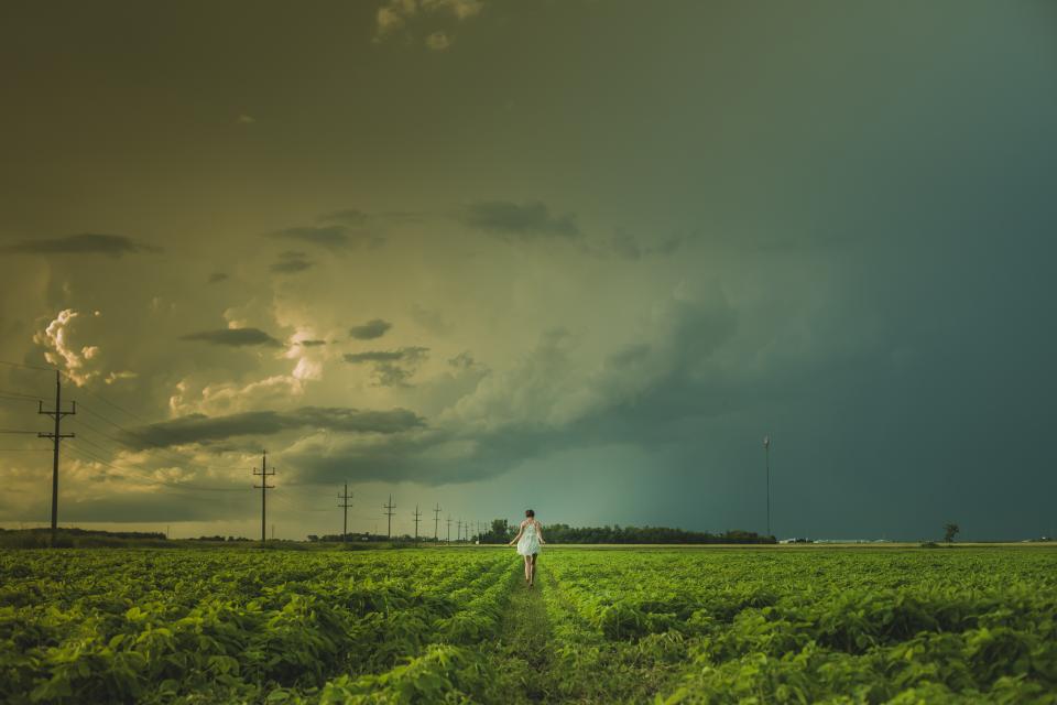
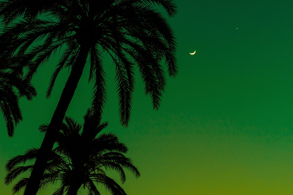
Picture this: you’re standing outside on what seems like an ordinary summer evening when suddenly the sky transforms into an otherworldly shade of green. Your heart skips a beat as you realize nature is putting on one of its most mysterious and captivating displays. This phenomenon isn’t a harbinger of extraterrestrial visitors or the apocalypse, though it certainly signals that the atmosphere is brewing something extraordinary. Green skies are nature’s dramatic warning sign that severe weather is approaching, often carrying with it the potential for powerful storms, large hail, and sometimes even tornadoes.
The emerald tint overhead occurs when specific atmospheric conditions align perfectly. The culprits behind this stunning display are Rayleigh scattering of short wavelengths by air molecules and absorption of long wavelengths by water molecules. Think of it as nature’s own special effects show, where thick storm clouds filled with water and ice particles filter sunlight in just the right way to create this haunting green glow. Let’s explore the ten most fascinating storm types across America that can paint the sky in these ethereal green hues.
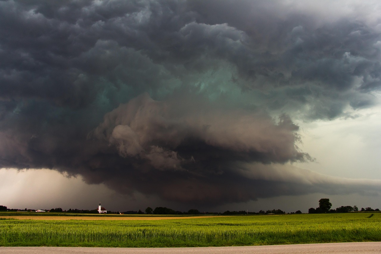
Supercell Thunderstorms: The Green Sky Monarchs
Supercells reign supreme as the most likely culprits behind those spine-tingling green sky displays. These are the storms most likely to produce severe weather, such as powerful wind, large hail and weak-to-violent tornadoes. What makes supercells so special is their rotating updraft called a mesocyclone, which can sustain the storm for hours while continuously feeding it with moisture and energy.
When you spot that eerie green tinge creeping across the sky, there’s a good chance a supercell is the mastermind behind the show. The yellow light from the late-day sun hits the blue light scattered by a thunderstorm that contains a lot of ice, creating green. It takes an incredibly high amount of water and ice to create these colors. These storms don’t just paint the sky green for aesthetic pleasure though. They’re packing some serious meteorological punch that demands immediate respect.
Classic Supercells: Nature’s Perfect Storm Architecture
Classic supercells are like the textbook definition of storm perfection, complete with all the visual drama you’d expect from a Hollywood disaster movie. Classic supercells are the most well-known type of supercell thunderstorms. They feature a well-defined structure with a rotating updraft, or mesocyclone, at their core. These storms often display that telltale anvil shape with a distinct wall cloud hanging beneath the main updraft.
The green sky phenomenon with classic supercells is particularly striking because these storms have such organized structure. A green sky is a visual signal that the storm approaching is incredibly intense. Large hail is almost certain in these storms. The combination of the storm’s height, moisture content, and the angle of sunlight creates ideal conditions for that haunting emerald glow to develop overhead.
Low-Precipitation Supercells: Deceptively Dangerous Beauty
Don’t let their relatively dry appearance fool you. Low-precipitation supercells might not dump buckets of rain, but they’re still perfectly capable of turning the sky into that ominous green shade. LP supercells usually form in dry regions, where there might be just enough moisture to form the storm, but not enough moisture to rain very hard. You can usually find the updraft on the rear flank of the storm, and the mesocyclone will be more defined and obvious.
These storms are particularly sneaky because their visual warning signs can be subtle. These storms might not look that strong, but they can pack a punch. LP supercells often produce tornadoes and large hail. The green sky effect with LP supercells can be especially dramatic because the lack of heavy precipitation allows for clearer visibility of the optical phenomenon occurring within the storm’s structure.
High-Precipitation Supercells: Rain-Wrapped Monsters
High-precipitation supercells are the storms that make meteorologists break out in a cold sweat. The HP supercell has a much heavier precipitation core that can wrap all the way around the mesocyclone. These are especially dangerous storms, since the mesocyclone is wrapped with rain and can hide a tornado from view. The green sky phenomenon with these storms can be particularly ominous because it’s often partially obscured by the heavy precipitation.
These beasts are notorious for their ability to cause multiple types of severe weather simultaneously. These storms also cause flooding due to heavy rain, damaging downbursts, and weak tornadoes, although they are also known to produce strong to violent tornadoes. They have a lower potential for damaging hail than Classic and LP supercells, although damaging hail is possible. The green coloration might appear in patches through the heavy rain, creating an almost apocalyptic atmosphere.
Derecho-Producing Bow Echoes: Land Hurricanes
Imagine a hurricane’s fury translated into straight-line winds, and you’ve got yourself a derecho. A derecho is a widespread, long-lived wind storm that is associated with a band of rapidly moving showers or thunderstorms. Although a derecho can produce destruction similar to that of tornadoes, the damage typically is directed in one direction along a relatively straight swath. These systems earned their fearsome reputation during events like the 2012 derecho that carved a path of destruction across the Midwest.
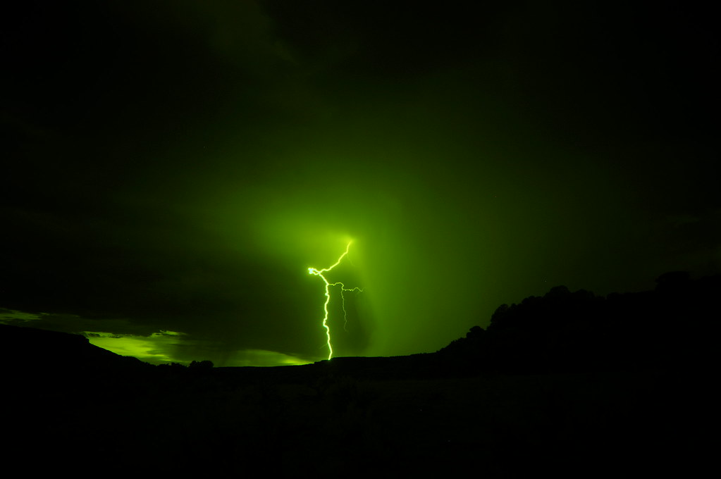
The green sky effect with derechos can be absolutely breathtaking and terrifying simultaneously. A derecho is a cluster of storms that produces destructive wind gusts and hail for hundreds of miles. Derecho events that move through the Northern Plains regularly produce hail, damaging winds and an eerie shade of green in the sky, with some events reportedly captured by Department of Transportation cameras showing stunning imagery that almost makes the landscape look like it was dyed. The widespread nature of derechos means the green sky phenomenon can persist for hours across multiple states.
Squall Lines: Linear Storms with Green Curtains
Squall lines are like nature’s version of a moving wall of severe weather. A squall line is an elongated line of severe thunderstorms that can form along cold fronts. The squall line contains heavy precipitation, hail, frequent lightning, strong straight-line winds, and possibly tornadoes and waterspouts. These linear formations can stretch for hundreds of miles, creating an impressive meteorological spectacle.
The green sky phenomenon with squall lines often appears as a continuous curtain of emerald light stretching across the horizon. A squall line is a group of storms arranged in a line, often accompanied by squalls of high wind and heavy rain. Squall lines tend to pass quickly and are less prone to produce tornadoes than supercells. They can be hundreds of miles long but are typically only 10 or 20 miles wide. This linear green display can be one of the most photographable weather phenomena, though it’s wise to capture it from a safe distance.
Mesoscale Convective Systems: Storm Collectives
Think of mesoscale convective systems as storm neighborhoods where individual thunderstorms band together to create something much more powerful. A mesoscale convective system is a complex of thunderstorms that becomes organized on a scale larger than individual thunderstorms but smaller than extratropical cyclones, and normally persists for several hours or more. Their overall cloud and precipitation pattern may be round or linear in shape. These systems are like storm cities, sprawling across vast areas and lasting much longer than individual storms.
The green sky effect with MCS events can be particularly widespread and long-lasting. A Mesoscale Convective System is a collection of thunderstorms that act as a system. An MCS can spread across an entire state and last more than 12 hours. On radar one of these monsters might appear as a solid line, a broken line, or a cluster of cells. The sheer size and persistence of these systems mean that green skies can stretch across multiple states and persist for many hours.
Multicell Thunderstorms: Serial Storm Producers
Multicell storms are the workhorses of the severe weather world, constantly regenerating new cells as older ones fade away. A multi-cell storm is a common, garden-variety thunderstorm in which new updrafts form along the leading edge of rain-cooled air. Individual cells usually last 30 to 60 minutes, while the system as a whole may last for many hours. Multicell storms may produce hail, strong winds, brief tornadoes, and flooding. It’s like watching a relay race where each runner passes the baton to the next generation of storms.
While multicell storms might not have the dramatic structure of supercells, they’re still perfectly capable of producing those mesmerizing green skies. The continuous cycle of cell development and regeneration can create varying intensities of the green sky phenomenon as different cells reach maturity at different times. This can result in a pulsating or wave-like effect of green coloration across the sky, creating a truly mesmerizing natural light show.
Pulse Storms with Microbursts: Short but Intense
Pulse storms might be brief, but they can pack a serious punch in their short lifespans. Most downbursts are less than 4 km in extent: these are called microbursts. The term microburst was defined by mesoscale meteorology expert Ted Fujita as affecting an area 4 km in diameter or less. These concentrated downbursts create intense localized weather events that can catch people completely off guard.
The green sky effect with microburst-producing pulse storms tends to be localized and brief but can be strikingly vivid. Heat bursts can produce winds over 160 km/h, are characterized by exceptionally dry air, can suddenly raise the surface temperature to 38°C or more, and sometimes persist for several hours. The rapid development and dissipation of these storms means the green coloration can appear and disappear within minutes, making it all the more mysterious and captivating to witness.
Mammatus-Producing Supercells: Upside-Down Storm Clouds
Mammatus clouds are one of nature’s most peculiar and fascinating cloud formations, appearing like giant pouches hanging from the storm’s underside. Mammatus are rounded, smooth, sack-like protrusions hanging from the underside of a cloud, usually a thunderstorm anvil. Mammatus clouds often accompany severe thunderstorms, but do not produce severe weather; they may accompany non-severe storms as well. These bizarre formations look like the storm is growing downward instead of upward.
When mammatus clouds form beneath green-tinted storm anvils, the visual effect is absolutely otherworldly. The combination of the eerie green glow filtering through these unusual cloud formations creates a scene that looks like something from a science fiction movie. Though mammatus themselves don’t produce severe weather, their presence indicates that the parent storm system is powerful enough to create the atmospheric conditions necessary for both the mammatus formation and the green sky phenomenon.
The Science Behind the Spectacle
Understanding why storms create green skies helps us appreciate this phenomenon even more. Researchers point to the liquid water content in the air. The moisture particles are so small that they can bend the light and alter its appearance to the observer. These water droplets absorb red light, making the scattered light appear blue. If this blue scattered light is set against an environment heavy in red light during sunset and a dark gray thunderstorm cloud, the net effect can make the sky appear faintly green.
The timing of these green sky events is crucial to their formation. The events are mostly known to occur during the evening and early mornings when the sun is at a low angle on the horizon. As the sun’s angle changes, particularly when it is low in the sky, and storm conditions intensify, the scattering process can favor wavelengths in the green part of the spectrum. This is why you might notice a green tint during severe weather. The perfect storm of atmospheric optics creates this rare and beautiful phenomenon that continues to captivate storm watchers across America.
Green skies represent one of nature’s most dramatic and mysterious displays, serving as both a visual spectacle and a serious weather warning. If the sky does turn green, you can expect strong-to-severe weather in the form of either large hail or tornadoes. From the rotating majesty of supercells to the linear fury of derechos, these ten storm types showcase the incredible diversity and power of American weather systems.
The next time you witness that ethereal emerald glow spreading across the sky, remember that you’re witnessing a rare convergence of atmospheric physics, storm dynamics, and perfect timing. While the green sky phenomenon is undeniably beautiful, it’s also nature’s way of telling you to seek shelter and prepare for potentially severe weather. Have you ever experienced the awe-inspiring sight of green skies during a storm? What do you think about this fascinating intersection of beauty and danger in our natural world?