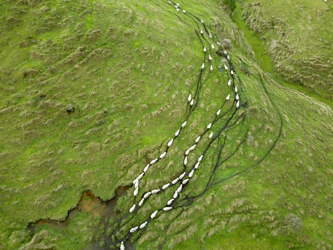
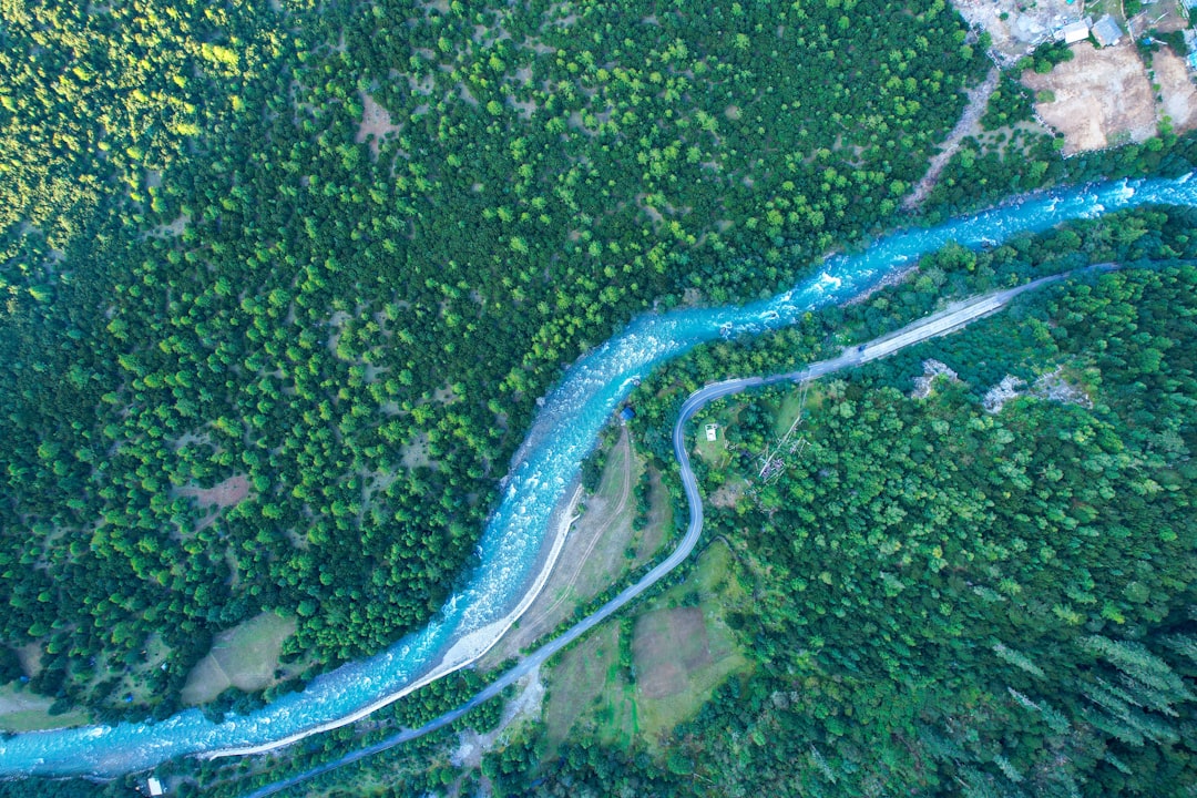
Rivers across America are in constant motion, and you might be surprised to learn just how dramatically some are shifting their paths. While we tend to think of rivers as permanent features carved into the landscape, the truth is far more dynamic. From Alaska to Louisiana, these waterways are writing and rewriting the geography of our continent in real time.
What makes this phenomenon particularly fascinating is how it affects everything from wildlife habitat to property lines to million-dollar infrastructure projects. The forces behind these changes tell a story of nature’s relentless power, and understanding them helps us prepare for a future where water takes the path it wants, not necessarily the one we’ve planned for it. So let’s get started.
The Mississippi River – America’s Most Famous Course Changer
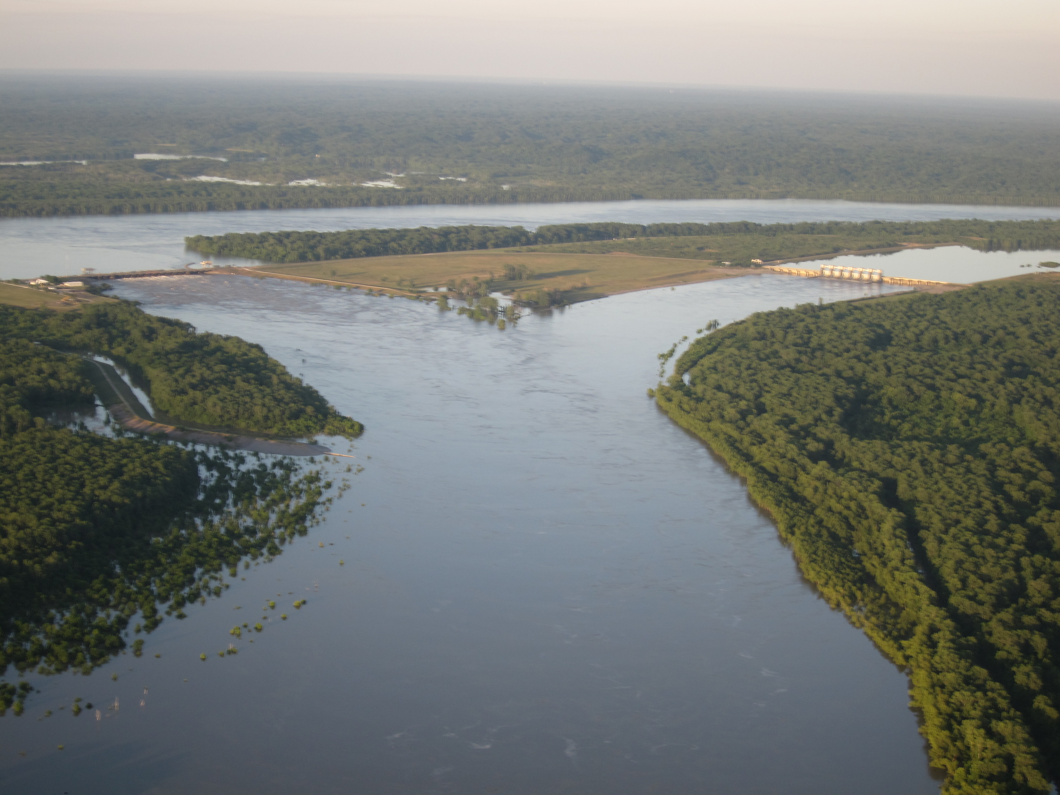
The Mississippi River has changed course many times over the past 7,000 years, making it perhaps America’s most dramatic example of natural river migration. Today, a multi-dam control structure in central Louisiana keeps it from jumping its banks and joining with the Atchafalaya River, though scientists warn that a massive flood could overwhelm these barriers.
The river’s tendency to meander stems from sediment deposition over time, which chokes up the river with sediment. Water always flows downhill, so as its current course becomes increasingly blocked, it eventually jumps to a new location. The Mississippi has a backwater length of nearly 300 miles, which means that the speed of its flow is affected by the Gulf of Mexico all the way to a point north of Baton Rouge, Louisiana.
The South Platte River – Reshaping Colorado’s Eastern Plains
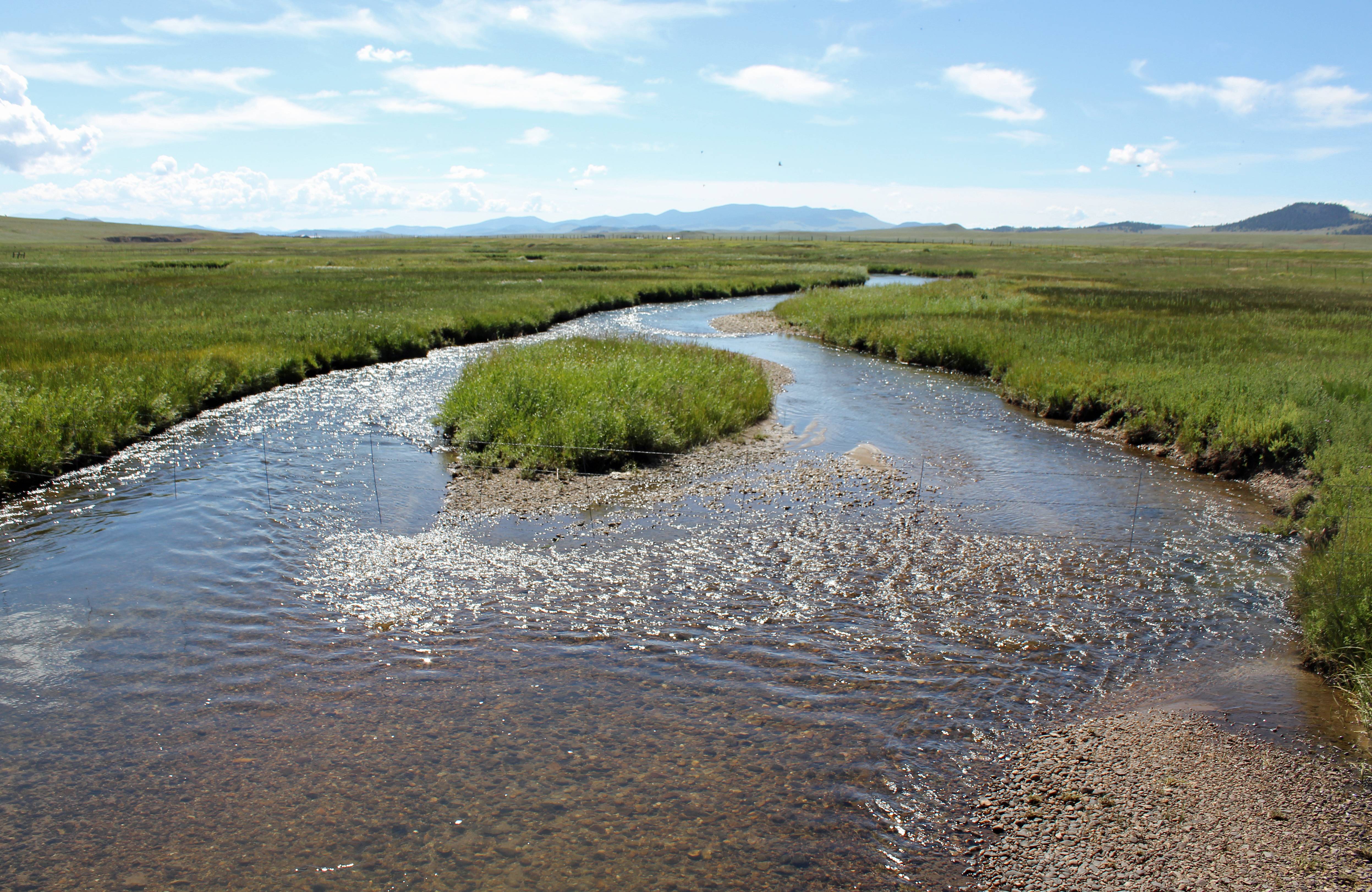
28 million years ago, the North American Plate underwent a slight bowing that lifted the High Plains to the east, forcing the river to carve a fresh northern trajectory through a new topographic depression called the Colorado Piedmont. This geological shift fundamentally altered the South Platte’s path through what would become one of Colorado’s most populated regions.
The South Platte channeled through the softer bedrock nearer the foothills and took in water and silt from Cherry Creek, Clear Creek, Boulder Creek, and St. Vrain Creek. The flows of the South Platte have been greatly modified by human activity. Originally the river was seasonal north of Fort Morgan to its confluence with the North Platte. In the 1800s the river would disappear in July, August, and September due to low flows and a sandy river bottom.
The Platte River System – Nebraska’s Narrowing Giant
Changes in streamflow patterns are manifested by changes in appearance of channels of the Platte River. Prior to water development in the 19th century, the Platte was a wide (-2 kilometers), shallow (1.8 to 2.4 meters) river characterized by bankfull spring flows and low summer flows. The transformation has been nothing short of dramatic.
Comparing surveyor’s maps, drawn during the 1860’s, with six sets of aerial photographs, taken between 1938 and 1979, for six 5-kilometer reaches of the river shows that the channels have narrowed considerably above the confluence with the Loup River. The width of the channels in 1979 ranged from 8 to 50 percent of the channel width in 1860. Below the confluence with the Loup River, the width of the river in 1979 was about 92 percent of the channel width in 1860. Water flows in the central Platte have fallen dramatically and the river has shrunk to a fraction of its historic width. Reduced water flows have changed the river’s surrounding vegetation.
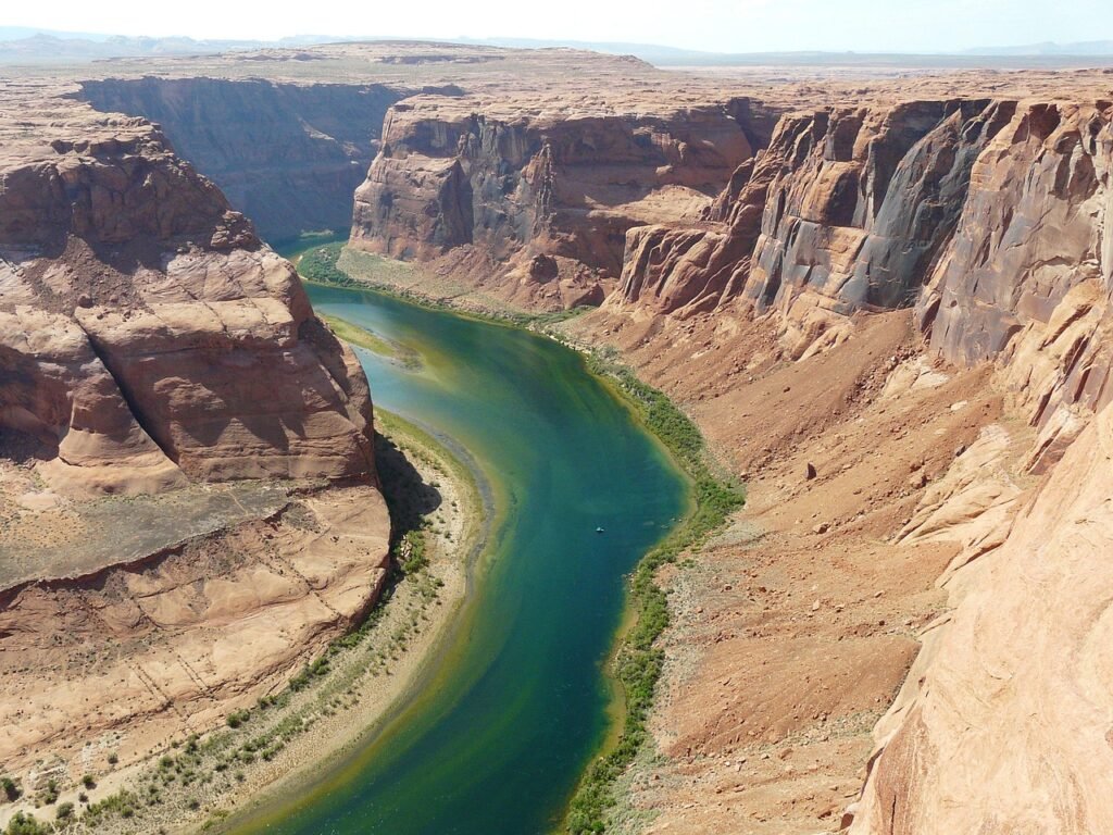
The Colorado River – A Canyon Carver in Constant Motion

Joseph C. Ives, who surveyed the lower river in 1857-1858, wrote that “the shifting of the channel, the banks, the islands, the bars is so continual and rapid that a detailed description, derived from the experiences of one trip, would be found incorrect, not only during the subsequent year, but perhaps in the course of a week, or even a day.” This observation from over 150 years ago still rings true today.
The Colorado River’s path changes are particularly visible in its lower reaches, where several large diversions draw from the river, providing water for both local uses and distant regions including the Salt River Valley of Arizona and metropolitan Southern California. These diversions draw water from the upper Colorado and its tributaries into the South Platte River, Arkansas River and Rio Grande basins, fundamentally altering the river’s natural flow patterns.
Rivers in Tropical Environments – Extreme Course Changes
These deltas were either on steep tropical islands like Madagascar and Papua New Guinea or in desert environments such as Eritrea. In these places, rivers carry exceptionally large quantities of sediment during floods, creating conditions ripe for dramatic course changes.
The combination of long typical flood durations and exceptionally high sediment loads during floods enables the erosion to progress far upstream. When the rivers flood, they erode their beds starting at their mouths and working backward far upriver, similar to large rivers like the Mississippi. As a result, these rivers can change course well above the backwater zone where avulsions happen in large coastal rivers.
Desert Rivers – When Water Finds New Paths in Arid Lands
Desert rivers face unique challenges that make course changes both more dramatic and more devastating when they occur. They think these avulsions are due to floods. When rivers break their banks, they erode the surrounding land. With enough flooding and enough edits to the landscape, the river may abruptly chart a new, more favorable path.
The sediment dynamics in desert environments create perfect conditions for sudden shifts. They knew that avulsions tend to happen on rivers that carry large amounts of sediment. (The Yellow River, to wit, gets its name from the amount of silt it picks up.) As that sediment builds up in the river’s path, it’s easier for the river to switch to another nearby course. Over time, the process repeats at the new course, leading to rivers that switch back and forth over the centuries.
Mountain Rivers – Carving New Channels Through Rocky Terrain
Mountain rivers showcase some of the most dramatic examples of geological forces at work. The formation of both entrenched meanders and ingrown meanders is thought to require that base level falls as a result of either relative change in mean sea level, isostatic or tectonic uplift, the breach of an ice or landslide dam, or regional tilting. These powerful geological processes can redirect entire river systems.
Classic examples of incised meanders are associated with rivers in the Colorado Plateau, the Kentucky River Palisades in central Kentucky, and streams in the Ozark Plateau. The waterway’s high sediment loads derive from steep peaks at the South Platte River’s high-altitude headwaters. Snowmelt and precipitation gather crumbling granite as water surges downward. Below on the plains, the gravel and sand slows. Thick, permeable deposits of ancient, unconsolidated sand, limestone, sandstone, and silt form the river’s alluvial basin and created an aquifer beneath it.
Rivers Breaking Free From Human Control
Despite our best engineering efforts, rivers continue to assert their natural tendency to change course. Despite Shreve’s cut, the Atchafalaya began to take in a greater share of the Mississippi’s flow in the 1900s, posing a risk to the river’s primary channel. Indeed, in the 1950s, 30% of the Mississippi River’s waterflow was naturally diverted to the Atchafalaya River.
In the 80 or so years since Harold Fisk’s report was written, we’ve spent billions of dollars on infrastructure just to coerce the mighty Mississippi to stay within its current channel. And that’s only a single case study in a battle that’s happening nonstop, around the world between human activity on Earth and the dynamic nature of the rivers that form its landscape. Additional researchers, such as Corps geologist Charles R. Kolb and ecologist Richard E. Sparks, have supported this approach of collaborating with nature, highlighting that sheer opposition to environmental forces can be both impractical and perilous over time.
The Science Behind River Migration
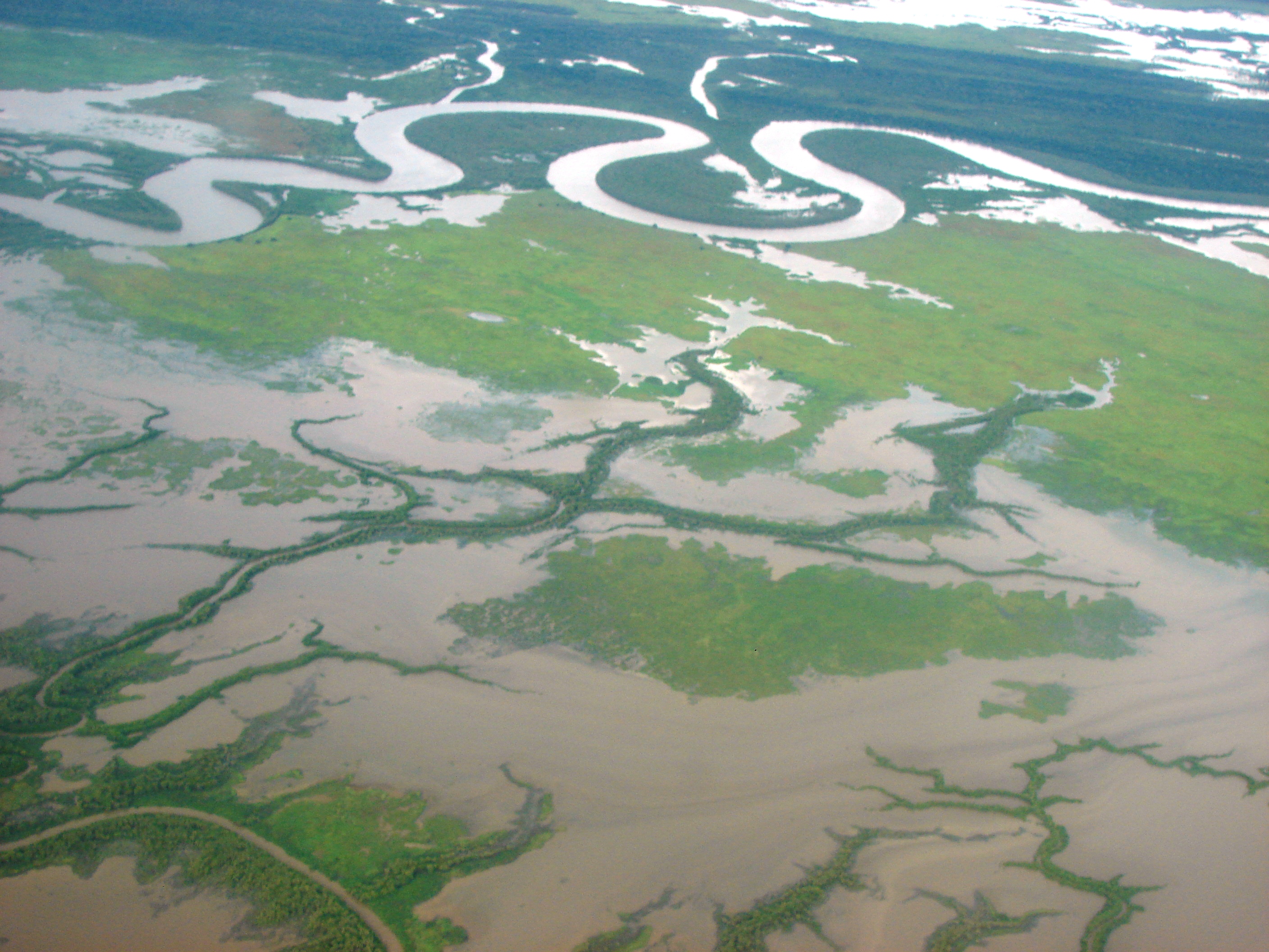
The higher velocities at the outside bend lead to higher shear stresses and therefore result in erosion. Similarly, lower velocities at the inside bend cause lower shear stresses and deposition occurs. Thus meander bends erode at the outside bend, causing the river to becoming increasingly sinuous (until cutoff events occur). This fundamental principle explains why rivers naturally develop curves and eventually change course.
It is produced as a watercourse erodes the sediments of an outer, concave bank (cut bank or river cliff) and deposits sediments on an inner, convex bank which is typically a point bar. The result of this coupled erosion and sedimentation is the formation of a sinuous course as the channel migrates back and forth across the axis of a floodplain. The river started to meander, to lengthen itself by curving back and forth, creating a sinuous path from start to finish.
Climate Change and Future River Behavior
Climate change is already increasing flooding in many parts of the world and washing more sediments into rivers. Land use changes, such as converting forests to farmlands, also are increasing sediment loads. These changes are accelerating the natural processes that cause rivers to shift course.
Climate change risks only add a compounding effect to the changes that Mississippi is currently experiencing. Risks that are already being felt by people and nature alike. In my view, it is imperative to understand how such changes can affect dynamic, volatile river systems – and the people who live around them – well into the future. The increasing frequency and intensity of extreme weather events mean we can expect more dramatic river course changes in the decades ahead.
Understanding why rivers change course isn’t just an academic exercise. It’s crucial knowledge for anyone living near these waterways, planning infrastructure, or working to protect ecosystems. Much like earthquakes, river avulsions happen periodically in the same places, making it possible to predict where future changes might occur. As we face an era of climate change and increasing human development along waterways, recognizing the dynamic nature of these systems becomes more important than ever. What do you think about living near a river that could literally change course overnight? Tell us in the comments.