Stand on a hillside in California, a crater in India, or an ice sheet in Canada, and you might feel a force you’ve trusted your whole life start to misbehave. Balls roll “uphill,” plumb lines tilt, and satellites register tiny dips and humps in the planet’s pull. For decades, these spots were dismissed as roadside curiosities or tourist traps, more illusion than insight. Today, they’re turning into natural laboratories where geologists, physicists, and climate scientists test ideas about how our restless planet really works. The mystery is no longer whether gravity changes from place to place – it does – but what those wobbles are trying to tell us.
Strange Slopes and Rolling Cars: Gravity Hills Around the World
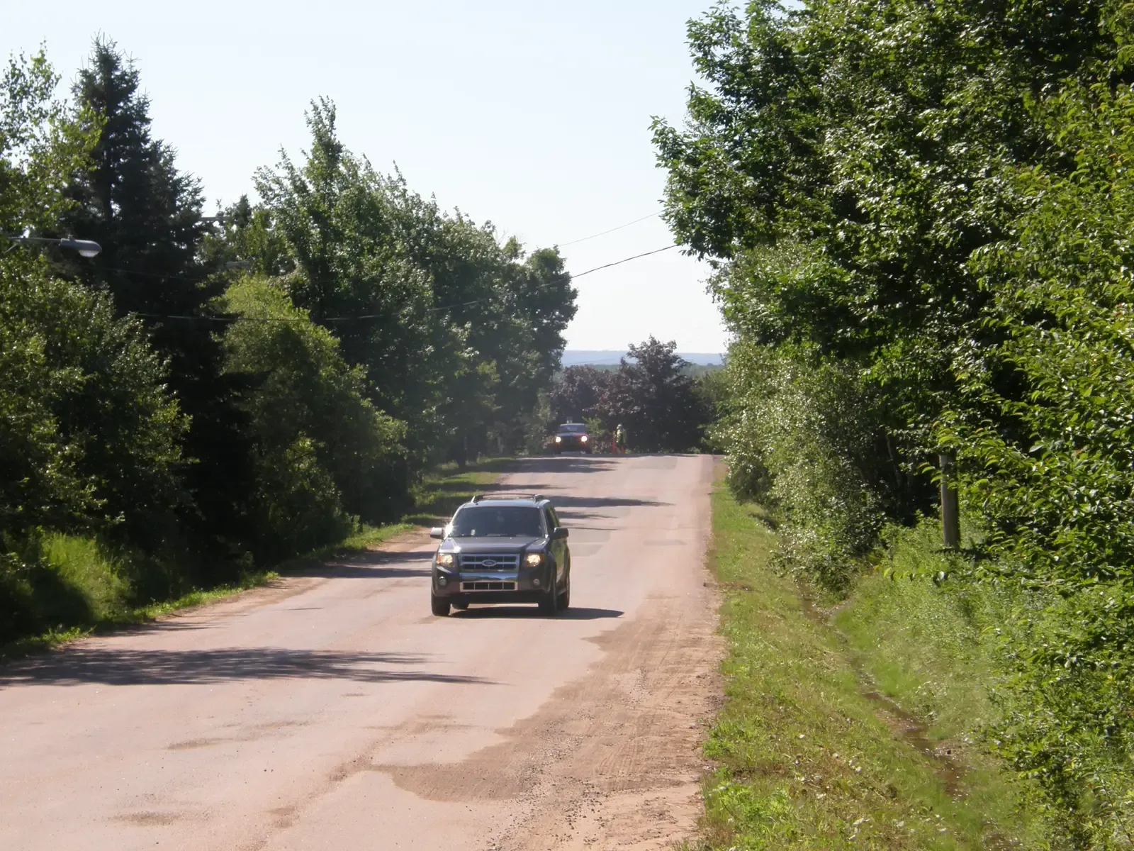
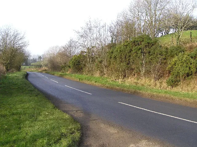
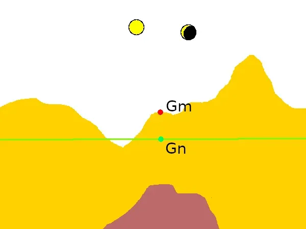
Few gravity anomalies are as instantly disorienting as a so‑called gravity hill, where a car in neutral appears to roll uphill and water seems to flow the wrong way. You’ll find versions from Pennsylvania and California to South Korea, India, and Scotland, each promising to overturn your instincts about what “down” means. On the ground, the effect feels almost spooky, as if some invisible hand is tugging objects in defiance of physics. In reality, much of what people experience on these hills is a powerful cocktail of visual illusion and subtle topography. When the horizon is obscured and trees or roadside structures lean just enough, our brains misjudge the true slope of the road beneath our feet.
That doesn’t make these sites scientifically boring; in fact, they are brilliant demonstrations of how easily our senses can misinterpret gravity’s direction. Surveying equipment and digital elevation models usually confirm that the “uphill” direction is actually slightly downhill, even though it feels wrong to almost everyone who stands there. Psychologists and geoscientists sometimes collaborate at these hills to test human perception against hard measurements, showing how the brain can be fooled while the laws of physics remain rock solid. What begins as a roadside gimmick becomes an entry point into deeper questions: if we can be tricked about something as basic as down, what else might we be missing about the forces that shape our planet?
The Indian “Magnetic” Hill: Where Vehicles Climb the Road
Near Leh in India’s Ladakh region, a stretch of road known as Magnetic Hill has been baffling and delighting travelers for years. Park a car in the marked zone, shift into neutral, and it appears to drift gently uphill toward the mountains, as if pulled by some mysterious force. Local legends once claimed powerful magnets in the hills could yank aircraft from the sky, and many visitors still arrive convinced something supernatural or high‑tech must be at work. When Indian road engineers and surveyors examined the site, they found no abnormal magnetism and no violation of Newton’s laws. Instead, the landscape presents a perfect stage set: a road that actually slopes downward while the surrounding ridges and valley walls deceive the eye.
What makes the Ladakh site particularly interesting is how persistently the illusion holds, even for people who know the explanation. GPS, laser levels, and gravitational surveys show that the acceleration is exactly what you’d expect from normal gravity acting on a slight downward gradient. Yet step out of the car, look up the road, and your brain insists the vehicle is climbing. For researchers, Magnetic Hill offers a controlled, real‑world setting to study how the visual system integrates context, horizon lines, and expectation. It’s a reminder that in the contest between perception and physics, gravity always wins – even when our eyes swear otherwise.
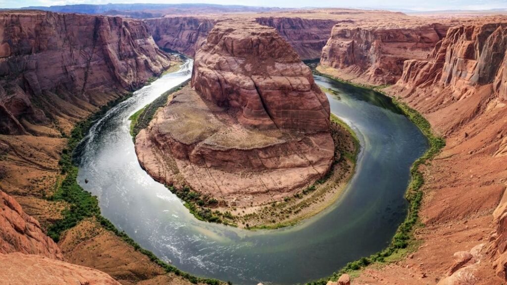
Hudson Bay, Canada: The Place Where Gravity Dips
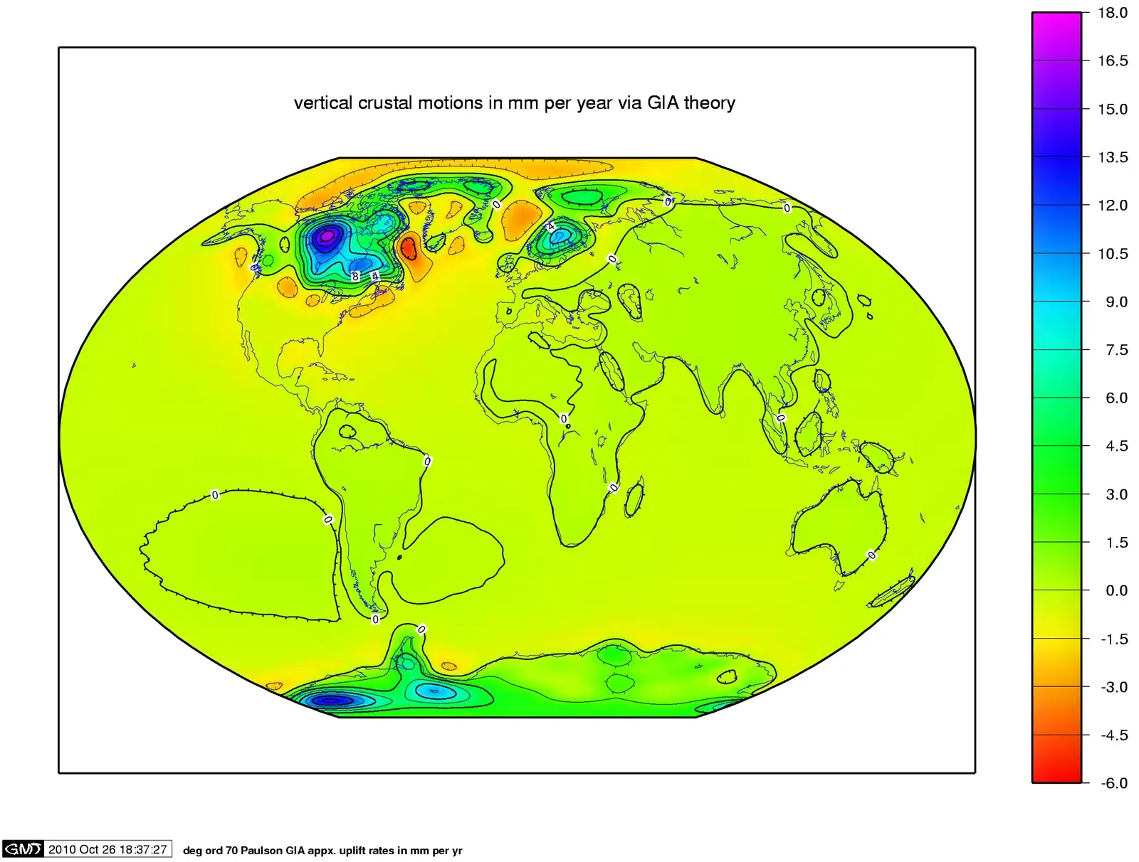
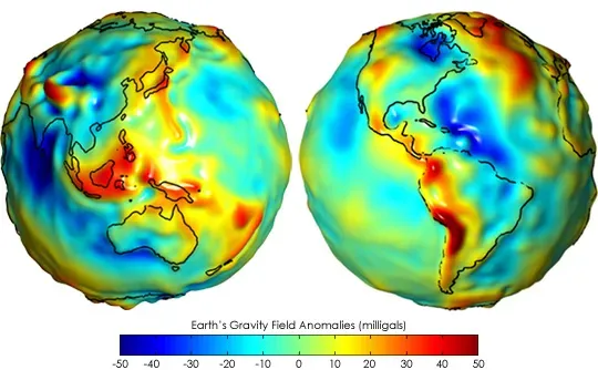
If most gravity “mysteries” on Earth are tricks of perspective, Hudson Bay in Canada is the opposite: you feel nothing unusual, but satellites detect a genuine sag in Earth’s gravitational field. Compared with many other regions, the gravitational pull over parts of Hudson Bay is measurably weaker, by roughly about one thousandth of what you would normally experience. Early on, scientists suspected a missing‑mass problem: either something had been carved away from the crust, or there was less dense material lurking beneath. Research combining satellite data and geological records now suggests a double explanation involving the legacy of ancient ice and deep‑seated mantle dynamics. The last great ice sheet that covered Canada depressed the crust, and the land is still slowly springing back, redistributing mass and subtly lightening the gravitational “tug” in the region.
At the same time, models indicate there may be long‑wavelength convection in the Earth’s mantle beneath Hudson Bay, like slow‑moving blobs in a lava lamp, reducing density in a broad swath of rock. These processes create a real gravitational low, one that sensitive instruments on the GRACE and GOCE satellite missions have mapped in detail. For climate scientists, this anomaly is more than a curiosity: tracking how gravity changes over Hudson Bay helps them quantify how fast ice and water are moving across the planet. When ice sheets melt or aquifers are drained, the mass shift shows up as a minute change in gravity, turning regions like Hudson Bay into benchmarks for understanding a warming world.
The Chicxulub Crater: A Gravity Scar from the Dinosaur-Killing Impact
Beneath the Yucatán Peninsula in Mexico lies one of the most consequential gravity anomalies on Earth, marking the scar of the asteroid impact that helped wipe out the dinosaurs. On the surface, much of the region looks like low, flat limestone plain, but geophysicists mapping tiny variations in gravity have traced a vast circular structure buried below. The rocks inside the crater are fractured, melted, and displaced, with lower average density than the surrounding crust, producing a subtle gravitational low. Airborne and marine gravimetry – measurements of gravity from planes and ships – were key pieces of evidence confirming the crater’s size and shape long before detailed drilling programs began. Without these gravity maps, the story of the impact would have remained frustratingly incomplete.
The Chicxulub anomaly offers a striking example of gravity as a forensic tool, reconstructing a catastrophe from the way it rearranged mass deep underground. By comparing the gravity signal with computer models of giant impacts, researchers can test scenarios for how the shock wave traveled, how high the tsunami waves may have been, and how debris was distributed. These insights ripple outward, informing how we think about impact risks today and how similar events might have shaped other planets. It is a reminder that gravity is a historian: every time mass is moved violently, from an asteroid strike to a mega‑volcanic eruption, Earth’s gravitational field quietly records the evidence.
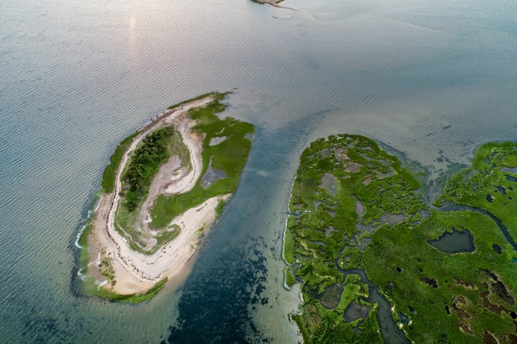
South Atlantic Gravity Low: A Quiet Disturbance in Earth’s Field
Far from tourist pull‑offs and dramatic craters, one of the planet’s most intriguing gravity oddities drapes over the open ocean: a broad region of unusually low gravitational pull in the South Atlantic. Satellite missions have revealed this subtle basin in the gravity field stretching off the coast of South America toward Africa. Ships sailing across feel nothing out of the ordinary, yet precise instruments show a deficit in mass deep in the underlying mantle. Some geophysicists link this anomaly to long‑standing hot upwellings or ancient slabs of subducted oceanic crust sinking and spreading at depth. Others see it as part of a larger pattern of mantle flow that may help drive plate motions at the surface.
What makes the South Atlantic low so important is how it ties together gravity, seafloor topography, and mantle convection into a single story. By studying the shape of this “gravity bowl,” scientists refine models of how heat and material circulate inside the planet, which in turn affect volcanic activity, continental drift, and even long‑term sea level. In recent years, gravity data have been combined with seismic imaging to build more detailed 3D pictures of the mantle, like medical scans of Earth’s interior. The result is a growing sense that gravity anomalies are not oddities to be cataloged on maps, but vital constraints on how the whole system works.
From Illusions to Instruments: How Scientists Measure Gravity’s Quirks
For most of history, strange gravity spots were explained by folklore: haunted hills, cursed valleys, mountains imbued with hidden powers. The shift from myth to measurement came with the development of precise pendulums, plumb lines, and later gravimeters – devices sensitive enough to feel changes hundreds of times weaker than a human can notice. Today, researchers use spring‑based instruments, superconducting gravimeters, and satellite pairs that track tiny changes in their mutual distance as they fly over lumpy gravity fields. What began as isolated readings at the surface has grown into global maps that show Earth’s gravitational highs and lows like a relief sculpture of invisible mass.
These tools have also revealed that gravity is not fixed in time. Seasonal snowpack, groundwater pumping, glacier melt, and even major earthquakes all shift mass around, slightly altering the pull we feel in different places. Modern missions have shown, for example, that gravity over parts of Greenland and West Antarctica is weakening as ice is lost, while regions receiving that water – often the ocean basins – experience a subtle strengthening. This dynamism has turned gravity research into a key part of climate science and natural hazard monitoring, not just a background constant in physics equations. The strange places we visit on road trips are just the most visible edge of a field that quietly tracks the planet’s every move.
Why Gravity’s Odd Behavior Matters More Than It Seems
It is tempting to treat gravity hills and weak‑gravity zones as scientific side shows, the kind of trivia that fills travel blogs and pub quizzes. But the same measurements that explain a rolling car in Ladakh or a dip over Hudson Bay are also the ones helping us track melting ice sheets, shifting tectonic plates, and changes in water storage that affect hundreds of millions of people. Compared with traditional surface surveys or isolated boreholes, gravity offers a rare, integrated view of mass – everything heavy, hidden, or submerged – without needing to dig or drill. In that sense, it complements seismic data, which excels at detecting contrasts in rock stiffness, by highlighting where real mass is missing or accumulating. The combination turns gravity anomalies from curiosities into crucial cross‑checks on our models of Earth’s deep plumbing.
There is also an important philosophical shift embedded in these studies. We used to treat gravity as a passive backdrop, something that simply “is” while the interesting action happens in volcanoes, storms, and earthquakes. Now researchers are treating gravity itself as a signal, a living record of those events written into the shape and strength of the field. The oddly behaving patches of gravity around the globe are like highlighted sentences in that record, drawing attention to places where the planet has been heavily reworked. Understanding them better means admitting that even supposedly stable parts of Earth are still adjusting to past ice ages, impacts, and deep mantle flows. When gravity feels strange, it is often because the ground beneath us is still mid‑story.
Looking Ahead: New Eyes on Earth’s Invisible Landscape
The next decade of gravity research is poised to make today’s anomaly maps look crude, as new technologies sharpen our view of Earth’s invisible landscape. Space agencies are already planning follow‑on missions to the GRACE and GOCE satellites, with instruments capable of picking up even smaller and faster changes in mass. Quantum gravimeters, which use chilled atoms instead of springs, are moving from physics labs into field testing, promising portable sensors that could spot underground voids, volcanic magma, or groundwater changes with previously impossible precision. These advances will likely turn more regions – mountain belts, deltas, even cities – into finely resolved gravity mosaics, each tile hinting at structures or processes we cannot see directly.
With that detail comes a new set of challenges. Interpreting dense gravity data demands powerful computing, careful calibration, and collaboration across geology, hydrology, and climate science. There are also political questions: information about underground resources revealed by gravity might influence everything from mining decisions to water disputes. Still, the global implications are hard to ignore. More sensitive gravity monitoring could improve early‑warning systems for volcanic unrest, refine projections of sea‑level rise by better tracking ice loss, and help manage water in drought‑prone regions by revealing which aquifers are being silently drained. The same strange behavior that once fueled campfire stories is now pushing us toward a more informed, and possibly more cautious, relationship with our changing planet.
What You Can Do with a World Where Gravity Is Not Quite Uniform
Most of us will never own a gravimeter or analyze satellite data, but there are surprisingly tangible ways to engage with a world where gravity is a little uneven. One is simply to visit these sites with a more informed curiosity: if you find yourself near a gravity hill, an impact crater, or a famous crater rim, treat it as an outdoor science lab rather than just a photo stop. Read the local geology displays, compare your senses with maps or smartphone elevation apps, and talk to guides about how explanations have changed over time. Another is to support institutions – museums, universities, and research agencies – that fund the unglamorous, long‑term monitoring work behind those colorful gravity maps. When you see headlines about losing ice mass or depleted aquifers, remember that gravity measurements often underpin those warnings.
You can also fold this awareness into everyday choices. Paying attention to climate research that relies on gravity data helps you see distant ice sheets and hidden groundwater as part of your own water and weather story, not something abstract. Supporting policies and organizations that push for open, global sharing of geophysical data makes it easier for scientists to spot dangerous trends early, whether they involve collapsing ice shelves or over‑pumped basins. Finally, keep an eye on how new quantum sensors and satellite missions are being used, and lend your voice when debates arise over their environmental and social impacts. In a world where even gravity is telling us that Earth is changing, the decision is no longer whether to listen, but how we choose to respond.

Suhail Ahmed is a passionate digital professional and nature enthusiast with over 8 years of experience in content strategy, SEO, web development, and digital operations. Alongside his freelance journey, Suhail actively contributes to nature and wildlife platforms like Discover Wildlife, where he channels his curiosity for the planet into engaging, educational storytelling.
With a strong background in managing digital ecosystems — from ecommerce stores and WordPress websites to social media and automation — Suhail merges technical precision with creative insight. His content reflects a rare balance: SEO-friendly yet deeply human, data-informed yet emotionally resonant.
Driven by a love for discovery and storytelling, Suhail believes in using digital platforms to amplify causes that matter — especially those protecting Earth’s biodiversity and inspiring sustainable living. Whether he’s managing online projects or crafting wildlife content, his goal remains the same: to inform, inspire, and leave a positive digital footprint.