You might think you need to venture far from American soil to encounter truly ancient mysteries. The truth is, scattered across the United States lie archaeological wonders that rival anything on other continents, places where Indigenous peoples left behind clues to civilizations that thrived long before European contact. These sites challenge what we thought we knew about early American history.
From massive earthen mounds to stone structures carved into cliffsides, these locations preserve stories written into the earth itself. Their legends stretch back thousands of years, and groundbreaking discoveries at each site have fundamentally reshaped our understanding of the past. Let’s dive into these enigmatic places and the archaeological breakthroughs that brought their secrets to light.
Cahokia Mounds: America’s Forgotten Metropolis
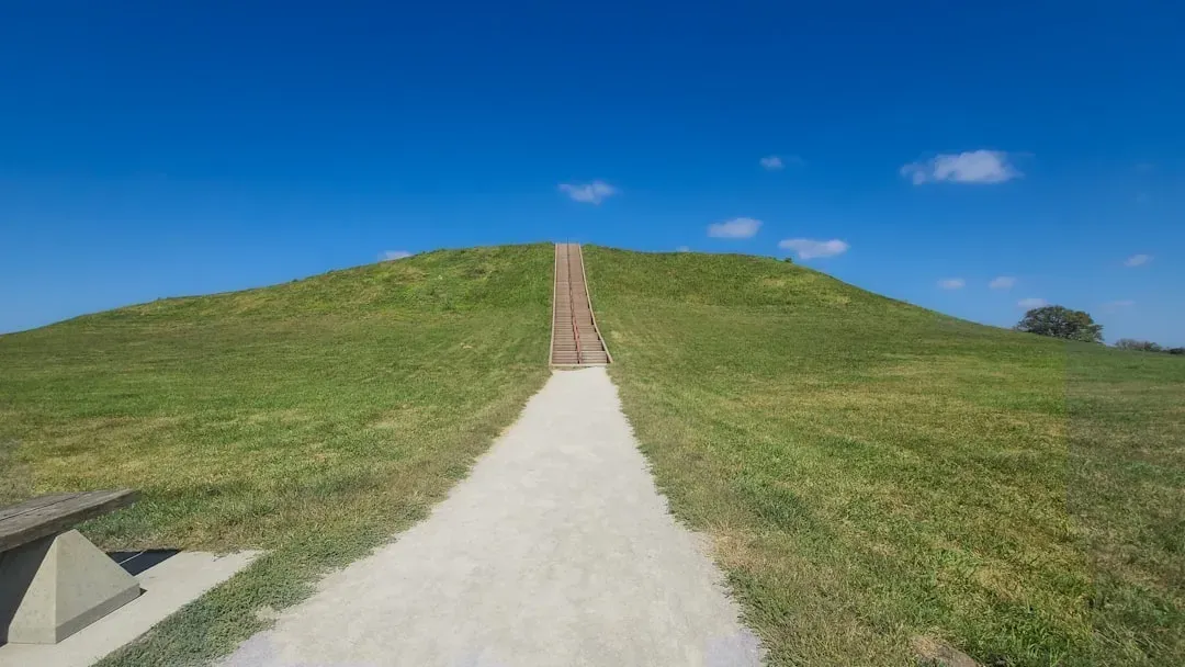
In its heyday around 1100 CE, Cahokia was home to nearly 20,000 individuals, larger than London at that time. Think about that for a second – a massive Native American city thriving in what is now Illinois, complete with urban planning that wouldn’t be matched by American cities until the late 1700s.
The site preserves the central section of the largest prehistoric Native American city north of Mexico, dominated by the hundred-foot-tall Monks Mound, the largest prehistoric earthen mound in the Americas. Here’s what’s truly fascinating: excavations confirmed that an enormous, two-mile-long stockade surrounded the central portion of Cahokia, started around A.D. 1100 and rebuilt three times.
Recent discoveries fundamentally altered our perception of this place. Climate change in the form of floods and droughts played a key role in the 13th century exodus, but fecal stanol evidence filled gaps in the region’s history, revealing a complex series of migrations and ecological changes before Europeans arrived. In Mound Seventy-two, archaeologists found a chief on a bed of twenty thousand shell beads, surrounded by copper, mica, and remains of sacrificed individuals. That discovery forced scholars to rethink earlier theories about Cahokian society.
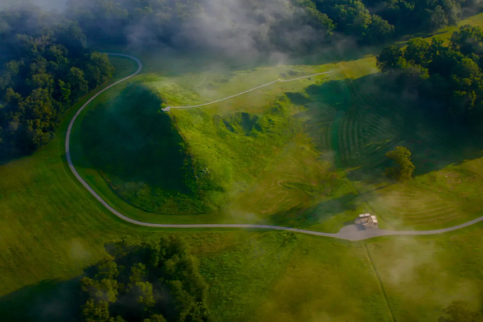
Serpent Mound: The Giant Snake Written in Earth
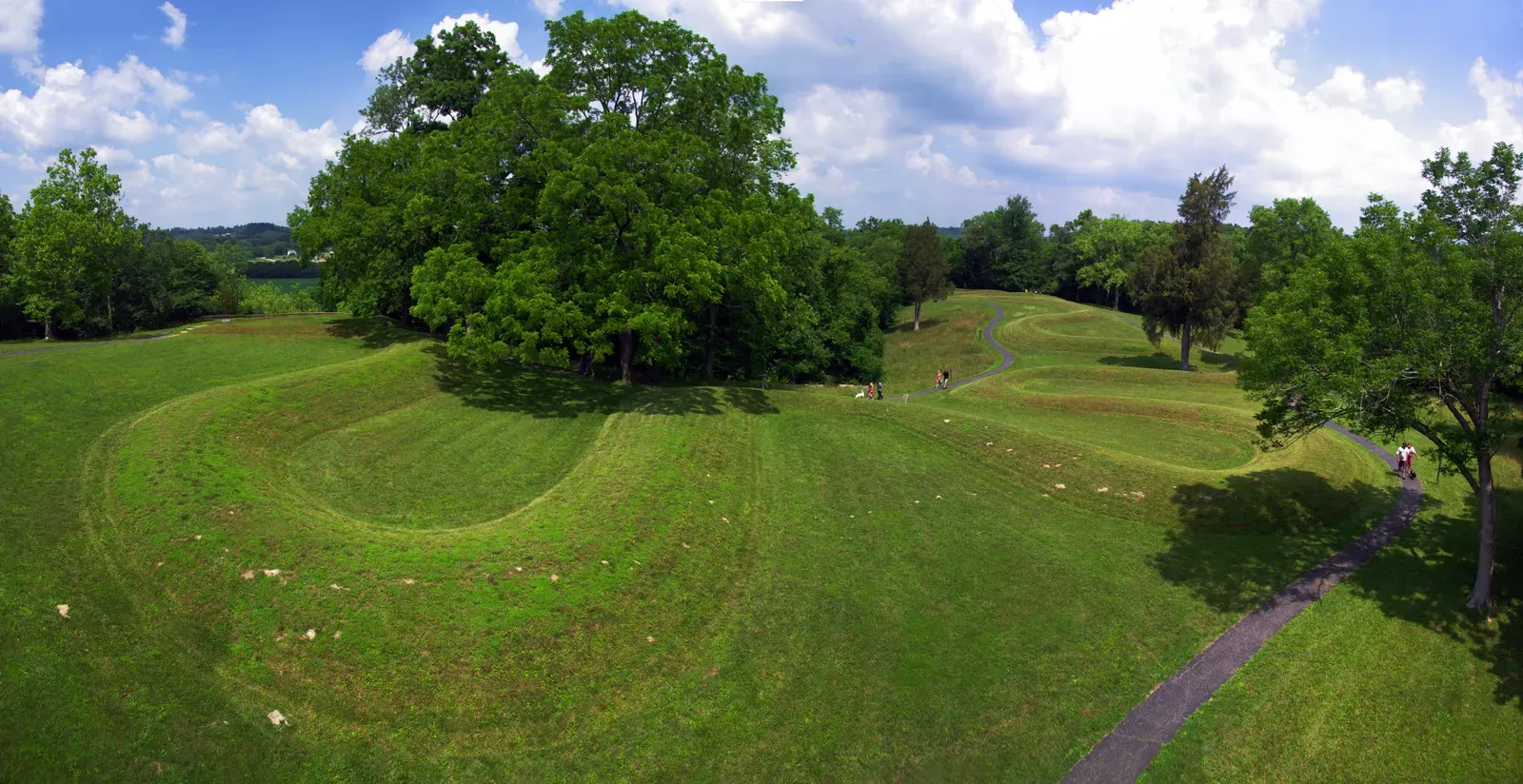
Imagine an earthwork so massive it can only be truly appreciated from the air. The Great Serpent Mound stretches 1,348 feet long and is the largest serpent effigy known in the world. Located in Ohio, this undulating snake has puzzled researchers for generations.
The dating of this mound sparked heated academic debate. Carbon dating studies on charcoal pieces yielded a date of around 1070 CE, placing the Serpent Mound within the Fort Ancient culture, while a third piece dated to approximately 2920 years before present. Who actually built it remains contentious among archaeologists.
The head and oval are aligned to the setting sun on the Summer Solstice, and two Late Precontact stone serpent effigies below the Fort Ancient Earthworks also have alignments to the sun. Was it an astronomical calendar? A spiritual symbol? Some interpret the egg or eye shape at the head as representing the sun, perhaps documenting a solar eclipse. The mystery deepens when you consider that it’s located on the site of an ancient meteor impact dating to around 300 million years ago, in what’s known as Serpent Mound crater.
Chaco Canyon: The Desert Civilization That Defied Logic
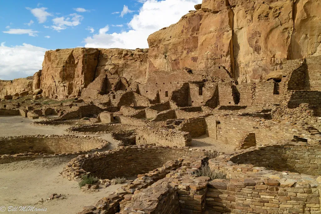
Summer heat scorches the desert canyon sandwiched between sandstone cliffs nearly two kilometers above sea level in New Mexico’s northwestern corner, with bitter cold sweeping in for winter and temperatures swinging as many as 28 degrees Celsius during a day. Yet somehow, an advanced civilization flourished here for centuries.
Between AD 900 and 1150, Chaco Canyon was a major cultural center where Chacoans quarried sandstone blocks and hauled timber from great distances, assembling fifteen major complexes that remained the largest buildings ever built in North America until the 19th century. The scale is mind-boggling.
Let’s be real – the discoveries here completely changed archaeological perspectives. The Zuni and Chuska Mountains provided close to 70 percent of the more than 240,000 trees used for roof beams and doorframes of Chaco great houses. Hauling that much timber across roughly 75 kilometers of harsh desert required extraordinary organizational skills. DNA analysis revealed the remains from Pueblo Bonito belonged to a single maternal line that persisted as leaders for more than 300 years, providing intimate details about elite groups that ruled this society. Even more surprising, six-toed individuals appear to have held special status at Pueblo Bonito, with three identified among the burials, a condition affecting about 2.4 of every 1,000 Native Americans today.
Mesa Verde: Cliff Cities That Touch the Sky
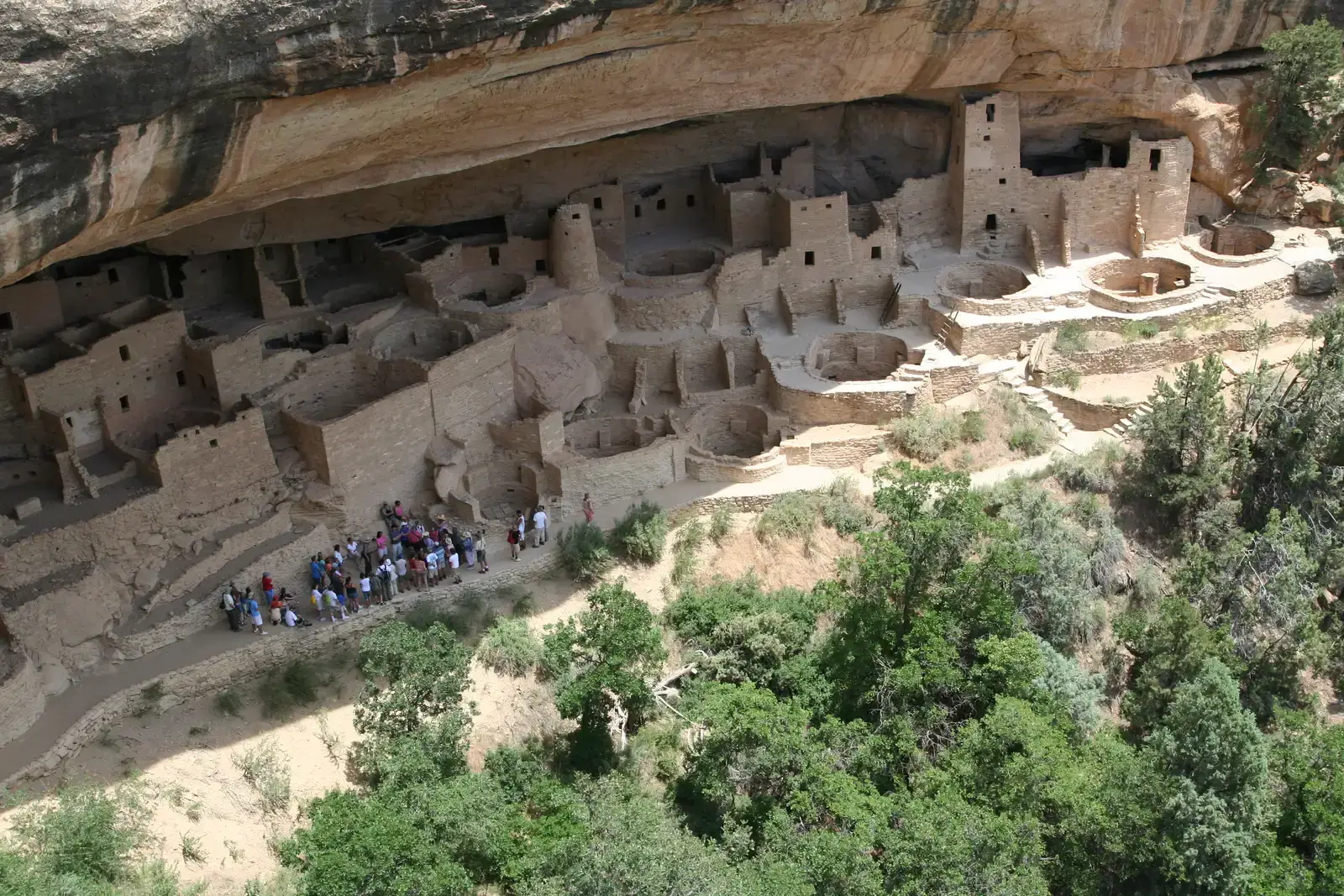
Cliff Palace is the largest cliff dwelling in North America, built by the Ancestral Puebloans in Mesa Verde National Park, constructed and lived in from about 1200 A.D. to 1300 A.D. Walking beneath these structures built into sheer rock faces feels surreal.
Beginning after 1000-1100 C.E., they built more than 600 structures into the cliff faces of the Four Corners region. The engineering prowess required to construct multi-story buildings in these precarious locations staggers the imagination. Most kivas contain six stone pillars supporting the roof, a firepit in the middle, a ventilation opening and chimney, and a small hole called a sipapu believed to symbolize the entryway for living souls to enter the current world.
Recent analysis revealed surprising facts about population. Archaeologists identified twenty-five living rooms with residential features like hearths, suggesting each was occupied by three to four residents, bringing the overall population to approximately 100-120 people. Far fewer than you’d expect from such massive structures.
For over six centuries, the Ancestral Pueblo people lived atop the mesa, but in the late 1190s, they began constructing intricate stone dwellings beneath the overhanging cliffs. Why the sudden move to these defensive positions? Cliff Palace was abandoned by 1300, with some contending that megadroughts interrupting food production systems were the main cause.
White Sands: Footprints That Rewrote Human History
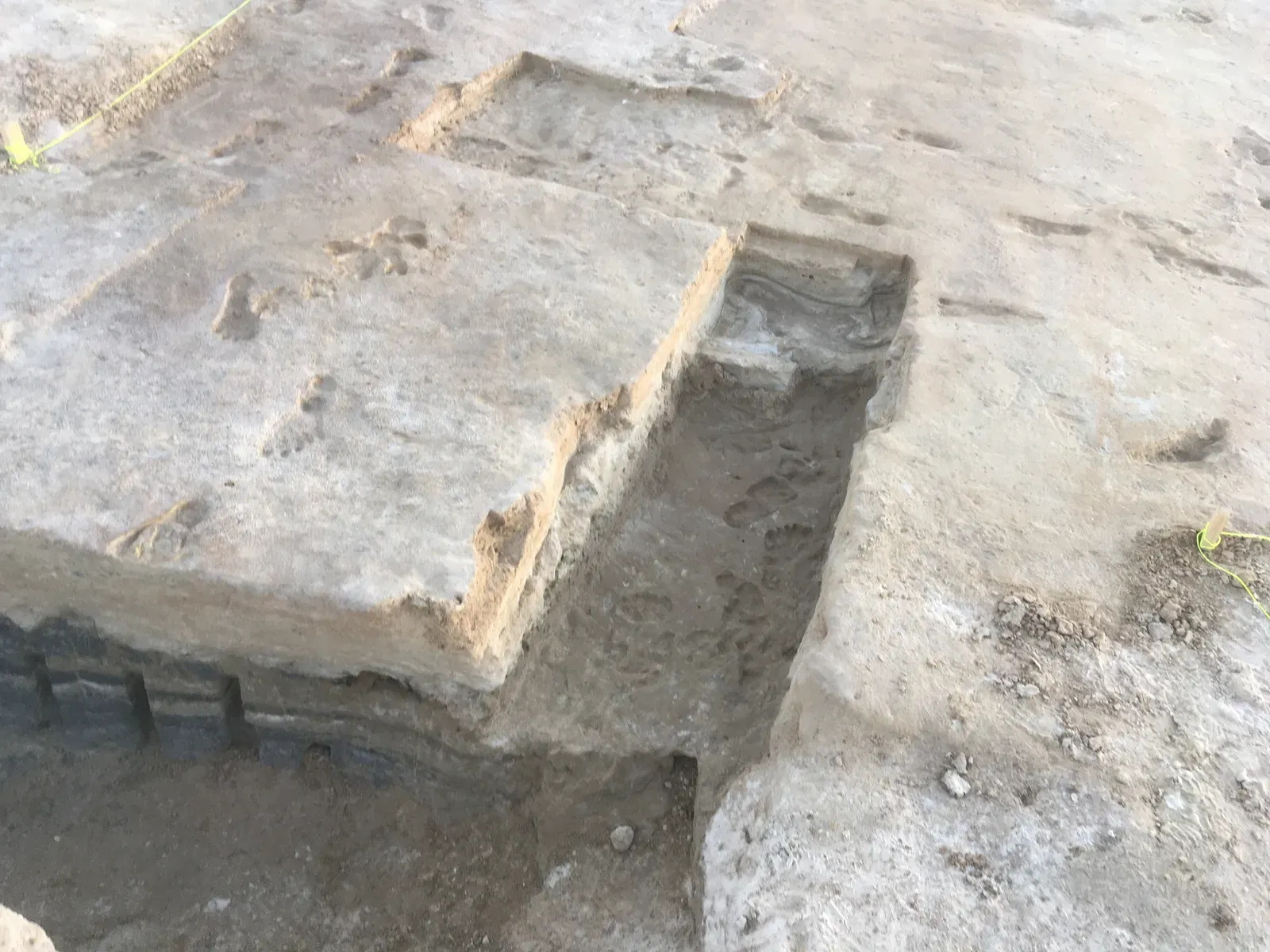
This one honestly blew my mind when I first learned about it. Archaeologists unearthed a set of human footprints around the shore of ancient Lake Otero in late 2020, revealing them to be 21,000-23,000 years old, the oldest known human footprints in North America. Let that sink in.
This discovery in White Sands National Park completely changed the way migration into the Americas is understood by scientists, as radiocarbon dating showed they’re 21-23,000 years old. Initially, scientists thought humans didn’t enter the Americas until around 15,000 years ago. This finding shattered that hypothesis.
Covering around a mile, it’s the longest track of fossilized human footprints ever discovered, made mostly by children and teenagers including one child under three, and prints show these people crossed paths with mammoths and giant sloths. The controversy surrounding the dating wasn’t settled easily either. The original 2021 study claimed the footprints were 21,000 to 23,000 years old, a 2022 study disputed this claiming 15,000 to 13,000 years, then a 2023 study reaffirmed the original findings, with confusion stemming from dating techniques still debated in scientific circles.
Poverty Point: The Earthwork Engineering Marvel
Koster Site produced deeply buried evidence of ancient human occupation from the early Archaic period (BC 7,500) to the Mississippian period (AD 1,000), but Poverty Point stands out for its sheer ambition. Rising from Louisiana’s landscape, these massive earthworks represent one of North America’s most sophisticated ancient construction projects, with precise geometric design and enormous scale requiring advanced engineering knowledge that seemed impossible for its time period, built without modern tools or even pottery technology.
Archaeological studies suggest it was an ancient residential, trade and ceremonial center, though researchers aren’t entirely certain why this sophisticated earthwork complex was constructed, and it’s thought Poverty Point was abandoned sometime around 1100 BC. Here’s the thing – the scale of labor coordination required suggests a highly organized society.
The mystery deepens when you consider the absence of certain technologies. These people moved massive amounts of earth, created complex geometric patterns visible only from above, and established extensive trade networks, all without the wheel or advanced metallurgy. How did they do it? That question still haunts archaeologists.
Judaculla Rock: The Billboard of Ancient Messages
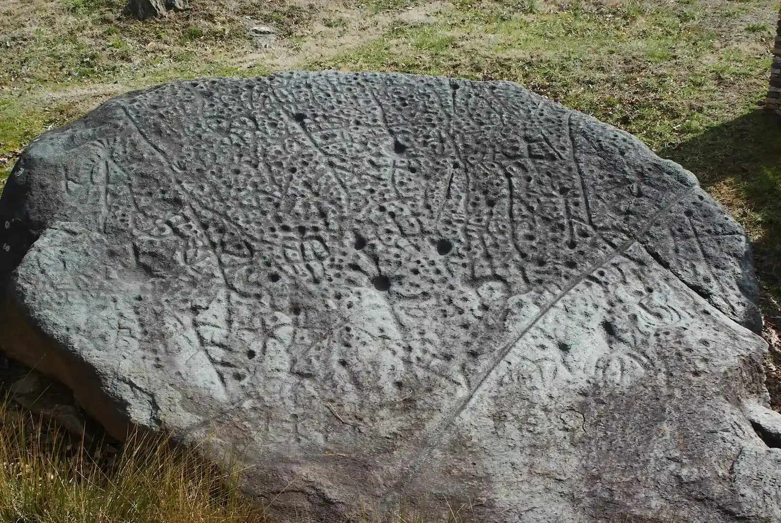
For years, the Cherokee people used the soapstone boulder now known as Judaculla Rock as a sort of billboard, etching so many petroglyph designs into the North Carolina stone that it’s difficult to tell exactly how many there are, with the boulder sporting seven grooves attributed to ancient masons mining soapstone to make bowls. Cherokee legend tells a different story – those grooves are the mythical footprints of a legendary giant.
Research has been slow because soapstone is naturally fragile and the Cherokee still see the rock as a sacred artifact, but they’re working with visitors and researchers to provide access while preserving the stone. This delicate balance between scientific inquiry and cultural preservation presents ongoing challenges.
The petroglyphs themselves remain largely undeciphered. The sheer density of carved symbols, overlapping across potentially thousands of years, makes interpretation nearly impossible. Were they recording historical events? Marking territorial boundaries? Communicating with spiritual forces? We may never know for certain, yet the stone continues to hold deep significance for descendant communities.
Blythe Intaglios: America’s Answer to the Nazca Lines
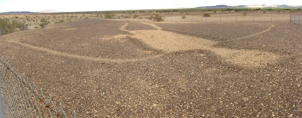
Many people know about the famous Nazca Lines of Peru, but few know the U.S. has its own series of desert geoglyphs in the Colorado Desert of California, home to the Blythe Intaglios, perhaps the USA’s version of the Nazca Lines. Stretching across the California desert near the Colorado River, these enormous ground figures depicting human forms, animals, and geometric shapes range from 95 to 171 feet in length.
Depicting animals, humanoid figures, and spirals, these intaglios remain mysterious, and although no one currently knows who made them, they’ve been an important part of indigenous history in the area. Created by scraping away desert pavement to reveal lighter soil underneath, these massive artworks can only be fully appreciated from the air.
The purpose? Your guess is as good as mine. The isolation and precision challenge archaeological explanations. Were they ceremonial pathways? Astronomical markers? Messages to the gods? Their exact age, purpose, and creators remain unknown, though they share similarities with newly discovered geoglyphs in the Nazca Desert, and the sites are accessible but best viewed from aircraft.
Stone Chambers of New England: Europe in Ancient America?
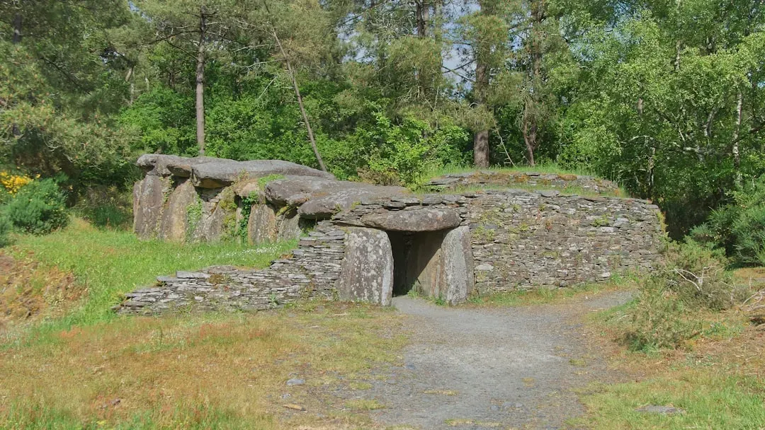
Scattered throughout the forests and fields of New England, particularly in Vermont and New Hampshire, stand hundreds of mysterious stone chambers that have left archaeologists puzzled for generations, with some experts claiming there may be over 250,000 miles of stone walls under the region. That’s an absolutely staggering amount of construction.
While some argue these chambers were simple root cellars built by colonial farmers, their advanced engineering, orientation to solar events, and carbon dating of surrounding artifacts suggest they may be far older, and many can be visited on private and public lands though some require special permission. The debate rages on.
Hundreds of distinctive stone structures found all over New England are of a design and form found nowhere else in North America, and though many historians believe they were built by early colonists as root cellars, others believe some chambers are ancient, built by European travelers during the Bronze Age. If the latter theory proves true, it would completely upend our understanding of pre-Columbian contact with the Americas. The controversy shows no signs of resolution.
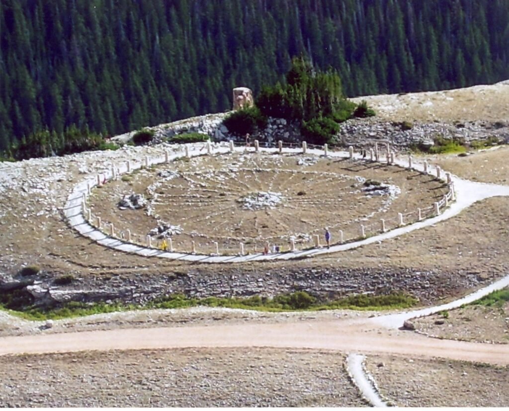
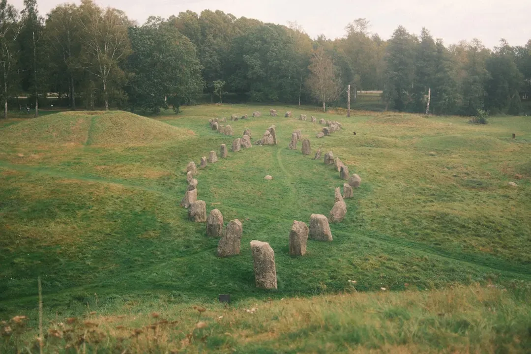
Bighorn Medicine Wheel: Where Earth Meets Sky
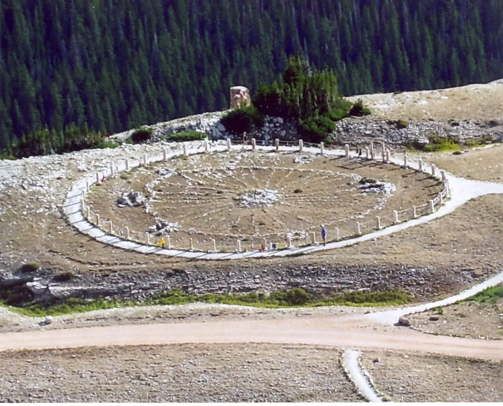
There are several “medicine wheel” monuments scattered around North America, with stones arranged in a wheel shape – a structure sacred to several tribes across the northern Great Plains. The Bighorn Medicine Wheel in Wyoming stands as one of the most impressive and well-preserved examples.
The wheel consists of a central cairn surrounded by a circle of stones with radiating spokes, resembling a giant wagon wheel laid upon the mountain. Various Indigenous tribes consider these sites sacred, used for ceremonies, vision quests, and astronomical observations. The alignment of certain spokes with solstice sunrises and sunsets suggests sophisticated astronomical knowledge.
They may be connected to sacred ceremonial dances once held in the area or could even be ancient star maps. Located at high altitude with sweeping views across the landscape, the wheel’s remote location adds to its mystique. Visiting requires a hike, and the site remains actively used for spiritual practices by Native American communities today. The exact age of the wheel’s construction remains uncertain, with estimates ranging from several hundred to several thousand years old.
Death Valley’s Underground Mystery: Legend or Reality?
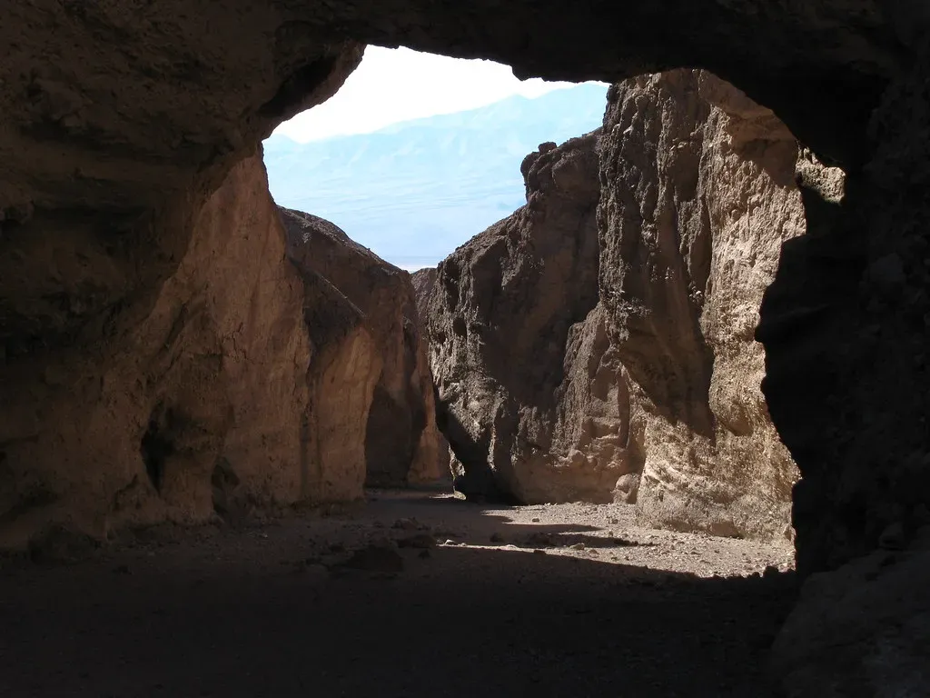
The idea that there could be a secret 5,000-years-old underground city hidden somewhere beneath Death Valley, California is fascinating, and according to those who entered the subterranean tunnels, the city was once inhabited by an unknown race. Now that’s a story that sounds like pure fiction, yet persistent legends won’t go away.
According to a 1947 report, in 1931 a man discovered a series of complex tunnels deep below Death Valley, with one tunnel supposedly leading to the discovery of three mummified ‘giants’ eight to nine feet tall, hieroglyphics and an alleged ritual hall. Could this be pure fabrication? Probably. Yet it aligns eerily with certain Indigenous oral traditions.
Before we can enter the realms of this mysterious subterranean world, we must first listen to the words of the Paiute Indians who have legends describing an underground world few people have heard of. Whether these tunnels exist or not, the legend speaks to something deeper – the recognition that Indigenous peoples possessed knowledge of their landscape that outsiders barely scratched the surface of understanding. Modern remote sensing technology could potentially verify or debunk these claims, yet the harsh conditions and protected status of Death Valley make extensive underground exploration unlikely.
Conclusion
These ten sites represent just a fraction of the archaeological mysteries scattered across the United States. Each discovery chips away at misconceptions about ancient America, revealing complex societies with sophisticated engineering, astronomical knowledge, and extensive trade networks that flourished thousands of years before European contact.
The most exciting part? We’re still uncovering new evidence. Advanced dating techniques, DNA analysis, and remote sensing technologies continue to rewrite what we thought we knew. These places aren’t just ruins – they’re living connections to ancestors whose stories were quite literally written in the earth, waiting for us to learn how to read them.
What strikes me most is how these discoveries humble our assumptions about progress and civilization. Did you expect that the largest building in North America for nearly two millennia would turn out to be an earthen mound in Illinois? That’s the power of archaeology – it forces us to question everything we think we know about the past and recognize the ingenuity of those who came before us.