For centuries, Thonis-Heracleion was a ghost rumor in old texts, a lost Egyptian port-city that some scholars quietly suspected might never have existed at all. Then, at the turn of the twenty–first century, divers working off Egypt’s Mediterranean coast began to pull statues, temple blocks, and ritual objects out of the murky water – and the myth abruptly turned into a very real city. What has emerged since is not just a sunken port, but a ritual landscape shaped by geometry, astronomy, and a kind of spatial logic that feels eerily familiar to anyone who studies sacred sites in the Americas. In the shadowy light of the seabed, Thonis-Heracleion forces a new question: were ancient cultures, separated by oceans and millennia, independently drawn to similar geometric patterns when they tried to speak with their gods? As archaeologists map this drowned metropolis in ever finer detail, the city is becoming less of an oddity and more of a missing chapter in the global story of sacred geometry.
The Hidden Clues Beneath the Waves
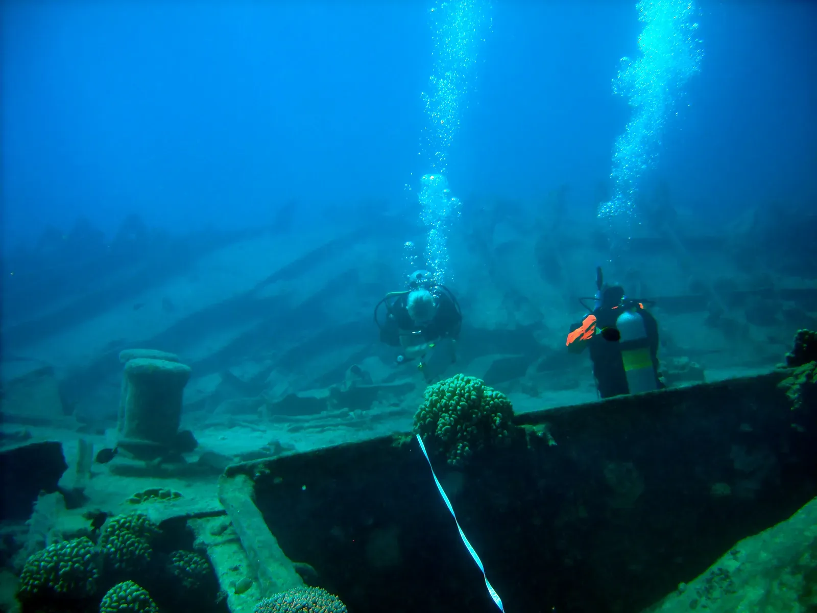
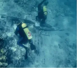
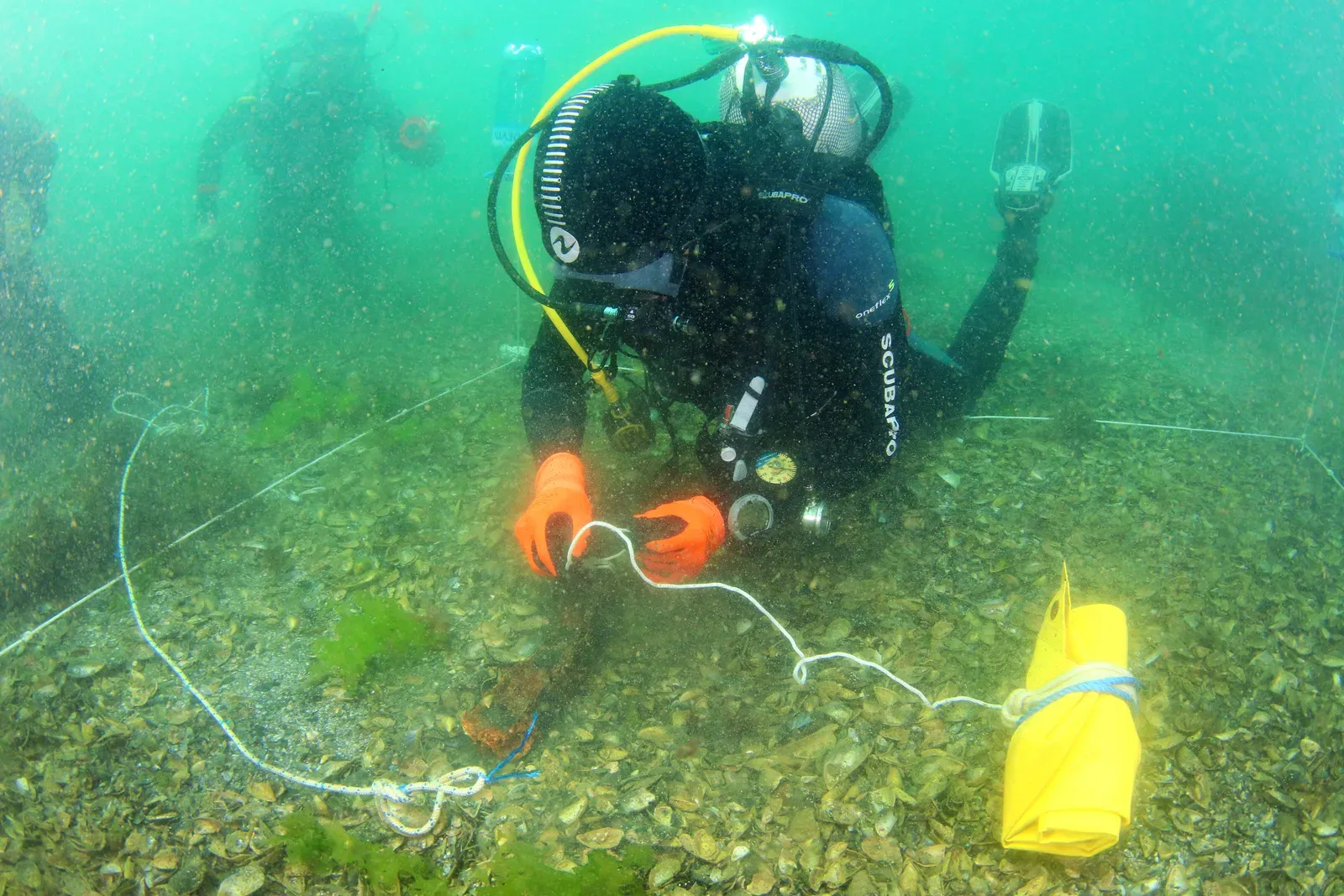
The first thing that shocks most people about Thonis-Heracleion is how late it reappeared in our story. Greek and Egyptian texts mentioned a powerful harbor-city at the mouth of the Nile, but by late antiquity it had slipped into legend, written off as a scribal confusion or a poetic embellishment. That changed in 2000, when underwater archaeologist Franck Goddio and his team announced the discovery of a massive settlement buried in the silts of Abu Qir Bay, some four miles off today’s coastline. Over the next years, they mapped temple precincts, canals, quays, and clusters of monuments, revealing not a minor port but the primary gateway between Egypt and the Mediterranean world for many centuries.
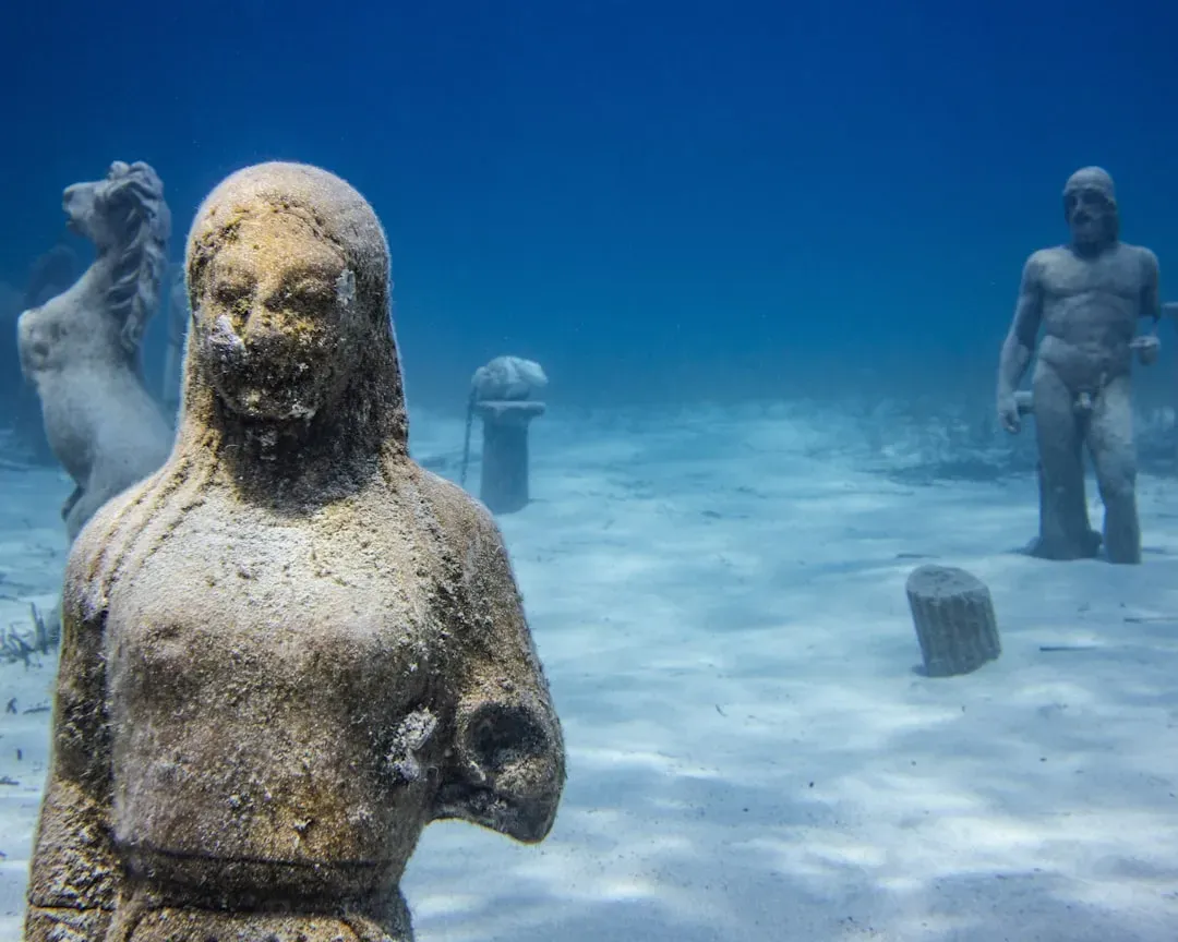
What makes this rediscovered city more than just a historical curiosity is the extraordinary preservation of its ritual spaces. The soft, anoxic mud of the bay effectively sealed statues, stelae, and even wooden structures in place, freezing a sacred urban landscape at the moment it went under. Divers have documented colossal red granite statues of pharaohs, a monumental temple of Amun‑Gereb, and smaller shrines aligned along what appear to be processional routes. From above, the pattern that emerges is not random; it is a planned geometry of power and belief, laid out with the same obsessive care you see in the earthworks of the Ohio River Valley or the great kivas of Chaco Canyon. The sea did not erase this geometry – it just hid it long enough for us to be surprised by it.
Geometry in Stone: How the City Was Laid Out
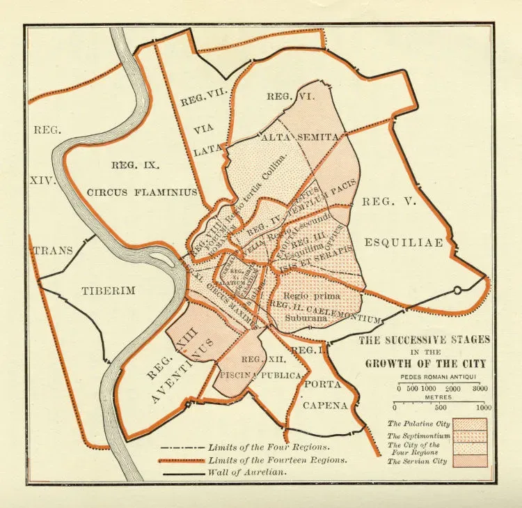
When marine surveyors began stitching together sonar scans, magnetometer readings, and diver sketches of Thonis-Heracleion, a striking order emerged from the underwater haze. Temples, quays, and canals were not scattered haphazardly; they followed repeated distances and angles that suggest deliberate geometric planning. The great temple of Amun‑Gereb appears to anchor a grid of ritual and commercial space, roughly oriented to the cardinal directions while also respecting the shifting channels of the Nile. Secondary shrines, harbor basins, and monumental gateways sit along axes that intersect at near-regular intervals, like the nodes in a cosmic diagram drawn at urban scale.
This is where comparisons with sacred geometry in ancient North America start to feel less speculative and more structural. At sites like the Newark Earthworks in Ohio or the Sun Temple in Mesa Verde, archaeologists have documented careful use of right angles, circles, and astronomical alignments to encode cosmology into the landscape. In Thonis-Heracleion, the geometry is mediated through water: canals delineate sacred precincts, harbors form near‑circular basins, and processional routes trace straight lines between key cult centers. It is as if the city’s designers were negotiating with the river, using geometry as a kind of shared language between human intention and a wildly mobile delta.
Circles, Axes, and the Sacred Port: Echoes of Global Ritual Landscapes
Stand back – at least in your mind’s eye – from the tangle of ruins and the picture begins to resemble other sacred port and pilgrimage landscapes around the world. In Thonis-Heracleion, circular harbor basins acted as both commercial hubs and ritual thresholds, receiving ships from the Greek world that were effectively entering the religious jurisdiction of Egypt. Radial canals and causeways extended from these watery circles toward temple complexes, much like the way roads and sightlines radiate from central plazas in ancient Puebloan great houses or from circular enclosures in Mississippian mound centers. The geometry guided movement, and movement encoded story.
Researchers have started to see patterns such as repeated ratios between harbor diameters and temple distances, or consistent angular relationships between major cult sites and the open sea. These are not decorative coincidences; they shape how people would have experienced the city during festivals and everyday trade. In North American earthwork complexes, similar repeated ratios between circle diameters, plaza widths, and mound heights have been interpreted as cosmological diagrams made habitable. Thonis-Heracleion hints that Mediterranean engineers and priests were playing a related game: using circles, axes, and proportional spacing to turn a hazardous delta into a navigable map of the sacred.
Rituals of Water and Light: A Shared Language Across Continents
Water was not a background feature in Thonis-Heracleion; it was the medium through which ritual and power flowed. The city sat at a liminal point where river and sea intermingled, and its temples seem calibrated to that in‑between state, much as many North American ceremonial centers sit where rivers meet, or where wetlands meet higher ground. Textual evidence from Egypt describes processions where the god Amun traveled by boat, accompanied by priests and crowds, stopping at stations along the waterways for offerings and oracles. Underwater, archaeologists have found the remains of these stations in the form of small shrines, quays, and perhaps even floating ritual platforms now lost to decay.
Imagine, for a moment, how this would have felt: torchlight flickering across the water, the geometry of the city revealed not in bird’s‑eye perfection but in a sequence of framed views and ritual pauses. Something very similar plays out at sites like Poverty Point in Louisiana or the Hopewell earthworks in Ohio, where circular and linear forms choreograph processions tied to solstices, river levels, and the seasonal movement of people. Sacred geometry in these cases is not about abstract perfection. It is about how bodies move through space, how light strikes a carved stone at a particular dawn, or how reflections on water double a temple façade into a mirrored axis between worlds.
From Ancient Tools to Modern Science: Mapping a Drowned City
If the priests and architects of Thonis-Heracleion used cords, sightlines, and simple surveying tools to lay out their sacred geometry, today’s investigators are working with a different toolkit entirely. The rediscovery and mapping of the city has depended on high‑resolution side‑scan sonar, sub‑bottom profilers, differential GPS, and photogrammetry that stitches thousands of underwater photographs into coherent three‑dimensional models. Each survey season adds a little more clarity, turning what began as ghostly outlines on sonar into street‑level reconstructions of quays, courtyards, and columned halls. In essence, scientists are reverse‑engineering the city’s geometry from its surviving traces on and beneath the seabed.
This is not a purely technical exercise; it is interpretive, bordering on forensic. Analysts compare measured angles and distances with known Egyptian surveying practices, checking for repeated modules or canonical proportions. They run simulations to see how water levels and shoreline positions shifted over centuries, asking whether certain alignments might have targeted rising or setting stars over the open sea at specific dates. In North American archaeology, similar digital methods have been applied to aerial LiDAR of earthworks and mounds, revealing alignments that are almost impossible to see from the ground. In both contexts, modern science becomes a bridge to ancient geometry, helping us see large-scale patterns that the original builders likely held in their minds and in their traditions.
Why It Matters: Rethinking Sacred Geometry as a Global Human Instinct
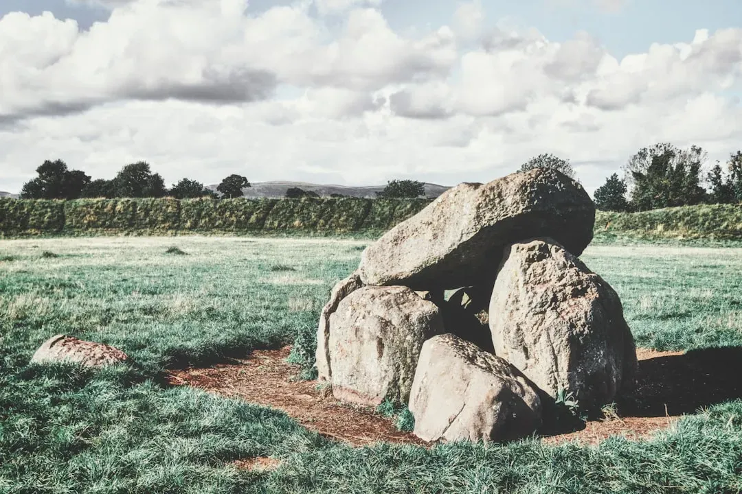
It might be tempting to file Thonis-Heracleion under “cool lost city” and move on, but that would miss the deeper significance of its rediscovery. The geometry embedded in its layout is not just an Egyptian curiosity; it is another data point in a growing recognition that many ancient cultures independently turned to similar shapes and spatial logics when framing the sacred. Circles, cardinal directions, processional lines, and proportional relationships show up again and again, from the stone circles of the British Isles to the mound complexes of the Mississippi Valley and the plazas of Mesoamerica. Thonis-Heracleion shows that a bustling port, not just an inland temple center, could be designed as a ritual diagram in its own right.
When you compare that to traditional narratives that treat sacred geometry as an esoteric side note or a fringe fascination, the difference is stark. The emerging view is that geometry was a practical and spiritual technology, used to negotiate with dangerous rivers, unpredictable rains, and distant deities. For North American sites long dismissed as mere “mounds” or “forts,” this matters: it supports the idea that their builders were engaged in a sophisticated, globally relatable project of world‑making. Thonis-Heracleion, precisely because it belongs to the well‑studied Egyptian tradition, helps legitimize the idea that similar geometric thinking in Native American contexts was not accidental or derivative, but fundamental.
The Future Landscape: New Technologies, Rising Seas, and Global Connections
The story of Thonis-Heracleion is not finished, and in some ways it is only just beginning. New remote‑sensing techniques, from autonomous underwater vehicles to machine‑learning analysis of sonar data, promise to reveal additional quarters of the city still buried under silt. As resolution improves, researchers expect to refine their understanding of the city’s geometry, testing whether subtle alignments to stars, solstices, or specific Nile flood markers are encoded in temple orientations and canal layouts. Meanwhile, collaborations between specialists in Egyptian archaeology and experts on North American earthworks are starting to ask explicitly comparative questions about how different societies used geometry to mediate between land, water, and sky.
There is an uncomfortable irony here: rising sea levels and coastal erosion in our own century are making submerged archaeology more urgent at the very moment when it becomes more dangerous to investigate. The same kinds of deltaic instability that likely contributed to Thonis-Heracleion’s sinking are now threatening coastal heritage from the Gulf Coast of the United States to the Bay of Bengal. Understanding how ancient engineers coped with shifting shorelines and powerful rivers is no longer a purely historical exercise; it may inform how we protect both modern cities and vulnerable archaeological sites. The drowned geometry of Thonis-Heracleion, in that sense, is a cautionary map of futures we are inching toward.
Lessons for North American Sacred Landscapes
For those of us in North America, perhaps the most provocative implication of Thonis-Heracleion lies in how it reframes our own archaeological backyard. When you look at the great circular earthworks of the Ohio Valley, the star‑tuned orientations of Chaco Canyon, or the water‑sensitive planning of mound centers along the lower Mississippi, the parallels with a place like Thonis-Heracleion come into sharper focus. None of these societies copied one another; instead, they seem to have tapped into similar geometric strategies for making sense of a chaotic world. That does not diminish their uniqueness, but it does highlight a shared human tendency to reach for lines, circles, and ratios when sketching the sacred onto real landscapes.
Personally, the first time I saw LiDAR imagery of an Ohio earthwork complex, I felt the same vertigo I later felt looking at the reconstructed plan of Thonis-Heracleion: a sense that the land itself had been turned into a diagram you could walk through. That visceral reaction matters, because it reminds us that sacred geometry is not just abstract math. It is about lived experience – how communities move, gather, remember, and tell stories across generations. Recognizing that in both Egyptian and Native American contexts nudges us away from treating any one civilization as uniquely enlightened. Instead, it suggests a quieter, more powerful idea: that the urge to weave geometry into the fabric of worship and daily life is a deep and widespread human habit.
How You Can Engage With This Hidden World
You do not need to strap on scuba gear in the Mediterranean to take part in the unfolding story of Thonis-Heracleion and sacred geometry. One of the simplest steps is to seek out accurate, science‑based resources – museum exhibits, reputable documentaries, and publications from archaeological institutes – that present underwater sites and Native American earthworks as complex engineered landscapes, not just mysterious ruins. Many institutions now share high‑resolution maps and 3‑D models online; spending time with these can be surprisingly powerful, helping you see the underlying patterns that tie different cultures together. You can also support organizations that fund underwater archaeology and Indigenous‑led research, both of which are chronically under‑resourced compared with flashier tech projects.
Closer to home, visiting mound sites, earthworks, or rock art panels with an eye for geometry can be quietly transformative. Look for alignments with the horizon, repeated distances between features, or the way paths funnel you toward a particular view – then imagine similar patterns playing out underwater in a city like Thonis-Heracleion. Simple actions matter: backing heritage‑protection legislation, listening to Native communities’ own interpretations of sacred landscapes, and resisting development that bulldozes ancient sites without study. If the past few decades have taught us anything, it is that the ground beneath our feet, and even the seabed beyond our coasts, still hold cities and stories we have not yet learned to see.

Suhail Ahmed is a passionate digital professional and nature enthusiast with over 8 years of experience in content strategy, SEO, web development, and digital operations. Alongside his freelance journey, Suhail actively contributes to nature and wildlife platforms like Discover Wildlife, where he channels his curiosity for the planet into engaging, educational storytelling.
With a strong background in managing digital ecosystems — from ecommerce stores and WordPress websites to social media and automation — Suhail merges technical precision with creative insight. His content reflects a rare balance: SEO-friendly yet deeply human, data-informed yet emotionally resonant.
Driven by a love for discovery and storytelling, Suhail believes in using digital platforms to amplify causes that matter — especially those protecting Earth’s biodiversity and inspiring sustainable living. Whether he’s managing online projects or crafting wildlife content, his goal remains the same: to inform, inspire, and leave a positive digital footprint.